Printable Vector Map of Charleroi Belgium detailed City Plan scale 1:2993 full editable Adobe Illustrator Street Map in layers , scalable, text format all names, 25 mb ZIP
All streets names, Main Objects, Buildings. Map for design, printing, arts, projects, presentations, for architects, designers and builders, business, logistics.
Layers: color_fills, water, streets_roads, labels_roads, names_objects, names_streets, names_places, water, buildings, grids, legend, etc.
The most exact and detailed map of the city in scale.
For Editing and High Quality Printing
DWG, DXF and other formats – on request, same price, please, contact
Charleroi is a city in Belgium in the historical region of Wallonia. It is known as one of the largest industrial centers in Europe, which flourished thanks to coal mining and steel production. Now Charleroi is considered one of the poorest cities in prosperous Belgium with many social problems that resulted from the decline of industrial production. Nevertheless, this distinctive place, which is home to the world-famous museum of photography, has an impressive industrial heritage and several interesting attractions.
Charleroi is located on the Sambre River in the province of Hainaut. The city is located 50 km south of Brussels and is connected to the capital of Belgium by a canal. Charleroi has a temperate maritime climate with cool summers and mild winters.
Population – 201.8 thousand people (2018).
Area – 102.08 km2.
The language is French.
The currency is euro.
Visa – Schengen.
The time is Central European (UTC +1, summer +2).
The surroundings of Charleroi have been inhabited since prehistoric times. During the Roman period, several public buildings, temples and villas were built in the area. The city itself was founded in 1666 as the fortress of Charnois. Charleroi quickly turned into a large industrial center that specialized in coal mining, as well as the production of steel and glass.
Industry played a key role until the 60s of the 20th century. In the future, industrial production declined, which significantly affected the prosperity of the city. Now Charleroi is developing as a major transport and cultural center, trying to solve social problems associated with the closure of mines and steel mills.
Charleroi, a city in the Belgian province of Hainaut, is one of the five largest in the country. And to be more precise, he is the “bronze medalist”, that is, the third-largest. The settlement is located on the Sambre River, it is only 50 km south of the Belgian capital Brussels. In the city of Charleroi, which, by the way, belongs to the Walloon part of the kingdom, 212 thousand people live. The population with suburbs is, even more, half a million. If we consider Charleroi on the scale of not the whole state, but only Wallonia, then it is the second largest at all, second only to Liege in this indicator.
The city has an interesting nickname: the capital of the “Black Country”. It did not appear by chance and is due to the fact that there are coal mines in this regional industrial center. At the same time, Charleroi is among the poorest and most unattractive megacities in Belgium. Unemployment rates remain high, in this regard, 2006 can be considered a record year, when the unemployment of the able-bodied population in Charleroi reached 30%. Such a gloomy picture is complemented by a high level of crime, including corruption among the ruling political elites in the city.
It would seem that these factors are enough to exclude Charleroi from the list of attractive places for tourists. However, do not rush to conclusions. The capital of the “Black Country” has many bright sides. For example, Charleroi is contesting with Brussels the title of the capital of Belgian comics, and not unsuccessfully. The well-known publishing house for children Editions Dupuis is also based here, and the local Marcinelle school has given the world such famous and beloved characters as Marsupilami, Boule&Bill, Spirou&Fantasio and Lucky Luke. The city can also boast of its own art museums – there are several of them here, and we will return to them later.
Charleroi is also a major transport hub, namely railway, and aviation. A strategically important transit station is located in the city. Through the Charleroi – Brussels canal, the city is connected to the waterways of Flanders, the second, along with Wallonia, the historical region of the country. In each of the districts of Charleroi, there are interesting sights that attract numerous travelers. The popularity of this industrial center among visitors is also due to its proximity to Brussels, which, as they say, is just around the corner.
Arriving in Belgium, be sure to find the time and opportunity to visit the city of Charleroi – beautiful, original, with its strengths and weaknesses, but even more attractive.

Related Images “Urban plan Charleroi Belgium ai”:
Charleroi
City in Belgium
Charleroi is a Belgian city in the Walloon province of Hainaut. On the central Place Charles II, the art deco City Hall has a belfry with a carillon chiming fragments of Belgian folk songs. Also on the square, St. Christopher’s Church is known for the large gold-leaf mosaic in the choir. Nearby, the Museum of Fine Arts focuses on 19th- and 20th-century Belgian painters and has a sizable René Magritte collection.
Area
• Total 102.08 km2 (39.41 sq mi)
Population
• Total 201,256
• Density 2,000/km2 (5,100/sq mi)
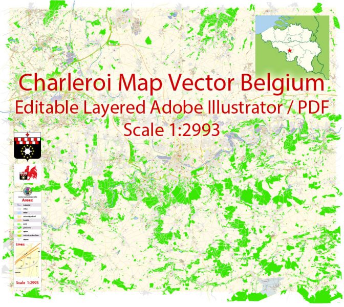
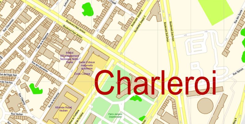
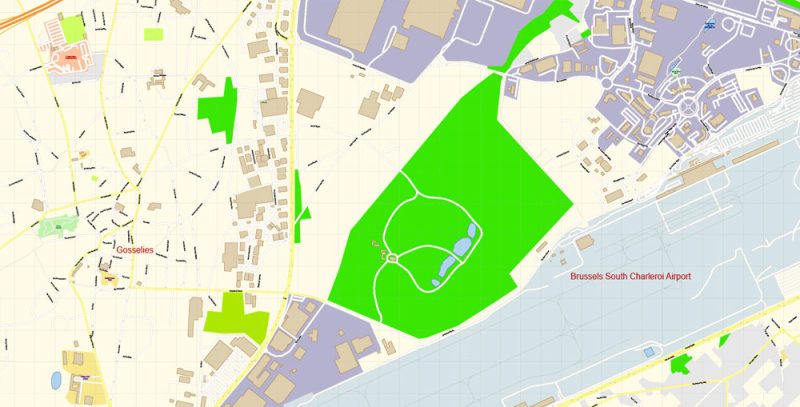
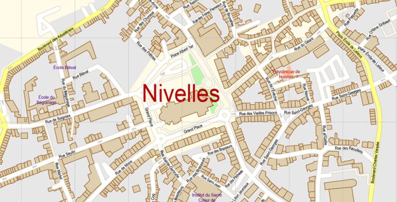
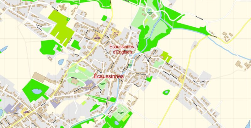
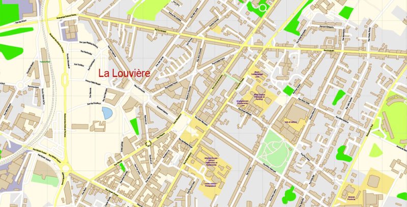
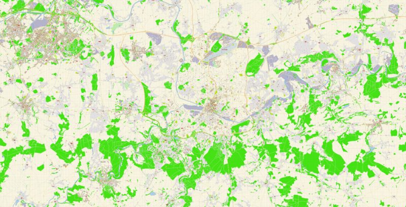
Vector Map of Charleroi Belgium detailed City Plan editable Adobe Illustrator overview
This vector map of Charleroi city is used as a basis for design, editing, and further printing.
This is the most detailed, exact map of Charleroi city for high-quality printing and polygraphy. You can always clarify the map development date by contacting us.
For your convenience, all objects on Charleroi vector city map are divided into layers, and the editing is very easy – colors, lines, etc.
You can easily add any objects needed (e.g. shops, salons, sale points, gas station or attraction) on any layer of Charleroi vector map.
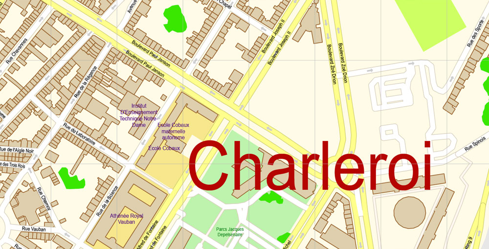
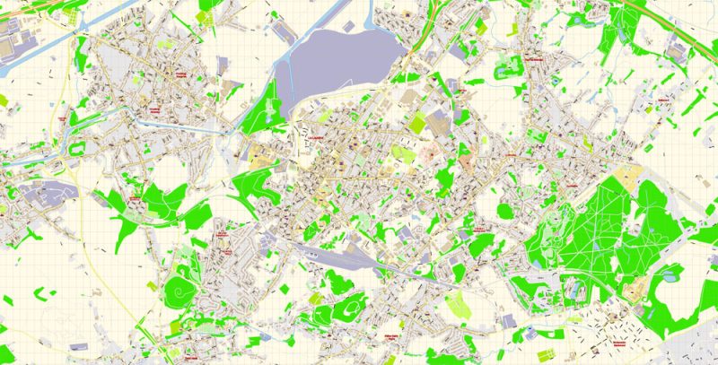
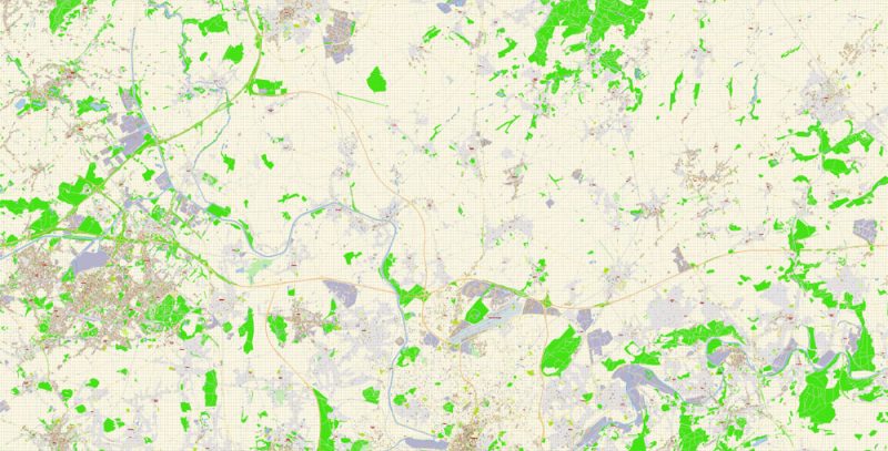
Vector Map of Charleroi Belgium detailed City Plan editable Adobe Illustrator preview 1
One of the advantages of Charleroi city vector maps of our production is the relevance of cartographic data, we constantly update all our products.
This vector map of Charleroi city is used by:
designers, layout designers, printers, advertisers and architects. Our product – vector maps – is designed for further editing and printing in large formats – from @Wall format (a few meters) to A-0 and A-1, A-2, A-3.
The Charleroi city map in vector format is used for design, urban planning, presentations and media visualizations.
The advertising and presentation map of Charleroi city (usually the final designer marks the routes, and puts the client’s objects (shops, saloons, gas stations etc.)
The undoubted advantage is that people will NEVER throw out this advertising product – the map. In fact, as an advertising medium, a city map is the most “long-playing” of the well-known polygraphic advertising media, with the longest lifespan, and the maximum number of interactions with the customer.

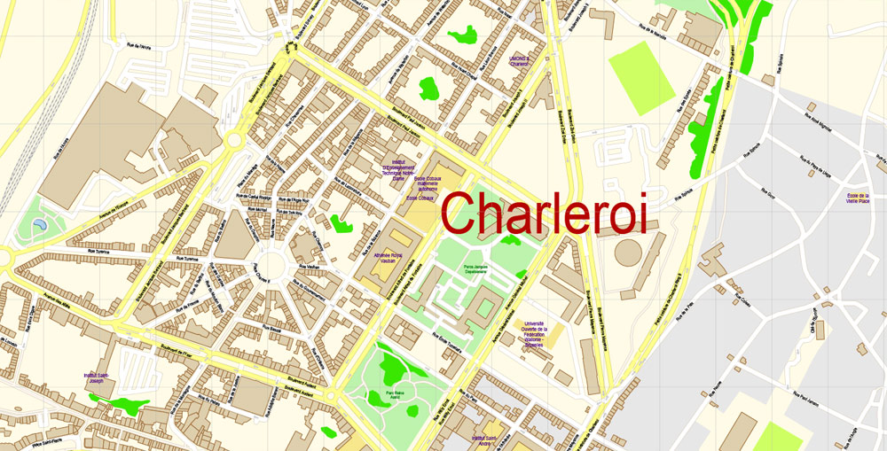
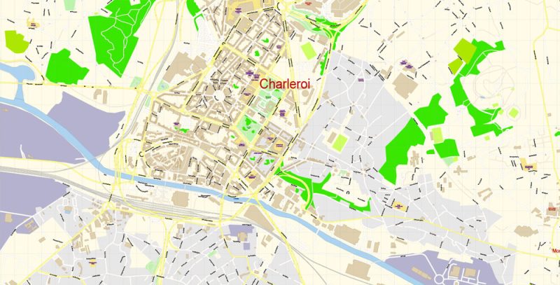
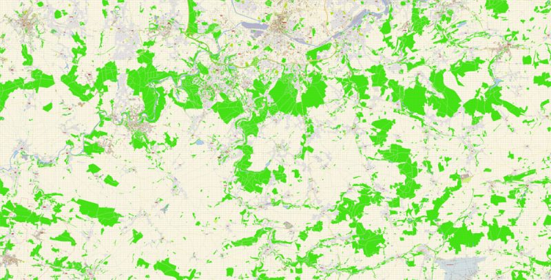
Vector Map of Charleroi Belgium detailed City Plan editable Adobe Illustrator preview 2
For travelers, maps are sold at the airports amd gas stations around the world. Often the source is our vector maps.
Take a look, who purchases our vector maps of Charleroi city in “Our Clients and Friends” page – these are large and small companies, from super-brands like Volvo and Starbucks, to small design studios and printing houses.
It’s very easy to work with vector maps of Charleroi city, even for a not very experienced designer who can turn on and off the map layers, add new objects, change the colors of fill and lines according to customer requirements.
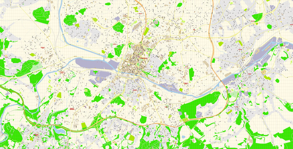
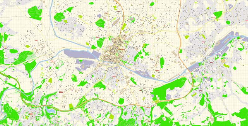
Vector Map of Charleroi Belgium detailed City Plan editable Adobe Illustrator preview 3
The undoubted advantage of Charleroi city vector maps in printing is an excellent and detailed visualization, when customer can expand a large paper map and instantly define his location, find a landmark, an object or address on map, unlike using the popular electronic formats of Google and Yandex maps for example.
Printable vector maps of Charleroi city is much more convenient and efficient than any electronic maps on your smartphone, because ALL DETAILS are displayed in the entire space of Charleroi city map.
Vector Map of Charleroi Belgium detailed City Plan editable Adobe Illustrator preview 4
Useful tips on working with vector map Charleroi City in Adobe Illustrator.
«V» – launches the Selection tool (cursor, black arrow), which makes active any vector line.
«А» – launches the Direct Selection tool (white cursor), allows you to select curve elements and drag them to the desired place.
«R» – activates the Rotate tool, which helps you rotating selected objects around the center point by 360 degrees.
«E» – gives you the opportunity to use the Eraser tool and erase unnecessary parts.
«X» – switches between Fill and Stroke in the Tools section. Try to get used to this hot key and
you will quickly understand that you can’t live and work without it.
Guides are not limited to vertical and horizontal in Adobe Illustrator. You can also create a diagonal guide for example. Moreover, you can turn any contours into guides. Select the outline and go to View > Guides > Make Guides (Create Guides), or simply press Cmd/Ctrl + 5. You can also turn the guides back into an editable object. Go to menu, View > Guides > Unlock Guides (Release Guides), select the guide you want to edit and select View > Guides > Release Guides (Reset Guides), or just press Cmd/Ctrl + Option / Alt + 5).
Vector Map of Charleroi Belgium detailed City Plan editable Adobe Illustrator preview 5
You will probably want to change the color scheme used on our Charleroi vector city map.
To quickly and effectively play with colors.
Of course, you can do it manually, all objects in our Charleroi city vector map are divided according to types and layers, and you can easily change the color gamma of vector objects in groups and layers.
But there is more effective way of working with the whole VECTOR MAP of Charleroi city and all layers:
Vector Map of Charleroi Belgium detailed City Plan editable Adobe Illustrator preview 6
The overview dialog «Edit colors»/«Repaint Graphic Object» (this dialog box name can change depending on the context):
If you have selected a part or a layer of Charleroi city vector map and open the dialog box by clicking the icon in the Control panel, on the Samples palette or the Color Catalog, or if you choose Edit > Edit Colors> Repaint Graphic Object, then the «Repaint Graphic Object» dialog box appears, and you get access to «Assign» and «Edit» tabs.
If a picture or a map fragment is not selected, and you open the dialog box by clicking the icon in the Control panel, on the Samples palette or in the Color Catalog, the «Edit Colors» dialog box appears and you can only access the «Edit» tab.
Vector Map of Charleroi Belgium detailed City Plan editable Adobe Illustrator preview 7
Regardless of the name at the top of the dialog box, the right-hand side always displays the color group of the current document, as well as two default color groups: Print Color and Grayscale. These color groups can be selected and used any time.
Create and edit color groups of Charleroi city vector map, and also assign colors using the «Edit Colors»/ а «Repaint Graphic Object» dialog box.
A. Creating and editing of a color group on the «Edit» tab
B. Assigning colors on the «Assign» tab
C. Select a group of colors from the «Color groups» list
The option «Repaint a graphic object» in the lower part of the dialog box allows you to preview the colors on a selected layer of Vector map, or a group of elements, and specify whether its colors will be redefined when the dialog box is closed.
Vector Map of Charleroi Belgium detailed City Plan editable Adobe Illustrator preview 8
The main areas of the dialog box are:
«Edit»
The «Edit» tab is designed to create a new or edit the existing color groups.
The harmony rules Menu and the Color Wheel are used to conduct experiments with color harmonies. The color wheel shows how colors are related in color harmony, and the color bars allow you to view and manipulate an individual color values. In addition, you can adjust the brightness, add and remove colors, save color groups and view colors on the selected Vector Map of Charleroi city or a separated layers.
«Assign»
The «Assign» tab is used to view and control on how the original colors are replaced with colors from the color group like your corporate colors in the Vector Map of Charleroi city.
The assign color ability is provided only if the entire map, layer or fragment is selected in the document. You can specify which of new colors replace the current colors, whether the spot colors should be preserved and how colors are replaced (for example, you can replace colors completely or changing the color tone while maintaining the brightness). The «Assign» tab allows you to redefine colors in the Vector Map of Charleroi city, or in separate layers and fragments using the current color group or reducing the number of colors in the current Vector Map.
Vector Map of Charleroi Belgium detailed City Plan editable Adobe Illustrator preview 9
«Color groups»
Is a list of all saved color groups for current document (the same groups appear in the «Samples» palette). You can edit and delete the existing color groups, as well as creating a new ones using the list of “Color Groups” in the dialog box. All changes appear in the «Samples» palette.
The highlighted color group shows, which color group is currently edited. Any color group can be selected and edited, or used to redefine the colors in the selected vector map of Charleroi city, its fragments or elements.
Saving a color group adds this group to the specified list.
Opening the «Edit Colors»/«Repaint Graphic Object» dialog box.
Open the «Edit Colors»/«Repaint Graphic Object» dialog box using one of the following methods:
«Edit»> «Edit Colors»> «Repaint Graphic object» or «Repaint With Style».
Vector Map of Charleroi Belgium detailed City Plan editable Adobe Illustrator preview 10
Use these commands if you need to edit the colors in the selected vector map of Charleroi city.
«Repaint Graphic object» button on the «Control» panel.
Use this button if you need to adjust colors of Charleroi city vector map using the а «Repaint graphic object» dialog box.
The specified button is available if the selected vector map or its fragment contains two or more colors.
Note. This color editing method is convenient for global color adjustment in a vector map, if global colors were not used when creating a City Map of Charleroi.
The «Edit colors» button or «Edit or apply colors» on the «Color Catalog» palette
Click this button if you need to edit colors on the «Color Catalog» palette or edit and then apply them to the selected Vector Map of Charleroi city or its fragment.
The «Edit color group» button or «Edit or apply color group» on the «Samples» palette.
Click this button if you need to edit the colors in the specific color group or edit and apply them to the selected Vector Map of Charleroi city or a group of its elements, for example, the whole layer “Streets and lines”. You can also double-click the color group in the Samples panel to open the dialog box.
Vector Map of Charleroi Belgium detailed City Plan editable Adobe Illustrator preview 11
If the map file is too large and your computer freezes or even can’t open it quickly:
1. Try to reduce the color resolution of the video card (display) to 256 colors while working with a large map.
2. Using Windows Task Manager, select all the application you don’t need, while working with map, just turn them off.
3. Launch Adobe Illustrator. (DO NOT OPEN the vector map file)
4. Start the Windows Task Manager using administrator rights > Find the “Illustrator” process > set the «real time» priority,
5. Open the file. When you see the LEGACY FONT popup window – click “OK” (do not update). You can restore the TEXT later.
6. ???? Can also be useful: ???? When the file is opened – Edit > Settings > Basic Settings > disable smoothing. /// It looks scary, but works quickly)))
We recommend saving the file in Adobe Illustrator 10 version. It’s much more stable when working with VERY BIG size files.
Vector Map of Charleroi Belgium detailed City Plan editable Adobe Illustrator preview 12


 Author: Kirill Shrayber, Ph.D. FRGS
