Extended Description of the Vector Map
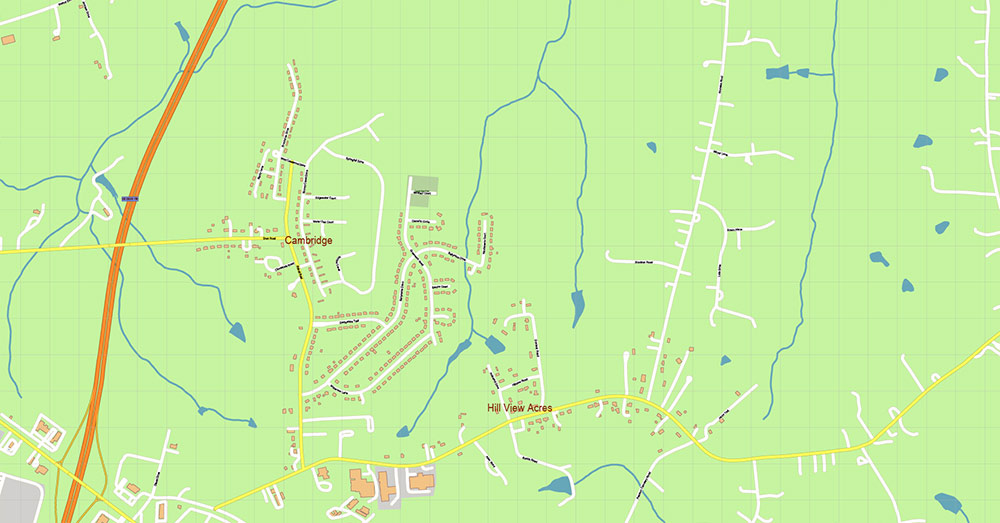
Printable PDF Vector Map of Caswell + Person Counties North Carolina USA detailed street / road map scale 1:3780 full editable Adobe PDF scalable, text format all names, 71 MB ZIP
All street names, Main Objects, Buildings. Map for design, printing, arts, projects, presentations, for architects, designers, and builders, business, logistics.
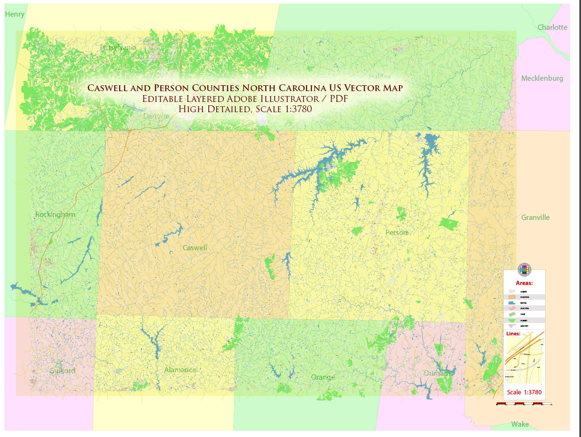
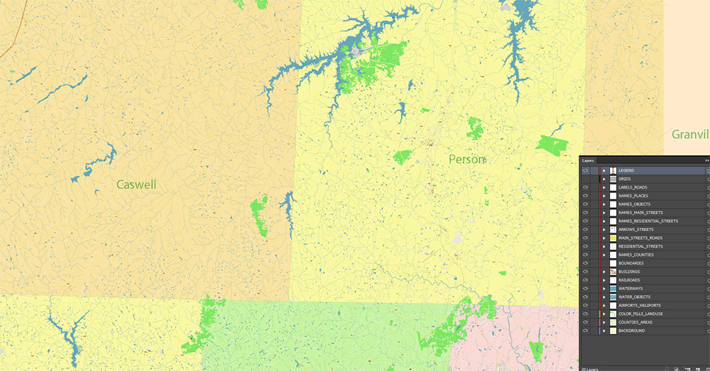
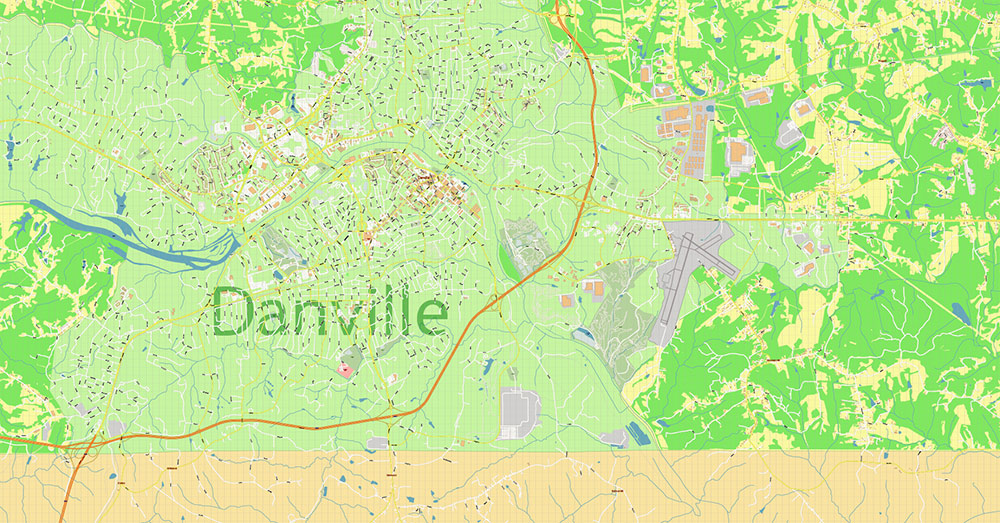
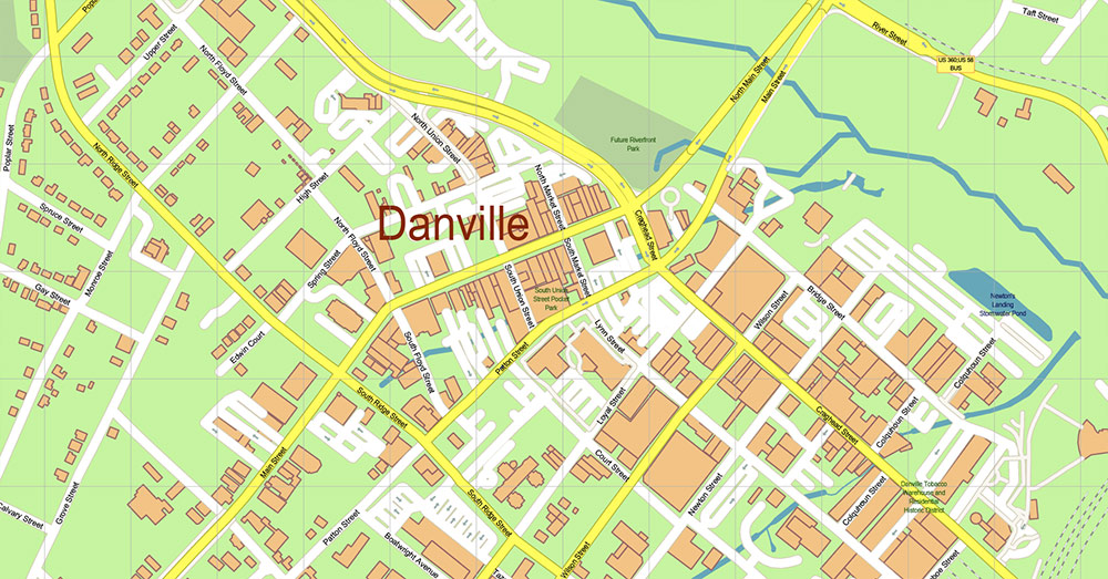
Caswell + Person Counties North Carolina USA PDF Map Vector Exact High Detailed Road Map editable Adobe PDF in layers
Layers list:
- Legend and Scale
- Grids
- Labels of roads
- Names of places (city, hamlet, etc.)
- Names of objects (parks, water, Hospitals)
- Names of main streets
- Names of residential streets
- Arrows of streets
- Names Counties
- Main Streets, roads
- Residential streets
- Railroads
- Buildings
- Airports and Heliports
- Water objects (rivers, lakes, ponds)
- Waterways
- Color fills (parks, hospital areas, land use, etc.)
- Counties areas
- Background
The most exact and detailed map of the counties in scale.
For Editing and High-Quality Printing
AO BRIEF — CASWELL + PERSON COUNTIES, NORTH CAROLINA
1. OVERVIEW
- Area: North-central North Carolina, directly on the Virginia border
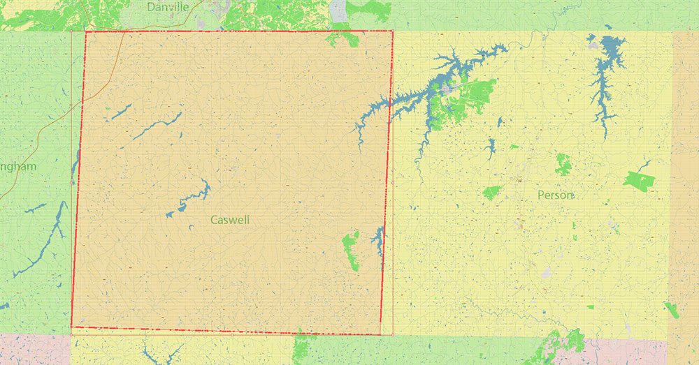
- Counties: Caswell County (west) + Person County (east)
- Regional frame: Inner Piedmont transition zone (between Research Triangle and Virginia tobacco belt)
- Key centers:
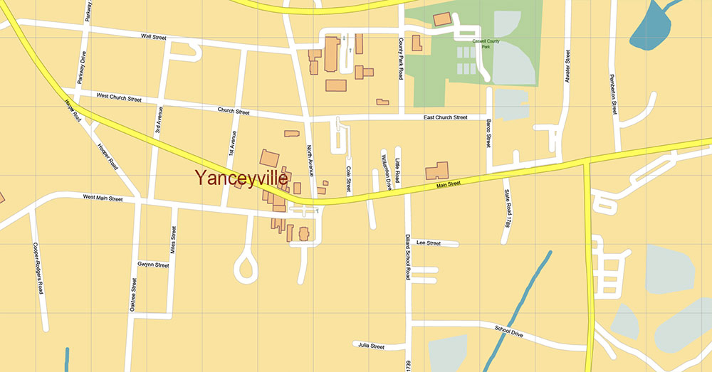
- Yanceyville (Caswell seat)
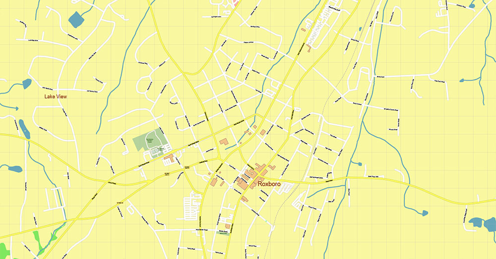
- Roxboro (Person seat, dominant node)
- Population: Low-density rural (~20–40K per county)
- Operational character: Agricultural hinterland + lake-based industrial/recreational nodes
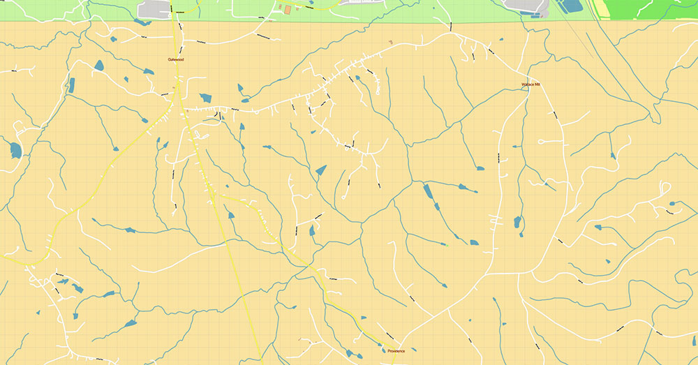
2. TERRAIN / PHYSICAL GEOGRAPHY
- Relief: Rolling Piedmont hills, low amplitude, broad ridgelines
- Elevation: ~120–250 m ASL, no sharp relief
- Micro-features:
- Rounded interfluves, shallow drainage valleys
- Occasional isolated hills (Hager’s Mountain, Mt. Tirzah)
- Surface cover:
- Mixed: farmland (tobacco legacy) + secondary forest
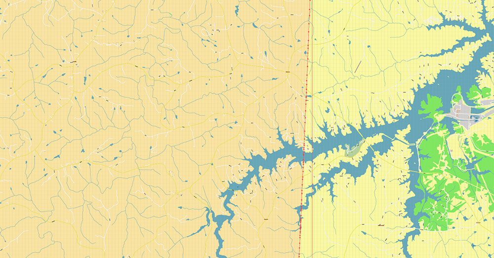
- Hydrography (critical terrain control):
- Dan River (Caswell, north flow to Virginia)
- Flat River / Tar River headwaters (Person)
- Artificial lakes: Hyco Lake, Mayo Lake, Lake Roxboro — terrain anchors, visibility + recreation zones
- Terrain effect:
- Good mobility overall
- Limited choke points → bridges and lake margins
3. LINES OF COMMUNICATION (KEY ROADS)
PRIMARY AXES (REGIONAL)
- US-501 (N–S spine)
- Durham → Roxboro → Virginia
- 4-lane sections, main economic artery
- US-158 (E–W corridor)
- Connects Roxboro ↔ Yanceyville ↔ Danville region
- Primary cross-county linkage
SECONDARY STRUCTURE (STATE HIGHWAYS)
- NC-57
- Durham/Orange → Roxboro → Milton
- Semi-rural connector tying both counties
- NC-49
- Diagonal SW–NE axis linking to Greensboro region and Person County
- NC-86
- Yanceyville ↔ Hillsborough (southbound link to Triangle)
- NC-62 / NC-119
- North–south feeders to Virginia border and Danville corridor
TERTIARY NETWORK
- Dense grid of state-maintained rural roads (NC has centralized road system)
- Key local connectors: Cunningham Rd, Shady Hill Rd, etc. (border mobility)
4. MOBILITY / ACCESS LOGIC
- No interstate inside AO
- Nearest: I-85 (~30 miles south, Durham axis)
- Operational dependency:
- US-501 = strategic lifeline
- Rail:
- Limited freight (Norfolk Southern in Person County)
- Air access:
- Regional: Raleigh-Durham Intl (~40 mi south)
5. CLIMATE / ENVIRONMENT
- Type: Humid subtropical
- Characteristics:
- Hot summers, mild winters
- Frequent thunderstorms
- Operational impact:
- Roads generally all-weather
- Occasional flooding along river corridors
6. HUMAN TERRAIN
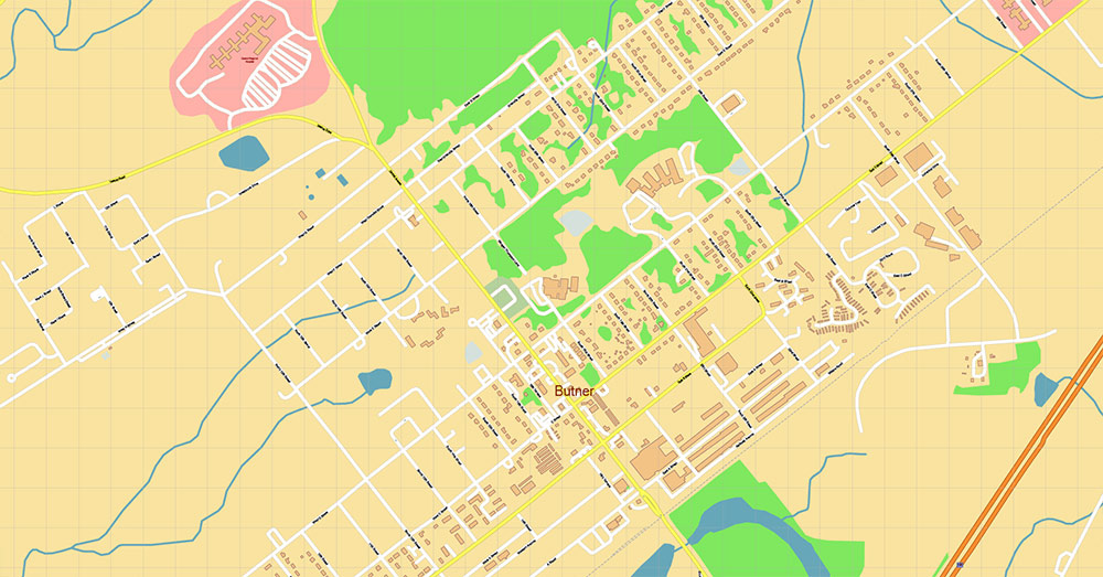
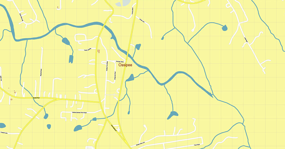
- Settlement pattern:
- Dispersed rural + small towns
- No major urban concentration
- Economic base:
- Historically tobacco agriculture (Caswell + Person)
- Modern: mixed agriculture, light industry, commuting to Durham
- Demographics:
- Stable rural population, moderate African-American share
- Urban influence:
- Southern pull: Research Triangle (Durham, Chapel Hill)
7. KEY TERRAIN / CONTROL POINTS
- Roxboro (Person):
- Road convergence (US-501 / US-158 / NC-57) → primary node
- Yanceyville (Caswell):
- Secondary administrative hub
- Hyco Lake / Mayo Lake zone:
- Terrain barrier + recreational node
- Dan River crossings:
- Critical northern boundary control
8. HAZARDS / CONSTRAINTS
- No major natural hazards (low disaster profile)
- Risks:
- Local flooding (river valleys)
- Limited redundancy of main routes
- Rural infrastructure gaps
9. LOGISTICS / SUSTAINMENT
- Strengths:
- Low congestion
- Multiple parallel secondary roads
- Weaknesses:
- No high-capacity interstate
- Dependence on Durham corridor for supply chains
10. COMMAND TAKEAWAYS
- Rural Piedmont AO with high mobility but low redundancy
- US-501 + US-158 intersection (Roxboro) = decisive control node
- Terrain does not restrict movement, but water bodies and rivers define structure
- Strategic orientation:
- Southward → Durham / I-85 (economic gravity)
- Northward → Virginia (Danville corridor)
- Ideal AO for:
- Logistics corridors
- Low-intensity dispersed operations
- Regional connectivity mapping
Caswell + Person Counties North Carolina USA PDF Map Vector Exact High Detailed Road Map editable Adobe PDF in layers
Caswell + Person Counties North Carolina USA PDF Map Vector Exact High Detailed Road Map editable Adobe PDF in layers
Caswell + Person Counties North Carolina USA PDF Map Vector Exact High Detailed Road Map editable Adobe PDF in layers
Caswell + Person Counties North Carolina USA PDF Map Vector Exact High Detailed Road Map editable Adobe PDF in layers
Caswell + Person Counties North Carolina USA PDF Map Vector Exact High Detailed Road Map editable Adobe PDF in layers
Caswell + Person Counties North Carolina USA PDF Map Vector Exact High Detailed Road Map editable Adobe PDF in layers
Caswell + Person Counties North Carolina USA PDF Map Vector Exact High Detailed Road Map editable Adobe PDF in layers
Caswell + Person Counties North Carolina USA PDF Map Vector Exact High Detailed Road Map editable Adobe PDF in layers
Caswell + Person Counties North Carolina USA PDF Map Vector Exact High Detailed Road Map editable Adobe PDF in layers
Caswell + Person Counties North Carolina USA PDF Map Vector Exact High Detailed Road Map editable Adobe PDF in layers
Caswell + Person Counties North Carolina USA PDF Map Vector Exact High Detailed Road Map editable Adobe PDF in layers
Caswell + Person Counties North Carolina USA PDF Map Vector Exact High Detailed Road Map editable Adobe PDF in layers

 Author: Kirill Shrayber, Ph.D. FRGS


