Extended Description of the Vector Map
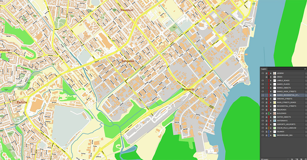
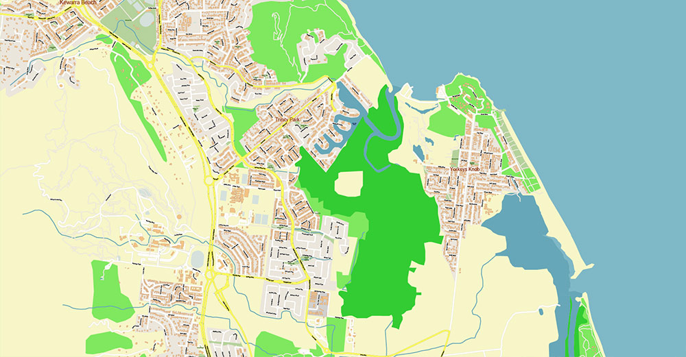
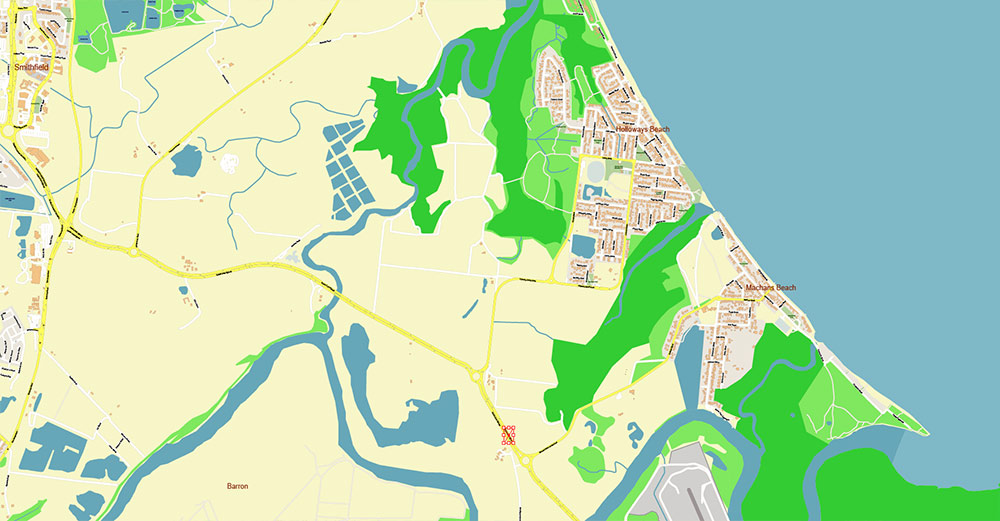
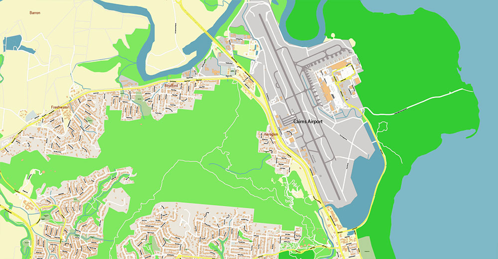
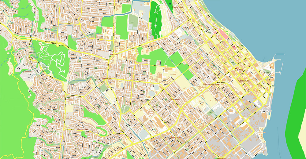
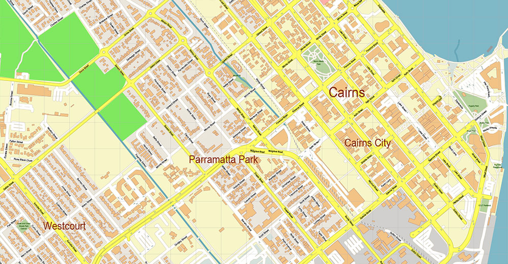
Printable PDF Vector Map of Cairns Area Australia High Detailed scale 1:4491 fully editable Adobe PDF Street Map in layers, scalable, text format all names, 39 MB ZIP
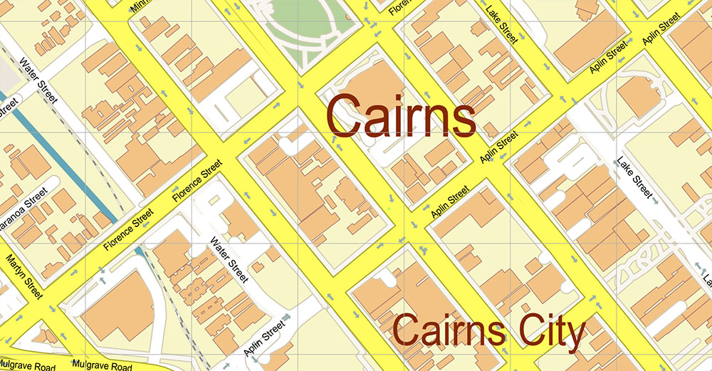
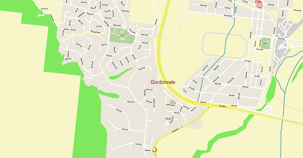
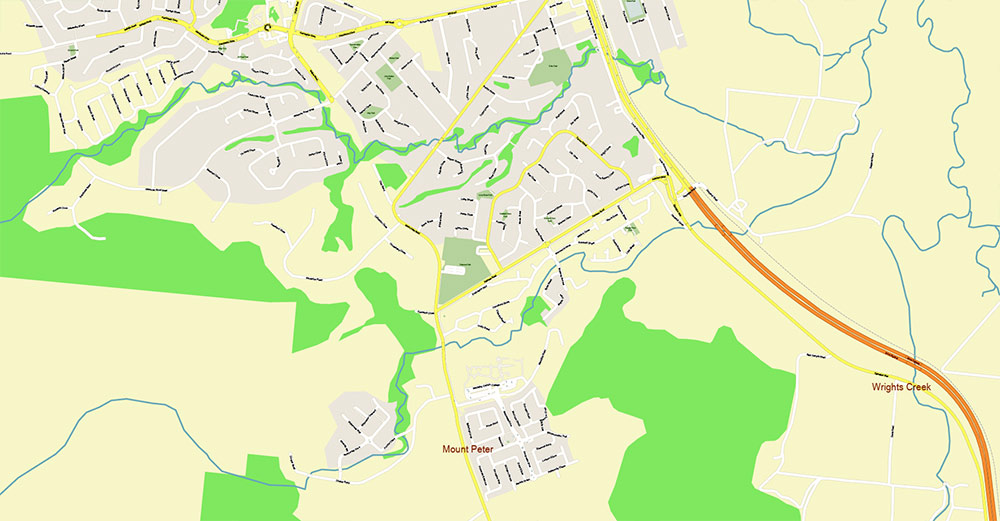
All street names, Main Objects, Buildings. Map for design, printing, arts, projects, presentations, for architects, designers, and builders, business, logistics.
Also: We can add (additional layer for this map), any other objects for you. It’s free for our customers.
If you need any OTHER format – or something else – please, email us
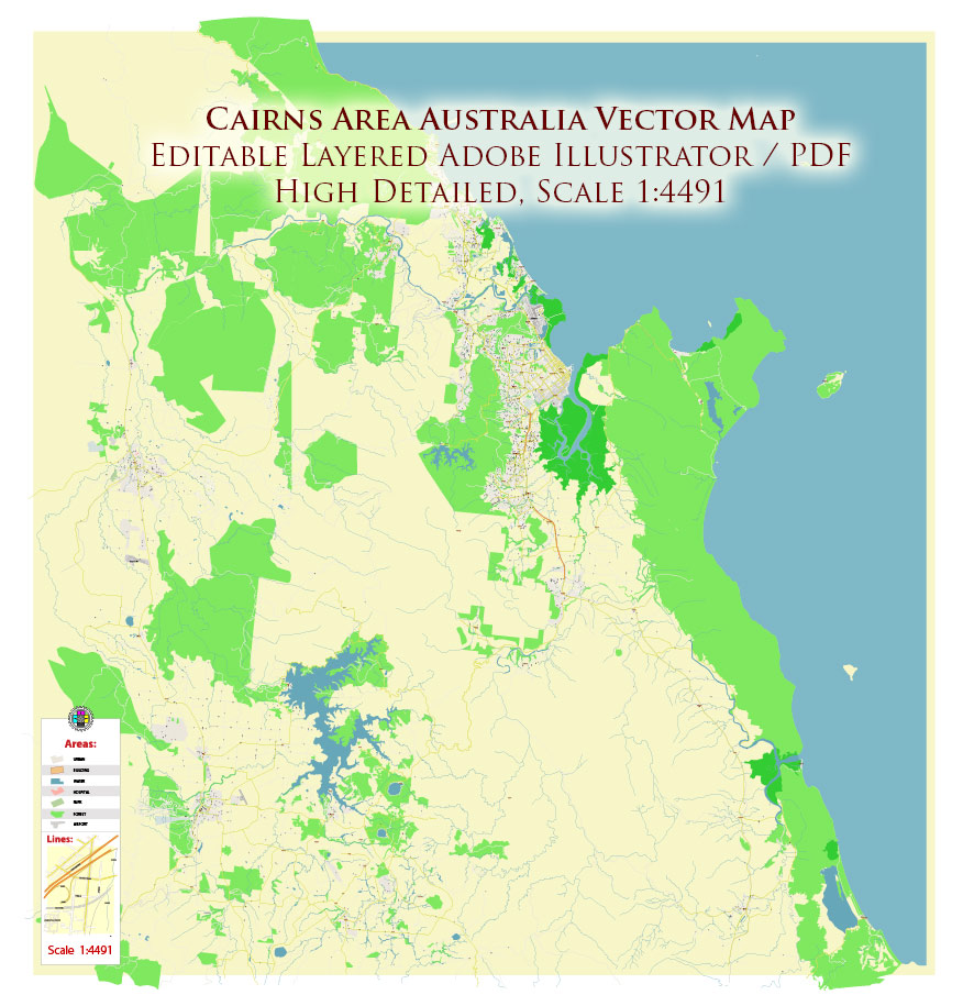
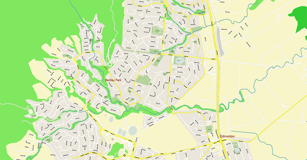
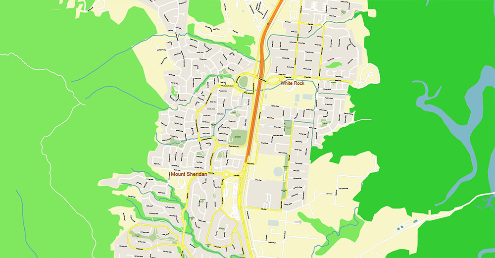
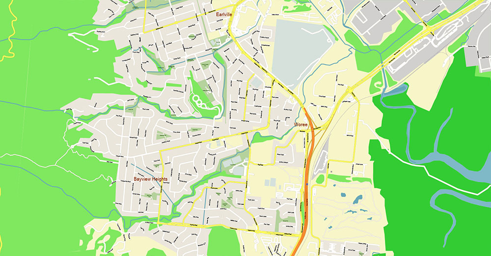
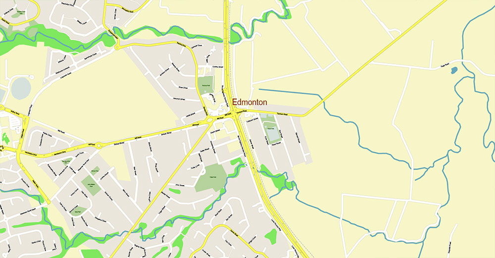
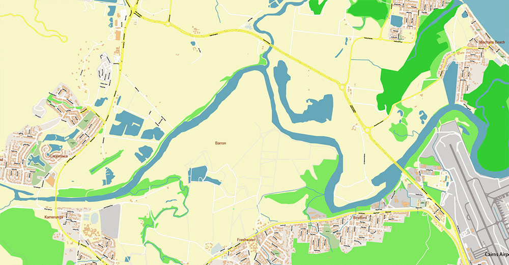
Cairns Area Australia PDF Map Vector High Detailed Street Map editable Adobe PDF in layers
Layers list:
- Legend
- Grids
- Labels of roads 1, 2
- Names of places
- Names of objects (hospitals, parks, water)
- Names main streets
- Names residential streets
- Arrows of street directions
- Main streets and roads
- Residential streets and roads
- Railroads
- Buildings
- Waterways
- Water and wetland areas
- Airports and Heliports
- Land use areas
- Islands
- Background and sea
Cairns Area Australia PDF Map Vector High Detailed Street Map editable Adobe PDF in layers
AO BRIEF — CAIRNS AO
Area of Operations: Cairns, Far North Queensland, Australia
Operational Tone: Tropical coastal urban zone — gateway to reef and rainforest
1. Overview
-
Location: Northeastern Australia, coastal city on the Coral Sea at the base of the Cape York Peninsula.
-
Terrain envelope: Narrow coastal strip between the Coral Sea and the Great Dividing Range mountains.
-
Urban layout: Linear city stretched roughly south–north along the coast, expanding from Edmonton (south) to Northern Beaches / Ellis Beach (north).
-
Strategic role: Primary regional hub of Far North Queensland, serving rainforest highlands, Cape York Peninsula, and the Great Barrier Reef tourism corridor.
Command assessment:
Forward coastal city with strong maritime and tourism economy; logistics constrained by terrain and limited land corridors.
2. Key Roads / Lines of Communication
Primary Highways
-
Bruce Highway (A1) — main north–south land corridor linking Cairns with Townsville and the rest of Queensland; terminates in southern Cairns suburbs.
-
Captain Cook Highway — coastal highway from Cairns north toward Port Douglas and Mossman; main route to Northern Beaches.
-
Kennedy Highway / Kuranda Range Road — climbs west into the Atherton Tablelands across mountainous rainforest terrain.
-
Gillies Highway (Gillies Range Road) — alternative inland route with steep gradients and numerous curves linking Cairns to the Tablelands.
Urban arterial structure
-
Mulgrave Road / Ray Jones Drive (southern approach).
-
Sheridan Street corridor (CBD–airport axis).
-
Cairns Western Arterial Road — bypass connecting suburbs and the Tablelands corridor.
Operational notes
-
Road network constrained by mountain ranges and wetlands, creating limited access corridors.
-
Tropical rainfall and flooding periodically disrupt roads and rail lines.
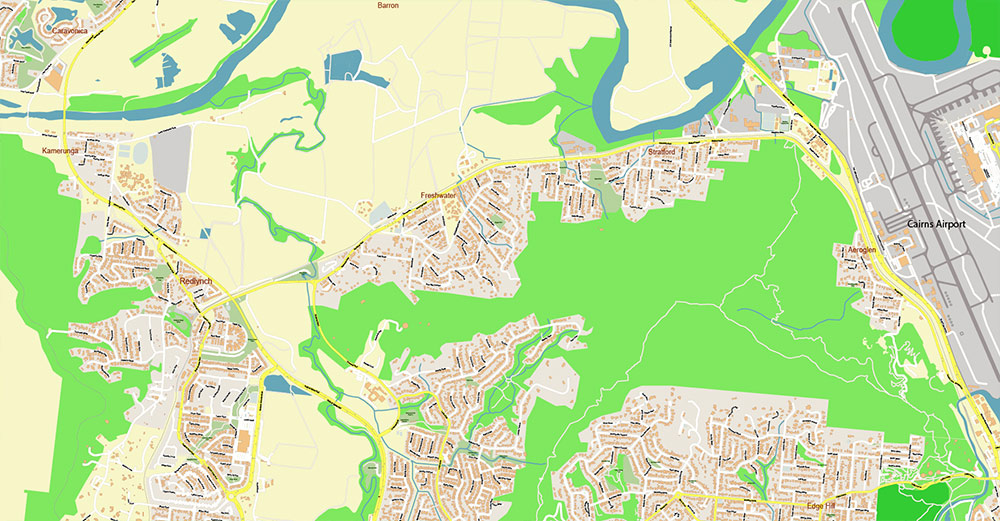
3. Transportation Infrastructure
Air
Rail
Port
Bus / Ground transport
Operational summary
4. Geography & Climate
Terrain
-
Coastal floodplain with mangrove estuaries around Trinity Inlet.
-
Rainforest-covered mountain ranges immediately west of the city.
-
Major rivers in the region: Barron River and Mulgrave River.
Climate
-
Tropical monsoon climate (Am) with distinct wet season (Nov–May).
-
Annual rainfall approx. ~2,000 mm.
-
Cyclones and seasonal flooding possible.
Operational implications
-
High humidity, dense vegetation, seasonal flooding.
-
Weather can rapidly affect transport corridors and visibility.
5. Demography / Human Terrain
-
Population (Cairns region): ~178,000 residents.
-
Greater statistical area: ~250,000 residents.
-
Median age: ~41 years.
-
Household size: ~2.4 persons per dwelling.
Population composition
-
Anglo-Australian majority with significant Indigenous Aboriginal communities.
-
High presence of tourism workers and seasonal residents.
-
International tourism generates strong transient population.
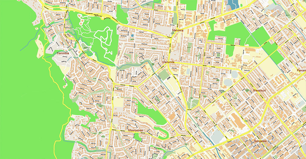
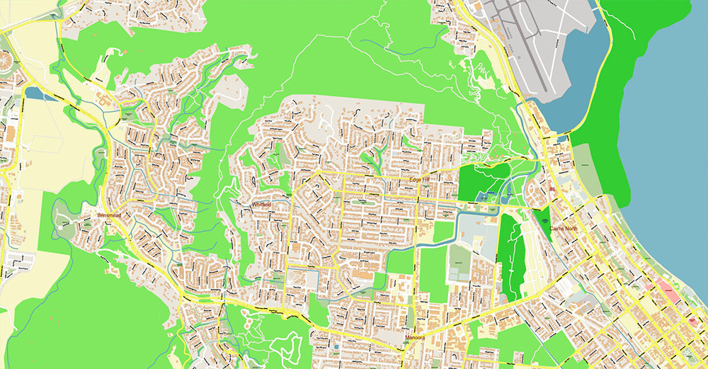
Urban districts
-
CBD around Trinity Inlet.
-
Inner suburbs: Parramatta Park, Bungalow, Manunda, Edge Hill.
-
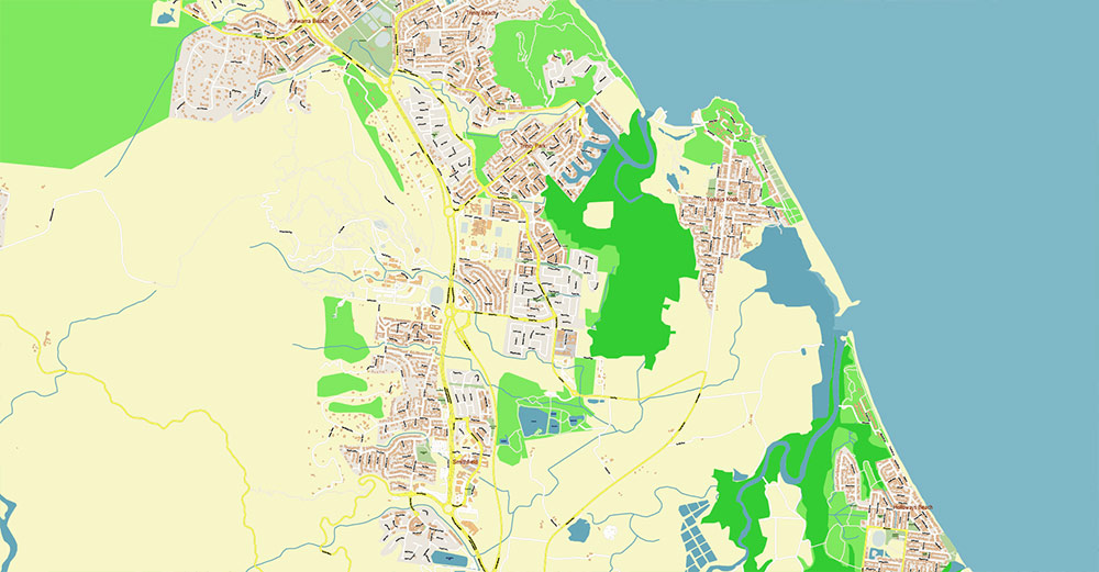
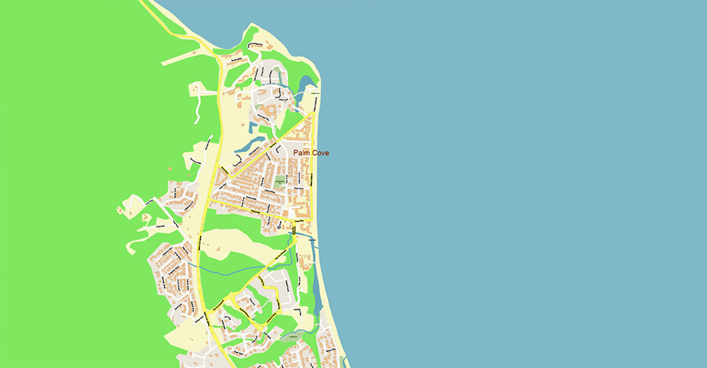
Northern Beaches corridor: Smithfield, Trinity Beach, Palm Cove.
-
Southern corridor: Mount Sheridan, Bentley Park, Edmonton.
6. Economy / Civil Infrastructure
Primary economic sectors:
-
Tourism (Great Barrier Reef gateway).
-
Regional services for northern Queensland.
-
Marine and fishing industries.
-
Agriculture support (sugar cane and tropical crops).
Urban expansion increasingly occupies former sugar-cane farmland.
7. Hazards / Environmental Factors
-
Tropical cyclones (Nov–May).
-
Flash flooding of rivers and coastal lowlands.
-
Landslides on mountain roads during heavy rain.
-
Heat, humidity, and dense rainforest vegetation.
8. Command Takeaways
-
Strategic gateway city linking reef tourism zones, Cape York, and the Tablelands.
-
Limited land corridors due to mountains and wetlands — highways are critical chokepoints.
-
Air and maritime transport dominate logistics.
-
Tropical weather and cyclones periodically disrupt infrastructure.
Cairns Area Australia PDF Map Vector High Detailed Street Map editable Adobe PDF in layers
Cairns Area Australia PDF Map Vector High Detailed Street Map editable Adobe PDF in layers
Cairns Area Australia PDF Map Vector High Detailed Street Map editable Adobe PDF in layers
Cairns Area Australia PDF Map Vector High Detailed Street Map editable Adobe PDF in layers
Cairns Area Australia PDF Map Vector High Detailed Street Map editable Adobe PDF in layers
Cairns Area Australia PDF Map Vector High Detailed Street Map editable Adobe PDF in layers
Cairns Area Australia PDF Map Vector High Detailed Street Map editable Adobe PDF in layers
Cairns Area Australia PDF Map Vector High Detailed Street Map editable Adobe PDF in layers
Cairns Area Australia PDF Map Vector High Detailed Street Map editable Adobe PDF in layers
Cairns Area Australia PDF Map Vector High Detailed Street Map editable Adobe PDF in layers
Cairns Area Australia PDF Map Vector High Detailed Street Map editable Adobe PDF in layers
Cairns Area Australia PDF Map Vector High Detailed Street Map editable Adobe PDF in layers
Cairns Area Australia PDF Map Vector High Detailed Street Map editable Adobe PDF in layers
Cairns Area Australia PDF Map Vector High Detailed Street Map editable Adobe PDF in layers
Cairns Area Australia PDF Map Vector High Detailed Street Map editable Adobe PDF in layers
Cairns Area Australia PDF Map Vector High Detailed Street Map editable Adobe PDF in layers
Cairns Area Australia PDF Map Vector High Detailed Street Map editable Adobe PDF in layers
Cairns Area Australia PDF Map Vector High Detailed Street Map editable Adobe PDF in layers
Cairns Area Australia PDF Map Vector High Detailed Street Map editable Adobe PDF in layers

 Author: Kirill Shrayber, Ph.D. FRGS
, full vector")