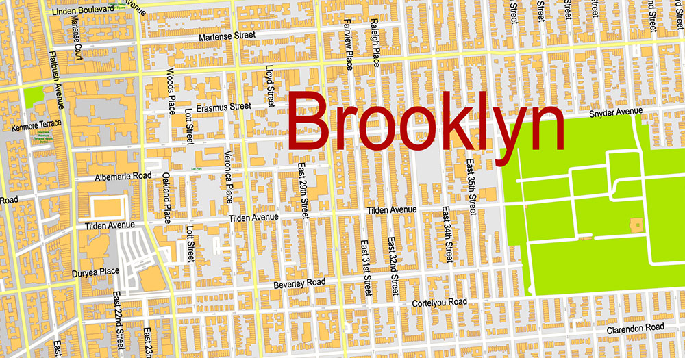
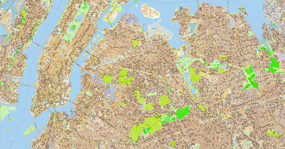
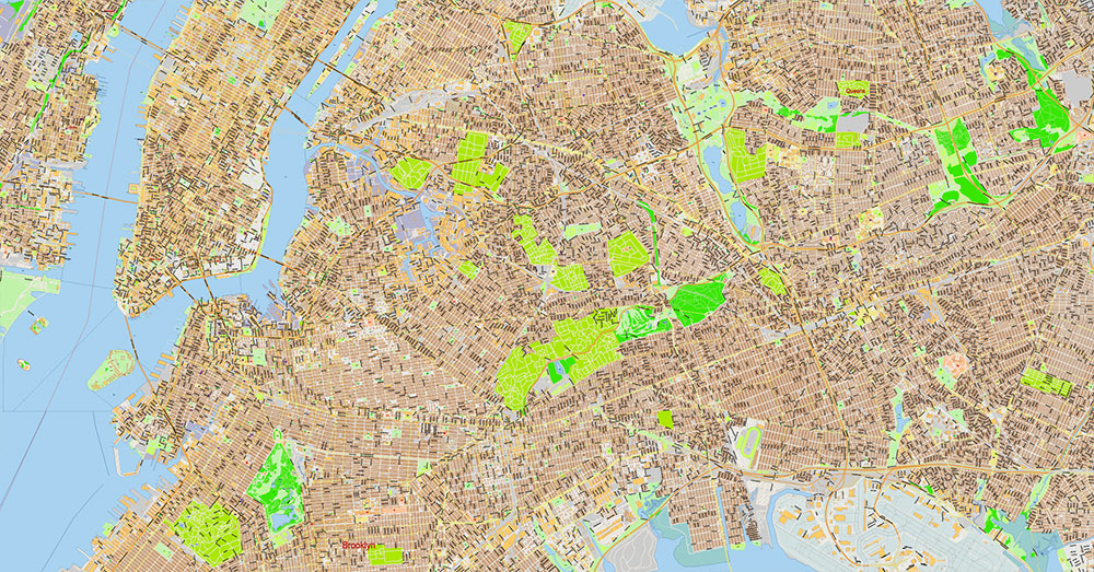
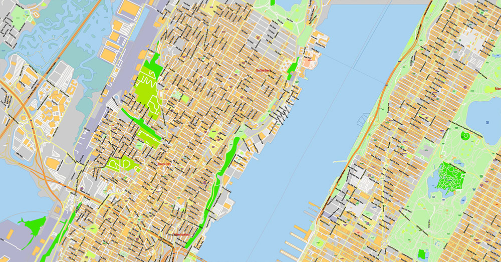
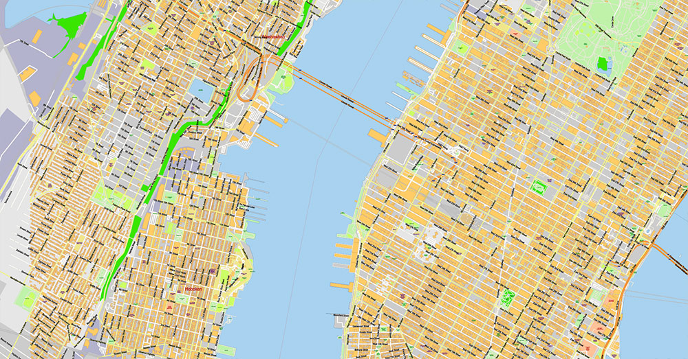
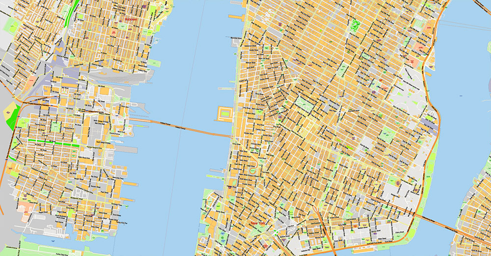
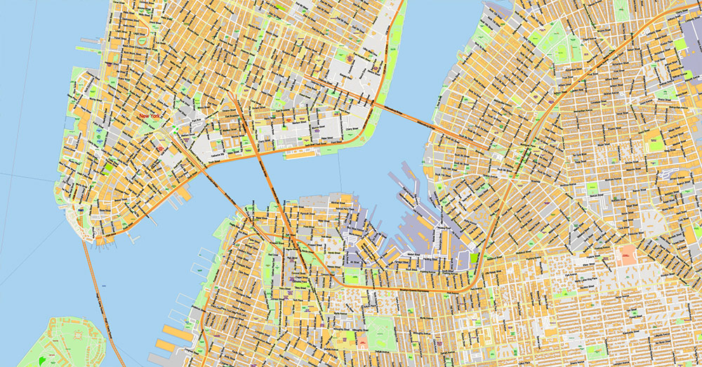
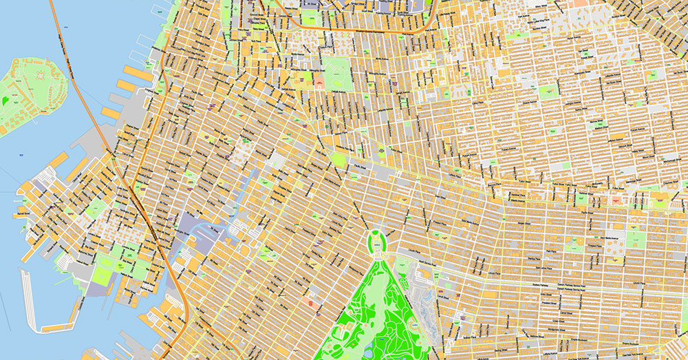
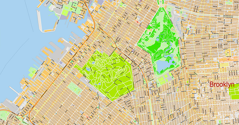
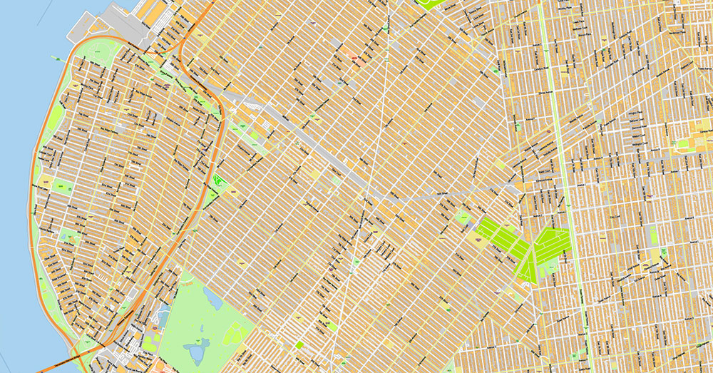
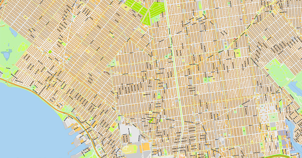
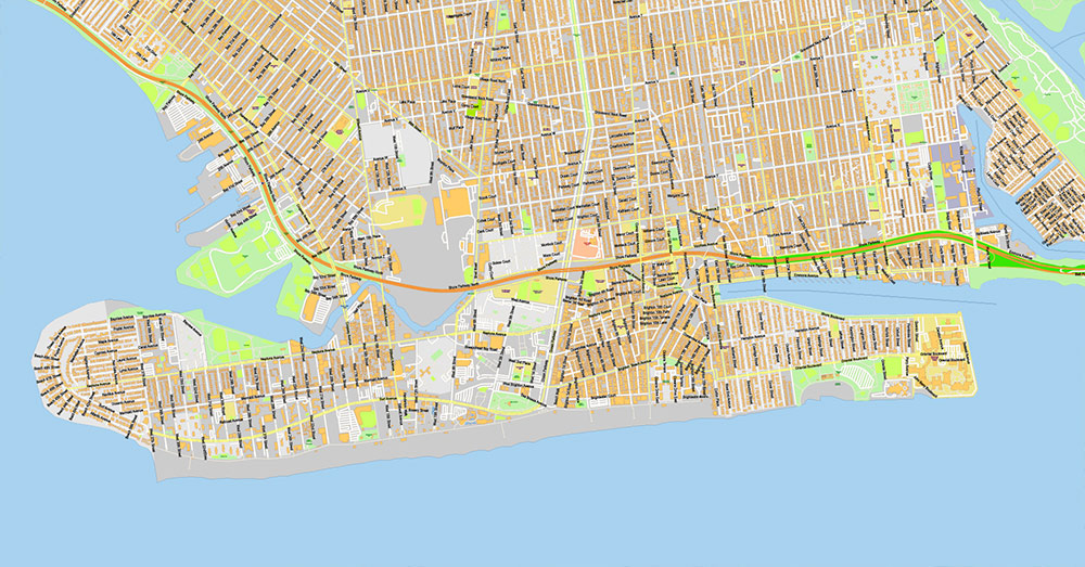
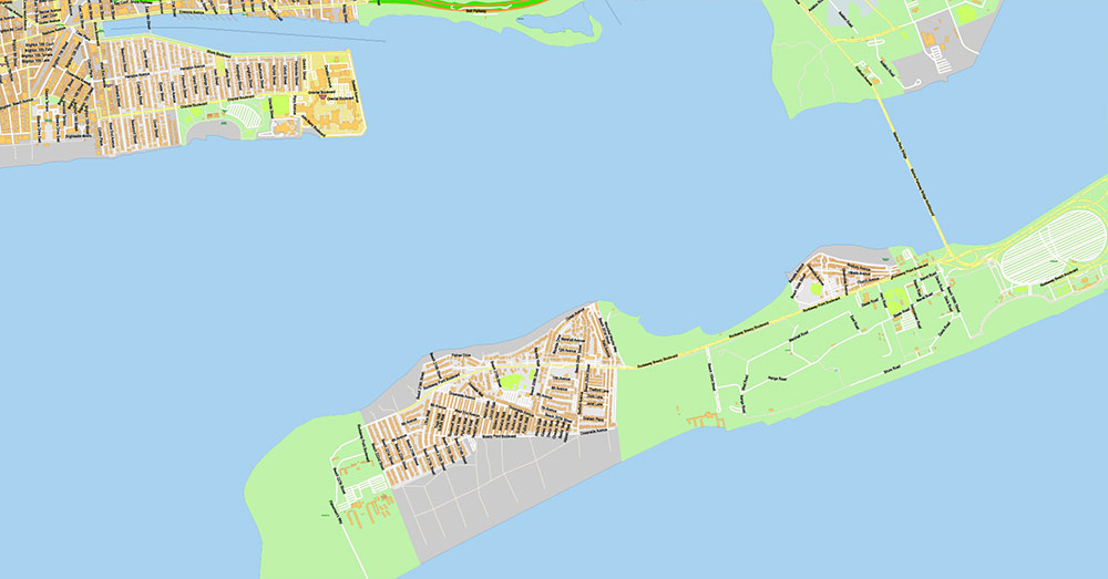
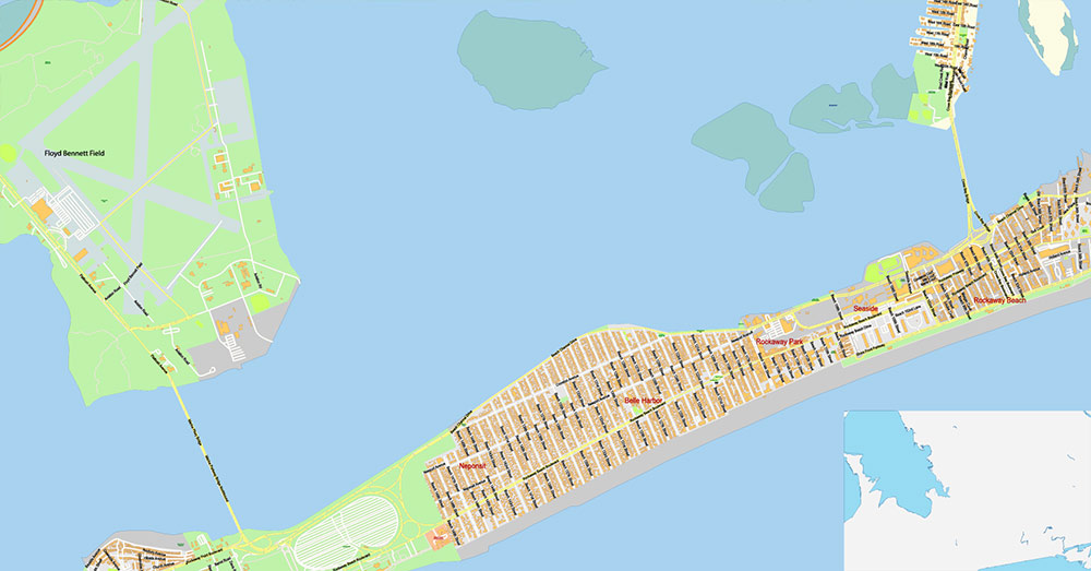
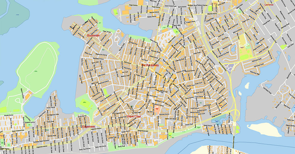
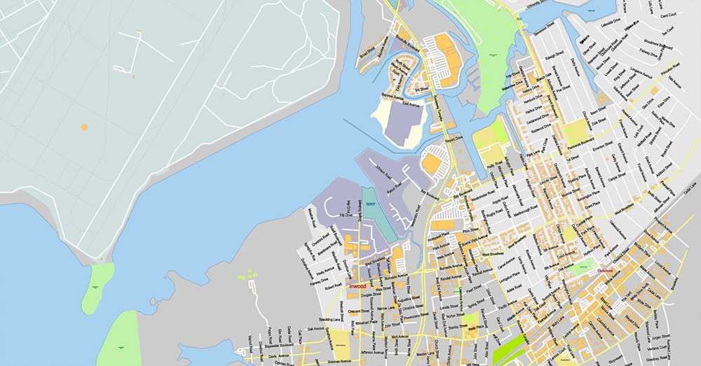
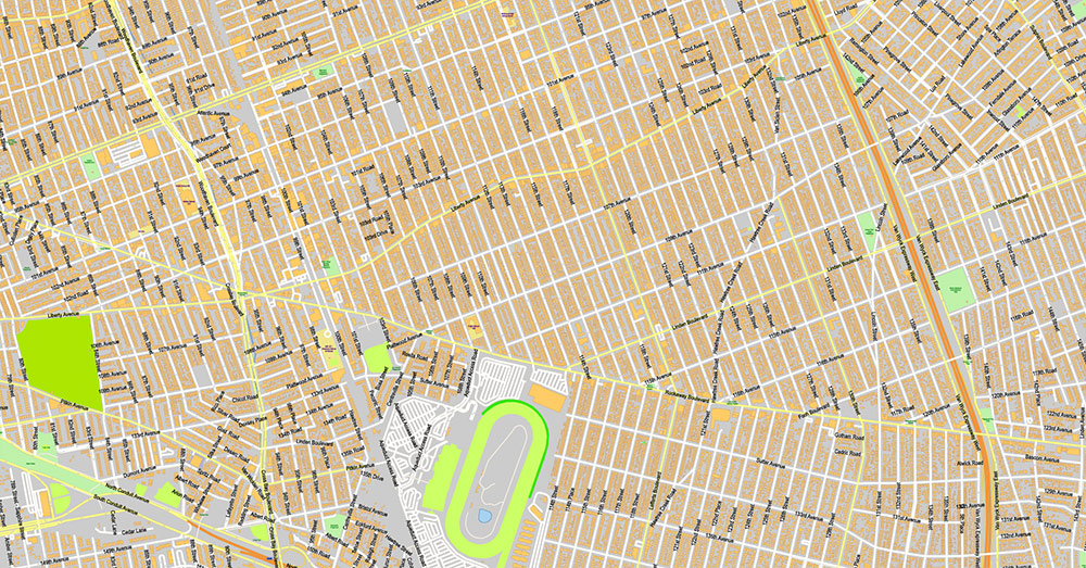
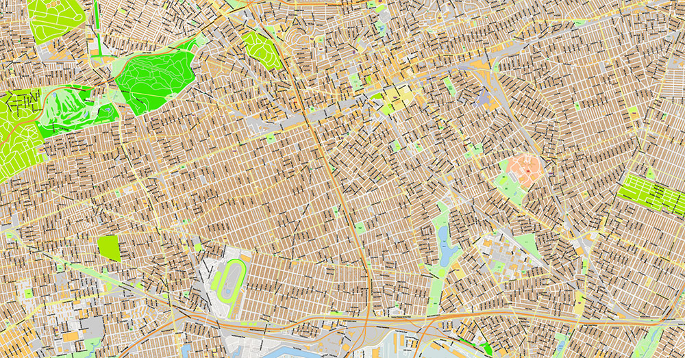
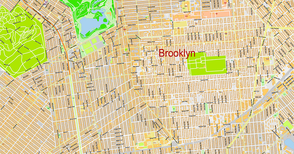
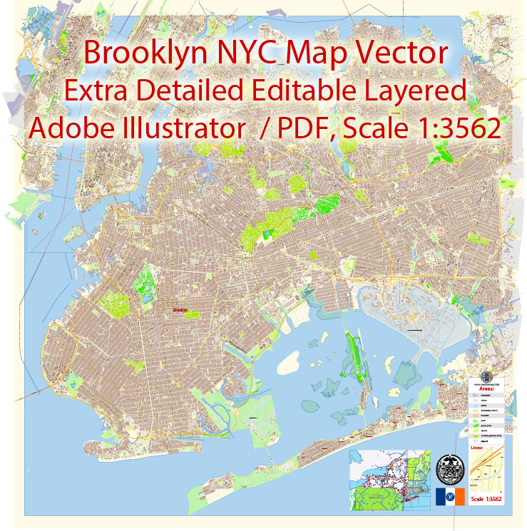
Printable PDF Vector Map of Brooklyn New York US extra detailed City Plan scale 100 m 1:3562 Large Fonts 300% fully editable Adobe PDF Street Map in layers, scalable, text/curves format all names, 207 MB ZIP
All street names, Main Objects, All Buildings. Map for design, printing, arts, projects, presentations, for architects, designers, and builders, business, logistics.
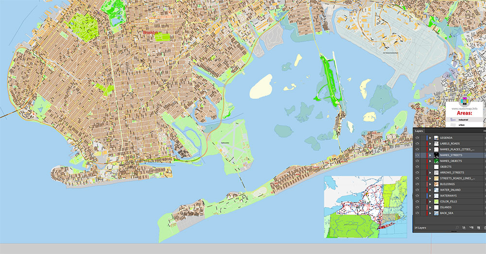
Layers: color_fills, water, streets_roads, labels_roads, names_objects, names_streets, names_places, arrows_streets, buildings, grids, legend, etc.
The most exact and detailed map of the city in scale.
For Editing and High-Quality Printing
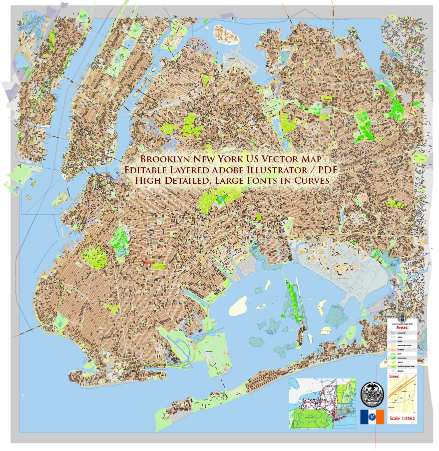
Brooklyn New York US PDF Map Vector Exact City Plan extra detailed Street Map Large Fonts editable Adobe PDF in layers
AO BRIEF
BROOKLYN, NEW YORK, USA
(Cartographic / Statistical Version)
1. Area Overview
Brooklyn is one of the five boroughs of New York City and corresponds geographically to Kings County. Located on the western end of Long Island, it forms the southeastern sector of the New York metropolitan core, separated from Manhattan by the East River and bordered by Queens to the northeast and the Atlantic Ocean to the south.
-
Area: ~210 km² (≈81 sq mi)
-
Population: approx. 2.6–2.7 million residents (largest borough in NYC)
-
Population density: ~36,000 people per sq mile (one of the highest in the United States)
Brooklyn functions as both a major residential borough and economic extension of Manhattan, with strong commuting flows and a dense urban street network.
2. Urban Structure & Districts
Brooklyn contains more than 70 recognized neighborhoods, many historically tied to immigrant settlement patterns.
Major districts frequently referenced in cartographic and planning contexts:
-
Downtown Brooklyn – administrative and commercial core
-
Brooklyn Heights – historic residential district overlooking Manhattan
-
Williamsburg / Greenpoint – post-industrial redevelopment zones
-
Bushwick – former industrial district undergoing rapid gentrification
-
Bedford-Stuyvesant – historically African-American residential area
-
Park Slope / Prospect Heights – high-density brownstone neighborhoods
-
Coney Island / Brighton Beach – coastal recreational zone
-
Flatbush / East Flatbush / Canarsie – large residential sectors
Urban morphology varies from 19th-century brownstone grids to high-density apartment blocks and modern waterfront redevelopment.
3. Transportation Network
Subway
Brooklyn contains one of the densest urban rail systems in the United States.
Subway commuting dominates cross-river travel; over 90% of Brooklyn residents commuting to Manhattan use the subway.
Bus routes cover areas with weaker subway access, particularly southern Brooklyn.
Bridges and Regional Connections
Brooklyn is connected to Manhattan and surrounding boroughs by several major bridges:
These crossings form the primary east–west transportation corridors in the NYC region.
4. Major Road Infrastructure
Expressways
Key limited-access highways:
-
I-278 – Brooklyn-Queens Expressway (BQE)
Major regional corridor linking Brooklyn to Queens and Manhattan bridges.
-
Gowanus Expressway
Southern extension connecting to the Verrazzano-Narrows Bridge.
-
Prospect Expressway (NY-27)
Connector between the BQE and southern Brooklyn.
-
Jackie Robinson Parkway
Eastern parkway linking Brooklyn to Queens.
Major Arterial Roads
Important urban arteries frequently shown on city maps:
-
Flatbush Avenue – major north-south corridor
-
Atlantic Avenue – key east-west commercial axis
-
Eastern Parkway – historic boulevard and cultural corridor
-
Ocean Parkway – landscaped boulevard linking Prospect Park and Coney Island
-
Coney Island Avenue – north-south urban artery (~5 miles)
-
Bushwick Avenue – central north-south route in northern Brooklyn
Street grids vary between orthogonal planning and diagonal parkway alignments.
5. Demography
Brooklyn is one of the most ethnically diverse urban regions in the world.
Population
Ethnic Composition (approx.)
Social Characteristics
-
~36% of residents are immigrants.
-
~71% of housing units are renter-occupied.
-
Median age is relatively young for a major US city.
Brooklyn contains numerous ethnic enclaves including:
-
Caribbean (Flatbush, Crown Heights)
-
Russian and Ukrainian (Brighton Beach)
-
Chinese (Sunset Park, Bensonhurst)
-
Pakistani (around Coney Island Avenue)
6. Historical Development
Colonial Period
The area was settled by the Dutch in the 1630s, forming several agricultural towns including Flatbush, Bushwick and Gravesend.
Revolutionary War
Brooklyn was the site of the Battle of Long Island (1776), the largest battle of the American Revolutionary War.
19th Century
Brooklyn became the first large commuter suburb of Manhattan, connected by ferry and later bridges.
Consolidation with NYC
In 1898, Brooklyn was incorporated into Greater New York as one of its five boroughs.
Industrial Era
From the late 19th to mid-20th century the borough developed major:
Post-industrial Transition
Since the late 20th century Brooklyn has undergone:
7. Cartographic Characteristics
For map design and vector datasets, Brooklyn typically exhibits:
-
extremely dense street grids
-
complex transportation layering (subways, elevated lines, highways)
-
high density of named neighborhoods
-
mixed coastal / estuarine shoreline (New York Harbor, Jamaica Bay)
Urban density and infrastructure complexity make Brooklyn one of the most data-rich urban cartographic environments in North America.
Brooklyn New York US PDF Map Vector Exact City Plan extra detailed Street Map Large Fonts editable Adobe PDF in layers
Brooklyn New York US PDF Map Vector Exact City Plan extra detailed Street Map Large Fonts editable Adobe PDF in layers
Brooklyn New York US PDF Map Vector Exact City Plan extra detailed Street Map Large Fonts editable Adobe PDF in layers
Brooklyn New York US PDF Map Vector Exact City Plan extra detailed Street Map Large Fonts editable Adobe PDF in layers
Brooklyn New York US PDF Map Vector Exact City Plan extra detailed Street Map Large Fonts editable Adobe PDF in layers
Brooklyn New York US PDF Map Vector Exact City Plan extra detailed Street Map Large Fonts editable Adobe PDF in layers
Brooklyn New York US PDF Map Vector Exact City Plan extra detailed Street Map Large Fonts editable Adobe PDF in layers
Brooklyn New York US PDF Map Vector Exact City Plan extra detailed Street Map Large Fonts editable Adobe PDF in layers
Brooklyn New York US PDF Map Vector Exact City Plan extra detailed Street Map Large Fonts editable Adobe PDF in layers
Brooklyn New York US PDF Map Vector Exact City Plan extra detailed Street Map Large Fonts editable Adobe PDF in layers
Brooklyn New York US PDF Map Vector Exact City Plan extra detailed Street Map Large Fonts editable Adobe PDF in layers
Brooklyn New York US PDF Map Vector Exact City Plan extra detailed Street Map Large Fonts editable Adobe PDF in layers
Brooklyn New York US PDF Map Vector Exact City Plan extra detailed Street Map Large Fonts editable Adobe PDF in layers
Brooklyn New York US PDF Map Vector Exact City Plan extra detailed Street Map Large Fonts editable Adobe PDF in layers
Brooklyn New York US PDF Map Vector Exact City Plan extra detailed Street Map Large Fonts editable Adobe PDF in layers
Brooklyn New York US PDF Map Vector Exact City Plan extra detailed Street Map Large Fonts editable Adobe PDF in layers
Brooklyn New York US PDF Map Vector Exact City Plan extra detailed Street Map Large Fonts editable Adobe PDF in layers

Brooklyn New York US PDF Map Vector Exact City Plan extra detailed Street Map Large Fonts editable Adobe PDF in layers
Brooklyn New York US PDF Map Vector Exact City Plan extra detailed Street Map Large Fonts editable Adobe PDF in layers
Brooklyn New York US PDF Map Vector Exact City Plan extra detailed Street Map Large Fonts editable Adobe PDF in layers
Brooklyn New York US PDF Map Vector Exact City Plan extra detailed Street Map Large Fonts editable Adobe PDF in layers
Author Rating
Aggregate Rating
0 based on 104 votes
@vectormapper
Product Name Brooklyn New York Map Vector Exact City Plan extra detailed Street Map editable Adobe Illustrator in layers
Price
USD 73
Product Availability
Available in Stock


 Author: Kirill Shrayber, Ph.D. FRGS


