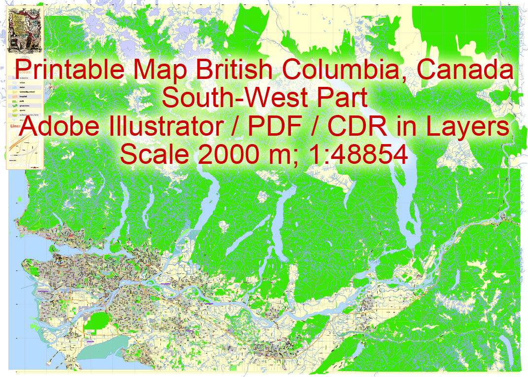
Printable Map British Columbia South-West part, Canada, exact vector in layers scale 1:48854, full editable, Adobe Illustrator, scalable, editable, text format all names, 41 mb ZIP
Principal streets named, Main Objects. Map for design, printing, arts, projects, presentations, for architects, designers and builders, business, logistics.
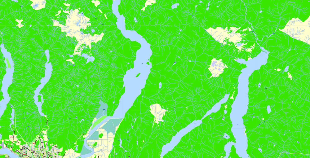
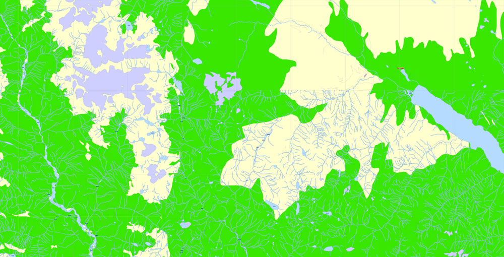
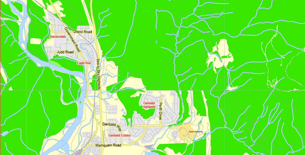
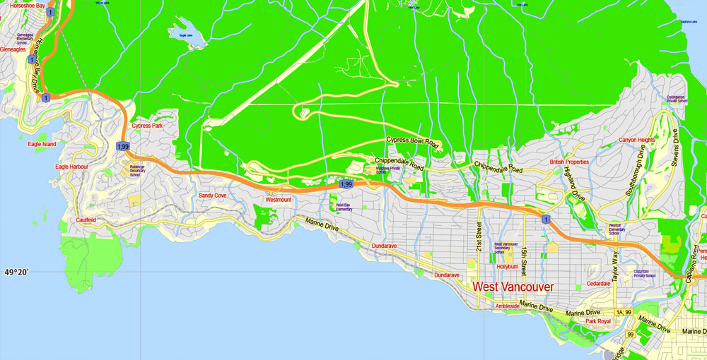
Layers: color fills, streets_roads, names_sreets, names_places, labels_roads, names_objects, grids, legend, water objects, names water etc.
DWG, DXF, EPS and other formats – on request, same price, please, contact
British Columbia, Canada.
This vector map of British Columbia is used as a basis for design, editing, and further printing.
This is the most detailed, exact map of British Columbia for high-quality printing and polygraphy. You can always clarify the map development date by contacting us.
For your convenience, all objects on British Columbia vector map are divided into layers. And the editing is very easy – colors, lines, etc.
You can easily add any objects needed (e.g. shops, salons, sale points, gas station or attraction) on any layer of British Columbia vector map.
British Columbia is the westernmost province of Canada, located between the Pacific Ocean and the Rocky Mountains. With an estimated population of 4.817 million as of 2017, it is Canada’s third-most populous province.
One of the advantages of British Columbia vector maps of our production is the relevance of cartographic data, we constantly update all our products.
This vector map of British Columbia is used by:
designers, layout designers, printers, advertisers and architects. Our product – vector maps – is designed for further editing and printing in large formats – from @Wall format (a few meters) to A-0 and A-1, A-2, A-3.
The British Columbia map in vector format is used for design, urban planning, presentations and media visualizations.
The advertising and presentation map of British Columbia (usually the final designer marks the routes, and puts the client’s objects (shops, saloons, gas stations etc.)
The undoubted advantage is that people will NEVER throw out this advertising product – the map. In fact, as an advertising medium, a map is the most “long-playing” of the well-known polygraphic advertising media, with the longest lifespan, and the maximum number of interactions with the customer.
For travelers, maps are sold at the airports and gas stations around the world. Often the source is our vector maps.
The first British settlement in the area was Fort Victoria, established in 1843, which gave rise to the City of Victoria, at first the capital of the separate Colony of Vancouver Island. Subsequently, on the mainland, the Colony of British Columbia (1858–1866) was founded by Richard Clement Moody and the Royal Engineers, Columbia Detachment, in response to the Fraser Canyon Gold Rush. Moody was Chief Commissioner of Lands and Works for the Colony and the first Lieutenant Governor of British Columbia: he was hand-picked by the Colonial Office in London to transform British Columbia into the British Empire’s “bulwark in the farthest west”, and “to found a second England on the shores of the Pacific”.
Take a look, who purchases our vector maps of British Columbia in “Our Clients and Friends” page – these are large and small companies, from super-brands like Volvo and Starbucks, to small design studios and printing houses.
It’s very easy to work with vector maps of British Columbia city, even for a not very experienced designer who can turn on and off the map layers, add new objects, change the colors of fill and lines according to customer requirements.
The undoubted advantage of British Columbia vector maps in printing is an excellent and detailed visualization, when customer can expand a large paper map and instantly define his location, find a landmark, an object or address on map, unlike using the popular electronic formats of Google and Yandex maps for example.
Printable vector maps of British Columbia are much more convenient and efficient than any electronic maps on your smartphone, because ALL DETAILS are displayed in the entire space of British Columbia map.
Moody selected the site for and founded the original capital of British Columbia, New Westminster, established the Cariboo Road and Stanley Park, and designed the first version of the Coat of arms of British Columbia. Port Moody is named after him.
In 1866, Vancouver Island became part of the colony of British Columbia, and Victoria became the united colony’s capital. In 1871, British Columbia became the sixth province of Canada. Its Latin motto is Splendor sine occasu (“Splendour without Diminishment”).
Useful tips on working with vector maps of cities and countries in Adobe Illustrator.
«V» – launches the Selection tool (cursor, black arrow), which makes active any vector line.
«А» – launches the Direct Selection tool (white cursor), allows you to select curve elements and drag them to the desired place.
«R» – activates the Rotate tool, which helps you rotating selected objects around the center point by 360 degrees.
«E» – gives you the opportunity to use the Eraser tool and erase unnecessary parts.
«X» – switches between Fill and Stroke in the Tools section. Try to get used to this hot key and
you will quickly understand that you can’t live and work without it.
Guides are not limited to vertical and horizontal in Adobe Illustrator. You can also create a diagonal guide for example. Moreover, you can turn any contours into guides. Select the outline and go to View > Guides > Make Guides (Create Guides), or simply press Cmd/Ctrl + 5. You can also turn the guides back into an editable object. Go to menu, View > Guides > Unlock Guides (Release Guides), select the guide you want to edit and select View > Guides > Release Guides (Reset Guides), or just press Cmd/Ctrl + Option / Alt + 5).
You will probably want to change the color scheme used on our British Columbia vector map.
The capital of British Columbia remains Victoria, the fifteenth-largest metropolitan region in Canada, named for the Queen who created the original European colonies. The largest city is Vancouver, the third-largest metropolitan area in Canada, the largest in Western Canada, and the second-largest in the Pacific Northwest. In October 2013, British Columbia had an estimated population of 4,606,371 (about 2.5 million of whom were in Greater Vancouver). The province is currently governed by the British Columbia New Democratic Party in a minority government supported by the Green Party of British Columbia, led by John Horgan, who became premier as a result of a no-confidence motion on June 29, 2017.
To quickly and effectively play with colors.
Of course, you can do it manually, all objects in our British Columbia vector map are divided according to types and layers, and you can easily change the color gamma of vector objects in groups and layers.
But there is more effective way of working with the whole VECTOR MAP of British Columbia and all layers:
The overview dialog «Edit colors»/«Repaint Graphic Object» (this dialog box name can change depending on the context):
If you have selected a part or a layer of British Columbia vector map and open the dialog box by clicking the icon in the Control panel, on the Samples palette or the Color Catalog, or if you choose Edit > Edit Colors> Repaint Graphic Object, then the «Repaint Graphic Object» dialog box appears, and you get access to «Assign» and «Edit» tabs.
If a picture or a map fragment is not selected, and you open the dialog box by clicking the icon in the Control panel, on the Samples palette or in the Color Catalog, the «Edit Colors» dialog box appears and you can only access the «Edit» tab.
British Columbia evolved from British possessions that were established in what is now British Columbia by 1871. First Nations, the original inhabitants of the land, have a history of at least 10,000 years in the area. Today there are few treaties and the question of Aboriginal Title, long ignored, has become a legal and political question of frequent debate as a result of recent court actions. Notably, the Tsilhqot’in Nation has established Aboriginal title to a portion of their territory, as a result of the recent Supreme Court of Canada decision (William v. British Columbia).
Regardless of the name at the top of the dialog box, the right-hand side always displays the color group of the current document, as well as two default color groups: Print Color and Grayscale. These color groups can be selected and used any time.
Create and edit color groups of British Columbia vector map, and also assign colors using the «Edit Colors»/ а «Repaint Graphic Object» dialog box.
A. Creating and editing of a color group on the «Edit» tab
B. Assigning colors on the «Assign» tab
C. Select a group of colors from the «Color groups» list
The option «Repaint a graphic object» in the lower part of the dialog box allows you to preview the colors on a selected layer of Vector map, or a group of elements, and specify whether its colors will be redefined when the dialog box is closed.
The main areas of the dialog box are:
«Edit»
The «Edit» tab is designed to create a new or edit the existing color groups.
The harmony rules Menu and the Color Wheel are used to conduct experiments with color harmonies. The color wheel shows how colors are related in color harmony, and the color bars allow you to view and manipulate an individual color values. In addition, you can adjust the brightness, add and remove colors, save color groups and view colors on the selected Vector Map of British Columbia or a separated layers.
Geography
British Columbia is bordered to the west by the Pacific Ocean and the American state of Alaska, to the north by Yukon Territory and the Northwest Territories, to the east by the province of Alberta, and to the south by the American states of Washington, Idaho, and Montana. The southern border of British Columbia was established by the 1846 Oregon Treaty, although its history is tied with lands as far south as California. British Columbia’s land area is 944,735 square kilometres (364,800 sq mi). British Columbia’s rugged coastline stretches for more than 27,000 kilometres (17,000 mi), and includes deep, mountainous fjords and about 6,000 islands, most of which are uninhabited. It is the only province in Canada that borders the Pacific Ocean.
«Assign»
The «Assign» tab is used to view and control on how the original colors are replaced with colors from the color group like your corporate colors in the Vector Map of British Columbia city.
The assign color ability is provided only if the entire map, layer or fragment is selected in the document. You can specify which of new colors replace the current colors, whether the spot colors should be preserved and how colors are replaced (for example, you can replace colors completely or changing the color tone while maintaining the brightness). The «Assign» tab allows you to redefine colors in the Vector Map of British Columbia city, or in separate layers and fragments using the current color group or reducing the number of colors in the current Vector Map.
Color groups
Is a list of all saved color groups for current document (the same groups appear in the «Samples» palette). You can edit and delete the existing color groups, as well as creating a new ones using the list of “Color Groups” in the dialog box. All changes appear in the «Samples» palette.
The highlighted color group shows, which color group is currently edited.
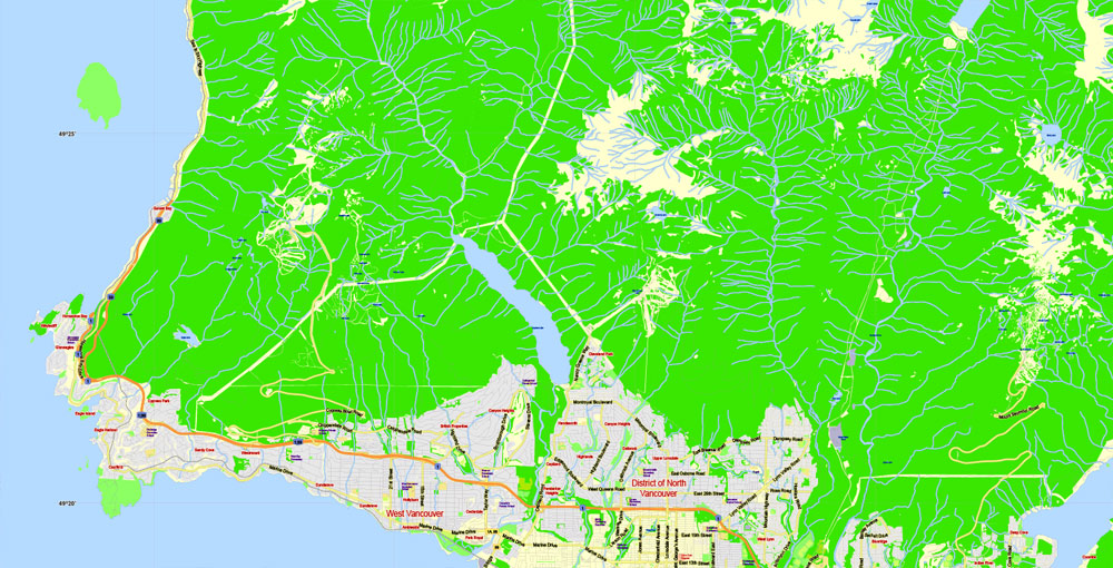
British Columbia’s capital is Victoria, located at the southeastern tip of Vancouver Island. Only a narrow strip of Vancouver Island, from Campbell River to Victoria, is significantly populated. Much of the western part of Vancouver Island and the rest of the coast is covered by temperate rainforest. The province’s most populous city is Vancouver, which is at the confluence of the Fraser River and Georgia Strait, in the mainland’s southwest corner (an area often called the Lower Mainland). By land area, Abbotsford is the largest city. Vanderhoof is near the geographic centre of the province.
Any color group can be selected and edited, or used to redefine the colors in the selected vector map of British Columbia city, its fragments or elements.
Saving a color group adds this group to the specified list.
Opening the «Edit Colors»/«Repaint Graphic Object» dialog box.
Open the «Edit Colors»/«Repaint Graphic Object» dialog box using one of the following methods:
«Edit»> «Edit Colors»> «Repaint Graphic object» or «Repaint With Style».
Use these commands if you need to edit the colors in the selected vector map of British Columbia city.
«Repaint Graphic object» button on the «Control» panel.
Use this button if you need to adjust colors of British Columbia vector map using the а «Repaint graphic object» dialog box.
The specified button is available if the selected vector map or its fragment contains two or more colors.
Note. This color editing method is convenient for global color adjustment in a vector map, if global colors were not used when creating a Map of British Columbia.
The «Edit colors» button or «Edit or apply colors» on the «Color Catalog» palette
Click this button if you need to edit colors on the «Color Catalog» palette or edit and then apply them to the selected Vector Map of British Columbia or its fragment.
The «Edit color group» button or «Edit or apply color group» on the «Samples» palette.
Click this button if you need to edit the colors in the specific color group or edit and apply them to the selected Vector Map of British Columbia or a group of its elements, for example, the whole layer “Streets and lines”. You can also double-click the color group in the Samples panel to open the dialog box.
If the map file is too large and your computer freezes or even can’t open it quickly:
1. Try to reduce the color resolution of the video card (display) to 256 colors while working with a large map.
2. Using Windows Task Manager, select all the application you don’t need, while working with map, just turn them off.
3. Launch Adobe Illustrator. (DO NOT OPEN the vector map file)
4. Start the Windows Task Manager using administrator rights > Find the “Illustrator” process > set the «real time» priority,
5. Open the file. When you see the LEGACY FONT popup window – click “OK” (do not update). You can restore the TEXT later.
6. Can also be useful: When file is opened – Edit > Settings > Basic Settings > disable smoothing. /// It looks scary, but works quickly)))
We recommend saving the file in Adobe Illustrator 10 version. It’s much more stable when working with VERY BIG size files.
British Columbia
Canadian Province
British Columbia, Canada’s westernmost province, is defined by its Pacific coastline and mountain ranges. Nature areas like Glacier National Park offer hiking and biking trails, as well as campgrounds. Whistler Blackcomb is a major ski resort that hosted the 2010 Winter Olympics. The scenic Sea-to-Sky Highway links Whistler with Vancouver, a city known for its film industry, at the province’s southern U.S. border.
Capital: Victoria
Area
• Total 944,735 km2 (364,764 sq mi)
• Land 925,186 km2 (357,216 sq mi)
• Water 19,548.9 km2 (7,547.9 sq mi) 2.1%
Area rank Ranked 5th 9.5% of Canada
Population
• Total 4,648,055
• Estimate (2017 Q4) 4,841,078
• Rank Ranked 3rd
• Density 5.02/km2 (13.0/sq mi)
Free vector map World, Adobe Illustrator, download now maps vector clipart
Map for design, projects, presentation free to use as you like.
See also: TERMS & CONDITIONS: SOFTWARE LICENSE AGREEMENT FOR DIGITAL CARTOGRAPHIC DATA.
Need more USA Vector Maps, printable and editable?


 Author: Kirill Shrayber, Ph.D. FRGS