Extended Description of the Vector Map
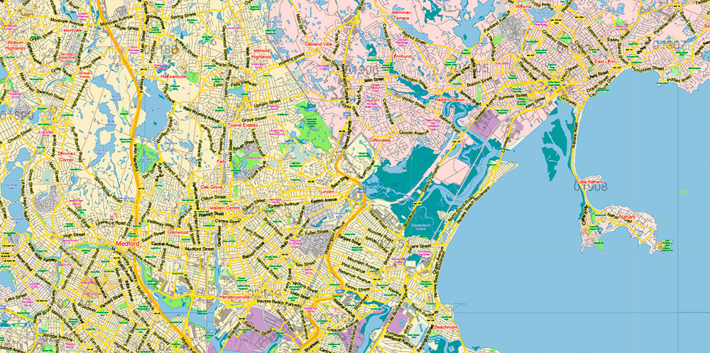
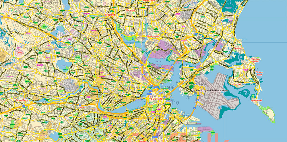
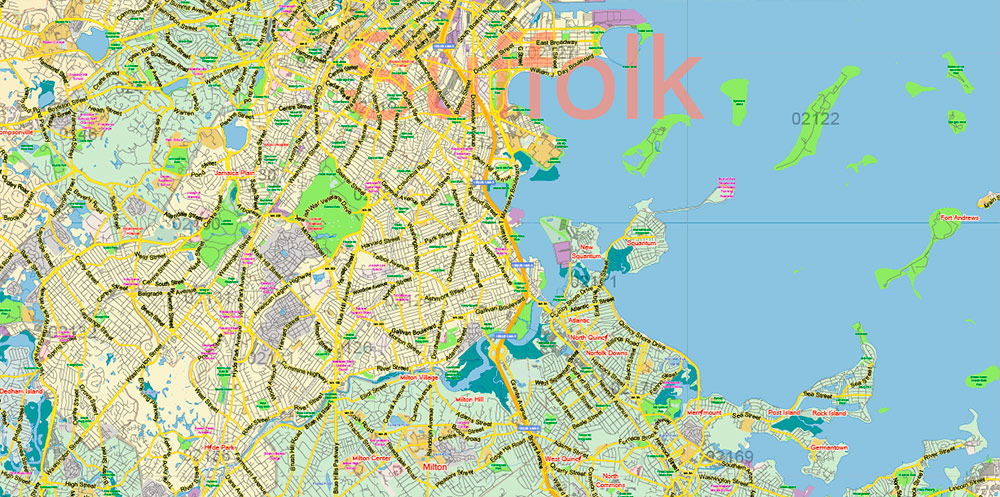
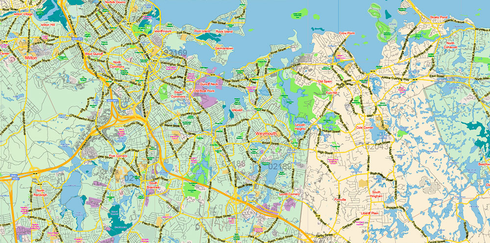
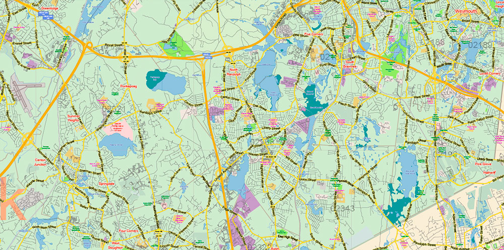
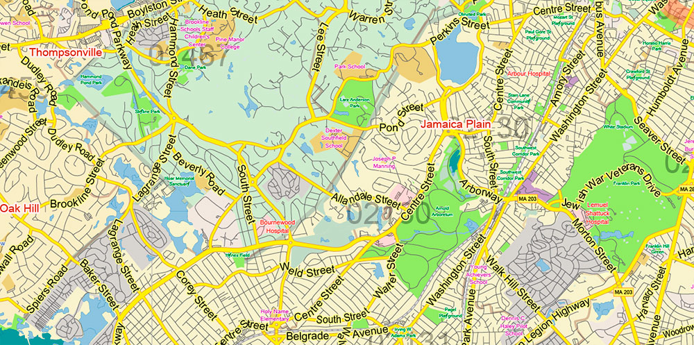
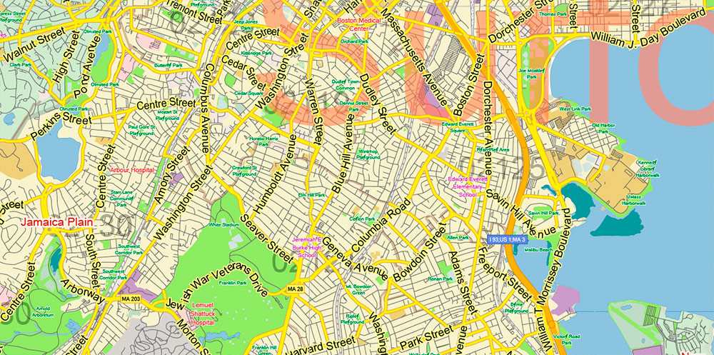
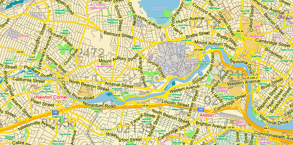
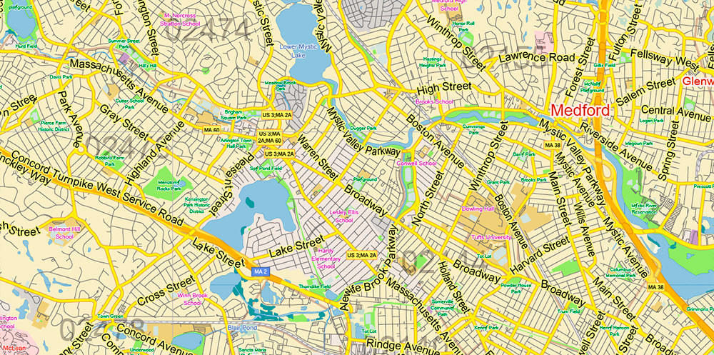
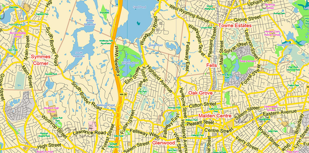
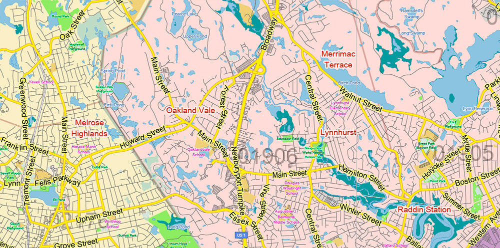
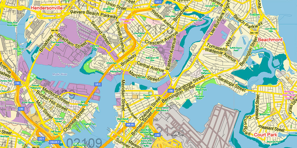
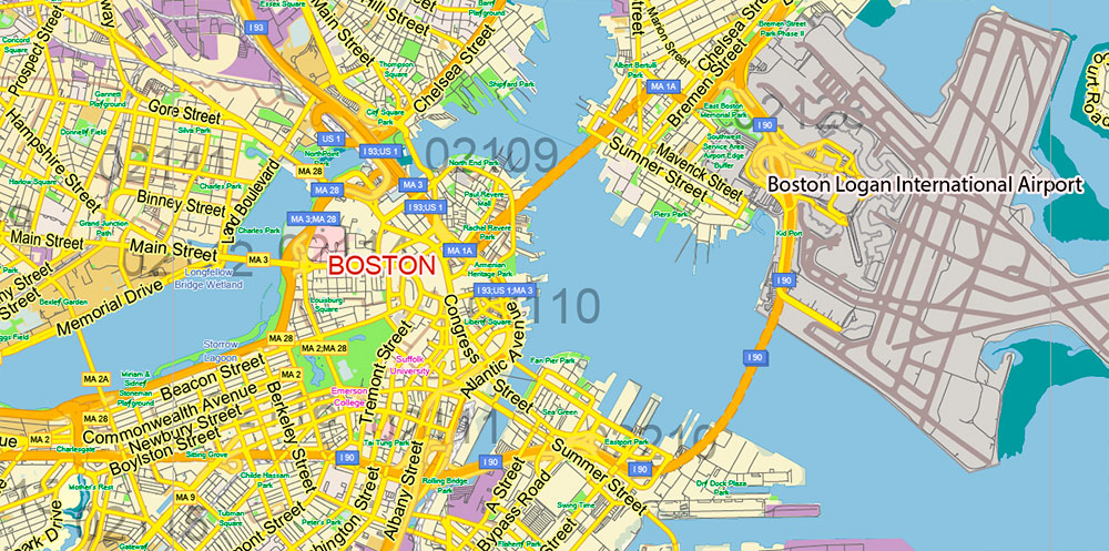
Printable Vector Map of Boston Massachusetts US LOW detailed City Plan Metro Area + Counties areas + ZIP (postal) Codes areas with numbers, scale 1:55533 full editable Adobe Illustrator Street Map in layers, scalable, text format all names, 23 MB ZIP
Principal street names, Main Objects, ZIP Codes areas, Counties. Map for design, printing, arts, projects, presentations, for architects, designers, and builders, business, logistics.
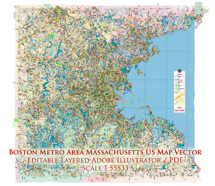
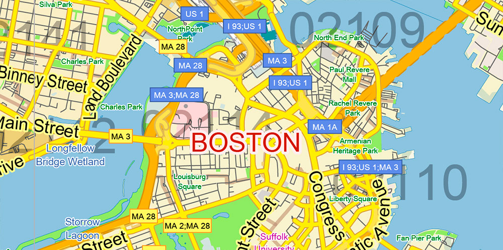
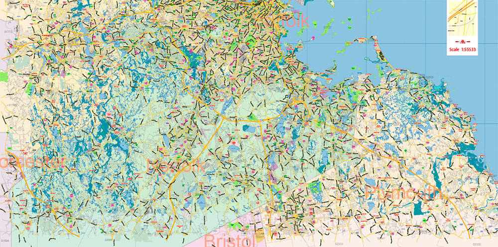
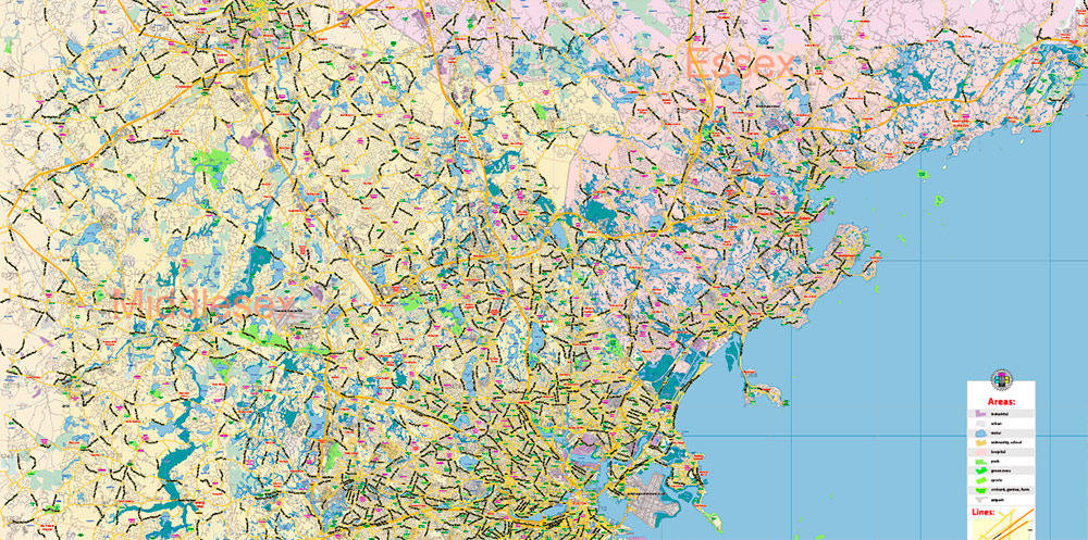
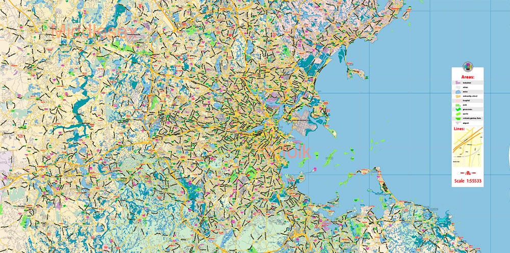
Boston Massachusetts US Map Vector Exact City Plan LOW Detailed Street Map Metro Area + ZIP-Codes editable Adobe Illustrator in layers
Layers list:
- Legend
- Grids
- Labels of roads
- Names of places (city, hamlet, etc.)
- Halo names of places
- Names of objects (hospitals, schools, parks, water)
- Halo names of objects
- Names of main streets
- Halo names of main streets
- Main Streets, roads, railroads, lines
- Civil streets
- ZIP Codes numbers
- ZIP Codes areas
- Railroads
- Airports and heliports
- Water objects (rivers, lakes, ponds)
- Waterways
- Color fills (parks, hospital areas, school areas, land use, etc.)
- Names Counties
- Counties areas
- Islands
- Sea
- Background
Boston is not only the capital of Massachusetts but also the main cultural and economic center of the entire New England region (6 States in the northeast of the United States), one of the largest cities in the country. It is located on the shore of Massachusetts Bay. There are several lakes on the territory of Boston, and the Charles River flows into the ocean.
The history of Boston began when puritans from the Massachusetts colony settled in this area in 1630. A few years later, Harvard school and College opened here, which eventually became the famous Harvard University. In 1773, it was Boston that became the starting point of the war of the American colonies for independence, when the so-called “Boston tea party” took place-colonists made their way on Board English ships and threw a batch of tea into the water. After the war of independence, although the city lost its status as the largest city in the country, it confidently held the position of the leading commercial port in the United States. Boston was one of the most important industrial centers of the American “North” and still occupies a leading position in the clothing and leather industry of the United States.
Multi-national Boston has become the cradle of many famous American families, mostly of Irish and English descent. For example, the Kennedy clan. The city has a diversified industry and is considered the technological and intellectual center of the United States.
Tourism plays an important role in the life of the city. About 20 million tourists visit Boston every year. The city has architectural attractions (the old and new state Capitol, Quincy Market, the public library building, and others) and ancient churches. The Freedom Trail, a 4-kilometer Hiking trail, passes major landmarks in the historic center of Boston. There are many interesting museums in the city, including the Museum of fine arts and the Boston University museums.
Boston is also a sports city. Boston teams compete in all major professional sports leagues in the United States (baseball, hockey, American football, and basketball). There are also regattas, rowing competitions, and the famous Boston Marathon, which attracts several hundred thousand participants.
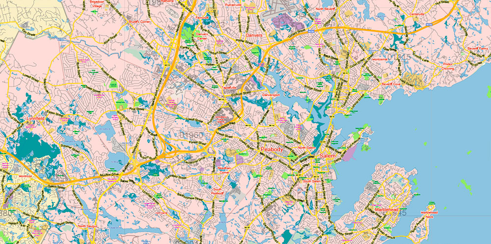
Boston Massachusetts US Map Vector Exact City Plan LOW Detailed Street Map Metro Area + ZIP-Codes editable Adobe Illustrator in layers
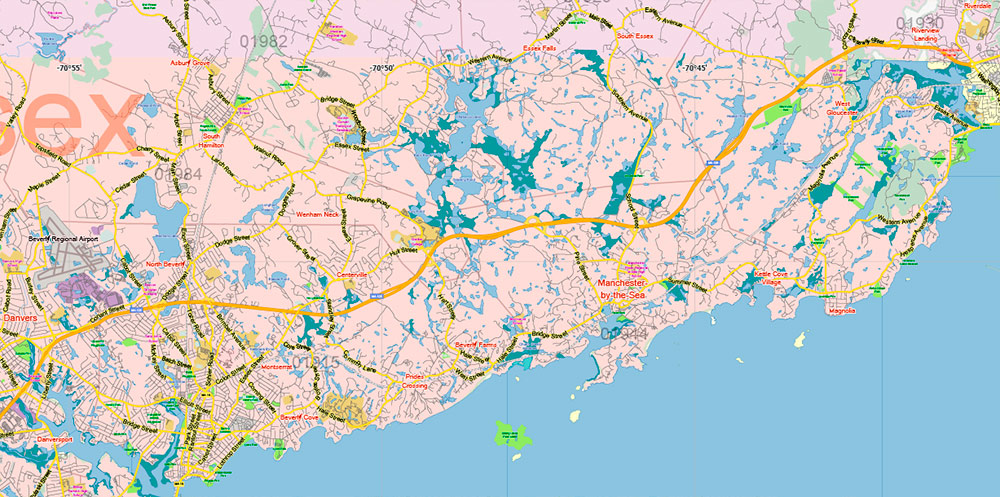
Boston Massachusetts US Map Vector Exact City Plan LOW Detailed Street Map Metro Area + ZIP-Codes editable Adobe Illustrator in layers
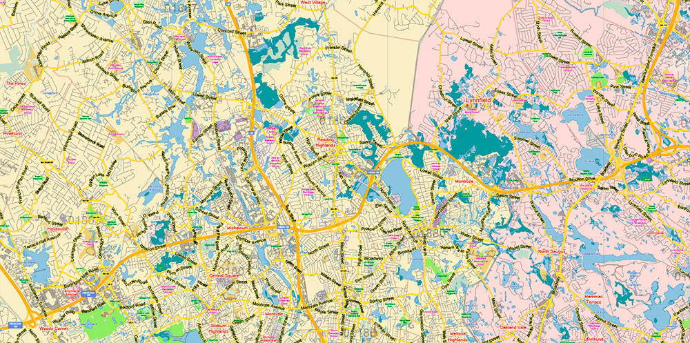
Boston Massachusetts US Map Vector Exact City Plan LOW Detailed Street Map Metro Area + ZIP-Codes editable Adobe Illustrator in layers
Boston Massachusetts US Map Vector Exact City Plan LOW Detailed Street Map Metro Area + ZIP-Codes editable Adobe Illustrator in layers
Boston Massachusetts US Map Vector Exact City Plan LOW Detailed Street Map Metro Area + ZIP-Codes editable Adobe Illustrator in layers
Boston Massachusetts US Map Vector Exact City Plan LOW Detailed Street Map Metro Area + ZIP-Codes editable Adobe Illustrator in layers
Boston Massachusetts US Map Vector Exact City Plan LOW Detailed Street Map Metro Area + ZIP-Codes editable Adobe Illustrator in layers
Boston Massachusetts US Map Vector Exact City Plan LOW Detailed Street Map Metro Area + ZIP-Codes editable Adobe Illustrator in layers
Boston Massachusetts US Map Vector Exact City Plan LOW Detailed Street Map Metro Area + ZIP-Codes editable Adobe Illustrator in layers
Boston Massachusetts US Map Vector Exact City Plan LOW Detailed Street Map Metro Area + ZIP-Codes editable Adobe Illustrator in layers
Boston Massachusetts US Map Vector Exact City Plan LOW Detailed Street Map Metro Area + ZIP-Codes editable Adobe Illustrator in layers
Boston Massachusetts US Map Vector Exact City Plan LOW Detailed Street Map Metro Area + ZIP-Codes editable Adobe Illustrator in layers
Boston Massachusetts US Map Vector Exact City Plan LOW Detailed Street Map Metro Area + ZIP-Codes editable Adobe Illustrator in layers
Boston Massachusetts US Map Vector Exact City Plan LOW Detailed Street Map Metro Area + ZIP-Codes editable Adobe Illustrator in layers
Boston Massachusetts US Map Vector Exact City Plan LOW Detailed Street Map Metro Area + ZIP-Codes editable Adobe Illustrator in layers
Boston Massachusetts US Map Vector Exact City Plan LOW Detailed Street Map Metro Area + ZIP-Codes editable Adobe Illustrator in layers
Boston Massachusetts US Map Vector Exact City Plan LOW Detailed Street Map Metro Area + ZIP-Codes editable Adobe Illustrator in layers
Boston Massachusetts US Map Vector Exact City Plan LOW Detailed Street Map Metro Area + ZIP-Codes editable Adobe Illustrator in layers
Boston Massachusetts US Map Vector Exact City Plan LOW Detailed Street Map Metro Area + ZIP-Codes editable Adobe Illustrator in layers
Boston Massachusetts US Map Vector Exact City Plan LOW Detailed Street Map Metro Area + ZIP-Codes editable Adobe Illustrator in layers

 Author: Kirill Shrayber, Ph.D. FRGS

