Extended Description of the Vector Map
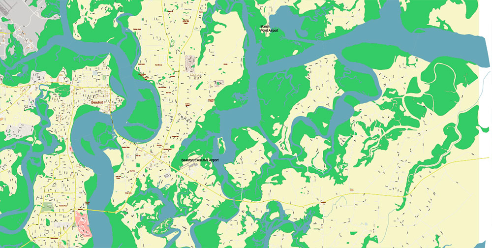
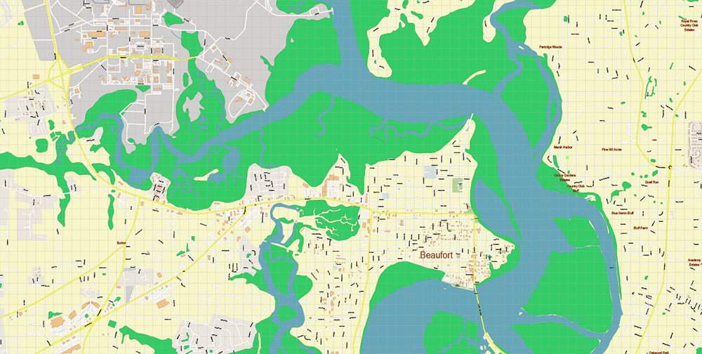
Printable PDF Vector Map of Beaufort and surrounds South Carolina USA detailed street map scale 1:3985 fully editable Adobe PDF scalable, text all names, 12 MB ZIP
All street names, Main Objects, Some Buildings. Map for design, printing, arts, projects, presentations, for architects, designers, and builders, business, logistics.
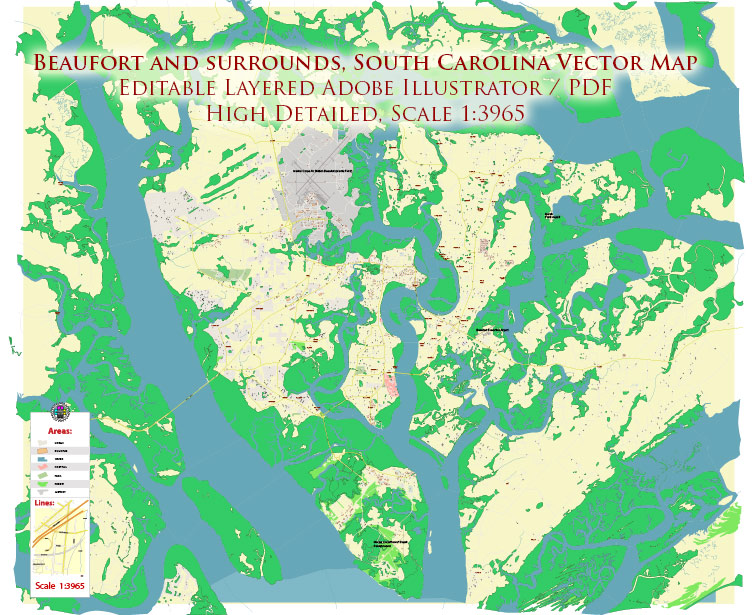
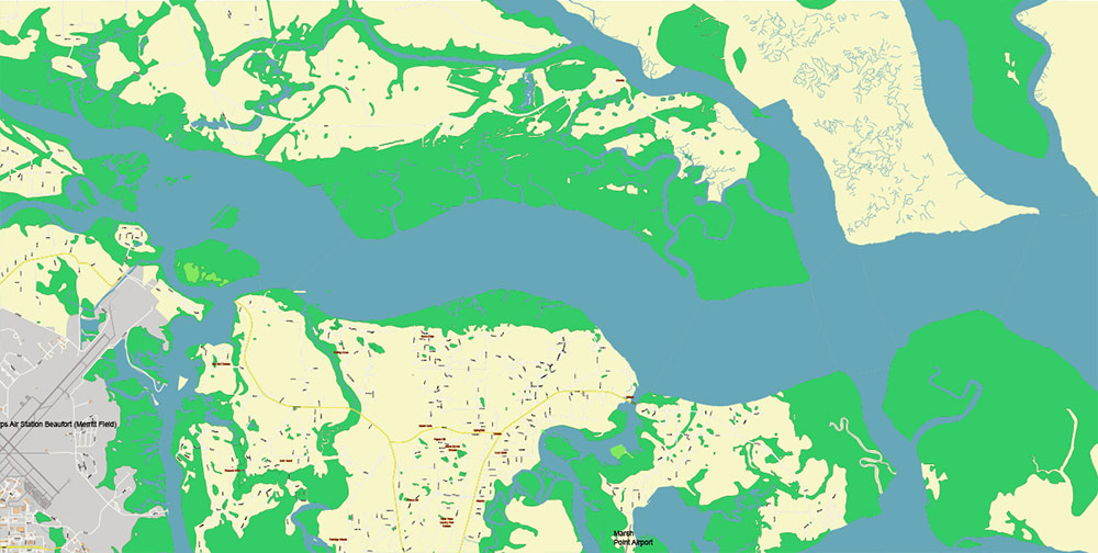
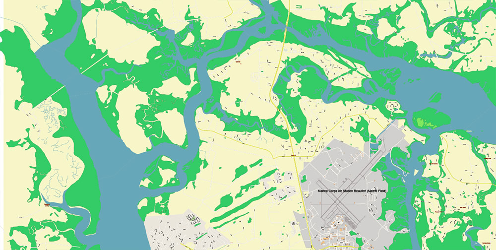
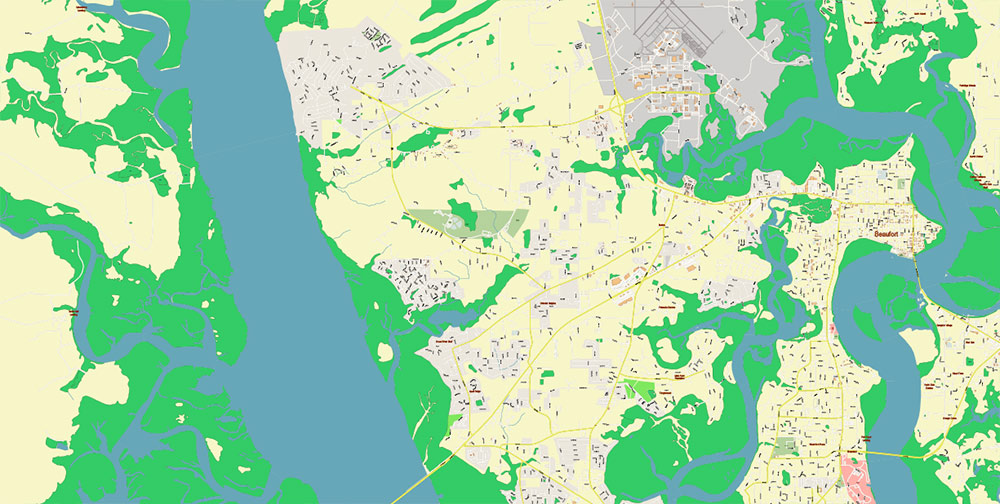
Beaufort and surrounds South Carolina USA PDF Map Vector Exact City Plan High Detailed Street Map editable Adobe PDF in layers
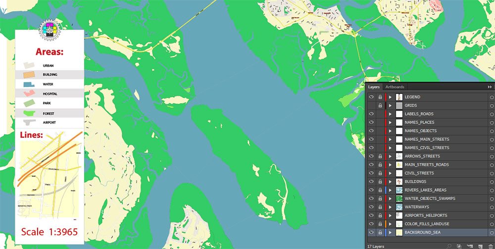
Layers list:
- Legend
- Grids
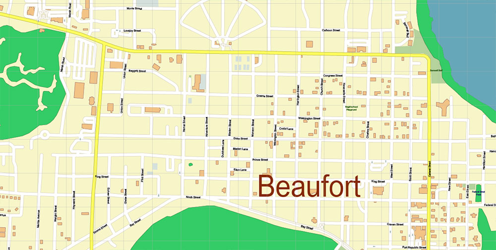
- Labels of roads
- Names of places (city, hamlet, etc.)
- Names of objects (hospitals, parks, water)
- Names of main streets
- Names of civil streets
- Arrows of streets
- Main Streets, roads
- Civil streets
- Buildings (some)
- Water objects (rivers, lakes, ponds)
- Water objects – Swamps
- Waterways
- Airports and Heliports
- Color fills (parks, hospital areas, land use, etc.)
- Background and sea
The most exact and detailed map of the city in scale.
For Editing and High-Quality Printing
Beaufort and surrounds South Carolina USA PDF Map Vector Exact City Plan High Detailed Street Map editable Adobe PDF in layers
Beaufort and surrounds South Carolina USA PDF Map Vector Exact City Plan High Detailed Street Map editable Adobe PDF in layers
Beaufort and surrounds South Carolina USA PDF Map Vector Exact City Plan High Detailed Street Map editable Adobe PDF in layers
Beaufort and surrounds South Carolina USA PDF Map Vector Exact City Plan High Detailed Street Map editable Adobe PDF in layers
Beaufort and surrounds South Carolina USA PDF Map Vector Exact City Plan High Detailed Street Map editable Adobe PDF in layers
Beaufort and surrounds South Carolina USA PDF Map Vector Exact City Plan High Detailed Street Map editable Adobe PDF in layers
Beaufort and surrounds South Carolina USA PDF Map Vector Exact City Plan High Detailed Street Map editable Adobe PDF in layers

Beaufort and surrounds South Carolina USA PDF Map Vector Exact City Plan High Detailed Street Map editable Adobe PDF in layers
Beaufort and surrounds South Carolina USA PDF Map Vector Exact City Plan High Detailed Street Map editable Adobe PDF in layers
Detailed Geographical Description of Beaufort, South Carolina, USA (and Surrounds)
Beaufort is a small, historic coastal city located in Beaufort County, in the Lowcountry region of South Carolina, United States. Renowned for its scenic beauty, antebellum architecture, and waterfront charm, Beaufort is the second-oldest city in South Carolina after Charleston. It lies on Port Royal Island, one of the inner Sea Islands of the southeastern Atlantic coast.
1. Location & Coordinates
2. Physical Geography
-
Topography:
-
The landscape is low-lying and flat, part of the broader Atlantic Coastal Plain.
-
It features a mix of tidal marshes, estuaries, rivers, creeks, and barrier and sea islands.
-
Waterways:
-
Beaufort is situated along the Beaufort River, a tidal channel of the Intracoastal Waterway.
-
Other nearby water bodies include the Broad River, Battery Creek, and Port Royal Sound.
-
The extensive marshland and tidal creeks define much of the local ecosystem.
3. Climate
4. Geographical Features & Surrounding Islands
-
Sea Islands:
Beaufort County is made up of over 60 islands, some of the most significant around Beaufort include:
-
Port Royal Island – where downtown Beaufort is located.
-
Lady’s Island – directly east across the river; now a major residential suburb.
-
St. Helena Island – southeast; known for its rural feel and strong Gullah culture.
-
Fripp Island – a resort and residential island further southeast.
-
Hunting Island – a state park with a historic lighthouse and natural beaches.
-
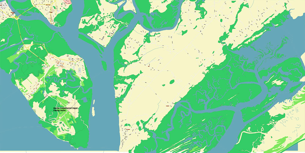
Parris Island – south of Beaufort, home to the U.S. Marine Corps Recruit Depot.
-
Beaches:
The closest beaches are on Hunting Island (about 16 miles away), which is one of the most popular natural attractions in South Carolina.
5. Urban Geography
-
Downtown Beaufort:
-
Located along the waterfront of the Beaufort River.
-
Known for its walkable historic district, shaded by large live oak trees with Spanish moss.
-
Main thoroughfares: Bay Street, Boundary Street, and Carteret Street.
-
Suburbs and Communities:
-
Lady’s Island, Burton, Port Royal, and Shell Point are adjacent communities forming part of the urban cluster.
-
The broader Beaufort Urban Cluster includes areas with residential, commercial, and military installations.
6. Ecology and Environment
-
Wetlands:
-
Dominant feature; salt marshes are critical to marine life and bird populations.
-
Part of the ACE Basin, a vast estuarine reserve encompassing the Ashepoo, Combahee, and Edisto Rivers.
-
Wildlife:
-
Home to a wide variety of birds (herons, egrets, osprey), dolphins, alligators, and saltwater fish.
-
Protected areas like Hunting Island State Park preserve local ecosystems.
7. Transportation Geography
-
Major Roads:
-
U.S. Route 21 – main artery from Beaufort to the Sea Islands and to Interstate 95.
-
SC Highway 170 – connects Beaufort to Bluffton and Hardeeville.
-
Boundary Street (US 21 Business) and Robert Smalls Parkway (SC 170) are key commercial routes.
-
Bridges:
8. Surrounding Regions
-
North and West:
-
Mostly rural and forested, with small towns like Sheldon and Yemassee.
-
Transition to the interior pine forests and agricultural fields of inland South Carolina.
-
South:
-
Port Royal and Parris Island lie adjacent, forming a military and port zone.
-
Beyond lies Hilton Head Island and the Savannah River border with Georgia.
-
East:

 Author: Kirill Shrayber, Ph.D. FRGS


