Extended Description of the Vector Map
Albany is one of the oldest cities in America, the capital of the state of New York and Albany County. The city is located on the banks of the Hudson River, 220 km north of New York City.
Albany itself has just under 100,000 residents. Together with its suburb of Colonie and the neighboring cities of Schenectady, Troy, Saratoga Springs, and others, Albany forms a region called the “Metropolitan Area“. In total, about 1 million people live in the Capital District. The city and its suburbs are home to the state administration, offices and departments, and seven universities.
Before European colonization, the area around Albany was inhabited by the Iroquois. In 1609, the explorer Henry Hudson discovered Manhattan Island and sailed up the river that bears his name today. The voyage ended just at what is now Albany. The city grew up around small Dutch trading posts – Fort Nassau (built-in 1614) and Fort Orange (built-in 1624). The settlers settled around Fort Orange, engaged in fur farming, and founded a village called Beverwijck. Later in 1664, the English took control of the area and renamed the city Albany in honor of James II, who bore the title “Duke of Albany” (Albany — the name of the historical region of Scotland).
Beginning in the late 18th century and throughout much of the 19th century, Albany was an important transportation hub. Located at the end of the navigable part of the Hudson River, the city became a center for the transportation of timber and other goods. By the beginning of the 19th century, the city was one of the ten most populated cities in the United States. The iron foundries attracted thousands of immigrants to the city. During the Great Depression, the city was a center for alcohol smuggling from Canada to the United States.
The racial composition of the population:
White – 53.2%
African American – 29.7%
Asian – 4.6%
Mixed race – 2.3%
Native American – 0.4%
Hispanics of any race make up 9.7% of the population.
Socio-economic indicators:
the median income per person (as of 2020) is $27,399
population living below the poverty line (as of 2020) – 27.8%
unemployment in the region (as of July 2020) – 7.9%
cost of living index (as of March 2020) – 112.0 (above the US average).
Albany’s economy is based on the administrative sector, education, and medicine. The local economy is less susceptible to economic problems due to the large administrative component, which includes a large number of institutions and agencies, both urban and state of New York. About a quarter of the employed population works for the state in one form or another. A large number of people come to Albany every day to work. It is believed that during working hours, the number of people in the city exceeds 160 thousand people.
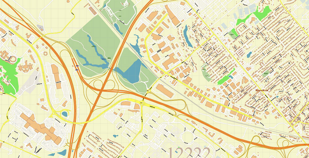
Albany International Airport is located 10 km northwest of the city and is very busy. Every day, an average of 180 departures (landings) take place in dozens of different destinations, including Canada.
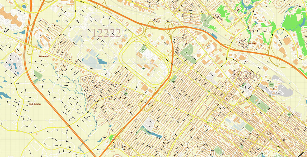
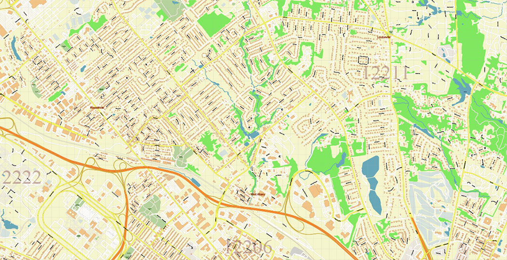
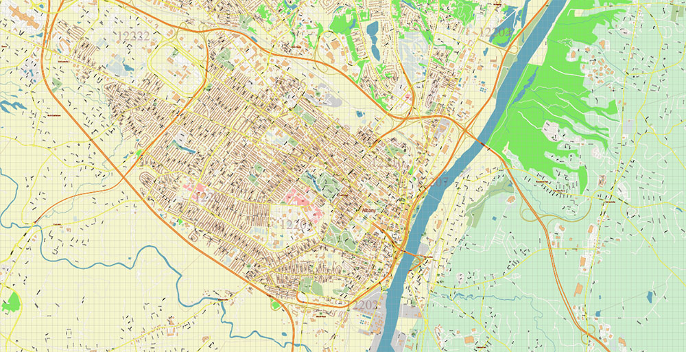
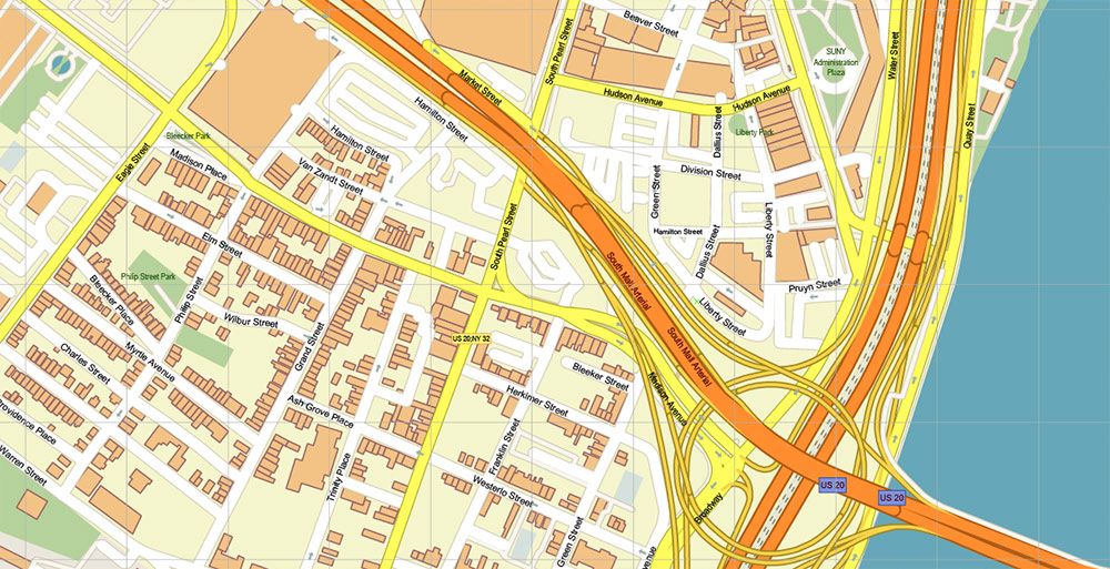
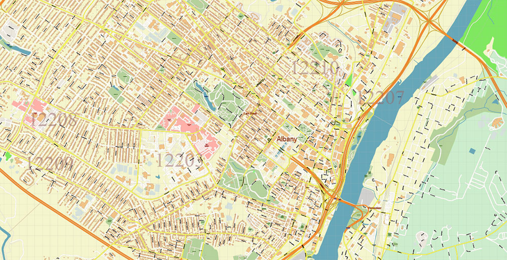
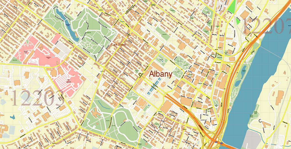
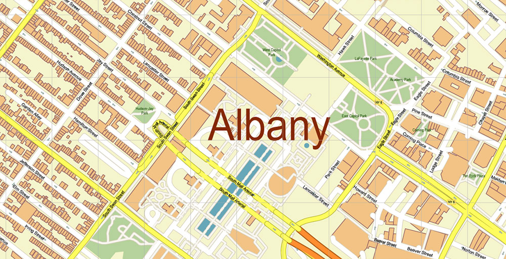
Printable Vector Map of Albany County New York US high detailed City Plan + Counties areas + Zipcodes areas and numbers, scale 1:3458 full editable Adobe Illustrator Street Map in layers, scalable, text format all names, 23 MB ZIP
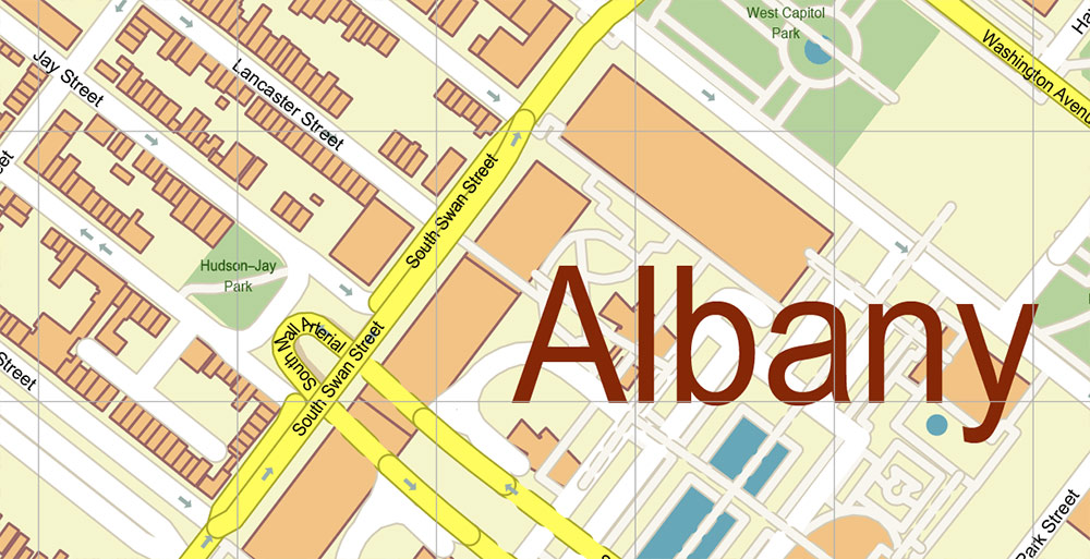
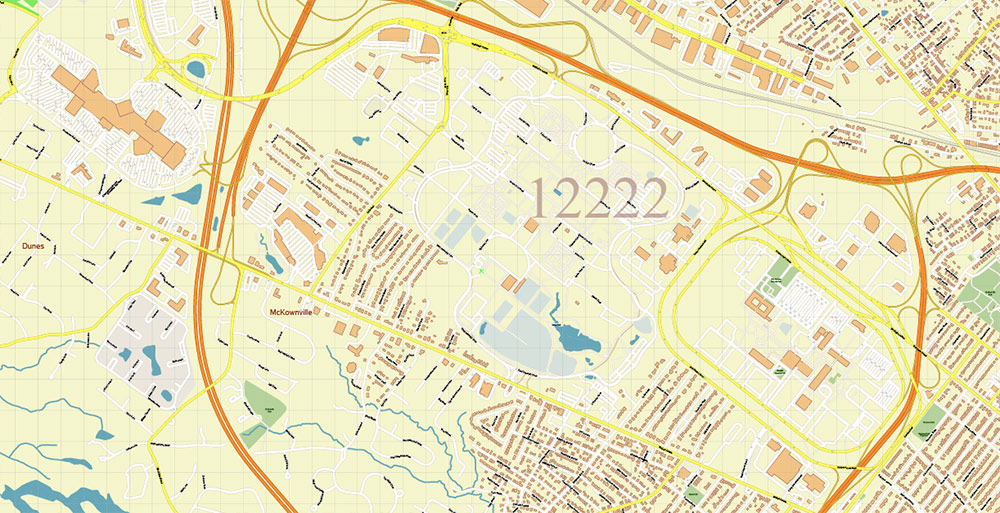
All street names, Main Objects, Buildings. Map for design, printing, arts, projects, presentations, for architects, designers, and builders, business, logistics.
Included: Simple vector map of New York State.
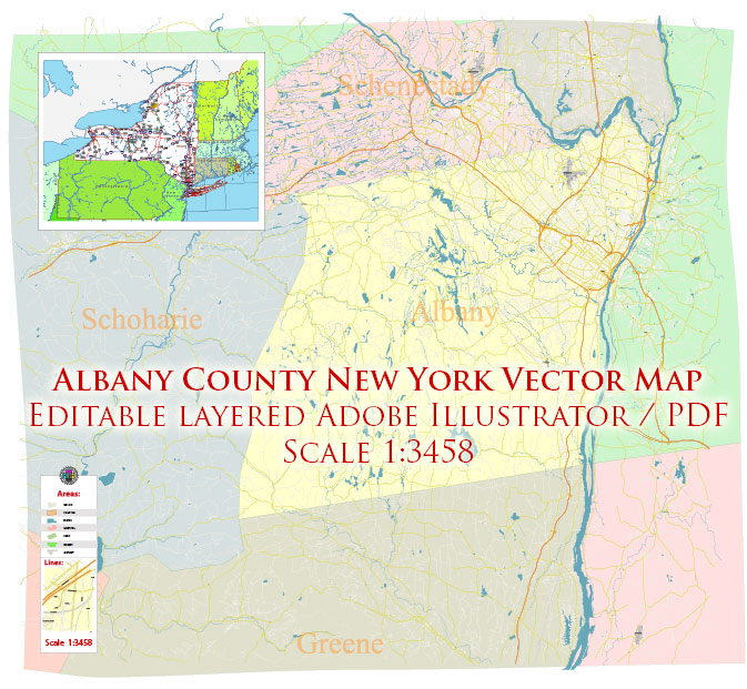
Albany County New York US Map Vector Exact State Plan High Detailed Road Map + admin + Zipcodes editable Adobe Illustrator in layers
Layers list:
- Legend
- Grids
- Labels of roads
- Names of places (city, hamlet, etc.)
- Names of objects (hospitals, parks, water)
- Names of main streets
- Names of civil streets
- Names of Counties
- Numbers of ZIPcodes
- Main Streets, roads
- Civil streets
- Railroads
- Buildings
- Airports and heliports
- Water objects (rivers, lakes, ponds)
- Waterways
- Color fills (parks, hospital areas, land use, etc.)
- ZIPcodes areas
- Counties areas
- Background
Albany County New York US Map Vector Exact State Plan High Detailed Road Map + admin + Zipcodes editable Adobe Illustrator in layers
Albany County New York US Map Vector Exact State Plan High Detailed Road Map + admin + Zipcodes editable Adobe Illustrator in layers
Albany County New York US Map Vector Exact State Plan High Detailed Road Map + admin + Zipcodes editable Adobe Illustrator in layers
Albany County New York US Map Vector Exact State Plan High Detailed Road Map + admin + Zipcodes editable Adobe Illustrator in layers
Albany County New York US Map Vector Exact State Plan High Detailed Road Map + admin + Zipcodes editable Adobe Illustrator in layers
Albany County New York US Map Vector Exact State Plan High Detailed Road Map + admin + Zipcodes editable Adobe Illustrator in layers
Albany County New York US Map Vector Exact State Plan High Detailed Road Map + admin + Zipcodes editable Adobe Illustrator in layers
Albany County New York US Map Vector Exact State Plan High Detailed Road Map + admin + Zipcodes editable Adobe Illustrator in layers
Albany County New York US Map Vector Exact State Plan High Detailed Road Map + admin + Zipcodes editable Adobe Illustrator in layers
Albany County New York US Map Vector Exact State Plan High Detailed Road Map + admin + Zipcodes editable Adobe Illustrator in layers


 Author: Kirill Shrayber, Ph.D. FRGS


