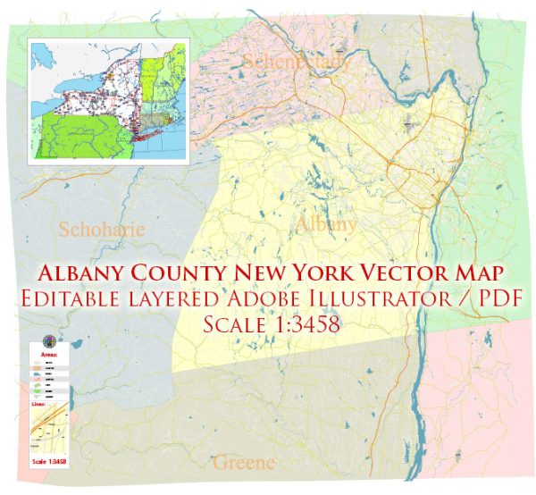
Albany County, located in the state of New York, has several water resources and bridges that play a significant role in the region’s transportation and infrastructure. Here’s some information about them:
Water Resources:
- Hudson River: The Hudson River flows along the eastern border of Albany County. It is a major waterway in the region, providing water for various purposes, including industrial use, recreation, and transportation.
- Mohawk River: The Mohawk River, which merges with the Hudson River in Cohoes, also flows through the northern part of Albany County. It is an essential water resource for the county, supporting various activities and industries.
- Reservoirs and Lakes: Albany County has several reservoirs and lakes that serve as sources of freshwater for the community. These include Alcove Reservoir and Lawson Lake County Park.
- Water Supply Systems: Albany County’s municipalities have their water supply systems, including the Albany Water Department, which supplies water to the city of Albany.
Bridges:
- Patroon Island Bridge: This bridge spans the Hudson River and connects Albany with Rensselaer County. It is part of the Interstate 90 highway system and is a vital transportation link in the area.
- Dunn Memorial Bridge: The Dunn Memorial Bridge also crosses the Hudson River, connecting Albany with Rensselaer. It is part of U.S. Route 9 and Route 20.
- Livingston Avenue Bridge: This railroad bridge crosses the Hudson River and connects Albany with the city of Rensselaer. It plays a crucial role in the transportation of goods and passengers via rail.
- Thaddeus Kosciusko Bridge: Located on the Adirondack Northway (Interstate 87), this bridge crosses the Mohawk River, connecting Albany County with Saratoga County.
- Various County and Local Bridges: Albany County has numerous smaller bridges that facilitate transportation within the county and connect its various municipalities.
These water resources and bridges are essential for the transportation and infrastructure of Albany County, helping to facilitate the movement of goods, people, and resources while also providing access to freshwater resources for the community. Please note that the specific details and conditions of these resources and bridges may change over time, so it’s advisable to consult up-to-date sources or local authorities for the latest information and developments.


 Author: Kirill Shrayber, Ph.D.