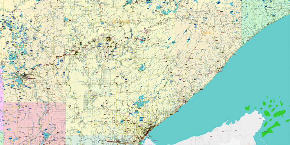
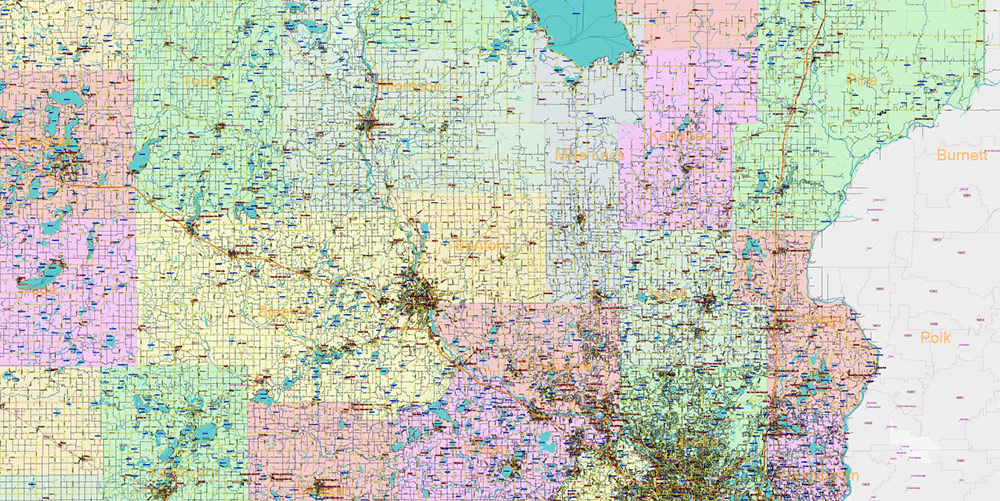
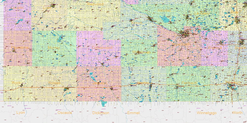
Printable PDF Vector Map of Minnesota State US extra high detailed State Plan fully editable Adobe PDF Road Map in layers, scalable, text/curves format all names, 281 MB ZIP
All Roads and Streets, All cities, towns and villages, Counties, Zip (postal) codes, Airports, main roads names and shields (labels). Map for design, printing, arts, projects, presentations, for architects, designers, and builders, business, logistics.
NOTE: on the preview images – all layers are enabled. You can simply turn off any layer, which you don’t need.
Also: We can add (additional layer for this map), any other objects for you. It’s free for our customers.
If you need any OTHER format – DWG, DXF, Corel, or something else – please, email us

Minnesota State US PDF Vector Map: Full Extra High Detailed (all roads, zipcodes, airports) + Admin Areas + main road names and shields editable Adobe PDF in layers
Layers list:
- Legend
- Names of places (city, hamlet, etc.)
- Points of Places
- Points of Airports, Heliports
- Names of water objects
- Names of Airports and Heliports
- Names of Main Cities
- Names of Counties
- Numbers of Zip codes
- Main Road shields (labels)
- Main roads and streets names
- Main Streets and Roads
- Residential streets and small roads
- Railroads
- Waterways / streams
- Water objects (rivers, lakes, ponds, islands)
- ZIP-codes areas
- Counties areas (color)
Detailed Geographical Description of Minnesota
Minnesota is the 12th-largest state in the United States, covering approximately 86,943 square miles (225,180 km²), or about 2.25% of the nation’s total area. It is located in the Upper Midwest region of North America and is the northernmost state in the contiguous U.S., with its isolated Northwest Angle being the only part of the lower 48 states lying north of the 49th parallel.
Borders and Location:
North: Canadian provinces of Manitoba and Ontario
East: Lake Superior (shared water border with Michigan and Wisconsin) and land border with Wisconsin
South: Iowa
West: North Dakota and South Dakota
Topography:
The state features a gently rolling peneplain, with dramatic local differences in elevation.
The highest point is Eagle Mountain at 2,301 feet (701 m), located only 13 miles from the state’s lowest point, the shore of Lake Superior at 601 feet (183 m).
The Leaf Hills in Otter Tail County also present relatively high elevations.
Hydrography:
Known as the “Land of 10,000 Lakes,” Minnesota actually has 14,420 bodies of fresh water covering at least ten acres each.
Its largest and deepest body of water is the Minnesota portion of Lake Superior, covering 962,700 acres (3,896 km²) and reaching depths of 1,290 feet (390 m).
The state contains 6,564 natural rivers and streams, totaling about 69,000 miles (111,000 km) in length.
The Mississippi River begins at Lake Itasca in northern Minnesota and flows south, joined by rivers such as the Minnesota, St. Croix, and Chippewa.
The Red River drains the northwest toward Canada’s Hudson Bay.
Minnesota has about 10.6 million acres (43,000 km²) of wetlands, the most of any state outside Alaska.
Watersheds:
Two major continental divides meet in northeastern Minnesota near Hibbing, forming a triple watershed. Precipitation can flow south to the Gulf of Mexico (Mississippi River), east to the Atlantic Ocean (St. Lawrence Seaway), or north to the Arctic Ocean (Hudson Bay).
Land Cover:
About one-third of the state is forested, especially in the north and northeast.
The remainder of the state is largely prairie and farmland, particularly in the south and west.
Main Roads of Minnesota
Minnesota has an extensive road network, including more than 142,000 miles of streets, roads, and highways. The main roads include several major Interstate Highways and state and county routes.
Primary Interstate Highways:
Interstate Length (mi) Key Cities/Termini Notes
I-35 220.3 From Iowa border through Twin Cities to Duluth Splits into I-35E (St. Paul) and I-35W (Minneapolis) in the Twin Cities
I-35E 39.3 Burnsville to Columbus (via St. Paul) Serves St. Paul
I-35W 41.8 Burnsville to Columbus (via Minneapolis) Serves Minneapolis
I-90 275.7 From South Dakota border to Wisconsin border Runs east-west across southern Minnesota
I-94 259.6 Fargo, ND to Hudson, WI (via Minneapolis and St. Paul) Major east-west corridor
Auxiliary Interstates:
I-394: Connects I-494 in Minnetonka to downtown Minneapolis
I-494 and I-694: Form a beltway around the Twin Cities metropolitan area
I-535: Connects Duluth, MN to Superior, WI
Other Major Roadways:
State Trunk Highways: 11,814 miles maintained by the Minnesota Department of Transportation (MnDOT)
County Roads: 44,821 miles
City Streets: 22,414 miles
Township Roads: 58,686 miles
Transit and Alternative Routes:
Minnesota also features national and state-designated bicycle routes, more than 4,000 miles of designated trails, and robust transit options in the Twin Cities, including bus and light rail lines.
Summary
Minnesota is a geographically diverse state defined by its lakes, rivers, forests, prairies, and farmland, with significant elevation contrasts between its high points and Lake Superior shoreline. Its extensive road network is anchored by major Interstates (I-35, I-90, I-94) and a comprehensive system of state, county, and local roads, supporting both urban and rural connectivity throughout the state

Minnesota State US PDF Vector Map: Full Extra High Detailed (all roads, zipcodes, airports) + Admin Areas + main road names and shields editable Adobe PDF in layers

Minnesota State US PDF Vector Map: Full Extra High Detailed (all roads, zipcodes, airports) + Admin Areas + main road names and shields editable Adobe PDF in layers

Minnesota State US PDF Vector Map: Full Extra High Detailed (all roads, zipcodes, airports) + Admin Areas + main road names and shields editable Adobe PDF in layers

Minnesota State US PDF Vector Map: Full Extra High Detailed (all roads, zipcodes, airports) + Admin Areas + main road names and shields editable Adobe PDF in layers

Minnesota State US PDF Vector Map: Full Extra High Detailed (all roads, zipcodes, airports) + Admin Areas + main road names and shields editable Adobe PDF in layers
Minnesota State US PDF Vector Map: Full Extra High Detailed (all roads, zipcodes, airports) + Admin Areas + main road names and shields editable Adobe PDF in layers

Minnesota State US PDF Vector Map: Full Extra High Detailed (all roads, zipcodes, airports) + Admin Areas + main road names and shields editable Adobe PDF in layers

Minnesota State US PDF Vector Map: Full Extra High Detailed (all roads, zipcodes, airports) + Admin Areas + main road names and shields editable Adobe PDF in layers

Minnesota State US PDF Vector Map: Full Extra High Detailed (all roads, zipcodes, airports) + Admin Areas + main road names and shields editable Adobe PDF in layers

Minnesota State US PDF Vector Map: Full Extra High Detailed (all roads, zipcodes, airports) + Admin Areas + main road names and shields editable Adobe PDF in layers
Minnesota State US PDF Vector Map: Full Extra High Detailed (all roads, zipcodes, airports) + Admin Areas + main road names and shields editable Adobe PDF in layers

Minnesota State US PDF Vector Map: Full Extra High Detailed (all roads, zipcodes, airports) + Admin Areas + main road names and shields editable Adobe PDF in layers

Minnesota State US PDF Vector Map: Full Extra High Detailed (all roads, zipcodes, airports) + Admin Areas + main road names and shields editable Adobe PDF in layers
Minnesota State US PDF Vector Map: Full Extra High Detailed (all roads, zipcodes, airports) + Admin Areas + main road names and shields editable Adobe PDF in layers

Minnesota State US PDF Vector Map: Full Extra High Detailed (all roads, zipcodes, airports) + Admin Areas + main road names and shields editable Adobe PDF in layers

Minnesota State US PDF Vector Map: Full Extra High Detailed (all roads, zipcodes, airports) + Admin Areas + main road names and shields editable Adobe PDF in layers

Minnesota State US PDF Vector Map: Full Extra High Detailed (all roads, zipcodes, airports) + Admin Areas + main road names and shields editable Adobe PDF in layers

Minnesota State US PDF Vector Map: Full Extra High Detailed (all roads, zipcodes, airports) + Admin Areas + main road names and shields editable Adobe PDF in layers

Minnesota State US PDF Vector Map: Full Extra High Detailed (all roads, zipcodes, airports) + Admin Areas + main road names and shields editable Adobe PDF in layers

 Author: Kirill Shrayber, Ph.D. FRGS

 Street Map editable Adobe Illustrator in layers")