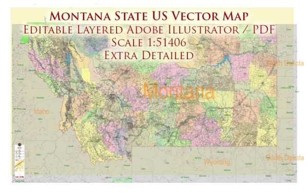
A general overview of Montana’s cities, towns, roads, and streets infrastructure.
Vectormap.Net provide you with the most accurate and up-to-date vector maps in Adobe Illustrator, PDF and other formats, designed for editing and printing. Please read the vector map descriptions carefully.
Cities and Towns:
- Billings: Billings is the largest city in Montana and serves as a major economic and cultural hub. It is located in the south-central part of the state, along the Yellowstone River.
- Missoula: Situated in western Montana, Missoula is known for its natural beauty and outdoor recreational opportunities. The University of Montana is located here, contributing to the city’s vibrant atmosphere.
- Great Falls: Located along the Missouri River in north-central Montana, Great Falls is known for its outdoor activities and is a gateway to the nearby Glacier National Park.
- Bozeman: Home to Montana State University, Bozeman is located in the southwestern part of the state. It’s a rapidly growing city with a strong focus on education and technology.
- Helena: Serving as the state capital, Helena is located in west-central Montana. It has a rich history, and visitors can explore landmarks such as the Montana State Capitol and the Cathedral of St. Helena.
- Kalispell: Situated in the northwest part of the state, Kalispell is a gateway to the Flathead Valley and Glacier National Park. It offers a picturesque setting with access to outdoor activities.
Roads and Highways: Montana has an extensive road network that connects its cities, towns, and rural areas. Major highways include:
- Interstate 90 (I-90): Runs east-west through southern Montana, connecting cities like Billings and Missoula.
- Interstate 15 (I-15): Travels north-south through western Montana, passing through cities like Helena and Great Falls.
- U.S. Route 93 (US 93): Connects the western and eastern parts of the state, passing through cities like Kalispell and Hamilton.
Montana’s roads often traverse vast and diverse landscapes, including mountainous terrain and wide-open prairies. Some areas may have limited services, so travelers are advised to plan accordingly.
Streets Infrastructure: In urban areas, cities have well-developed street infrastructure with a grid system in many cases. The downtown areas typically feature a mix of residential and commercial streets, with amenities such as parks, shops, and restaurants.
It’s worth noting that Montana’s rural areas may have more basic infrastructure, with gravel roads in some places. The state’s infrastructure is designed to accommodate the unique challenges posed by its expansive and varied geography.
For the most up-to-date and specific information, it’s recommended to consult local government sources or use mapping services like Google Maps.


 Author: Kirill Shrayber, Ph.D. FRGS