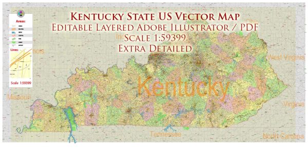
Kentucky is a state located in the southeastern region of the United States. It is bordered by Illinois to the northwest, Indiana to the north, Ohio to the northeast, West Virginia to the east, Virginia to the southeast, Tennessee to the south, and Missouri to the west. The capital of Kentucky is Frankfort, while its largest city is Louisville.
Vectormap.Net provide you with the most accurate and up-to-date vector maps in Adobe Illustrator, PDF and other formats, designed for editing and printing. Please read the vector map descriptions carefully.
Here are some key aspects of Kentucky:
- Geography:
- Land Area: Kentucky covers an area of about 40,408 square miles, making it the 37th largest state in the U.S.
- Topography: The state is characterized by diverse landscapes, including the Appalachian Mountains in the east, the Cumberland Plateau, and the Bluegrass Region in the central part of the state. The western region is known for its fertile lowlands.
- Climate:
- Climate: Kentucky experiences a humid subtropical climate, with hot summers and generally mild winters. Precipitation is relatively evenly distributed throughout the year.
- Economy:
- Major Industries: Kentucky’s economy has traditionally been associated with agriculture and coal mining. However, the state has diversified, and major industries now include manufacturing, services, healthcare, and tourism.
- Horse Industry: Kentucky is renowned for its thoroughbred horse industry, with the famous Kentucky Derby being held annually in Louisville. The state is home to numerous horse farms and is a major player in the global horse racing industry.
- Culture:
- Bluegrass Music: Kentucky is often associated with bluegrass music, a genre that originated in the state. The International Bluegrass Music Museum is located in Owensboro.
- Bourbon: Kentucky is also famous for its bourbon whiskey. The state is home to numerous distilleries, and the Bourbon Trail attracts visitors from around the world.
- Education:
- Higher Education: Kentucky is home to several universities, including the University of Kentucky and the University of Louisville.
- Natural Attractions:
- Mammoth Cave: Located in western Kentucky, Mammoth Cave is the world’s longest known cave system and is a UNESCO World Heritage Site.
- Land Between the Lakes: This national recreation area is situated between Kentucky Lake and Lake Barkley and offers a variety of outdoor activities.
- Government:
- Governor: As of my last knowledge update in January 2022, the Governor of Kentucky is Andy Beshear.
- History:
- Settlement and Frontier Life: Kentucky was initially explored and settled by pioneers in the late 18th century. It became the 15th state to join the Union in 1792.
Overall, Kentucky is a state with a rich cultural heritage, diverse geography, and a mix of urban and rural landscapes. Its contributions to music, horse racing, and bourbon production have left a lasting impact on American culture.


 Author: Kirill Shrayber, Ph.D. FRGS