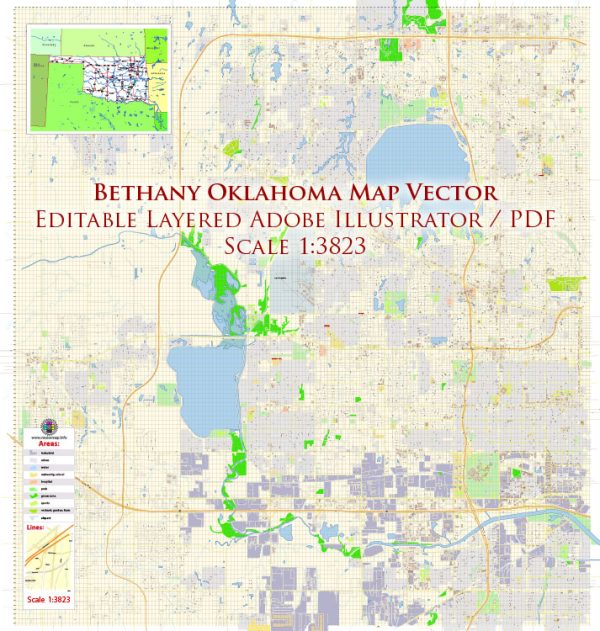
Vector Maps of the Bethany : city, Oklahoma county, central Oklahoma, U.S., immediately west of Oklahoma City. It was established in 1909 as a religious colony centered on Southern Nazarene University, which was established as Oklahoma Holiness College in 1909 but later merged with the Texas Holiness University (founded 1899). Until the mid-1990s pool halls, dance halls, movie theatres, beauty salons, and the use of alcoholic beverages were prohibited by local blue laws. Bethany’s industry, like that of Oklahoma City, is based on the manufacture of aviation equipment and the processing of agricultural products. Lake Overholser, just outside the city, is a popular recreation area. Stinchcomb Wildlife Refuge, on the lake’s north shore, provides habitat for many songbirds and waterfowl and is used as a U.S. Department of the Interior banding station. Inc. 1910.
Instant download archives: royalty free, editable vector maps of Bethany Oklahoma in high resolution digital PDF and Adobe Illustrator format.\
Bethany OK geographical dataCity Name: Bethany |
Small towns nearby:Del City OK |
Large cities nearby:Oklahoma City OK street map |
All of our editable Bethany Oklahoma vector maps are digital files,
which can be instantly downloaded in editable PDF or Adobe Illustrator format.
Objects on maps are usually divided into layers according to their types – lines, polygons, street names, object names (see map description!!!!)
Each of our Bethany Oklahoma digital maps is available in Adobe Illustrator or editable PDF format, (or on request in any other known format for the same price)
which use a vector approach to display images,
you can easily enlarge any part of our maps without compromising text, line or graphic quality,
with any increase or decrease ratio.
Using a vector graphics editor such as Adobe Illustrator, CorelDraw, Inkscape, or Freehand
you can easily crop parts of the map, add custom characters, and change colors and font attributes as needed.
We have a variety of Bethany Oklahoma vector maps with different levels of detail, from simple empty paths to highly detailed maps with roads and terrain layers.
Don’t see exactly what you’re looking for? Contact us to receive a special offer for an individual Bethany Oklahoma map for your project.


 Author: Kirill Shrayber, Ph.D.