Free vector map State Wisconsin US Adobe Illustrator and PDF download
Free vector map State Wisconsin US Adobe Illustrator download now >>>
Free vector map State Wisconsin US Adobe PDF download now >>>
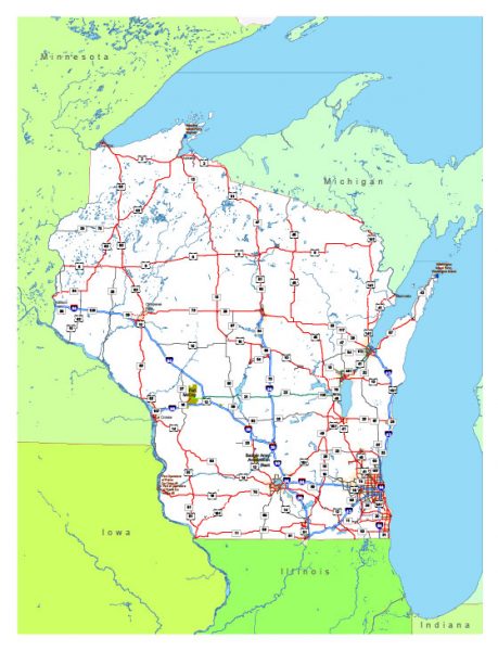
Wisconsin See also: Full version high detailed vector maps of the State territory, and Cities
US State
Wisconsin is a midwestern U.S. state with coastlines on 2 Great Lakes (Michigan and Superior) and an interior of forests and farms. Milwaukee, the largest city, is known for the Milwaukee Public Museum, with its numerous re-created international villages, and the Harley-Davidson Museum, displaying classic motorcycles. Several beer companies are based in Milwaukee, and many offer brewery tours.
Capital: Madison
Abbreviation: WI
Area: 169,639 km²
See also: Full Version Vector Map of Wisconsin

Map Wisconsin State US, exact extra detailed All Roads, Cities, and Counties
 Author: Kirill Shrayber, Ph.D. FRGS