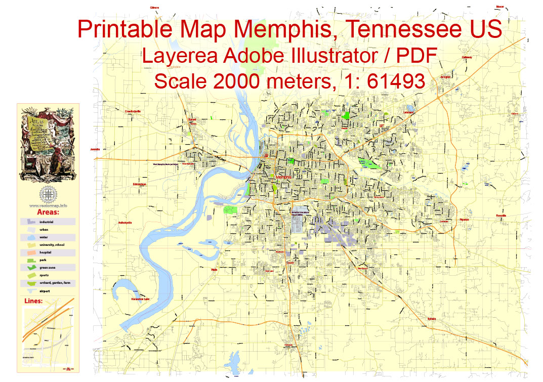
Free Printable Map Memphis, Tennessee US, exact vector City Plan Map street G-View Level 13 (2000 meters scale) full editable, Adobe Illustrator, full vector, scalable, editable text format street names, 9 mb ZIP
Major streets named, Main Objects. Map for design, printing, arts, projects, presentations, for architects, designers and builders, business, logistics.
Layers: color fills, streets_roads, labels_roads, names_objects, names_streets, names_places, grids, halo.
The most exact and detailed map of the city.
For print ANY format.
Free Download Memphis map in AdobeIllustrator:
Memphis Printable Map, Tennessee US, exact vector City Plan Map street G-View Level 13 (2000 meters scale) full editable, Adobe Illustrator
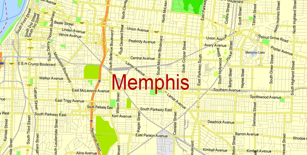
Memphis
City in Tennessee
Memphis is a city on the Mississippi River in southwest Tennessee, famous for the influential strains of blues, soul and rock ‘n’ roll that originated there. Elvis Presley, B.B. King and Johnny Cash recorded albums at the legendary Sun Studio, and Presley’s Graceland mansion is a popular attraction. Other music landmarks include the Rock ‘n’ Soul Museum, Blues Hall of Fame and Stax Museum of American Soul Music.
Area
• City 324.0 sq mi (839.2 km2)
• Land 315.1 sq mi (816.0 km2)
• Water 9.0 sq mi (23.2 km2)
Elevation 337 ft (103 m)
Population
• City 646,889
• Estimate 652,717
• Rank US: 25th
• Density 2,000/sq mi (770/km2)
• Urban 1,060,061 (US: 41st)
• Metro 1,341,746 (US: 41st)
Free US vector maps

Free Download Vector Map US County and State Adobe Illustrator
Free_Vector_Map_US_States_County_Map.ai
Free Download Vector Map US County and State Adobe PDF
Free_Vector_Map_US_States_County_Map.pdf

Free Download Vector Map US With States Names, Adobe Illustrator
Free_Map_of_USA_with_state_names_en.ai
Free Download Vector Map US With States Names, Adobe PDF
Free_Map_of_USA_with_state_names_en.pdf
Free vector map World, Adobe Illustrator, download now maps vector clipart
Map for design, projects, presentation free to use as you like.
See also: TERMS & CONDITIONS: SOFTWARE LICENSE AGREEMENT FOR DIGITAL CARTOGRAPHIC DATA.
Need more USA Vector Maps, printable and editable?
 Author: Kirill Shrayber, Ph.D. FRGS