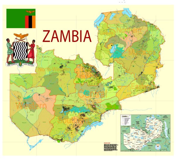
Zambia Printable Map Admin 01 Roads, Cities, Towns, Railroads, Water objects Adobe Illustrator

  1. Home
  2. Africa maps
  3. Zambia Vector Maps: PDF and Adobe Illustrator
  4. Zambia Printable Map Admin 01 Roads, Cities, Towns, Railroads, Water objects Adobe Illustrator

WhatsApp us! If you have any questions, please, feel free to contact us via WhatsApp +1.829.4100078

We accept PayPal and all  Debit or Credit Cards | Instantly Download Your Map after payment.
Verified Seller 10+ years.

$ 39.00

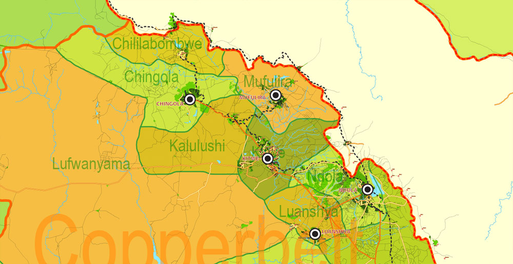
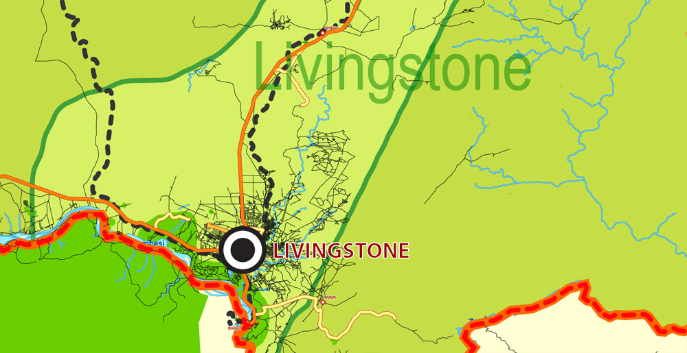
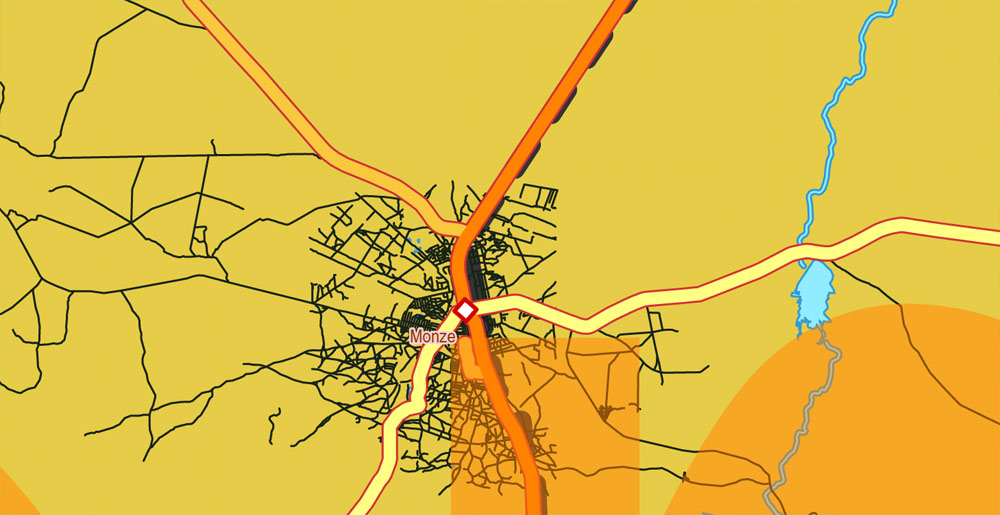
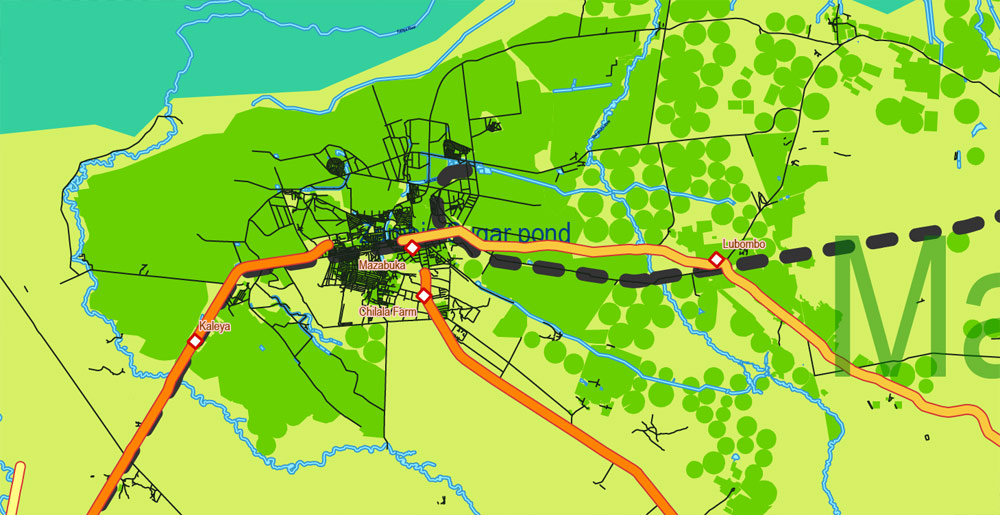
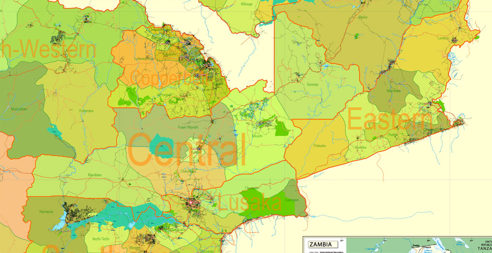
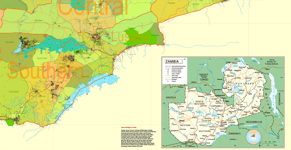
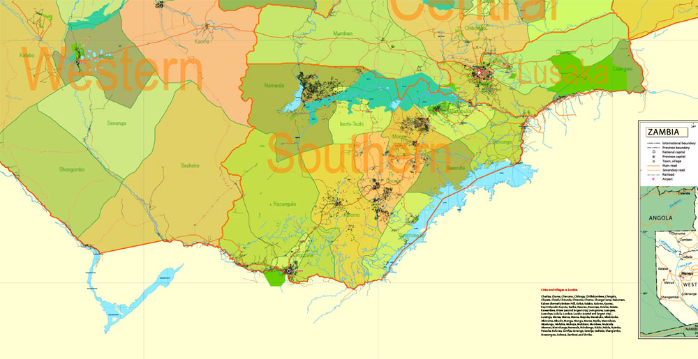
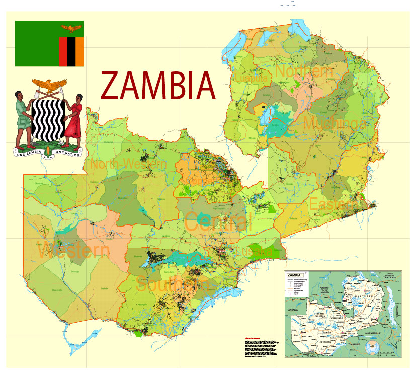
Printable Exact Detailed Map Zambia Admin, Roads, Cities, Towns, Railroads, Water objects Adobe Illustrator, 31 mb ZIP
Map for publishing, design, printing, publications,
arts, projects, presentations, for architects, designers and builders, business, logistics. The most exact and detailed map of the country.
Layers:
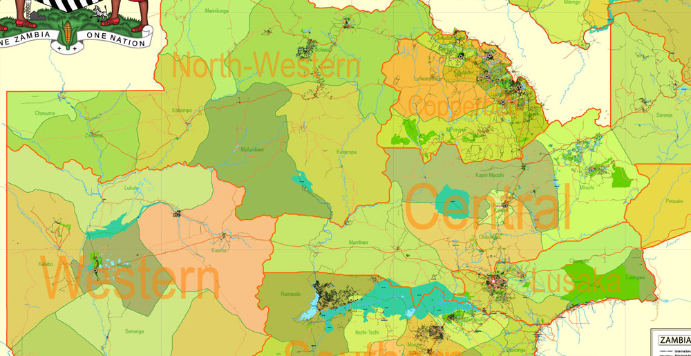
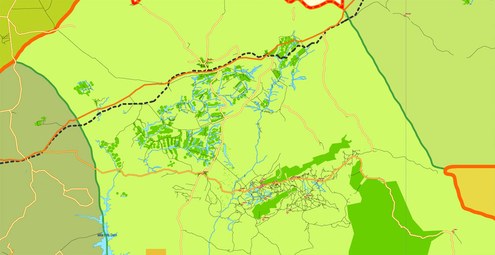
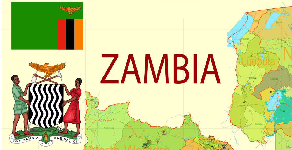
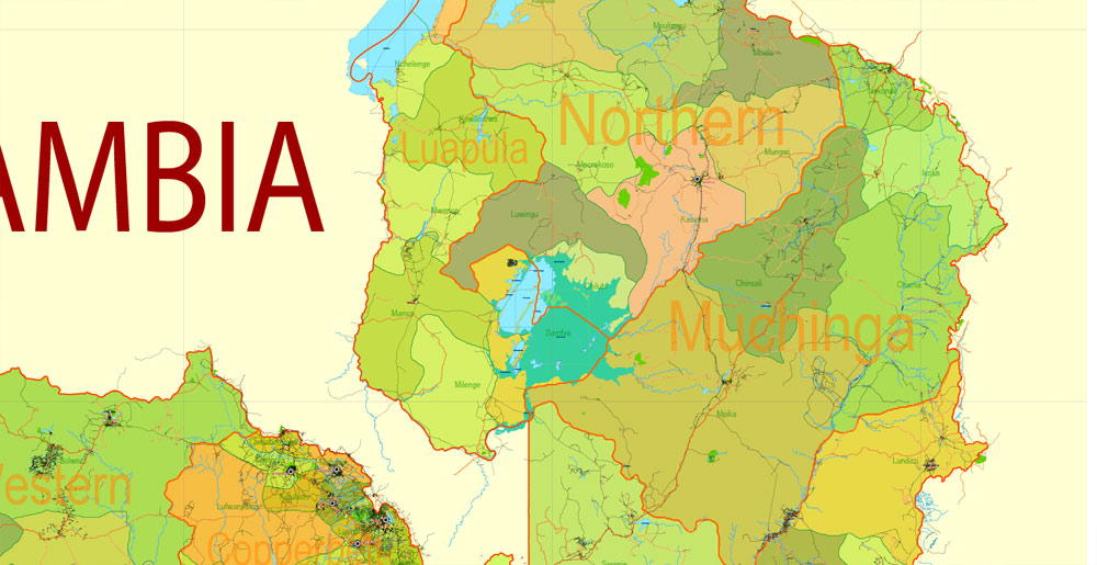
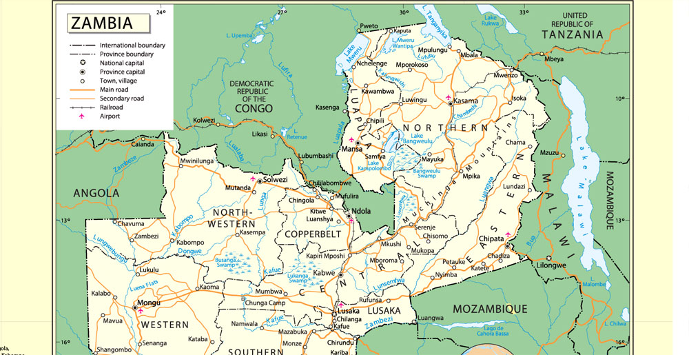
legend + coat of arms + simple map (UN) + flag, grids, waterways and water objects, names_water, districts and names_districts, provinces and names provinces, main_roads, civil_roads, main_cities with names and icons, towns and villages, names towns and villages, etc.
Text format names

SKU: 2018.19.01.ZM.AF.CM.ADMR.AI
Share this map for your friends!

Taxonomy: Product Tags for this Vector Map

AutoCAD Map Zambia full, City Map Zambia full, City Plan Zambia full, CorelDraw Map Zambia full, DWG Map Zambia full, DXF Map Zambia full, Editable Map Zambia full, Illustrator Map Zambia full, Map Zambia full for Printing, PDF Map Zambia full, printable map Zambia full, Road Map Zambia full, Street Map Zambia full, Tourist Map Zambia full, Urban Plan Zambia full, Vector Map Zambia full, Zambia full City Vector Map, Zambia full Map

Map Categories

Africa maps, Countries full vector maps: PDF and Adobe Illustrator, Zambia Vector Maps: PDF and Adobe Illustrator

Extended Description of the Vector Map

Printable Exact Detailed Map Zambia Admin, Roads, Cities, Towns, Railroads, Water objects Adobe Illustrator, 31 mb ZIP
Map for publishing, design, printing, publications,
arts, projects, presentations, for architects, designers and builders, business, logistics. The most exact and detailed map of the country.
Layers:
legend + coat of arms + simple map (UN) + flag, grids, waterways and water objects, names_water, districts and names_districts, provinces and names provinces, main_roads, civil_roads, main_cities with names and icons, towns and villages, names towns and villages, etc.
Text format names
DWG, DXF, ESRI Shapes, and other formats – by request, same price, please contact.


Zambia, Africa.

This vector map of Zambia is used as a basis for design, editing, and further printing.

This is the most detailed, exact map of Zambia for high-quality printing and polygraphy. You can always clarify the map development date by contacting us.

For your convenience, all objects on Zambia vector map are divided into layers. And the editing is very easy – colors, lines, etc.

You can easily add any objects needed (e.g. shops, salons, sale points, gas station or attraction) on any layer of Zambia vector map.

Zambia is a landlocked country in south-central Africa (although some sources consider it part of east Africa), neighbouring the Democratic Republic of the Congo to the north, Tanzania to the north-east, Malawi to the east, Mozambique to the southeast, Zimbabwe and Botswana to the south, Namibia to the southwest, and Angola to the west. The capital city is Lusaka, in the south-central part of Zambia. The population is concentrated mainly around Lusaka in the south and the Copperbelt Province to the northwest, the core economic hubs of the country.

Printable Exact Detailed Map Zambia Admin, Roads, Cities, Towns, Railroads, Water objects Adobe Illustrator, 31 mb ZIP Map for publishing, design, printing

One of the advantages of Zambia vector maps of our production is the relevance of cartographic data, we constantly update all our products.

This vector map of Zambia is used by:
designers, layout designers, printers, advertisers and architects. Our product – vector maps – is designed for further editing and printing in large formats – from @Wall format (a few meters) to A-0 and A-1, A-2, A-3.

The Zambia map in vector format is used for design, urban planning, presentations and media visualizations.

The advertising and presentation map of Zambia (usually the final designer marks the routes, and puts the client’s objects (shops, saloons, gas stations etc.)
The undoubted advantage is that people will NEVER throw out this advertising product – the map. In fact, as an advertising medium, a map is the most “long-playing” of the well-known polygraphic advertising media, with the longest lifespan, and the maximum number of interactions with the customer.

For travelers, maps are sold at the airports and gas stations around the world. Often the source is our vector maps.

Printable Exact Detailed Map Zambia Admin, Roads, Cities, Towns, Railroads, Water objects Adobe Illustrator, 31 mb ZIP Map for publishing, design, printing

Take a look, who purchases our vector maps of Zambia in “Our Clients and Friends” page – these are large and small companies, from super-brands like Volvo and Starbucks, to small design studios and printing houses.

It’s very easy to work with vector maps of Zambia city, even for a not very experienced designer who can turn on and off the map layers, add new objects, change the colors of fill and lines according to customer requirements.

The undoubted advantage of Zambia vector maps in printing is an excellent and detailed visualization, when customer can expand a large paper map and instantly define his location, find a landmark, an object or address on map, unlike using the popular electronic formats of Google and Yandex maps for example.

Printable vector maps of Zambia are much more convenient and efficient than any electronic maps on your smartphone, because ALL DETAILS are displayed in the entire space of Zambia map.

Useful tips on working with vector maps of cities and countries in Adobe Illustrator.

«V» – launches the Selection tool (cursor, black arrow), which makes active any vector line.
«А» – launches the Direct Selection tool (white cursor), allows you to select curve elements and drag them to the desired place.
«R» – activates the Rotate tool, which helps you rotating selected objects around the center point by 360 degrees.
«E» – gives you the opportunity to use the Eraser tool and erase unnecessary parts.
«X» – switches between Fill and Stroke in the Tools section. Try to get used to this hot key and
you will quickly understand that you can’t live and work without it.

Originally inhabited by Khoisan peoples, the region was affected by the Bantu expansion of the thirteenth century. After visits by European explorers in the eighteenth century, the region became the British protectorates of Barotziland-North-Western Rhodesia and North-Eastern Rhodesia towards the end of the nineteenth century. These were merged in 1911 to form Northern Rhodesia. For most of the colonial period, Zambia was governed by an administration appointed from London with the advice of the British South Africa Company.

Printable Exact Detailed Map Zambia Admin, Roads, Cities, Towns, Railroads, Water objects Adobe Illustrator, 31 mb ZIP Map for publishing, design, printing


Guides are not limited to vertical and horizontal in Adobe Illustrator. You can also create a diagonal guide for example. Moreover, you can turn any contours into guides. Select the outline and go to View > Guides > Make Guides (Create Guides), or simply press Cmd/Ctrl + 5. You can also turn the guides back into an editable object. Go to menu, View > Guides > Unlock Guides (Release Guides), select the guide you want to edit and select View > Guides > Release Guides (Reset Guides), or just press Cmd/Ctrl + Option / Alt + 5).

You will probably want to change the color scheme used on our Zambia vector map.

To quickly and effectively play with colors.
Of course, you can do it manually, all objects in our Zambia vector map are divided according to types and layers, and you can easily change the color gamma of vector objects in groups and layers.

But there is more effective way of working with the whole VECTOR MAP of Zambia and all layers:

The overview dialog «Edit colors»/«Repaint Graphic Object» (this dialog box name can change depending on the context):

If you have selected a part or a layer of Zambia vector map and open the dialog box by clicking the icon in the Control panel, on the Samples palette or the Color Catalog, or if you choose Edit > Edit Colors> Repaint Graphic Object, then the «Repaint Graphic Object» dialog box appears, and you get access to «Assign» and «Edit» tabs.

On 24 October 1964, Zambia became independent of the United Kingdom and prime minister Kenneth Kaunda became the inaugural president. Kaunda’s socialist United National Independence Party (UNIP) maintained power from 1964 until 1991. Kaunda played a key role in regional diplomacy, cooperating closely with the United States in search of solutions to conflicts in Rhodesia (Zimbabwe), Angola, and Namibia. From 1972 to 1991 Zambia was a one-party state with the UNIP as the sole legal political party under the motto “One Zambia, One Nation”. Kaunda was succeeded by Frederick Chiluba of the social-democratic Movement for Multi-Party Democracy in 1991, beginning a period of social-economic growth and government decentralisation. Levy Mwanawasa, Chiluba’s chosen successor, presided over Zambia from January 2002 until his death in August 2008, and is credited with campaigns to reduce corruption and increase the standard of living.

Printable Exact Detailed Map Zambia Admin, Roads, Cities, Towns, Railroads, Water objects Adobe Illustrator, 31 mb ZIP Map for publishing, design, printing

If a picture or a map fragment is not selected, and you open the dialog box by clicking the icon in the Control panel, on the Samples palette or in the Color Catalog, the «Edit Colors» dialog box appears and you can only access the «Edit» tab.

Regardless of the name at the top of the dialog box, the right-hand side always displays the color group of the current document, as well as two default color groups: Print Color and Grayscale. These color groups can be selected and used any time.

Create and edit color groups of Zambia vector map, and also assign colors using the «Edit Colors»/ а «Repaint Graphic Object» dialog box.

A. Creating and editing of a color group on the «Edit» tab
B. Assigning colors on the «Assign» tab
C. Select a group of colors from the «Color groups» list
The option «Repaint a graphic object» in the lower part of the dialog box allows you to preview the colors on a selected layer of Vector map, or a group of elements, and specify whether its colors will be redefined when the dialog box is closed.

The main areas of the dialog box are:

«Edit»
The «Edit» tab is designed to create a new or edit the existing color groups.
The harmony rules Menu and the Color Wheel are used to conduct experiments with color harmonies. The color wheel shows how colors are related in color harmony, and the color bars allow you to view and manipulate an individual color values. In addition, you can adjust the brightness, add and remove colors, save color groups and view colors on the selected Vector Map of Zambia or a separated layers.

After Mwanawasa’s death, Rupiah Banda presided as Acting President before being elected President in 2008. Holding office for only three years, Banda stepped down after his defeat in the 2011 elections by Patriotic Front party leader Michael Sata. Sata died on 28 October 2014, the second Zambian president to die in office. Guy Scott served briefly as interim president until new elections were held on 20 January 2015, in which Edgar Lungu was elected as the sixth President.

In 2010, the World Bank named Zambia one of the world’s fastest economically reformed countries. The Common Market for Eastern and Southern Africa (COMESA) is headquartered in Lusaka.

Printable Exact Detailed Map Zambia Admin, Roads, Cities, Towns, Railroads, Water objects Adobe Illustrator, 31 mb ZIP Map for publishing, design, printing

«Assign»
The «Assign» tab is used to view and control on how the original colors are replaced with colors from the color group like your corporate colors in the Vector Map of Zambia city.

The assign color ability is provided only if the entire map, layer or fragment is selected in the document. You can specify which of new colors replace the current colors, whether the spot colors should be preserved and how colors are replaced (for example, you can replace colors completely or changing the color tone while maintaining the brightness). The «Assign» tab allows you to redefine colors in the Vector Map of Zambia city, or in separate layers and fragments using the current color group or reducing the number of colors in the current Vector Map.

Color groups

Is a list of all saved color groups for current document (the same groups appear in the «Samples» palette). You can edit and delete the existing color groups, as well as creating a new ones using the list of “Color Groups” in the dialog box. All changes appear in the «Samples» palette.
The highlighted color group shows, which color group is currently edited.

Any color group can be selected and edited, or used to redefine the colors in the selected vector map of Zambia city, its fragments or elements.

Geography
Main article: Geography of Zambia
Zambia map of Köppen climate classification.

Zambia is a landlocked country in southern Africa, with a tropical climate, and consists mostly of high plateaus with some hills and mountains, dissected by river valleys. At 752,614 km2 (290,586 sq mi) it is the 39th-largest country in the world, slightly smaller than Chile. The country lies mostly between latitudes 8° and 18°S, and longitudes 22° and 34°E.

Printable Exact Detailed Map Zambia Admin, Roads, Cities, Towns, Railroads, Water objects Adobe Illustrator, 31 mb ZIP Map for publishing, design, printing

Saving a color group adds this group to the specified list.
Opening the «Edit Colors»/«Repaint Graphic Object» dialog box.
Open the «Edit Colors»/«Repaint Graphic Object» dialog box using one of the following methods:
«Edit»> «Edit Colors»> «Repaint Graphic object» or «Repaint With Style».

Use these commands if you need to edit the colors in the selected vector map of Zambia city.

«Repaint Graphic object» button on the «Control» panel.
Use this button if you need to adjust colors of Zambia vector map using the а «Repaint graphic object» dialog box.

The specified button is available if the selected vector map or its fragment contains two or more colors.

Note. This color editing method is convenient for global color adjustment in a vector map, if global colors were not used when creating a Map of Zambia.

The «Edit colors» button or «Edit or apply colors» on the «Color Catalog» palette

Click this button if you need to edit colors on the «Color Catalog» palette or edit and then apply them to the selected Vector Map of Zambia or its fragment.

Zambia is drained by two major river basins: the Zambezi/Kafue basin in the centre, west and south covering about three-quarters of the country; and the Congo basin in the north covering about one-quarter of the country. A very small area in the northeast forms part of the internal drainage basin of Lake Rukwa in Tanzania.

Printable Exact Detailed Map Zambia Admin, Roads, Cities, Towns, Railroads, Water objects Adobe Illustrator, 31 mb ZIP Map for publishing, design, printing

The «Edit color group» button or «Edit or apply color group» on the «Samples» palette.

Click this button if you need to edit the colors in the specific color group or edit and apply them to the selected Vector Map of Zambia or a group of its elements, for example, the whole layer “Streets and lines”. You can also double-click the color group in the Samples panel to open the dialog box.

If the map file is too large and your computer freezes or even can’t open it quickly:

1. Try to reduce the color resolution of the video card (display) to 256 colors while working with a large map.
2. Using Windows Task Manager, select all the application you don’t need, while working with map, just turn them off.
3. Launch Adobe Illustrator. (DO NOT OPEN the vector map file)
4. Start the Windows Task Manager using administrator rights > Find the “Illustrator” process > set the «real time» priority,
5. Open the file. When you see the LEGACY FONT popup window – click “OK” (do not update). You can restore the TEXT later.

6. Can also be useful: When file is opened – Edit > Settings > Basic Settings > disable smoothing. /// It looks scary, but works quickly)))
We recommend saving the file in Adobe Illustrator 10 version. It’s much more stable when working with VERY BIG size files.

In the Zambezi basin, there are a number of major rivers flowing wholly or partially through Zambia: the Kabompo, Lungwebungu, Kafue, Luangwa, and the Zambezi itself, which flows through the country in the west and then forms its southern border with Namibia, Botswana and Zimbabwe. Its source is in Zambia but it diverts into Angola, and a number of its tributaries rise in Angola’s central highlands. The edge of the Cuando River floodplain (not its main channel) forms Zambia’s southwestern border, and via the Chobe River that river contributes very little water to the Zambezi because most is lost by evaporation.

Printable Exact Detailed Map Zambia Admin, Roads, Cities, Towns, Railroads, Water objects Adobe Illustrator, 31 mb ZIP Map for publishing, design, printing

Two of the Zambezi’s longest and largest tributaries, the Kafue and the Luangwa, flow mainly in Zambia. Their confluences with the Zambezi are on the border with Zimbabwe at Chirundu and Luangwa town respectively. Before its confluence, the Luangwa River forms part of Zambia’s border with Mozambique. From Luangwa town, the Zambezi leaves Zambia and flows into Mozambique, and eventually into the Mozambique Channel.
Printable Exact Detailed Map Zambia Admin, Roads, Cities, Towns, Railroads, Water objects Adobe Illustrator, 31 mb ZIP Map for publishing, design, printing
The Zambezi falls about 100 metres (328 ft) over the 1.6 km (0.99 mi) wide Victoria Falls, located in the south-west corner of the country, subsequently flowing into Lake Kariba. The Zambezi valley, running along the southern border, is both deep and wide. From Lake Kariba going east it is formed by grabens and like the Luangwa, Mweru-Luapula, Mweru-wa-Ntipa and Lake Tanganyika valleys, is a rift valley.
Printable Exact Detailed Map Zambia Admin, Roads, Cities, Towns, Railroads, Water objects Adobe Illustrator, 31 mb ZIP Map for publishing, design, printing
The north of Zambia is very flat with broad plains. In the west the most notable being the Barotse Floodplain on the Zambezi, which floods from December to June, lagging behind the annual rainy season (typically November to April). The flood dominates the natural environment and the lives, society and culture of the inhabitants and those of other smaller, floodplains throughout the country.
Printable Exact Detailed Map Zambia Admin, Roads, Cities, Towns, Railroads, Water objects Adobe Illustrator, 31 mb ZIP Map for publishing, design, printing
In Eastern Zambia the plateau which extends between the Zambezi and Lake Tanganyika valleys is tilted upwards to the north, and so rises imperceptibly from about 900 m (2,953 ft) in the south to 1,200 m (3,937 ft) in the centre, reaching 1,800 m (5,906 ft) in the north near Mbala. These plateau areas of northern Zambia have been categorised by the World Wildlife Fund as a large section of the Central Zambezian Miombo woodlands ecoregion.
Printable Exact Detailed Map Zambia Admin, Roads, Cities, Towns, Railroads, Water objects Adobe Illustrator, 31 mb ZIP Map for publishing, design, printing
Eastern Zambia shows great diversity. The Luangwa Valley splits the plateau in a curve north east to south west, extended west into the heart of the plateau by the deep valley of the Lunsemfwa River. Hills and mountains are found by the side of some sections of the valley, notably in its north-east the Nyika Plateau (2,200 m or 7,218 ft) on the Malawi border, which extend into Zambia as the Mafinga Hills, containing the country’s highest point, Mafinga Central (2,339 m or 7,674 ft).
Printable Exact Detailed Map Zambia Admin, Roads, Cities, Towns, Railroads, Water objects Adobe Illustrator, 31 mb ZIP Map for publishing, design, printing
The Muchinga Mountains, the watershed between the Zambezi and Congo drainage basins, run parallel to the deep valley of the Luangwa River and form a sharp backdrop to its northern edge, although they are almost everywhere below 1,700 m (5,577 ft). Their culminating peak Mumpu is at the western end and at 1,892 m (6,207 ft) is the highest point in Zambia away from the eastern border region. The border of the Congo Pedicle was drawn around this mountain.
Printable Exact Detailed Map Zambia Admin, Roads, Cities, Towns, Railroads, Water objects Adobe Illustrator, 31 mb ZIP Map for publishing, design, printing

The southernmost headstream of the Congo River rises in Zambia and flows west through its northern area firstly as the Chambeshi and then, after the Bangweulu Swamps as the Luapula, which forms part of the border with the Democratic Republic of the Congo. The Luapula flows south then west before it turns north until it enters Lake Mweru. The lake’s other major tributary is the Kalungwishi River, which flows into it from the east. The Luvua River drains Lake Mweru, flowing out of the northern end to the Lualaba River (Upper Congo River).

Lake Tanganyika is the other major hydrographic feature that belongs to the Congo basin. Its south-eastern end receives water from the Kalambo River, which forms part of Zambia’s border with Tanzania. This river has Africa’s second highest uninterrupted waterfall, the Kalambo Falls.

Zambia
Country in East Africa

Zambia, in southern Africa, is a landlocked country of rugged terrain and diverse wildlife, with many parks and safari areas. On its border with Zimbabwe is famed Victoria Falls – indigenously called Mosi-oa-Tunya, or “Smoke That Thunders” – plunging a misty 108m into narrow Batoka Gorge. Spanning the Zambezi River just below the falls is Victoria Falls Bridge, a spectacular viewpoint.

Zambia, officially the Republic of Zambia, is a landlocked country in Southern Africa, neighbouring the Democratic Republic of the Congo to the north, Tanzania to the north-east, Malawi to the east, Mozambique, Zimbabwe, Botswana and Namibia to the south, and Angola to the west. The capital city is Lusaka, in the south-central part of Zambia. The population is concentrated mainly around Lusaka in the south and the Copperbelt Province to the northwest, the core economic hubs of the country.

Originally inhabited by Khoisan peoples, the region was affected by the Bantu expansion of the thirteenth century. After visits by European explorers in the eighteenth century, the region became the British protectorates of Barotziland-North-Western Rhodesia and North-Eastern Rhodesia towards the end of the nineteenth century. These were merged in 1911 to form Northern Rhodesia. For most of the colonial period, Zambia was governed by an administration appointed from London with the advice of the British South Africa Company.

On 24 October 1964, Zambia became independent of the United Kingdom and prime minister Kenneth Kaunda became the inaugural president. Kaunda’s socialist United National Independence Party (UNIP) maintained power from 1964 until 1991. Kaunda played a key role in regional diplomacy, cooperating closely with the United States in search of solutions to conflicts in Rhodesia (Zimbabwe), Angola, and Namibia. From 1972 to 1991 Zambia was a one-party state with the UNIP as the sole legal political party under the motto “One Zambia, One Nation”. Kaunda was succeeded by Frederick Chiluba of the social-democratic Movement for Multi-Party Democracy in 1991, beginning a period of social-economic growth and government decentralisation. Levy Mwanawasa, Chiluba’s chosen successor, presided over Zambia from January 2002 until his death in August 2008, and is credited with campaigns to reduce corruption and increase the standard of living. After Mwanawasa’s death, Rupiah Banda presided as Acting President before being elected President in 2008. Holding office for only three years, Banda stepped down after his defeat in the 2011 elections by Patriotic Front party leader Michael Sata. Sata died on 28 October 2014, the second Zambian president to die in office. Guy Scott served briefly as interim president until new elections were held on 20 January 2015, in which Edgar Lungu was elected as the sixth President.

In 2010, the World Bank named Zambia one of the world’s fastest economically reformed countries. The Common Market for Eastern and Southern Africa (COMESA) is headquartered in Lusaka.

Area
• Total
752,618 km2 (290,587 sq mi) (38th)
• Water (%) 1
Population
• 2016 estimate 16,591,390 (68th)
• 2010 census 13,092,666
• Density 17.2/km2 (44.5/sq mi) (191st)

close
Author: Kirill Shrayber, Ph.D.

I have been working with vector cartography for over 25 years, including GPS, GIS, Adobe Illustrator and other professional cartographic software.
Linkedin: https://www.linkedin.com/in/kirill-shrayber-0b839325/
Twitter: https://twitter.com/vectormapper

See more maps of this city / area / state / country

Menu