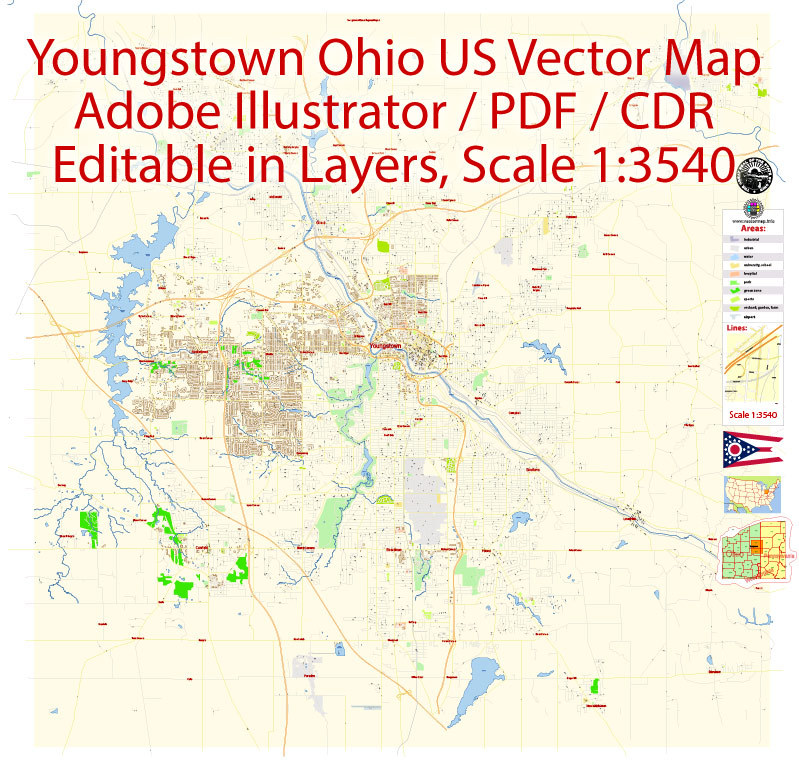
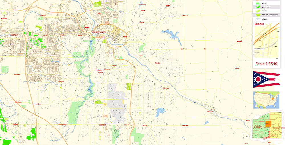
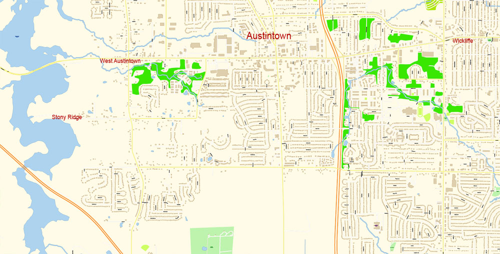
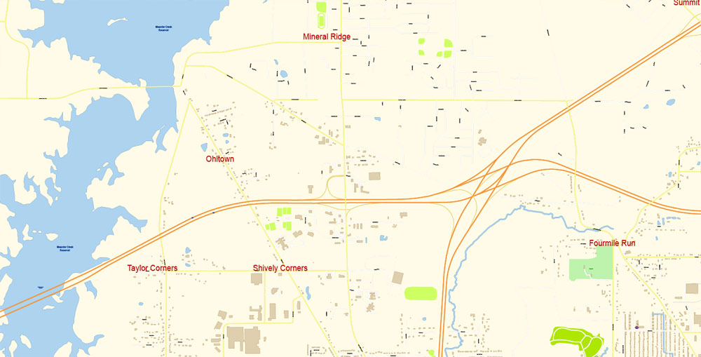
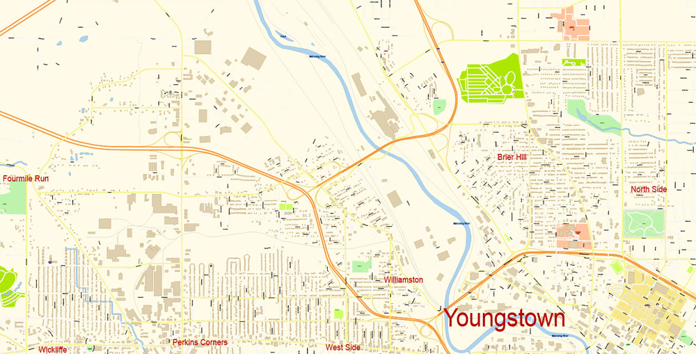
Printable Vector Map Youngstown Area Ohio US extra detailed City Plan scale 1:3540 full editable Adobe Illustrator Street Map in layers with buildings, scalable, editable text format all names, 5 mb ZIP
All streets names, Main Objects, Main Buildings. Map for design, printing, arts, projects, presentations, for architects, designers and builders, business, logistics.
Layers: color_fills, streets_roads, labels_roads, names_objects, names_streets, water, names_places, grids, buildings, legend.
The most exact and detailed map of the city in scale.
For High Quality Printing
DWG, DXF and other formats – on request, same price, please, contact
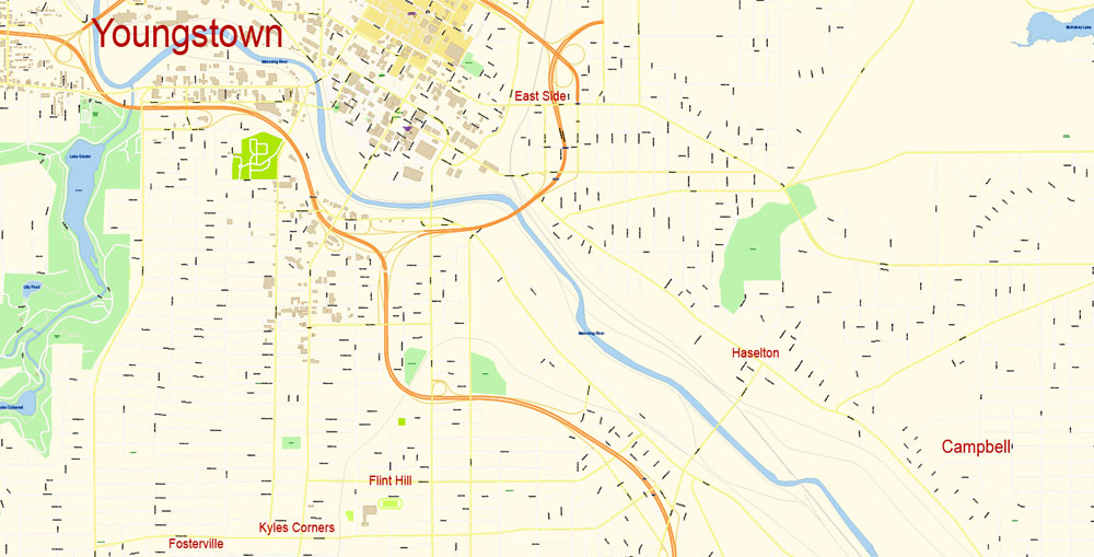
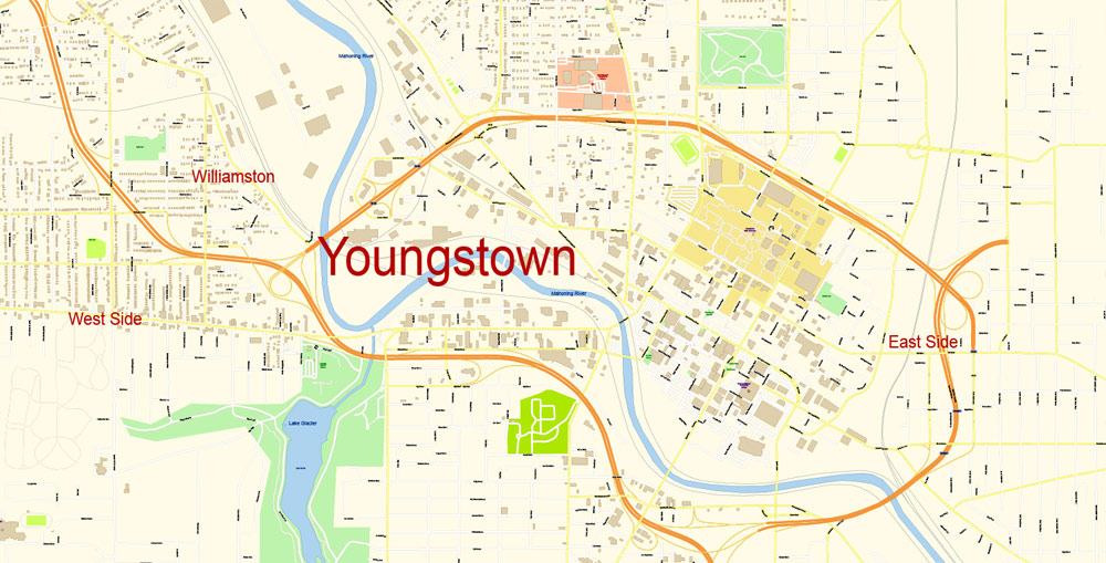
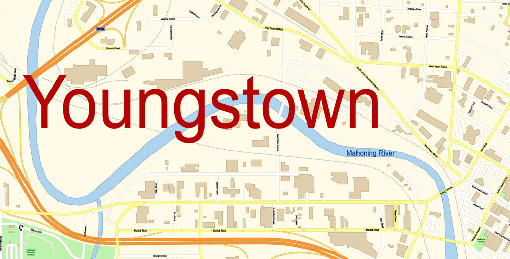
Youngstown, Ohio, USA.
This vector map of Youngstown city is used as a basis for design, editing, and further printing.
This is the most detailed, exact map of Youngstown city for high-quality printing and polygraphy. You can always clarify the map development date by contacting us.
For your convenience, all objects on Youngstown vector city map are divided into layers. And the editing is very easy – colors, lines, etc.
You can easily add any objects needed (e.g. shops, salons, sale points, gas station or attraction) on any layer of Youngstown vector map.
Youngstown is a city in and the county seat of Mahoning County in the U.S. state of Ohio, with small portions extending into Trumbull County. According to the 2010 Census, Youngstown had a city proper population of 66,982, while the Youngstown-Warren-Boardman, OH-PA Metropolitan Statistical Area it anchors contained 565,773 people in Mahoning and Trumbull counties in Ohio, and Mercer County in Pennsylvania.
One of the advantages of Youngstown city vector maps of our production is the relevance of cartographic data, we constantly update all our products.
This vector map of Youngstown city is used by:
designers, layout designers, printers, advertisers and architects. Our product – vector maps – is designed for further editing and printing in large formats – from @Wall format (a few meters) to A-0 and A-1, A-2, A-3.
Youngstown is located on the Mahoning River, approximately 65 miles (105 km) southeast of Cleveland and 61 miles (100 km) northwest of Pittsburgh. Despite having its own media market, Youngstown is often included in commercial and cultural depictions of both Northeast Ohio as well as the Greater Pittsburgh Region due to these proximities. Youngstown is also the midway between New York City and Chicago via Interstate 80.
The Youngstown city map in vector format is used for design, urban planning, presentations and media visualizations.
The advertising and presentation map of Youngstown city (usually the final designer marks the routes, and puts the client’s objects (shops, saloons, gas stations etc.)
The undoubted advantage is that people will NEVER throw out this advertising product – the map. In fact, as an advertising medium, a city map is the most “long-playing” of the well-known polygraphic advertising media, with the longest lifespan, and the maximum number of interactions with the customer.
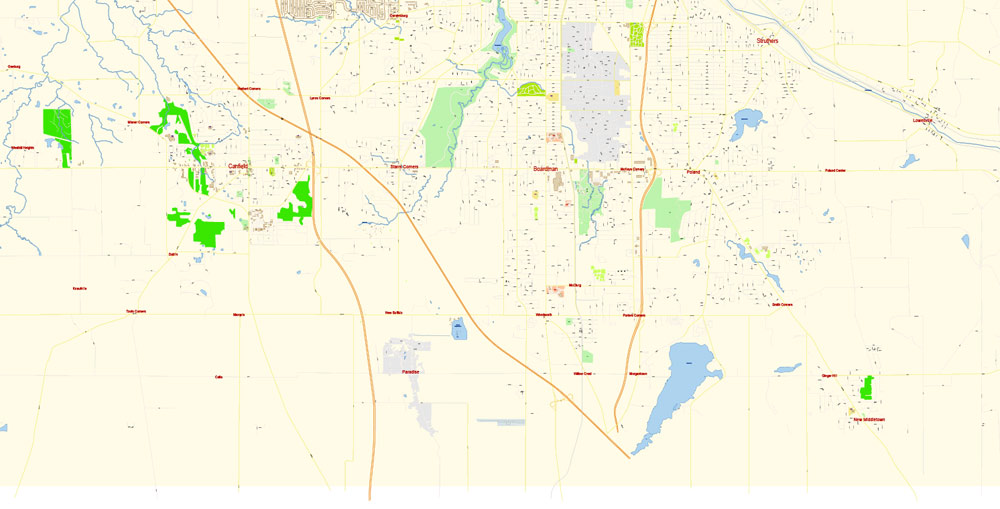
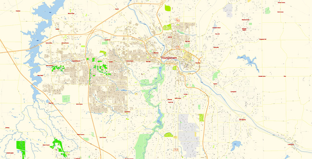
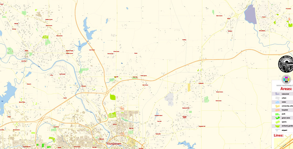
Map area.
The city was named for John Young, an early settler from Whitestown, New York, who established the community’s first sawmill and gristmill. Youngstown is in a region of America that is often referred to as the Rust Belt. Traditionally known as a center of steel production, Youngstown was forced to redefine itself when the U.S. steel industry fell into decline in the 1970s, leaving communities throughout the region without major industry. The city has experienced a decline of over 60% of its population since 1959. Youngstown also falls within the Appalachian Ohio region, among the foothills of the Appalachian Mountains.
For travelers, maps are sold at the airports and gas stations around the world. Often the source is our vector maps.
Take a look, who purchases our vector maps of Youngstown city in “Our Clients and Friends” page – these are large and small companies, from super-brands like Volvo and Starbucks, to small design studios and printing houses.
It’s very easy to work with vector maps of Youngstown city, even for a not very experienced designer who can turn on and off the map layers, add new objects, change the colors of fill and lines according to customer requirements.
According to the United States Census Bureau, the city has a total area of 34.60 square miles (89.61 km2), of which 33.96 square miles (87.96 km2) is land and 0.64 square miles (1.66 km2) is water.
Located in the Pittsburgh Tri-State Area, Youngstown is in the Mahoning Valley on the Glaciated Allegheny Plateau. At the end of the last Ice Age, the glaciers left behind a uniform plain with valleys eroded by the Mahoning River crossing the plain. Lakes created by glaciers that dammed small streams were eventually drained, leaving behind fertile terrain.
The undoubted advantage of Youngstown city vector maps in printing is an excellent and detailed visualization, when customer can expand a large paper map and instantly define his location, find a landmark, an object or address on map, unlike using the popular electronic formats of Google and Yandex maps for example.
Printable vector maps of Youngstown city are much more convenient and efficient than any electronic maps on your smartphone, because ALL DETAILS are displayed in the entire space of Youngstown city map.
Useful tips on working with vector maps of cities and countries in Adobe Illustrator.
«V» – launches the Selection tool (cursor, black arrow), which makes active any vector line.
«А» – launches the Direct Selection tool (white cursor), allows you to select curve elements and drag them to the desired place.
«R» – activates the Rotate tool, which helps you rotating selected objects around the center point by 360 degrees.
«E» – gives you the opportunity to use the Eraser tool and erase unnecessary parts.
«X» – switches between Fill and Stroke in the Tools section. Try to get used to this hot key and
you will quickly understand that you can’t live and work without it.
Guides are not limited to vertical and horizontal in Adobe Illustrator. You can also create a diagonal guide for example. Moreover, you can turn any contours into guides. Select the outline and go to View > Guides > Make Guides (Create Guides), or simply press Cmd/Ctrl + 5. You can also turn the guides back into an editable object. Go to menu, View > Guides > Unlock Guides (Release Guides), select the guide you want to edit and select View > Guides > Release Guides (Reset Guides), or just press Cmd/Ctrl + Option / Alt + 5).
You will probably want to change the color scheme used on our Youngstown vector city map.
To quickly and effectively play with colors.
Of course, you can do it manually, all objects in our Youngstown city vector map are divided according to types and layers, and you can easily change the color gamma of vector objects in groups and layers.
But there is more effective way of working with the whole VECTOR MAP of Youngstown city and all layers:
The overview dialog «Edit colors»/«Repaint Graphic Object» (this dialog box name can change depending on the context):
If you have selected a part or a layer of Youngstown city vector map and open the dialog box by clicking the icon in the Control panel, on the Samples palette or the Color Catalog, or if you choose Edit > Edit Colors> Repaint Graphic Object, then the «Repaint Graphic Object» dialog box appears, and you get access to «Assign» and «Edit» tabs.
If a picture or a map fragment is not selected, and you open the dialog box by clicking the icon in the Control panel, on the Samples palette or in the Color Catalog, the «Edit Colors» dialog box appears and you can only access the «Edit» tab.
Regardless of the name at the top of the dialog box, the right-hand side always displays the color group of the current document, as well as two default color groups: Print Color and Grayscale. These color groups can be selected and used any time.
Create and edit color groups of Youngstown city vector map, and also assign colors using the «Edit Colors»/ а «Repaint Graphic Object» dialog box.
A. Creating and editing of a color group on the «Edit» tab
B. Assigning colors on the «Assign» tab
C. Select a group of colors from the «Color groups» list
The option «Repaint a graphic object» in the lower part of the dialog box allows you to preview the colors on a selected layer of Vector map, or a group of elements, and specify whether its colors will be redefined when the dialog box is closed.
The main areas of the dialog box are:
«Edit»
The «Edit» tab is designed to create a new or edit the existing color groups.
The harmony rules Menu and the Color Wheel are used to conduct experiments with color harmonies. The color wheel shows how colors are related in color harmony, and the color bars allow you to view and manipulate an individual color values. In addition, you can adjust the brightness, add and remove colors, save color groups and view colors on the selected Vector Map of Youngstown city or a separated layers.
«Assign»
The «Assign» tab is used to view and control on how the original colors are replaced with colors from the color group like your corporate colors in the Vector Map of Youngstown city.
The assign color ability is provided only if the entire map, layer or fragment is selected in the document. You can specify which of new colors replace the current colors, whether the spot colors should be preserved and how colors are replaced (for example, you can replace colors completely or changing the color tone while maintaining the brightness). The «Assign» tab allows you to redefine colors in the Vector Map of Youngstown city, or in separate layers and fragments using the current color group or reducing the number of colors in the current Vector Map.
Color groups
Is a list of all saved color groups for current document (the same groups appear in the «Samples» palette). You can edit and delete the existing color groups, as well as creating a new ones using the list of “Color Groups” in the dialog box. All changes appear in the «Samples» palette.
The highlighted color group shows, which color group is currently edited.
Any color group can be selected and edited, or used to redefine the colors in the selected vector map of Youngstown city, its fragments or elements.
Saving a color group adds this group to the specified list.
Opening the «Edit Colors»/«Repaint Graphic Object» dialog box.
Open the «Edit Colors»/«Repaint Graphic Object» dialog box using one of the following methods:
«Edit»> «Edit Colors»> «Repaint Graphic object» or «Repaint With Style».
Use these commands if you need to edit the colors in the selected vector map of Youngstown city.
«Repaint Graphic object» button on the «Control» panel.
Use this button if you need to adjust colors of Youngstown city vector map using the а «Repaint graphic object» dialog box.
The specified button is available if the selected vector map or its fragment contains two or more colors.
Note. This color editing method is convenient for global color adjustment in a vector map, if global colors were not used when creating a City Map of Youngstown.
The «Edit colors» button or «Edit or apply colors» on the «Color Catalog» palette
Click this button if you need to edit colors on the «Color Catalog» palette or edit and then apply them to the selected Vector Map of Youngstown city or its fragment.
The «Edit color group» button or «Edit or apply color group» on the «Samples» palette.
Click this button if you need to edit the colors in the specific color group or edit and apply them to the selected Vector Map of Youngstown city or a group of its elements, for example, the whole layer “Streets and lines”. You can also double-click the color group in the Samples panel to open the dialog box.
If the map file is too large and your computer freezes or even can’t open it quickly:
1. Try to reduce the color resolution of the video card (display) to 256 colors while working with a large map.
2. Using Windows Task Manager, select all the application you don’t need, while working with map, just turn them off.
3. Launch Adobe Illustrator. (DO NOT OPEN the vector map file)
4. Start the Windows Task Manager using administrator rights > Find the “Illustrator” process > set the «real time» priority,
5. Open the file. When you see the LEGACY FONT popup window – click “OK” (do not update). You can restore the TEXT later.
6. Can also be useful: When file is opened – Edit > Settings > Basic Settings > disable smoothing. /// It looks scary, but works quickly)))
We recommend saving the file in Adobe Illustrator 10 version. It’s much more stable when working with VERY BIG size files.
Youngstown
Youngstown is a city in and the county seat of Mahoning County in the U.S. state of Ohio, with small portions extending into Trumbull County. According to the 2010 Census, Youngstown had a city proper population of 66,982, while the Youngstown-Warren-Boardman, OH-PA Metropolitan Statistical Area it anchors contained 565,773 people in Mahoning and Trumbull counties in Ohio, and Mercer County in Pennsylvania.
Youngstown is located on the Mahoning River, approximately 65 miles (105 km) southeast of Cleveland and 61 miles (100 km) northwest of Pittsburgh. Despite having its own media market, Youngstown is often included in commercial and cultural depictions of both Northeast Ohio as well as the Pittsburgh Tri-State Area due to these proximities. Youngstown lies 10 miles (16 km) west of the Pennsylvania state line, midway between New York City and Chicago via Interstate 80.
The city was named for John Young, an early settler from Whitestown, New York, who established the community’s first sawmill and gristmill. Youngstown is in a region of America that is often referred to as the Rust Belt. Traditionally known as a center of steel production, Youngstown was forced to redefine itself when the U.S. steel industry fell into decline in the 1970s, leaving communities throughout the region without major industry. The city has experienced a decline of over 60% of its population since 1959. Youngstown also falls within the Appalachian Ohio region, among the foothills of the Appalachian Mountains.
Area
• City 34.2 sq mi (88.5 km2)
• Land 33.9 sq mi (87.8 km2)
• Water 0.3 sq mi (0.77 km2)
Elevation 850 ft (259 m)
Population
• City 66,982
• Estimate 65,184
• Density 2,312.9/sq mi (893.0/km2)
• Urban 387,550 (US: 97th)
• Metro 555,506 (US: 97th)
Time zone EST (UTC-5)
• Summer (DST) EDT (UTC-4)
ZIP codes 44501–44507, 44509-44515, 44555
Area codes 234/330
Free US vector maps

Free Download Vector Map US County and State Adobe Illustrator
Free_Vector_Map_US_States_County_Map.ai
Free Download Vector Map US County and State Adobe PDF
Free_Vector_Map_US_States_County_Map.pdf

Free Download Vector Map US With States Names, Adobe Illustrator
Free_Map_of_USA_with_state_names_en.ai
Free Download Vector Map US With States Names, Adobe PDF
Free_Map_of_USA_with_state_names_en.pdf
From WIKI
Free vector map World, Adobe Illustrator, download now maps vector clipart
Map for design, projects, presentation free to use as you like.
See also: TERMS & CONDITIONS: SOFTWARE LICENSE AGREEMENT FOR DIGITAL CARTOGRAPHIC DATA.
Need more USA Vector Maps, printable and editable?

 Author: Kirill Shrayber, Ph.D. FRGS


