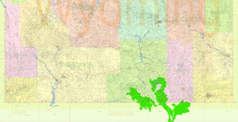
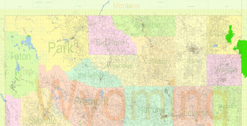
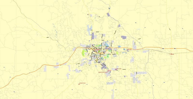
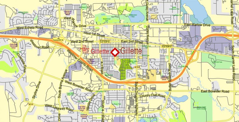
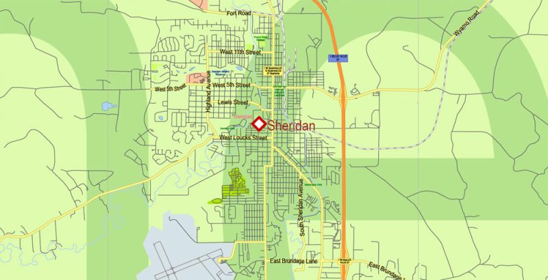
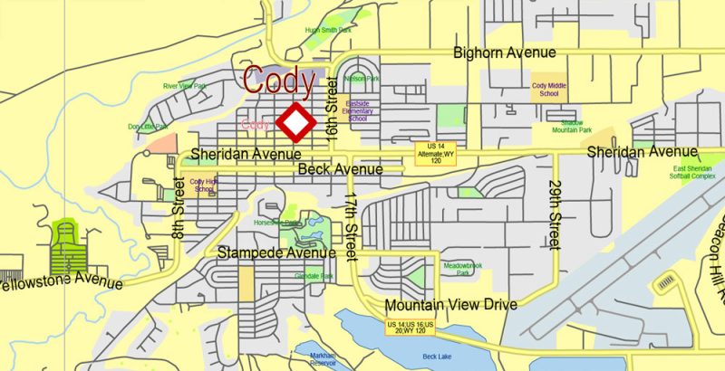
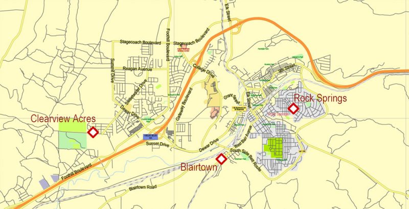
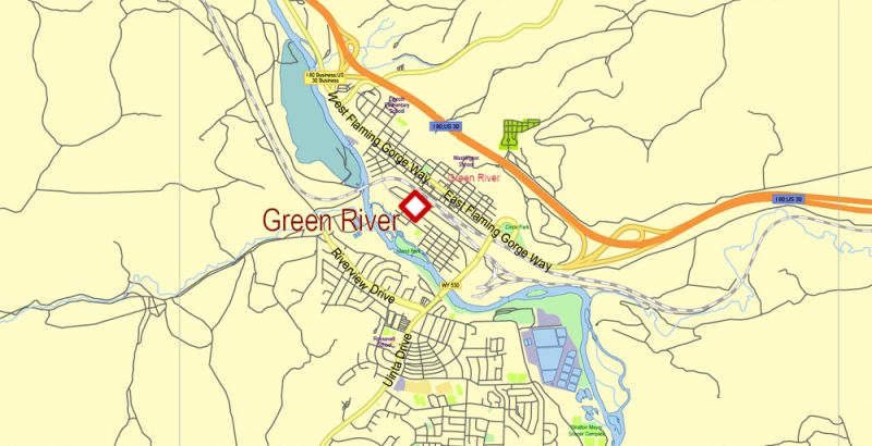
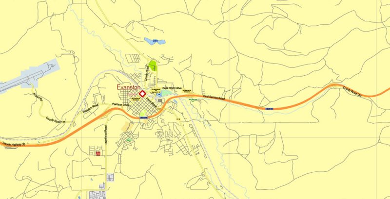
Printable PDF Vector Map of West Wyoming State US High Detailed Plan scale 1:54944 full editable Adobe PDF Road Admin Map in layers, scalable, text format all names, 86 MB ZIP
All streets and roads, Principal street names, All Cities and Towns, Main Objects, Counties. Map for design, printing, arts, projects, presentations, for architects, designers, and builders, business, logistics.
Layers: color_fills, water, main_streets_roads, civil_streets, labels_roads, counties_areas, state_areas, names_objects, names_streets, names_places, grids, legend, etc.
If you need: we can add postal codes layer (zip codes areas with numbers) to the map as a separated layer.
The most exact and detailed map of the state in scale.
For Editing and High-Quality Printing, Royalty free
TERMS AND CONDITIONS
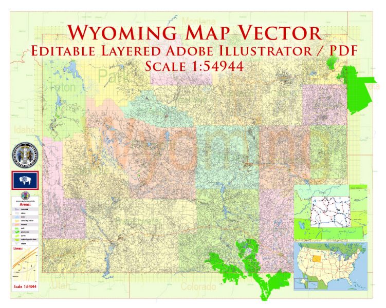
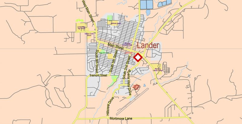
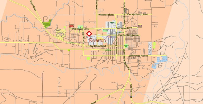
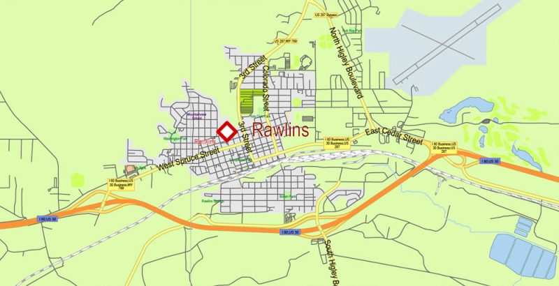
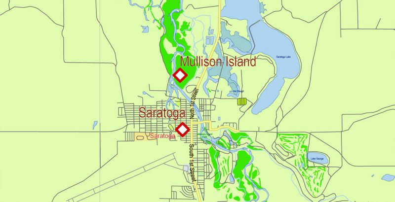
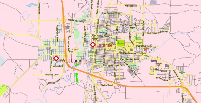
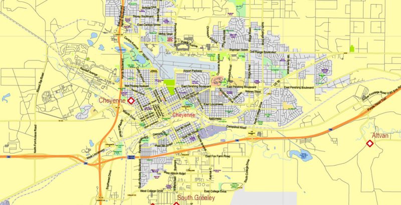
Wyoming US PDF Map Vector Exact State Plan High Detailed Street Road Admin Map editable Adobe PDF in layers
Wyoming is the Western state of the United States, ranked 10th in area and 50th in number among the territories of America. The name of the territory of Indian origin means “Mountains and valleys”. Archaeological finds indicate that people have lived in the state for about thirteen thousand years. Its history is closely intertwined with the history of confrontation between Europeans and indigenous peoples – Indian tribes. The main branch of the state – mining, mineral deposits are found here.
Wyoming US PDF Map Vector Exact State Plan High Detailed Street Road Admin Map editable Adobe PDF in layers
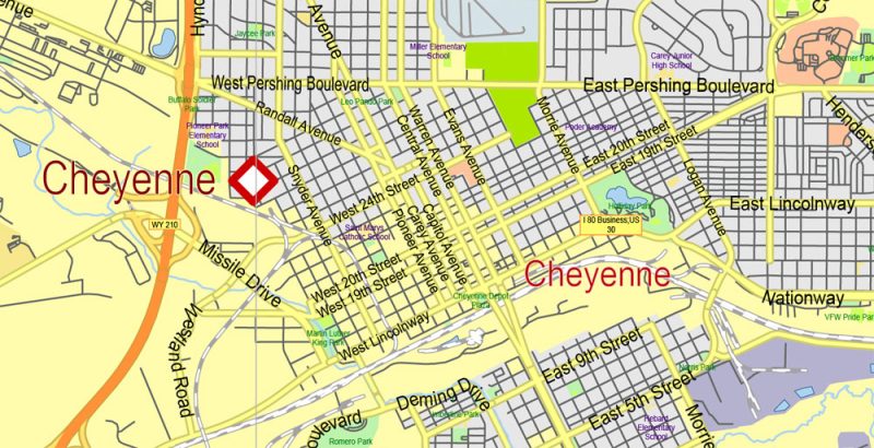
In the West of the state there are the Rocky Mountains, and in the East – the Great Plains. The capital and at the same time the largest city of the state is Cheyenne.
Wyoming US PDF Map Vector Exact State Plan High Detailed Street Road Admin Map editable Adobe PDF in layers
Dreaming of catching salmon go fishing in Yellowstone National Park. Climbers choose for rock climbing another Park Grand Teton, named after its highest mountain, as well as the southern part of the ridge Absaroka. In General, the state has many opportunities for mountaineering thanks to the mountainous terrain. The snake river and North Platte popular among the sports fans of the alloy.
Wyoming US PDF Map Vector Exact State Plan High Detailed Street Road Admin Map editable Adobe PDF in layers
One of the most beautiful places in the world is located in American Wyoming – the international biosphere reserve Yellowstone and the world’s first National Park. The uniqueness of the National Park, not counting the abundance of species of plants, animals, and birds, give the streams of lava covering most of the territory. Traces of the eruption of dormant volcano Yellowstone attract thousands of tourists every year. In addition, the Park has thousands of geysers, hot springs, mud ponds, rivers that have formed deep canyons, as well as waterfalls, one of which is almost twice as high as Niagara. There are even hot springs, full of blue, gold, red and brown colors, thereby creating an unusual, fabulous picture.
Wyoming US PDF Map Vector Exact State Plan High Detailed Street Road Admin Map editable Adobe PDF in layers
In the Northern regions of the state is the “big horn Wheel”, which was created presumably nine hundred years ago, is a stone circle. It is believed that the Indians used it for religious purposes.
Nature created another unique monument – Devils tower or Devil’s Tower. The rock formed many millions of years ago, was formed as a result of the release of magma. Its height is 386 meters.
Wyoming US PDF Map Vector Exact State Plan High Detailed Street Road Admin Map editable Adobe PDF in layers
In the capital of Wyoming is the oldest military base of the American air force, the streets are famous for their famous Botanical gardens. One of the most beautiful buildings in Cheyenne – Nagle Warren mansion, amazing for its external and internal decoration. Nowadays, the hotel is located within its walls. A special pride of the locals is the local Capitol, created in the late XIX century in the Renaissance style.
Wyoming US PDF Map Vector Exact State Plan High Detailed Street Road Admin Map editable Adobe PDF in layers
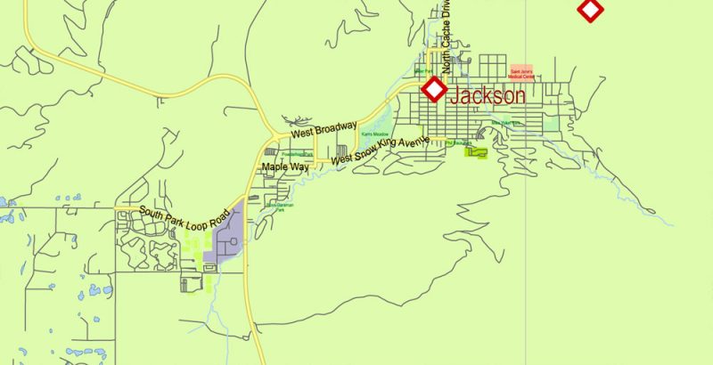
The city of Jackson built a special track for the so-called air tram, which lifts skiers and tourists to the mountain Rendezvous. Jackson is literally saturated with the cowboy past, museums, theater, art galleries are created to preserve the traditions.
Wyoming US PDF Map Vector Exact State Plan High Detailed Street Road Admin Map editable Adobe PDF in layers
In Wyoming, there is even a moose shelter where the largest individuals of this species found shelter. In the North-West of the state in the Grand Teton National Park is one of the cleanest lakes in the world – Jenny. It is formed as a result of melting glaciers.
Wyoming US PDF Map Vector Exact State Plan High Detailed Street Road Admin Map editable Adobe PDF in layers
Cowboy state, also known as Foaming, it is simply impossible to imagine without the Rodeo, which becomes a part of any celebration. You can see the brave tamers of horses and bulls, as well as popular Indian dances, horse competitions at the annual festival lasting ten days “frontier days”, which takes place in the state capital. In the city of Cody, cowboy competitions are held daily from June to August.
Wyoming US PDF Map Vector Exact State Plan High Detailed Street Road Admin Map editable Adobe PDF in layers
Wyoming US PDF Map Vector Exact State Plan High Detailed Street Road Admin Map editable Adobe PDF in layers
Wyoming US PDF Map Vector Exact State Plan High Detailed Street Road Admin Map editable Adobe PDF in layers
Wyoming US PDF Map Vector Exact State Plan High Detailed Street Road Admin Map editable Adobe PDF in layers
Wyoming US PDF Map Vector Exact State Plan High Detailed Street Road Admin Map editable Adobe PDF in layers
Wyoming US PDF Map Vector Exact State Plan High Detailed Street Road Admin Map editable Adobe PDF in layers
Wyoming US PDF Map Vector Exact State Plan High Detailed Street Road Admin Map editable Adobe PDF in layers
Wyoming US PDF Map Vector Exact State Plan High Detailed Street Road Admin Map editable Adobe PDF in layers
Wyoming US PDF Map Vector Exact State Plan High Detailed Street Road Admin Map editable Adobe PDF in layers
Wyoming US PDF Map Vector Exact State Plan High Detailed Street Road Admin Map editable Adobe PDF in layers
Wyoming US PDF Map Vector Exact State Plan High Detailed Street Road Admin Map editable Adobe PDF in layers
Wyoming US PDF Map Vector Exact State Plan High Detailed Street Road Admin Map editable Adobe PDF in layers
Wyoming US PDF Map Vector Exact State Plan High Detailed Street Road Admin Map editable Adobe PDF in layers
Wyoming US PDF Map Vector Exact State Plan High Detailed Street Road Admin Map editable Adobe PDF in layers


 Author: Kirill Shrayber, Ph.D. FRGS

