Extended Description of the Vector Map
Printable PDF Vector Map of Vejle Denmark High detailed street map scale 1:2646 fully editable Layered Adobe PDF scalable, text format all names, 21 MB ZIP
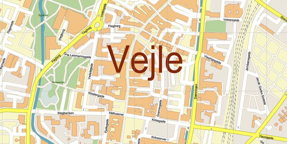
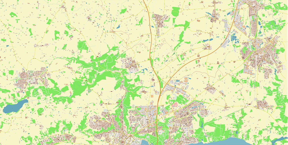
All street names, Main Objects, Buildings. Map for design, printing, arts, projects, presentations, for architects, designers, and builders, business, logistics.
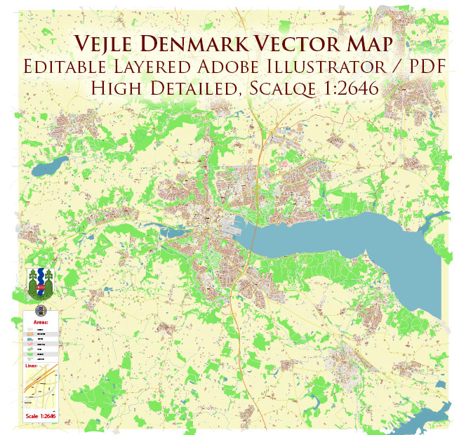
Vejle Denmark PDF Map Vector Exact High Detailed Street Map editable Adobe PDF in layers
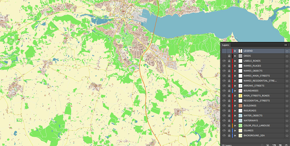
Layers list:
- Legend
- Names of places (city, hamlet, etc.)
- Names of objects (parks, hospital, water)
- Names of main streets
- Names of residential streets
- Main Streets, roads
- Residential streets
- Railroads
- Boundaries
- Buildings
- Water objects (rivers, lakes, ponds)
- Waterways
- Color fills (parks, land use, etc.)
- Islands
- Background and sea
The most exact and detailed map of the Vejle Denmark in scale.
For Editing and High-Quality Printing
AO BRIEF — VEJLE, DENMARK
Product: Printable PDF Vector Exact High-Detailed Street Map
Format: Fully editable Adobe PDF, layered
OVERVIEW
-
Location: East Jutland, Denmark; head of Vejle Fjord
-
Role: Regional hub linking coastal industry, logistics, and inland urban zones
-
Urban Form: Compact historic core, modern waterfront, suburban rings along valleys and hills
-
Map Use: Design, print, urban analysis, logistics planning, real estate, presentations
KEY ROADS / LINES OF COMMUNICATION
-
E45 (European Route): Primary north–south artery; regional connectivity to Aarhus and Kolding
-
Route 28 / Route 170: City access and internal distribution
-
Urban Network: Dense local street grid in the center; arterial feeders toward industrial zones and suburbs
-
Rail: Vejle Station on the East Jutland corridor (intercity + regional)
TERRAIN / RELIEF
-
Topography: One of Denmark’s most hilly cities; valleys, slopes, and elevated neighborhoods
-
Hydrography: Vejle Fjord, river corridors, canals near the port
-
Implication for Mapping: Clear elevation-sensitive street alignments; bridges and grade changes matter
URBAN STRUCTURE
-
City Center: Pedestrian streets, mixed-use blocks, civic squares
-
Waterfront / Port: Redeveloped quays, modern architecture, logistics access
-
Residential: Distinct neighborhoods following terrain contours
-
Industrial / Business Areas: Concentrated near port and highway access
TRANSPORT & MOBILITY
-
Public Transport: Bus network radiating from central hub
-
Cycling: Strong cycling infrastructure integrated into street network
-
Freight: Port access + E45 support regional logistics flows
DEMOGRAPHY / HUMAN TERRAIN
-
Population: Mid-size Danish city; stable growth
-
Profile: Educated workforce, design and innovation orientation
-
Urban Behavior: High pedestrian and cyclist activity in central areas
TOURISM / KEY COMPOUNDS
-
Landmarks: Waterfront architecture, city bridges, cultural venues
-
Recreation: Fjord access, hills, parks, trail systems
-
Hospitality Zones: City center and waterfront clusters
HAZARDS / CONSTRAINTS
-
Natural: Flood risk in low-lying waterfront areas during extreme weather
-
Planning: Terrain-driven constraints on road expansion
-
Seasonality: Winter conditions affect minor streets and cycling routes
MAP CONTENT — INCLUDED
-
Street Network: All roads and streets, exact geometry
-
Labels: Full street names in text (editable)
-
Administrative: Neighborhoods, districts (where applicable)
-
Transport: Highways, arterials, rail lines
-
Hydrography: Fjord, rivers, canals
-
Layers: Logical layer separation for design and analysis
COMMAND TAKEAWAYS
-
Terrain-aware street detail is critical for accuracy in Vejle.
-
E45 connectivity defines logistics and regional flow.
-
Layered PDF enables rapid customization for print, planning, and presentation.
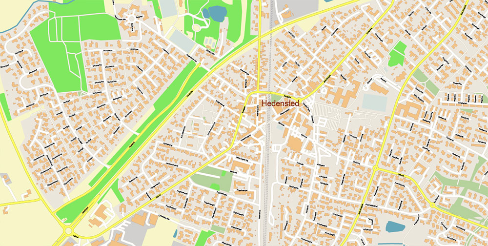
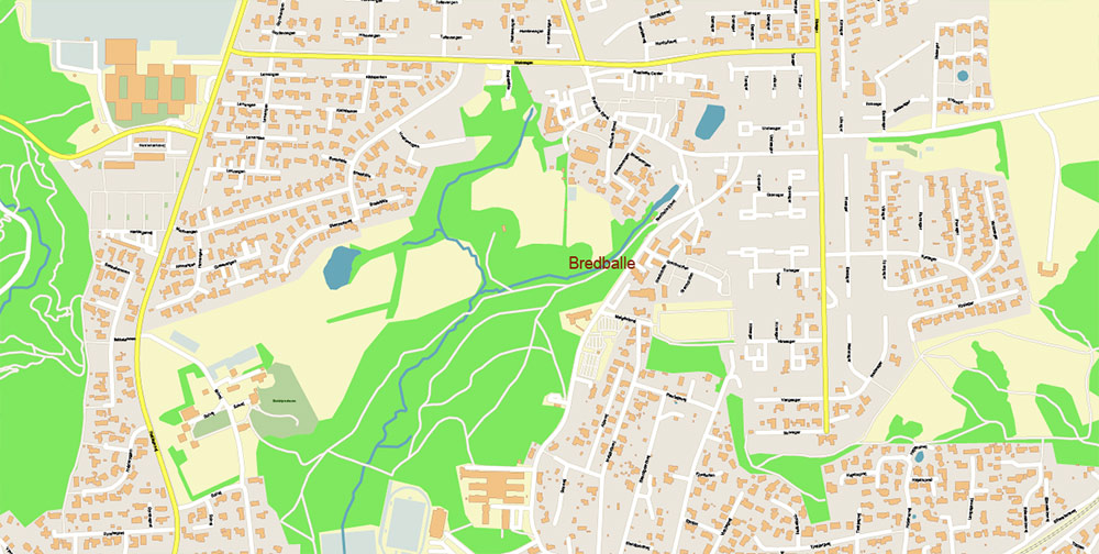
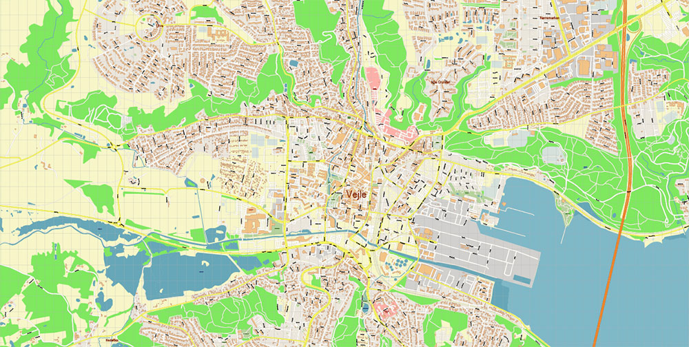
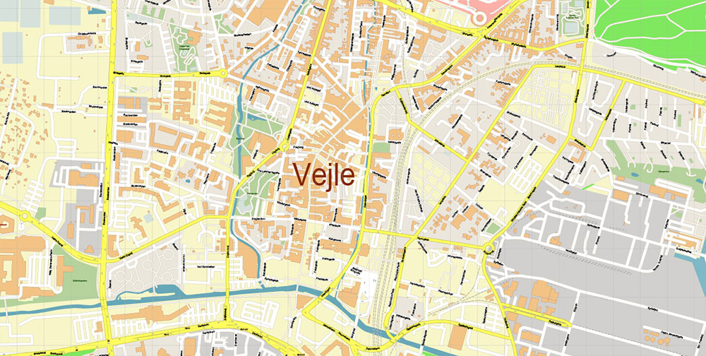
Vejle Denmark PDF Map Vector Exact High Detailed Street Map editable Adobe PDF in layers
Vejle Denmark PDF Map Vector Exact High Detailed Street Map editable Adobe PDF in layers
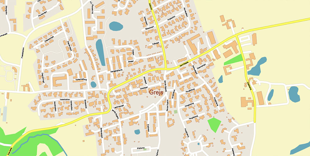
Vejle Denmark PDF Map Vector Exact High Detailed Street Map editable Adobe PDF in layers
Vejle Denmark PDF Map Vector Exact High Detailed Street Map editable Adobe PDF in layers
Vejle Denmark PDF Map Vector Exact High Detailed Street Map editable Adobe PDF in layers
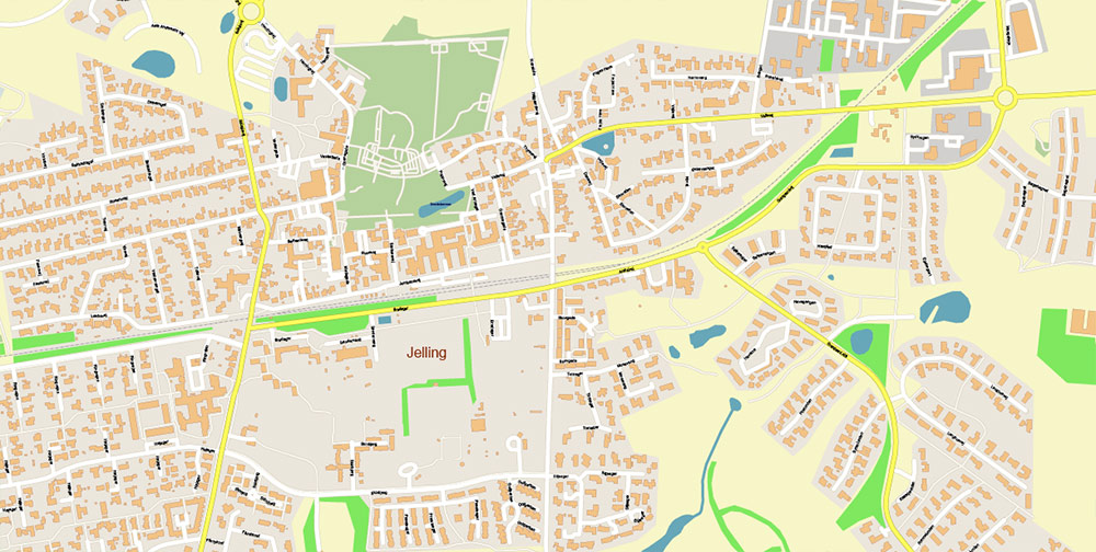
Vejle Denmark PDF Map Vector Exact High Detailed Street Map editable Adobe PDF in layers
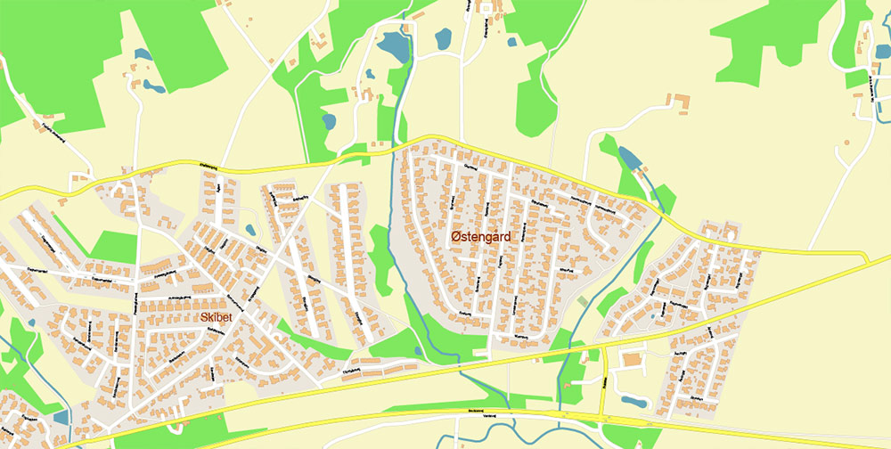
Vejle Denmark PDF Map Vector Exact High Detailed Street Map editable Adobe PDF in layers
Vejle Denmark PDF Map Vector Exact High Detailed Street Map editable Adobe PDF in layers
Vejle Denmark PDF Map Vector Exact High Detailed Street Map editable Adobe PDF in layers
Vejle Denmark PDF Map Vector Exact High Detailed Street Map editable Adobe PDF in layers

 Author: Kirill Shrayber, Ph.D. FRGS