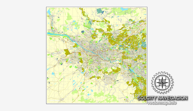
Glasgow, Scotland, UK Great Britain, printable vector street City Plan map, full editable, Adobe Illustrator, full vector, scalable, editable, text format street names, 14,8 mb ZIP
All streets, All buildings. Map for design, print, arts, projects, presentations,
for architects, designers and builders.
The most accurate and detailed map of the city.
DXF, DWG, CDR and other formats – on request, same price, please, contact
Glasgow, Scotland
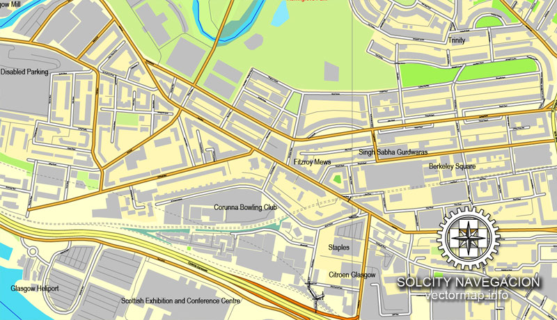
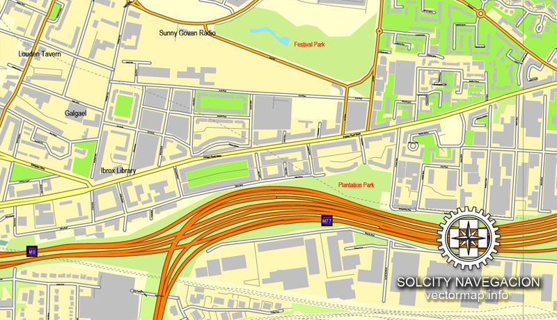
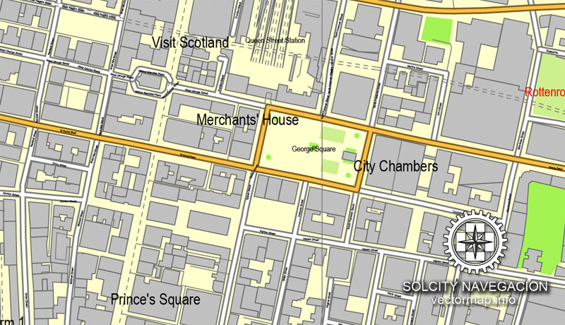
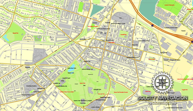
This vector map of Glasgow city is used as a basis for design, editing, and further printing.
This is the most detailed, exact map of Glasgow city for high-quality printing and polygraphy. You can always clarify the map development date by contacting us.
For your convenience, all objects on Glasgow vector city map are divided into layers. And the editing is very easy – colors, lines, etc.
Glasgow is the most populous city in Scotland, and the third most populous city in the United Kingdom, as of the 2017 estimated city population of 621,020. Historically part of Lanarkshire, the city now forms the Glasgow City council area, one of the 32 council areas of Scotland; the local authority is Glasgow City Council.
One of the advantages of Glasgow city vector maps of our production is the relevance of cartographic data, we constantly update all our products.
This vector map of Glasgow city is used by:
designers, layout designers, printers, advertisers and architects. Our product – vector maps – is designed for further editing and printing in large formats – from @Wall format (a few meters) to A-0 and A-1, A-2, A-3.
Glasgow is situated on the River Clyde in the country’s West Central Lowlands. Inhabitants of the city are referred to as “Glaswegians” or “Weegies”. It is the fifth most visited city in the UK. Glasgow is also known for the Glasgow patter, a distinct dialect of the Scots language that is noted for being difficult to understand by those from outside the city.
The advertising and presentation map of Glasgow city (usually the final designer marks the routes, and puts the client’s objects (shops, saloons, gas stations etc.)
The undoubted advantage is that people will NEVER throw out this advertising product – the map. In fact, as an advertising medium, a city map is the most “long-playing” of the well-known polygraphic advertising media, with the longest lifespan, and the maximum number of interactions with the customer.
For travelers, maps are sold at the airports and gas stations around the world. Often the source is our vector maps.
Glasgow grew from a small rural settlement on the River Clyde to become the largest seaport in Scotland, and tenth largest by tonnage in Britain. Expanding from the medieval bishopric and royal burgh, and the later establishment of the University of Glasgow in the fifteenth century, it became a major centre of the Scottish Enlightenment in the eighteenth century. From the eighteenth century onwards, the city also grew as one of Great Britain’s main hubs of transatlantic trade with North America and the West Indies.
Take a look, who purchases our vector maps of Glasgow city in “Our Clients and Friends” page – these are large and small companies, from super-brands like Volvo and Starbucks, to small design studios and printing houses.
It’s very easy to work with vector maps of Glasgow city, even for a not very experienced designer who can turn on and off the map layers, add new objects, change the colors of fill and lines according to customer requirements.
With the onset of the Industrial Revolution, the population and economy of Glasgow and the surrounding region expanded rapidly to become one of the world’s pre-eminent centres of chemicals, textiles and engineering; most notably in the shipbuilding and marine engineering industry, which produced many innovative and famous vessels. Glasgow was the “Second City of the British Empire” for much of the Victorian era and Edwardian period, although many cities argue the title was theirs.
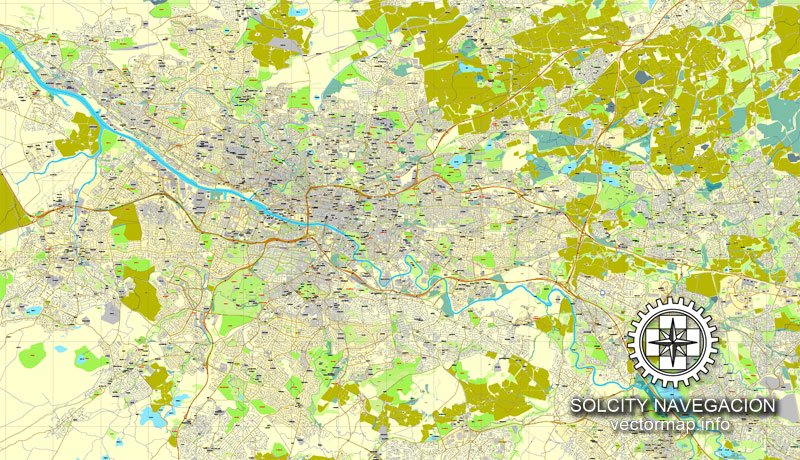
The undoubted advantage of Glasgow city vector maps in printing is an excellent and detailed visualization, when customer can expand a large paper map and instantly define his location, find a landmark, an object or address on map, unlike using the popular electronic formats of Google and Yandex maps for example.
Printable vector maps of Glasgow city are much more convenient and efficient than any electronic maps on your smartphone, because ALL DETAILS are displayed in the entire space of Glasgow city map.
Useful tips on working with vector maps of cities and countries in Adobe Illustrator.
«V» – launches the Selection tool (cursor, black arrow), which makes active any vector line.
«А» – launches the Direct Selection tool (white cursor), allows you to select curve elements and drag them to the desired place.
«R» – activates the Rotate tool, which helps you rotating selected objects around the center point by 360 degrees.
«E» – gives you the opportunity to use the Eraser tool and erase unnecessary parts.
«X» – switches between Fill and Stroke in the Tools section. Try to get used to this hot key and
you will quickly understand that you can’t live and work without it.
Guides are not limited to vertical and horizontal in Adobe Illustrator. You can also create a diagonal guide for example. Moreover, you can turn any contours into guides. Select the outline and go to View > Guides > Make Guides (Create Guides), or simply press Cmd/Ctrl + 5. You can also turn the guides back into an editable object. Go to menu, View > Guides > Unlock Guides (Release Guides), select the guide you want to edit and select View > Guides > Release Guides (Reset Guides), or just press Cmd/Ctrl + Option / Alt + 5).
You will probably want to change the color scheme used on our Glasgow vector city map.
To quickly and effectively play with colors.
Of course, you can do it manually, all objects in our Glasgow city vector map are divided according to types and layers, and you can easily change the color gamma of vector objects in groups and layers.
But there is more effective way of working with the whole VECTOR MAP of Glasgow city and all layers:
The overview dialog «Edit colors»/«Repaint Graphic Object» (this dialog box name can change depending on the context):
If you have selected a part or a layer of Glasgow city vector map and open the dialog box by clicking the icon in the Control panel, on the Samples palette or the Color Catalog, or if you choose Edit > Edit Colors> Repaint Graphic Object, then the «Repaint Graphic Object» dialog box appears, and you get access to «Assign» and «Edit» tabs.
If a picture or a map fragment is not selected, and you open the dialog box by clicking the icon in the Control panel, on the Samples palette or in the Color Catalog, the «Edit Colors» dialog box appears and you can only access the «Edit» tab.
Regardless of the name at the top of the dialog box, the right-hand side always displays the color group of the current document, as well as two default color groups: Print Color and Grayscale. These color groups can be selected and used any time.
Create and edit color groups of Glasgow city vector map, and also assign colors using the «Edit Colors»/ а «Repaint Graphic Object» dialog box.
A. Creating and editing of a color group on the «Edit» tab
B. Assigning colors on the «Assign» tab
C. Select a group of colors from the «Color groups» list
The option «Repaint a graphic object» in the lower part of the dialog box allows you to preview the colors on a selected layer of Vector map, or a group of elements, and specify whether its colors will be redefined when the dialog box is closed.
The main areas of the dialog box are:
«Edit»
The «Edit» tab is designed to create a new or edit the existing color groups.
The harmony rules Menu and the Color Wheel are used to conduct experiments with color harmonies. The color wheel shows how colors are related in color harmony, and the color bars allow you to view and manipulate an individual color values. In addition, you can adjust the brightness, add and remove colors, save color groups and view colors on the selected Vector Map of Glasgow city or a separated layers.
«Assign»
The «Assign» tab is used to view and control on how the original colors are replaced with colors from the color group like your corporate colors in the Vector Map of Glasgow city.
The assign color ability is provided only if the entire map, layer or fragment is selected in the document. You can specify which of new colors replace the current colors, whether the spot colors should be preserved and how colors are replaced (for example, you can replace colors completely or changing the color tone while maintaining the brightness). The «Assign» tab allows you to redefine colors in the Vector Map of Glasgow city, or in separate layers and fragments using the current color group or reducing the number of colors in the current Vector Map.
Color groups
Is a list of all saved color groups for current document (the same groups appear in the «Samples» palette). You can edit and delete the existing color groups, as well as creating a new ones using the list of “Color Groups” in the dialog box. All changes appear in the «Samples» palette.
The highlighted color group shows, which color group is currently edited.
Any color group can be selected and edited, or used to redefine the colors in the selected vector map of Glasgow city, its fragments or elements.
Saving a color group adds this group to the specified list.
Opening the «Edit Colors»/«Repaint Graphic Object» dialog box.
Open the «Edit Colors»/«Repaint Graphic Object» dialog box using one of the following methods:
«Edit»> «Edit Colors»> «Repaint Graphic object» or «Repaint With Style».
Use these commands if you need to edit the colors in the selected vector map of Glasgow city.
«Repaint Graphic object» button on the «Control» panel.
Use this button if you need to adjust colors of Glasgow city vector map using the а «Repaint graphic object» dialog box.
The specified button is available if the selected vector map or its fragment contains two or more colors.
Note. This color editing method is convenient for global color adjustment in a vector map, if global colors were not used when creating a City Map of Glasgow.
The «Edit colors» button or «Edit or apply colors» on the «Color Catalog» palette
Click this button if you need to edit colors on the «Color Catalog» palette or edit and then apply them to the selected Vector Map of Glasgow city or its fragment.
The «Edit color group» button or «Edit or apply color group» on the «Samples» palette.
Click this button if you need to edit the colors in the specific color group or edit and apply them to the selected Vector Map of Glasgow city or a group of its elements, for example, the whole layer “Streets and lines”. You can also double-click the color group in the Samples panel to open the dialog box.
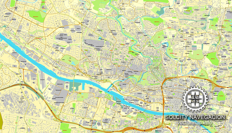
To the western edge of the city centre, occupying the areas of Blythswood Hill and Anderston, lies Glasgow’s financial district, known officially as the International Financial Services District (IFSD), although often irreverently nicknamed by the contemporary press as the “square kilometre” or “Wall Street on Clyde”.
If the map file is too large and your computer freezes or even can’t open it quickly:
1. Try to reduce the color resolution of the video card (display) to 256 colors while working with a large map.
2. Using Windows Task Manager, select all the application you don’t need, while working with map, just turn them off.
3. Launch Adobe Illustrator. (DO NOT OPEN the vector map file)
4. Start the Windows Task Manager using administrator rights > Find the “Illustrator” process > set the «real time» priority,
5. Open the file. When you see the LEGACY FONT popup window – click “OK” (do not update). You can restore the TEXT later.
6. Can also be useful: When file is opened – Edit > Settings > Basic Settings > disable smoothing. /// It looks scary, but works quickly)))
We recommend saving the file in Adobe Illustrator 10 version. It’s much more stable when working with VERY BIG size files.
In the late-19th and early-20th centuries, Glasgow’s population grew rapidly, reaching a peak of 1,127,825 people in 1938. Comprehensive urban renewal projects in the 1960s, resulting in large-scale relocation of people to designated new towns; such as Cumbernauld, Livingston, East Kilbride and peripheral suburbs, followed by successive boundary changes, reduced the population of the City of Glasgow council area to an estimated 615,070, with 1,209,143 people living in the Greater Glasgow urban area. The wider metropolitan area is home to over 1,800,000 people, equating to around 33% of Scotland’s population. The city has one of the highest densities of any locality in Scotland at 4,023/km2.
Glasgow hosted the 2014 Commonwealth Games and the first European Championships in 2018; and is also well known in the sporting world for football (particularly the Old Firm rivalry between Celtic and Rangers), rugby, athletics, tennis, golf and swimming.
Geography of Glasgow
Glasgow is a city located on the banks of the River Clyde, in West Central Scotland.
Areas and suburbs
City centre
The city centre is bounded by Saltmarket, High Street and Castle Street to the east, Broomielaw and Clyde Street (along the River Clyde) to the south and Newton Street to the west. The northern boundary (from east to west) follows Cathedral Street, North Hanover Street, Dobbie’s Loan and Pheonix Road. The city centre is composed of the areas of Garnethill, Blythswood Hill, and Merchant City as well as parts of Anderston, Calton, Cowcaddens and Townhead.
Retail and theatre district
The city centre is based on a grid system of streets on the north bank of the River Clyde. The heart of the city is George Square, site of many of Glasgow’s public statues and the elaborate Victorian Glasgow City Chambers, headquarters of Glasgow City Council. To the south and west are the shopping precincts of Argyle Street, Sauchiehall Street and Buchanan Street, the last featuring more upmarket retailers and winner of the Academy of Urbanism “Great Street Award” 2008. The collection of shops around these streets accumulate to become known as “The Style Mile”.
The main shopping areas include Buchanan Street, Buchanan Galleries, linking Buchanan Street and Sauchiehall Street, and the St. Enoch Centre linking Argyle Street and St Enoch Square), with the up-market Princes Square, which specifically features shops such as Ted Baker, Radley and Kurt Geiger. The Italian Centre in Ingram Street also specialises in designer labels. Glasgow’s retail portfolio forms the UK’s second largest and most economically important retail sector after Central London.
Since the late 1980s the construction of many modern office blocks and high rise developments have paved the way for the IFSD to become one of the UK’s largest financial quarters. With a reputation as an established financial services centre, coupled with comprehensive support services, Glasgow continues to attract and grow new business.
Of the 10 largest general insurance companies in the UK, 8 have a base or head office in Glasgow — including Direct Line, Esure, AXA and Norwich Union. Key banking sector companies have also moved some of their services to commercial property in Glasgow – Resolution, JPMorgan Chase, Barclays Wealth, Tesco Personal Finance, Morgan Stanley, Lloyds Banking Group, Clydesdale Bank, BNP Paribas, HSBC, Santander and the Royal Bank of Scotland. The Ministry of Defence have several departments and Clydeport, the Glasgow Stock Exchange, Student Loans Company, Scottish Executive Enterprise, Transport and Lifelong Learning Department, BT Group, Scottish Friendly. Scottish Qualifications Authority and Scottish Enterprise also have their headquarters in the district. Royal Dutch Shell also have one of their six worldwide Shared Business Centres located in the IFSD. Hilton have a corporate office based in the area.
West End
Kelvingrove Art Gallery and Museum is Glasgow’s premier museum and art gallery, housing one of Europe’s best civic art collections.
Glasgow’s West End is a bohemian district of cafés, tea rooms, bars, boutiques, upmarket hotels, clubs and restaurants in the hinterland of Kelvingrove Park, the University of Glasgow, Glasgow Botanic Gardens and the Scottish Exhibition and Conference Centre, focused especially on the area’s main thoroughfares of Argyle Street (Finnieston), Great Western Road and Byres Road. The area is popular with tourists and students and contains many hotels.
The West End includes residential areas of Hillhead, Dowanhill, Kelvingrove, Kelvinside, Hyndland, Broomhill, Scotstoun, Jordanhill, Kelvindale and Anniesland and, to an increasing extent, Partick. The name is also increasingly being used to refer to any area to the west of Charing Cross. The West End is bisected by the River Kelvin, which flows from the Campsie Fells in the north and confluences with the River Clyde at Yorkhill Quay.
The spire of Sir George Gilbert Scott’s Glasgow University main building (the second largest Gothic Revival building in Great Britain) is a major landmark, and can be seen from miles around, sitting atop Gilmorehill. The university itself is the fourth oldest in the English-speaking world. Much of the city’s student population is based in the West End, adding to its cultural vibrancy.
The area is also home to the Kelvingrove Art Gallery and Museum, Hunterian Museum and Art Gallery, Kelvin Hall museums and research facilities, stores, and community sport. Adjacent to the Kelvin Hall was the Museum of Transport, which reopened in 2010 after moving to a new location on a former dockland site at Glasgow Harbour where the River Kelvin flows into the Clyde. The new building is built to a design by Zaha Hadid. The West End Festival, one of Glasgow’s largest festivals, is held annually in June.
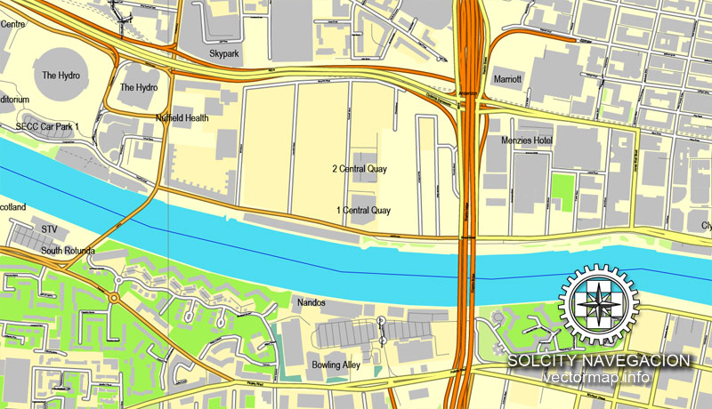
Glasgow is the home of the SECC, Great Britain’s largest exhibition and conference centre. On 30 September 2013, a major expansion of the SECC facilities at the former Queen’s Dock by Foster and Partners officially opened – the 13,000 seat Hydro arena.
East End
People’s Palace museum on Glasgow Green
The East End extends from Glasgow Cross in the City Centre to the boundary with North and South Lanarkshire. It is home to the Glasgow Barrowland market, popularly known as “The Barras”, Barrowland Ballroom, Glasgow Green, and Celtic Park, home of Celtic FC. Many of the original sandstone tenements remain in this district. The East End was once a major industrial centre, home to Sir William Arrol & Co., James Templeton & Co and William Beardmore and Company. A notable local employer continues to be the Wellpark Brewery, home of Tennent’s Lager.
The Glasgow Necropolis Garden Cemetery was created by the Merchants House on a hill above the cathedral in 1831. Routes curve through the landscape uphill to the 62-metre (203 ft) high statue of John Knox at the summit. There are two late 18th century tenements in Gallowgate. Dating from 1771 and 1780, both have been well restored. The construction of Charlotte Street was financed by David Dale, whose former scale can be gauged by the one remaining house, now run by the National Trust for Scotland. Further along Charlotte Street there stands a modern Gillespie, Kidd & Coia building of some note. Once a school, it has been converted into offices. Surrounding these buildings are a series of innovative housing developments conceived as “Homes for the Future”, part of a project during the city’s year as UK City of Architecture and Design in 1999.
East of Glasgow Cross is St Andrew’s in the Square, the oldest post-Reformation church in Scotland, built in 1739–1757 and displaying a Presbyterian grandeur befitting the church of the city’s wealthy tobacco merchants. Also close by is the more modest Episcopalian St Andrew’s-by-the-Green, the oldest Episcopal church in Scotland. The Episcopalian St Andrew’s was also known as the “Whistlin’ Kirk” due to it being the first church after the Reformation to own an organ.
The Doulton Fountain in Glasgow Green
Overlooking Glasgow Green is the façade of Templeton on the Green, featuring vibrant polychromatic brickwork intended to evoke the Doge’s Palace in Venice.
The extensive Tollcross Park was originally developed from the estate of James Dunlop, the owner of a local steelworks. His large baronial mansion was built in 1848 by David Bryce, which later housed the city’s Children’s Museum until the 1980s. Today, the mansion is a sheltered housing complex.
The new Scottish National Indoor Sports Arena, a modern replacement for the Kelvin Hall, is in Dalmarnock. The area was the site of the Athletes’ Village for the 2014 Commonwealth Games, located adjacent to the new indoor sports arena.
The East End Healthy Living Centre (EEHLC) was established in mid-2005 at Crownpoint Road with Lottery Funding and City grants to serve community needs in the area. Now called the Glasgow Club Crownpoint Sports Complex, the centre provides service such as sports facilities, health advice, stress management, leisure and vocational classes. To the north of the East End lie the two large gasometers of Provan Gas Works, which stand overlooking Alexandra Park and a major interchange between the M8 and M80 motorways.
South Side
Glasgow’s South Side sprawls out south of the Clyde. The urban area includes some of Greater Glasgow’s most affluent suburbs such as Newton Mearns, Whitecraigs, Clarkston, Giffnock and Thorntonhall, all of which are outside the city boundaries in East Renfrewshire. Newlands and Dumbreck are examples of high-value residential districts within the city boundaries. There are many areas containing a high concentration of sandstone tenements, examples being Battlefield, Govanhill, Mount Florida and Shawlands. The large suburb of Pollokshields comprises both a quiet western part with undulating tree-lined boulevards lined with expensive villas, and a busier eastern part with a high-density grid of tenements and small shops. The south side also includes some post-war housing estates of various sizes such as Toryglen, Pollok, Castlemilk and Arden. The towns of Cambuslang and Rutherglen were included in the City of Glasgow district from 1975 to 1996, but are now in the South Lanarkshire council area.
Although predominantly residential, the area does have several notable public buildings including, Charles Rennie Mackintosh’s Scotland Street School Museum and House for an Art Lover; the Burrell Collection in Pollok Country Park; Alexander “Greek” Thomson’s Holmwood House villa; the National Football Stadium Hampden Park in Mount Florida (home of Queens Park FC) and Ibrox Stadium (home of Rangers FC).
The former docklands site at Pacific Quay on the south bank of the River Clyde, opposite the SECC, is the site of the Glasgow Science Centre and the headquarters of BBC Scotland and STV Group (owner of STV), in a new purpose built digital media campus.
In addition, several new bridges spanning the River Clyde have been built, including the Clyde Arc known by locals as the Squinty Bridge at Pacific Quay and others at Tradeston and Springfield Quay.
The South Side also includes many public parks, including Linn Park, Queen’s Park, Bellahouston Park and Rouken Glen Park, and several golf clubs, including the championship course at Haggs Castle. The South Side is also home to Pollok Country Park, which was awarded the accolade of Europe’s Best Park 2008. Pollok Park is Glasgow’s largest park and the only country park within the city boundaries.
Govan is a district and former burgh in the south-western part of the city. It is situated on the south bank of the River Clyde, opposite Partick. It was an administratively independent Police Burgh from 1864 until it was incorporated into the expanding city of Glasgow in 1912. Govan has a legacy as an engineering and shipbuilding centre of international repute and is home to one of two BAE Systems Surface Ships shipyards on the River Clyde and the precision engineering firm, Thales Optronics. It is also home to the Queen Elizabeth University Hospital, one of the largest hospitals in the country, and the maintenance depot for the Glasgow Subway system. The wider Govan area includes the districts of Ibrox, Kinning Park and Cessnock.
North Glasgow
Ruchill Church, seen from the Forth and Clyde Canal
North Glasgow extends out from the north of the city centre towards the affluent suburbs of Bearsden, Milngavie and Bishopbriggs in East Dunbartonshire and Clydebank in West Dunbartonshire. The area also contains some of the city’s poorest residential areas. Possilpark is one such district, where levels of unemployment and drug abuse continue to be above the national average. Much of the housing in areas such as Possilpark and Hamiltonhill have fallen into a state of disrepair in recent years.
This has led to large scale redevelopment of much of the poorer housing stock in north Glasgow, and the wider regeneration of many areas, such as Ruchill, which have been transformed; many run-down tenements have now been refurbished or replaced by modern housing estates. Much of the housing stock in north Glasgow is rented social housing, with a high proportion of high-rise tower blocks, managed by the North Glasgow Housing Association trading as NG Homes and Glasgow Housing Association.
Maryhill consists of well maintained traditional sandstone tenements. Although historically a working class area, its borders with the upmarket West End of the city mean that it is relatively wealthy compared to the rest of the north of the city, containing affluent areas such as Maryhill Park and North Kelvinside. Maryhill is also the location of Firhill Stadium, home of Partick Thistle F.C. since 1909. The junior team, Maryhill F.C. are also located in this part of north Glasgow.
The Forth and Clyde Canal passes through this part of the city, and at one stage formed a vital part of the local economy. It was for many years polluted and largely unused after the decline of heavy industry, but recent efforts to regenerate and re-open the canal to navigation have seen it rejuvenated, including art campuses at Port Dundas.
Sighthill was home to Scotland’s largest asylum seeker community but the area is now regenerated as part of the Youth Olympic Games bid.
A huge part of the economic life of Glasgow was once located in Springburn, where the Saracen Foundry, engineering works of firms like Charles Tennant and locomotive workshops employed many Glaswegians. Indeed, Glasgow dominated this type of manufacturing, with 25% of all the world’s locomotives being built in the area at one stage. It was home to the headquarters of the North British Locomotive Company. Today part of the St. Rollox railway works continues in use as a railway maintenance facility, all that is left of the industry in Springburn.
Glasgow
City in Scotland
Glasgow is a port city on the River Clyde in Scotland‘s western Lowlands. It’s famed for its Victorian and art nouveau architecture, a rich legacy of the city’s 18th-20th-century prosperity due to trade and shipbuilding. Today it’s a national cultural hub, home to institutions including the Scottish Opera, Scottish Ballet and National Theatre of Scotland, acclaimed museums and a thriving music scene.
Council area: Glasgow City Council
Glasgow is the largest city in Scotland, and the third largest in the United Kingdom (after London and Birmingham). Historically part of Lanarkshire, it is now one of the 32 Council Areas of Scotland. It is situated on the River Clyde in the country’s West Central Lowlands. Inhabitants of the city are often referred to as Glaswegians.
Glasgow grew from a small rural settlement on the River Clyde to become the largest seaport in Britain. Expanding from the medieval bishopric and royal burgh, and the later establishment of the University of Glasgow in the 15th century, it became a major centre of the Scottish Enlightenment in the 18th century. From the 18th century the city also grew as one of Great Britain’s main hubs of transatlantic trade with North America and the West Indies.
With the onset of the Industrial Revolution, the population and economy of Glasgow and the surrounding region expanded rapidly to become one of the world’s pre-eminent centres of chemicals, textiles and engineering; most notably in the shipbuilding and marine engineering industry, which produced many innovative and famous vessels. Glasgow was the “Second City of the British Empire” for much of the Victorian era and Edwardian period, although many cities argue the title was theirs.
In the late 19th and early 20th centuries Glasgow grew in population, reaching a peak of 1,128,473 in 1939. Comprehensive urban renewal projects in the 1960s, resulting in large-scale relocation of people to new towns and peripheral suburbs, followed by successive boundary changes, reduced the population of the City of Glasgow council area to 599,650 with 1,209,143 people living in the Greater Glasgow urban area. The entire region surrounding the conurbation covers about 2.3 million people, 41% of Scotland’s population. At the 2011 census, Glasgow had a population density of 8,790/sq mi (3,390/km2), the highest of any Scottish city.
Glasgow hosted the 2014 Commonwealth Games. Glasgow is also well known in the sporting world for the football rivalry of the Old Firm between Celtic and Rangers. Glasgow is also known for Glasgow patter, a distinct dialect that is noted for being difficult to understand for most.
Small guide: How to work with the vector map?
You can: Mass select objects by type and color – for example, the objects type “building” (they are usually dark gray) – and remove them from the map, if you do not need them in your print or design project. You can also easily change the thickness of lines (streets), just bulk selection the road by the line color.
The streets are separated by type, for example, type “residential road” are usually white with a gray stroke. Highway usually orange with a brown or dark gray stroke.
It is easy to change the font of inscriptions, all or each individually. Also, just can be make and any other manipulation of objects on the vector map in Adobe illustrator format.
Important: All the proportions on the map are true, that is, the relative sizes of the objects are true, because Map is based on an accurate GPS projection, and It transated into the (usual for all) the Mercator projection.
You can easily change the color, stroke and fill of any object on the map, zoom without loss of quality Image Verification.
Select object

Bulk selection the same objects on the vector map

See the bulk selected objects on the vector map

Bulk delete buildungs from the vector map

Select residencial road (small street) on the vector map

Bulk selection the same lines (streets, roads) on the full map

Create fat lines of the streets on the vector maps (bulk action) 1

Create fat lines of the streets on the vector maps (bulk action) 2

Create fat lines of the streets on the vector maps (bulk action) 3

You can easily change the color, stroke and fill of any object on the map, zoom without loss of quality Image Verification.

 Author: Kirill Shrayber, Ph.D. FRGS


