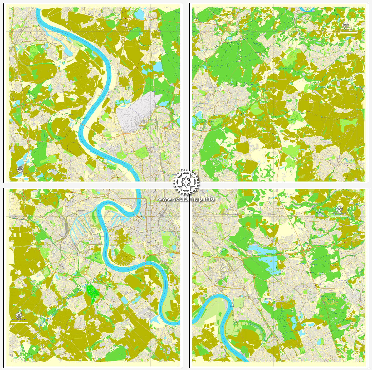
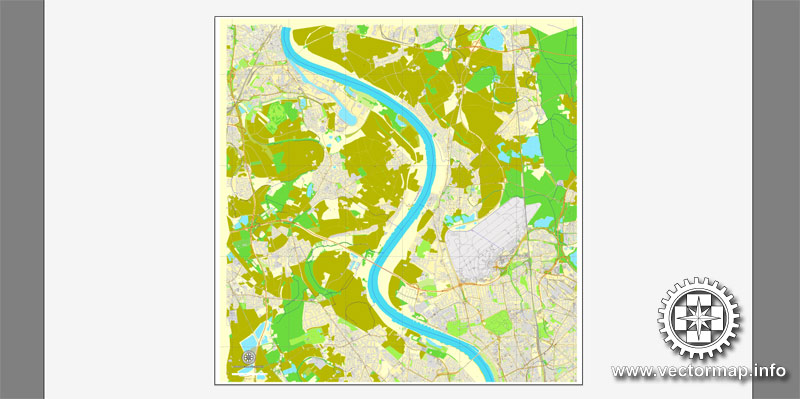
Duesseldorf, Germany, printable vector street City Plan map in 4 parts, full editable, Adobe Illustrator, full vector, scalable, editable, text format street names, 36,7 mb ZIP
All streets, All buildings. Map for design, print, arts, projects, presentations.
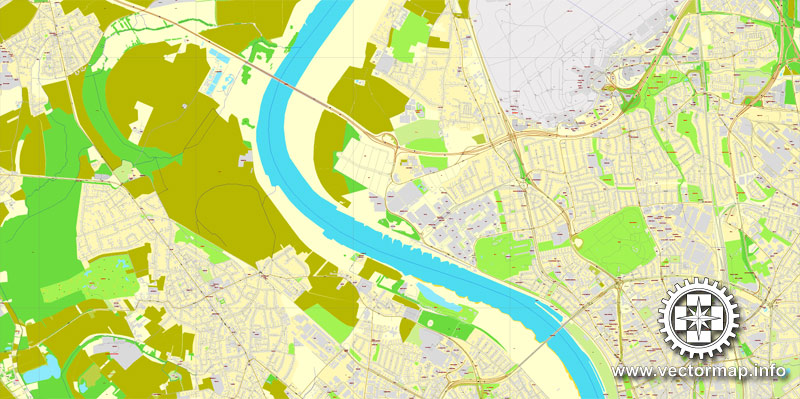
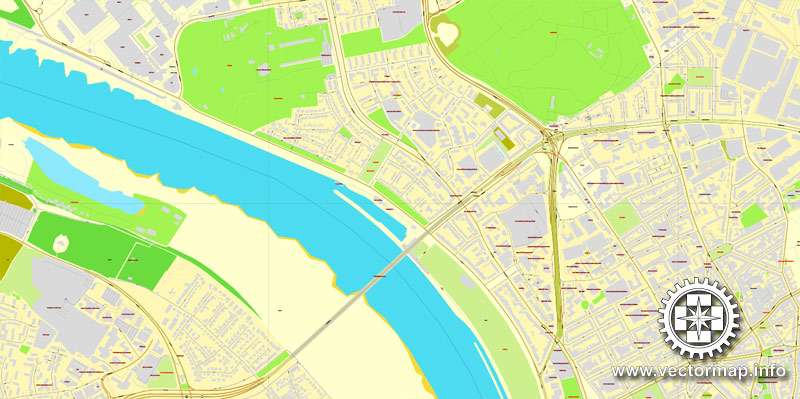
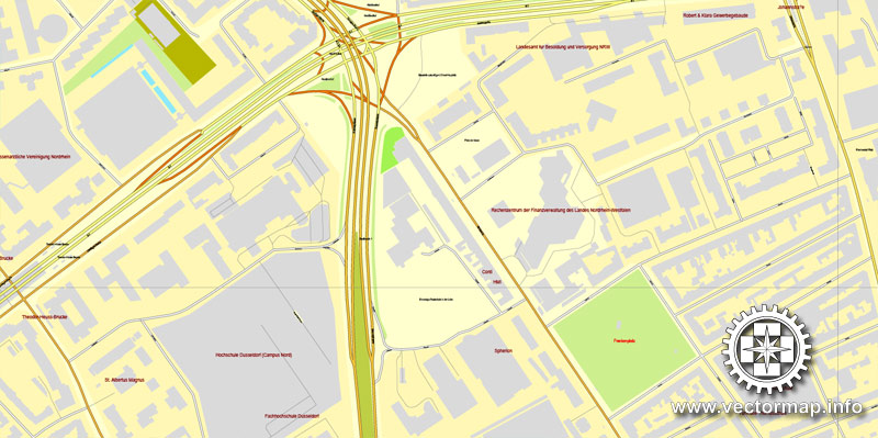
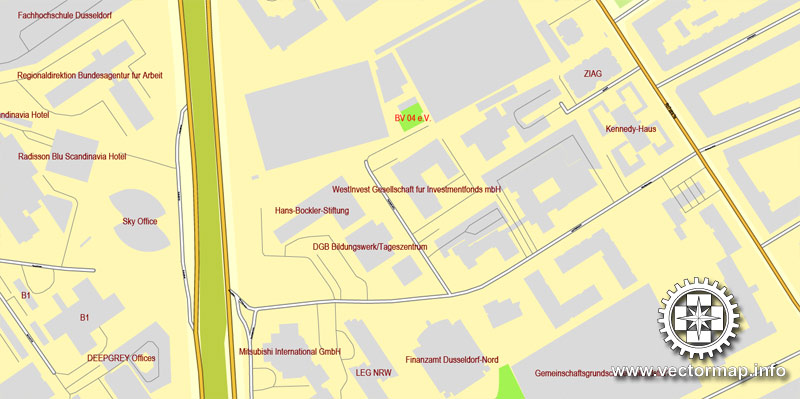
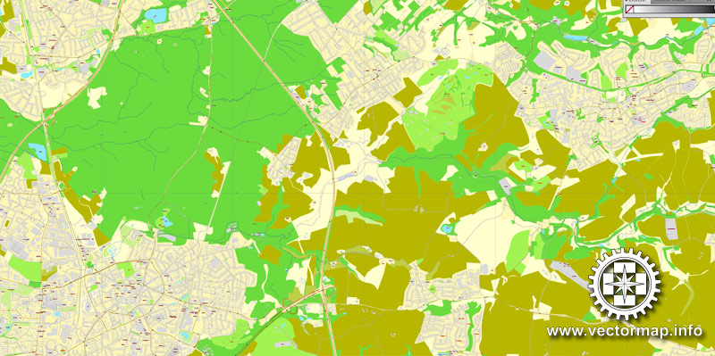
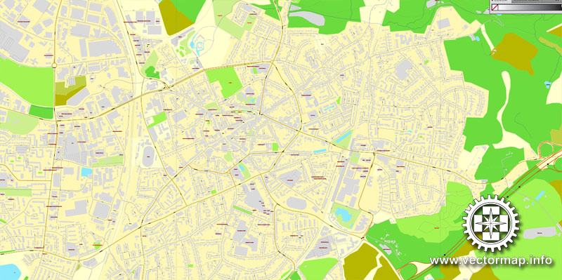
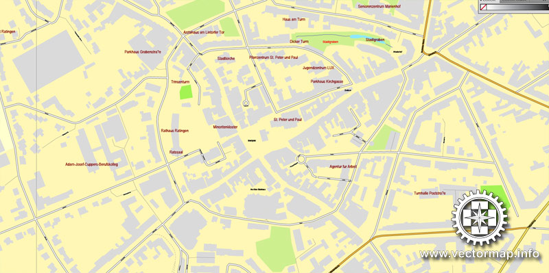
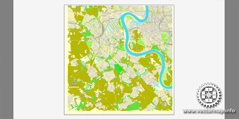
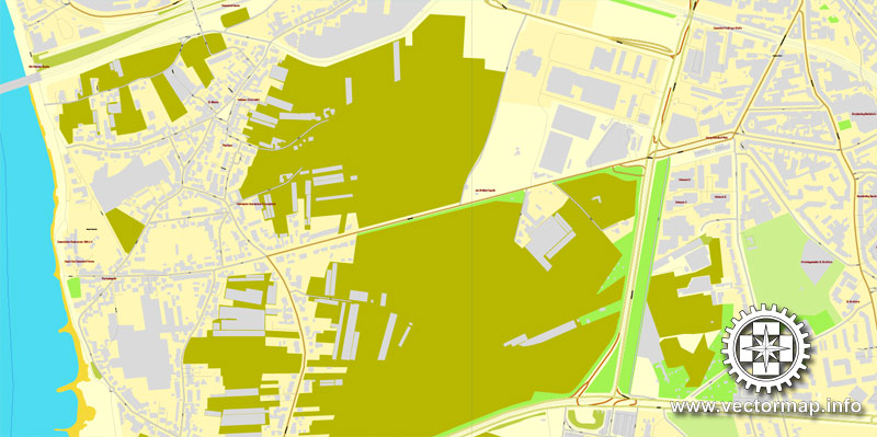
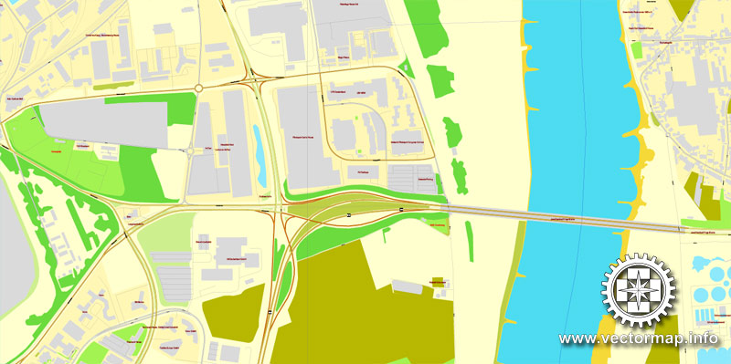
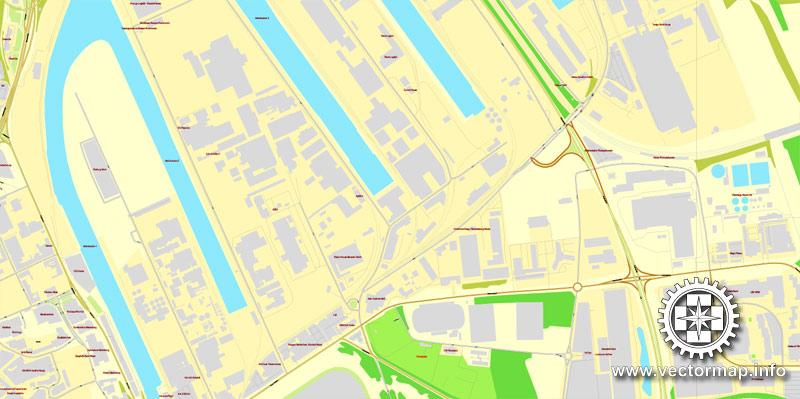
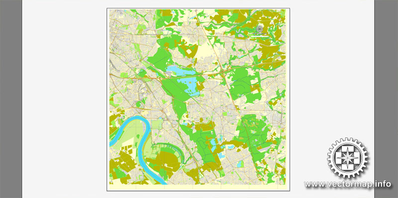
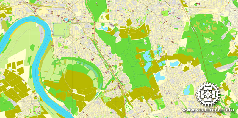
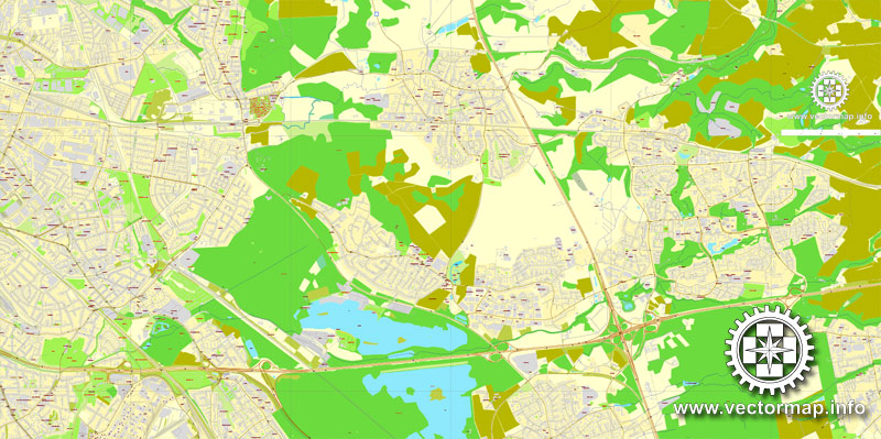
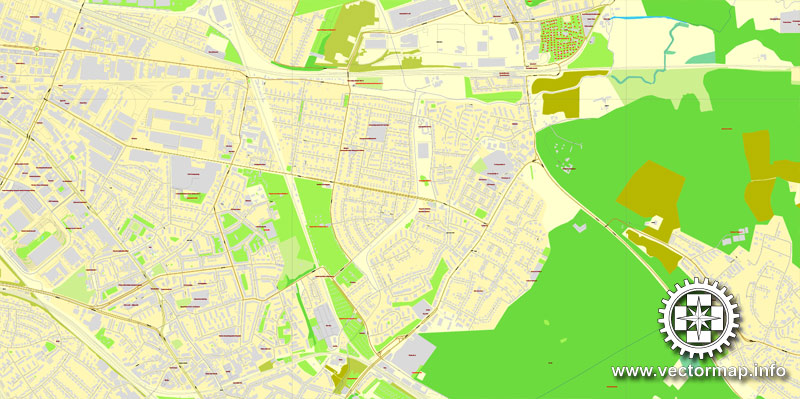
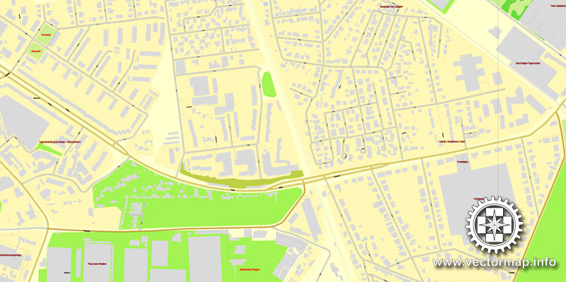
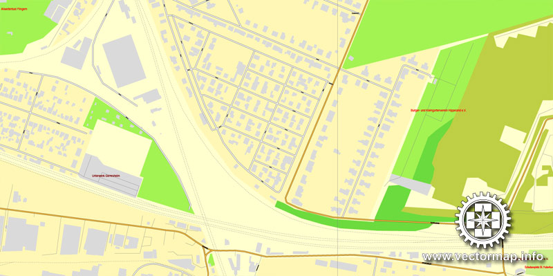
The most accurate and detailed map of the city.
Different font colors of the street names (black); object names by type (brown, red).
DXF, DWG, CDR and other formats – on request, same price, please, contact
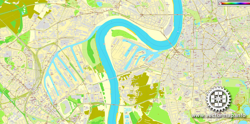
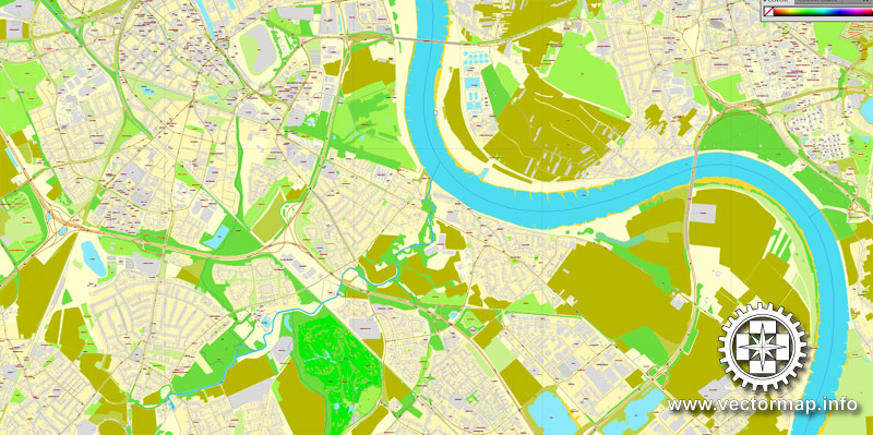
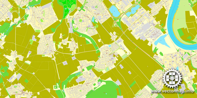
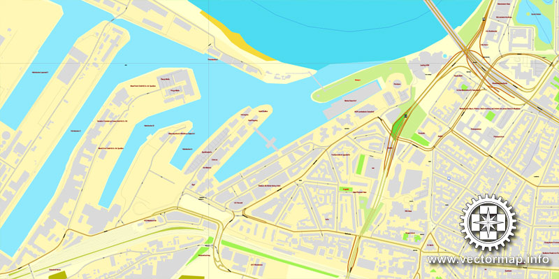
Düsseldorf, Germany.
This vector map of Dusseldorf city is used as a basis for design, editing, and further printing.
This is the most detailed, exact map of Dusseldorf city for high-quality printing and polygraphy. You can always clarify the map development date by contacting us.
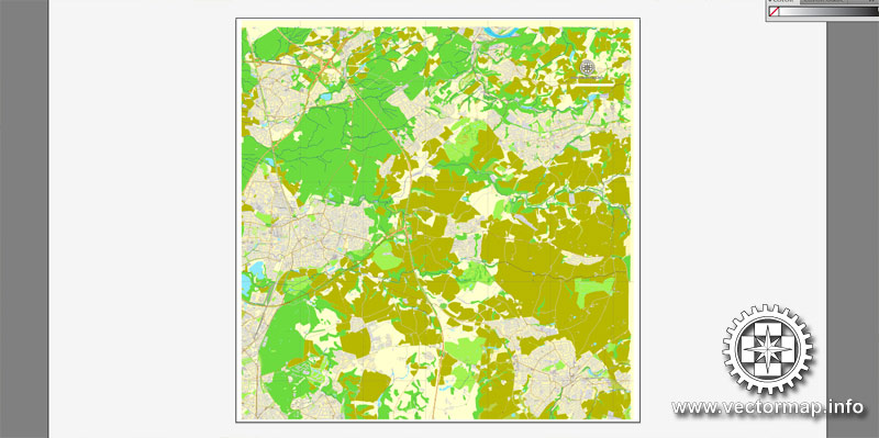
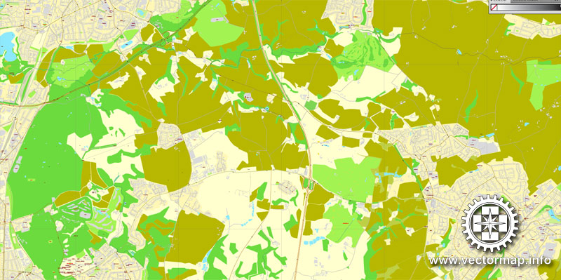
For your convenience, all objects on Dusseldorf vector city map are divided into layers. And the editing is very easy – colors, lines, etc.
You can easily add any objects needed (e.g. shops, salons, sale points, gas station or attraction) on any layer of Dusseldorf vector map.
Düsseldorf is the capital and, after Cologne, second most populous city of the most populous German federal state of North Rhine-Westphalia, as well as the seventh most populous city in Germany. At the confluence of the Rhine and its tributary Düssel, the city lies in the centre of both the Rhine-Ruhr and the Rhineland Metropolitan Regions with the Cologne/Bonn urban area to its south and the Ruhr to its north. The city is the largest in the German Low Franconian (closely related to Dutch) dialect area. Most of the city lies on the right bank of the Rhine (as opposed to Cologne, whose city centre lies on the river’s left bank). “Dorf” meaning “village”, Düsseldorf is the largest settlement with that suffix in the German-speaking area.
One of the advantages of Dusseldorf city vector maps of our production is the relevance of cartographic data, we constantly update all our products.
This vector map of Dusseldorf city is used by:
designers, layout designers, printers, advertisers and architects. Our product – vector maps – is designed for further editing and printing in large formats – from @Wall format (a few meters) to A-0 and A-1, A-2, A-3.
The Dusseldorf city map in vector format is used for design, urban planning, presentations and media visualizations.
The advertising and presentation map of Dusseldorf city (usually the final designer marks the routes, and puts the client’s objects (shops, saloons, gas stations etc.)
The undoubted advantage is that people will NEVER throw out this advertising product – the map. In fact, as an advertising medium, a city map is the most “long-playing” of the well-known polygraphic advertising media, with the longest lifespan, and the maximum number of interactions with the customer.
For travelers, maps are sold at the airports and gas stations around the world. Often the source is our vector maps.
Take a look, who purchases our vector maps of Dusseldorf city in “Our Clients and Friends” page – these are large and small companies, from super-brands like Volvo and Starbucks, to small design studios and printing houses.
It’s very easy to work with vector maps of Dusseldorf city, even for a not very experienced designer who can turn on and off the map layers, add new objects, change the colors of fill and lines according to customer requirements.
The undoubted advantage of Dusseldorf city vector maps in printing is an excellent and detailed visualization, when customer can expand a large paper map and instantly define his location, find a landmark, an object or address on map, unlike using the popular electronic formats of Google and Yandex maps for example.
Printable vector maps of Dusseldorf city are much more convenient and efficient than any electronic maps on your smartphone, because ALL DETAILS are displayed in the entire space of Dusseldorf city map.
Useful tips on working with vector maps of cities and countries in Adobe Illustrator.
«V» – launches the Selection tool (cursor, black arrow), which makes active any vector line.
«А» – launches the Direct Selection tool (white cursor), allows you to select curve elements and drag them to the desired place.
«R» – activates the Rotate tool, which helps you rotating selected objects around the center point by 360 degrees.
«E» – gives you the opportunity to use the Eraser tool and erase unnecessary parts.
«X» – switches between Fill and Stroke in the Tools section. Try to get used to this hot key and
you will quickly understand that you can’t live and work without it.
Guides are not limited to vertical and horizontal in Adobe Illustrator. You can also create a diagonal guide for example. Moreover, you can turn any contours into guides. Select the outline and go to View > Guides > Make Guides (Create Guides), or simply press Cmd/Ctrl + 5. You can also turn the guides back into an editable object. Go to menu, View > Guides > Unlock Guides (Release Guides), select the guide you want to edit and select View > Guides > Release Guides (Reset Guides), or just press Cmd/Ctrl + Option / Alt + 5).
You will probably want to change the color scheme used on our Dusseldorf vector city map.
To quickly and effectively play with colors.
Of course, you can do it manually, all objects in our Dusseldorf city vector map are divided according to types and layers, and you can easily change the color gamma of vector objects in groups and layers.
But there is more effective way of working with the whole VECTOR MAP of Dusseldorf city and all layers:
The overview dialog «Edit colors»/«Repaint Graphic Object» (this dialog box name can change depending on the context):
If you have selected a part or a layer of Dusseldorf city vector map and open the dialog box by clicking the icon in the Control panel, on the Samples palette or the Color Catalog, or if you choose Edit > Edit Colors> Repaint Graphic Object, then the «Repaint Graphic Object» dialog box appears, and you get access to «Assign» and «Edit» tabs.
If a picture or a map fragment is not selected, and you open the dialog box by clicking the icon in the Control panel, on the Samples palette or in the Color Catalog, the «Edit Colors» dialog box appears and you can only access the «Edit» tab.
Regardless of the name at the top of the dialog box, the right-hand side always displays the color group of the current document, as well as two default color groups: Print Color and Grayscale. These color groups can be selected and used any time.
Create and edit color groups of Dusseldorf city vector map, and also assign colors using the «Edit Colors»/ а «Repaint Graphic Object» dialog box.
A. Creating and editing of a color group on the «Edit» tab
B. Assigning colors on the «Assign» tab
C. Select a group of colors from the «Color groups» list
The option «Repaint a graphic object» in the lower part of the dialog box allows you to preview the colors on a selected layer of Vector map, or a group of elements, and specify whether its colors will be redefined when the dialog box is closed.
The main areas of the dialog box are:
«Edit»
The «Edit» tab is designed to create a new or edit the existing color groups.
The harmony rules Menu and the Color Wheel are used to conduct experiments with color harmonies. The color wheel shows how colors are related in color harmony, and the color bars allow you to view and manipulate an individual color values. In addition, you can adjust the brightness, add and remove colors, save color groups and view colors on the selected Vector Map of Dusseldorf city or a separated layers.
«Assign»
The «Assign» tab is used to view and control on how the original colors are replaced with colors from the color group like your corporate colors in the Vector Map of Dusseldorf city.
The assign color ability is provided only if the entire map, layer or fragment is selected in the document. You can specify which of new colors replace the current colors, whether the spot colors should be preserved and how colors are replaced (for example, you can replace colors completely or changing the color tone while maintaining the brightness). The «Assign» tab allows you to redefine colors in the Vector Map of Dusseldorf city, or in separate layers and fragments using the current color group or reducing the number of colors in the current Vector Map.
Color groups
Is a list of all saved color groups for current document (the same groups appear in the «Samples» palette). You can edit and delete the existing color groups, as well as creating a new ones using the list of “Color Groups” in the dialog box. All changes appear in the «Samples» palette.
The highlighted color group shows, which color group is currently edited.
Any color group can be selected and edited, or used to redefine the colors in the selected vector map of Dusseldorf city, its fragments or elements.
Saving a color group adds this group to the specified list.
Opening the «Edit Colors»/«Repaint Graphic Object» dialog box.
Open the «Edit Colors»/«Repaint Graphic Object» dialog box using one of the following methods:
«Edit»> «Edit Colors»> «Repaint Graphic object» or «Repaint With Style».
Use these commands if you need to edit the colors in the selected vector map of Dusseldorf city.
«Repaint Graphic object» button on the «Control» panel.
Use this button if you need to adjust colors of Dusseldorf city vector map using the а «Repaint graphic object» dialog box.
The specified button is available if the selected vector map or its fragment contains two or more colors.
Note. This color editing method is convenient for global color adjustment in a vector map, if global colors were not used when creating a City Map of Dusseldorf.
The «Edit colors» button or «Edit or apply colors» on the «Color Catalog» palette
Click this button if you need to edit colors on the «Color Catalog» palette or edit and then apply them to the selected Vector Map of Dusseldorf city or its fragment.
The «Edit color group» button or «Edit or apply color group» on the «Samples» palette.
Click this button if you need to edit the colors in the specific color group or edit and apply them to the selected Vector Map of Dusseldorf city or a group of its elements, for example, the whole layer “Streets and lines”. You can also double-click the color group in the Samples panel to open the dialog box.
If the map file is too large and your computer freezes or even can’t open it quickly:
1. Try to reduce the color resolution of the video card (display) to 256 colors while working with a large map.
2. Using Windows Task Manager, select all the application you don’t need, while working with map, just turn them off.
3. Launch Adobe Illustrator. (DO NOT OPEN the vector map file)
4. Start the Windows Task Manager using administrator rights > Find the “Illustrator” process > set the «real time» priority,
5. Open the file. When you see the LEGACY FONT popup window – click “OK” (do not update). You can restore the TEXT later.
6. Can also be useful: When file is opened – Edit > Settings > Basic Settings > disable smoothing. /// It looks scary, but works quickly)))
We recommend saving the file in Adobe Illustrator 10 version. It’s much more stable when working with VERY BIG size files.
Mercer’s 2012 Quality of Living survey ranked Düsseldorf the sixth most livable city in the world. Düsseldorf Airport is Germany’s third-busiest airport after those of Frankfurt and Munich, serving as the most important international airport for the inhabitants of the densely populated Ruhr, Germany’s largest urban area. Düsseldorf is an international business and financial centre, renowned for its fashion and trade fairs, and is headquarters to one Fortune Global 500 and two DAX companies. Messe Düsseldorf organises nearly one fifth of premier trade shows. As second largest city of the Rhineland, Düsseldorf holds Rhenish Carnival celebrations every year in February/March, the Düsseldorf carnival celebrations being the third most popular in Germany after those held in Cologne and Mainz.
There are 22 institutions of higher education in the city including the Heinrich-Heine-Universität Düsseldorf, the university of applied sciences (Hochschule Düsseldorf), the academy of arts (Kunstakademie Düsseldorf) (Joseph Beuys, Emanuel Leutze, August Macke, Gerhard Richter, Sigmar Polke, and Andreas Gursky), and the university of music (Robert-Schumann-Musikhochschule Düsseldorf). The city is also known for its pioneering influence on electronic/experimental music (Kraftwerk) and its Japanese community.
Geography
Düsseldorf lies at the centre of the Lower Rhine basin, where the delta of the Düssel flows into the Rhine. The city lies on the east side of the Rhine, except District 4 (Oberkassel, Niederkassel, Heerdt and Lörick). Across the Rhine, the city of Neuss stands on the delta of the Erft. Düsseldorf lies southwest of the Ruhr urban area, and in the middle of the Rhine-Ruhr metropolitan region.
Düsseldorf is built entirely on alluvium, mud, sand, clay and occasionally gravel. The highest point in Düsseldorf is the top of Sandberg in the far eastern part of the city (Hubbelrath borough) at 165 metres (541 ft). The lowest point is at the far northern end in Wittlaer borough where the Schwarzbach enters the Rhine, with an average elevation of 28 metres (92 ft).
Adjacent cities and districts
The following districts and cities border Düsseldorf (clockwise starting from the north): the City of Duisburg, the District of Mettmann (Ratingen, Mettmann, Erkrath, Hilden, Langenfeld, and Monheim), and the District of Neuss (Dormagen, Neuss, and Meerbusch).
Climate
The city has a oceanic climate (Köppen: Cfb, mild in relation the East Germany). Like the rest of the lower Rhineland, Düsseldorf experiences moderate winters with little snowfall and mild to warm summers. The average annual temperature is 10.6 °C (51 °F) with an average yearly precipitation of 797 millimetres (31 in). The dominant wind direction is from the west with velocities in the range of 3 to 4 m/s (7–9 mph), with gusts of 3.5 −4.8 m/s (8–10.7 mph). The wind is calm (defined as being under 2 m/s or 4.5 mph) about 35% of the time, more frequently at night and in the winter.

Düsseldorf is the capital city of the German state of North Rhine-Westphalia and the seventh most populous city in Germany. Düsseldorf is an international business and financial centre, renowned for its fashion and trade fairs.The city is headquarters to five Fortune Global 500 and several DAX companies. Messe Düsseldorf organises nearly one fifth of premier trade shows.
Düsseldorf is known for its academy of fine arts (Joseph Beuys, Emanuel Leutze, August Macke, Gerhard Richter, Sigmar Polke and Andreas Gursky), its pioneering influence on electronic/experimental music (Kraftwerk) and its Japanese community. On the river Rhine, Düsseldorf holds Rhenish Carnival celebrations every year in February / March. Mercer’s 2012 Quality of Living survey ranked Düsseldorf sixth city in the world.
Düsseldorf is a city in western Germany known for its fashion industry and art scene. It’s divided by the Rhine River, with its Old Town on the east bank and modern commercial areas to the west. In the Old Town, St. Lambertus Church and Castle Tower both date to the 13th century. Streets such as Königsalle and Schadowstraße are lined with boutiques.
Population: 593,682 (2013) UNdata
Small guide: How to work with the vector map?
You can: Mass select objects by type and color – for example, the objects type “building” (they are usually dark gray) – and remove them from the map, if you do not need them in your print or design project. You can also easily change the thickness of lines (streets), just bulk selection the road by the line color.
The streets are separated by type, for example, type “residential road” are usually white with a gray stroke. Highway usually orange with a brown or dark gray stroke.
It is easy to change the font of inscriptions, all or each individually. Also, just can be make and any other manipulation of objects on the vector map in Adobe illustrator format.
Important: All the proportions on the map are true, that is, the relative sizes of the objects are true, because Map is based on an accurate GPS projection, and It transated into the (usual for all) the Mercator projection.
You can easily change the color, stroke and fill of any object on the map, zoom without loss of quality Image Verification.
Select object

Bulk selection the same objects on the vector map

See the bulk selected objects on the vector map

Bulk delete buildungs from the vector map

Select residencial road (small street) on the vector map

Bulk selection the same lines (streets, roads) on the full map

Create fat lines of the streets on the vector maps (bulk action) 1

Create fat lines of the streets on the vector maps (bulk action) 2

Create fat lines of the streets on the vector maps (bulk action) 3

You can easily change the color, stroke and fill of any object on the map, zoom without loss of quality Image Verification.

 Author: Kirill Shrayber, Ph.D. FRGS


