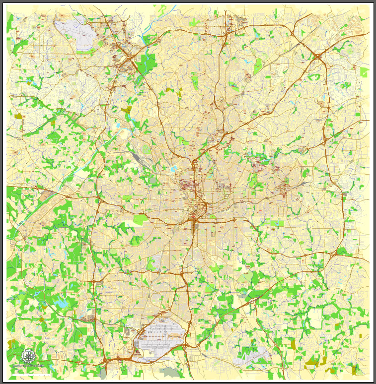
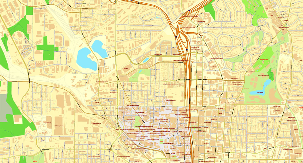
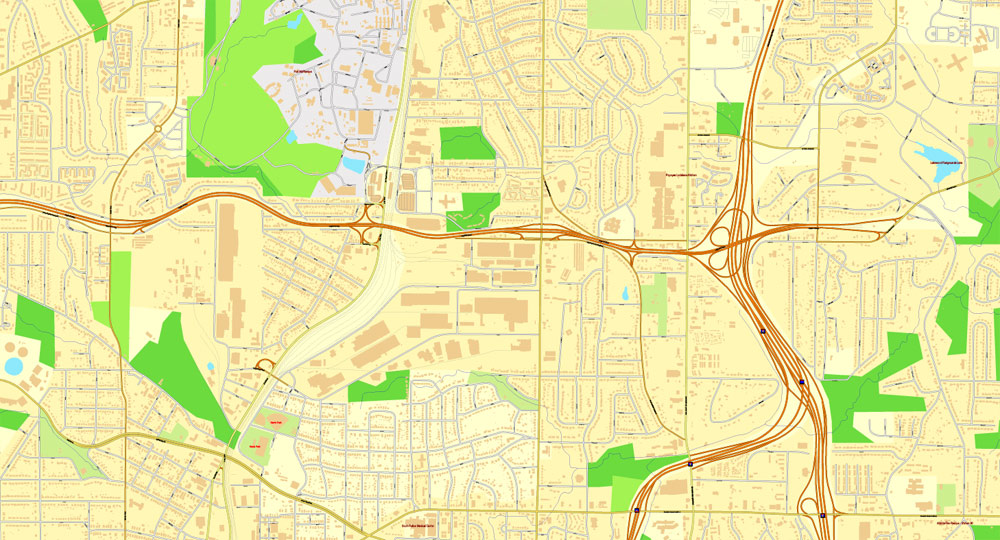
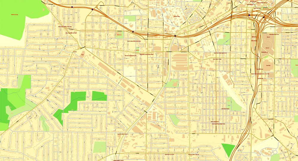
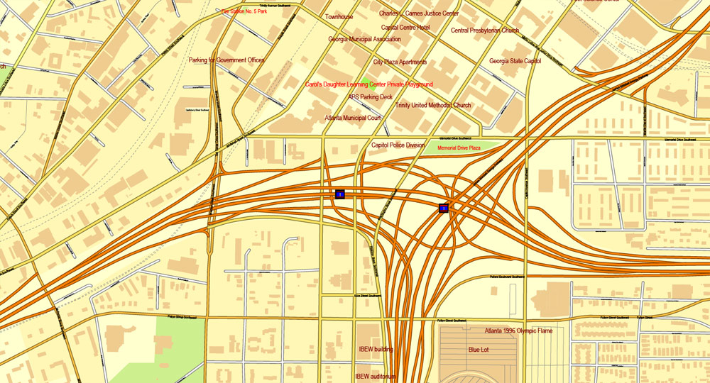
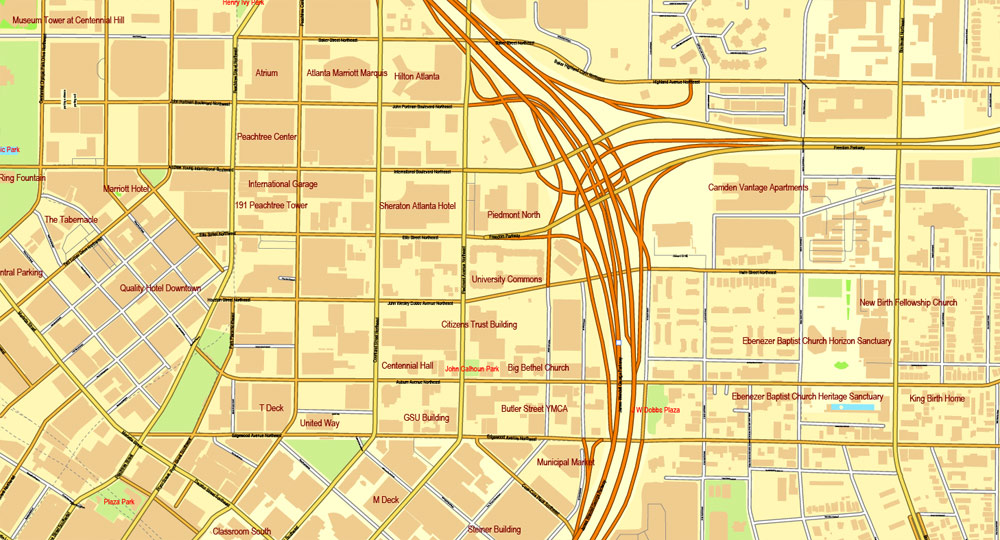
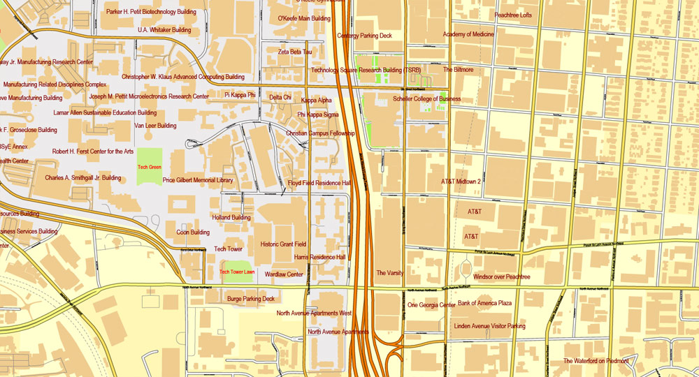
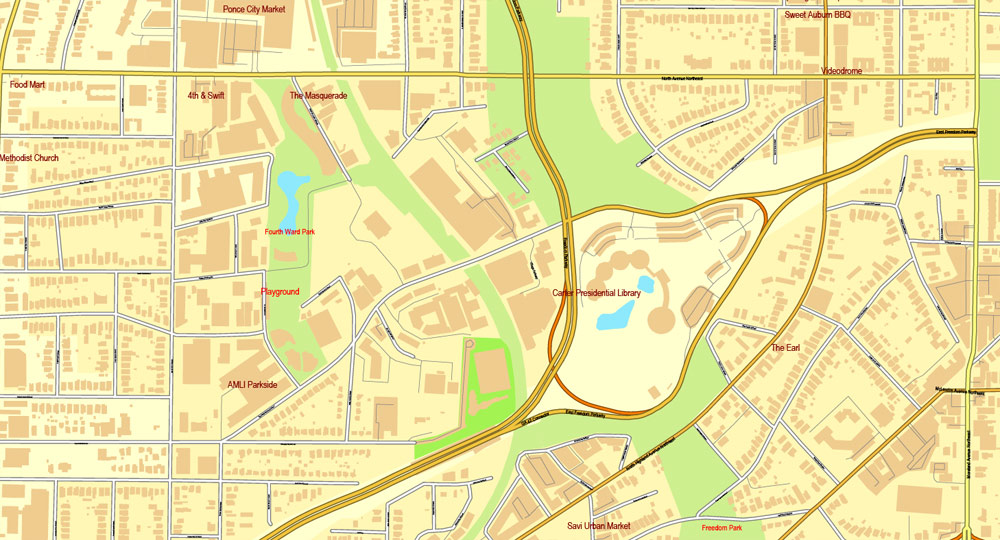
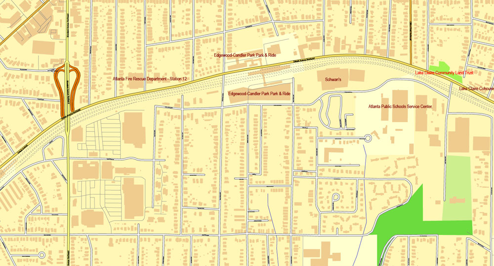
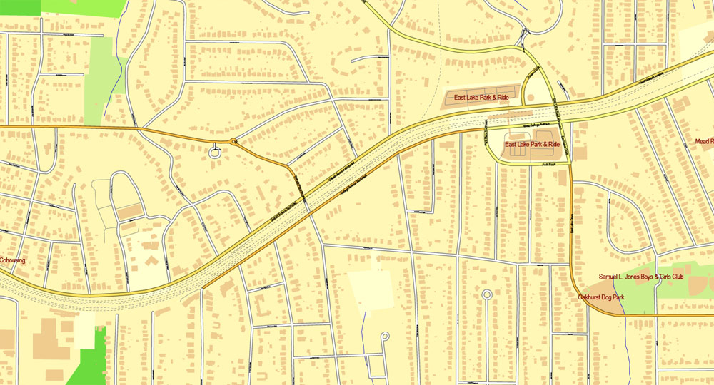
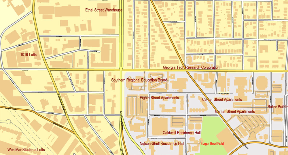
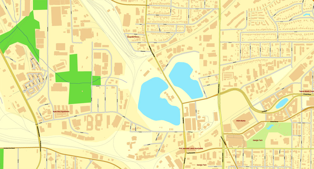
Atlanta, Georgia, US, vector map Adobe Illustrator editable City Plan V3, full vector, scalable, editable, text format street names, 32 Mb ZIP.
All streets, all buildings. Map for design, printing, arts, projects, presentations,
for architects, designers and builders.
The most accurate and detailed map of the city.
CDR, DWG, DXF and other formats – on demand, same price, please contact.
Atlanta, Georgia, USA.
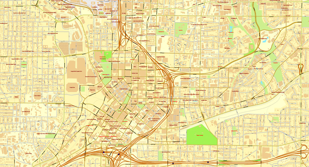
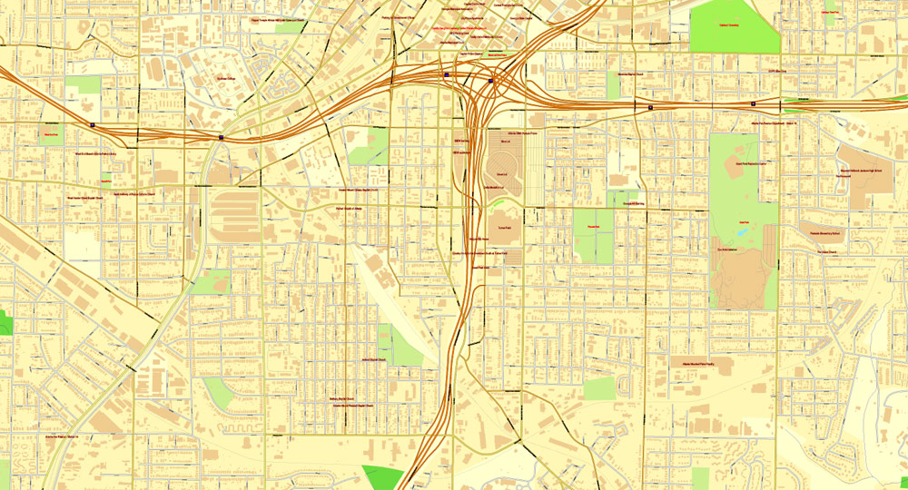
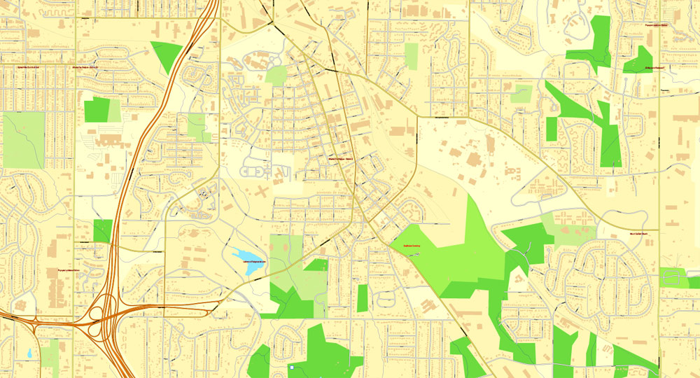
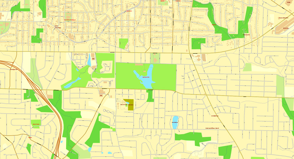
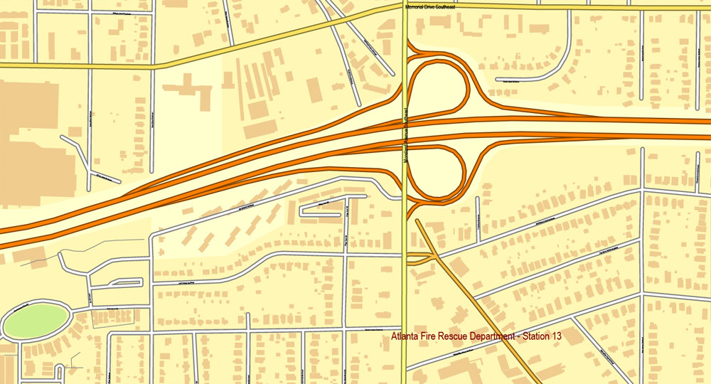
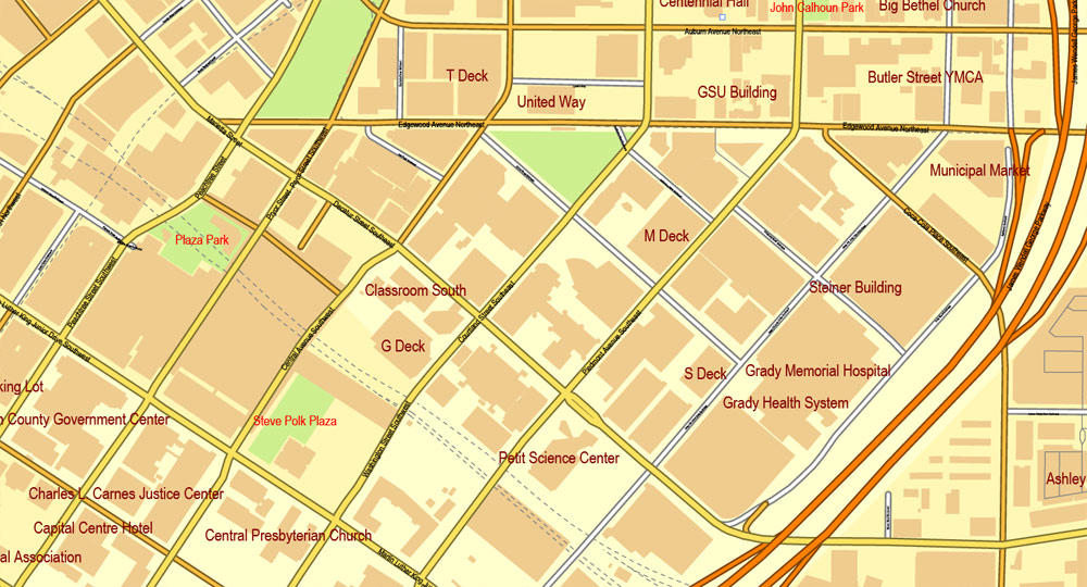
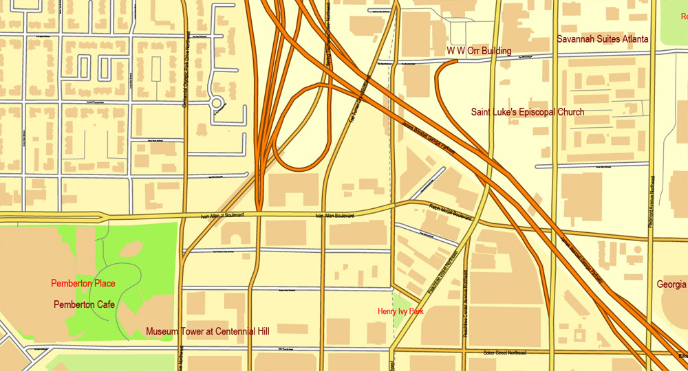
This vector map of Atlanta city is used as a basis for design, editing, and further printing.
This is the most detailed, exact map of Atlanta city for high-quality printing and polygraphy. You can always clarify the map development date by contacting us.
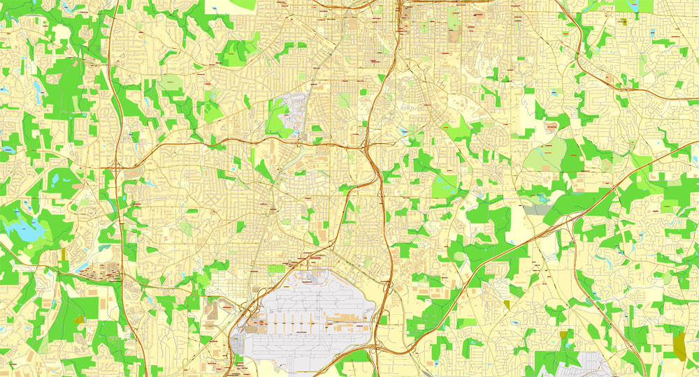
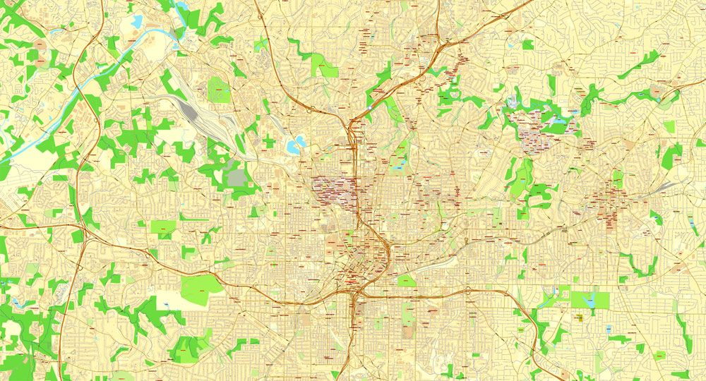
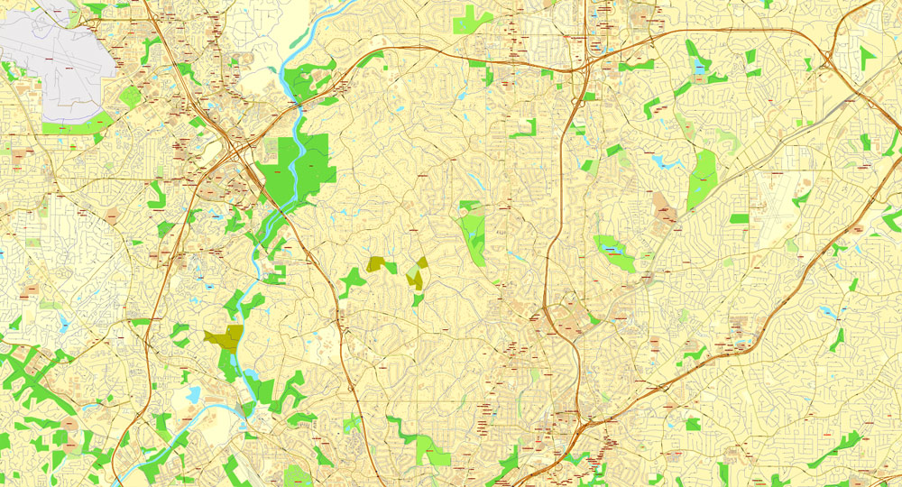
For your convenience, all objects on Atlanta vector city map are divided into layers. And the editing is very easy – colors, lines, etc.
You can easily add any objects needed (e.g. shops, salons, sale points, gas station or attraction) on any layer of Atlanta vector map.
One of the advantages of Atlanta city vector maps of our production is the relevance of cartographic data, we constantly update all our products.
Atlanta is the capital of, and the most populous city in, the U.S. state of Georgia. With an estimated 2017 population of 486,290, it is also the 39th most-populous city in the United States. The city serves as the cultural and economic center of the Atlanta metropolitan area, home to 5.8 million people and the ninth-largest metropolitan area in the nation. Atlanta is the seat of Fulton County, the most populous county in Georgia. A small portion of the city extends eastward into neighboring DeKalb County.
This vector map of Atlanta city is used by:
designers, layout designers, printers, advertisers and architects. Our product – vector maps – is designed for further editing and printing in large formats – from @Wall format (a few meters) to A-0 and A-1, A-2, A-3.
The Atlanta city map in vector format is used for design, urban planning, presentations and media visualizations.
The advertising and presentation map of Atlanta city (usually the final designer marks the routes, and puts the client’s objects (shops, saloons, gas stations etc.)
The undoubted advantage is that people will NEVER throw out this advertising product – the map. In fact, as an advertising medium, a city map is the most “long-playing” of the well-known polygraphic advertising media, with the longest lifespan, and the maximum number of interactions with the customer.
For travelers, maps are sold at the airports and gas stations around the world. Often the source is our vector maps.
Take a look, who purchases our vector maps of Atlanta city in “Our Clients and Friends” page – these are large and small companies, from super-brands like Volvo and Starbucks, to small design studios and printing houses.
Atlanta was founded as a transportation hub at the intersection of two railroad lines in 1837. After being mostly burned to the ground during the American Civil War, the city rose from its ashes to become a national center of commerce and the unofficial capital of the “New South”. During the 1950s and 1960s, Atlanta became a major organizing center of the civil rights movement, with Dr. Martin Luther King Jr., Ralph David Abernathy, and many other locals playing major roles in the movement’s leadership. In the decades following, the city earned a reputation as “too busy to hate” for the relatively progressive views of its citizens and leaders compared to other cities in the “Deep South”.
It’s very easy to work with vector maps of Atlanta city, even for a not very experienced designer who can turn on and off the map layers, add new objects, change the colors of fill and lines according to customer requirements.
The undoubted advantage of Atlanta city vector maps in printing is an excellent and detailed visualization, when customer can expand a large paper map and instantly define his location, find a landmark, an object or address on map, unlike using the popular electronic formats of Google and Yandex maps for example.
Printable vector maps of Atlanta city are much more convenient and efficient than any electronic maps on your smartphone, because ALL DETAILS are displayed in the entire space of Atlanta city map.
Useful tips on working with vector maps of cities and countries in Adobe Illustrator.
«V» – launches the Selection tool (cursor, black arrow), which makes active any vector line.
«А» – launches the Direct Selection tool (white cursor), allows you to select curve elements and drag them to the desired place.
«R» – activates the Rotate tool, which helps you rotating selected objects around the center point by 360 degrees.
«E» – gives you the opportunity to use the Eraser tool and erase unnecessary parts.
«X» – switches between Fill and Stroke in the Tools section. Try to get used to this hot key and
you will quickly understand that you can’t live and work without it.
During the modern era, Atlanta has attained international prominence as a major air transportation hub, with Hartsfield–Jackson Atlanta International Airport being the world’s busiest airport by passenger traffic since 1998.
Guides are not limited to vertical and horizontal in Adobe Illustrator. You can also create a diagonal guide for example. Moreover, you can turn any contours into guides. Select the outline and go to View > Guides > Make Guides (Create Guides), or simply press Cmd/Ctrl + 5. You can also turn the guides back into an editable object. Go to menu, View > Guides > Unlock Guides (Release Guides), select the guide you want to edit and select View > Guides > Release Guides (Reset Guides), or just press Cmd/Ctrl + Option / Alt + 5).
You will probably want to change the color scheme used on our Atlanta vector city map.
To quickly and effectively play with colors.
Of course, you can do it manually, all objects in our Atlanta city vector map are divided according to types and layers, and you can easily change the color gamma of vector objects in groups and layers.
Atlanta is rated as a “beta(+)” world city that exerts a moderate impact on global commerce, finance, research, technology, education, media, art, and entertainment. It ranks in the top twenty among world cities and 10th in the nation with a gross domestic product (GDP) of $385 billion.
But there is more effective way of working with the whole VECTOR MAP of Atlanta city and all layers:
The overview dialog «Edit colors»/«Repaint Graphic Object» (this dialog box name can change depending on the context):
If you have selected a part or a layer of Atlanta city vector map and open the dialog box by clicking the icon in the Control panel, on the Samples palette or the Color Catalog, or if you choose Edit > Edit Colors> Repaint Graphic Object, then the «Repaint Graphic Object» dialog box appears, and you get access to «Assign» and «Edit» tabs.
If a picture or a map fragment is not selected, and you open the dialog box by clicking the icon in the Control panel, on the Samples palette or in the Color Catalog, the «Edit Colors» dialog box appears and you can only access the «Edit» tab.
Regardless of the name at the top of the dialog box, the right-hand side always displays the color group of the current document, as well as two default color groups: Print Color and Grayscale. These color groups can be selected and used any time.
Atlanta’s economy is considered diverse, with dominant sectors that include transportation, logistics, professional and business services, media operations, medical services, and information technology. Atlanta has topographic features that include rolling hills and dense tree coverage, earning it the nickname of “the city in a forest.” Revitalization of Atlanta’s neighborhoods, initially spurred by the 1996 Summer Olympics, has intensified in the 21st century, altering the city’s demographics, politics, and culture.
«Assign»
The «Assign» tab is used to view and control on how the original colors are replaced with colors from the color group like your corporate colors in the Vector Map of Atlanta city.
The assign color ability is provided only if the entire map, layer or fragment is selected in the document. You can specify which of new colors replace the current colors, whether the spot colors should be preserved and how colors are replaced (for example, you can replace colors completely or changing the color tone while maintaining the brightness). The «Assign» tab allows you to redefine colors in the Vector Map of Atlanta city, or in separate layers and fragments using the current color group or reducing the number of colors in the current Vector Map.
Atlanta straddles the Eastern Continental Divide, such that rainwater that falls on the south and east side of the divide flows into the Atlantic Ocean, while rainwater on the north and west side of the divide flows into the Gulf of Mexico. Atlanta sits atop a ridge south of the Chattahoochee River, which is part of the ACF River Basin. Located at the far northwestern edge of the city, much of the river’s natural habitat is preserved, in part by the Chattahoochee River National Recreation Area.
Color groups
Is a list of all saved color groups for current document (the same groups appear in the «Samples» palette). You can edit and delete the existing color groups, as well as creating a new ones using the list of “Color Groups” in the dialog box. All changes appear in the «Samples» palette.
The highlighted color group shows, which color group is currently edited.
Any color group can be selected and edited, or used to redefine the colors in the selected vector map of Atlanta city, its fragments or elements.
Saving a color group adds this group to the specified list.
Opening the «Edit Colors»/«Repaint Graphic Object» dialog box.
Open the «Edit Colors»/«Repaint Graphic Object» dialog box using one of the following methods:
«Edit»> «Edit Colors»> «Repaint Graphic object» or «Repaint With Style».
Use these commands if you need to edit the colors in the selected vector map of Atlanta city.
«Repaint Graphic object» button on the «Control» panel.
Use this button if you need to adjust colors of Atlanta city vector map using the а «Repaint graphic object» dialog box.
Effect of geography
The area’s geography affects the weather as well. An anticyclone over the Northeastern U.S. will blow cold air over the warmer Atlantic Ocean, forming a wedge or marine layer up against the mountains. This east or northeast wind will often blow down into the metro area in winter or even spring (sometimes fall and very rarely summer), dramatically lowering the temperature and bringing clouds and often fog or mist, along with a swift breeze.
The specified button is available if the selected vector map or its fragment contains two or more colors.
Note. This color editing method is convenient for global color adjustment in a vector map, if global colors were not used when creating a City Map of Atlanta.
The «Edit colors» button or «Edit or apply colors» on the «Color Catalog» palette
Click this button if you need to edit colors on the «Color Catalog» palette or edit and then apply them to the selected Vector Map of Atlanta city or its fragment.
The «Edit color group» button or «Edit or apply color group» on the «Samples» palette.
The temperature gradient across the sprawling metro Atlanta can be as much as 20 °F or 10 °C, occasionally even more. In winter this can be a curse, bringing freezing rain to exposed objects on the north and/or east sides of town, and occasionally very dangerously to the ground and roads. Later in the spring however, it can be a great blessing, as it often protects the area from severe thunderstorms and tornadoes, with the cool air acting like a fire extinguisher to the storms. The wedge may occasionally go the entire way through central Georgia and even into Alabama in the strongest conditions, while still leaving areas of northwest Georgia much warmer than the metro area. Conversely, shallow and heavy cold air from the northwest may be blocked by the mountains, preventing snow.
Click this button if you need to edit the colors in the specific color group or edit and apply them to the selected Vector Map of Atlanta city or a group of its elements, for example, the whole layer “Streets and lines”. You can also double-click the color group in the Samples panel to open the dialog box.
If the map file is too large and your computer freezes or even can’t open it quickly:
1. Try to reduce the color resolution of the video card (display) to 256 colors while working with a large map.
2. Using Windows Task Manager, select all the application you don’t need, while working with map, just turn them off.
3. Launch Adobe Illustrator. (DO NOT OPEN the vector map file)
4. Start the Windows Task Manager using administrator rights > Find the “Illustrator” process > set the «real time» priority,
5. Open the file. When you see the LEGACY FONT popup window – click “OK” (do not update). You can restore the TEXT later.
6. Can also be useful: When file is opened – Edit > Settings > Basic Settings > disable smoothing. /// It looks scary, but works quickly)))
We recommend saving the file in Adobe Illustrator 10 version. It’s much more stable when working with VERY BIG size files.
The local geography also plays a role in the day-to-day weather, with the shallow valleys to the southwest (rather than the mountains to the northeast) cooling rapidly on clear and calm nights, particularly when the humidity is low. Peachtree City and especially Newnan often report dramatically lower temperatures (by as much as 4 °C or 7.2 °F) on the 10 pm and 11 pm news, and will not drop much further, while the city (built on a ridge) will continue falling slowly but never reach that low. This type of dramatic difference in microclimate is somewhat unusual for a place not near large mountains or bodies of water.
See more United States (USA) cities street map in vector
For example: Vector Map Albuquerque, New Mexico, US
Allentown, Pennsylvania, Printable Map, US
PDF Map Austin, Texas, US
Atlanta
City in Georgia
Atlanta is the sprawling capital of Georgia. It played an important part in both the Civil War and the 1960s Civil Rights Movement. Atlanta History Center chronicles the city’s past, and the Martin Luther King Jr. National Historic Site is dedicated to the African-American leader’s life and times. Downtown, 21-acre Centennial Olympic Park, built for the 1996 Olympics, encompasses the massive Georgia Aquarium.
Population: 447,841 (2013)
Sports teams: Atlanta Braves, Atlanta Falcons, Atlanta Hawks, Atlanta Thrashers, Georgia Tech Yellow Jackets football
Atlanta is the capital of and the most populous city in the U.S. state of Georgia, with an estimated 2015 population of 463,878. Atlanta is the cultural and economic center of the Atlanta metropolitan area, home to 5,522,942 people and the ninth largest metropolitan area in the United States. Atlanta is the county seat of Fulton County, and a small portion of the city extends eastward into DeKalb County.
Atlanta was established in 1837 at the intersection of two railroad lines, and the city rose from the ashes of the American Civil War to become a national center of commerce. In the decades following the Civil Rights Movement, during which the city earned a reputation as “too busy to hate” for the progressive views of its citizens and leaders, Atlanta attained international prominence. Atlanta is the primary transportation hub of the Southeastern United States, via highway, railroad, and air, with Hartsfield–Jackson Atlanta International Airport being the world’s busiest airport since 1998.
Atlanta is an “alpha-” or “world city”, exerting a significant impact upon commerce, finance, research, technology, education, media, art, and entertainment. It ranks 36th among world cities and 8th in the nation with a gross domestic product of $270 billion. Atlanta’s economy is considered diverse, with dominant sectors including logistics, professional and business services, media operations, and information technology. Topographically, Atlanta is marked by rolling hills and dense tree coverage. Revitalization of Atlanta’s neighborhoods, initially spurred by the 1996 Olympics in Atlanta, has intensified in the 21st century, altering the city’s demographics, politics, and culture.
Area
• City 134.0 sq mi (347.1 km2)
• Land 133.2 sq mi (344.9 km2)
• Water 0.8 sq mi (2.2 km2)
• Urban 1,963 sq mi (5,080 km2)
• Metro 8,376 sq mi (21,690 km2)
Elevation 738 to 1,050 ft (225 to 320 m)
Population (2015)[10]
• City 463,878[6]
• Density 3,360/sq mi (1,299/km2)
• Urban 4,975,300
• Urban density 2,540/sq mi (979/km2)
• Metro 5,522,942[7] (9th)
• Metro density 660/sq mi (255/km2)
• CSA 6,162,195[8] (11th)
• Demonym Atlantan[9]
Time zone EST (UTC-5)
• Summer (DST) EDT (UTC-4)
ZIP code(s) 30060, 30301-30322, 30324-30334, 30336-30350, 30353
Area code(s) 404/678/470
Geography of Atlanta
Atlanta encompasses 134.0 square miles (347.1 km2), of which 133.2 square miles (344.9 km2) is land and 0.85 square miles (2.2 km2) is water. The city is situated among the foothills of the Appalachian Mountains, and at 1,050 feet (320 m) above mean sea level, Atlanta has the highest elevation of major cities east of the Mississippi River. Atlanta straddles the Eastern Continental Divide, such that rainwater that falls on the south and east side of the divide flows into the Atlantic Ocean, while rainwater on the north and west side of the divide flows into the Gulf of Mexico. Atlanta sits atop a ridge south of the Chattahoochee River, which is part of the ACF River Basin. Located at the far northwestern edge of the city, much of the river’s natural habitat is preserved, in part by the Chattahoochee River National Recreation Area.
https://en.wikipedia.org/wiki/Atlanta
Free vector map World, Adobe Illustrator, download now maps vector clipart
Map for design, projects, presentation free to use as you like.
Free Download All World Vector Maps here >>>>>
See also: TERMS & CONDITIONS: SOFTWARE LICENSE AGREEMENT FOR DIGITAL CARTOGRAPHIC DATA

 Author: Kirill Shrayber, Ph.D. FRGS

