Extended Description of the Vector Map
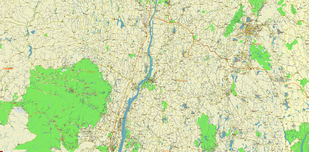
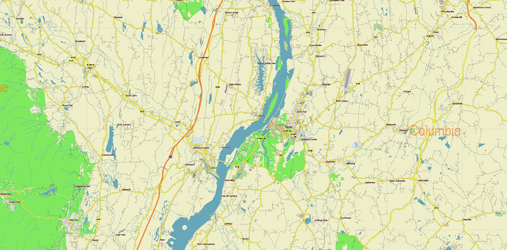
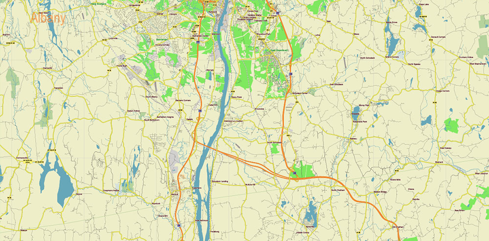
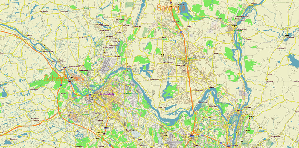
Printable Vector Map of Upper Hudson Valley Albany Area NY USA low detailed street map full editable Adobe Illustrator scalable, curves format all names, 46 MB ZIP
Main and Local roads and streets, Land Use areas, Buildings. Included Albany, Columbia, Greene, Rensselaer Counties and nearest, Map for design, printing, arts, projects, presentations, for architects, designers, and builders, business, logistics.
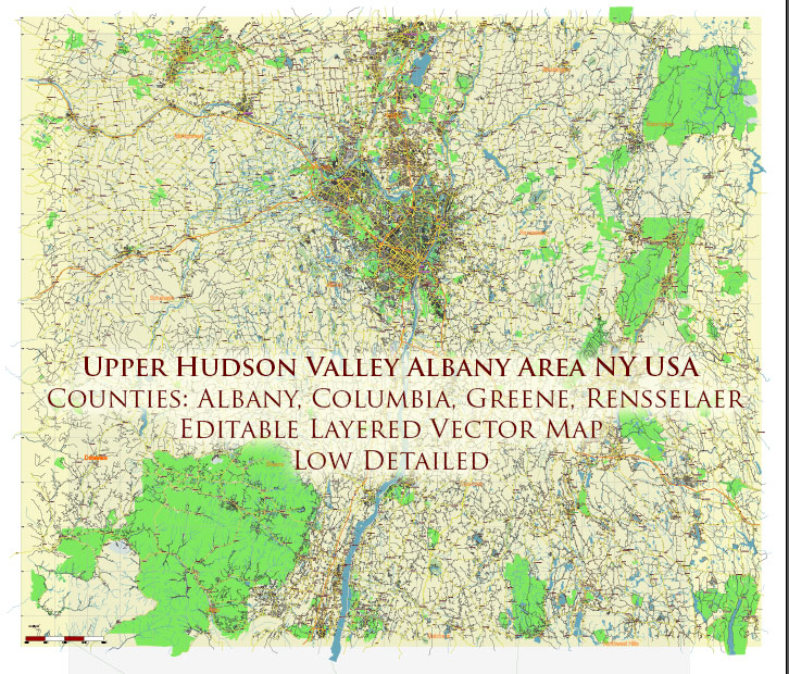
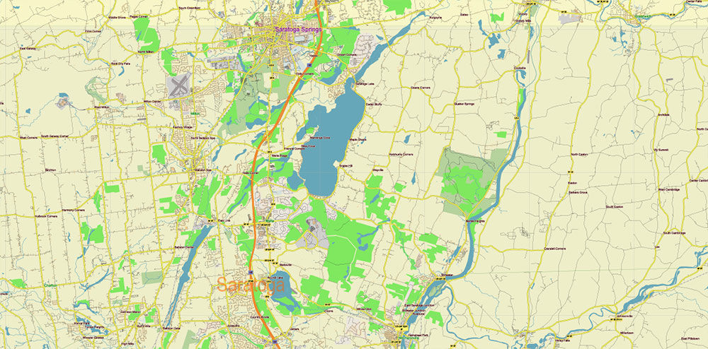
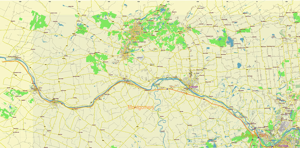
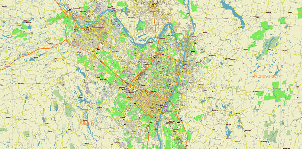
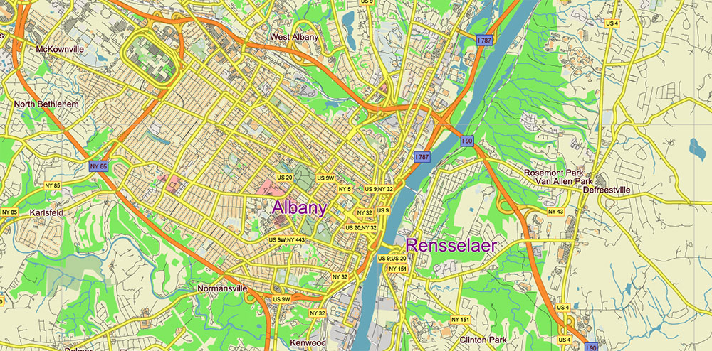
Upper Hudson Valley Albany Area NY USA Map Vector Exact City Plan Low Detailed Street Map editable Adobe Illustrator in layers
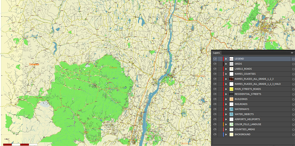
Layers list:
- Legend / Scales
- Grids
- Labels of roads
- Names of places (city, hamlet, etc.)
- Main Streets, roads
- Residential streets
- Names Counties
- Buildings
- Airports and Heliports
- Water objects (rivers, lakes, ponds)
- Waterways
- Color fills (parks, hospital areas, land use, etc.)
- Counties areas
- Background
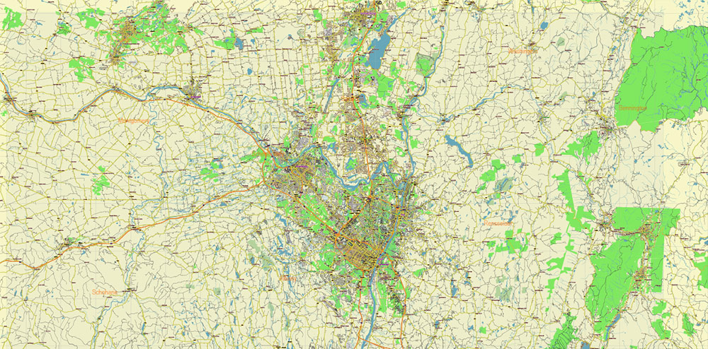
The most exact and detailed map of the city in scale. Low Detailed for small print size.
For Editing and High-Quality Printing
Upper Hudson Valley Albany Area NY USA Map Vector Exact City Plan Low Detailed Street Map editable Adobe Illustrator in layers
AO BRIEF — UPPER HUDSON VALLEY (Capital District Sector)
Area of Operations: Albany County • Columbia County • Greene County • Rensselaer County (New York, USA)
1. OVERVIEW / TERRAIN
- Northern segment of the Hudson Valley, centered on the Capital District (Albany–Troy axis).
- Dominant feature: Hudson River (N–S corridor) — primary geographic and economic spine.
- Terrain split:
- East of Hudson: rising uplands → Rensselaer Plateau → Taconic Mountains (MA/VT border).
- West of Hudson: Catskill Mountains foothills (Greene County), rugged dissected terrain.
- Central corridor: lowlands and floodplain around Albany–Troy (transport/logistics hub).
- Glacial legacy: wide valley floor, alluvial soils, sand plains; strong hydrography.
2. KEY ROADS / LINES OF COMMUNICATION
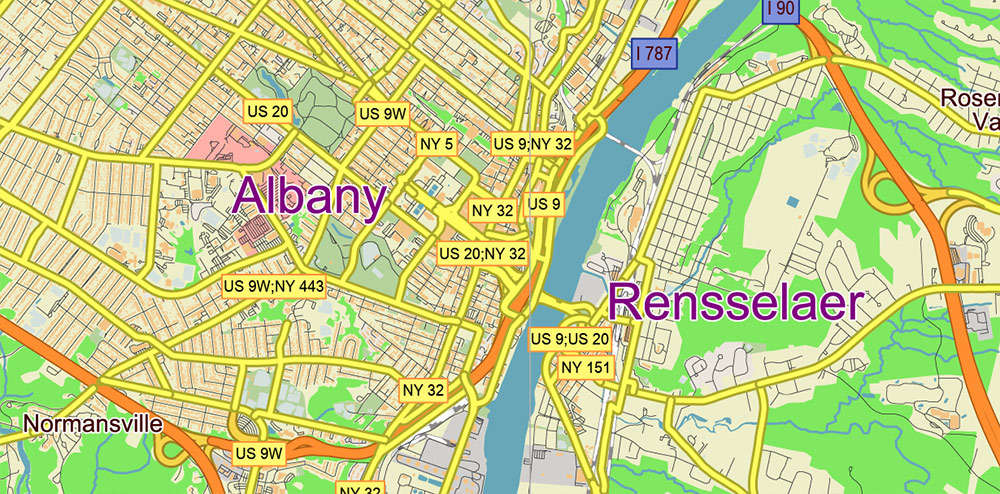
Primary North–South Axis:
- I-87 (Adirondack Northway) — Albany → Montreal corridor (strategic interstate spine).
- US-9 / NY-9J / NY-32 — parallel secondary corridors along both sides of Hudson.
East–West Corridors:
- I-90 (New York State Thruway / Berkshire Connector) — Boston ↔ Buffalo; critical cross-state artery.
- US-20 — historic transcontinental route across Albany/Rensselaer.
- NY-7 — Albany ↔ Troy ↔ Vermont linkage.
Bridges / River Crossings (critical chokepoints):
- Albany–Rensselaer crossings (I-90 bridge, Dunn Memorial Bridge).
- Limited crossing density → strong canalization of traffic.
Rail / Intermodal:
- Albany–Rensselaer = major Amtrak hub (Top-10 busiest in U.S.)
- CSX mainline along Hudson (freight backbone).
3. KEY URBAN NODES
- Albany (state capital) — administrative + tech hub (“Tech Valley”), >300k county population.
- Troy (Rensselaer County) — historic industrial city, university presence (RPI).
- Rensselaer — transport node opposite Albany (rail + bridgehead).
- Hudson (Columbia County) — small city, cultural/tourism node.
- Catskill (Greene County) — river town, gateway to Catskills.
Urban pattern:
- Dense urban core along Hudson.
- Rapid transition to low-density rural / forested terrain outside corridor.
4. DEMOGRAPHY / HUMAN TERRAIN
Population structure:
- Albany County ~300k (regional core).
- Rensselaer County ~160k; similar scale across Columbia/Greene (smaller, rural).
Ethnic composition:
- Predominantly White majority (≈80–90%) in rural counties.
- More diversity in urban nodes (Albany, Troy).
Socio-economic pattern:
- Mixed economy:
- Government, education, healthcare (Albany core).
- Tech sector (semiconductor / research corridor).
- Tourism + second-home economy (Columbia, Greene).
- Aging population in rural areas; younger/educated clusters near universities and tech hubs.
Settlement density:
- Urban corridor: moderate density (~200–600 ppl/sq mi).
- Rural counties: sparse, fragmented settlement.
5. CLIMATE / SEASONALITY
- Humid continental climate.
- Winters: cold, snow, operational friction (transport/logistics).
- Summers: warm, humid; tourism peak (Catskills / river towns).
- Seasonal river level fluctuations — localized flood risk.
6. ECONOMIC / FUNCTIONAL LAND USE
- Government + institutional core (Albany).
- Higher education cluster: RPI, SUNY system → knowledge economy.
- Industrial legacy zones: Hudson waterfront cities.
- Agriculture + estates: Columbia County (vineyards, farms).
- Tourism belt: Catskill Mountains (Greene County).
7. HAZARDS / CONSTRAINTS
- Limited Hudson crossings → bridge dependency.
- Winter weather impacts mobility.
- Floodplain exposure along Hudson and tributaries.
- Terrain constraints in Catskills / Taconic uplands.
8. COMMAND TAKEAWAYS
- Hudson River corridor = decisive axis (transport, population, economy).
- Albany–Troy–Rensselaer triangle = operational center of gravity.
- Mobility heavily shaped by:
- Few bridge crossings
- Parallel N–S corridors
- Rapid transition from urban to rural terrain → fragmented control outside core corridor.
- Region combines:
- State-level administrative power (Albany)
- Academic/tech infrastructure
- Peripheral rural hinterland
Upper Hudson Valley Albany Area NY USA Map Vector Exact City Plan Low Detailed Street Map editable Adobe Illustrator in layers
Upper Hudson Valley Albany Area NY USA Map Vector Exact City Plan Low Detailed Street Map editable Adobe Illustrator in layers
Upper Hudson Valley Albany Area NY USA Map Vector Exact City Plan Low Detailed Street Map editable Adobe Illustrator in layers
Upper Hudson Valley Albany Area NY USA Map Vector Exact City Plan Low Detailed Street Map editable Adobe Illustrator in layers
Upper Hudson Valley Albany Area NY USA Map Vector Exact City Plan Low Detailed Street Map editable Adobe Illustrator in layers
Upper Hudson Valley Albany Area NY USA Map Vector Exact City Plan Low Detailed Street Map editable Adobe Illustrator in layers
Upper Hudson Valley Albany Area NY USA Map Vector Exact City Plan Low Detailed Street Map editable Adobe Illustrator in layers
Upper Hudson Valley Albany Area NY USA Map Vector Exact City Plan Low Detailed Street Map editable Adobe Illustrator in layers
Upper Hudson Valley Albany Area NY USA Map Vector Exact City Plan Low Detailed Street Map editable Adobe Illustrator in layers
Upper Hudson Valley Albany Area NY USA Map Vector Exact City Plan Low Detailed Street Map editable Adobe Illustrator in layers

 Author: Kirill Shrayber, Ph.D. FRGS


