Extended Description of the Vector Map
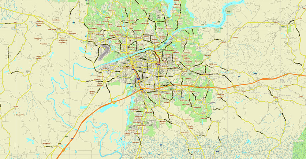
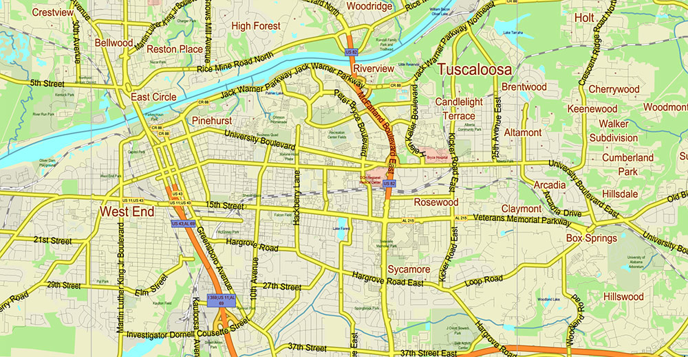
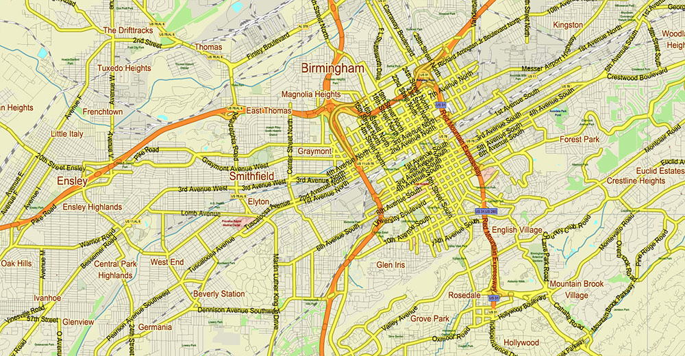
Printable Shaded Relief Vector Map of Tornado Area: Tuscaloosa – Birmingham Alabama Area US High Detailed Road Map fully editable Adobe Illustrator Road and Counties Map in layers, scalable, text/curves format all names, 1115 MB ZIP
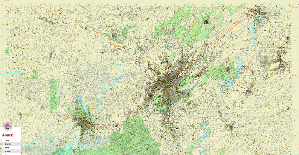
All streets and roads, All Cities and Towns, Airports and Heliports, Main Objects, Counties, raster Shaded Relief HD. Map for design, printing, arts, projects, presentations, for architects, designers, and builders, business, logistics.
The most exact and detailed map of the state in scale.
For Editing and High-Quality Printing, Royalty free
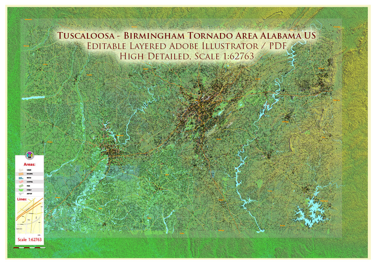
Tuscaloosa – Birmingham Alabama Area Vector Map US high detailed road map + Shaded Relief editable Adobe Illustrator
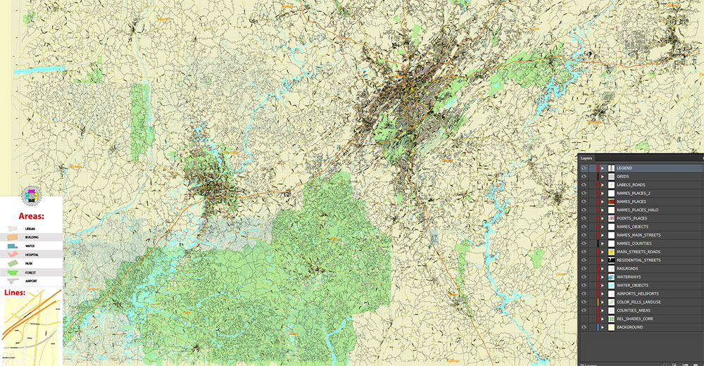
Layers list:
- Legend – Scale in miles
- Grids
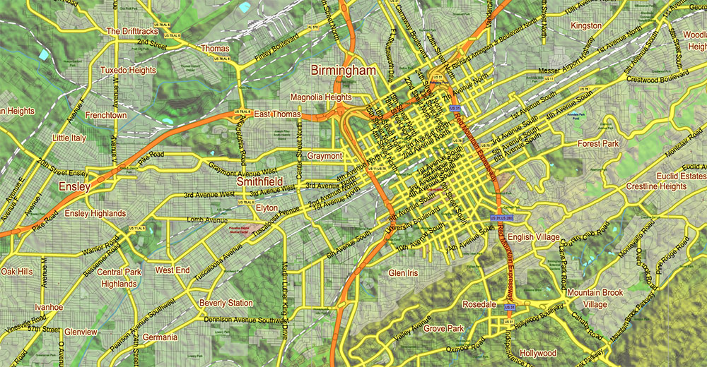
- Names of places (city, hamlet, etc.)
- Names of Places 2
- Points of the Cities and Towns
- Names of objects
- Names of Counties
- Principal Streets and Roads
- Residential streets and roads
- Railroads
- Airports and Heliports runways
- Water objects (rivers, lakes, ponds)
- Waterways
- Land Use Areas transparent 50%
- Counties areas transparent 20%
- Shader Relief Raster transparent 70%
- Background
AO BRIEF — TUSCALOOSA–BIRMINGHAM CORRIDOR (ALABAMA)
(Cartographic / National Geographic style)
OVERVIEW
-
Central Alabama corridor, ~95 km (60 mi), SW–NE orientation
-
Connects Tuscaloosa (university city, Black Warrior basin) with Birmingham (largest metro, Appalachian foothills)
-
Transitional landscape between Gulf Coastal Plain and Appalachian Ridge-and-Valley system
PHYSIOGRAPHY & RELIEF
-
Tuscaloosa sector:
-
Located near the Fall Line
-
Low-relief terrain, sandy/clayey soils
-
Broad river floodplains and gentle rolling hills
-
Central corridor:
-
Birmingham sector:
-
Classic ridge-and-valley morphology
-
Parallel ridges (Red Mountain, Shades Mountain)
-
Narrow valleys forming natural urban corridors
-
Hydrology:
-
Black Warrior River (Tuscaloosa) — dominant drainage axis
-
Cahaba River (Birmingham region) — ecologically significant
-
Numerous tributaries create fragmented micro-terrain
TRANSPORT & SPATIAL STRUCTURE
-
Primary axis:
-
Secondary corridors:
-
I-65 (Birmingham) — major north–south axis
-
US-11 — historic parallel route
-
US-82 — key Tuscaloosa east–west link
-
Rail:
-
Spatial pattern:
CLIMATE
-
Type: Humid subtropical
-
Summer: Hot, humid, frequent convective storms
-
Winter: Mild, occasional cold snaps
-
Precipitation: High, evenly distributed (~1300–1500 mm annually)
SEVERE WEATHER (KEY CARTOGRAPHIC LAYER)
DEMOGRAPHY / SETTLEMENT PATTERN
-
Birmingham metro:
-
Tuscaloosa:
-
Rural zones:
LAND COVER
-
Predominantly mixed deciduous forest
-
Urban-industrial footprint concentrated in Birmingham valley
-
Agricultural patches in lowland areas near Tuscaloosa
-
River floodplains with wetlands and soft soils
KEY RISKS FOR MAPPING / INTERPRETATION
CARTOGRAPHIC TAKEAWAYS
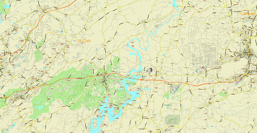
Tuscaloosa – Birmingham Alabama Area Vector Map US high detailed road map + Shaded Relief editable Adobe Illustrator
Tuscaloosa – Birmingham Alabama Area Vector Map US high detailed road map + Shaded Relief editable Adobe Illustrator
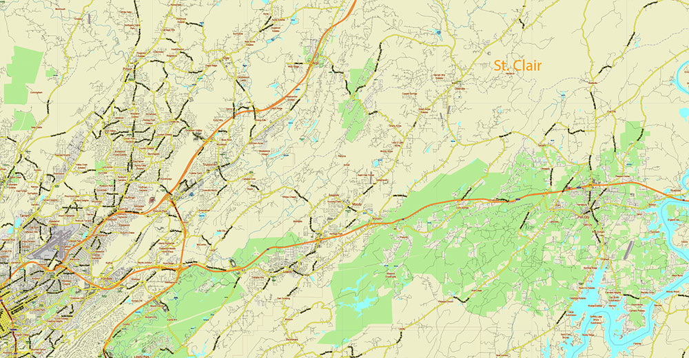
Tuscaloosa – Birmingham Alabama Area Vector Map US high detailed road map + Shaded Relief editable Adobe Illustrator
Tuscaloosa – Birmingham Alabama Area Vector Map US high detailed road map + Shaded Relief editable Adobe Illustrator
Tuscaloosa – Birmingham Alabama Area Vector Map US high detailed road map + Shaded Relief editable Adobe Illustrator
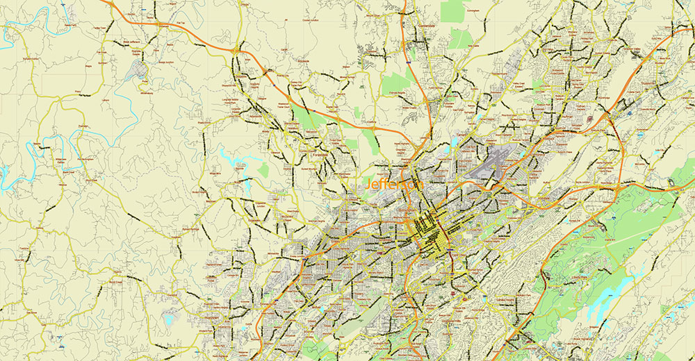
Tuscaloosa – Birmingham Alabama Area Vector Map US high detailed road map + Shaded Relief editable Adobe Illustrator
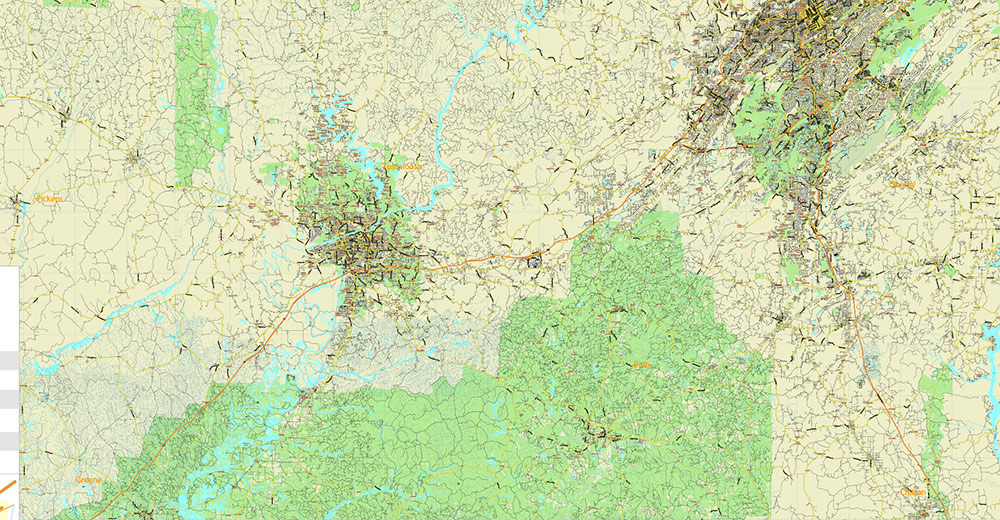
Tuscaloosa – Birmingham Alabama Area Vector Map US high detailed road map + Shaded Relief editable Adobe Illustrator
Tuscaloosa – Birmingham Alabama Area Vector Map US high detailed road map + Shaded Relief editable Adobe Illustrator
Tuscaloosa – Birmingham Alabama Area Vector Map US high detailed road map + Shaded Relief editable Adobe Illustrator
Tuscaloosa – Birmingham Alabama Area Vector Map US high detailed road map + Shaded Relief editable Adobe Illustrator

 Author: Kirill Shrayber, Ph.D. FRGS


