Extended Description of the Vector Map
Printable PDF Vector Map of Tornado Area: Tuscaloosa – Birmingham Alabama Area US High Detailed Road Map fully editable layered Adobe PDF Road and Counties Map in layers, scalable, text/curves format all names, 113 MB ZIP
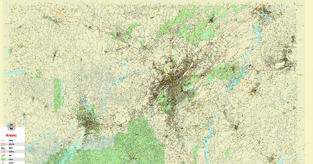
All streets and roads, All Cities and Towns, Airports and Heliports, Main Objects, Counties. Map for design, printing, arts, projects, presentations, for architects, designers, and builders, business, logistics.
The most exact and detailed map of the state in scale.
For Editing and High-Quality Printing, Royalty free
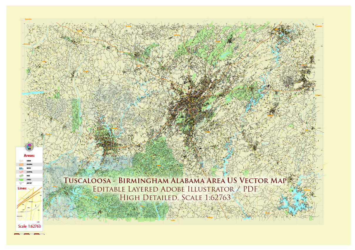
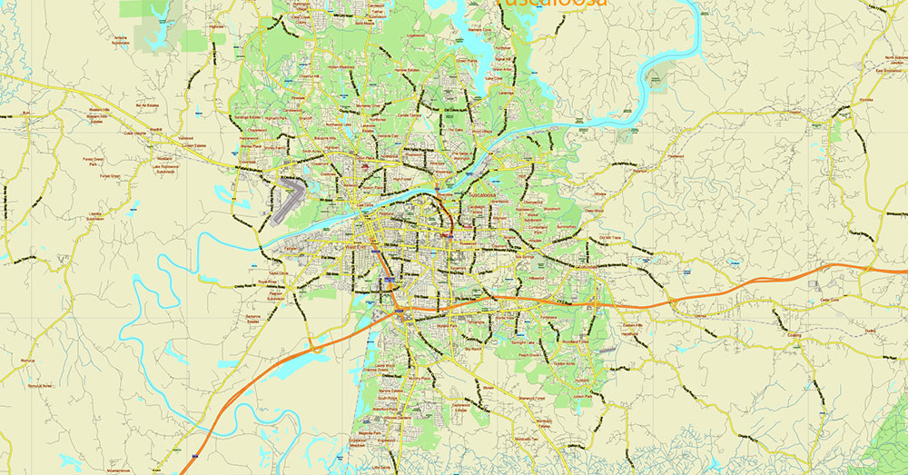
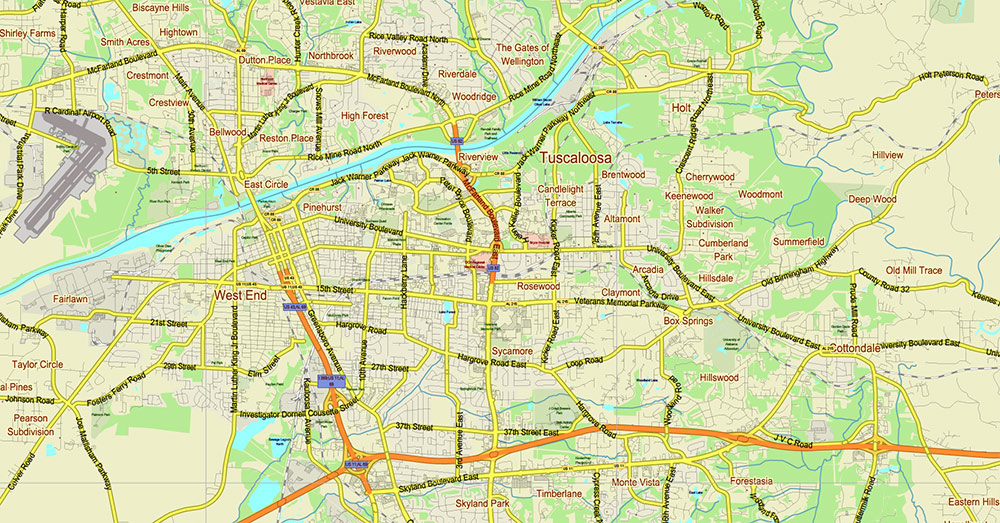
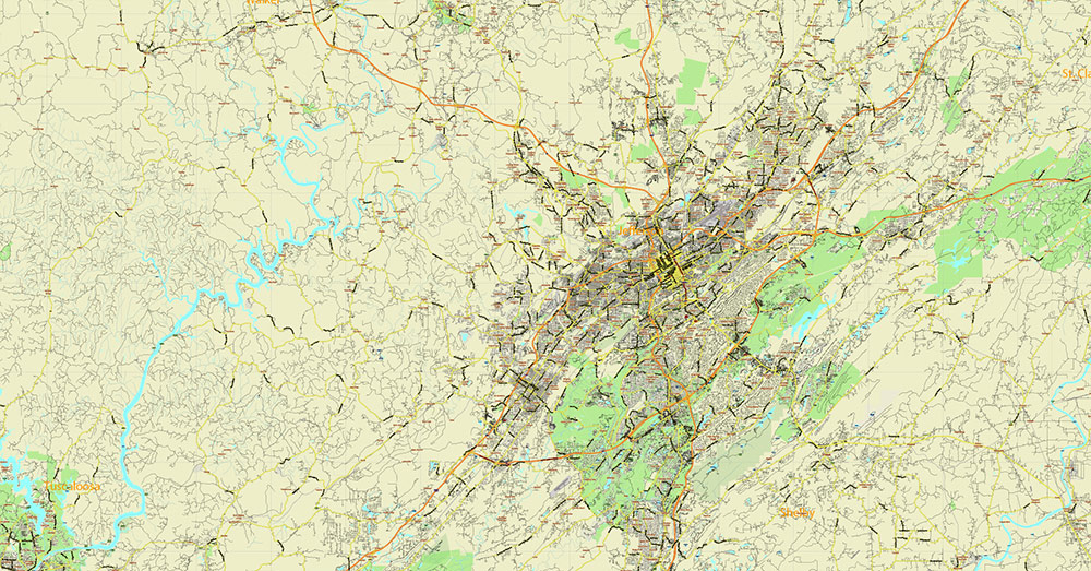
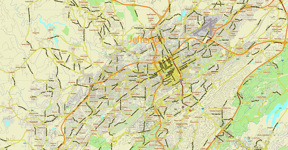
Tuscaloosa – Birmingham Alabama Area PDF Vector Map US high detailed road map editable layered Adobe PDF
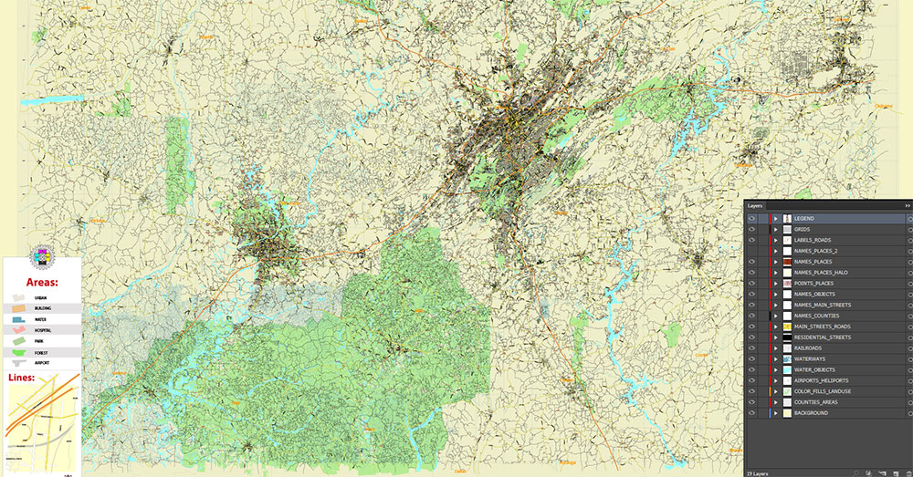
Layers list:
- Legend – Scale in miles
- Grids
- Names of places (city, hamlet, etc.)
- Names of Places 2
- Points of the Cities and Towns
- Names of objects
- Names of Counties
- Principal Streets and Roads
- Residential streets and roads
- Railroads
- Airports and Heliports runways
- Water objects (rivers, lakes, ponds)
- Waterways
- Land Use Areas transparent 50%
- Counties areas transparent 20%
- Background
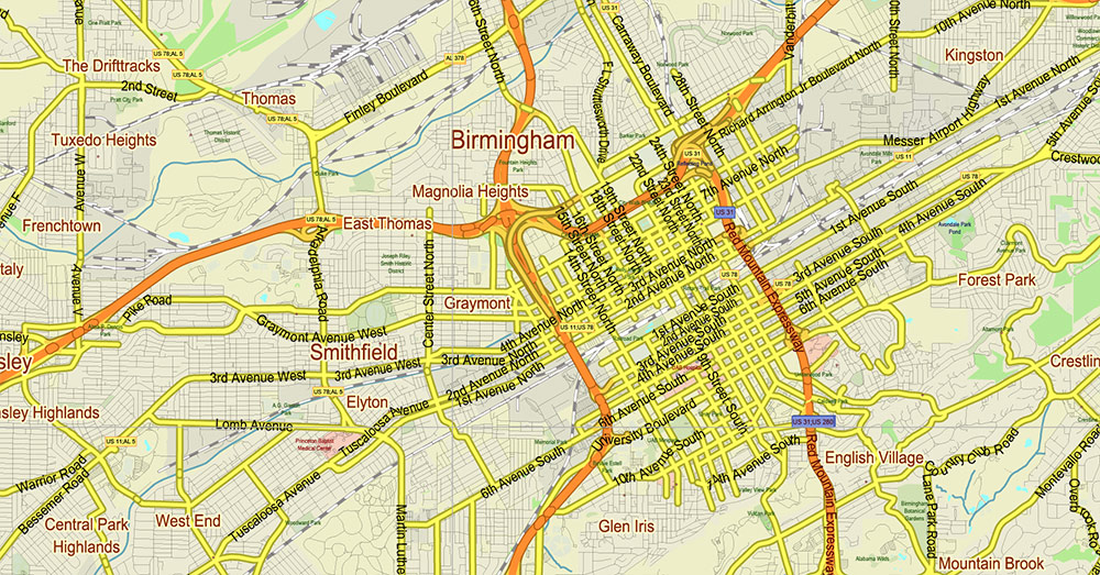
AO BRIEF — TUSCALOOSA–BIRMINGHAM CORRIDOR (ALABAMA, USA)
1. AO OVERVIEW
-
Area of operations (AO): Central Alabama corridor (~95 km / 60 mi), from Tuscaloosa to Birmingham
-
Operational axis: SW–NE alignment along I-20/59 corridor
-
Strategic role: Industrial + academic belt (University of Alabama → Birmingham metro core)
-
Terrain transition zone: Appalachian foothills ↔ Gulf Coastal Plain
2. TERRAIN & RELIEF (KEY GROUND FEATURES)
3. KEY ROADS / LINES OF COMMUNICATION (LOCs)
4. CLIMATE & SEASONALITY
5. SEVERE WEATHER / THREAT ENVIRONMENT
6. DEMOGRAPHY / HUMAN TERRAIN
7. TRANSPORT & LOGISTICS
-
Strengths:
-
Strong interstate connectivity (I-20/59, I-65)
-
Rail + road redundancy
-
River corridor (limited tactical use, more economic)
-
Constraints:
-
Terrain channelization (valleys/ridges)
-
Weather disruption (storms frequently impact roads)
-
Urban congestion in Birmingham
8. HAZARDS / THREATS SUMMARY
-
Primary threats:
-
Tornadoes (frequent, high-intensity)
-
Severe thunderstorms (winds, hail)
-
Flash flooding (localized but impactful)
-
Secondary:
-
Not significant:
9. COMMAND TAKEAWAYS (TACTICAL)
-
Control I-20/59 corridor = control AO movement
-
Expect terrain channelization → predictable maneuver corridors
-
Weather = dominant risk factor (especially spring/fall ops)
-
Urban Birmingham = complex multi-layer battlespace
-
Maintain rapid shelter capability (tornado-grade threat)
-
Plan for high humidity degradation of personnel/equipment
Tuscaloosa – Birmingham Alabama Area PDF Vector Map US high detailed road map editable layered Adobe PDF
Tuscaloosa – Birmingham Alabama Area PDF Vector Map US high detailed road map editable layered Adobe PDF
Tuscaloosa – Birmingham Alabama Area PDF Vector Map US high detailed road map editable layered Adobe PDF
Tuscaloosa – Birmingham Alabama Area PDF Vector Map US high detailed road map editable layered Adobe PDF
Tuscaloosa – Birmingham Alabama Area PDF Vector Map US high detailed road map editable layered Adobe PDF
Tuscaloosa – Birmingham Alabama Area PDF Vector Map US high detailed road map editable layered Adobe PDF
Tuscaloosa – Birmingham Alabama Area PDF Vector Map US high detailed road map editable layered Adobe PDF

 Author: Kirill Shrayber, Ph.D. FRGS


