Extended Description of the Vector Map
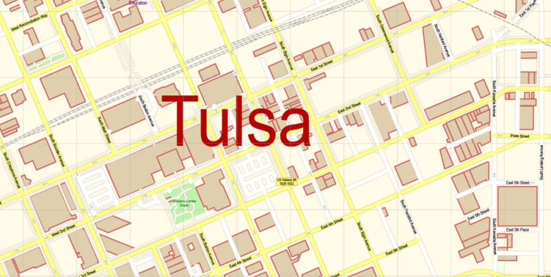
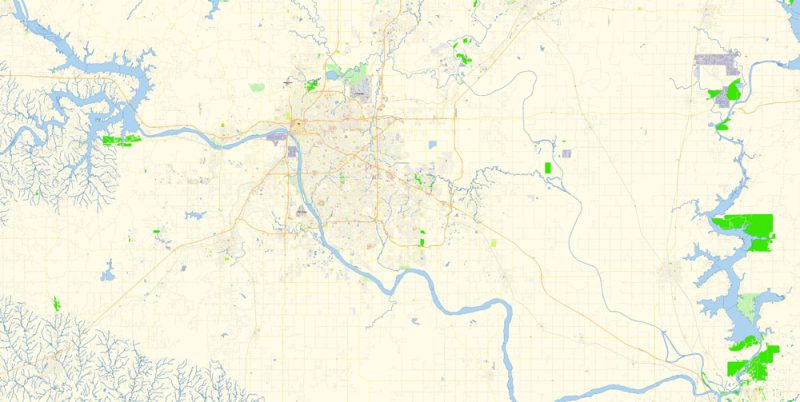
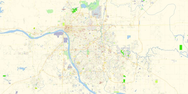
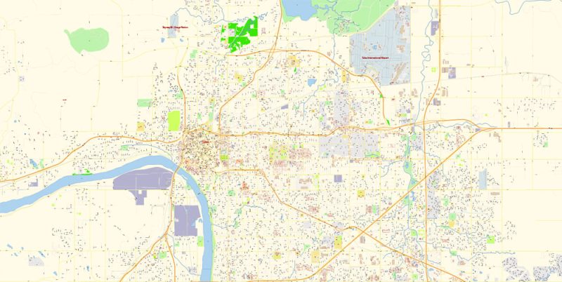
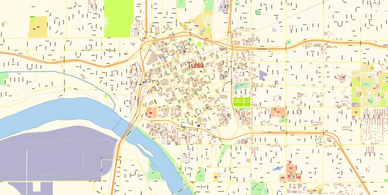
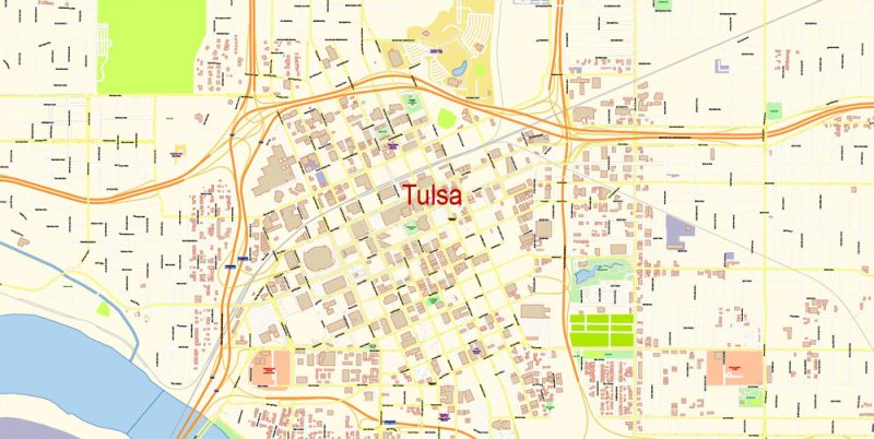
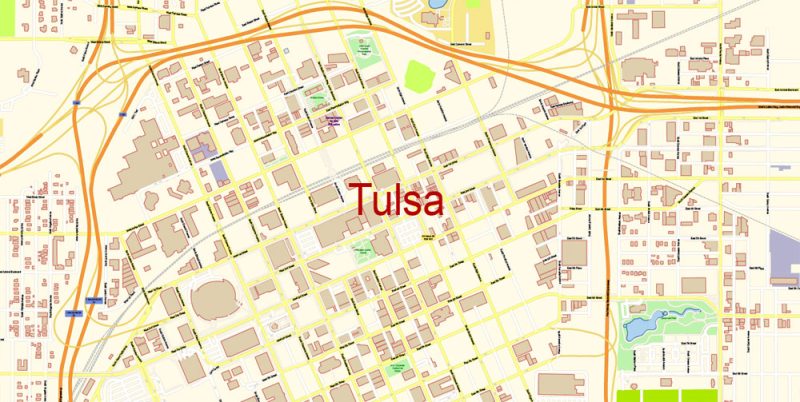
Printable PDF Vector Map of Tulsa Oklahoma detailed City Plan scale 100 m 1:3792 full editable Adobe PDF Street Map in layers, scalable, text format all names, 169 MB ZIP
All street names, Main Objects, Principal Buildings. Map for design, printing, arts, projects, presentations, for architects, designers, and builders, business, logistics.
Layers: color_fills, water, streets_roads, labels_roads, names_objects, names_streets, names_places, arrows_streets, buildings, grids, legend, etc.
The most exact and detailed map of the city in scale.
For Editing and High-Quality Printing
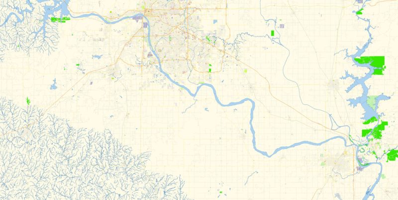
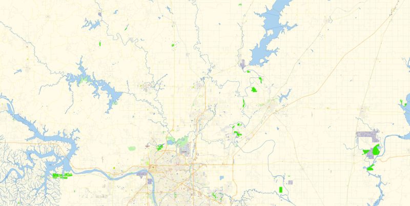
Map covered area:
Tulsa
City in Oklahoma
Tulsa is a city on the Arkansas River, in the U.S. state of Oklahoma. It’s known for its art deco architecture, mostly in the central Deco District. Landmarks like the Philcade and Philtower buildings reflect a 20th-century construction boom fueled by the prosperous local oil industry. The Philbrook Museum of Art is housed in an Italianate villa that was once the home of a local oil magnate.
Elevation: 220 m
Population: 401,800
Metro population: 991,561 (US: 50th)
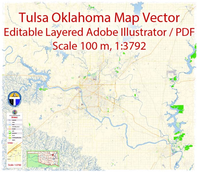
Tulsa Oklahoma Map Vector Exact City Plan detailed Street Map editable Adobe Illustrator in layers
Tulsa Oklahoma Map Vector Exact City Plan detailed Street Map editable Adobe Illustrator in layers
Tulsa Oklahoma Map Vector Exact City Plan detailed Street Map editable Adobe Illustrator in layers
Tulsa Oklahoma Map Vector Exact City Plan detailed Street Map editable Adobe Illustrator in layers
Tulsa Oklahoma Map Vector Exact City Plan detailed Street Map editable Adobe Illustrator in layers
Tulsa Oklahoma Map Vector Exact City Plan detailed Street Map editable Adobe Illustrator in layers
Tulsa Oklahoma Map Vector Exact City Plan detailed Street Map editable Adobe Illustrator in layers
Tulsa Oklahoma Map Vector Exact City Plan detailed Street Map editable Adobe Illustrator in layers
Tulsa Oklahoma Map Vector Exact City Plan detailed Street Map editable Adobe Illustrator in layers
Tulsa Oklahoma Map Vector Exact City Plan detailed Street Map editable Adobe Illustrator in layers


 Author: Kirill Shrayber, Ph.D. FRGS

