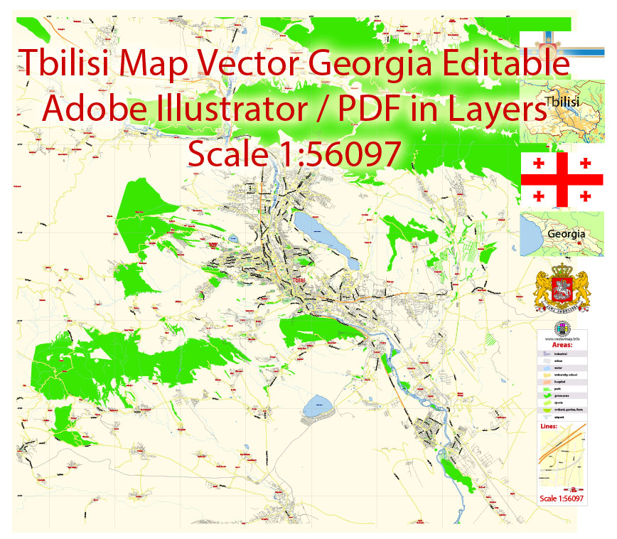
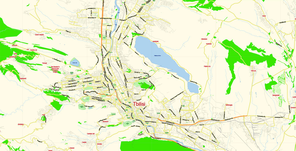
Printable Vector Map of Tbilisi Georgia EN Low detailed City Plan scale 1:56097 editable Adobe Illustrator Street Map in layers for Small size Printing, scalable, editable text format all names, 4 mb ZIP
English Principal streets names, Main Objects. Map for design, printing, arts, projects, presentations, for architects, designers and builders, business, logistics.
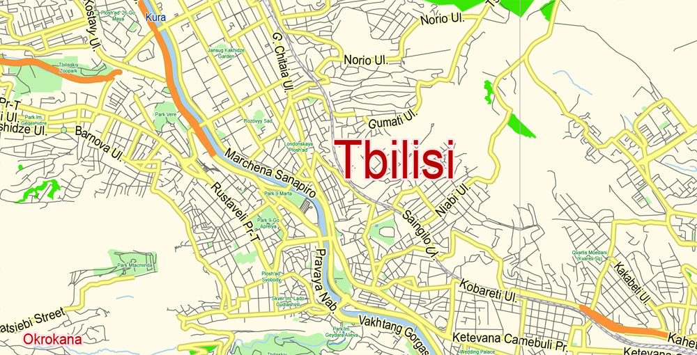
Layers: color_fills, streets_roads, names_objects, names_streets, names_places, grids, legend, etc.
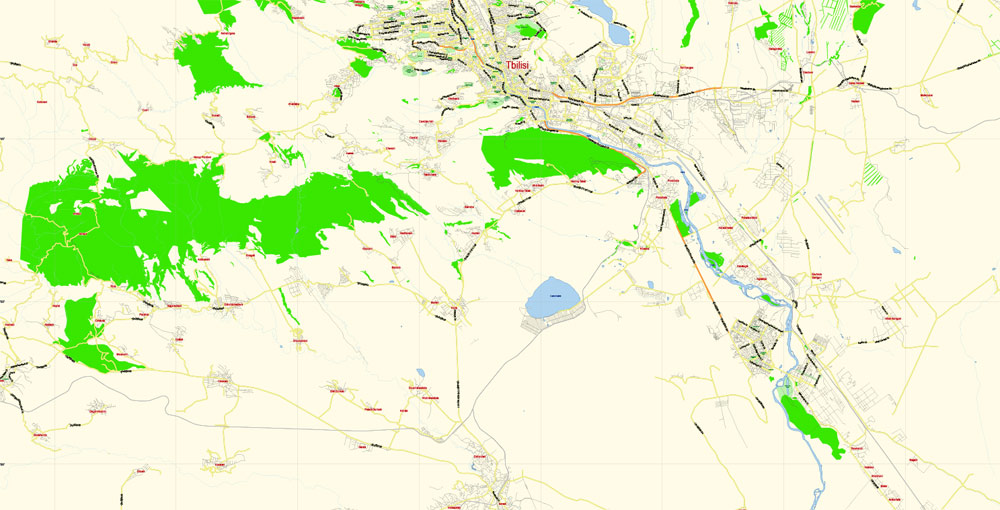
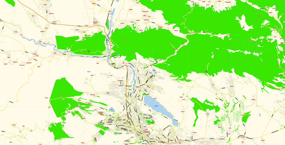
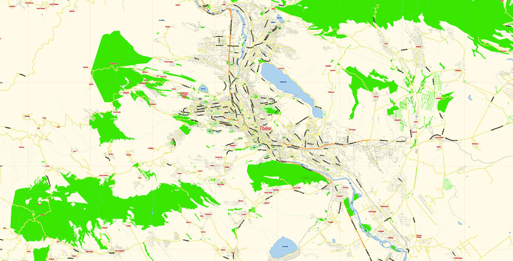
The most exact and detailed map of the city in scale.
For Editing and High Quality Printing
DWG, DXF and other formats – on request, same price, please, contact
Capital of Georgia
Tbilisi is the capital of the country of Georgia. Its cobblestoned old town reflects a long, complicated history, with periods under Persian and Russian rule. Its diverse architecture encompasses Eastern Orthodox churches, ornate art nouveau buildings and Soviet Modernist structures. Looming over it all are Narikala, a reconstructed 4th-century fortress, and Kartlis Deda, an iconic statue of the “Mother of Georgia.”
This vector map of Tbilisi city is used as a basis for design, editing, and further printing.
This is the most detailed, exact map of Tbilisi city for high-quality printing and polygraphy. You can always clarify the map development date by contacting us.
For your convenience, all objects on Tbilisi vector city map are divided into layers, and the editing is very easy – colors, lines, etc.
Founded in the 5th century AD by Vakhtang I of Iberia, since then Tbilisi served as the capital of various Georgian kingdoms and republics.
You can easily add any objects needed (e.g. shops, salons, sale points, gas station or attraction) on any layer of Tbilisi vector map.
One of the advantages of Tbilisi city vector maps of our production is the relevance of cartographic data, we constantly update all our products.
This vector map of Tbilisi city is used by:
designers, layout designers, printers, advertisers and architects. Our product – vector maps – is designed for further editing and printing in large formats – from @Wall format (a few meters) to A-0 and A-1, A-2, A-3.
Use these commands if you need to edit the colors in the selected vector map of Tbilisi city.
«Repaint Graphic object» button on the «Control» panel.
Use this button if you need to adjust colors of Tbilisi city vector map using the а «Repaint graphic object» dialog box.
The specified button is available if the selected vector map or its fragment contains two or more colors.
Note. This color editing method is convenient for global color adjustment in a vector map, if global colors were not used when creating a City Map of Tbilisi.
The «Edit colors» button or «Edit or apply colors» on the «Color Catalog» palette
Click this button if you need to edit colors on the «Color Catalog» palette or edit and then apply them to the selected Vector Map of Tbilisi city or its fragment.
The «Edit color group» button or «Edit or apply color group» on the «Samples» palette.
Click this button if you need to edit the colors in the specific color group or edit and apply them to the selected Vector Map of Tbilisi city or a group of its elements, for example, the whole layer “Streets and lines”. You can also double-click the color group in the Samples panel to open the dialog box.
Between 1801 and 1917, then part of the Russian Empire, Tbilisi was the seat of the Imperial Viceroy, governing both Southern and Northern Caucasus.
Because of its location on the crossroads between Europe and Asia, and its proximity to the lucrative Silk Road, throughout history Tbilisi was a point of contention among various global powers.
The Tbilisi city map in vector format is used for design, urban planning, presentations and media visualizations.
The advertising and presentation map of Tbilisi city (usually the final designer marks the routes, and puts the client’s objects (shops, saloons, gas stations etc.)
The undoubted advantage is that people will NEVER throw out this advertising product – the map. In fact, as an advertising medium, a city map is the most “long-playing” of the well-known polygraphic advertising media, with the longest lifespan, and the maximum number of interactions with the customer.
For travelers, maps are sold at the airports and gas stations around the world. Often the source is our vector maps.
The city’s location to this day ensures its position as an important transit route for various energy and trade projects. Tbilisi’s diverse history is reflected in its architecture, which is a mix of medieval, neoclassical, Beaux Arts, Art Nouveau, Stalinist and the Modern structures.
Historically, Tbilisi has been home to people of multiple cultural, ethnic, and religious backgrounds, though it is currently overwhelmingly Eastern Orthodox Christian. Its notable tourist destinations include cathedrals Sameba and Sioni, Freedom Square, Rustaveli Avenue and Agmashenebeli Avenue, medieval Narikala Fortress, the pseudo-Moorish Opera Theater, and the Georgian National Museum.
Geography
Tbilisi is located in the South Caucasus at 41° 43′ North Latitude and 44° 47′ East Longitude. The city lies in Eastern Georgia on both banks of the Mt’k’vari River.
Take a look, who purchases our vector maps of Tbilisi city in “Our Clients and Friends” page – these are large and small companies, from super-brands like Volvo and Starbucks, to small design studios and printing houses.
It’s very easy to work with vector maps of Tbilisi city, even for a not very experienced designer who can turn on and off the map layers, add new objects, change the colors of fill and lines according to customer requirements.
The elevation of the city ranges from 380–770 metres above sea level (1,250–2,530 ft) and has the shape of an amphitheatre surrounded by mountains on three sides.
The undoubted advantage of Tbilisi city vector maps in printing is an excellent and detailed visualization, when customer can expand a large paper map and instantly define his location, find a landmark, an object or address on map, unlike using the popular electronic formats of Google and Yandex maps for example.
Printable vector maps of Tbilisi city is much more convenient and efficient than any electronic maps on your smartphone, because ALL DETAILS are displayed in the entire space of Tbilisi city map.
To the north, Tbilisi is bounded by the Saguramo Range, to the east and south-east by the Iori Plain, to the south and west by various endings (sub-ranges) of the Trialeti Range.
The relief of Tbilisi is complex. The part of the city which lies on the left bank of the Mt’k’vari River extends for more than 30 km (19 mi) from the Avchala District to River Lochini. The part of the city which lies on the right side of the Mt’k’vari River, on the other hand, is built along the foothills of the Trialeti Range, the slopes of which in many cases descend all the way to the edges of the river Mt’k’vari.
Useful tips on working with vector maps of cities and countries in Adobe Illustrator.
«V» – launches the Selection tool (cursor, black arrow), which makes active any vector line.
«А» – launches the Direct Selection tool (white cursor), allows you to select curve elements and drag them to the desired place.
«R» – activates the Rotate tool, which helps you rotating selected objects around the center point by 360 degrees.
«E» – gives you the opportunity to use the Eraser tool and erase unnecessary parts.
«X» – switches between Fill and Stroke in the Tools section. Try to get used to this hot key and
you will quickly understand that you can’t live and work without it.
The mountains, therefore, are a significant barrier to urban development on the right bank of the Mt’k’vari River.
Guides are not limited to vertical and horizontal in Adobe Illustrator. You can also create a diagonal guide for example. Moreover, you can turn any contours into guides. Select the outline and go to View > Guides > Make Guides (Create Guides), or simply press Cmd/Ctrl + 5. You can also turn the guides back into an editable object. Go to menu, View > Guides > Unlock Guides (Release Guides), select the guide you want to edit and select View > Guides > Release Guides (Reset Guides), or just press Cmd/Ctrl + Option / Alt + 5).
You will probably want to change the color scheme used on our Tbilisi vector city map.
To quickly and effectively play with colors.
Of course, you can do it manually, all objects in our Tbilisi city vector map are divided according to types and layers, and you can easily change the color gamma of vector objects in groups and layers.
This type of a geographic environment creates pockets of very densely developed areas while other parts of the city are left undeveloped due to the complex topographic relief.
But there is more effective way of working with the whole VECTOR MAP of Tbilisi city and all layers:
The overview dialog «Edit colors»/«Repaint Graphic Object» (this dialog box name can change depending on the context):
If you have selected a part or a layer of Tbilisi city vector map and open the dialog box by clicking the icon in the Control panel, on the Samples palette or the Color Catalog, or if you choose Edit > Edit Colors> Repaint Graphic Object, then the «Repaint Graphic Object» dialog box appears, and you get access to «Assign» and «Edit» tabs.
If a picture or a map fragment is not selected, and you open the dialog box by clicking the icon in the Control panel, on the Samples palette or in the Color Catalog, the «Edit Colors» dialog box appears and you can only access the «Edit» tab.
Regardless of the name at the top of the dialog box, the right-hand side always displays the color group of the current document, as well as two default color groups: Print Color and Grayscale. These color groups can be selected and used any time.
Create and edit color groups of Tbilisi city vector map, and also assign colors using the «Edit Colors»/ а «Repaint Graphic Object» dialog box.
A. Creating and editing of a color group on the «Edit» tab
B. Assigning colors on the «Assign» tab
C. Select a group of colors from the «Color groups» list
The option «Repaint a graphic object» in the lower part of the dialog box allows you to preview the colors on a selected layer of Vector map, or a group of elements, and specify whether its colors will be redefined when the dialog box is closed.
To the north of the city, there is a large reservoir (commonly known as the Tbilisi Sea) fed by irrigation canals.
The main areas of the dialog box are:
«Edit»
The «Edit» tab is designed to create a new or edit the existing color groups.
The harmony rules Menu and the Color Wheel are used to conduct experiments with color harmonies. The color wheel shows how colors are related in color harmony, and the color bars allow you to view and manipulate an individual color values. In addition, you can adjust the brightness, add and remove colors, save color groups and view colors on the selected Vector Map of Tbilisi city or a separated layers.
Assign
The «Assign» tab is used to view and control on how the original colors are replaced with colors from the color group like your corporate colors in the Vector Map of Tbilisi city.
The assign color ability is provided only if the entire map, layer or fragment is selected in the document. You can specify which of new colors replace the current colors, whether the spot colors should be preserved and how colors are replaced (for example, you can replace colors completely or changing the color tone while maintaining the brightness). The «Assign» tab allows you to redefine colors in the Vector Map of Tbilisi city, or in separate layers and fragments using the current color group or reducing the number of colors in the current Vector Map.
Color groups
Is a list of all saved color groups for current document (the same groups appear in the «Samples» palette). You can edit and delete the existing color groups, as well as creating a new ones using the list of “Color Groups” in the dialog box. All changes appear in the «Samples» palette.
The highlighted color group shows, which color group is currently edited. Any color group can be selected and edited, or used to redefine the colors in the selected vector map of Tbilisi city, its fragments or elements.
Saving a color group adds this group to the specified list.
Opening the «Edit Colors»/«Repaint Graphic Object» dialog box.
Open the «Edit Colors»/«Repaint Graphic Object» dialog box using one of the following methods:
«Edit»> «Edit Colors»> «Repaint Graphic object» or «Repaint With Style».
If the map file is too large and your computer freezes or even can’t open it quickly:
1. Try to reduce the color resolution of the video card (display) to 256 colors while working with a large map.
2. Using Windows Task Manager, select all the application you don’t need, while working with map, just turn them off.
3. Launch Adobe Illustrator. (DO NOT OPEN the vector map file)
4. Start the Windows Task Manager using administrator rights > Find the “Illustrator” process > set the «real time» priority,
5. Open the file. When you see the LEGACY FONT popup window – click “OK” (do not update). You can restore the TEXT later.
6. Can also be useful: When file is opened – Edit > Settings > Basic Settings > disable smoothing. /// It looks scary, but works quickly)))
We recommend saving the file in Adobe Illustrator 10 version. It’s much more stable when working with VERY BIG size files.
Tbilisi is the capital and the largest city of Georgia, lying on the banks of the Kura River with a population of approximately 1.5 million people. Founded in the 5th century AD by Vakhtang I of Iberia, since then Tbilisi served as the capital of various Georgian kingdoms and republics. Between 1801 and 1917, then part of the Russian Empire, Tbilisi was the seat of the Imperial Viceroy, governing both Southern and Northern Caucasus.
Because of its location on the crossroads between Europe and Asia, and its proximity to the lucrative Silk Road, throughout history Tbilisi was a point of contention among various global powers. The city’s location to this day ensures its position as an important transit route for various energy and trade projects. Tbilisi’s diverse history is reflected in its architecture, which is a mix of medieval, neoclassical, Beaux Arts, Art Nouveau, Stalinist and the Modern structures.
Historically, Tbilisi has been home to people of multiple cultural, ethnic, and religious backgrounds, though it is currently overwhelmingly Eastern Orthodox Christian. Its notable tourist destinations include cathedrals Sameba and Sioni, Freedom Square, Rustaveli Avenue and Agmashenebeli Avenue, medieval Narikala Fortress, the pseudo-Moorish Opera Theater, and the Georgian National Museum.
Area
• Capital city 504.2 km2 (194.7 sq mi)
Highest elevation 770 m (2,530 ft)
Lowest elevation 380 m (1,250 ft)
Population
• Capital city 1,118,035
• Density 3,194.38/km2 (8,273.4/sq mi)
• Metro 1,485,293
Free vecto map Europe:

Free download printable map Europe vector Adobe Illustrator >>>
Free download printable PDF map Europe vector Adobe PDF >>>
Free vector map World, Adobe Illustrator, download now maps vector clipart
Map for design, projects, presentation free to use as you like.
See also: TERMS & CONDITIONS: SOFTWARE LICENSE AGREEMENT FOR DIGITAL CARTOGRAPHIC DATA.
Need more USA Vector Maps, printable and editable?

 Author: Kirill Shrayber, Ph.D. FRGS
