Extended Description of the Vector Map
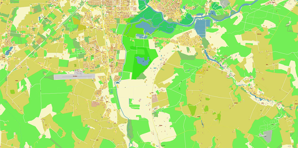
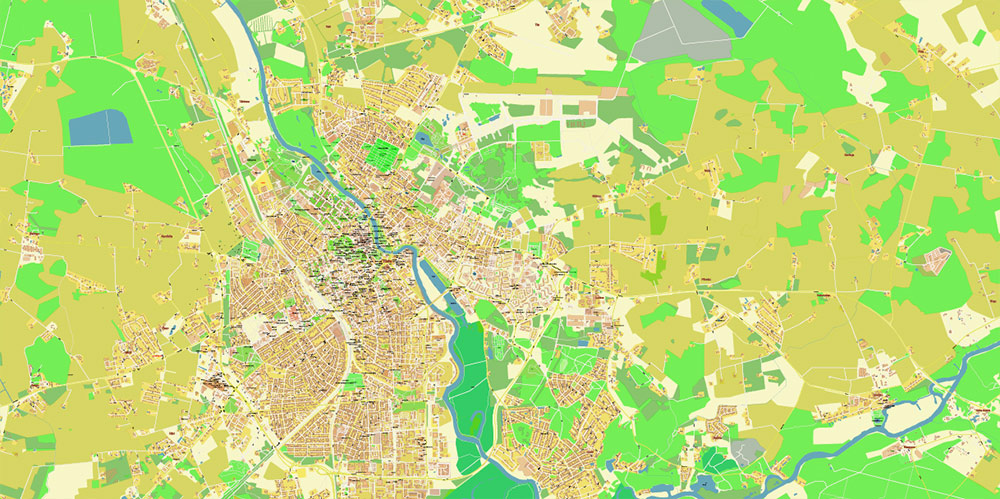
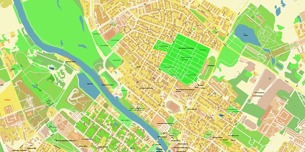
Printable PDF Vector Map of Tartu Estonia + surrounds High detailed street map scale 1:2465 fully editable Layered Adobe PDF scalable, text format all names, 29 MB ZIP
All street names, Main Objects, Buildings. Map for design, printing, arts, projects, presentations, for architects, designers, and builders, business, logistics.
Note: All layers in the preview are enabled and displayed, you may not need all layers – just disable the layers you don’t need.
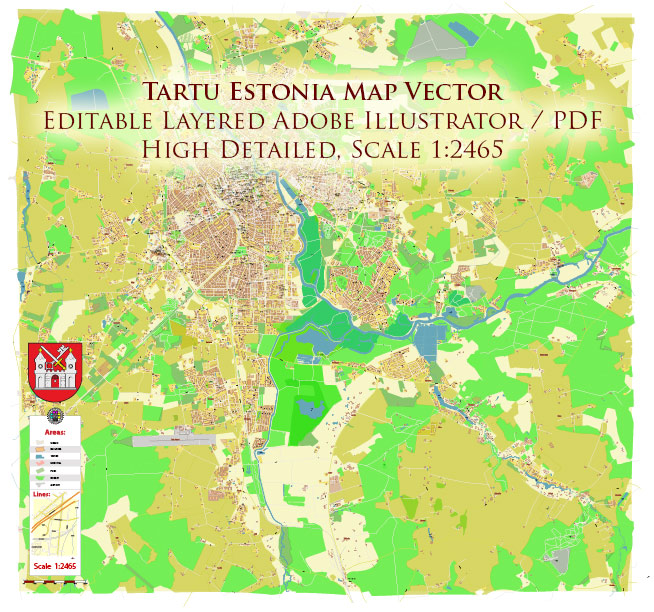
Tartu Estonia PDF Vector Map high detailed All Roads Streets map editable Layered Adobe PDF
Layers list:
- Legend
- Labels of roads
- Names of places (city, hamlet, etc.)
- Names of places – 2
- Names of objects (parks, hospitals, water)
- Names of main streets
- Names of civil streets
- Arrows of streets
- Main Streets, roads
- Residential streets
Railroads
- Buildings
- Buildings 2 layer – 50% transparent
- Water objects (rivers, lakes, ponds)
- Waterways
- Airports and heliports
- Color fills (parks, land use, etc.)
- Land use 2 layer – 50% transparent
- Background
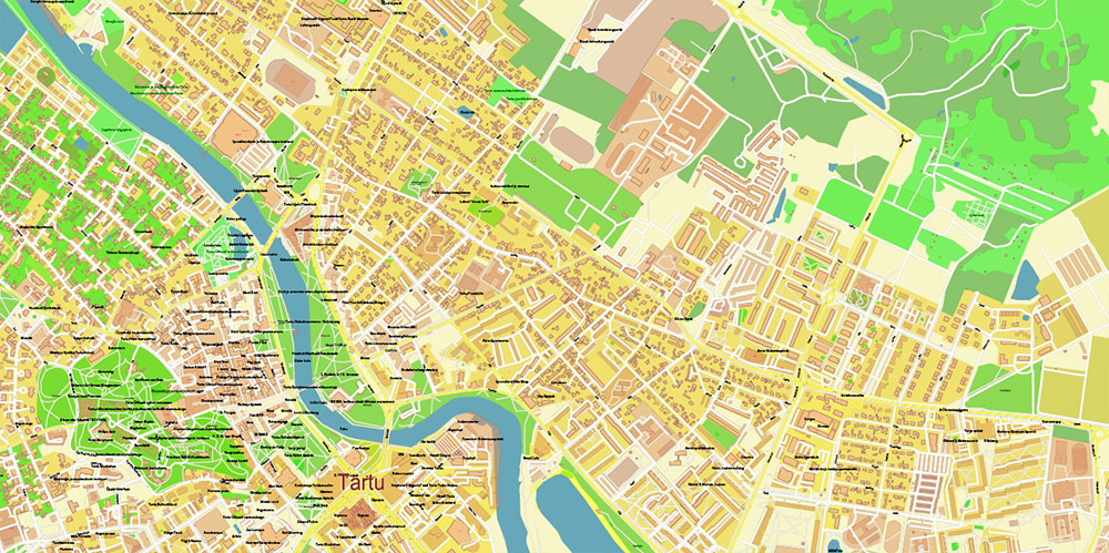
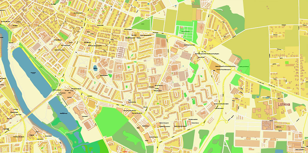
The most exact and detailed map of the city in scale.
For Editing and High-Quality Printing
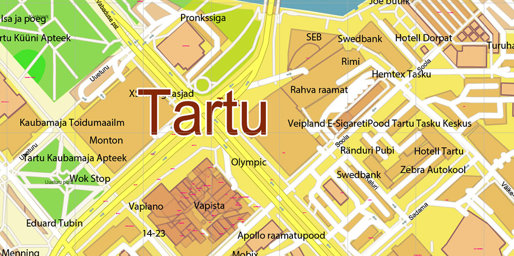
Tartu Estonia PDF Vector Map high detailed All Roads Streets map editable Layered Adobe PDF
Tartu Estonia PDF Vector Map high detailed All Roads Streets map editable Layered Adobe PDF
AO BRIEF: TARTU, ESTONIA
1. Overview
Tartu — secondary urban center of Estonia, located ~185 km SE of Tallinn. Acts as intellectual capital and command node for education, culture, and tech. Situated along the Emajõgi River, connecting Lake Võrtsjärv and Lake Peipus. Elevation generally 35–70 m ASL, surrounded by forested lowlands and agricultural terrain.
2. Lines of Communication / Key Roads
-
E263 (Tallinn–Tartu–Võru–Luhamaa) — main N–S axis; dual-lane highway linking Tartu to Tallinn (north) and the southeastern border near Russia (south).
-
T2 / A1 arterial belt — internal ring providing access to industrial zones and river crossings.
-
E264 (Tartu–Viljandi–Pärnu) — WSW route connecting to western Estonia and Baltic coast.
-
Secondary roads radiate toward Elva, Jõgeva, and Mustvee, supporting lateral mobility.
-
River bridges: Kaarsild (pedestrian) and Vabadussild / Freedom Bridge (vehicle) are primary crossing points within city AO.
3. Geography / Terrain
Urban grid straddles both sides of Emajõgi River, terrain relatively flat with minor undulations near Toome Hill (Toomemägi).
To west and south: mixed forest and farmland — suitable for dispersed logistics staging.
To east: residential sprawl and rail yards.
Climate: temperate continental — cold winters (−10 °C typical lows), warm summers (~+23 °C).
Visibility and mobility affected by fog and ice from late October to March.
4. Demography / Human Terrain
Population ~100 000. Predominantly ethnic Estonian (≈80%), Russian minority ≈15%.
High concentration of students and academics — University of Tartu dominates cultural and economic landscape.
Civic attitude: pro-EU, high digital literacy, English widely understood.
Relatively low crime; population density heaviest near Kesklinn (city center) and Annelinn districts.
5. Transportation / Mobility
-
Tartu Airport (EETU / Ülenurme) — 10 km S; limited commercial flights, usable for small transports and UAV ops.
-
Rail — Tallinn–Tartu line (hourly service), terminus near city center.
-
Bus Terminal (Bussijaam) — major regional node, links to Riga, Tallinn, and Võru.
-
Local movement: electric buses and bike lanes; urban speed limits 40–50 km/h.
-
River navigable for small craft; limited operational use.
6. Points of Interest / Key Compounds
-
Toomemägi Hill — historical core; cathedral ruins and university buildings, observation point.
-
Town Hall Square (Raekoja plats) — symbolic civic center.
-
AHHAA Science Centre, Estonian National Museum, Botanical Garden — civilian soft-targets / cultural infrastructure.
-
Emajõgi waterfront — recreation corridor, also potential gathering axis for population.
-
Industrial zone (Ropka area) — warehouses, light manufacturing, potential logistics hub.
7. Command Takeaways
-
AO Type: river-based academic city, flat terrain, high civilian density.
-
Mobility: unrestricted; excellent road network, stable comms grid.
-
Key Terrain: Toome Hill (elevation & line-of-sight advantage), bridges across Emajõgi.
-
Human Factor: cooperative, high situational awareness; minimal threat environment.
-
Best access vector: from NW via E263; fallback egress via southern ring and E264 corridor.
Summary:
Tartu functions as a secure, knowledge-driven urban zone with clear transport axes, strong digital infrastructure, and minimal physical obstacles. Ideal for coordination, logistics, and civilian interface operations.
Tartu Estonia PDF Vector Map high detailed All Roads Streets map editable Layered Adobe PDF
Tartu Estonia PDF Vector Map high detailed All Roads Streets map editable Layered Adobe PDF
Tartu Estonia PDF Vector Map high detailed All Roads Streets map editable Layered Adobe PDF
Tartu Estonia PDF Vector Map high detailed All Roads Streets map editable Layered Adobe PDF


 Author: Kirill Shrayber, Ph.D. FRGS