Extended Description of the Vector Map
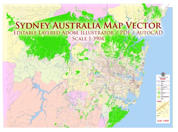
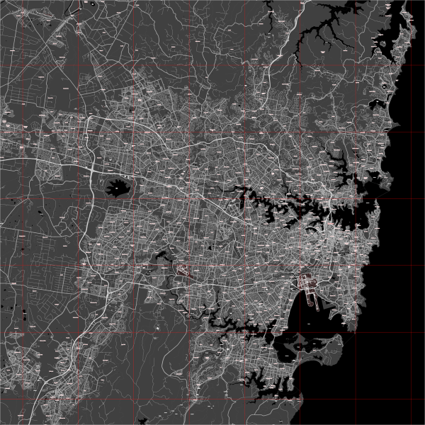
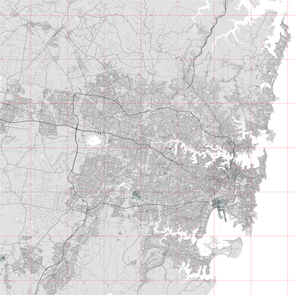
Printable Vector Map of Sydney Metro Area Australia (geodata 2025) high detailed scale 1:3902 full editable Adobe Illustrator Street Map in layers, scalable, text format all names, 86 MB ZIP
All street names, Main Objects, Buildings. Map for design, printing, arts, projects, presentations, for architects, designers, and builders, business, logistics.
Layers list:
- Legend
- Grids
- Labels of roads
- Names of places (city, hamlet, etc.)
- Names of objects (hospitals, parks, water)
- Names of main streets
- Names of secondary streets
- Names of principal buildings
- Arrows of streets
- Main Streets, roads,
- Railroads
- Secondary streets
- Railroads
- Buildings
- Buildings 2 transparent 50%
- Airports and heliports
- Water objects (rivers, lakes, ponds)
- Color fills (parks, hospital areas, land use, etc.)
- Back
The most exact and detailed map of the city in scale.
For Editing and High-Quality Printing

Sydney Metro Area Australia 2025 Vector Map Exact Extra High Detailed Street Map Adobe Illustrator in layers
Geographical Description of Sydney, Australia
1. Location and General Overview
Sydney, the capital of New South Wales (NSW), is the largest and most populous city in Australia. It is situated on the southeastern coast of the continent along the Tasman Sea. Sydney is globally recognized for its stunning natural harbor, coastal beauty, and iconic landmarks, such as the Sydney Opera House and Sydney Harbour Bridge.
2. Geographic Coordinates
- Latitude: 33.8688° S
- Longitude: 151.2093° E
This places Sydney within the temperate zone, giving it a climate with warm summers and mild winters.
3. Topography and Landforms
Sydney’s geography is characterized by:
- Sydney Basin: A large sedimentary basin with sandstone cliffs and plateaus.
- Hawkesbury Sandstone Escarpment: A prominent feature forming cliffs and ridges around the city.
- Coastal Plains: The city spreads across a mix of coastal lowlands and rolling hills.
- Harbors and Inlets: Sydney Harbour (Port Jackson) is one of the world’s largest natural harbors, deeply indented with bays and inlets.
- Beaches: More than 100 beaches, including Bondi Beach, Manly Beach, and Coogee Beach.
4. Waterways
Sydney is rich in water bodies, including:
- Sydney Harbour (Port Jackson): A deep natural harbor that extends inland.
- Parramatta River: The main river running westward through the city into Sydney Harbour.
- Georges River & Hawkesbury River: Major rivers forming the southern and northern boundaries.
- Botany Bay: A significant inlet south of Sydney Harbour, known for its historical importance (Captain Cook landed here in 1770).
5. Climate
Sydney experiences a humid subtropical climate (Cfa in the Köppen classification) with:
- Summer (Dec–Feb): Warm to hot (Average: 18–30°C / 64–86°F).
- Winter (Jun–Aug): Mild and cool (Average: 8–19°C / 46–66°F).
- Rainfall: Fairly distributed throughout the year, with heavier rains in late summer and early autumn.
- Extreme Weather: Bushfires in summer and storms in spring/autumn.
6. Urban Structure & Land Use
- Central Business District (CBD): The economic hub with skyscrapers, including Sydney Tower.
- Eastern Suburbs: Affluent areas with famous beaches.
- Western Sydney: Rapidly growing with a mix of residential and industrial zones.
- Northern Sydney: Green, affluent, and connected by the Harbour Bridge.
- Southern Sydney: Features residential and coastal landscapes.
7. Surrounding Natural Areas
Sydney is surrounded by several significant national parks and natural reserves:
- Blue Mountains National Park (West): Famous for the Three Sisters rock formation.
- Ku-ring-gai Chase National Park (North): Offers bushland and Aboriginal rock engravings.
- Royal National Park (South): The world’s second-oldest national park, known for coastal cliffs and rainforests.
8. Transportation & Infrastructure
- Roads: Major roads include the Pacific Highway, M1, M2, M4, M5, and M7 Motorways.
- Bridges & Tunnels: Sydney Harbour Bridge and Sydney Harbour Tunnel connect north and south.
- Public Transport: Extensive rail, bus, and ferry networks.
- Airports: Sydney Kingsford Smith Airport (SYD), Australia’s busiest airport.
Conclusion
Sydney’s geography is defined by its stunning harbor, coastal cliffs, beaches, and a mix of urban and natural landscapes. It is one of the world’s most scenic and geographically diverse cities, blending natural beauty with a thriving metropolis.

Sydney Metro Area Australia 2025 Vector Map Exact Extra High Detailed Street Map Adobe Illustrator in layers

Sydney Metro Area Australia 2025 Vector Map Exact Extra High Detailed Street Map Adobe Illustrator in layers

Sydney Metro Area Australia 2025 Vector Map Exact Extra High Detailed Street Map Adobe Illustrator in layers

Sydney Metro Area Australia 2025 Vector Map Exact Extra High Detailed Street Map Adobe Illustrator in layers

Sydney Metro Area Australia 2025 Vector Map Exact Extra High Detailed Street Map Adobe Illustrator in layers

Sydney Metro Area Australia 2025 Vector Map Exact Extra High Detailed Street Map Adobe Illustrator in layers

Sydney Metro Area Australia 2025 Vector Map Exact Extra High Detailed Street Map Adobe Illustrator in layers

Sydney Metro Area Australia 2025 Vector Map Exact Extra High Detailed Street Map Adobe Illustrator in layers

Sydney Metro Area Australia 2025 Vector Map Exact Extra High Detailed Street Map Adobe Illustrator in layers

Sydney Metro Area Australia 2025 Vector Map Exact Extra High Detailed Street Map Adobe Illustrator in layers

Sydney Metro Area Australia 2025 Vector Map Exact Extra High Detailed Street Map Adobe Illustrator in layers

Sydney Metro Area Australia 2025 Vector Map Exact Extra High Detailed Street Map Adobe Illustrator in layers

Sydney Metro Area Australia 2025 Vector Map Exact Extra High Detailed Street Map Adobe Illustrator in layers

Sydney Metro Area Australia 2025 Vector Map Exact Extra High Detailed Street Map Adobe Illustrator in layers

Sydney Metro Area Australia 2025 Vector Map Exact Extra High Detailed Street Map Adobe Illustrator in layers

Sydney Metro Area Australia 2025 Vector Map Exact Extra High Detailed Street Map Adobe Illustrator in layers

Sydney Metro Area Australia 2025 Vector Map Exact Extra High Detailed Street Map Adobe Illustrator in layers

Sydney Metro Area Australia 2025 Vector Map Exact Extra High Detailed Street Map Adobe Illustrator in layers

Sydney Metro Area Australia 2025 Vector Map Exact Extra High Detailed Street Map Adobe Illustrator in layers

Sydney Metro Area Australia 2025 Vector Map Exact Extra High Detailed Street Map Adobe Illustrator in layers

Sydney Metro Area Australia 2025 Vector Map Exact Extra High Detailed Street Map Adobe Illustrator in layers


 Author: Kirill Shrayber, Ph.D. FRGS

