Extended Description of the Vector Map
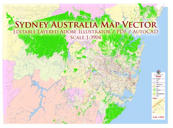
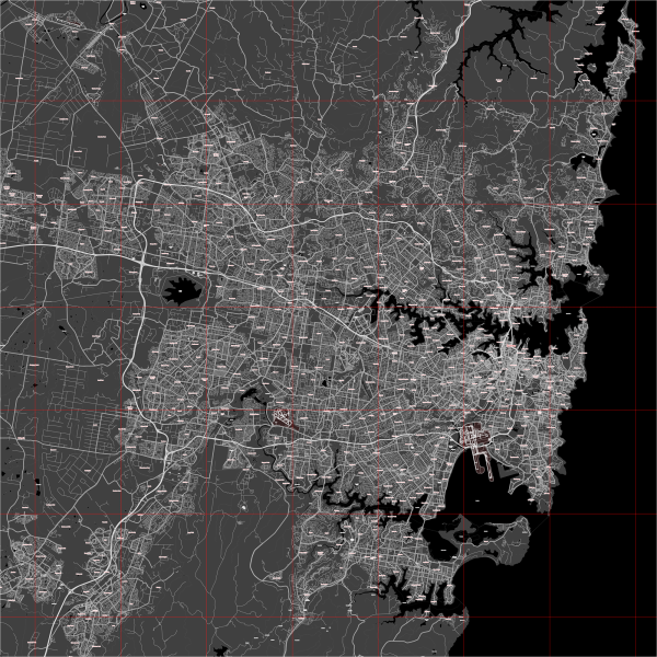
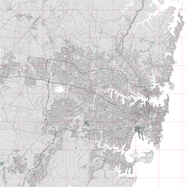
Printable PDF Vector Map of Sydney Metro Area Australia (geodata 2025) high detailed scale 1:3902 full editable Adobe PDF Street Map in layers, scalable, text format all names, 337 MB ZIP
All street names, Main Objects, Buildings. Map for design, printing, arts, projects, presentations, for architects, designers, and builders, business, logistics.
Layers list:
- Legend
- Grids
- Labels of roads
- Names of places (city, hamlet, etc.)
- Names of objects (hospitals, parks, water)
- Names of main streets
- Names of secondary streets
- Names of principal buildings
- Arrows of streets
- Main Streets, roads,
- Railroads
- Secondary streets
- Railroads
- Buildings
- Buildings 2 transparent 50%
- Airports and heliports
- Water objects (rivers, lakes, ponds)
- Color fills (parks, hospital areas, land use, etc.)
- Back
The most exact and detailed map of the city in scale.
For Editing and High-Quality Printing

Sydney Metro Area Australia 2025 PDF Vector Map Exact Extra High Detailed Street Map Adobe PDF in layers
Sydney, Australia – Detailed Description of Main Streets, Roads, City Districts, and Seaport
1. City Districts of Sydney
Sydney is divided into several major districts, each with unique characteristics, functions, and urban layouts. These districts can be broadly categorized into Central Sydney, Inner Suburbs, Outer Suburbs, and Greater Sydney Metropolitan Area.
A. Central Business District (CBD)
The heart of Sydney with a mix of skyscrapers, commercial zones, historic buildings, and entertainment hubs.
- Main Streets: George Street, Pitt Street, Castlereagh Street, Elizabeth Street, King Street.
- Key Landmarks: Sydney Tower, Circular Quay, Martin Place, Darling Harbour, Hyde Park.
B. The Rocks & Millers Point
- The Rocks: Historic area with old colonial buildings, narrow laneways, and pubs.
- Millers Point: Overlooks the Sydney Harbour Bridge with restored heritage buildings.
- Main Roads: Hickson Road, George Street.
C. Darling Harbour & Pyrmont
A waterfront district with entertainment venues, convention centers, and harborside parks.
- Key Attractions: Sydney Fish Market, Star Casino, International Convention Centre (ICC).
- Main Roads: Darling Drive, Pyrmont Bridge Road, Murray Street.
D. Kings Cross & Potts Point
- Kings Cross: Former red-light district, now a trendy nightlife hub.
- Potts Point: Upscale residential area with historic terraces.
- Main Roads: William Street, Darlinghurst Road, Bayswater Road.
E. Surry Hills & Darlinghurst
- Surry Hills: Hipster-friendly area with cafes, bars, and converted warehouses.
- Darlinghurst: Known for Oxford Street, a hub for Sydney’s LGBTQ+ community.
- Main Roads: Oxford Street, Crown Street, Bourke Street.
F. Inner West (Newtown, Glebe, Marrickville)
- Newtown: Alternative, bohemian area with street art, music venues, and bookshops.
- Glebe: University district near the University of Sydney.
- Marrickville: Culturally diverse, known for food and industrial gentrification.
- Main Roads: Parramatta Road, King Street, Glebe Point Road.
G. North Sydney & Lower North Shore
- North Sydney: Second major business district across the Harbour Bridge.
- Lower North Shore: Includes Milsons Point, Neutral Bay, and Crows Nest.
- Main Roads: Pacific Highway, Falcon Street, Military Road.
H. Eastern Suburbs (Bondi, Double Bay, Randwick)
- Bondi Beach: Famous for its coastline, surf, and relaxed lifestyle.
- Double Bay: Wealthy enclave with boutique shopping.
- Randwick: Home to the University of New South Wales and the Royal Randwick Racecourse.
- Main Roads: Oxford Street, New South Head Road, Bondi Road.
I. Western Sydney (Parramatta, Penrith, Blacktown)
A rapidly growing area with major commercial, industrial, and residential developments.
- Parramatta: Sydney’s “second CBD.”
- Penrith: Near the Blue Mountains, with outdoor activities.
- Blacktown: One of the most multicultural areas.
- Main Roads: Great Western Highway, M4 Motorway, Cumberland Highway.
2. Main Streets and Roads of Sydney
Sydney has an extensive road network that includes motorways, highways, arterial roads, and iconic streets.
A. Iconic and Major Streets
- George Street – The oldest and most significant street, running through the heart of the CBD.
- Pitt Street – Known for Pitt Street Mall, Sydney’s premier shopping area.
- Oxford Street – Connects the CBD to Bondi, lined with shops, restaurants, and nightlife.
- Macquarie Street – Features many government buildings, including the NSW Parliament House.
- Elizabeth Street – Runs parallel to George Street, with Hyde Park at its center.
B. Major Highways & Motorways
Sydney has several major motorways that connect different regions.
| Road Name |
Function & Key Areas Connected |
| M1 Pacific Motorway |
Links Sydney to Newcastle & Brisbane (north) |
| M2 Hills Motorway |
Connects North Shore to Western Sydney |
| M4 Western Motorway |
Runs from Sydney CBD to the Blue Mountains |
| M5 Motorway |
Main southern route to Liverpool, Campbelltown, and Canberra |
| M7 Motorway |
Connects western and northwestern Sydney |
| Great Western Highway |
Alternative route west through the Blue Mountains |
| Hume Highway (A28/M31) |
Sydney to Melbourne’s primary road link |
C. Bridges & Tunnels
- Sydney Harbour Bridge – The primary road and rail link between the CBD and the North Shore.
- Sydney Harbour Tunnel – An alternative to the Harbour Bridge.
- ANZAC Bridge – Connects the CBD to the Inner West.
3. Port of Sydney (Seaport)
Sydney’s main seaport is Port Botany, complemented by Sydney Harbour’s cruise and cargo terminals.
A. Port Botany (Primary Cargo Port)
- Location: 12 km south of Sydney CBD, near Botany Bay.
- Function: Handles container ships, bulk liquids (fuel, chemicals), and general cargo.
- Key Features:
- Container Terminals: Three main terminals managed by DP World, Patrick, and Hutchison.
- Oil Refineries & Fuel Storage: Major hub for petroleum imports.
- Connected by Road & Rail: M5 Motorway and rail freight corridors.
B. Sydney Harbour (Cruise & Smaller Cargo Operations)
- Circular Quay & Overseas Passenger Terminal – Main cruise terminal, serving ships like P&O and Royal Caribbean.
- White Bay Cruise Terminal – Secondary cruise facility in Balmain.
- Glebe Island & White Bay Ports – Handles smaller cargo, cement, and break-bulk operations.
4. Conclusion
Sydney’s road network and districts form a complex and dynamic urban landscape. The CBD and Inner Suburbs host historical streets, commercial hubs, and entertainment centers. Outer regions like Western Sydney are rapidly expanding. The Port of Sydney, primarily at Port Botany, plays a vital role in Australia’s trade and tourism.

Sydney Metro Area Australia 2025 PDF Vector Map Exact Extra High Detailed Street Map Adobe PDF in layers

Sydney Metro Area Australia 2025 PDF Vector Map Exact Extra High Detailed Street Map Adobe PDF in layers

Sydney Metro Area Australia 2025 PDF Vector Map Exact Extra High Detailed Street Map Adobe PDF in layers

Sydney Metro Area Australia 2025 PDF Vector Map Exact Extra High Detailed Street Map Adobe PDF in layers

Sydney Metro Area Australia 2025 PDF Vector Map Exact Extra High Detailed Street Map Adobe PDF in layers

Sydney Metro Area Australia 2025 PDF Vector Map Exact Extra High Detailed Street Map Adobe PDF in layers

Sydney Metro Area Australia 2025 PDF Vector Map Exact Extra High Detailed Street Map Adobe PDF in layers

Sydney Metro Area Australia 2025 PDF Vector Map Exact Extra High Detailed Street Map Adobe PDF in layers

Sydney Metro Area Australia 2025 PDF Vector Map Exact Extra High Detailed Street Map Adobe PDF in layers

Sydney Metro Area Australia 2025 PDF Vector Map Exact Extra High Detailed Street Map Adobe PDF in layers

Sydney Metro Area Australia 2025 PDF Vector Map Exact Extra High Detailed Street Map Adobe PDF in layers

Sydney Metro Area Australia 2025 PDF Vector Map Exact Extra High Detailed Street Map Adobe PDF in layers

Sydney Metro Area Australia 2025 PDF Vector Map Exact Extra High Detailed Street Map Adobe PDF in layers

Sydney Metro Area Australia 2025 PDF Vector Map Exact Extra High Detailed Street Map Adobe PDF in layers

Sydney Metro Area Australia 2025 PDF Vector Map Exact Extra High Detailed Street Map Adobe PDF in layers

Sydney Metro Area Australia 2025 PDF Vector Map Exact Extra High Detailed Street Map Adobe PDF in layers

Sydney Metro Area Australia 2025 PDF Vector Map Exact Extra High Detailed Street Map Adobe PDF in layers

Sydney Metro Area Australia 2025 PDF Vector Map Exact Extra High Detailed Street Map Adobe PDF in layers

Sydney Metro Area Australia 2025 PDF Vector Map Exact Extra High Detailed Street Map Adobe PDF in layers

Sydney Metro Area Australia 2025 PDF Vector Map Exact Extra High Detailed Street Map Adobe PDF in layers

Sydney Metro Area Australia 2025 PDF Vector Map Exact Extra High Detailed Street Map Adobe PDF in layers


 Author: Kirill Shrayber, Ph.D. FRGS

