Extended Description of the Vector Map
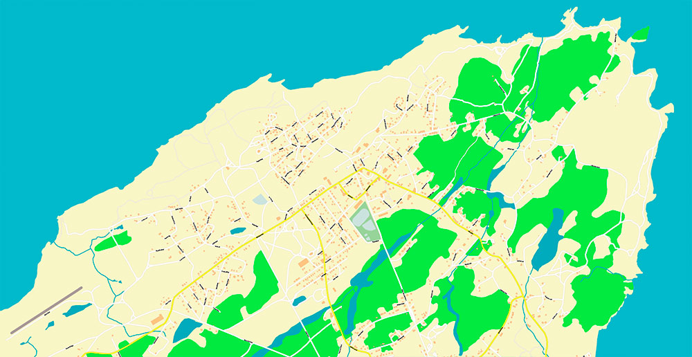
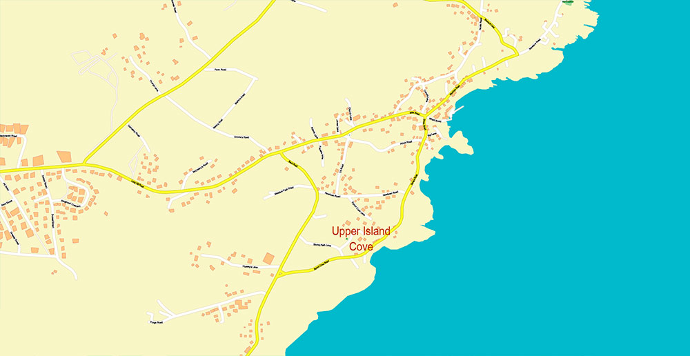
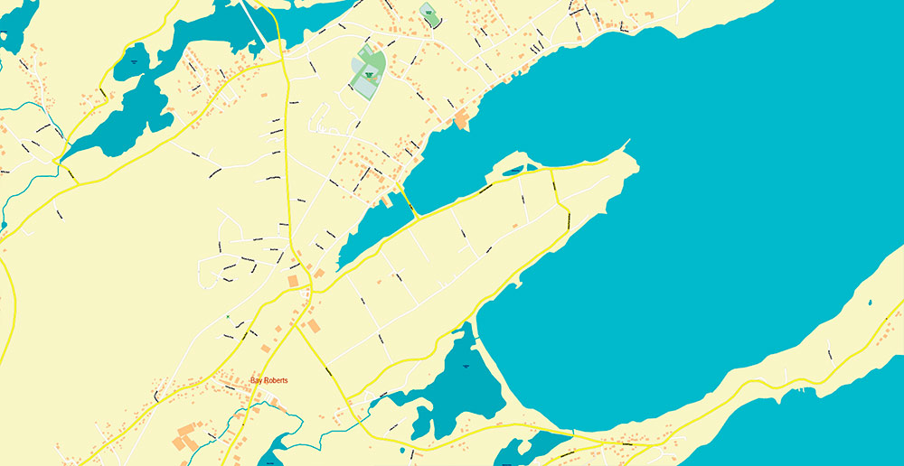
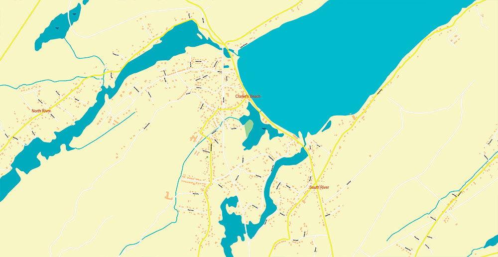
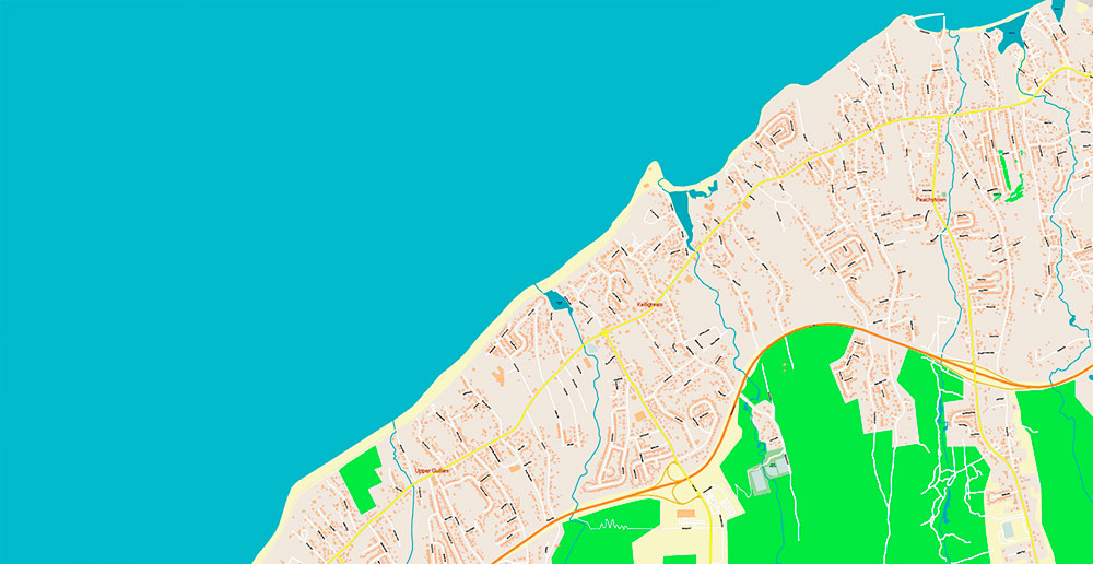
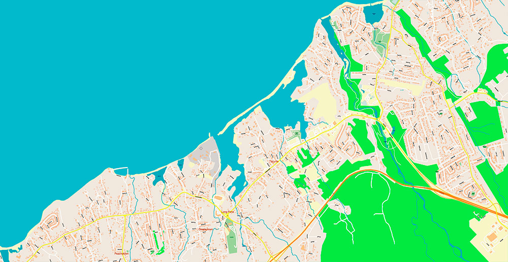
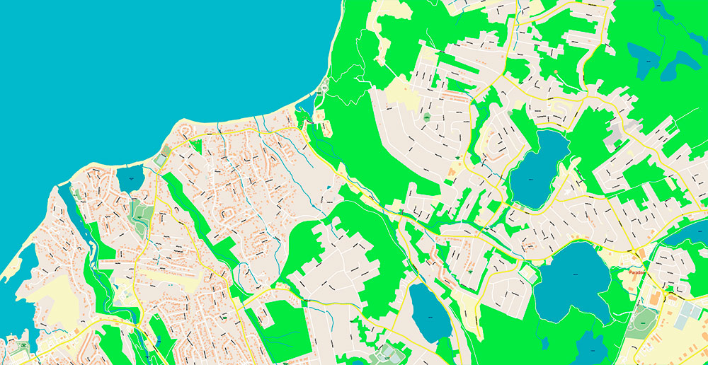
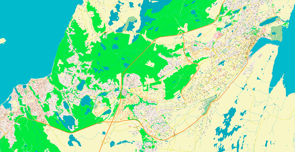
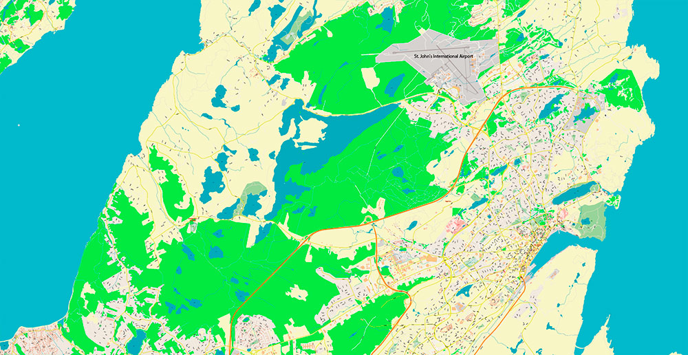
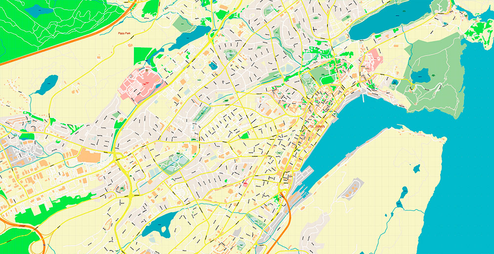
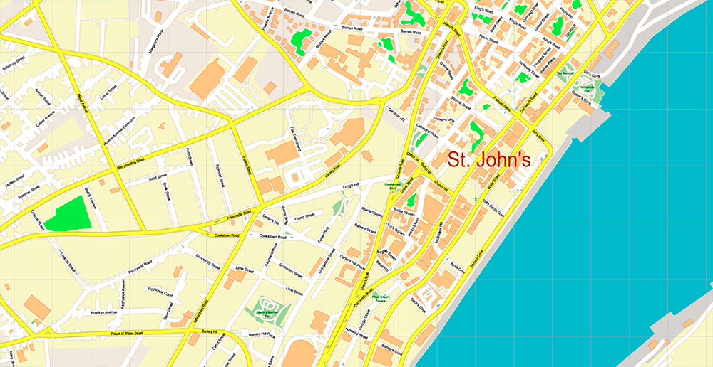
Printable PDF Vector Map of St John’s Newfoundland Canada high detailed scale 1:3174 fully editable Adobe PDF Street Road Map in layers, scalable, text format all names, 43 MB ZIP
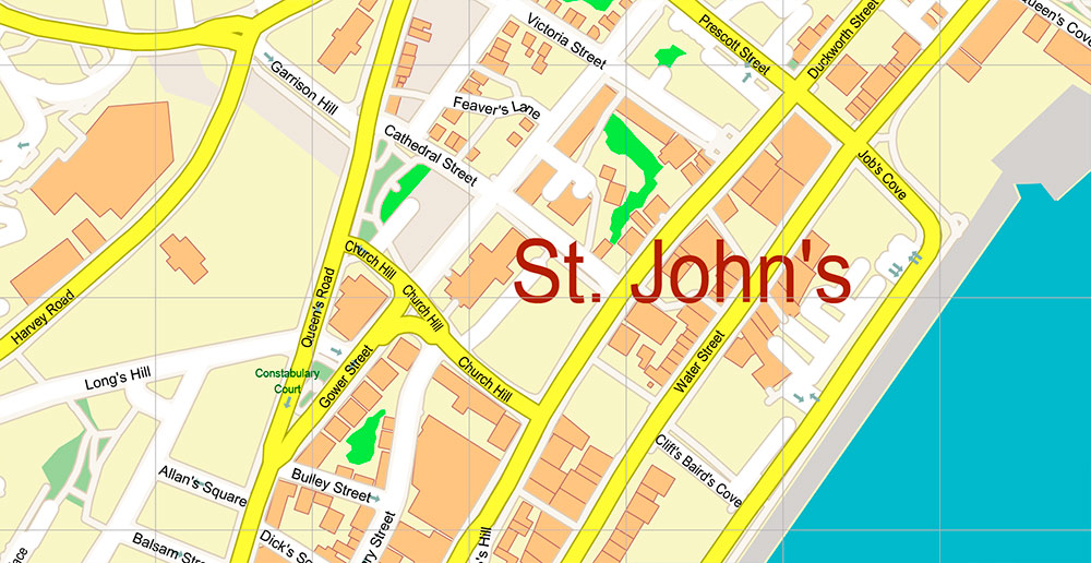
All street names, Main Objects, Buildings. Map for design, printing, arts, projects, presentations, for architects, designers, and builders, business, logistics.
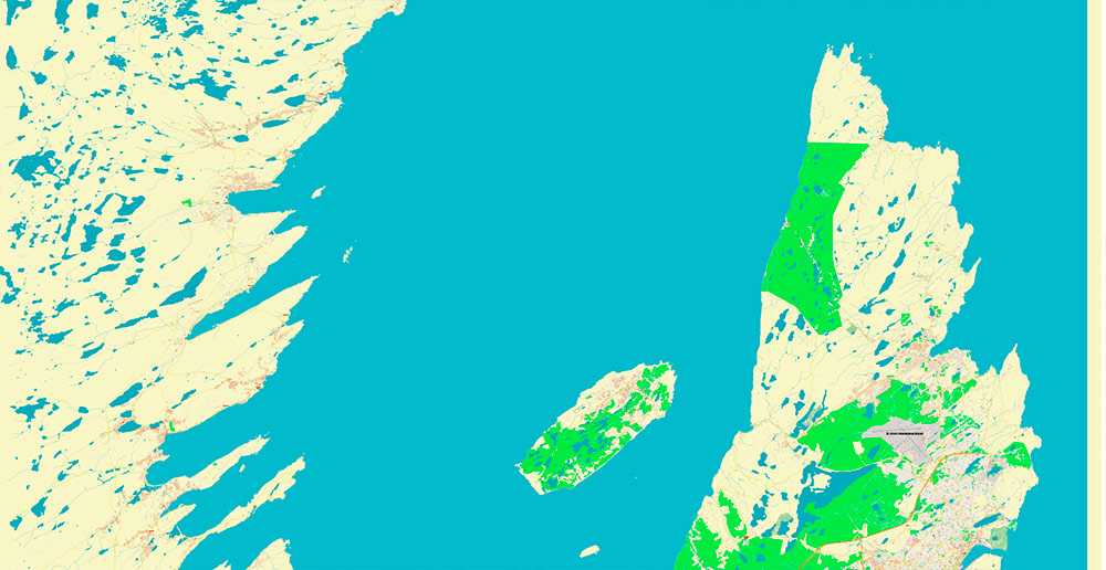
The most exact and detailed map of this area in scale.
For Editing and High-Quality Printing
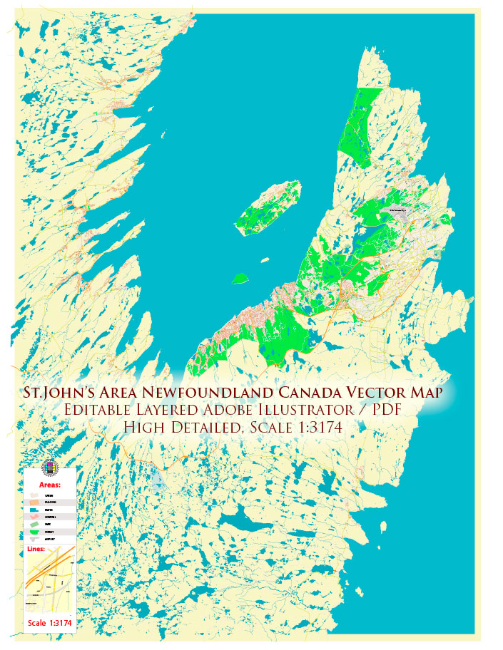
St John’s Newfoundland Canada PDF Map Vector Exact high detailed Street Road Map editable Adobe PDF in layers
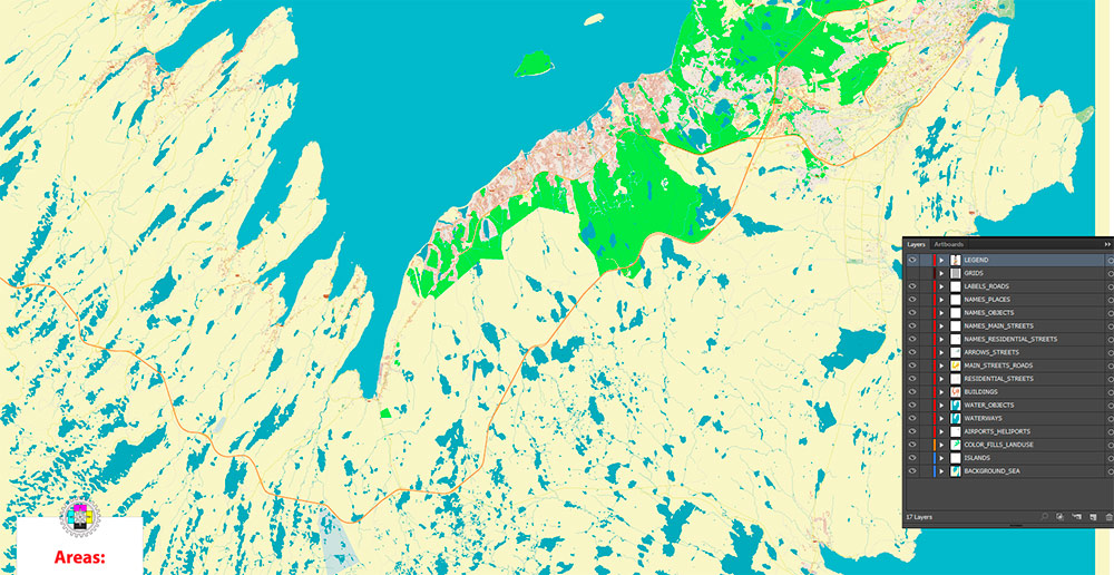
Layers list:
- Legend
- Grids
- Names of places (city, hamlet, etc.)
- Names of objects (parks, hospital, water)
- Names of main streets
- Names of residential streets
- Main Streets, roads
- Residential streets
- Railroads
- Buildings
- Water objects (rivers, lakes, ponds)
- Waterways
- Color fills (parks, land use, etc.)
- Background and sea
St John’s Newfoundland Canada PDF Map Vector Exact high detailed Street Road Map editable Adobe PDF in layers
ST. JOHN’S, NEWFOUNDLAND — RECON BRIEF
1. Strategic Geography
-
Location: St. John’s is the capital and largest city of the province of Newfoundland and Labrador, positioned on the eastern tip of the Avalon Peninsula on the island of Newfoundland in Atlantic Canada. It is recognized as the easternmost city in North America (excluding Greenland).
-
Terrain: The city rises around a natural, well-protected harbour opening to the Atlantic Ocean. The harbour entrance (known as The Narrows) is framed by Signal Hill and the South Side Hills, making it a historically defensible maritime gateway.
-
Climate: Influenced by the Atlantic, the region has frequent fog, wind, cloud cover, and mixed precipitation—rain in summer and snow in winter.
2. Demographics & Population
-
City Population: Around 110,000 people within city limits (2021 census).
-
Metro Area: Greater St. John’s metropolitan area (CMA) has a population of approximately 210,000+, making it one of Atlantic Canada’s larger urban regions.
-
Population Structure: Roughly 15% children, 67% working-age adults, and 18% seniors.
-
Cultural Roots: Predominantly of English and Irish descent, with visible minority populations growing over recent years.
3. Transport & Access
By Air
Road Network
-
Trans-Canada Highway (Route 1): St. John’s is the eastern terminus of this major national corridor, linking the region to western parts of Newfoundland.
-
City Arterials:
-
The Parkway (Columbus Drive → Prince Philip Drive → Macdonald Drive): Major city express route connecting key urban sectors and institutions.
-
Route 60 (Topsail Road): Runs west–east through St. John’s and beyond toward Conception Bay communities, historically an important access route.
-
Urban Transit: Local city bus service links neighbourhoods; taxis and personal vehicles are common for intra-city movement.
-
Rail: Historic Newfoundland Railway service ended in 1988; no active rail network remains.
4. Urban Layout & Key Roads
-
Water Street: Historic downtown commercial street, major hub for shops, restaurants, and culture.
-
Pitts Memorial Drive, Portugal Cove Road, Torbay Road: Other major arterial connectors to residential and commercial districts.
5. Neighbouring Settlements
6. Economy & Strategic Importance
-
Governance: Provincial capital with significant public administration presence.
-
Economic Base: Mix of public services, retail and trade, health care, and historically ocean-linked industries. Offshore oil and gas operations contribute substantially to regional economic activity.
-
Cultural Role: Centre for arts, education (including a major university), festivals, and tourism.
Operational Summary
St. John’s is a key Atlantic Canadian centre with coastal strategic geography, a well-defined road and air transport framework, a stable and diverse population base, and economic importance anchored in governance, services, and ocean-related sectors.
St John’s Newfoundland Canada PDF Map Vector Exact high detailed Street Road Map editable Adobe PDF in layers
St John’s Newfoundland Canada PDF Map Vector Exact high detailed Street Road Map editable Adobe PDF in layers
St John’s Newfoundland Canada PDF Map Vector Exact high detailed Street Road Map editable Adobe PDF in layers
St John’s Newfoundland Canada PDF Map Vector Exact high detailed Street Road Map editable Adobe PDF in layers
St John’s Newfoundland Canada PDF Map Vector Exact high detailed Street Road Map editable Adobe PDF in layers
St John’s Newfoundland Canada PDF Map Vector Exact high detailed Street Road Map editable Adobe PDF in layers
St John’s Newfoundland Canada PDF Map Vector Exact high detailed Street Road Map editable Adobe PDF in layers
St John’s Newfoundland Canada PDF Map Vector Exact high detailed Street Road Map editable Adobe PDF in layers
St John’s Newfoundland Canada PDF Map Vector Exact high detailed Street Road Map editable Adobe PDF in layers
St John’s Newfoundland Canada PDF Map Vector Exact high detailed Street Road Map editable Adobe PDF in layers
St John’s Newfoundland Canada PDF Map Vector Exact high detailed Street Road Map editable Adobe PDF in layers
St John’s Newfoundland Canada PDF Map Vector Exact high detailed Street Road Map editable Adobe PDF in layers
St John’s Newfoundland Canada PDF Map Vector Exact high detailed Street Road Map editable Adobe PDF in layers

 Author: Kirill Shrayber, Ph.D. FRGS