Extended Description of the Vector Map
St. Gallen is the capital of Eastern Switzerland and the canton of the same name. It is one of the highest cities in Switzerland (it is located at an altitude of about 700 meters above sea level). The city itself is quite large by the standards of Switzerland — more than 70 thousand people live here.
The monastery and the Abbey Library of St. Gallen are listed as UNESCO World Heritage Sites.
History of St. Gallen:
The founder of the city was in fact the Irish monk Gallus, who settled in a hut on the river Steinach in 612 . 100 years after his death, an abbey was built on the site of the hut and named after the monk — Abbey of St. Gallen.
In 954, fortress walls were erected around the abbey to protect it from the Saracens, and the city began to grow around these walls under the control of the monastery. In 1311, St. Gallen became a free imperial city, and forty years later, the guilds headed by the Guild of weavers gained control of the civil government. In 1415, they bought the freedom of the city from the German King Sigismund. In the mid-15th century, the city joined the Swiss Confederation.
After the invasion of Napoleon, the city and the abbey lost their power and were united together with the Appenzell region in one canton of Sentis as part of the Republic of Helvetia. However, such a republic caused extreme rejection throughout Switzerland and in 1803 it was destroyed. At the same time, St. Gallen became the capital of the Protestant canton of the same name. This was followed by the survival of the Catholic monks from the abbey.
Since the 15th century, St. Gallen has been successful in the production of textiles and has maintained a leading position for several centuries. In the early 19th century, the first embroidery machines were developed here. In 1910, St. Gallen embroidery accounted for most of Switzerland’s exports (18%), and more than half of the world’s production. However, the First World War and the Great Depression caused a significant production crisis. Only since the 50s of the 20th century, a certain revival of the industry began, but only a small part of the textile industry of the city was able to survive thanks to the high specialization and production of embroidery machines. To this day, embroidery from St. Gallen is popular with the Parisian creators of Haute Couture.
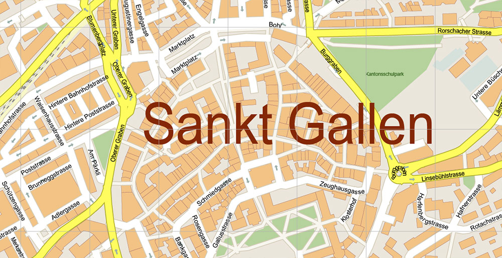
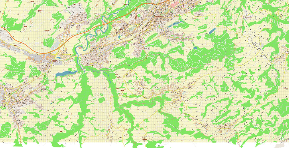
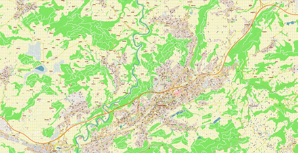
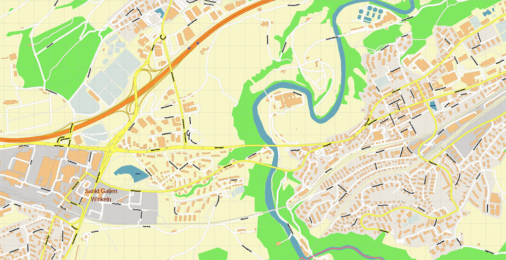
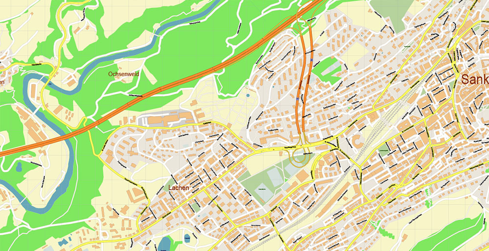
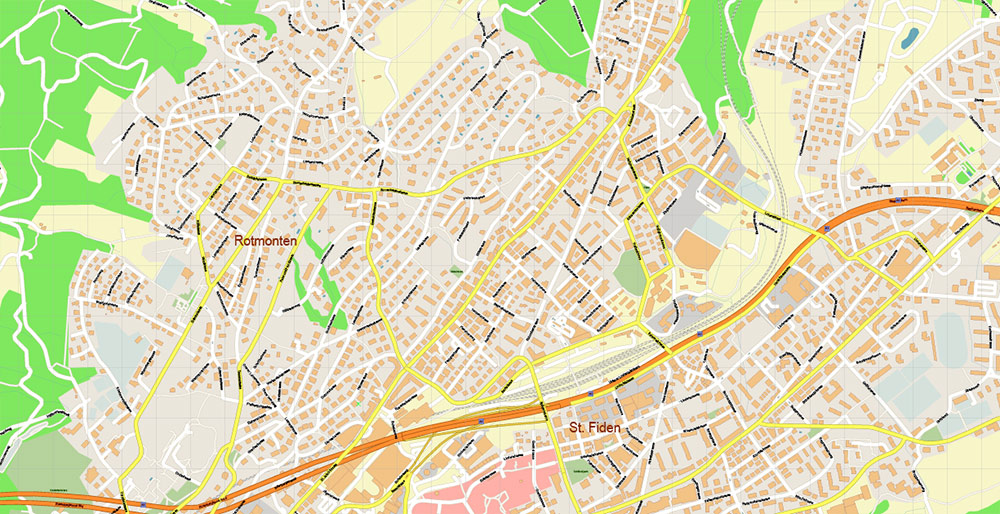
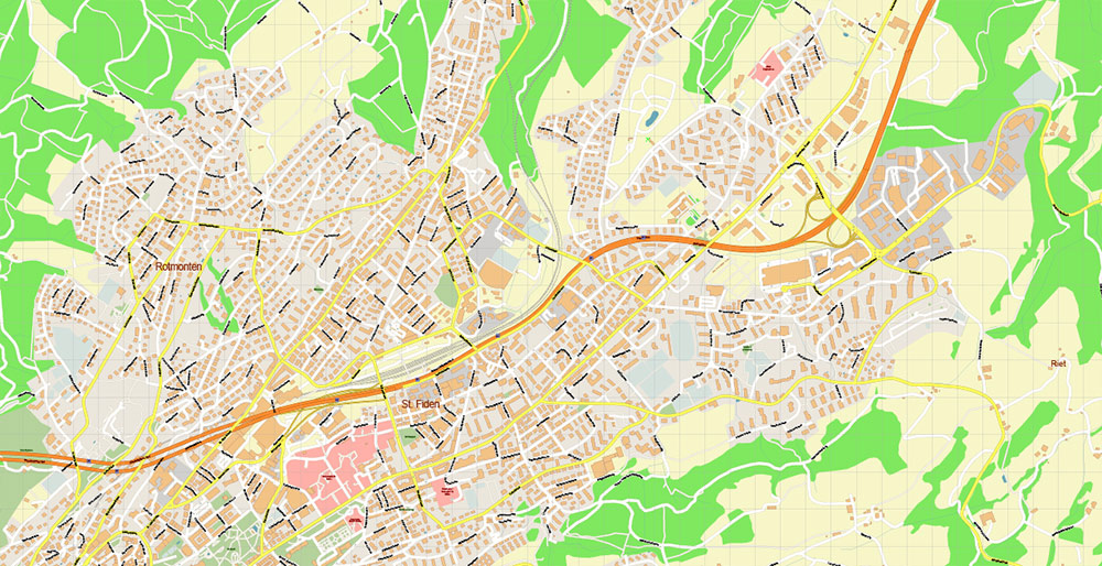
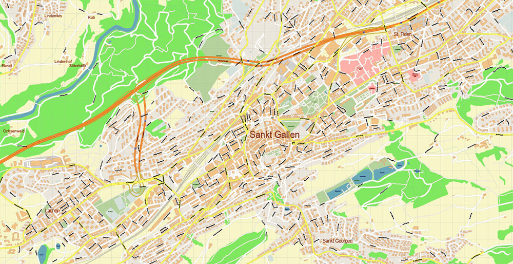
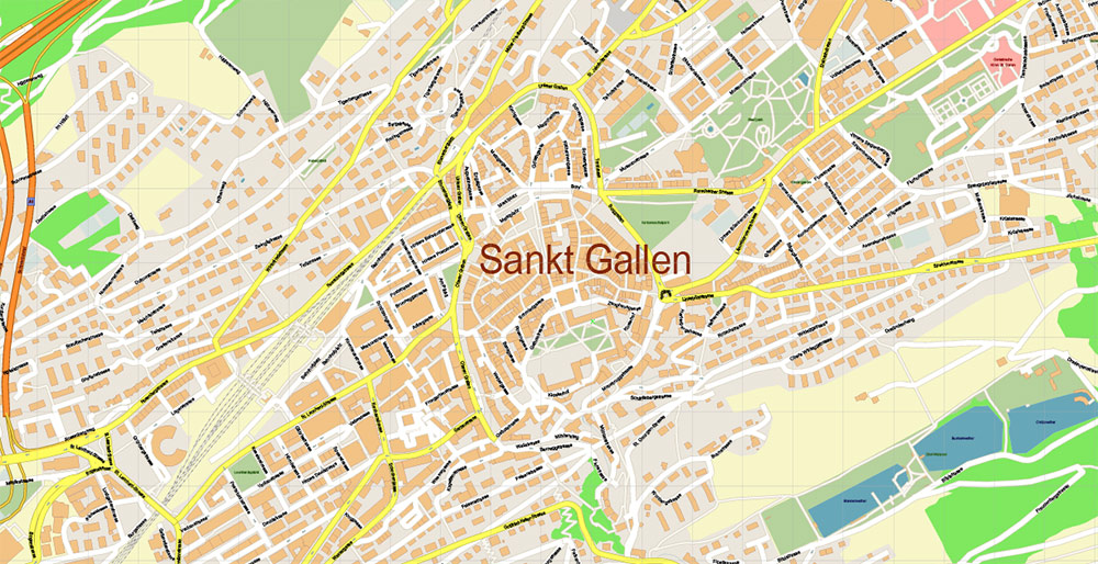
Printable Vector Map of St. Gallen Switzerland detailed City Plan scale 1:3178 full editable Adobe PDF Street Map in layers, scalable, text / curves format all names, 12 MB ZIP
All street names, Main Objects, Buildings. Map for design, printing, arts, projects, presentations, for architects, designers, and builders, business, logistics.
Need AutoCAD DWG / DXF or any other format? Please, contact us!
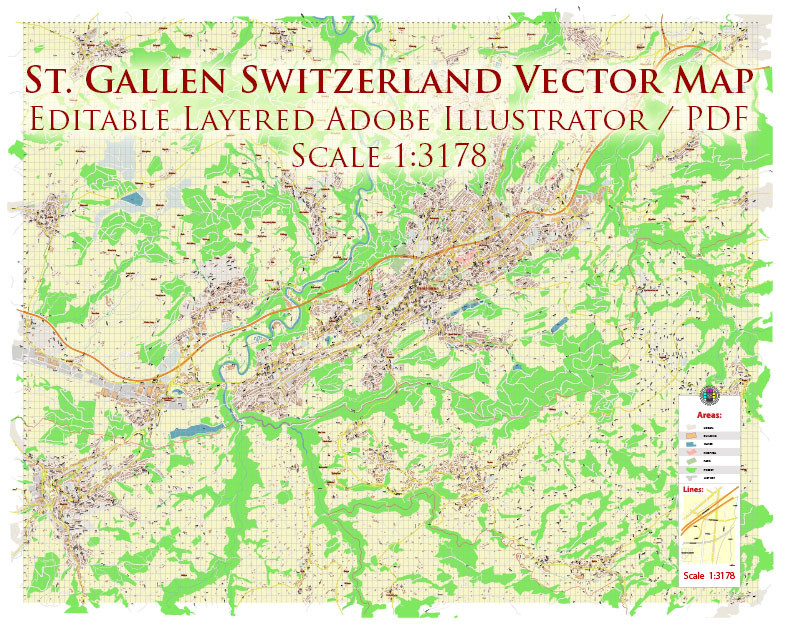
St. Gallen Switzerland PDF Vector Map Accurate High Detailed City Plan editable Adobe PDF Street Map in layers
Layers list:
- Legend
- Grids
- Labels of roads
- Names of places (city, hamlet, etc.)
- Names of objects (hospitals, parks, water)
- Names of main streets
- Names of civil streets
- Arrows of street drive direction
- Main Streets, roads
- Civil streets
- Railroads
- Buildings
- Airports and heliports
- Water objects (rivers, lakes, ponds)
- Waterways
- Color fills (parks, hospital areas, land use, etc.)
- Background
St. Gallen Switzerland PDF Vector Map Accurate High Detailed City Plan editable Adobe PDF Street Map in layers
St. Gallen Switzerland PDF Vector Map Accurate High Detailed City Plan editable Adobe PDF Street Map in layers
St. Gallen Switzerland PDF Vector Map Accurate High Detailed City Plan editable Adobe PDF Street Map in layers
St. Gallen Switzerland PDF Vector Map Accurate High Detailed City Plan editable Adobe PDF Street Map in layers
St. Gallen Switzerland PDF Vector Map Accurate High Detailed City Plan editable Adobe PDF Street Map in layers
St. Gallen Switzerland PDF Vector Map Accurate High Detailed City Plan editable Adobe PDF Street Map in layers
St. Gallen Switzerland PDF Vector Map Accurate High Detailed City Plan editable Adobe PDF Street Map in layers
St. Gallen Switzerland PDF Vector Map Accurate High Detailed City Plan editable Adobe PDF Street Map in layers
St. Gallen Switzerland PDF Vector Map Accurate High Detailed City Plan editable Adobe PDF Street Map in layers

 Author: Kirill Shrayber, Ph.D. FRGS
 Street Map editable Adobe Illustrator in layers")