Extended Description of the Vector Map
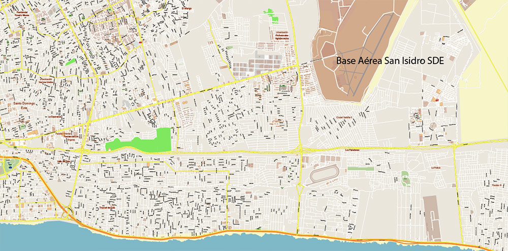
Printable Vector Map of Santo Domingo Metro Area Dominicana high detailed scale 1:4455 full editable Adobe Illustrator Street Map in layers, scalable, text/curves format all names, 18 MB ZIP
Covered Area: from San Cristobal to Las Americas
All street names, Main Objects, Buildings. Map for design, printing, arts, projects, presentations, for architects, designers, and builders, business, logistics.

Santo Domingo Dominicana Metro Area Vector Map Exact Extra High Detailed Street Map Adobe Illustrator in layers
Layers list:
- Legend
- Grids
- Labels of roads
- Names of places (city, hamlet, etc.)
- Names of objects (hospitals, parks, water)
- Names of main streets
- Names of secondary streets
- Names of principal buildings
- Arrows of streets
- Main Streets, roads,
- Railroads
- Secondary streets
- Buildings
- Buildings 2 transparent 50%
- Airports and heliports
- Water objects (rivers, lakes, ponds)
- Color fills (parks, hospital areas, land use, etc.)
- Islands
- Background and sea
The most exact and detailed map of the city in scale.
For Editing and High-Quality Printing
Geographical Description of Santo Domingo, Dominican Republic
1. Location and General Overview
Santo Domingo is the capital city of the Dominican Republic and serves as the country’s largest and most populous urban center. It is located on the southern coast of the island of Hispaniola, which the Dominican Republic shares with Haiti. The city lies along the Caribbean Sea, at the mouth of the Ozama River, one of the country’s major waterways. Its strategic position on the southeastern edge of the island has historically made it a vital port and trade hub.
- Coordinates : Approximately 18.4719° N latitude and 69.8923° W longitude.
- Region : The city is part of the Distrito Nacional (National District), a special administrative division separate from the surrounding Santo Domingo Province.
2. Topography
The geography of Santo Domingo is characterized by its coastal location and relatively flat terrain, though it transitions into rolling hills and low mountains in some areas.
- Coastal Plains : The city is situated on a coastal plain that slopes gently toward the Caribbean Sea. This area is ideal for urban development and agriculture due to its fertile soil.
- Ozama River Basin : The Ozama River plays a central role in shaping the city’s geography. It flows through Santo Domingo before emptying into the Caribbean, forming a natural harbor that has been critical to the city’s historical and economic development.
- Elevation : The elevation of Santo Domingo ranges from sea level along the coastline to approximately 100 meters (330 feet) above sea level in some inland neighborhoods.
- Proximity to Mountains : To the north and west of the city lie the Cordillera Central mountain range, part of the larger Caribbean mountain system. While these mountains are not within the city limits, they influence the climate and provide scenic backdrops.
3. Climate
Santo Domingo has a tropical climate, classified as Aw under the Köppen climate classification system, characterized by warm temperatures year-round and distinct wet and dry seasons.
- Temperature : Average temperatures range between 25°C (77°F) and 31°C (88°F). The city rarely experiences significant temperature fluctuations.
- Rainfall : The wet season occurs from May to November, coinciding with the Atlantic hurricane season. During this period, heavy rainfall is common, often leading to flooding in low-lying areas. The dry season spans December to April, with minimal precipitation.
- Humidity : High humidity levels prevail throughout the year, typical of tropical coastal regions.
- Hurricanes : As a Caribbean city, Santo Domingo is vulnerable to hurricanes and tropical storms, which can bring strong winds, heavy rains, and storm surges.
4. Natural Features
Santo Domingo is blessed with several notable natural features that contribute to its beauty and ecological diversity.
- Beaches : Although urbanization has diminished some of the natural coastline, Santo Domingo still boasts beaches such as Boca Chica and Juan Dolio, located just outside the city proper. These sandy shores attract both locals and tourists.
- Mangroves : The estuaries and riverbanks around the Ozama River are home to mangrove forests, which provide critical habitat for marine life and help protect the coastline from erosion.
- Biodiversity : The surrounding region supports diverse flora and fauna, including tropical hardwoods, migratory birds, and marine species like coral reefs near the coast.
5. Urban Layout
Santo Domingo is divided into distinct zones, each with unique characteristics:
- Colonial Zone (Zona Colonial) : Located on the western bank of the Ozama River, this UNESCO World Heritage Site is the historic heart of the city. It features cobblestone streets, colonial-era architecture, and landmarks such as the Alcázar de Colón and the First Cathedral of the Americas.
- Modern Downtown (Ensanche) : The bustling commercial and financial district, known as Gazcue or Ensanche, lies farther inland. It includes modern skyscrapers, government buildings, and shopping centers.
- Residential Areas : Suburbs and residential neighborhoods extend outward from the city center, often blending into rural landscapes. Notable districts include Naco, Piantini, and Los Prados.
- Industrial Zones : Industrial activity is concentrated along the Ozama River and in peripheral areas, where factories and warehouses support the local economy.
6. Environmental Challenges
Santo Domingo faces several environmental issues due to rapid urbanization and population growth.
- Pollution : The Ozama River suffers from severe pollution caused by untreated sewage, industrial waste, and plastic debris. Efforts are underway to clean and restore the river.
- Urban Sprawl : Unplanned expansion has led to deforestation, loss of green spaces, and increased vulnerability to flooding.
- Climate Change : Rising sea levels and extreme weather events pose threats to coastal infrastructure and ecosystems.
7. Transportation and Connectivity
Santo Domingo is a key transportation hub in the Caribbean.
- Ports : The Port of Santo Domingo is one of the busiest in the region, handling cargo and passenger traffic.
- Airports : Las Américas International Airport (SDQ), located about 30 kilometers east of the city, connects Santo Domingo to global destinations.
- Road Network : A network of highways and arterial roads links Santo Domingo to other parts of the Dominican Republic, including Santiago and Punta Cana.
- Public Transit : The city operates a metro system (Metro de Santo Domingo), buses, and informal transport options like “guaguas” (minibuses).
8. Cultural and Historical Significance
As the oldest continuously inhabited European settlement in the Americas, founded in 1496 by Bartholomew Columbus, Santo Domingo holds immense cultural and historical importance. Its Zona Colonial preserves centuries-old structures that reflect Spain’s colonial legacy.
In summary, Santo Domingo’s geography—its coastal setting, riverine environment, and proximity to mountains—has shaped its development over centuries. Despite challenges posed by urbanization and climate change, the city remains a vibrant center of commerce, culture, and history in the Caribbean.

Santo Domingo Dominicana Metro Area Vector Map Exact Extra High Detailed Street Map Adobe Illustrator in layers

Santo Domingo Dominicana Metro Area Vector Map Exact Extra High Detailed Street Map Adobe Illustrator in layers

Santo Domingo Dominicana Metro Area Vector Map Exact Extra High Detailed Street Map Adobe Illustrator in layers

Santo Domingo Dominicana Metro Area Vector Map Exact Extra High Detailed Street Map Adobe Illustrator in layers

Santo Domingo Dominicana Metro Area Vector Map Exact Extra High Detailed Street Map Adobe Illustrator in layers

Santo Domingo Dominicana Metro Area Vector Map Exact Extra High Detailed Street Map Adobe Illustrator in layers

Santo Domingo Dominicana Metro Area Vector Map Exact Extra High Detailed Street Map Adobe Illustrator in layers

Santo Domingo Dominicana Metro Area Vector Map Exact Extra High Detailed Street Map Adobe Illustrator in layers

Santo Domingo Dominicana Metro Area Vector Map Exact Extra High Detailed Street Map Adobe Illustrator in layers

Santo Domingo Dominicana Metro Area Vector Map Exact Extra High Detailed Street Map Adobe Illustrator in layers

Santo Domingo Dominicana Metro Area Vector Map Exact Extra High Detailed Street Map Adobe Illustrator in layers
Santo Domingo Dominicana Metro Area Vector Map Exact Extra High Detailed Street Map Adobe Illustrator in layers

Santo Domingo Dominicana Metro Area Vector Map Exact Extra High Detailed Street Map Adobe Illustrator in layers

Santo Domingo Dominicana Metro Area Vector Map Exact Extra High Detailed Street Map Adobe Illustrator in layers

Santo Domingo Dominicana Metro Area Vector Map Exact Extra High Detailed Street Map Adobe Illustrator in layers

Santo Domingo Dominicana Metro Area Vector Map Exact Extra High Detailed Street Map Adobe Illustrator in layers

Santo Domingo Dominicana Metro Area Vector Map Exact Extra High Detailed Street Map Adobe Illustrator in layers

Santo Domingo Dominicana Metro Area Vector Map Exact Extra High Detailed Street Map Adobe Illustrator in layers

Santo Domingo Dominicana Metro Area Vector Map Exact Extra High Detailed Street Map Adobe Illustrator in layers

Santo Domingo Dominicana Metro Area Vector Map Exact Extra High Detailed Street Map Adobe Illustrator in layers

Santo Domingo Dominicana Metro Area Vector Map Exact Extra High Detailed Street Map Adobe Illustrator in layers

Santo Domingo Dominicana Metro Area Vector Map Exact Extra High Detailed Street Map Adobe Illustrator in layers

Santo Domingo Dominicana Metro Area Vector Map Exact Extra High Detailed Street Map Adobe Illustrator in layers

 Author: Kirill Shrayber, Ph.D. FRGS

