Extended Description of the Vector Map
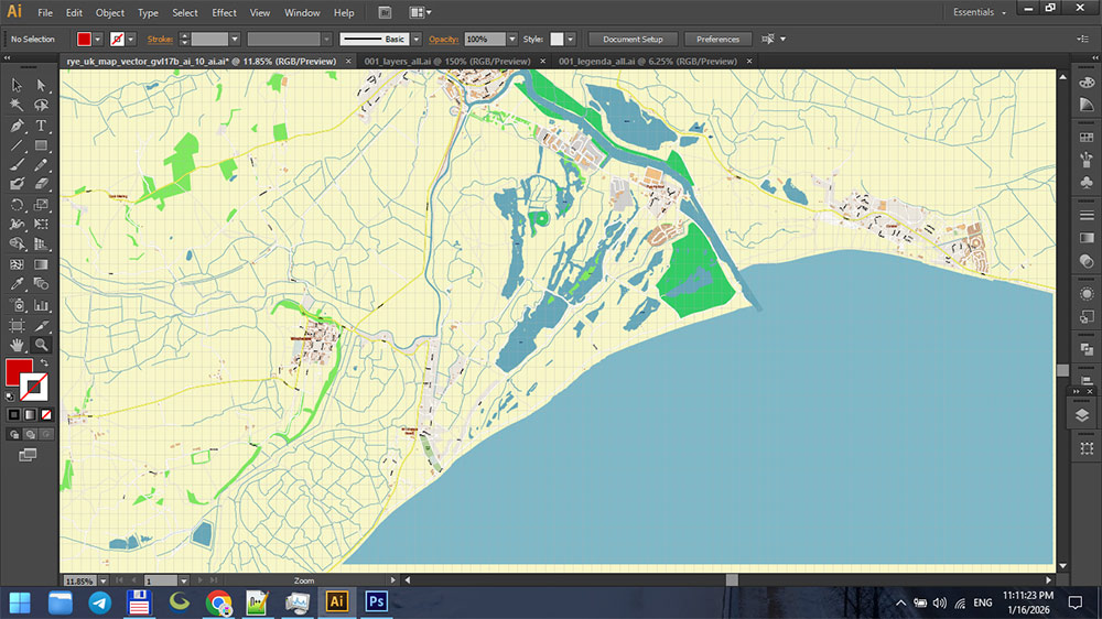
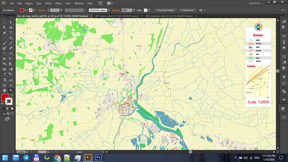
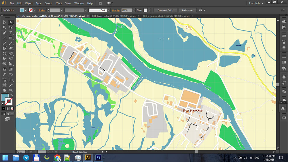
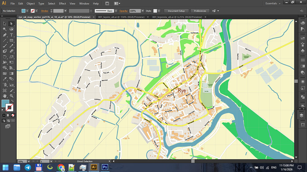
Printable PDF Vector Map of Rye East Sussex UK detailed street map scale 1:2959 fully editable Layered Adobe PDF scalable, text format all names, 3 MB ZIP
All street names, Main Objects, Buildings. Map for design, printing, arts, projects, presentations, for architects, designers, and builders, business, logistics.
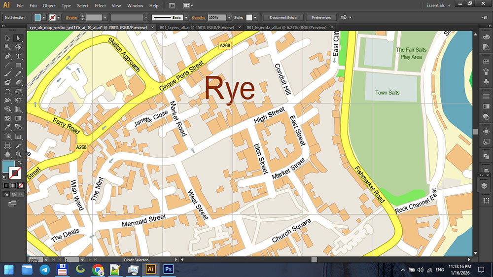
Rye East Sussex UK PDF Map Vector Exact City Plan High Detailed Street Map editable Adobe PDF in layers
Layers list:
- Legend
- Grids
- Labels of roads
- Names of places (city, hamlet, etc.)
- Names of objects (parks, water)
- Names of main streets
- Names of residential streets
- Arrows of streets
- Main Streets, roads
- Residential streets
- Buildings
- Water objects (rivers, lakes, ponds)
- Waterways
- Color fills (parks, land use, etc.)
- Background and sea
The most exact and detailed map of the city in scale.
For Editing and High-Quality Printing
🌍 Geography
Rye is a small historic town and civil parish in the Rother district of East Sussex, in the South East England region. It lies about 2 miles (3 km) from the English Channel, at the meeting point of three rivers — the Rother, the Tillingham and the Brede. Originally virtually surrounded by water and tidal marshes, the coastline has since shifted inland due to natural silting and deliberate land reclamation, leaving Rye slightly inland but close to flat marshland and nature reserves.
📜 History
Rye has ancient roots stretching back to at least the Norman period and is recorded in the Domesday Book (1086) as a significant settlement. Initially almost surrounded by the sea, it became an important seaport and fishing community. In medieval times it joined the Cinque Ports confederation — a strategic alliance of ports that supplied ships and men for the Crown’s defence.
Because of its coastal position and wealth, Rye was frequently attacked by the French and Spanish in the Middle Ages. Over time, aggressive storms, silting, and changes in the River Rother’s course pushed the shoreline outward, reducing the harbour’s accessibility and leading the town to become more inland.
The town’s historic structures reflect its martial and commercial past: stone walls, ancient inns, churches, and defensive towers speak to its roles in maritime defense, smuggling, and trade.
🛣️ Main Roads & Transport
Rye sits at a crossing point on several local routes:
-
The A259 is the main arterial road passing through the town, linking Rye with other coastal towns such as Hastings (to the east) and Folkestone (to the west), and it crosses the River Rother via Monk Bretton Bridge.
Rye’s railway station on the Marshlink Line connects the town with larger hubs including Ashford and Hastings, making it accessible by train as well as by road. Though a historical local tramway once linked Rye to Camber, it is now closed.
Beyond roads and rails, the network of flat marshland paths and trails around Rye (including long-distance foot paths like the High Weald Landscape Trail) highlights its rural setting and access to countryside walks.
📍 Key Sights & Attractions
Rye is famed for its well-preserved medieval character and variety of attractions:
📜 Historic Streets & Buildings
-
Mermaid Street – One of the most photographed and picturesque cobbled streets in England, lined with timber-framed houses and historic inns.
-
The Mermaid Inn – A historic inn dating back to the 12th century (current building from 1420) with stories of smugglers and hauntings.
-
St Mary’s Church – A dominant medieval church whose tower offers panoramic views across the town and marshes.
🛡️ Museums & Fortifications
-
Ypres Tower & Rye Castle Museum – A fortified medieval tower now housing historical displays and views over the surrounding landscape.
-
Rye Heritage Centre – Exhibits and models exploring Rye’s long history as a fortified maritime town.
🌿 Nature & Surroundings
-
Rye Harbour Nature Reserve – A coastal reserve of salt marshes and shingle with trails, bird hides and wildlife.
-
Camber Sands – A popular sandy beach a short distance south of Rye, ideal for walks and water sports.
🧭 Summary
Rye blends dramatic medieval history with charming architecture and scenic natural landscapes. Once a vital medieval port and defensive citadel, it now preserves its heritage in cobbled streets, historic inns and museums, while offering access to coastal nature reserves and nearby beaches.
Rye East Sussex UK PDF Map Vector Exact City Plan High Detailed Street Map editable Adobe PDF in layers
Rye East Sussex UK PDF Map Vector Exact City Plan High Detailed Street Map editable Adobe PDF in layers
Rye East Sussex UK PDF Map Vector Exact City Plan High Detailed Street Map editable Adobe PDF in layers
Rye East Sussex UK PDF Map Vector Exact City Plan High Detailed Street Map editable Adobe PDF in layers
Rye East Sussex UK PDF Map Vector Exact City Plan High Detailed Street Map editable Adobe PDF in layers


 Author: Kirill Shrayber, Ph.D. FRGS