Extended Description of the Vector Map
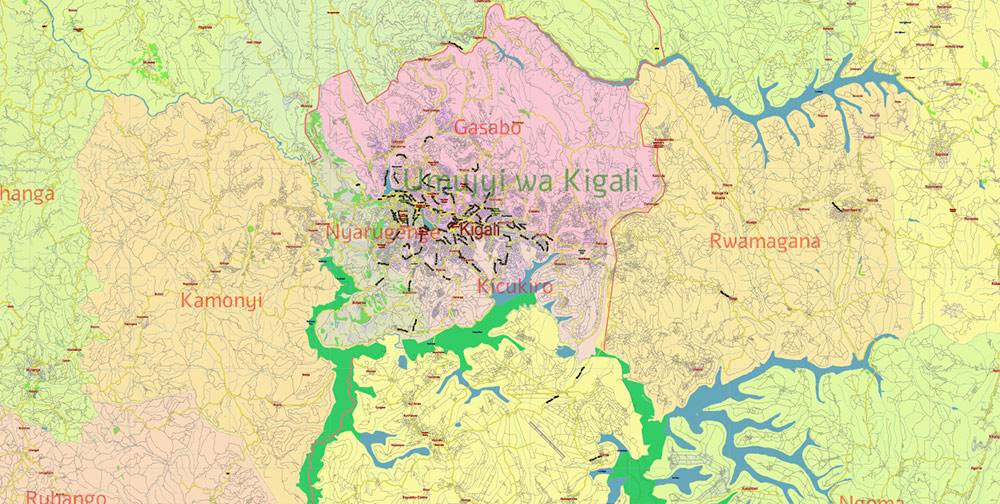
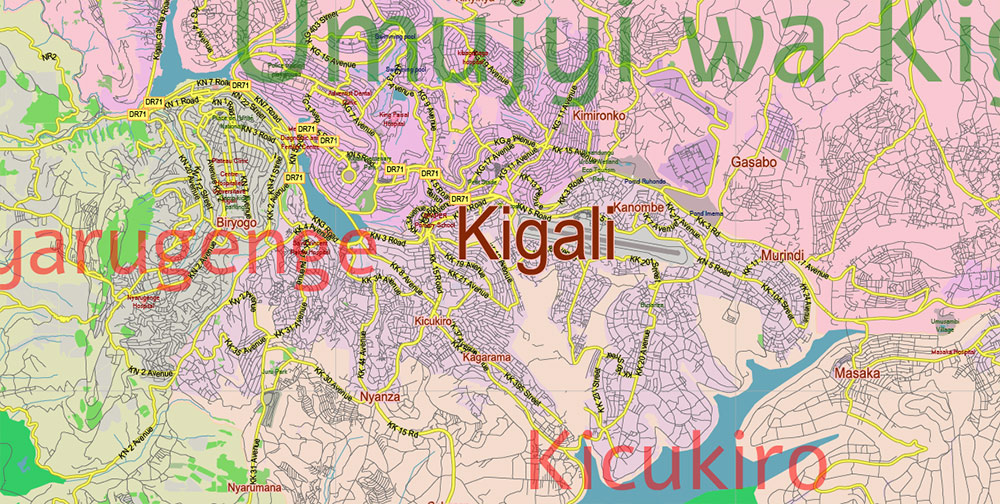
Printable PDF Vector Map of Rwanda high detailed road map + admin areas 1, 2, + cities and water objects editable Layered Adobe PDF, scalable, editable text/curves format of names, 54 Mb ZIP.
Layered exact editable map: Map for publishing, design, printing, publications, arts, projects, presentations, for architects, designers, and builders, business, logistics. The most exact and detailed map. GPS correct Mercator Projection.
For printing any format.
Please note: This country map is compiled from multiple, unrelated geodata sources. The state border line (according to the UN data) DOES NOT COINCIDE with the boundaries of the administrative territories of the country (according to the national geo-statistical bureau).
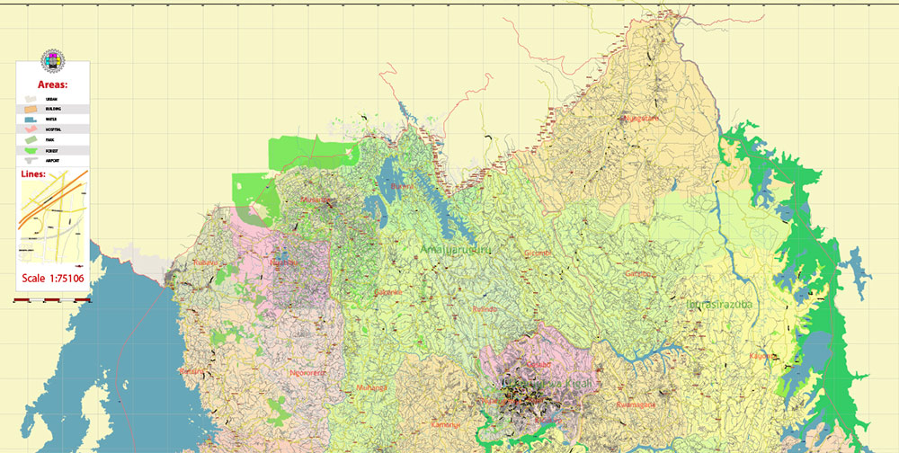
Please note: in the preview, ALL LAYERS are enabled and visible. Of course, you can easily turn off the layers you don’t need and the map will become much simpler.
DWG, DXF, CDR, ESRI Shapes, and other formats – by request, the same price, please contact.
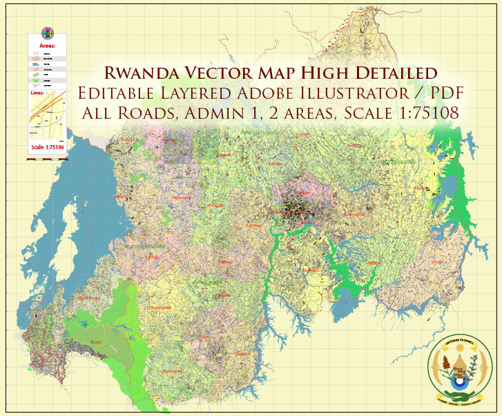
Rwanda PDF Vector Map high detailed road map + admin areas 1, 2, + cities and water objects editable Layered Adobe PDF
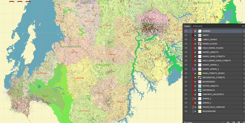
Separated layers:
- Legend
- Grids
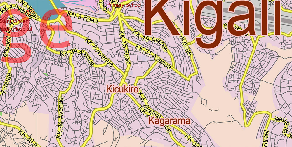
- Road labels
- Names Places + Halo
- Names principal roads and streets (some)
- Names Water objects (areas)
- Names Districts 2
- Names Provinces 1
- Urban areas / land use areas
- Names main streets and roads + Halo
- Main roads and streets
- Residential streets and roads
- Country boundaries
- Waterways
- Water areas
- Districts areas 2
- Provinces areas 1
- Background
AO BRIEF: REPUBLIC OF RWANDA
OVERVIEW
Rwanda – compact, landlocked nation in Central-East Africa, bounded by Uganda (N), Tanzania (E), Burundi (S), and the Democratic Republic of the Congo (W). Total area ≈ 26 000 km². Nickname: “Land of a Thousand Hills.”
TERRAIN / RELIEF
-
Heavily dissected highlands: rolling hills, steep ridges, and deep valleys.
-
Western frontier formed by the Albertine Rift escarpment; Lake Kivu occupies the western trough.
-
Elevations: 1 000 m (east) → 4 507 m (Mount Karisimbi, Virunga Range).
-
Terrain complicates line-of-sight communications and ground convoy movement; frequent switchbacks, limited straight roads.
-
Soils fertile but erosion-prone.
CLIMATE / SEASONALITY
-
Equatorial highland climate: mild days, cool nights.
-
Rain seasons: Mar–May, Sep–Dec (heavy storms, landslide risk).
-
Dry windows: Jun–Aug, Jan–Feb (preferred for operations).
-
Annual rainfall ≈ 1 200 mm; average temp ≈ 19 °C in highlands.
-
Fog and low clouds common above 2 000 m; degrade air-support visibility.
LINES OF COMMUNICATION / INFRASTRUCTURE
-
Primary arterial: Kigali – Rubavu – Goma (to DRC); Kigali – Gatuna – Kampala (to Uganda); Kigali – Rusumo – Dar es Salaam (to Indian Ocean port).
-
Internal grid: paved N–S and E–W spines radiating from Kigali; numerous secondary laterite roads passable only in dry season.
-
Rail: none inside Rwanda; reliance on Tanzanian port and overland trucking.
-
Airfields: international at Kigali (paved, 3 500 m runway); minor strips at Kamembe and Ruhengeri.
POPULATION / HUMAN TERRAIN
-
≈ 14 million (densest in continental Africa).
-
Ethnic composition: Hutu ~ 84 %, Tutsi ~ 15 %, Twa < 1 %.
-
Language triad: Kinyarwanda (universal), French, English.
-
High literacy; governance centralized, efficient; civil control strong.
-
Rural population ≈ 75 %, agriculture-based (coffee, tea, bananas).
TOURISM / KEY COMPOUNDS
-
Volcanoes NP (gorilla reserves, Virunga chain) – high-security eco-zone.
-
Akagera NP – savanna lowlands along Tanzanian border.
-
Lake Kivu resorts – Gisenyi, Kibuye.
-
Capital Kigali – modern hub, grid-planned, secure, primary logistics node.
HAZARDS / THREATS
-
Terrain-induced isolation; limited cross-country mobility.
-
Seasonal landslides, flash floods.
-
Seismic risk from Rift Valley faults.
-
Border tensions episodic with DRC; potential insurgent infiltration (FDLR remnants).
LOGISTICS / SUSTAINMENT
-
Ground resupply via Tanzanian corridor (Dar es Salaam–Rusumo–Kigali) – 1 300 km paved.
-
Fuel and heavy cargo moved by convoy; airlift required for highland posts.
-
Local procurement feasible: food, water, construction material abundant.
COMMAND TAKEAWAYS
-
Expect restricted maneuver speed (average < 40 km/h on paved, < 20 km/h on rural).
-
High altitude + humidity → adjust vehicle tuning, med protocols.
-
Secure Kigali as forward HQ; maintain redundancy with Rusumo entry axis.
-
Deploy light rotary assets; fixed-wing limited by cloud and relief.
Rwanda PDF Vector Map high detailed road map + admin areas 1, 2, + cities and water objects editable Layered Adobe PDF
Rwanda PDF Vector Map high detailed road map + admin areas 1, 2, + cities and water objects editable Layered Adobe PDF
Rwanda PDF Vector Map high detailed road map + admin areas 1, 2, + cities and water objects editable Layered Adobe PDF
Rwanda PDF Vector Map high detailed road map + admin areas 1, 2, + cities and water objects editable Layered Adobe PDF
Rwanda PDF Vector Map high detailed road map + admin areas 1, 2, + cities and water objects editable Layered Adobe PDF

 Author: Kirill Shrayber, Ph.D. FRGS