Extended Description of the Vector Map
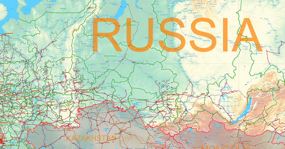
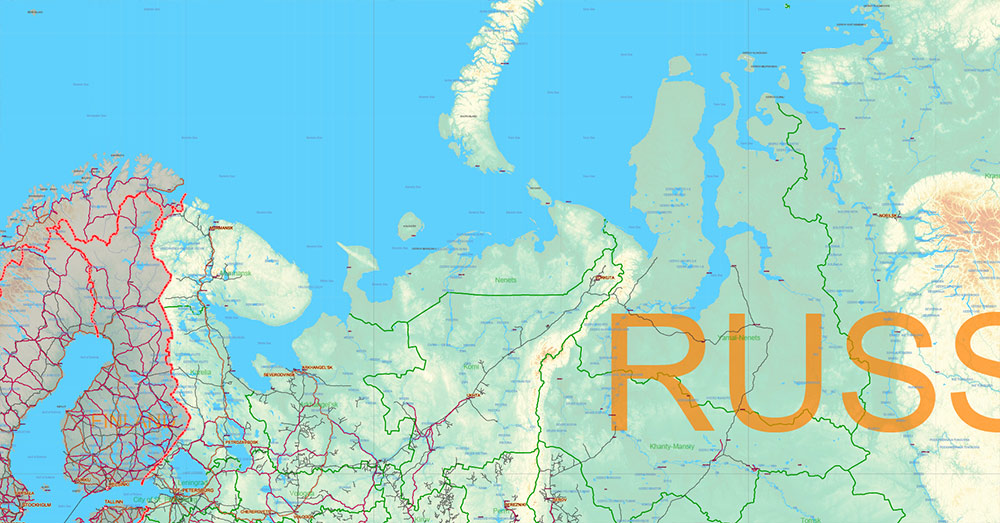
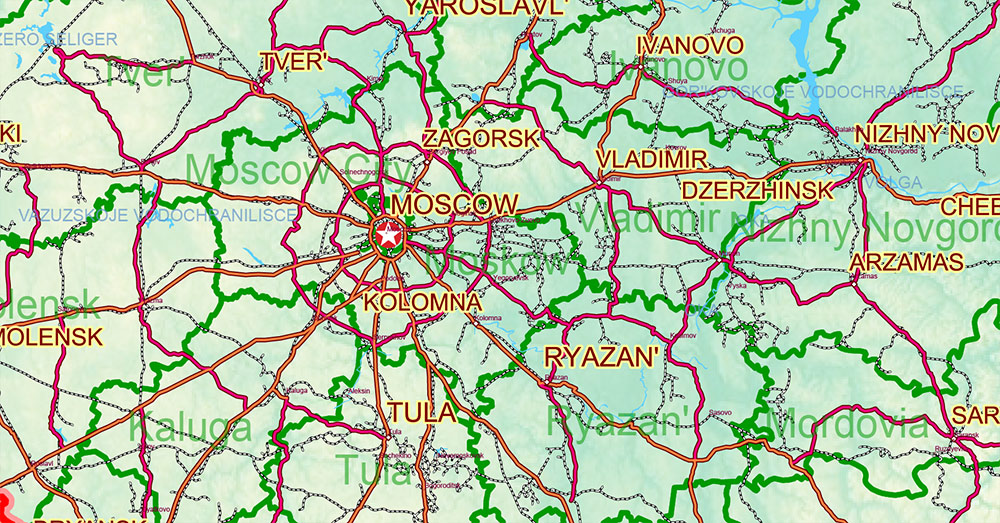
Printable Vector Map of Russian Federation (English names) high detailed Relief and road map + admin areas + cities, roads, railroads and water objects, disputed areas 2026 year data, editable Layered Adobe Illustrator, scalable, editable text/curves format of names, 48 Mb ZIP.
Layered exact editable map: Map for publishing, design, printing, publications, arts, projects, presentations, for architects, designers, and builders, business, logistics. The most exact and detailed map. GPS correct Mercator Projection.
For printing any format.
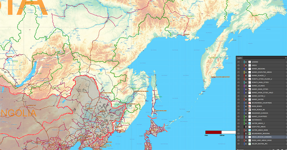
Please note: in the preview, ALL LAYERS are enabled and visible. Of course, you can easily turn off the layers you don’t need and the map will become much simpler.
DWG, DXF, CDR, ESRI Shapes, and other formats – by request, the same price, please contact.
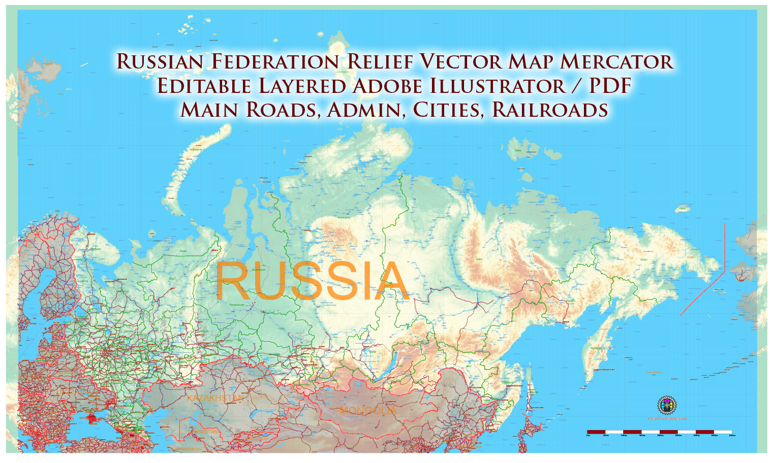
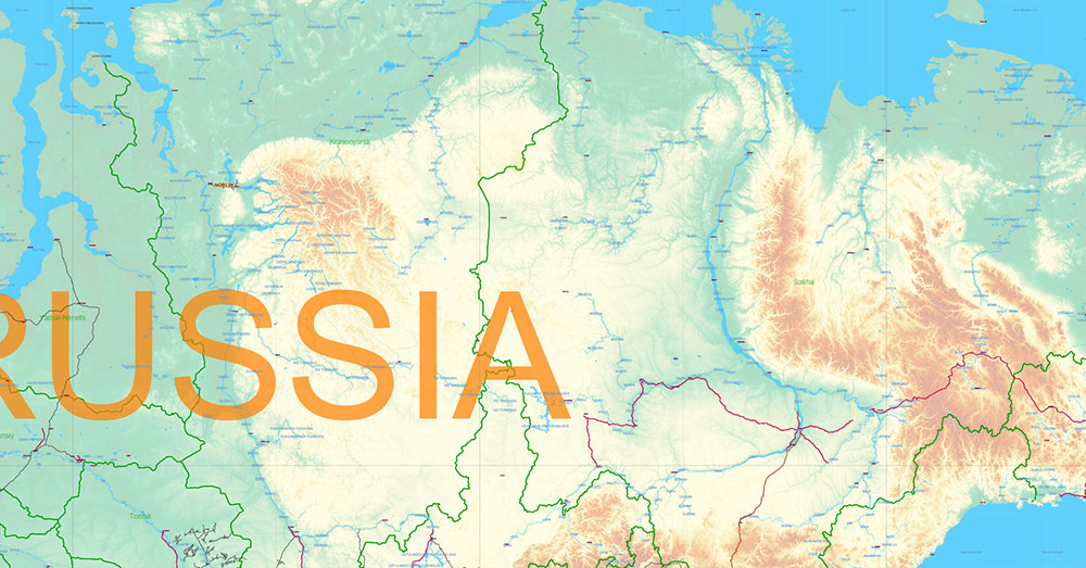
Russia Vector Map high detailed road map + Relief + admin areas + cities and main roads and railroads, water objects editable Layered Adobe Illustrator (English)
Separated layers:
- Legend
- Grids
- Names Main Cities + Halo
- Names Cities 2
- Names Water objects (areas)
- Names Admin Areas Russia
- Main roads
- Main Railroads
- Country boundaries
- Waterways
- Water areas
- Admin areas Russian Federation
- Countries Areas
- Sea
- Relief Raster JPG
- Background
AO BRIEF — Russian Federation
Overview
-
World’s largest country by area: ~17.1 million km², spans Eastern Europe → North Asia.
-
11 time zones; extreme scale drives logistics complexity.
-
Strategic depth is geographic; population and infrastructure concentrated in the western 25%.
Physical geography
-
Major regions
-
European Plain (west) — dense settlement, agriculture, industry
-
Ural Mountains — traditional Europe/Asia divide, resource zones
-
West Siberian Plain — vast lowland, oil/gas fields
-
Central Siberian Plateau — forested uplands
-
Far East — mountains, Pacific frontage
-
Hydrology
-
Major rivers: Volga (economic spine), Ob, Yenisei, Lena, Amur
-
Extensive Arctic coastline; many ports ice-restricted part of year
-
Climate
-
Predominantly continental/subarctic
-
Severe winters; permafrost in Siberia
-
Seasonal rasputitsa (mud) impacts ground mobility
Key roads & ground corridors
Primary federal highways
-
M10 highway — Moscow ↔ St. Petersburg
-
M4 Don highway — Moscow ↔ Black Sea (Rostov/Novorossiysk)
-
M5 Ural highway — Moscow → Urals
-
M7 Volga highway — Moscow → Kazan/Ufa
-
R297 Amur Highway — Trans-Siberian road segment
Characteristics
-
Western RF: multilane motorways, dense grid
-
Siberia/Far East: long single corridors; limited redundancy
-
Bridges and river crossings = critical nodes
Rail network (strategic mobility backbone)
Rail carries the majority of long-distance freight.
Major cities (population order of magnitude)
| City |
Role |
| Moscow |
Political, financial, transport hub |
| Saint Petersburg |
Baltic port, industry |
| Novosibirsk |
Siberian logistics center |
| Yekaterinburg |
Europe–Asia industrial node |
| Kazan |
Volga region hub |
| Vladivostok |
Pacific naval/commercial port |
Urban population heavily western-weighted.
Demography
-
Population: ~146 million
-
Density uneven: European RF dense, Siberia sparse
-
Aging trend; natural population decline in many regions
-
Multiethnic federation (>190 ethnic groups)
Economy (spatial logic)
-
Energy core: West Siberia oil/gas basins
-
Industry: Urals + Volga belt
-
Agriculture: Black Earth region (southwest)
-
Ports: Baltic (StP), Black Sea (Novorossiysk), Pacific (Vladivostok), Arctic terminals
Political structure
-
Federal semi-presidential republic in form; strong central executive authority in practice.
-
80+ federal subjects (oblasts, republics, krais).
-
Centralized fiscal and security apparatus.
-
Strategic orientation: Eurasian land power, focus on border periphery influence.
Environmental & operational factors
-
Extreme cold, snow, ice → mobility constraints
-
Vast distances → logistics dependent on rail
-
Limited east–west road redundancy east of Urals
-
Arctic ice, permafrost degradation affecting infrastructure
Command takeaways
-
Control of Moscow hub, Volga corridor, Trans-Siberian rail, and southern highway belt (M4/M5/M7) defines national mobility.
-
Infrastructure density drops sharply east of Urals → chokepoint reliance.
-
Rail = primary strategic transport mode.
-
Climate and terrain equal strategic actors alongside geography.
Russia Vector Map high detailed road map + Relief + admin areas + cities and main roads and railroads, water objects editable Layered Adobe Illustrator (English)
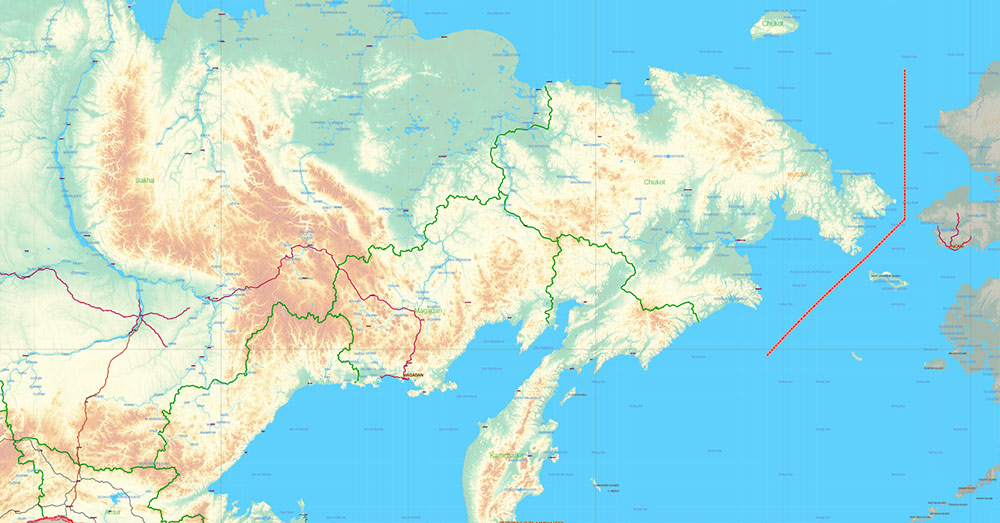
Russia Vector Map high detailed road map + Relief + admin areas + cities and main roads and railroads, water objects editable Layered Adobe Illustrator (English)

Russia Vector Map high detailed road map + Relief + admin areas + cities and main roads and railroads, water objects editable Layered Adobe Illustrator (English)
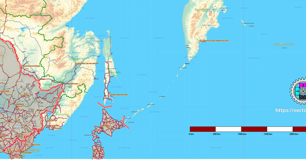
Russia Vector Map high detailed road map + Relief + admin areas + cities and main roads and railroads, water objects editable Layered Adobe Illustrator (English)
Russia Vector Map high detailed road map + Relief + admin areas + cities and main roads and railroads, water objects editable Layered Adobe Illustrator (English)
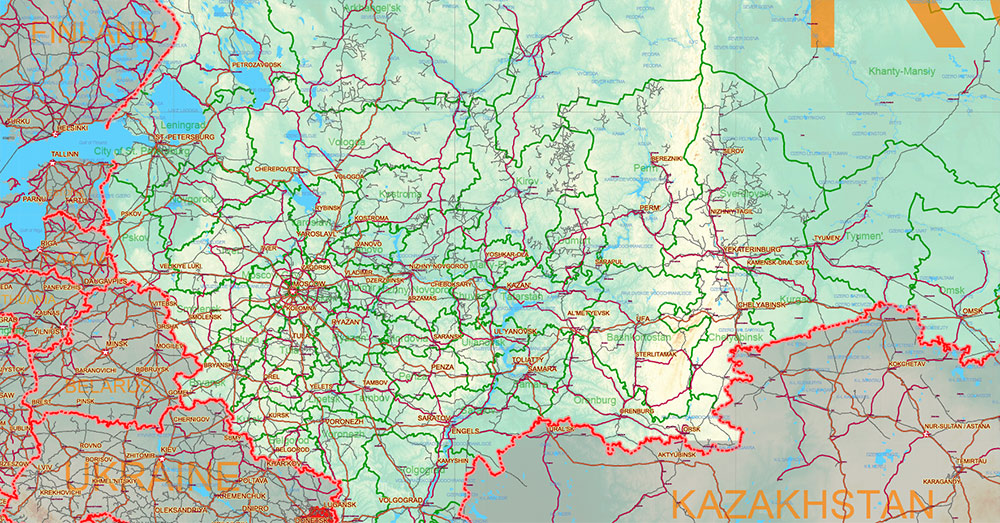
Russia Vector Map high detailed road map + Relief + admin areas + cities and main roads and railroads, water objects editable Layered Adobe Illustrator (English)
Russia Vector Map high detailed road map + Relief + admin areas + cities and main roads and railroads, water objects editable Layered Adobe Illustrator (English)
Russia Vector Map high detailed road map + Relief + admin areas + cities and main roads and railroads, water objects editable Layered Adobe Illustrator (English)
Russia Vector Map high detailed road map + Relief + admin areas + cities and main roads and railroads, water objects editable Layered Adobe Illustrator (English)

 Author: Kirill Shrayber, Ph.D. FRGS
")
")