Extended Description of the Vector Map
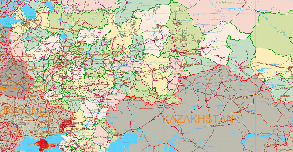
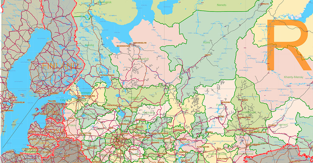
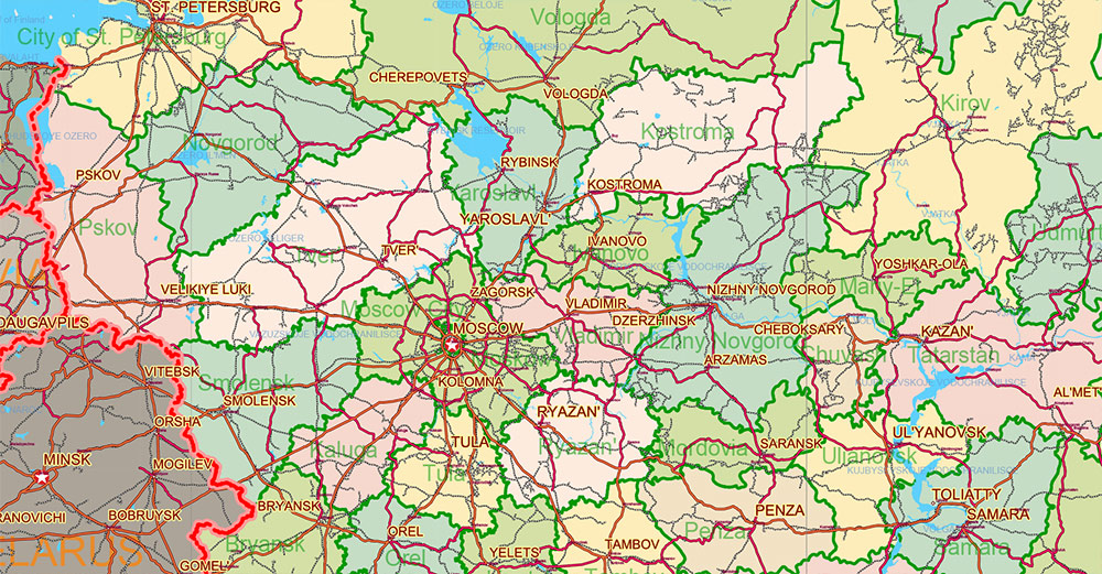
Printable PDF Vector Map of Russian Federation (English names) high detailed road map + admin areas + cities, roads, railroads and water objects, disputed areas 2026 year data, editable Layered Adobe PDF, scalable, editable text/curves format of names, 37 Mb ZIP.
Layered exact editable map: Map for publishing, design, printing, publications, arts, projects, presentations, for architects, designers, and builders, business, logistics. The most exact and detailed map. GPS correct Mercator Projection.
For printing any format.
Please note: in the preview, ALL LAYERS are enabled and visible. Of course, you can easily turn off the layers you don’t need and the map will become much simpler.
DWG, DXF, CDR, ESRI Shapes, and other formats – by request, the same price, please contact.
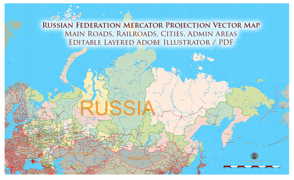
Russia PDF Vector Map high detailed road map + admin areas + cities and main roads and railroads, water objects editable Layered Adobe PDF (English)
Separated layers:
- Legend
- Grids
- Names Main Cities + Halo
- Names Cities 2
- Names Water objects (areas)
- Names Admin Areas Russia
- Main roads
- Main Railroads
- Country boundaries
- Waterways
- Water areas
- Admin areas Russian Federation
- Countries Areas
- Sea
- Background
AO BRIEF — Russian Federation
Territorial frame
-
Extent: Baltic Sea → Pacific Ocean (~9,000 km W–E), Arctic Ocean → Caucasus/Central Asia (~4,000 km N–S).
-
Area: ~17.1 M km² (≈11% of world land).
-
Time zones: 11 longitudinal belts — major mapping factor for logistics timing.
Macro-relief structure (map logic)
| Belt |
Landform |
Cartographic significance |
| East European Plain |
Lowland |
Dense settlement, agriculture, transport grid |
| Urals |
N–S mountain chain |
Natural divider, mining/industry belt |
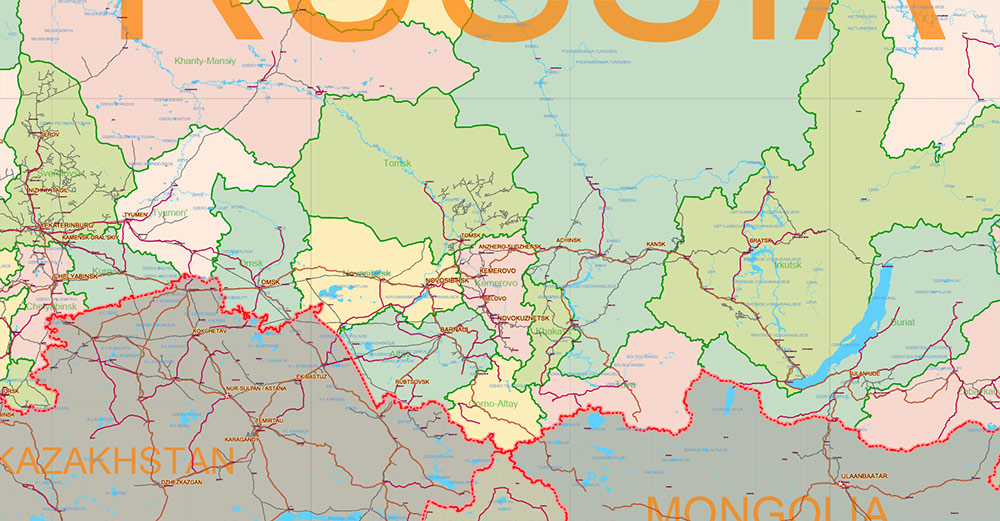
| West Siberian Plain |
Vast flat basin |
Oil/gas core, floodplains |
| Central Siberian Plateau |
Uplands/taiga |
Sparse roads, air/rail reliance |
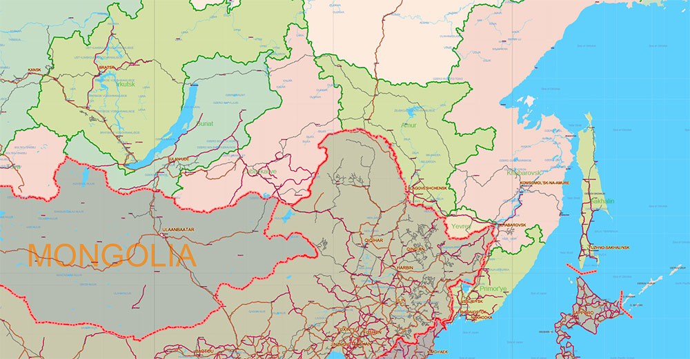
| Far East ranges |
Mountains + Pacific coast |
Linear coastal corridors |
Relief simplifies west, fragments east.
Hydrography (major linear features)
-
Volga basin — internal economic axis
-
Ob, Yenisei, Lena — north-flowing Siberian giants
-
Amur — Far East border river
Large rivers = natural barriers + corridor alignments.
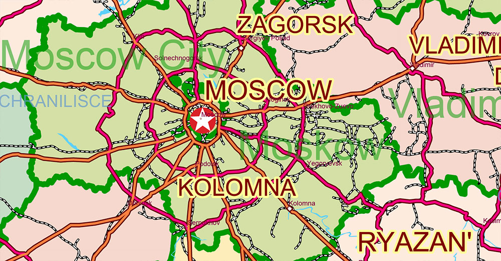
Road network morphology
European Russia (dense mesh)
Siberia / Far East (linear corridors)
Road redundancy decreases sharply east of Urals.
Rail structure (primary national skeleton)
Urban spatial pattern
Western concentration zone (core triangle):
-
Moscow
-
Saint Petersburg
-
Kazan
Ural industrial belt
Siberian nodes
Pacific terminus
Population density gradient: high west → very low east.
Economic geography (layer overlay)
| Zone |
Resource/industry layer |
| West Siberia |
Oil & gas basins |
| Urals |
Metallurgy, heavy industry |
| Volga belt |
Manufacturing, petrochemicals |
| South (Black Earth) |
Grain agriculture |
| Arctic coast |
Energy terminals |
Demographic distribution
Political-territorial grid
-
80+ federal subjects (oblasts, republics, krais)
-
Administrative borders often follow historical/ethnic lines more than physical geography
-
Centralized governance radiating from Moscow
Environmental overlays
-
Permafrost zone across north/east
-
Continental winter severity
-
Seasonal mud (rasputitsa) affecting secondary roads
-
River ice regimes impact navigation
Cartographic takeaways
-
National structure = radial-western core + single transcontinental corridor
-
Rail lines define strategic continuity; roads secondary in Siberia
-
Major rivers and mountains create natural segmentation
-
Map products should emphasize:
-
West behaves like a European network; east like a corridor-and-node system.
Russia PDF Vector Map high detailed road map + admin areas + cities and main roads and railroads, water objects editable Layered Adobe PDF (English)
Russia PDF Vector Map high detailed road map + admin areas + cities and main roads and railroads, water objects editable Layered Adobe PDF (English)
Russia PDF Vector Map high detailed road map + admin areas + cities and main roads and railroads, water objects editable Layered Adobe PDF (English)
Russia PDF Vector Map high detailed road map + admin areas + cities and main roads and railroads, water objects editable Layered Adobe PDF (English)
Russia PDF Vector Map high detailed road map + admin areas + cities and main roads and railroads, water objects editable Layered Adobe PDF (English)
Russia PDF Vector Map high detailed road map + admin areas + cities and main roads and railroads, water objects editable Layered Adobe PDF (English)

 Author: Kirill Shrayber, Ph.D. FRGS
")
")