Extended Description of the Vector Map
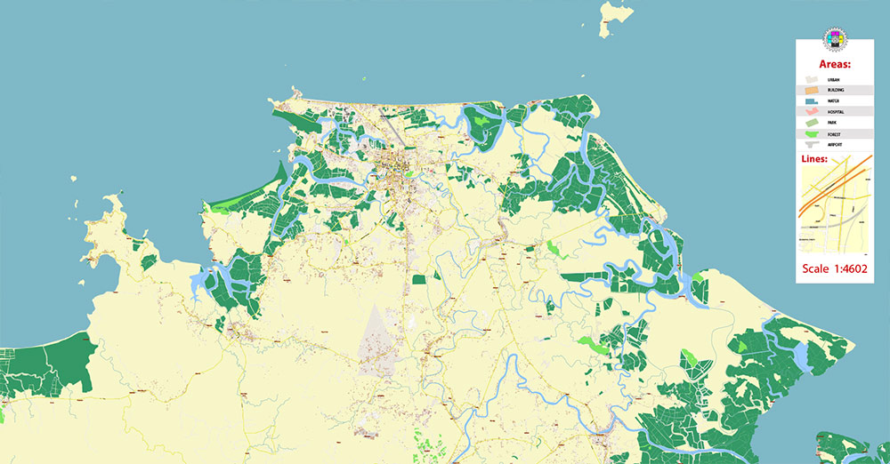
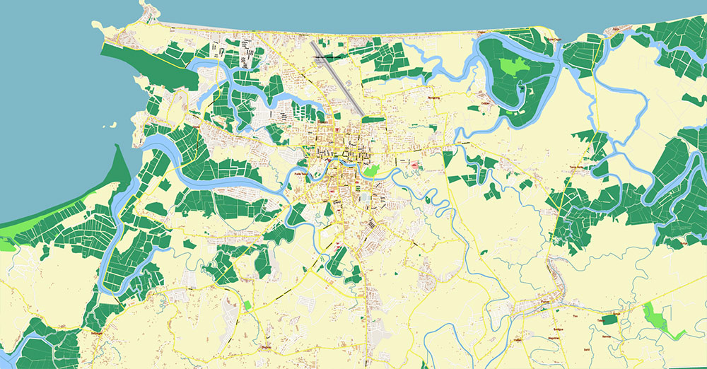
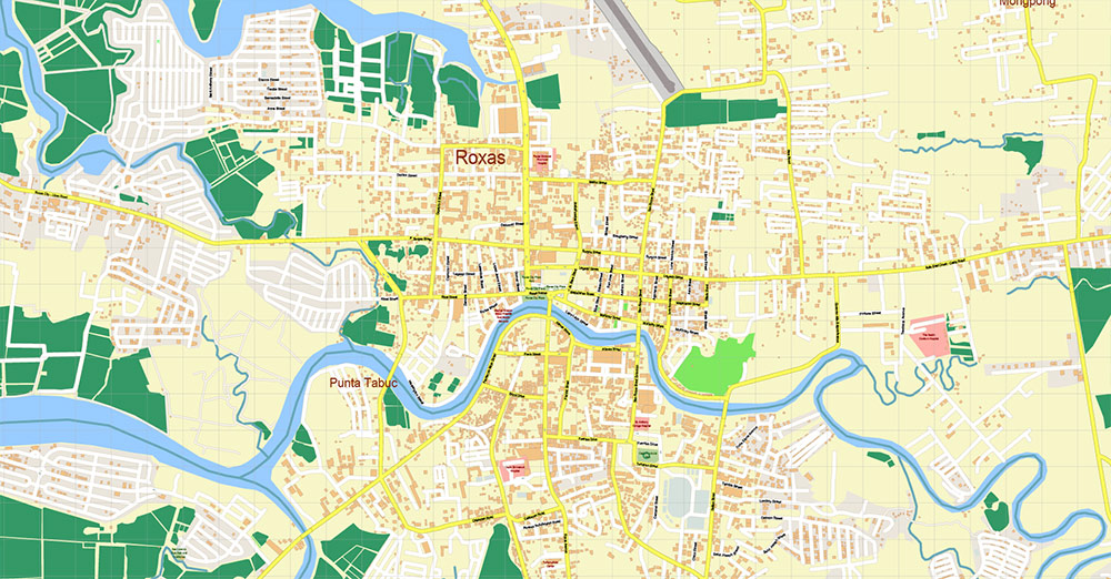
Printable Vector Map of Roxas City Philippines detailed street map scale 1:4602 full editable Adobe Illustrator scalable, text all names, 5 MB ZIP
All street names, Main Objects, Buildings. Map for design, printing, arts, projects, presentations, for architects, designers, and builders, business, logistics.
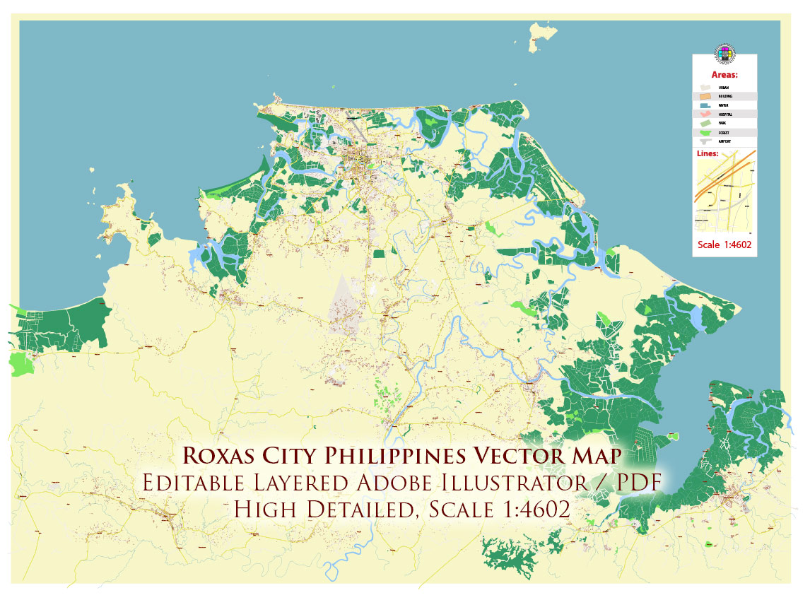
Roxas City Philippines Map Vector Exact City Plan High Detailed Street Map editable Adobe Illustrator in layers
Layers list:
- Legend and scale
- Grids
- Labels of roads
- Names of places (city, hamlet, etc.)
- Names of objects (parks, water, Hospitals)
- Names of main streets
- Names of residential streets
- Arrows of streets
- Main Streets, roads
- Residential streets
- Buildings
- Airports and Heliports
- Water objects (rivers, lakes, ponds)
- Waterways
- Color fills (parks, hospital areas, land use, etc.)
- Islands
- Background and sea
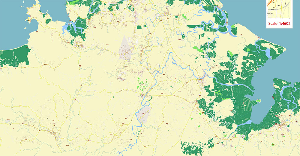
The most exact and detailed map of the city in scale.
For Editing and High-Quality Printing
AO BRIEF — ROXAS CITY (PHILIPPINES)
1. GEOGRAPHIC OVERVIEW
- Location: Northern coast of Panay Island, facing the Sibuyan Sea
- Terrain:
- Predominantly flat coastal plain
- Extensive fishponds, estuaries, mangrove belts
- Very low elevation across most of the AO
- Hydrography:
- Network of small rivers and tidal channels draining into coastal lagoons
- Urban structure:
- Central grid-based core (historic Spanish layout)
- Peripheral expansion over reclaimed or former aquaculture zones
- Operational assessment:
- High mobility terrain (no elevation barriers)
- High flood and storm surge exposure
2. KEY ROADS / LINES OF COMMUNICATION
Primary external corridors:
- Roxas City – Iloilo Road (southbound)
→ Main strategic land link to Iloilo City (regional capital)
- Panay Circumferential Road
→ Island-wide backbone connecting Roxas to Kalibo and Antique
Critical internal axes:
- Airport access road
→ Direct link between city core and Roxas Airport
- Port access (Culasi / Baybay sector)
→ Connects urban core to maritime logistics zone
Urban network:
- Rizal Street and adjacent grid
→ Administrative + commercial spine
- Secondary streets: narrow, dense, locally congested
Assessment:
- Network is functional but capacity-limited
- Strategic triangle: airport – port – city center
3. DEMOGRAPHY / HUMAN TERRAIN
- Population: ~180,000
- Density: medium (provincial urban center)
- Role:
- Capital of Capiz Province
- Regional hub for trade, services, and education
Ethno-linguistic profile:
- Capiznon / Hiligaynon majority
- High English comprehension in business sector
Economic base:
- Fishing and aquaculture (dominant)
- Agriculture (rice, coconut)
- Emerging services and BPO
Human terrain:
- Strong daytime inflow from surrounding municipalities
- Coastal communities tied to fishing economy
- Urban population concentrated in central barangays
4. TRANSPORT & LOGISTICS
Air:
- Roxas Airport
→ Domestic hub (primarily Manila connection)
→ Key for time-sensitive logistics and passenger flow
Sea:
- Culasi port and coastal facilities
→ Fishing fleets, cargo handling, inter-island movement
Land transport:
- Jeepneys — main urban and inter-town transport
- Tricycles — dominant last-mile system
- Vans/buses — regional connectivity across Panay
Logistics profile:
- Strong seafood export chain
- City operates as distribution node for northern Panay
5. CLIMATE / ENVIRONMENTAL FACTORS
- Climate: tropical maritime
- Key hazards:
- Typhoons (seasonal)
- Flooding (especially coastal and low-lying zones)
- Storm surge from Sibuyan Sea
- Vegetation: mangroves, agricultural lowlands
6. COMMAND TAKEAWAYS
- Flat coastal AO → unrestricted movement but zero natural cover
- Critical infrastructure nodes: airport, Culasi port, Iloilo road corridor
- Economy = maritime-dependent (seafood production and export)
- Urban expansion on reclaimed/fishpond land increases vulnerability
- Transport system simple, decentralized (jeepney + tricycle)
- Primary risk factor: weather disruption affecting all lines of communication

Roxas City Philippines Map Vector Exact City Plan High Detailed Street Map editable Adobe Illustrator in layers
Roxas City Philippines Map Vector Exact City Plan High Detailed Street Map editable Adobe Illustrator in layers
Roxas City Philippines Map Vector Exact City Plan High Detailed Street Map editable Adobe Illustrator in layers
Roxas City Philippines Map Vector Exact City Plan High Detailed Street Map editable Adobe Illustrator in layers
Roxas City Philippines Map Vector Exact City Plan High Detailed Street Map editable Adobe Illustrator in layers

 Author: Kirill Shrayber, Ph.D. FRGS


