Extended Description of the Vector Map
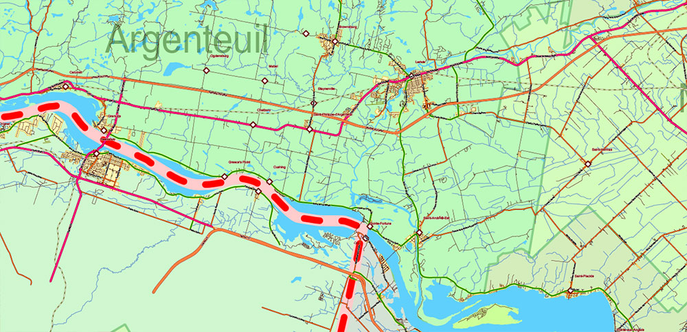
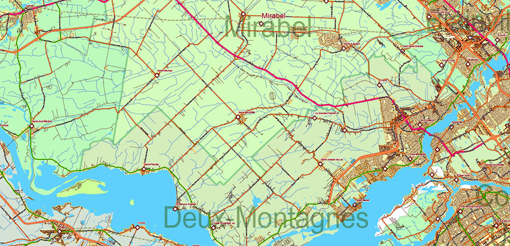
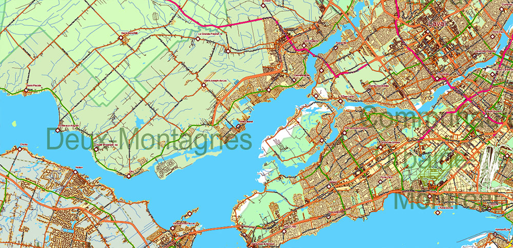
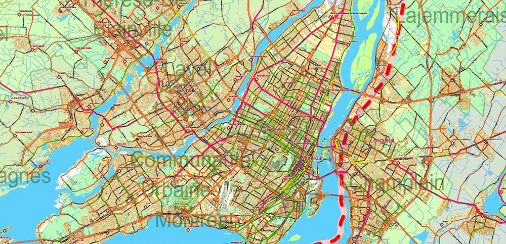
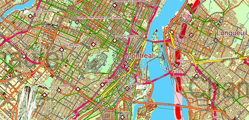
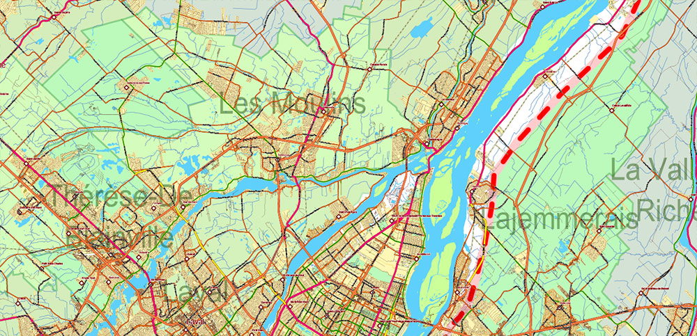
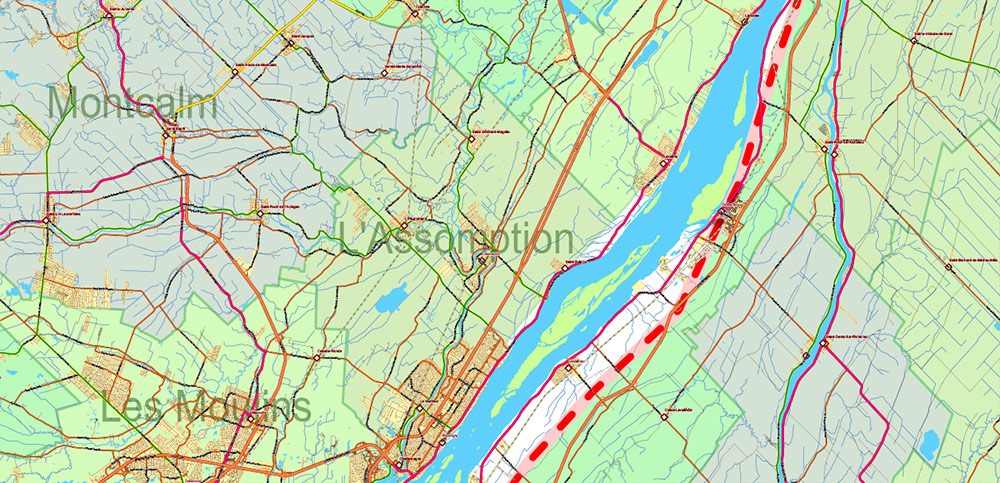
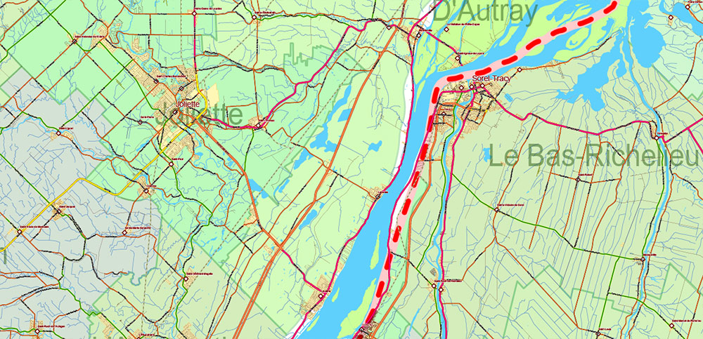
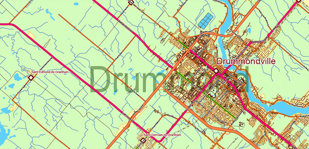
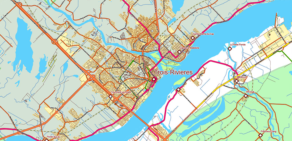
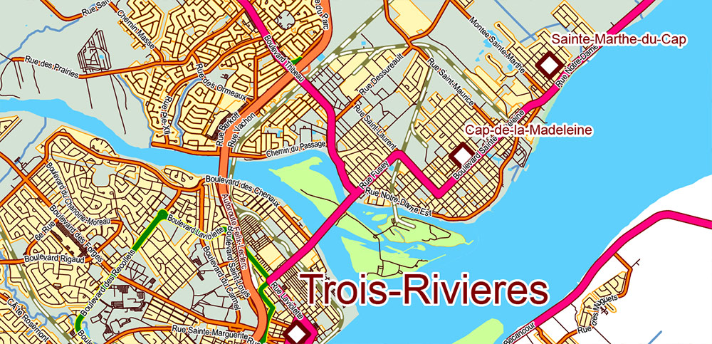
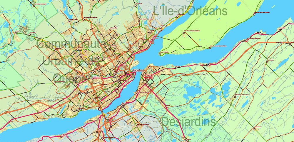
Printable PDF Vector Map of the Southern Part of Quebec Canada high detailed All road and railroad map + admin areas + all cities and towns and water objects editable Layered Adobe PDF, scalable, editable text / curves format of all names, 682 Mb ZIP, full size 744 Mb.
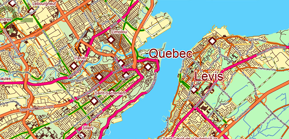
Principal streets and roads names.
Layered exact editable map: Map for publishing, design, printing, publications, arts, projects, presentations, for architects, designers, and builders, business, logistics. The most exact and detailed map. GPS correct Mercator Projection.
For printing any format.
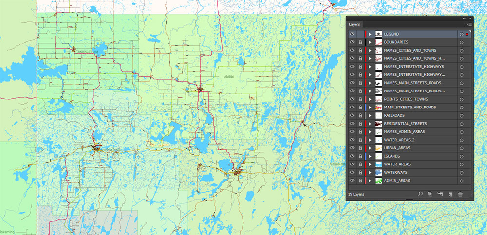
Please note: in the preview, ALL LAYERS are enabled and visible. Of course, you can easily turn off the layers you don’t need and the map will become much simpler.
DWG, DXF, CDR, ESRI Shapes, and other formats – by request, the same price, please contact.
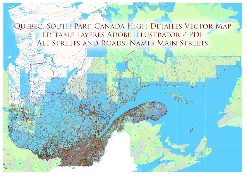
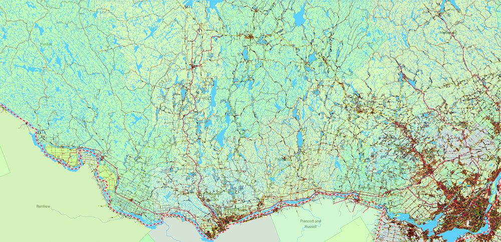
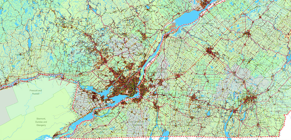
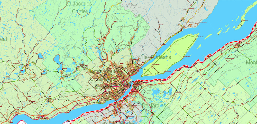
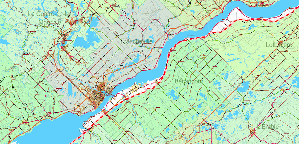
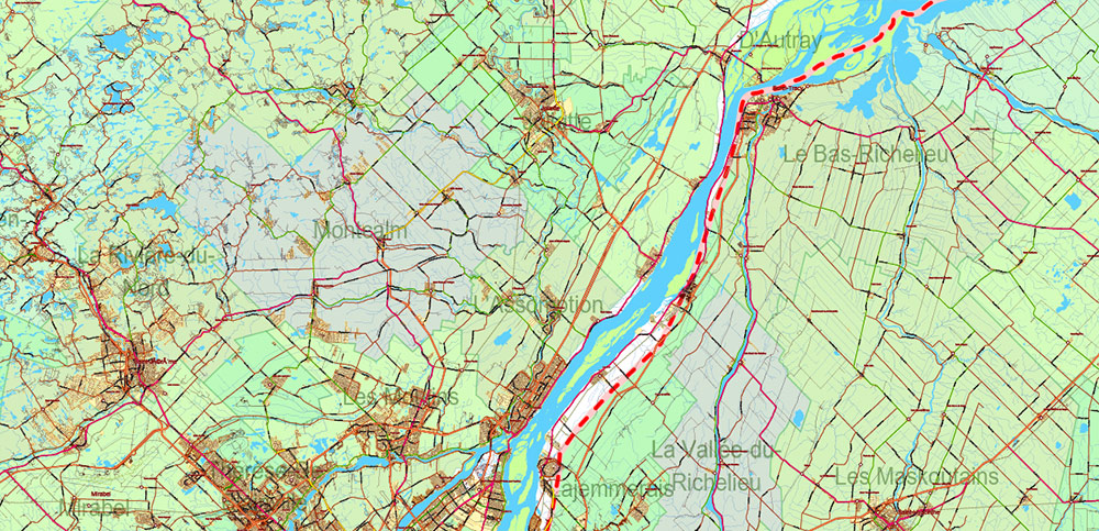
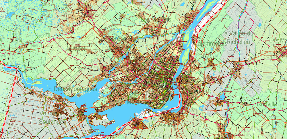
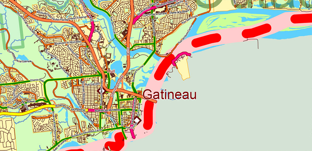
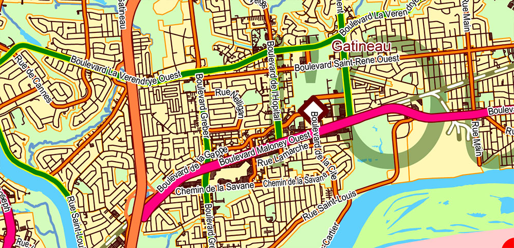
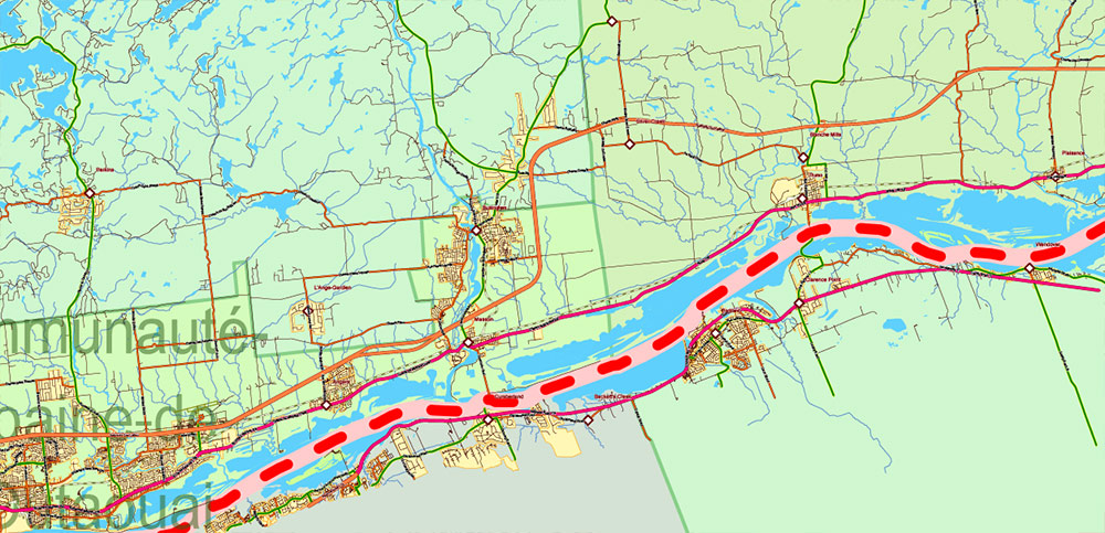
Quebec South Part Canada PDF Vector Map High Detailed All Streets and Roads all Cities and Towns Adobe PDF
Separated layers:
- Legend
- Grids
- Names Cities and Towns (with halo)
- Points Geo (all cities and towns)
- Names Principal Streets and Roads (with halo)
- Names Higways and Interstate Roads (with halo)
- Names admin areas
- Urban areas
- Main roads and Streets
- Residential roads and streets
- Railroads
- Province boundaries
- Waterways
- Water areas 2
- Islands and swamp areas
- Water areas
- Admin areas (color polygons)
Quebec South Part Canada PDF Vector Map High Detailed All Streets and Roads all Cities and Towns Adobe PDF
Quebec South Part Canada PDF Vector Map High Detailed All Streets and Roads all Cities and Towns Adobe PDF
Quebec South Part Canada PDF Vector Map High Detailed All Streets and Roads all Cities and Towns Adobe PDF
Quebec South Part Canada PDF Vector Map High Detailed All Streets and Roads all Cities and Towns Adobe PDF

Quebec South Part Canada PDF Vector Map High Detailed All Streets and Roads all Cities and Towns Adobe PDF

Quebec South Part Canada PDF Vector Map High Detailed All Streets and Roads all Cities and Towns Adobe PDF
Quebec South Part Canada PDF Vector Map High Detailed All Streets and Roads all Cities and Towns Adobe PDF
Quebec South Part Canada PDF Vector Map High Detailed All Streets and Roads all Cities and Towns Adobe PDF
Quebec South Part Canada PDF Vector Map High Detailed All Streets and Roads all Cities and Towns Adobe PDF
Quebec South Part Canada PDF Vector Map High Detailed All Streets and Roads all Cities and Towns Adobe PDF
Quebec South Part Canada PDF Vector Map High Detailed All Streets and Roads all Cities and Towns Adobe PDF
Quebec South Part Canada PDF Vector Map High Detailed All Streets and Roads all Cities and Towns Adobe PDF
Quebec South Part Canada PDF Vector Map High Detailed All Streets and Roads all Cities and Towns Adobe PDF
Quebec South Part Canada PDF Vector Map High Detailed All Streets and Roads all Cities and Towns Adobe PDF
Quebec South Part Canada PDF Vector Map High Detailed All Streets and Roads all Cities and Towns Adobe PDF
Quebec South Part Canada PDF Vector Map High Detailed All Streets and Roads all Cities and Towns Adobe PDF
Quebec South Part Canada PDF Vector Map High Detailed All Streets and Roads all Cities and Towns Adobe PDF
Quebec South Part Canada PDF Vector Map High Detailed All Streets and Roads all Cities and Towns Adobe PDF

Quebec South Part Canada PDF Vector Map High Detailed All Streets and Roads all Cities and Towns Adobe PDF
Quebec South Part Canada PDF Vector Map High Detailed All Streets and Roads all Cities and Towns Adobe PDF
Quebec South Part Canada PDF Vector Map High Detailed All Streets and Roads all Cities and Towns Adobe PDF
Quebec South Part Canada PDF Vector Map High Detailed All Streets and Roads all Cities and Towns Adobe PDF
Quebec South Part Canada PDF Vector Map High Detailed All Streets and Roads all Cities and Towns Adobe PDF
Quebec South Part Canada PDF Vector Map High Detailed All Streets and Roads all Cities and Towns Adobe PDF
Quebec South Part Canada PDF Vector Map High Detailed All Streets and Roads all Cities and Towns Adobe PDF
Quebec South Part Canada PDF Vector Map High Detailed All Streets and Roads all Cities and Towns Adobe PDF

 Author: Kirill Shrayber, Ph.D. FRGS