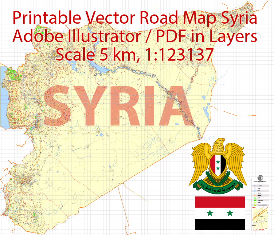
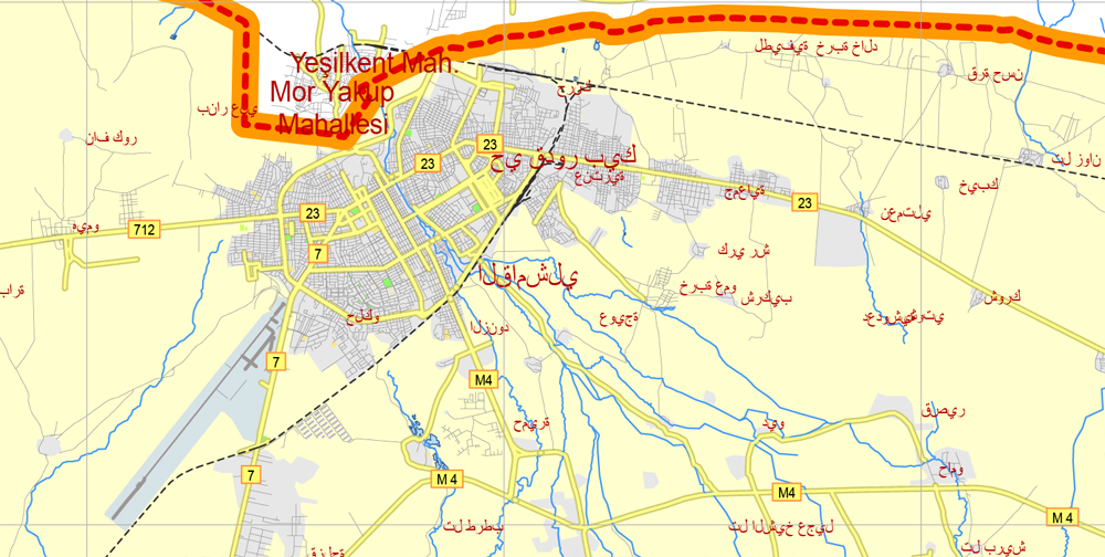
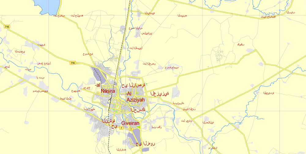
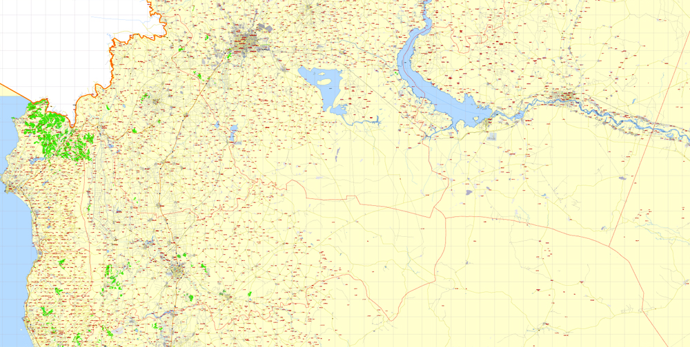
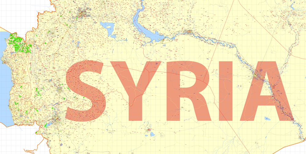
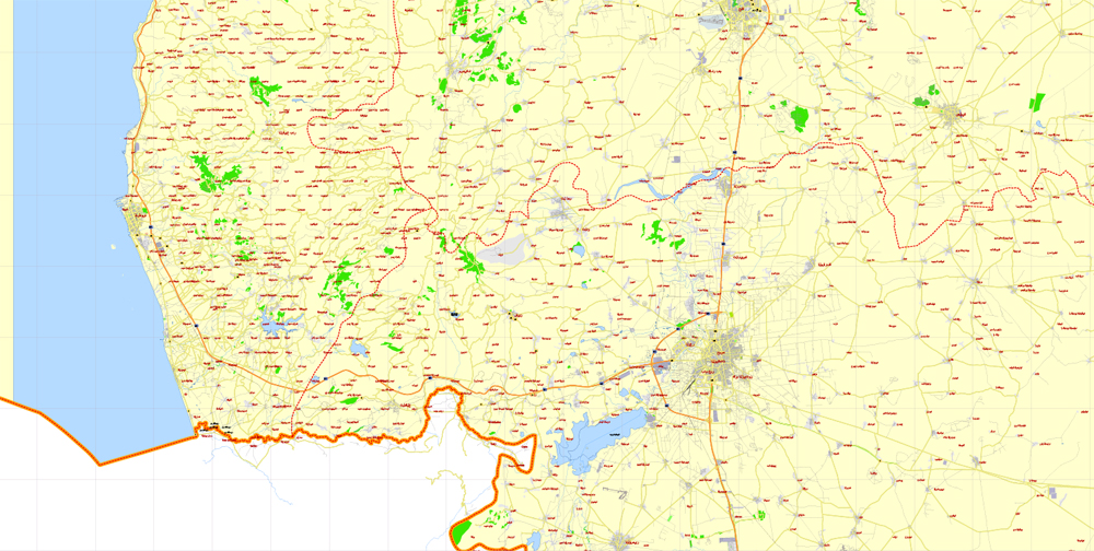
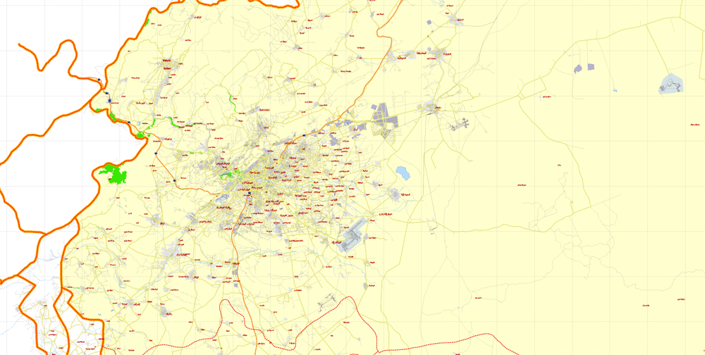
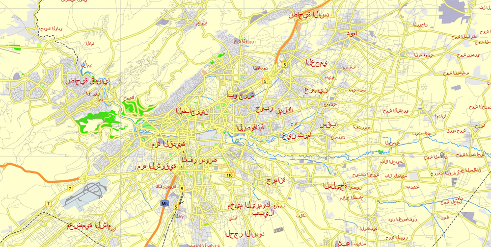
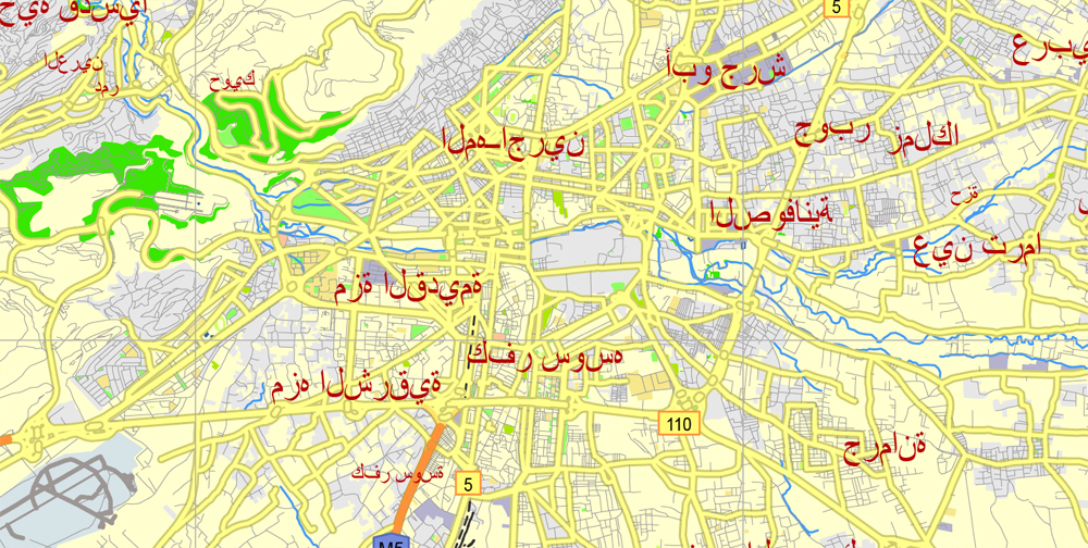
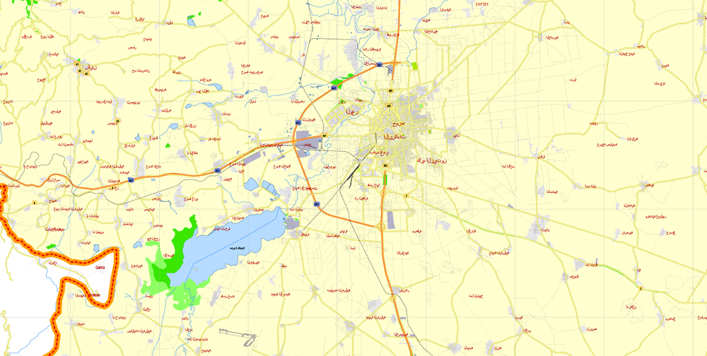
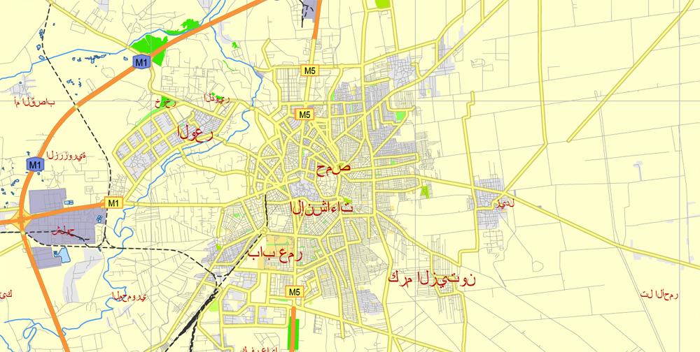
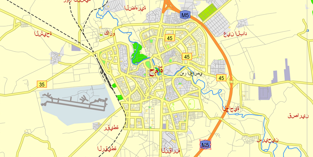
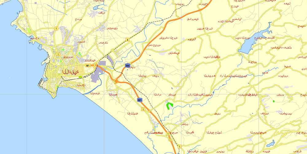
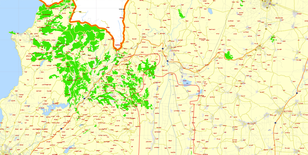
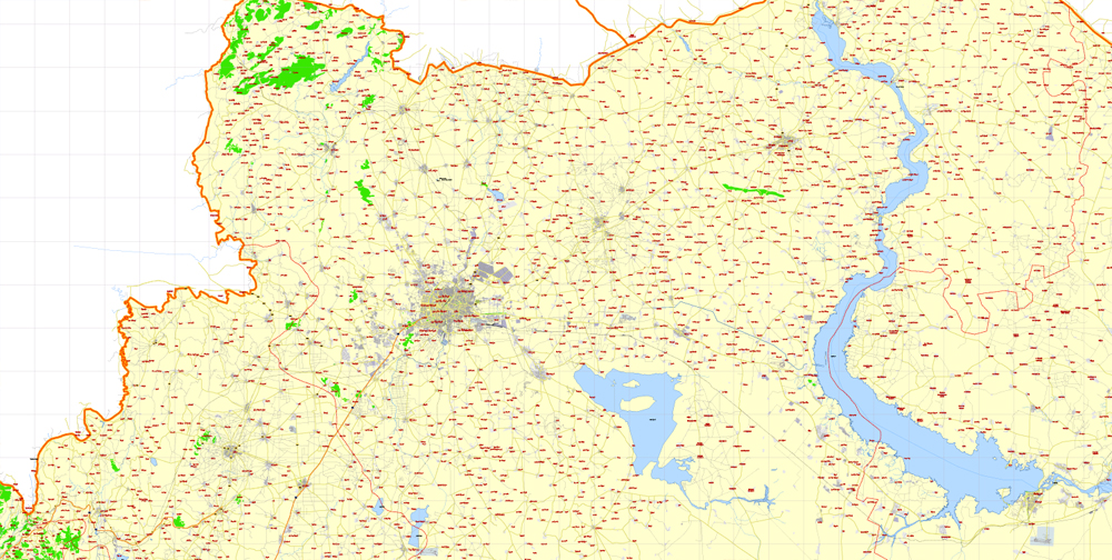
Printable Vector Map Syria, 5 km scale Road Map editable Country Plan, Adobe Illustrator, scalable, editable text format all names, 21 mb ZIP
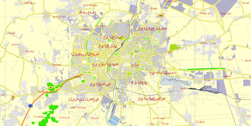
All street and roads, main objects. Map for publishing, design, printing, publications, arts, media, projects, presentations, for architects, designers and builders, business, logistics. The most exact and detailed map of the Syria.
Layers: color_fills, streets_roads, labels_roads, names_places, grids, legend.
Syria.
This vector map of Syria is used as a basis for design, editing, and further printing.
This is the most detailed, exact map of Syria for high-quality printing and polygraphy. You can always clarify the map development date by contacting us.
For your convenience, all objects on Syria vector map are divided into layers. And the editing is very easy – colors, lines, etc.
You can easily add any objects needed (e.g. shops, salons, sale points, gas station or attraction) on any layer of Syria vector map.
Syria is a country in Western Asia, bordering Lebanon and the Mediterranean Sea to the west, Turkey to the north, Iraq to the east, Jordan to the south, and Israel to the southwest. A country of fertile plains, high mountains, and deserts, Syria is home to diverse ethnic and religious groups, including Syrian Arabs, Greeks, Armenians, Assyrians, Kurds, Circassians, Mandeans and Turks. Religious groups include Sunnis, Christians, Alawites, Druze, Isma’ilis, Mandeans, Shiites, Salafis, Yazidis, and Jews. Sunni make up the largest religious group in Syria.
One of the advantages of Syria vector maps of our production is the relevance of cartographic data, we constantly update all our products.
This vector map of Syria is used by:
designers, layout designers, printers, advertisers and architects. Our product – vector maps – is designed for further editing and printing in large formats – from @Wall format (a few meters) to A-0 and A-1, A-2, A-3.
The Syria map in vector format is used for design, urban planning, presentations and media visualizations.
The advertising and presentation map of Syria (usually the final designer marks the routes, and puts the client’s objects (shops, saloons, gas stations etc.)
The undoubted advantage is that people will NEVER throw out this advertising product – the map. In fact, as an advertising medium, a map is the most “long-playing” of the well-known polygraphic advertising media, with the longest lifespan, and the maximum number of interactions with the customer.
For travelers, maps are sold at the airports and gas stations around the world. Often the source is our vector maps.
Take a look, who purchases our vector maps of Syria in “Our Clients and Friends” page – these are large and small companies, from super-brands like Volvo and Starbucks, to small design studios and printing houses.
It’s very easy to work with vector maps of Syria city, even for a not very experienced designer who can turn on and off the map layers, add new objects, change the colors of fill and lines according to customer requirements.
The undoubted advantage of Syria vector maps in printing is an excellent and detailed visualization, when customer can expand a large paper map and instantly define his location, find a landmark, an object or address on map, unlike using the popular electronic formats of Google and Yandex maps for example.
Printable vector maps of Syria are much more convenient and efficient than any electronic maps on your smartphone, because ALL DETAILS are displayed in the entire space of Syria map.
Useful tips on working with vector maps of cities and countries in Adobe Illustrator.
«V» – launches the Selection tool (cursor, black arrow), which makes active any vector line.
«А» – launches the Direct Selection tool (white cursor), allows you to select curve elements and drag them to the desired place.
«R» – activates the Rotate tool, which helps you rotating selected objects around the center point by 360 degrees.
«E» – gives you the opportunity to use the Eraser tool and erase unnecessary parts.
«X» – switches between Fill and Stroke in the Tools section. Try to get used to this hot key and
you will quickly understand that you can’t live and work without it.
Guides are not limited to vertical and horizontal in Adobe Illustrator. You can also create a diagonal guide for example. Moreover, you can turn any contours into guides. Select the outline and go to View > Guides > Make Guides (Create Guides), or simply press Cmd/Ctrl + 5. You can also turn the guides back into an editable object. Go to menu, View > Guides > Unlock Guides (Release Guides), select the guide you want to edit and select View > Guides > Release Guides (Reset Guides), or just press Cmd/Ctrl + Option / Alt + 5).
Syria is a unitary republic consisting of 14 governorates and is the only country that politically espouses Ba’athism. It is a member of one international organization other than the United Nations, the Non-Aligned Movement; it has become suspended from the Arab League on November 2011 and the Organisation of Islamic Cooperation, and self-suspended from the Union for the Mediterranean.
You will probably want to change the color scheme used on our Syria vector map.
To quickly and effectively play with colors.
Of course, you can do it manually, all objects in our Syria vector map are divided according to types and layers, and you can easily change the color gamma of vector objects in groups and layers.
But there is more effective way of working with the whole VECTOR MAP of Syria and all layers:
The overview dialog «Edit colors»/«Repaint Graphic Object» (this dialog box name can change depending on the context):
If you have selected a part or a layer of Syria vector map and open the dialog box by clicking the icon in the Control panel, on the Samples palette or the Color Catalog, or if you choose Edit > Edit Colors> Repaint Graphic Object, then the «Repaint Graphic Object» dialog box appears, and you get access to «Assign» and «Edit» tabs.
If a picture or a map fragment is not selected, and you open the dialog box by clicking the icon in the Control panel, on the Samples palette or in the Color Catalog, the «Edit Colors» dialog box appears and you can only access the «Edit» tab.
In English, the name “Syria” was formerly synonymous with the Levant (known in Arabic as al-Sham), while the modern state encompasses the sites of several ancient kingdoms and empires, including the Eblan civilization of the 3rd millennium BC. Aleppo and the capital city Damascus and are among the oldest continuously inhabited cities in the world. In the Islamic era, Damascus was the seat of the Umayyad Caliphate and a provincial capital of the Mamluk Sultanate in Egypt. The modern Syrian state was established in mid-20th century after centuries of Ottoman and a brief period French mandate, and represented the largest Arab state to emerge from the formerly Ottoman-ruled Syrian provinces. It gained de-jure independence as a parliamentary republic on 24 October 1945, when Republic of Syria became a founding member of the United Nations, an act which legally ended the former French Mandate – although French troops did not leave the country until April 1946.
Regardless of the name at the top of the dialog box, the right-hand side always displays the color group of the current document, as well as two default color groups: Print Color and Grayscale. These color groups can be selected and used any time.
Create and edit color groups of Syria vector map, and also assign colors using the «Edit Colors»/ а «Repaint Graphic Object» dialog box.
A. Creating and editing of a color group on the «Edit» tab
B. Assigning colors on the «Assign» tab
C. Select a group of colors from the «Color groups» list
The option «Repaint a graphic object» in the lower part of the dialog box allows you to preview the colors on a selected layer of Vector map, or a group of elements, and specify whether its colors will be redefined when the dialog box is closed.
The post-independence period was tumultuous, and a large number of military coups and coup attempts shook the country in the period 1949–71. In 1958, Syria entered a brief union with Egypt called the United Arab Republic, which was terminated by the 1961 Syrian coup d’état. The republic was renamed into the Arab Republic of Syria in late 1961 after December 1 constitutional referendum, and was increasingly unstable until the 1963 Ba’athist coup d’état, since which the Ba’ath Party has maintained its power. Syria was under Emergency Law from 1963 to 2011, effectively suspending most constitutional protections for citizens. Bashar al-Assad has been president since 2000 and was preceded by his father Hafez al-Assad, who was in office from 1971 to 2000.
The main areas of the dialog box are:
«Edit»
The «Edit» tab is designed to create a new or edit the existing color groups.
The harmony rules Menu and the Color Wheel are used to conduct experiments with color harmonies. The color wheel shows how colors are related in color harmony, and the color bars allow you to view and manipulate an individual color values. In addition, you can adjust the brightness, add and remove colors, save color groups and view colors on the selected Vector Map of Syria or a separated layers.
«Assign»
The «Assign» tab is used to view and control on how the original colors are replaced with colors from the color group like your corporate colors in the Vector Map of Syria city.
The assign color ability is provided only if the entire map, layer or fragment is selected in the document. You can specify which of new colors replace the current colors, whether the spot colors should be preserved and how colors are replaced (for example, you can replace colors completely or changing the color tone while maintaining the brightness). The «Assign» tab allows you to redefine colors in the Vector Map of Syria city, or in separate layers and fragments using the current color group or reducing the number of colors in the current Vector Map.
Since March 2011, Syria has been embroiled in an armed conflict, with a number of countries in the region and beyond involved militarily or otherwise. As a result, a number of self-proclaimed political entities have emerged on Syrian territory, including the Syrian opposition, Rojava, Tahrir al-Sham and Islamic State of Iraq and the Levant. Syria is ranked last on the Global Peace Index, making it the most violent country in the world due to the war, although life continues normally for most of its citizens as of December 2017. The war caused 470,000 deaths (February 2016 SCPR estimate), 7.6 million internally displaced people (July 2015 UNHCR estimate) and over 5 million refugees (July 2017 registered by UNHCR), making population assessment difficult in recent years.
Color groups
Is a list of all saved color groups for current document (the same groups appear in the «Samples» palette). You can edit and delete the existing color groups, as well as creating a new ones using the list of “Color Groups” in the dialog box. All changes appear in the «Samples» palette.
The highlighted color group shows, which color group is currently edited.
Any color group can be selected and edited, or used to redefine the colors in the selected vector map of Syria city, its fragments or elements.
Saving a color group adds this group to the specified list.
Opening the «Edit Colors»/«Repaint Graphic Object» dialog box.
Open the «Edit Colors»/«Repaint Graphic Object» dialog box using one of the following methods:
«Edit»> «Edit Colors»> «Repaint Graphic object» or «Repaint With Style».
Use these commands if you need to edit the colors in the selected vector map of Syria city.
«Repaint Graphic object» button on the «Control» panel.
Use this button if you need to adjust colors of Syria vector map using the а «Repaint graphic object» dialog box.
Geography
Syria lies between latitudes 32° and 38° N, and longitudes 35° and 43° E. It consists mostly of arid plateau, although the northwest part of the country bordering the Mediterranean is fairly green. The Northeast of the country “al-Jazira” and the South “Hawran” are important agricultural areas. The Euphrates, Syria’s most important river, crosses the country in the east. It is considered to be one of the fifteen states that comprise the so-called “Cradle of civilization”. Its land straddles the “northwest of the Arabian plate”.
The specified button is available if the selected vector map or its fragment contains two or more colors.
Note. This color editing method is convenient for global color adjustment in a vector map, if global colors were not used when creating a Map of Syria.
The «Edit colors» button or «Edit or apply colors» on the «Color Catalog» palette
Click this button if you need to edit colors on the «Color Catalog» palette or edit and then apply them to the selected Vector Map of Syria or its fragment.
The «Edit color group» button or «Edit or apply color group» on the «Samples» palette.
Click this button if you need to edit the colors in the specific color group or edit and apply them to the selected Vector Map of Syria or a group of its elements, for example, the whole layer “Streets and lines”. You can also double-click the color group in the Samples panel to open the dialog box.
If the map file is too large and your computer freezes or even can’t open it quickly:
1. Try to reduce the color resolution of the video card (display) to 256 colors while working with a large map.
2. Using Windows Task Manager, select all the application you don’t need, while working with map, just turn them off.
3. Launch Adobe Illustrator. (DO NOT OPEN the vector map file)
4. Start the Windows Task Manager using administrator rights > Find the “Illustrator” process > set the «real time» priority,
5. Open the file. When you see the LEGACY FONT popup window – click “OK” (do not update). You can restore the TEXT later.
6. Can also be useful: When file is opened – Edit > Settings > Basic Settings > disable smoothing. /// It looks scary, but works quickly)))
We recommend saving the file in Adobe Illustrator 10 version. It’s much more stable when working with VERY BIG size files.
The climate in Syria is dry and hot, and winters are mild. Because of the country’s elevation, snowfall does occasionally occur during winter. Petroleum in commercial quantities was first discovered in the northeast in 1956. The most important oil fields are those of Suwaydiyah, Qaratshui, Rumayian, and Tayyem, near Dayr az–Zawr. The fields are a natural extension of the Iraqi fields of Mosul and Kirkuk. Petroleum became Syria’s leading natural resource and chief export after 1974. Natural gas was discovered at the field of Jbessa in 1940.
Syria is located in Southwestern Asia, north of the Arabian Peninsula, at the eastern end of the Mediterranean Sea. It is bordered by Turkey to the north, Lebanon and Israel to the west and southwest, Iraq to the east, and Jordan to the south. It consists of mountain ranges in the west and a steep area inland. In the east is the Syrian Desert and in the south is the Jabal al-Druze Range. The former is bisected by the Euphrates valley. A dam built in 1973 on the Euphrates created a reservoir named Lake Assad, the largest lake in Syria.
The highest point in Syria is Mount Hermon (2,814 m; 9,232 ft) on the Lebanese border. Between the humid Mediterranean coast and the arid desert regions lies a semiarid steep zone extending across three-quarters of the country, which receives hot, dry winds blowing across the desert. Syria is extensively depleted, with 28 percent of the land arable, 4 percent dedicated to permanent crops, 46 percent utilized as meadows and pastures, and only 3 percent forest and woodland.
Syria is divided into fourteen governorates, or muhafazat (singular: muhafazah). The governorates are divided into a total of sixty districts, or manatiq (sing. mintaqah), which are further divided into sub-districts, or nawahi (sing. nahiya). The capital Damascus is the second largest city in Syria, and the metropolitan area is a governorate on its own. Aleppo (population 2,301,570) in northern Syria is the largest city. Latakia along with Tartus are Syria’s main ports on the Mediterranean Sea.
Geographical regions
The area includes about 185,180 square kilometers of deserts, plains, and mountains. It is divided into a coastal zone—with a narrow, double mountain belt enclosing a depression in the west—and a much larger eastern plateau. The climate is predominantly dry; about three-fifths of the country has less than 250 millimeters (9.84 in) of rain a year. Fertile land is the state’s most important natural resource, and efforts have been made to increase the amount of arable land through irrigation projects.
Coastal plain
Along the Mediterranean, a narrow coastal plain stretches south from the Turkish border to Lebanon. The flatness of this littoral, covered with sand dunes, is broken only by lateral promontories running down from the mountains to the sea. The major ports are Latakia and Tartous. Syria claimed a territorial limit of 35 nautical miles (64.8 km; 40.3 mi) off its Mediterranean coastline. However, in 2003, Syria unilaterally declared its maritime zones, adhering to the 12 nautical miles allowed by the United Nations Law of the Sea.
Topography of Syria
The Jabal an Nusayriyah, a mountain range paralleling the coastal plain, has an average elevation of just over 1,212 meters above sea level; the highest peak, Nabi Yunis, is about 1,575 meters above sea level. The western slopes catch moisture-laden western sea winds and are thus more fertile and more heavily populated than the eastern slopes, which receive only hot, dry winds blowing across the desert. Before reaching the Lebanese border and the Anti-Lebanon Mountains, the Jabal an Nusayriyah range terminates, leaving a corridor—the Homs Gap—through which run the highway and railroad from Homs to the Lebanese port of Tripoli.
For centuries the Homs Gap has been a favorite trade and invasion route from the coast to the country’s interior and to other parts of Asia. Eastward, the line of al-Ansariyah mountains is separated from the Jabal az Zawiyah range and the plateau region by the Al Ghab valley, a fertile, irrigated trench crossed by the meandering Orontes River.
Inland and farther south, the Anti-Lebanon Mountains rise to peaks of over 2,700 meters above sea level on the Syrian-Lebanese frontier and spread in spurs eastward toward the plateau region. The eastern slopes have little rainfall and vegetation and merge eventually with the desert.
In the southwest, the lofty Mount Hermon (Jabal ash Shaykh), also on the border between Syria and Lebanon, descends to the Hawran Plateau that receives rain-bearing winds from the Mediterranean. All but the lowest slopes of Mount Hermon are uninhabited, however. Volcanic cones, some of which reach over 900 meters, intersperse the open, rolling, once-fertile Hawran Plateau south of Damascus and east of the Anti-Lebanon Mountains. Southwest of the Hawran lies the high volcanic region of the Jabal al-Druze range home of the country’s Druze population. This is part of the Harrat ash Shaam volcanic field that stretches all the way to Saudi Arabia. Northeast of Jabal al-Druze is a large lava field called Al-Safa that stands out in satellite views.
Eastern plateau
The entire eastern plateau region is intersected by a low chain of mountains, the Jabal ar Ruwaq, the Jabal Abu Rujmayn, and the Jebel Bishri, extending northeastward from the Jabal Al Arab to the Euphrates. South of these mountains lies a barren desert region known as the Hamad. North of the Jabal ar Ruwaq and east of the city of Homs is another barren area known as the Homs Desert, which has a hard-packed dirt surface.
Northeast of the Euphrates, which originates in the mountains of Turkey and flows diagonally across Syria into Iraq, is the fertile Jazira region. This region is watered by two tributaries to the Euphrates, the Balikh and the Khabur. The area underwent irrigation improvements during the 1960s and 1970s, and it provides substantial cereal and cotton crops. Oil and natural gas discoveries in the extreme northeastern portion of the Jazira have significantly enhanced the region’s economic potential.
Syria
Country in the Middle East
Syria, officially known as the Syrian Arab Republic is a country in Western Asia, bordering Lebanon and the Mediterranean Sea to the west, Turkey to the north, Iraq to the east, Jordan to the south, and Israel to the southwest.
Area
• Total
185,180[3] km2 (71,500 sq mi) (87th)
• Water (%) 1.1
Population
• July 2014 estimate
17,064,854[4] (54th)
• Density
118.3/km2 (306.4/sq mi)

 Author: Kirill Shrayber, Ph.D. FRGS