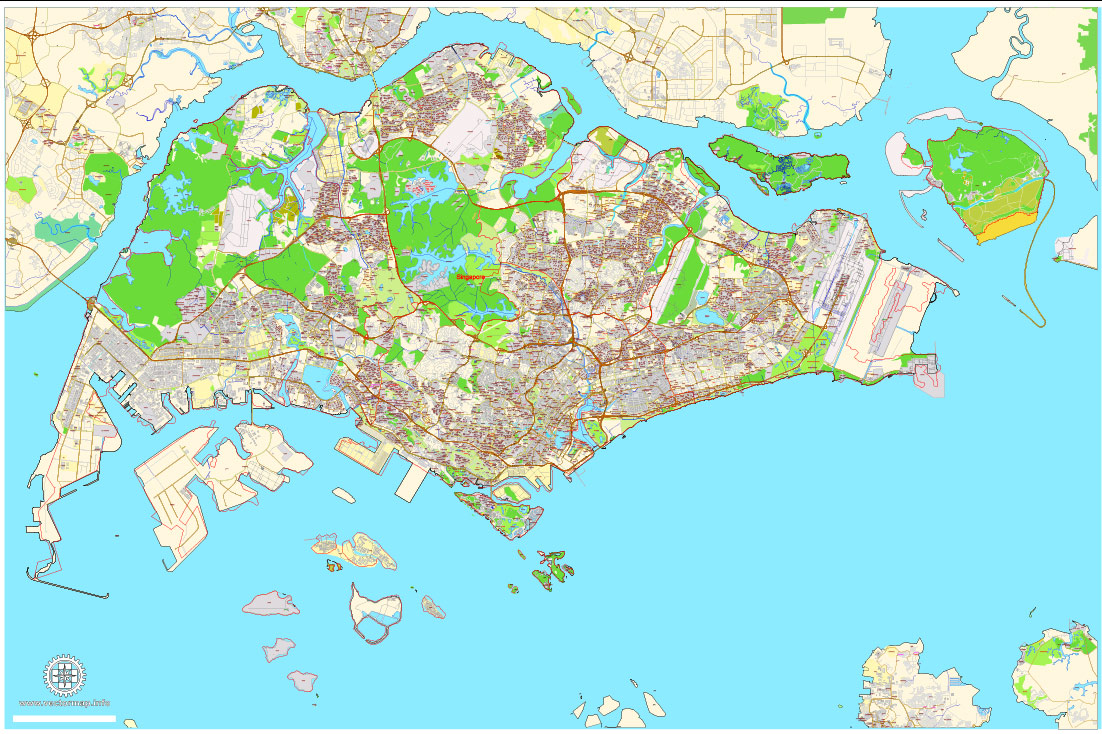
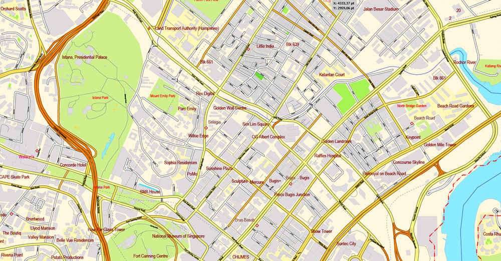
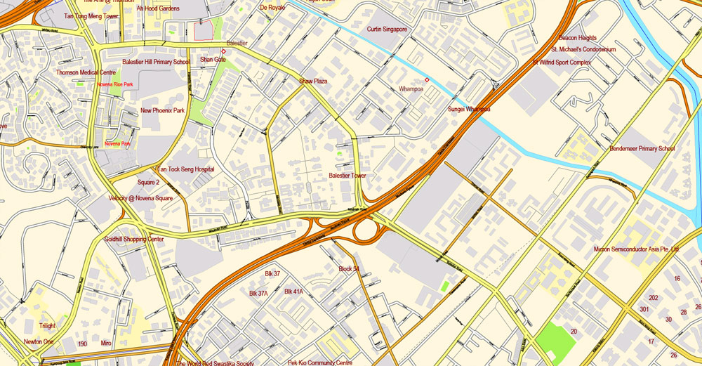
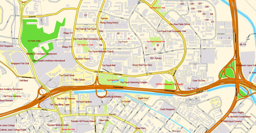
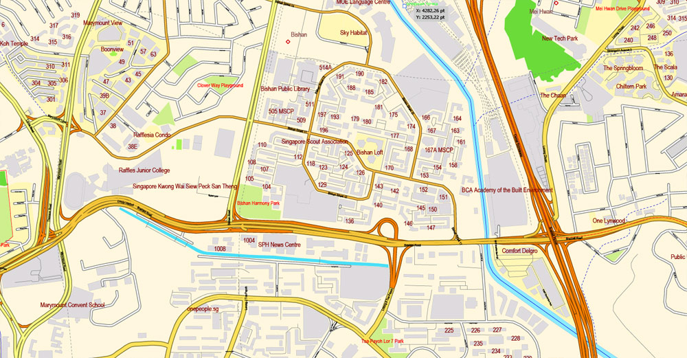
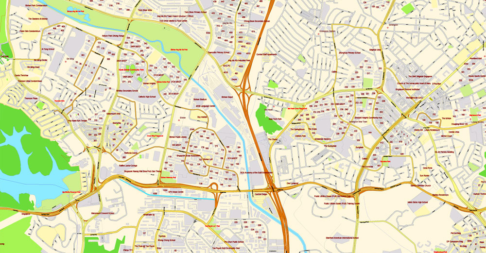
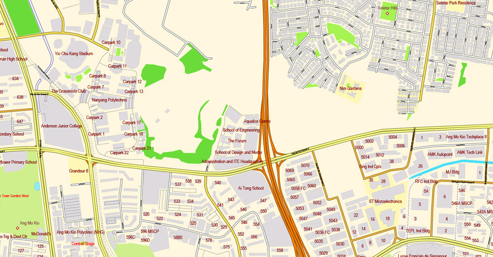
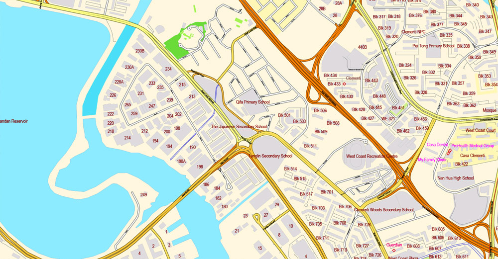
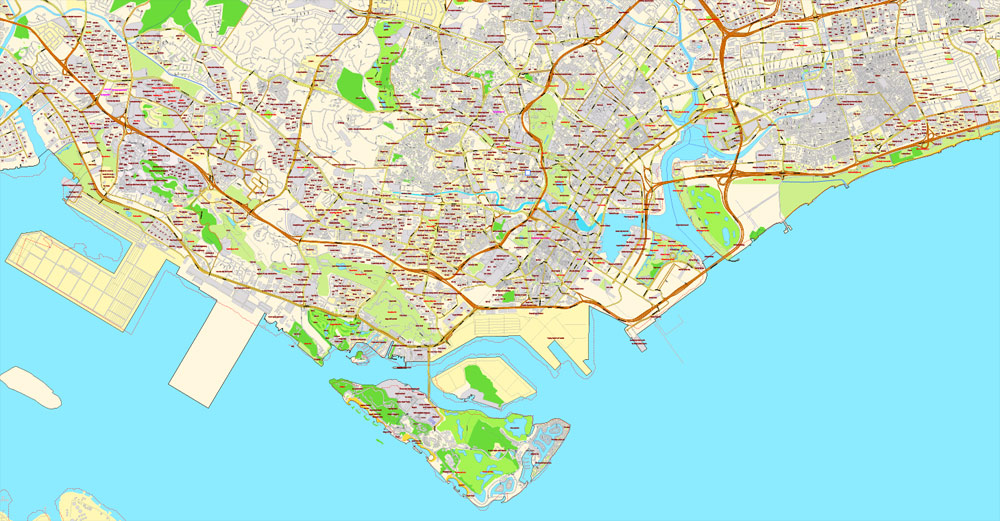
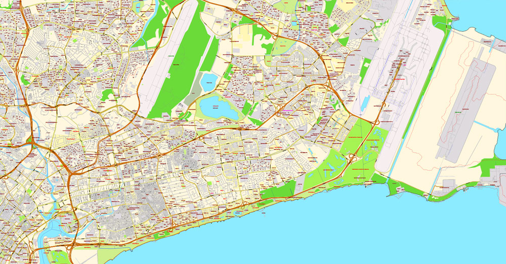
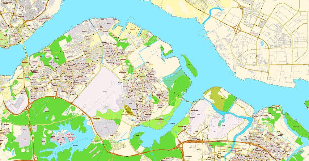
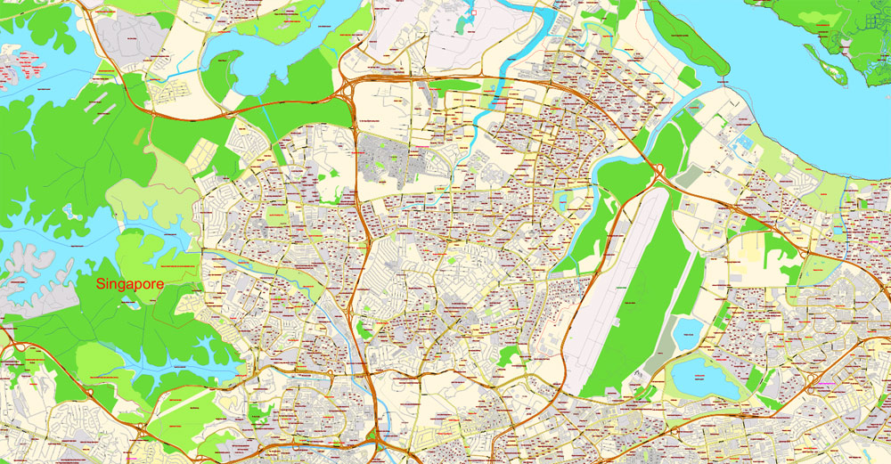
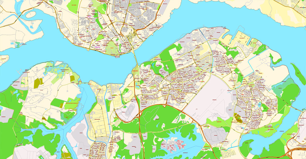
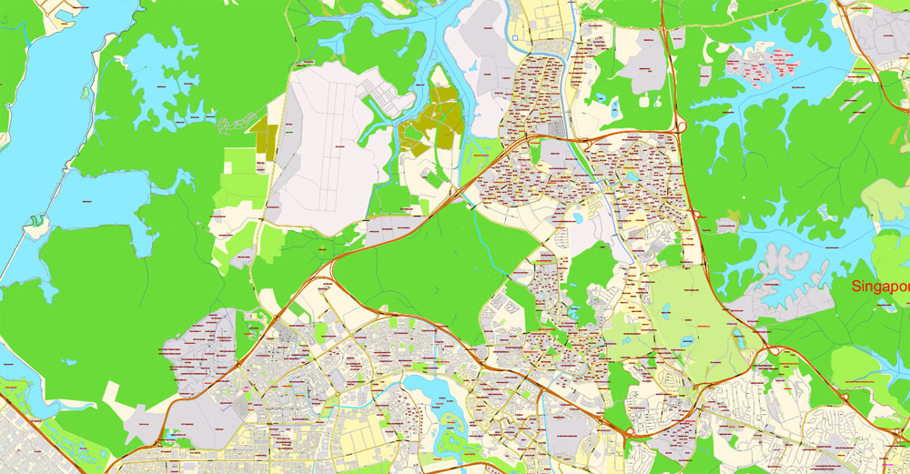
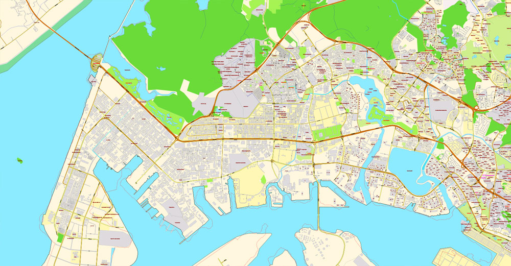
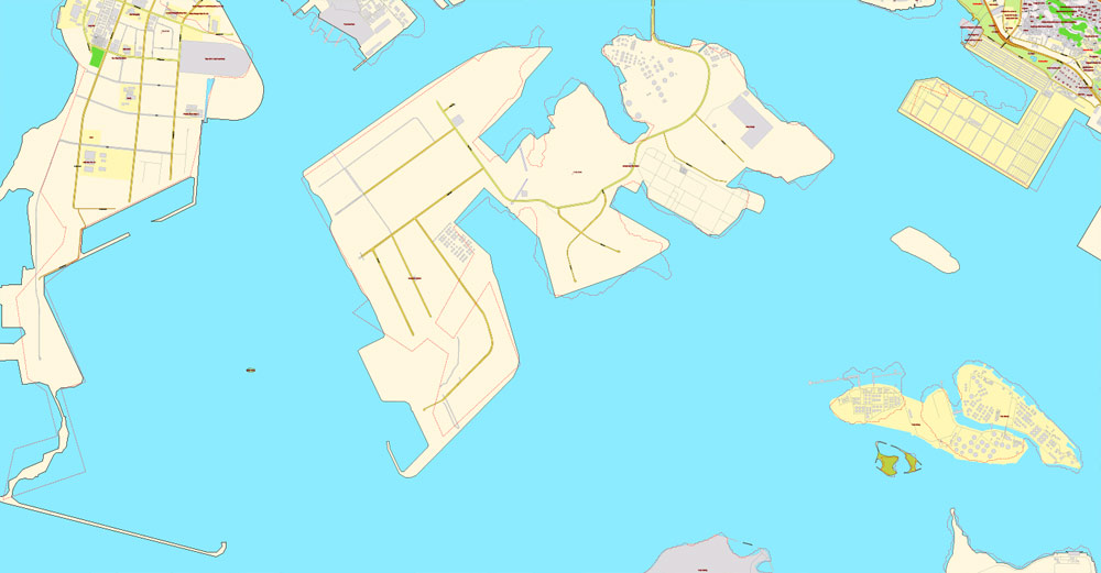
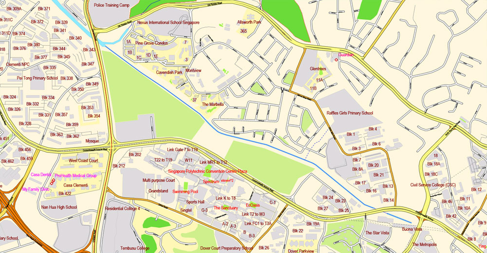
Printable Map Singapore, exact City Plan street map, full editable, Adobe illustrator, full vector, scalable, editable, text format street names, 10 mb ZIP
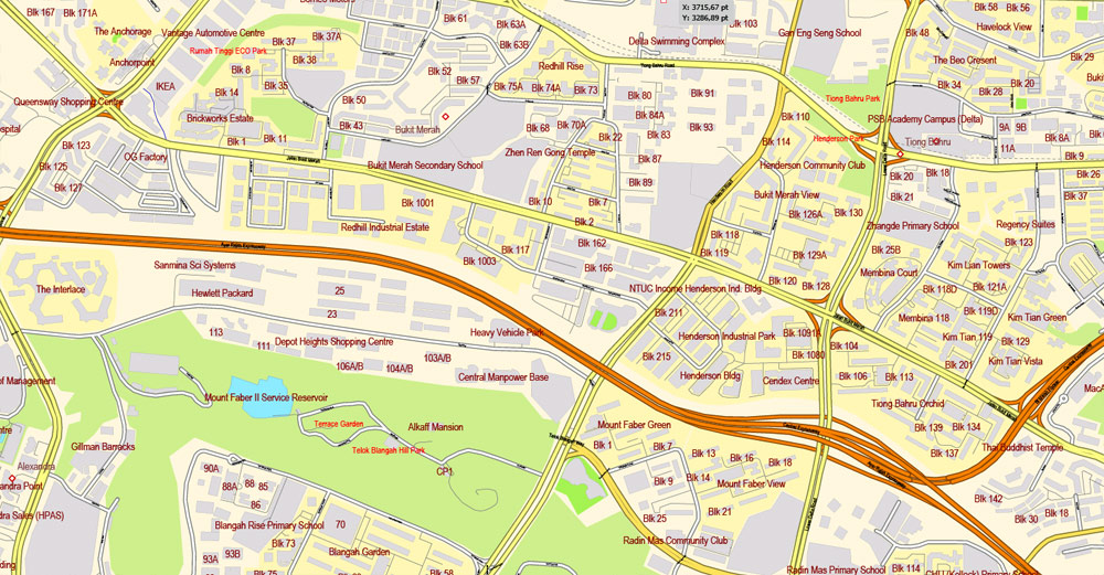
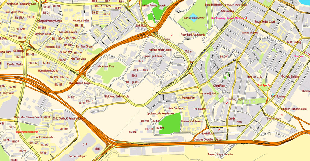
All streets, All Buildings, lot of objects. Map for publishing, design, print, arts, projects, presentations, for architects, designers and builders. Royalty Free.
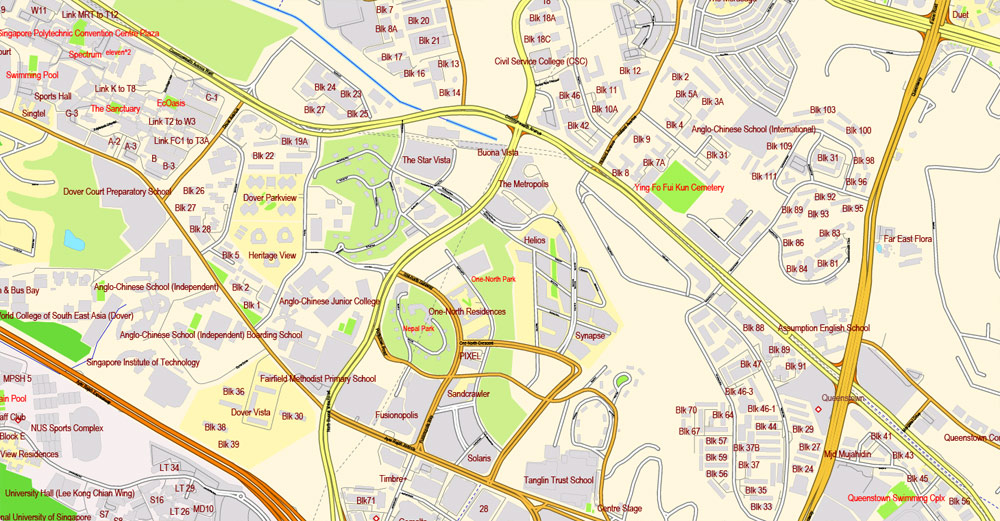
Separated layers: back, color fills, names 1, 2, 3, 4, streets and roads, borders.
DXF, DWG, CDR and other formats – on request, same price, please, contact
Singapore.
This vector map of Singapore is used as a basis for design, editing, and further printing.
This is the most detailed, exact map of Singapore for high-quality printing and polygraphy. You can always clarify the map development date by contacting us.
For your convenience, all objects on Singapore vector map are divided into layers. And the editing is very easy – colors, lines, etc.
You can easily add any objects needed (e.g. shops, salons, sale points, gas station or attraction) on any layer of Singapore vector map.
Singapore is a sovereign city-state and island country in Southeast Asia. It lies one degree (137 kilometres or 85 miles) north of the equator, at the southern tip of the Malay Peninsula, with Indonesia’s Riau Islands to the south and Peninsular Malaysia to the north. Singapore’s territory consists of one main island along with 62 other islets. Since independence, extensive land reclamation has increased its total size by 23% (130 square kilometres or 50 square miles). The country is known for its transition from third world to first world in a single generation, under the leadership of its founding father, Lee Kuan Yew.
One of the advantages of Singapore vector maps of our production is the relevance of cartographic data, we constantly update all our products.
This vector map of Singapore is used by:
designers, layout designers, printers, advertisers and architects. Our product – vector maps – is designed for further editing and printing in large formats – from @Wall format (a few meters) to A-0 and A-1, A-2, A-3.
Singapore map in vector format is used for design, urban planning, presentations and media visualizations.
Advertising and presentation map of Singapore (usually the final designer marks the routes, and puts the client’s objects (shops, saloons, gas stations etc.)
The undoubted advantage is that people will NEVER throw out this advertising product – the map. In fact, as an advertising medium, a map is the most “long-playing” of the well-known polygraphic advertising media, with the longest lifespan, and the maximum number of interactions with the customer.
For travelers, maps are sold at the airports and gas stations around the world. Often the source is our vector maps.
Take a look, who purchases our vector maps of Singapore in “Our Clients and Friends” page – these are large and small companies, from super-brands like Volvo and Starbucks, to small design studios and printing houses.
It’s very easy to work with vector maps of Singapore, even for a not very experienced designer who can turn on and off the map layers, add new objects, change the colors of fill and lines according to customer requirements.
Stamford Raffles founded colonial Singapore in 1819 as a trading post of the British East India Company. After the company’s collapse in 1858, the islands were ceded to the British Raj as a crown colony. During the Second World War, Singapore was occupied by Japan. It gained independence from the UK in 1963 by federating with other former British territories to form Malaysia, but separated two years later over ideological differences, becoming a sovereign nation in 1965. After early years of turbulence and despite lacking natural resources and a hinterland, the nation developed rapidly as an Asian Tiger economy, based on external trade and its workforce.
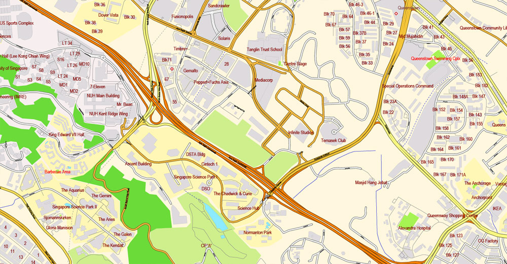
The undoubted advantage of Singapore vector maps in printing is an excellent and detailed visualization, when customer can expand a large paper map and instantly define his location, find a landmark, an object or address on map, unlike using the popular electronic formats of Google and Yandex maps for example.
Printable vector maps of Singapore are much more convenient and efficient than any electronic maps on your smartphone, because ALL DETAILS are displayed in the entire space of Singapore map.
Useful tips on working with vector maps of cities and countries in Adobe Illustrator.
«V» – launches the Selection tool (cursor, black arrow), which makes active any vector line.
«А» – launches the Direct Selection tool (white cursor), allows you to select curve elements and drag them to the desired place.
«R» – activates the Rotate tool, which helps you rotating selected objects around the center point by 360 degrees.
«E» – gives you the opportunity to use the Eraser tool and erase unnecessary parts.
«X» – switches between Fill and Stroke in the Tools section. Try to get used to this hot key and
you will quickly understand that you can’t live and work without it.
Guides are not limited to vertical and horizontal in Adobe Illustrator. You can also create a diagonal guide for example. Moreover, you can turn any contours into guides. Select the outline and go to View > Guides > Make Guides (Create Guides), or simply press Cmd/Ctrl + 5. You can also turn the guides back into an editable object. Go to menu, View > Guides > Unlock Guides (Release Guides), select the guide you want to edit and select View > Guides > Release Guides (Reset Guides), or just press Cmd/Ctrl + Option / Alt + 5).
You will probably want to change the color scheme used on our Singapore vector map.
To quickly and effectively play with colors.
Of course, you can do it manually, all objects in our Singapore vector map are divided according to types and layers, and you can easily change the color gamma of vector objects in groups and layers.
But there is more effective way of working with the whole VECTOR MAP of Singapore and all layers:
The overview dialog «Edit colors»/«Repaint Graphic Object» (this dialog box name can change depending on the context):
If you have selected a part or a layer of Singapore vector map and open the dialog box by clicking the icon in the Control panel, on the Samples palette or the Color Catalog, or if you choose Edit > Edit Colors> Repaint Graphic Object, then the «Repaint Graphic Object» dialog box appears, and you get access to «Assign» and «Edit» tabs.
If a picture or a map fragment is not selected, and you open the dialog box by clicking the icon in the Control panel, on the Samples palette or in the Color Catalog, the «Edit Colors» dialog box appears and you can only access the «Edit» tab.
Regardless of the name at the top of the dialog box, the right-hand side always displays the color group of the current document, as well as two default color groups: Print Color and Grayscale. These color groups can be selected and used any time.
Create and edit color groups of Singapore vector map, and also assign colors using the «Edit Colors»/ а «Repaint Graphic Object» dialog box.
A. Creating and editing of a color group on the «Edit» tab
B. Assigning colors on the «Assign» tab
C. Select a group of colors from the «Color groups» list
The option «Repaint a graphic object» in the lower part of the dialog box allows you to preview the colors on a selected layer of Vector map, or a group of elements, and specify whether its colors will be redefined when the dialog box is closed.
The main areas of the dialog box are:
«Edit»
The «Edit» tab is designed to create a new or edit the existing color groups.
The harmony rules Menu and the Color Wheel are used to conduct experiments with color harmonies. The color wheel shows how colors are related in color harmony, and the color bars allow you to view and manipulate an individual color values. In addition, you can adjust the brightness, add and remove colors, save color groups and view colors on the selected Vector Map of Singapore or a separated layers.
«Assign»
The «Assign» tab is used to view and control on how the original colors are replaced with colors from the color group like your corporate colors in the Vector Map of Singapore.
The assign color ability is provided only if the entire map, layer or fragment is selected in the document. You can specify which of new colors replace the current colors, whether the spot colors should be preserved and how colors are replaced (for example, you can replace colors completely or changing the color tone while maintaining the brightness). The «Assign» tab allows you to redefine colors in the Vector Map of Singapore, or in separate layers and fragments using the current color group or reducing the number of colors in the current Vector Map.
Color groups
Is a list of all saved color groups for current document (the same groups appear in the «Samples» palette). You can edit and delete the existing color groups, as well as creating a new ones using the list of “Color Groups” in the dialog box. All changes appear in the «Samples» palette.
The highlighted color group shows, which color group is currently edited.
Any color group can be selected and edited, or used to redefine the colors in the selected vector map of Singapore, its fragments or elements.
Saving a color group adds this group to the specified list.
Opening the «Edit Colors»/«Repaint Graphic Object» dialog box.
Open the «Edit Colors»/«Repaint Graphic Object» dialog box using one of the following methods:
«Edit»> «Edit Colors»> «Repaint Graphic object» or «Repaint With Style».
Use these commands if you need to edit the colors in the selected vector map of Singapore.
«Repaint Graphic object» button on the «Control» panel.
Use this button if you need to adjust colors of Singapore vector map using the а «Repaint graphic object» dialog box.
The specified button is available if the selected vector map or its fragment contains two or more colors.
Note. This color editing method is convenient for global color adjustment in a vector map, if global colors were not used when creating a Map of Singapore.
The «Edit colors» button or «Edit or apply colors» on the «Color Catalog» palette
Click this button if you need to edit colors on the «Color Catalog» palette or edit and then apply them to the selected Vector Map of Singapore or its fragment.
The «Edit color group» button or «Edit or apply color group» on the «Samples» palette.
Click this button if you need to edit the colors in the specific color group or edit and apply them to the selected Vector Map of Singapore or a group of its elements, for example, the whole layer “Streets and lines”. You can also double-click the color group in the Samples panel to open the dialog box.
If the map file is too large and your computer freezes or even can’t open it quickly:
1. Try to reduce the color resolution of the video card (display) to 256 colors while working with a large map.
2. Using Windows Task Manager, select all the application you don’t need, while working with map, just turn them off.
3. Launch Adobe Illustrator. (DO NOT OPEN the vector map file)
4. Start the Windows Task Manager using administrator rights > Find the “Illustrator” process > set the «real time» priority,
5. Open the file. When you see the LEGACY FONT popup window – click “OK” (do not update). You can restore the TEXT later.
6. Can also be useful: When file is opened – Edit > Settings > Basic Settings > disable smoothing. /// It looks scary, but works quickly)))
We recommend saving the file in Adobe Illustrator 10 version. It’s much more stable when working with VERY BIG size files.
Singapore is a global hub for education, entertainment, finance, healthcare, human capital, innovation, logistics, manufacturing, technology, tourism, trade, and transport. The city ranks highly in numerous international rankings, and has been recognized as the most “technology-ready” nation (WEF), top International-meetings city (UIA), city with “best investment potential” (BERI), world’s smartest city, world’s safest country, second-most competitive country, third-largest foreign exchange market, third-largest financial centre, third-largest oil refining and trading centre, fifth-most innovative country, and the second-busiest container port. The Economist has ranked Singapore as the most expensive city to live in, since 2013. It is identified as a tax haven. Singapore is the only country in Asia with an AAA sovereign rating from all major rating agencies, and one of 11 worldwide. Globally, the Port of Singapore and Changi Airport have held the titles of leading “Maritime Capital” and “Best Airport” respectively for consecutive years, while Singapore Airlines is the 2018 “World’s Best Airline”.
Singapore ranks 9th on the UN Human Development Index with the 3rd highest GDP per capita. It is placed highly in key social indicators: education, healthcare, life expectancy, quality of life, personal safety and housing. Although income inequality is high, 90% of homes are owner-occupied. According to the Democracy Index, the country is described as a “flawed democracy”. The Singaporean passport is second in the world after Japan for visa-free travel granted by the most countries to its citizens.
The city-state is home to 5.6 million residents, 39% of whom are foreign nationals, including permanent residents. There are four official languages: English, Malay, Mandarin Chinese, and Tamil; most Singaporeans are bilingual and English serves as the nation’s lingua franca. Its cultural diversity is reflected in its extensive ethnic cuisine and major festivals. Pew Research has found that Singapore has the highest religious diversity of any country. Multiracialism has been enshrined in its constitution since independence, and continues to shape national policies in education, housing, politics, among others.
Singapore is a unitary parliamentary republic with a Westminster system of unicameral parliamentary government. The People’s Action Party has won every election since self-government began in 1959. As one of the five founding members of ASEAN, Singapore is the host of the Asia-Pacific Economic Cooperation (APEC) Secretariat and Pacific Economic Cooperation Council (PECC) Secretariat, as well as many international conferences and events. It is also a member of the East Asia Summit, Non-Aligned Movement and the Commonwealth of Nations.
Singapore is a small, heavily urbanised, island city-state in Southeast Asia, located at the end of the Malayan Peninsula between Malaysia and Indonesia. Singapore has a total land area of 721.5 square kilometres (278.6 sq mi).
The Singapore area comprises mainland and other islands. The mainland of Singapore measures 50 kilometres (31 mi) from east to west and 27 kilometres (17 mi) from north to south with 193 kilometres (120 mi) of coastline. These figures are based on 2.515 metres (8 ft 3.0 in) High Water Mark cadastral survey boundaries.
Singapore is separated from Indonesia by the Singapore Strait and from Malaysia by the Straits of Johor.
Topography
Singapore’s main territory is a diamond-shaped island, although its territory includes surrounding smaller islands. The farthest outlying island is Pedra Branca. Of Singapore’s dozens of smaller islands, Jurong Island, Pulau Tekong, Pulau Ubin and Sentosa are the larger ones. Most of Singapore is no more than 15 metres above sea level.
The highest point of Singapore is Bukit Timah Hill, with a height of 165 m (538 ft) and made up of igneous rock, granite. Hills and valleys of sedimentary rock dominate the northwest, while the eastern region consists of sandy and flatter land. Singapore has no natural lakes, but reservoirs and water catchment areas have been constructed to store fresh water for Singapore’s water supply.
Singapore has reclaimed land with earth obtained from its own hills, the seabed, and neighbouring countries. As a result, Singapore’s land area has grown from 581.5 km² in the 1960s to 723.2 km² today, and may grow by another 100 km² by 2033.

Singapore
Country in Asia
Singapore, an island city-state off southern Malaysia, is a global financial center with a tropical climate and multicultural population. Its colonial core centers on the Padang, a cricket field since the 1830s and now flanked by grand buildings such as City Hall, with its 18 Corinthian columns. In Singapore’s circa-1820 Chinatown stands the red-and-gold Buddha Tooth Relic Temple, said to house one of Buddha’s teeth.
Dialing code: +65
Population: 5.399 million
Currency: Singapore dollar
Official languages: English, Tamil, Malay, Standard Mandarin
Small guide: How to work with the vector map?
You can: Mass select objects by type and color – for example, the objects type “building” (they are usually dark gray) – and remove them from the map, if you do not need them in your print or design project. You can also easily change the thickness of lines (streets), just bulk selection the road by the line color.
The streets are separated by type, for example, type “residential road” are usually white with a gray stroke. Highway usually orange with a brown or dark gray stroke.
It is easy to change the font of inscriptions, all or each individually. Also, just can be make and any other manipulation of objects on the vector map in Adobe illustrator format.
Important: All the proportions on the map are true, that is, the relative sizes of the objects are true, because Map is based on an accurate GPS projection, and It transated into the (usual for all) the Mercator projection.
You can easily change the color, stroke and fill of any object on the map, zoom without loss of quality Image Verification.


 Author: Kirill Shrayber, Ph.D. FRGS


