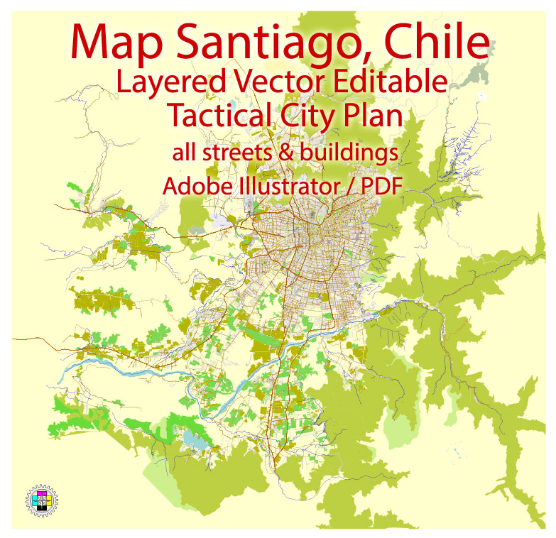
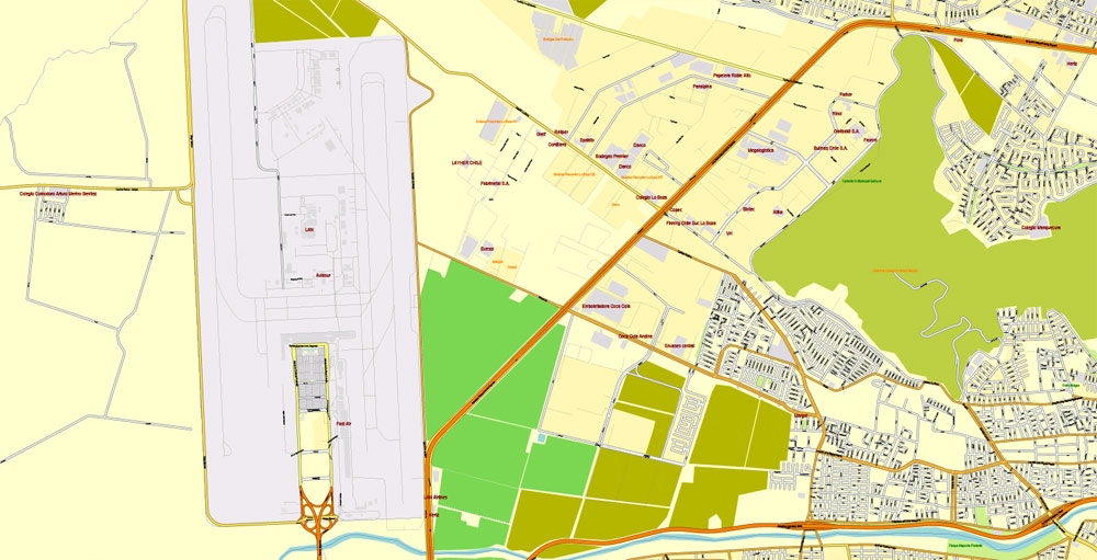
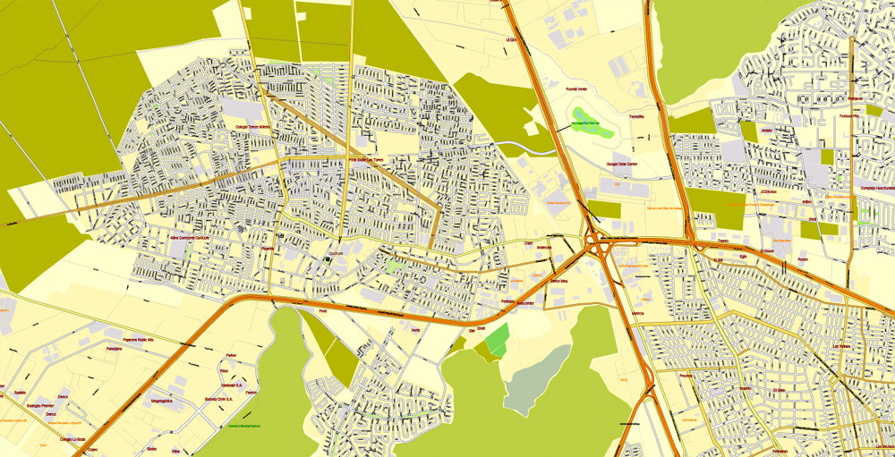
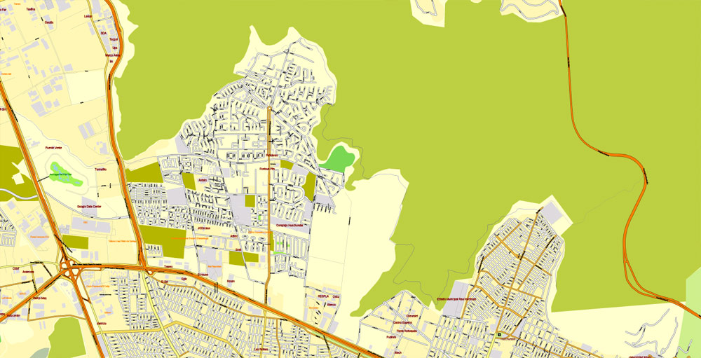
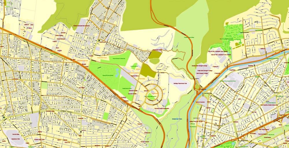
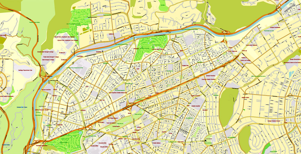
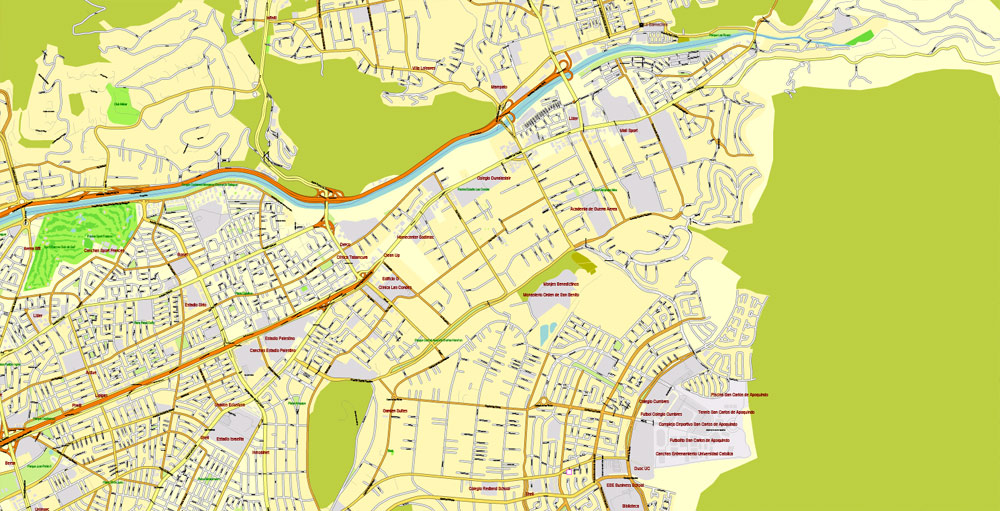
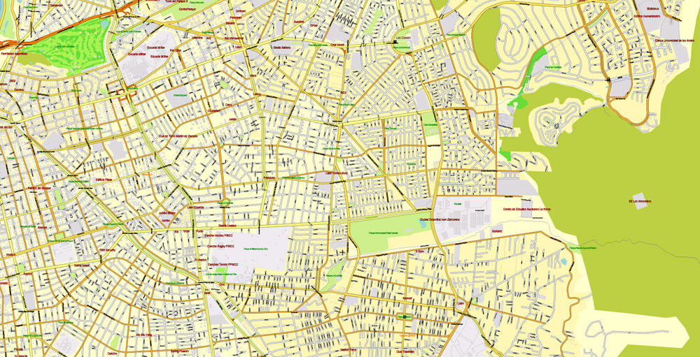
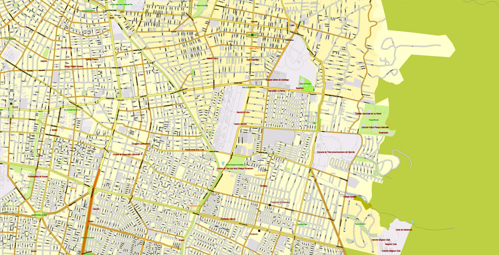
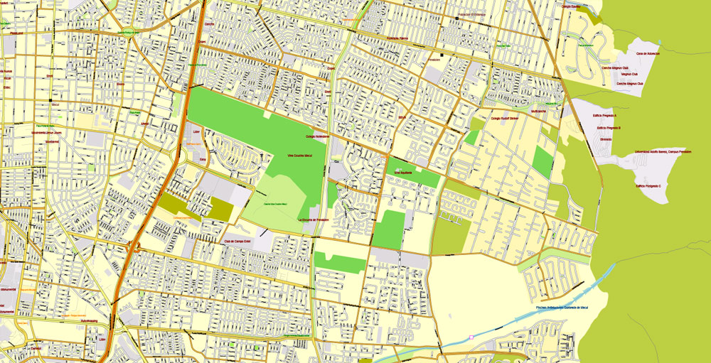
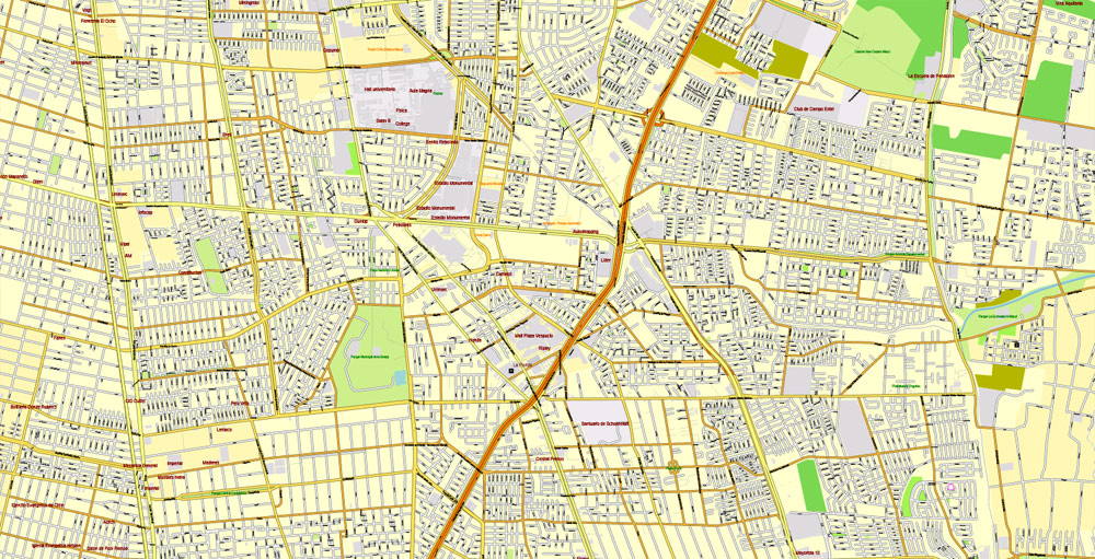
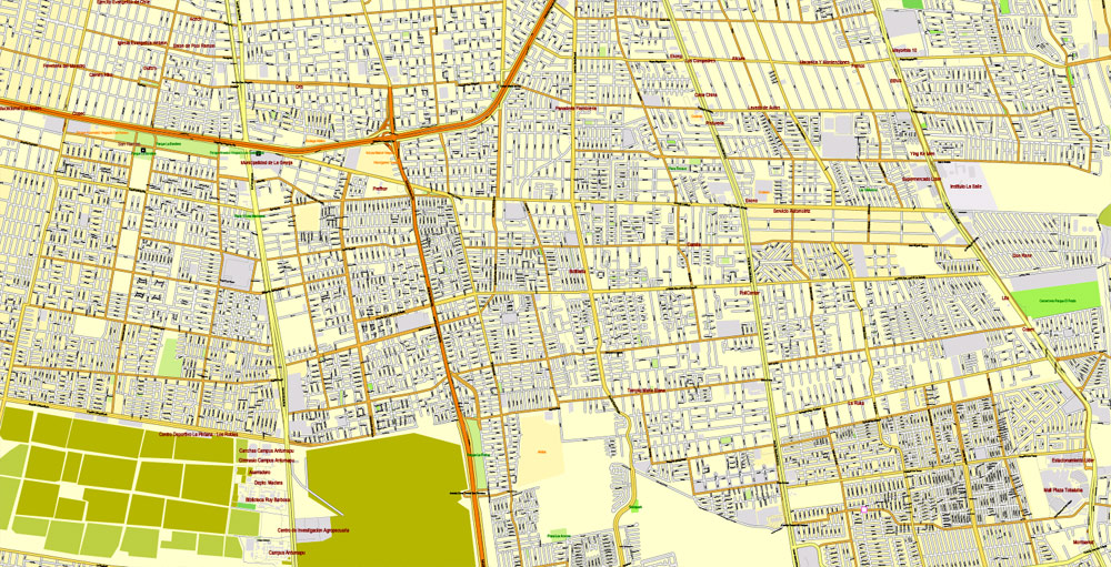
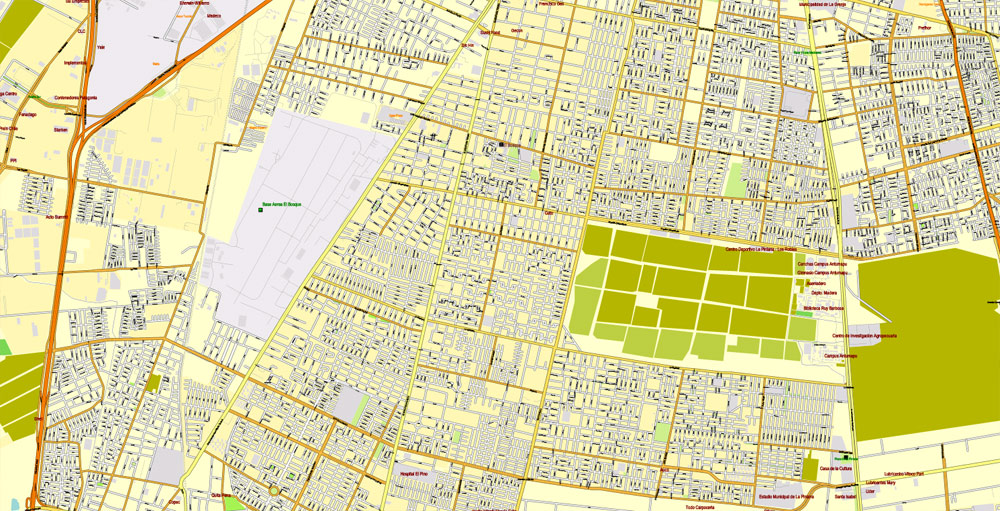
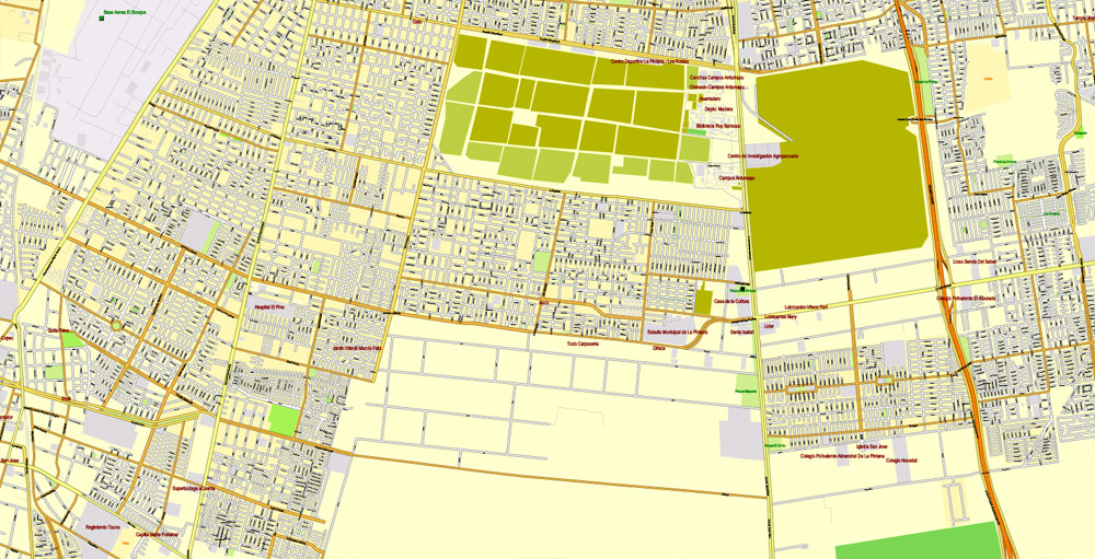
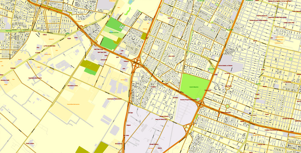
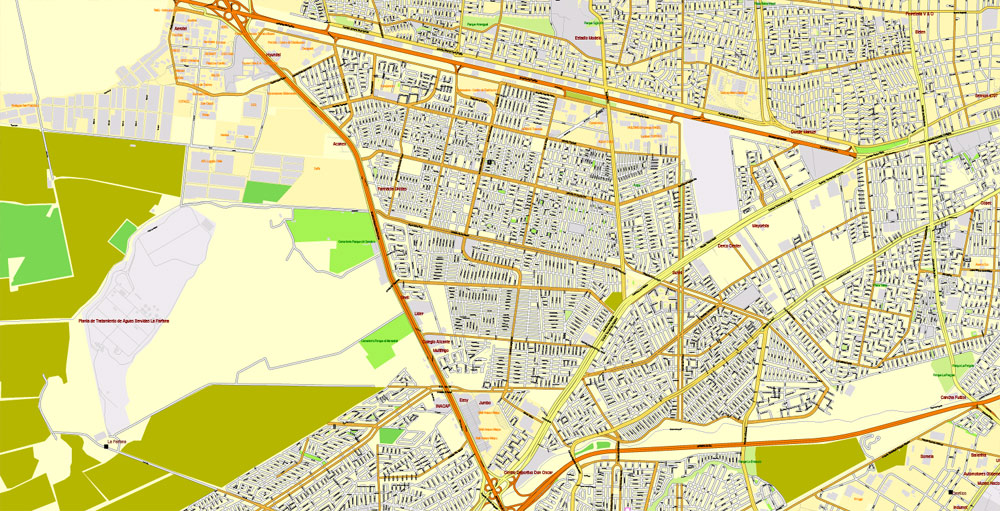
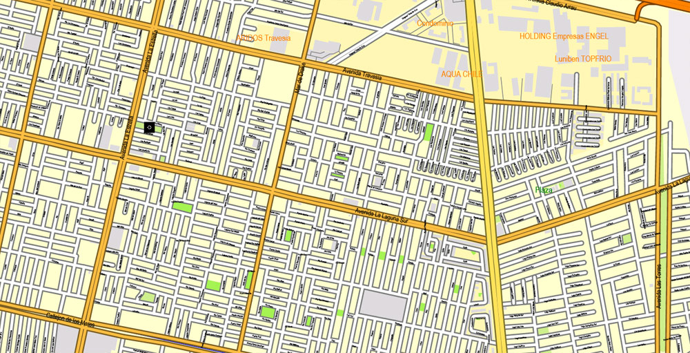
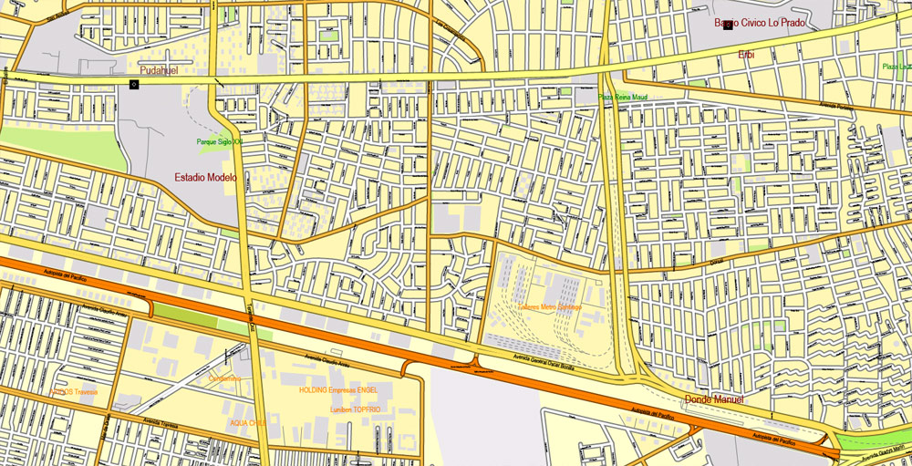
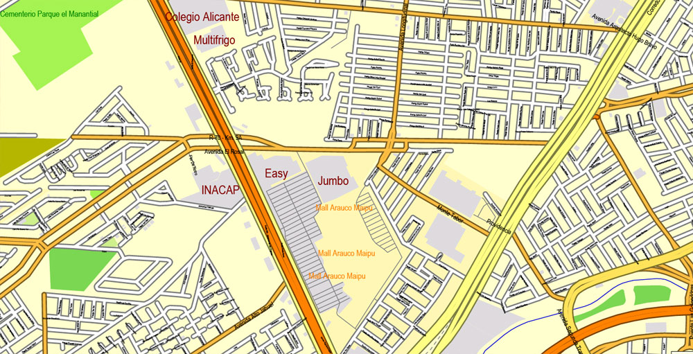
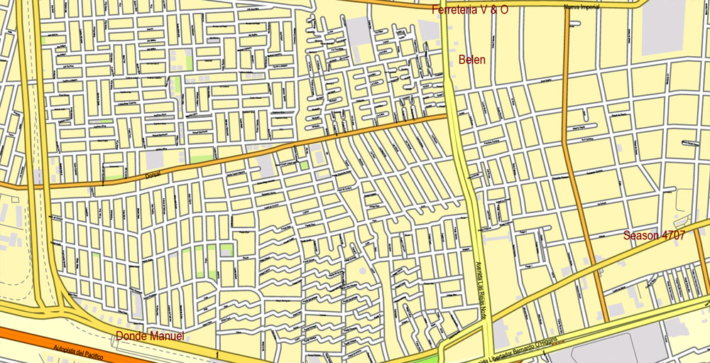
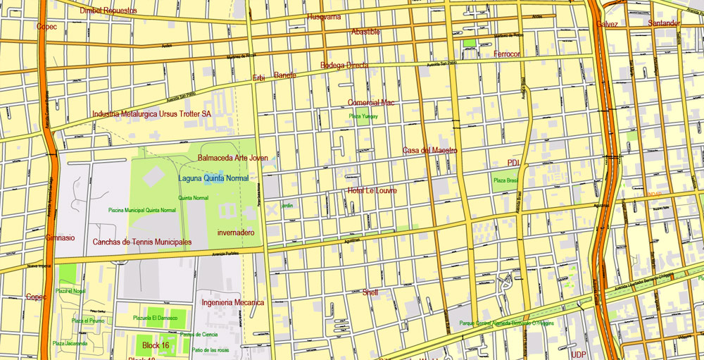
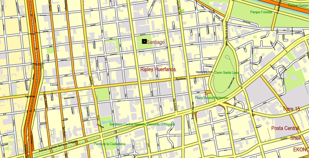
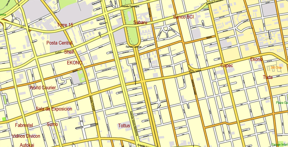
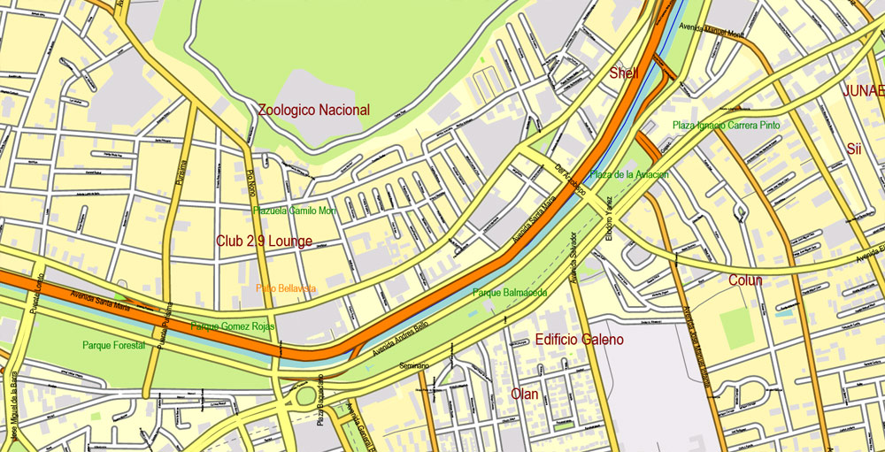
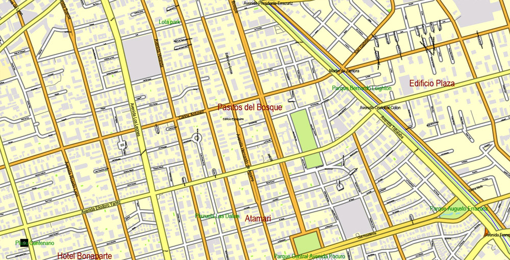
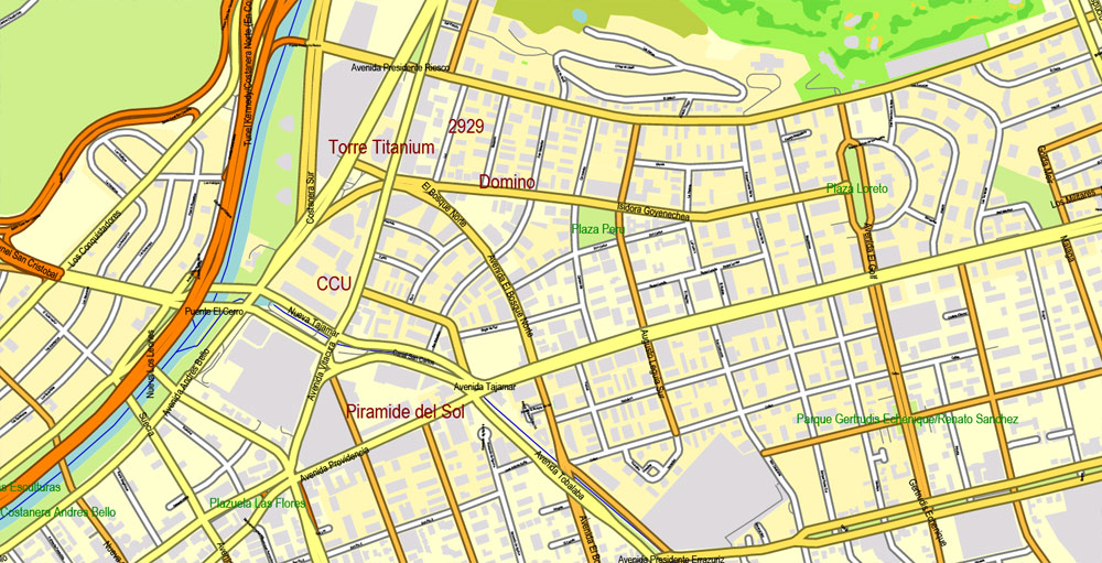
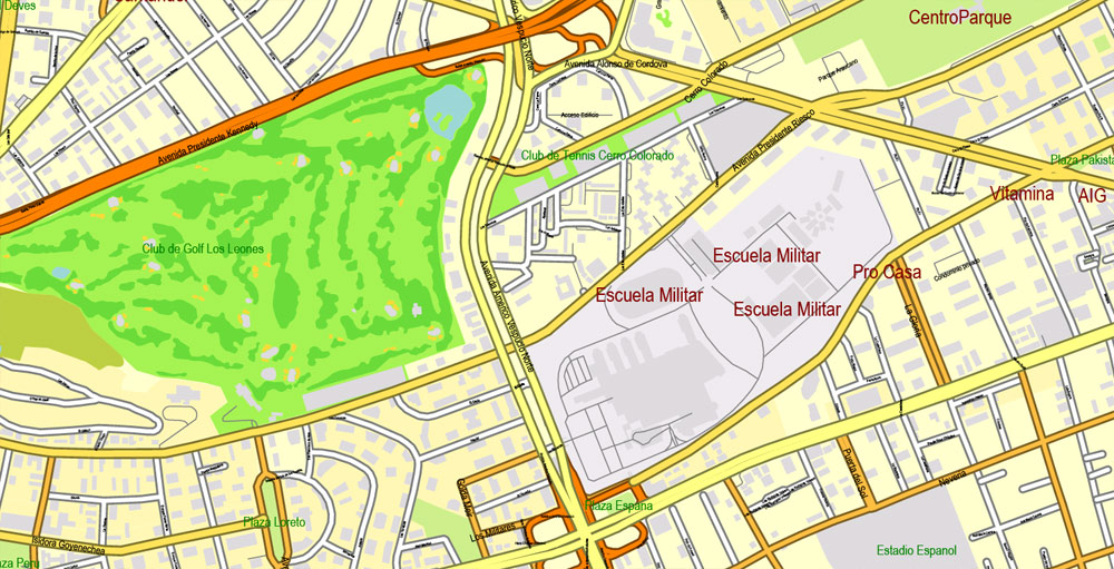
Printable Map Santiago, Chile, exact vector Map street City Plan G-View Level 17 (100 meters scale) full editable, Adobe Illustrator, full vector, scalable, editable text format street names, 17 mb ZIP
All streets named, Main Objects, No buildings. Map for design, printing, arts, projects, presentations, for architects, designers and builders, business, logistics.
Layers: color fills, streets_roads, arrows_streets, labels_roads, objects, names objects,
names_streets, names_places, grids, legend. Schools and Hospitals
The most exact and detailed map of the city.
For print LARGE (WALL) format.
DWG, DXF, CDR and other formats – on request, same price, please, contact
Santiago, Chile.
This vector map of Chile city is used as a basis for design, editing, and further printing.
This is the most detailed, exact map of Chile city for high-quality printing and polygraphy. You can always clarify the map development date by contacting us.
For your convenience, all objects on Chile vector city map are divided into layers. And the editing is very easy – colors, lines, etc.
You can easily add any objects needed (e.g. shops, salons, sale points, gas station or attraction) on any layer of Chile vector map.
One of the advantages of Chile city vector maps of our production is the relevance of cartographic data, we constantly update all our products.
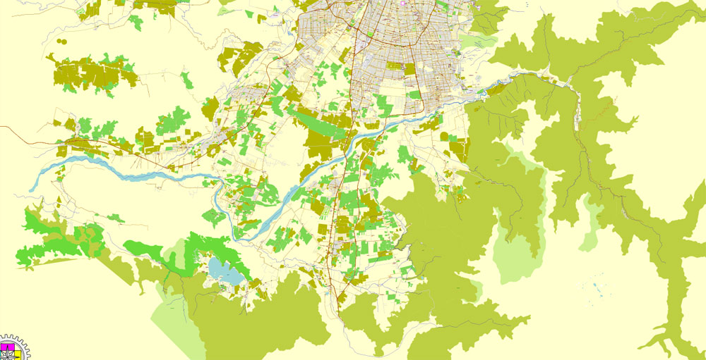
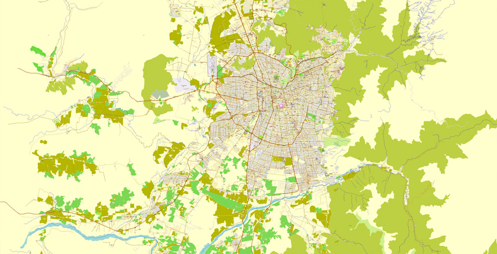
Santiago is the capital and largest city of Chile as well as one of the largest cities in the Americas. It is the center of Chile’s largest and the most densely populated conurbation, the Santiago Metropolitan Region, whose total population is 7 million. The city is entirely located in the country’s central valley. Most of the city lies between 500 m (1,640 ft) and 650 m (2,133 ft) above mean sea level.
This vector map of Chile city is used by:
designers, layout designers, printers, advertisers and architects. Our product – vector maps – is designed for further editing and printing in large formats – from @Wall format (a few meters) to A-0 and A-1, A-2, A-3.
The Chile city map in vector format is used for design, urban planning, presentations and media visualizations.
The advertising and presentation map of Chile city (usually the final designer marks the routes, and puts the client’s objects (shops, saloons, gas stations etc.)
The undoubted advantage is that people will NEVER throw out this advertising product – the map. In fact, as an advertising medium, a city map is the most “long-playing” of the well-known polygraphic advertising media, with the longest lifespan, and the maximum number of interactions with the customer.
For travelers, maps are sold at the airports and gas stations around the world. Often the source is our vector maps.
Founded in 1541 by the Spanish conqueror Pedro de Valdivia, Santiago has been the capital city of Chile since colonial times. The city has a downtown core of 19th-century neoclassical architecture and winding side-streets, dotted by art deco, neo-gothic, and other styles. Santiago’s cityscape is shaped by several stand-alone hills and the fast-flowing Mapocho River, lined by parks such as Parque Forestal. The Andes Mountains can be seen from most points in the city. These mountains contribute to a considerable smog problem, particularly during winter. The city outskirts are surrounded by vineyards and Santiago is within an hour of both the mountains and the Pacific Ocean.
Take a look, who purchases our vector maps of Chile city in “Our Clients and Friends” page – these are large and small companies, from super-brands like Volvo and Starbucks, to small design studios and printing houses.
It’s very easy to work with vector maps of Chile city, even for a not very experienced designer who can turn on and off the map layers, add new objects, change the colors of fill and lines according to customer requirements.
The undoubted advantage of Chile city vector maps in printing is an excellent and detailed visualization, when customer can expand a large paper map and instantly define his location, find a landmark, an object or address on map, unlike using the popular electronic formats of Google and Yandex maps for example.
Printable vector maps of Chile city are much more convenient and efficient than any electronic maps on your smartphone, because ALL DETAILS are displayed in the entire space of Chile city map.
Santiago is the cultural, political and financial center of Chile and is home to the regional headquarters of many multinational corporations. The Chilean executive and judiciary are located in Santiago, but Congress meets mostly in nearby Valparaíso. Santiago is named after the biblical figure St. James. Santiago will host the 2023 Pan American Games.
Useful tips on working with vector maps of cities and countries in Adobe Illustrator.
«V» – launches the Selection tool (cursor, black arrow), which makes active any vector line.
«А» – launches the Direct Selection tool (white cursor), allows you to select curve elements and drag them to the desired place.
«R» – activates the Rotate tool, which helps you rotating selected objects around the center point by 360 degrees.
«E» – gives you the opportunity to use the Eraser tool and erase unnecessary parts.
«X» – switches between Fill and Stroke in the Tools section. Try to get used to this hot key and
you will quickly understand that you can’t live and work without it.
Guides are not limited to vertical and horizontal in Adobe Illustrator. You can also create a diagonal guide for example. Moreover, you can turn any contours into guides. Select the outline and go to View > Guides > Make Guides (Create Guides), or simply press Cmd/Ctrl + 5. You can also turn the guides back into an editable object. Go to menu, View > Guides > Unlock Guides (Release Guides), select the guide you want to edit and select View > Guides > Release Guides (Reset Guides), or just press Cmd/Ctrl + Option / Alt + 5).
You will probably want to change the color scheme used on our Chile vector city map.
To quickly and effectively play with colors.
Of course, you can do it manually, all objects in our Chile city vector map are divided according to types and layers, and you can easily change the color gamma of vector objects in groups and layers.
Geography
The city lies in the center of the Santiago Basin, a large bowl-shaped valley consisting of broad and fertile lands surrounded by mountains. The city has a varying elevation, gradually increasing from 400 m (1,312 ft) in the western areas to more than 700 m (2,297 ft) in the eastern areas. Santiago’s international airport, in the west, lies at an altitude of 460 m (1,509 ft). Plaza Baquedano, near the center, lies at 570 m (1,870 ft). Estadio San Carlos de Apoquindo, at the eastern edge of the city, has an elevation of 960 m (3,150 ft).
But there is more effective way of working with the whole VECTOR MAP of Chile city and all layers:
The overview dialog «Edit colors»/«Repaint Graphic Object» (this dialog box name can change depending on the context):
If you have selected a part or a layer of Chile city vector map and open the dialog box by clicking the icon in the Control panel, on the Samples palette or the Color Catalog, or if you choose Edit > Edit Colors> Repaint Graphic Object, then the «Repaint Graphic Object» dialog box appears, and you get access to «Assign» and «Edit» tabs.
If a picture or a map fragment is not selected, and you open the dialog box by clicking the icon in the Control panel, on the Samples palette or in the Color Catalog, the «Edit Colors» dialog box appears and you can only access the «Edit» tab.
Regardless of the name at the top of the dialog box, the right-hand side always displays the color group of the current document, as well as two default color groups: Print Color and Grayscale. These color groups can be selected and used any time.
Create and edit color groups of Chile city vector map, and also assign colors using the «Edit Colors»/ а «Repaint Graphic Object» dialog box.
A. Creating and editing of a color group on the «Edit» tab
B. Assigning colors on the «Assign» tab
C. Select a group of colors from the «Color groups» list
The option «Repaint a graphic object» in the lower part of the dialog box allows you to preview the colors on a selected layer of Vector map, or a group of elements, and specify whether its colors will be redefined when the dialog box is closed.
The main areas of the dialog box are:
«Edit»
The «Edit» tab is designed to create a new or edit the existing color groups.
The harmony rules Menu and the Color Wheel are used to conduct experiments with color harmonies. The color wheel shows how colors are related in color harmony, and the color bars allow you to view and manipulate an individual color values. In addition, you can adjust the brightness, add and remove colors, save color groups and view colors on the selected Vector Map of Chile city or a separated layers.
«Assign»
The «Assign» tab is used to view and control on how the original colors are replaced with colors from the color group like your corporate colors in the Vector Map of Chile city.
The assign color ability is provided only if the entire map, layer or fragment is selected in the document. You can specify which of new colors replace the current colors, whether the spot colors should be preserved and how colors are replaced (for example, you can replace colors completely or changing the color tone while maintaining the brightness). The «Assign» tab allows you to redefine colors in the Vector Map of Chile city, or in separate layers and fragments using the current color group or reducing the number of colors in the current Vector Map.
Color groups
Is a list of all saved color groups for current document (the same groups appear in the «Samples» palette). You can edit and delete the existing color groups, as well as creating a new ones using the list of “Color Groups” in the dialog box. All changes appear in the «Samples» palette.
The highlighted color group shows, which color group is currently edited.
Any color group can be selected and edited, or used to redefine the colors in the selected vector map of Chile city, its fragments or elements.
Saving a color group adds this group to the specified list.
Opening the «Edit Colors»/«Repaint Graphic Object» dialog box.
Open the «Edit Colors»/«Repaint Graphic Object» dialog box using one of the following methods:
«Edit»> «Edit Colors»> «Repaint Graphic object» or «Repaint With Style».
Use these commands if you need to edit the colors in the selected vector map of Chile city.
«Repaint Graphic object» button on the «Control» panel.
Use this button if you need to adjust colors of Chile city vector map using the а «Repaint graphic object» dialog box.
The specified button is available if the selected vector map or its fragment contains two or more colors.
Note. This color editing method is convenient for global color adjustment in a vector map, if global colors were not used when creating a City Map of Chile.
The «Edit colors» button or «Edit or apply colors» on the «Color Catalog» palette
Click this button if you need to edit colors on the «Color Catalog» palette or edit and then apply them to the selected Vector Map of Chile city or its fragment.
The «Edit color group» button or «Edit or apply color group» on the «Samples» palette.
Click this button if you need to edit the colors in the specific color group or edit and apply them to the selected Vector Map of Chile city or a group of its elements, for example, the whole layer “Streets and lines”. You can also double-click the color group in the Samples panel to open the dialog box.
If the map file is too large and your computer freezes or even can’t open it quickly:
1. Try to reduce the color resolution of the video card (display) to 256 colors while working with a large map.
2. Using Windows Task Manager, select all the application you don’t need, while working with map, just turn them off.
3. Launch Adobe Illustrator. (DO NOT OPEN the vector map file)
4. Start the Windows Task Manager using administrator rights > Find the “Illustrator” process > set the «real time» priority,
5. Open the file. When you see the LEGACY FONT popup window – click “OK” (do not update). You can restore the TEXT later.
6. Can also be useful: When file is opened – Edit > Settings > Basic Settings > disable smoothing. /// It looks scary, but works quickly)))
We recommend saving the file in Adobe Illustrator 10 version. It’s much more stable when working with VERY BIG size files.
The Santiago Basin is part of the Intermediate Depression and is remarkably flat, interrupted only by a few “island hills”; among them are Cerro Renca, Cerro Blanco, and Cerro Santa Lucía. The basin is approximately 80 kilometres (50 miles) in a north–south direction and 35 km (22 mi) from east to west. The Mapocho River flows through the city.
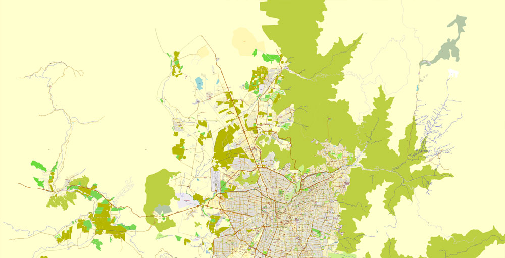
The city is flanked by the main chain of the Andes to the east and the Chilean Coastal Range to the west. On the north, it is bordered by the Cordón de Chacabuco, a mountain range of the Andes. At the southern border lies the Angostura de Paine, an elongated spur of the Andes that almost reaches the coast.
The mountain range immediately bordering the city on the east is known as the Sierra de Ramón, which was formed due to tectonic activity of the San Ramón Fault. This range reaches 3296 metres at Cerro de Ramón. The Sierra de Ramón represents the “Precordillera” of the Andes. 20 km (12 mi) further east is the even larger Cordillera of the Andes, which has mountains and volcanoes that exceed 6,000 m (19,690 ft) and on which some glaciers are present. The tallest is the Tupungato mountain at 6,570 m (21,555 ft). Other mountains include Tupungatito, San José, and Maipo. Cerro El Plomo is the highest mountain visible from Santiago’s urban area.
During recent decades, urban growth has outgrown the boundaries of the city, expanding to the east up the slopes of the Andean Precordillera. In areas such as La Dehesa, Lo Curro, and El Arrayan, urban development is present at over 1,000 metres of altitude.

Santiago
Capital of Chile
Santiago, Chile’s capital and largest city, sits in a valley surrounded by the snow-capped Andes and the Chilean Coast Range. Plaza de Armas, the grand heart of the city’s old colonial core, is home to 2 neoclassical landmarks: the 1808 Palacio de la Real Audiencia, housing the National History Museum, and the 18th-century Metropolitan Cathedral. La Chascona is the home-turned-museum of poet Pablo Neruda.
Area
• Total 641 km2 (247.6 sq mi)
Elevation 521 m (1,706 ft)
Population
• Total 6,158,080
• Density 8,470/km2 (21,925/sq mi)
Small guide: How to work with the vector map?
You can: Mass select objects by type and color – for example, the objects type “building” (they are usually dark gray) – and remove them from the map, if you do not need them in your print or design project. You can also easily change the thickness of lines (streets), just bulk selection the road by the line color.
The streets are separated by type, for example, type “residential road” are usually white with a gray stroke. Highway usually orange with a brown or dark gray stroke.
It is easy to change the font of inscriptions, all or each individually. Also, just can be make and any other manipulation of objects on the vector map in Adobe illustrator format.
Important: All the proportions on the map are true, that is, the relative sizes of the objects are true, because Map is based on an accurate GPS projection, and It transated into the (usual for all) the Mercator projection.
You can easily change the color, stroke and fill of any object on the map, zoom without loss of quality Image Verification.
Select object

Bulk selection the same objects on the vector map

See the bulk selected objects on the vector map

Bulk delete buildungs from the vector map

Select residencial road (small street) on the vector map

Bulk selection the same lines (streets, roads) on the full map

Create fat lines of the streets on the vector maps (bulk action) 1

Create fat lines of the streets on the vector maps (bulk action) 2

Create fat lines of the streets on the vector maps (bulk action) 3

You can easily change the color, stroke and fill of any object on the map, zoom without loss of quality Image Verification.
Free vector map World, Adobe Illustrator, download now maps vector clipart
Map for design, projects, presentation free to use as you like.
See also: TERMS & CONDITIONS: SOFTWARE LICENSE AGREEMENT FOR DIGITAL CARTOGRAPHIC DATA.
Need more USA Vector Maps, printable and editable?
 full editable, Adobe Illustrator")
 full editable, Adobe Illustrator")
 full editable, Adobe Illustrator")
 full editable, Adobe Illustrator")
 full editable, Adobe Illustrator")
 full editable, Adobe Illustrator")
 full editable, Adobe Illustrator")
 full editable, Adobe Illustrator")
 full editable, Adobe Illustrator")
 full editable, Adobe Illustrator")
 full editable, Adobe Illustrator")
 full editable, Adobe Illustrator")
 full editable, Adobe Illustrator")
 full editable, Adobe Illustrator")
 full editable, Adobe Illustrator")
 full editable, Adobe Illustrator")
 full editable, Adobe Illustrator")
 full editable, Adobe Illustrator")
 full editable, Adobe Illustrator")
 full editable, Adobe Illustrator")
 full editable, Adobe Illustrator")
 full editable, Adobe Illustrator")
 full editable, Adobe Illustrator")
 full editable, Adobe Illustrator")
 full editable, Adobe Illustrator")
 full editable, Adobe Illustrator")
 full editable, Adobe Illustrator")
 full editable, Adobe Illustrator")
 full editable, Adobe Illustrator")
 full editable, Adobe Illustrator")
 full editable, Adobe Illustrator")
 full editable, Adobe Illustrator")
 full editable, Adobe Illustrator")
 full editable, Adobe Illustrator")
 full editable, Adobe Illustrator")
 full editable, Adobe Illustrator")
 full editable, Adobe Illustrator")
 full editable, Adobe Illustrator")
 full editable, Adobe Illustrator")
 full editable, Adobe Illustrator")
 full editable, Adobe Illustrator")
 full editable, Adobe Illustrator")
 full editable, Adobe Illustrator")

 Author: Kirill Shrayber, Ph.D. FRGS