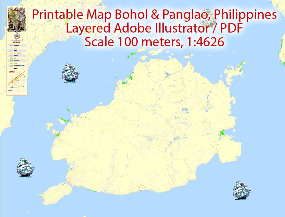
Printable Map Bohol and Panglao Philippines, exact vector City Plan Map street G-View Level 17 (100 meters scale 1:4626) full editable, Adobe Illustrator, full vector, scalable, editable text format street names, 13 mb ZIP
All streets named, Main Objects, Principal buildings. Map for design, printing, arts, projects, presentations, for architects, designers and builders, business, logistics.
Layers: color fills, streets_roads, arrows_streets, labels_roads, objects, names_objects, names_streets, names_places, grids, legend.
For print LARGE (WALL) format.
DWG, DXF and other formats – on request, same price, please, contact
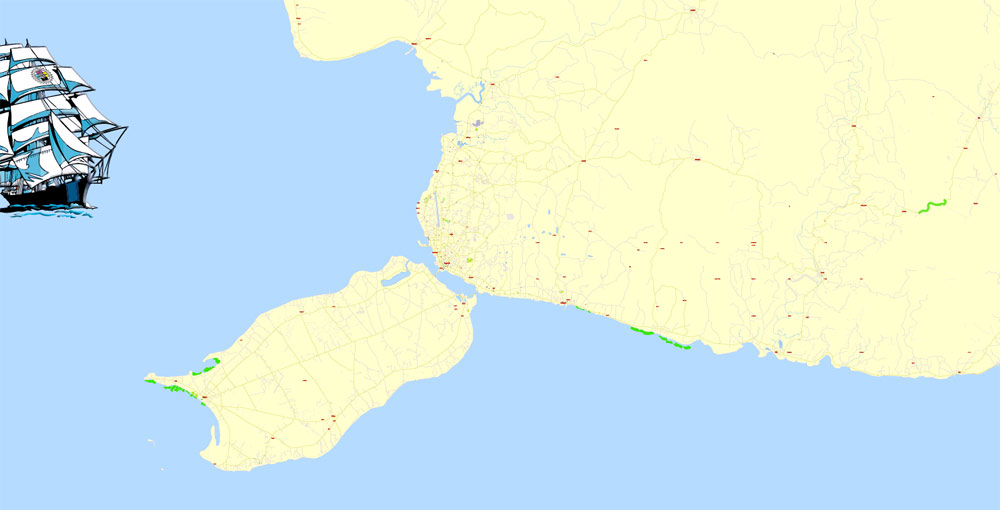
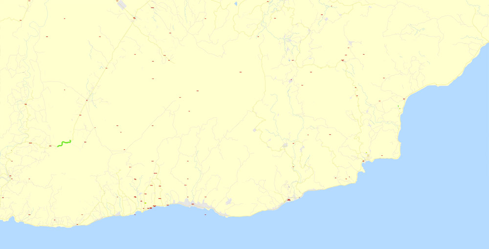
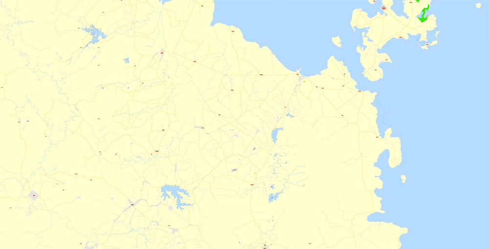
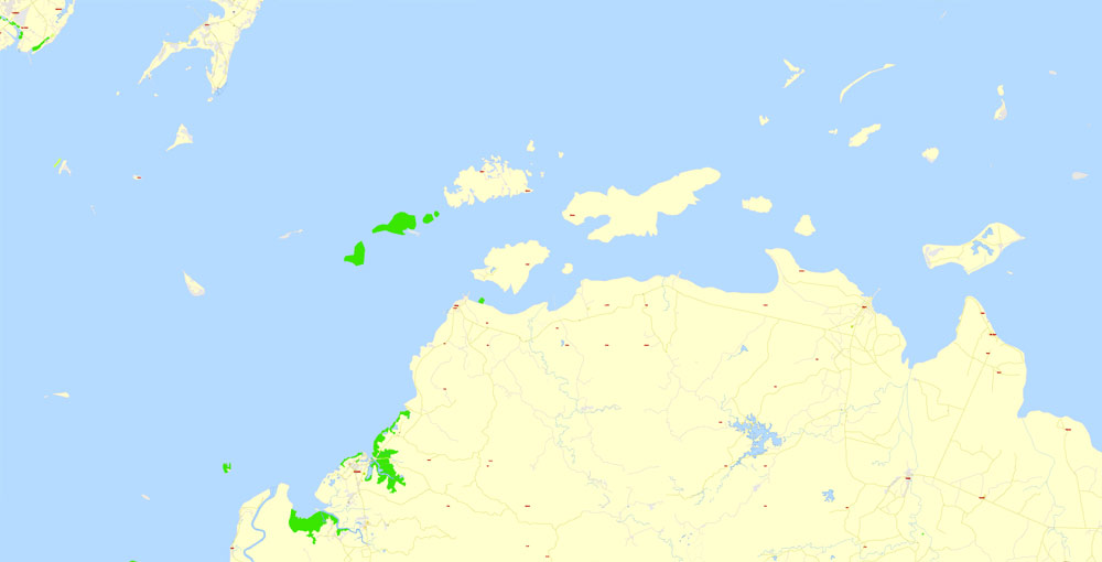
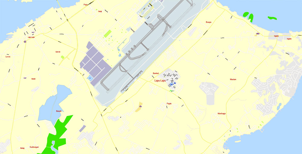
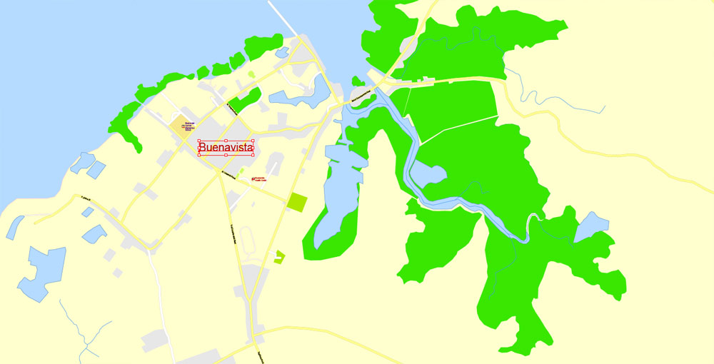
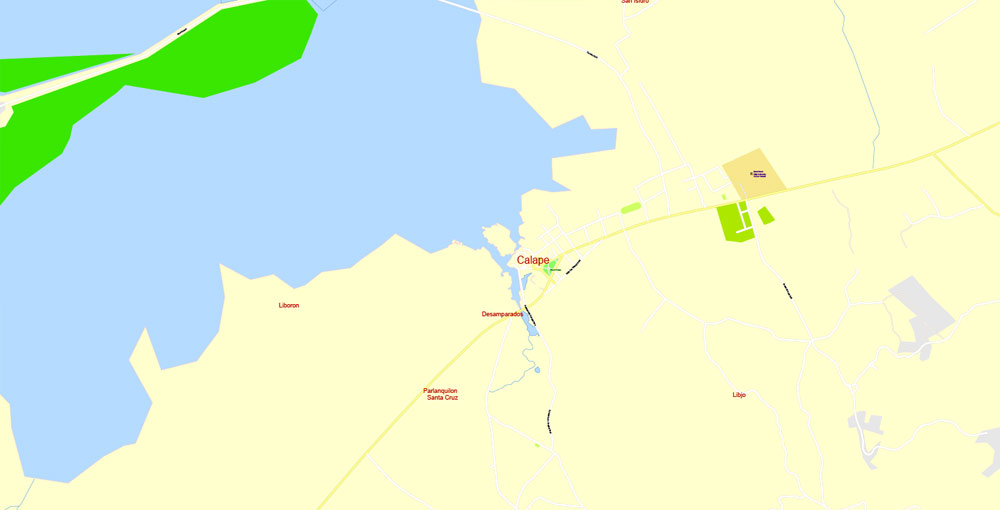
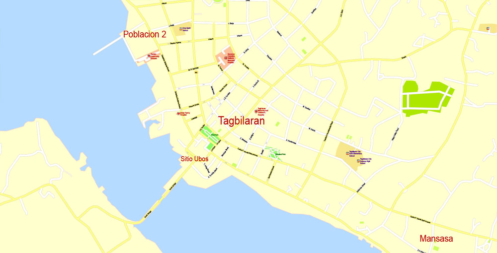
Bohol + Panglao, Philippines.
This vector map of Bohol city is used as a basis for design, editing, and further printing.
This is the most detailed, exact map of Bohol city for high-quality printing and polygraphy. You can always clarify the map development date by contacting us.
For your convenience, all objects on Bohol vector city map are divided into layers. And the editing is very easy – colors, lines, etc.
You can easily add any objects needed (e.g. shops, salons, sale points, gas station or attraction) on any layer of Bohol vector map.
Bohol is a 1st provincial income class island province of the Philippines located in the Central Visayas region, consisting of the island itself and 75 minor surrounding islands. Its capital is Tagbilaran. With a land area of 4,821 km2 (1,861 sq mi) and a coastline 261 km (162 mi) long, Bohol is the tenth largest island of the Philippines. To the west of Bohol is Cebu, to the northeast is the island of Leyte and to the south, across the Bohol Sea, is Mindanao.
One of the advantages of Bohol city vector maps of our production is the relevance of cartographic data, we constantly update all our products.
This vector map of Bohol city is used by:
designers, layout designers, printers, advertisers and architects. Our product – vector maps – is designed for further editing and printing in large formats – from @Wall format (a few meters) to A-0 and A-1, A-2, A-3.
The Bohol city map in vector format is used for design, urban planning, presentations and media visualizations.
The advertising and presentation map of Bohol city (usually the final designer marks the routes, and puts the client’s objects (shops, saloons, gas stations etc.)
The undoubted advantage is that people will NEVER throw out this advertising product – the map. In fact, as an advertising medium, a city map is the most “long-playing” of the well-known polygraphic advertising media, with the longest lifespan, and the maximum number of interactions with the customer.
For travelers, maps are sold at the airports and gas stations around the world. Often the source is our vector maps.
Take a look, who purchases our vector maps of Bohol city in “Our Clients and Friends” page – these are large and small companies, from super-brands like Volvo and Starbucks, to small design studios and printing houses.
It’s very easy to work with vector maps of Bohol city, even for a not very experienced designer who can turn on and off the map layers, add new objects, change the colors of fill and lines according to customer requirements.
The undoubted advantage of Bohol city vector maps in printing is an excellent and detailed visualization, when customer can expand a large paper map and instantly define his location, find a landmark, an object or address on map, unlike using the popular electronic formats of Google and Yandex maps for example.
Printable vector maps of Bohol city are much more convenient and efficient than any electronic maps on your smartphone, because ALL DETAILS are displayed in the entire space of Bohol city map.
Useful tips on working with vector maps of cities and countries in Adobe Illustrator.
«V» – launches the Selection tool (cursor, black arrow), which makes active any vector line.
«А» – launches the Direct Selection tool (white cursor), allows you to select curve elements and drag them to the desired place.
«R» – activates the Rotate tool, which helps you rotating selected objects around the center point by 360 degrees.
«E» – gives you the opportunity to use the Eraser tool and erase unnecessary parts.
«X» – switches between Fill and Stroke in the Tools section. Try to get used to this hot key and
you will quickly understand that you can’t live and work without it.
Guides are not limited to vertical and horizontal in Adobe Illustrator. You can also create a diagonal guide for example. Moreover, you can turn any contours into guides. Select the outline and go to View > Guides > Make Guides (Create Guides), or simply press Cmd/Ctrl + 5. You can also turn the guides back into an editable object. Go to menu, View > Guides > Unlock Guides (Release Guides), select the guide you want to edit and select View > Guides > Release Guides (Reset Guides), or just press Cmd/Ctrl + Option / Alt + 5).
The province of Bohol is a first-class province divided into 3 congressional districts, comprising 1 component city and 47 municipalities. It has 1,109 barangays.
The province is a popular tourist destination with its beaches and resorts. The Chocolate Hills, numerous mounds of brown-coloured limestone formations, are the most popular attraction. The formations can be seen by land (climbing the highest point) or by air via ultralight air tours. Panglao Island, located just southwest of Tagbilaran, is famous for its diving locations and is routinely listed as one of the top ten diving locations in the world. Numerous tourist resorts and dive centers dot the southern beaches. The Philippine tarsier, amongst the world’s smallest primates, is indigenous to the island.
You will probably want to change the color scheme used on our Bohol vector city map.
To quickly and effectively play with colors.
Of course, you can do it manually, all objects in our Bohol city vector map are divided according to types and layers, and you can easily change the color gamma of vector objects in groups and layers.
But there is more effective way of working with the whole VECTOR MAP of Bohol city and all layers:
The overview dialog «Edit colors»/«Repaint Graphic Object» (this dialog box name can change depending on the context):
If you have selected a part or a layer of Bohol city vector map and open the dialog box by clicking the icon in the Control panel, on the Samples palette or the Color Catalog, or if you choose Edit > Edit Colors> Repaint Graphic Object, then the «Repaint Graphic Object» dialog box appears, and you get access to «Assign» and «Edit» tabs.
If a picture or a map fragment is not selected, and you open the dialog box by clicking the icon in the Control panel, on the Samples palette or in the Color Catalog, the «Edit Colors» dialog box appears and you can only access the «Edit» tab.
Regardless of the name at the top of the dialog box, the right-hand side always displays the color group of the current document, as well as two default color groups: Print Color and Grayscale. These color groups can be selected and used any time.
Create and edit color groups of Bohol city vector map, and also assign colors using the «Edit Colors»/ а «Repaint Graphic Object» dialog box.
A. Creating and editing of a color group on the «Edit» tab
B. Assigning colors on the «Assign» tab
C. Select a group of colors from the «Color groups» list
The option «Repaint a graphic object» in the lower part of the dialog box allows you to preview the colors on a selected layer of Vector map, or a group of elements, and specify whether its colors will be redefined when the dialog box is closed.
The main areas of the dialog box are:
«Edit»
The «Edit» tab is designed to create a new or edit the existing color groups.
The harmony rules Menu and the Color Wheel are used to conduct experiments with color harmonies. The color wheel shows how colors are related in color harmony, and the color bars allow you to view and manipulate an individual color values. In addition, you can adjust the brightness, add and remove colors, save color groups and view colors on the selected Vector Map of Bohol city or a separated layers.
«Assign»
The «Assign» tab is used to view and control on how the original colors are replaced with colors from the color group like your corporate colors in the Vector Map of Bohol city.
The assign color ability is provided only if the entire map, layer or fragment is selected in the document. You can specify which of new colors replace the current colors, whether the spot colors should be preserved and how colors are replaced (for example, you can replace colors completely or changing the color tone while maintaining the brightness). The «Assign» tab allows you to redefine colors in the Vector Map of Bohol city, or in separate layers and fragments using the current color group or reducing the number of colors in the current Vector Map.
A strait separates Bohol from Cebu, and both island provinces share a common language, but the Boholanos retain a conscious distinction from the Cebuanos. Bohol’s climate is generally dry, with maximum rainfall between the months of June and October. The interior is cooler than the coast.
It was the home province of Carlos P. Garcia, the eighth president of the Republic of the Philippines (1957–1961) who was born in Talibon, Bohol.
Color groups
Is a list of all saved color groups for current document (the same groups appear in the «Samples» palette). You can edit and delete the existing color groups, as well as creating a new ones using the list of “Color Groups” in the dialog box. All changes appear in the «Samples» palette.
The highlighted color group shows, which color group is currently edited.
Any color group can be selected and edited, or used to redefine the colors in the selected vector map of Bohol city, its fragments or elements.
Saving a color group adds this group to the specified list.
Opening the «Edit Colors»/«Repaint Graphic Object» dialog box.
Open the «Edit Colors»/«Repaint Graphic Object» dialog box using one of the following methods:
«Edit»> «Edit Colors»> «Repaint Graphic object» or «Repaint With Style».
Use these commands if you need to edit the colors in the selected vector map of Bohol city.
«Repaint Graphic object» button on the «Control» panel.
Use this button if you need to adjust colors of Bohol city vector map using the а «Repaint graphic object» dialog box.
The specified button is available if the selected vector map or its fragment contains two or more colors.
Note. This color editing method is convenient for global color adjustment in a vector map, if global colors were not used when creating a City Map of Bohol.
The «Edit colors» button or «Edit or apply colors» on the «Color Catalog» palette
Click this button if you need to edit colors on the «Color Catalog» palette or edit and then apply them to the selected Vector Map of Bohol city or its fragment.
The «Edit color group» button or «Edit or apply color group» on the «Samples» palette.
Click this button if you need to edit the colors in the specific color group or edit and apply them to the selected Vector Map of Bohol city or a group of its elements, for example, the whole layer “Streets and lines”. You can also double-click the color group in the Samples panel to open the dialog box.
If the map file is too large and your computer freezes or even can’t open it quickly:
1. Try to reduce the color resolution of the video card (display) to 256 colors while working with a large map.
2. Using Windows Task Manager, select all the application you don’t need, while working with map, just turn them off.
3. Launch Adobe Illustrator. (DO NOT OPEN the vector map file)
4. Start the Windows Task Manager using administrator rights > Find the “Illustrator” process > set the «real time» priority,
5. Open the file. When you see the LEGACY FONT popup window – click “OK” (do not update). You can restore the TEXT later.
6. Can also be useful: When file is opened – Edit > Settings > Basic Settings > disable smoothing. /// It looks scary, but works quickly)))
We recommend saving the file in Adobe Illustrator 10 version. It’s much more stable when working with VERY BIG size files.
On 15 October 2013, Bohol was devastated by a 7.2 magnitude earthquake whose epicenter was 6 km (3.7 mi) south of Sagbayan town. The earthquake, which also hit southern Cebu, claimed 156 lives altogether and injured 374 people. It also destroyed or damaged a number of Bohol’s heritage churches.
In 2017, the provincial government began initiating the nomination of the entire province to the UNESCO Global Geoparks Network.
The Chocolate Hills are considered one of Philippine’s natural wonders and Bohol is often referred to as the Jewel of the Philippines. They are hills made of limestone left over from coral reefs during the Ice Age when the island was submerged. They turn brown during the summer.
Bohol has 114 springs, 172 creeks, and four main rivers that run through Bohol with a radial drainage pattern. The largest river, the Inabanga River, runs in the northwestern part of the province; the Loboc River drains the center of the island to the mid-southern coast; the Abatan River runs in the southwest, and Ipil River in the north.
Numerous waterfalls and caves are scattered across the island, including Mag‑Aso Falls in Antequera. Mag‑Aso means smoke in the native tongue. The water is cool and often creates a mist in humid mornings which can hide the falls.
The Rajah Sikatuna Protected Landscape protects Bohol’s largest remaining lowland forest and can be found in the island’s southern portion near Bilar.
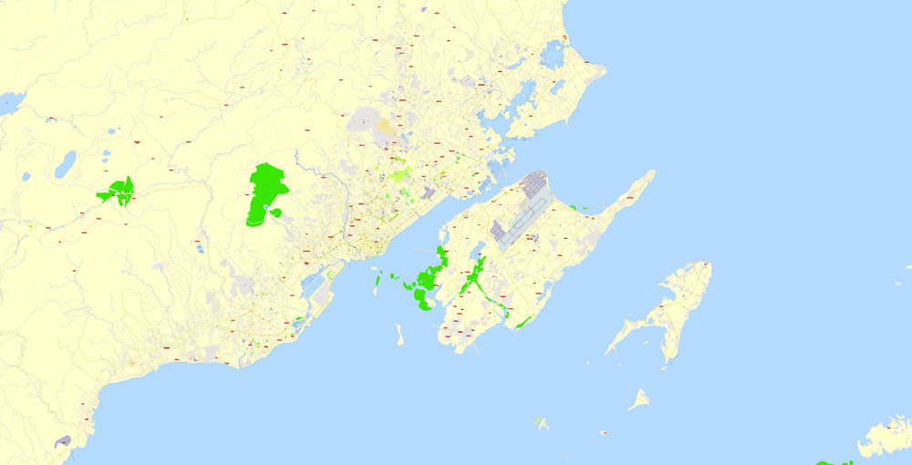
Panglao is an island in the north Bohol Sea, located in the Central Visayas region of the Visayas island group, in the south-central Philippines.
The island has an area of 91.12 square kilometres (35.18 sq mi). It is within Bohol Province, and comprises two municipalities: Dauis and Panglao. Panglao island is located southwest of the island of Bohol and east and south of Cebu.
Panglao has a terrain that ranges from plain, hilly to mountainous. Panglao is made of Maribojoc limestone, the youngest of the limestone units found in the western area of Bohol. The limestone composition halted the development of an airport as coralline limestone is soluble which causes formation of caves and sinkholes. One interesting geological feature found in the island is the Hinagdanan Cave which has an underground water source. The cave is an important water source as the island has no rivers or lakes.
Panglao is a popular tourist destination in the Philippines, and includes several small islands, such as Gak-ang, Pontod, and Balicasag.
According to the 2015 census, it has a population of 79,216.
Bohol is a 1st provincial income class island province of the Philippines located in the Central Visayas region, consisting of the island itself and 75 minor surrounding islands. Its capital is Tagbilaran. With a land area of 4,821 km2 (1,861 sq mi) and a coastline 261 km (162 mi) long, Bohol is the tenth largest island of the Philippines. To the west of Bohol is Cebu, to the northeast is the island of Leyte and to the south, across the Bohol Sea, is Mindanao.
Area
• Total 4,820.95 km2 (1,861.38 sq mi)
Elevation (Mount Mayana) 870 m (2,850 ft)
Population (2015 census)
• Total 1,313,560
• Density 270/km2 (710/sq mi)
• Voter 798,768
Small guide: How to work with the vector map?
You can: Mass select objects by type and color – for example, the objects type “building” (they are usually dark gray) – and remove them from the map, if you do not need them in your print or design project. You can also easily change the thickness of lines (streets), just bulk selection the road by the line color.
The streets are separated by type, for example, type “residential road” are usually white with a gray stroke. Highway usually orange with a brown or dark gray stroke.
It is easy to change the font of inscriptions, all or each individually. Also, just can be make and any other manipulation of objects on the vector map in Adobe illustrator format.
Important: All the proportions on the map are true, that is, the relative sizes of the objects are true, because Map is based on an accurate GPS projection, and It transated into the (usual for all) the Mercator projection.
You can easily change the color, stroke and fill of any object on the map, zoom without loss of quality Image Verification.
Select object

Bulk selection the same objects on the vector map

See the bulk selected objects on the vector map

Bulk delete buildungs from the vector map

Select residencial road (small street) on the vector map

Bulk selection the same lines (streets, roads) on the full map

Create fat lines of the streets on the vector maps (bulk action) 1

Create fat lines of the streets on the vector maps (bulk action) 2

Create fat lines of the streets on the vector maps (bulk action) 3

You can easily change the color, stroke and fill of any object on the map, zoom without loss of quality Image Verification.
Free vector map World, Adobe Illustrator, download now maps vector clipart
Map for design, projects, presentation free to use as you like.
See also: TERMS & CONDITIONS: SOFTWARE LICENSE AGREEMENT FOR DIGITAL CARTOGRAPHIC DATA.

 Author: Kirill Shrayber, Ph.D. FRGS