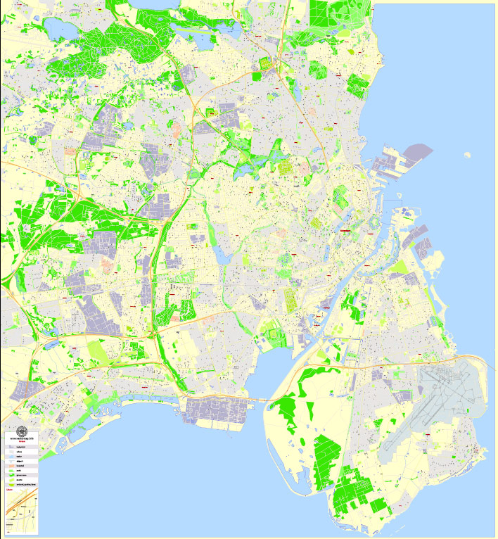
PDF Vector Map Copenhagen / København, Denmark, G-View level 17 (100 m scale) street City Plan map, full editable, Adobe PDF, full vector, scalable, editable text format street names, 28 mb ZIP
All streets named, main objects, no buildings. Map for publishing, design, printing, publications, arts, projects, presentations, for architects, designers and builders, business, logistics. The most exact and detailed map of the city.
Layers: color fills, streets_roads, arrows_streets, labels_roads, objects, names objects, names_streets, names_places, grids, legend.
You can edit this file by Adobe Illustrator, Adobe Acrobat, Corel Draw.
For printing LARGE (WALL) format
DXF, DWG, CDR and other formats – on request, same price, please, contact
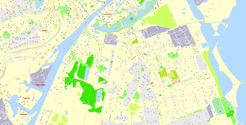
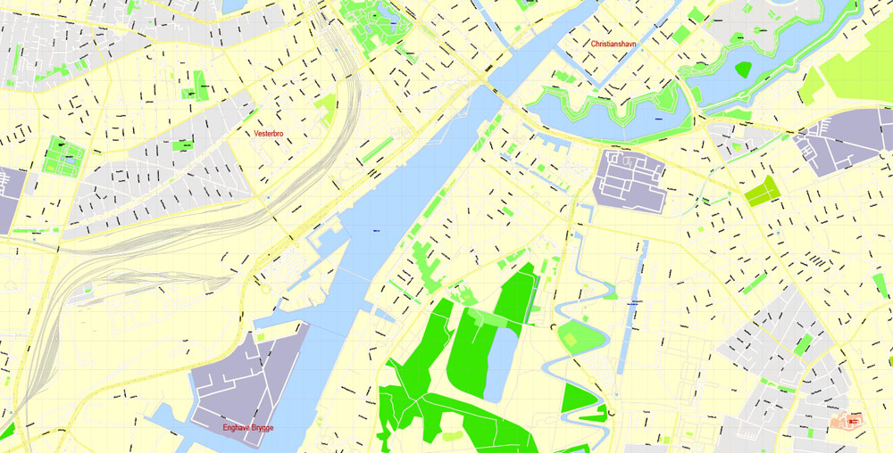
Copenhagen, Denmark. København
This vector map of Copenhagen city is used as a basis for design, editing, and further printing.
This is the most detailed, exact map of Copenhagen city for high-quality printing and polygraphy. You can always clarify the map development date by contacting us.
For your convenience, all objects on Copenhagen vector city map are divided into layers. And the editing is very easy – colors, lines, etc.
You can easily add any objects needed (e.g. shops, salons, sale points, gas station or attraction) on any layer of Copenhagen vector map.
Copenhagen is the capital and most populous city of Denmark. As of July 2018, the city has a population of 777,218 (616,098 in Copenhagen Municipality, 103,914 in Frederiksberg Municipality, 43,005 in Tårnby Municipality, and 14,201 in Dragør Municipality). It forms the core of the wider urban area of Copenhagen (population 1,627,705) and the Copenhagen metropolitan area (population 2,057,737). Copenhagen is situated on the eastern coast of the island of Zealand; another small portion of the city is located on Amager, and is separated from Malmö, Sweden, by the strait of Øresund. The Øresund Bridge connects the two cities by rail and road.
One of the advantages of Copenhagen city vector maps of our production is the relevance of cartographic data, we constantly update all our products.
This vector map of Copenhagen city is used by:
designers, layout designers, printers, advertisers and architects. Our product – vector maps – is designed for further editing and printing in large formats – from @Wall format (a few meters) to A-0 and A-1, A-2, A-3.
The Copenhagen city map in vector format is used for design, urban planning, presentations and media visualizations.
The advertising and presentation map of Copenhagen city (usually the final designer marks the routes, and puts the client’s objects (shops, saloons, gas stations etc.)
The undoubted advantage is that people will NEVER throw out this advertising product – the map. In fact, as an advertising medium, a city map is the most “long-playing” of the well-known polygraphic advertising media, with the longest lifespan, and the maximum number of interactions with the customer.
For travelers, maps are sold at the airports and gas stations around the world. Often the source is our vector maps.
Take a look, who purchases our vector maps of Copenhagen city in “Our Clients and Friends” page – these are large and small companies, from super-brands like Volvo and Starbucks, to small design studios and printing houses.
It’s very easy to work with vector maps of Copenhagen city, even for a not very experienced designer who can turn on and off the map layers, add new objects, change the colors of fill and lines according to customer requirements.
The undoubted advantage of Copenhagen city vector maps in printing is an excellent and detailed visualization, when customer can expand a large paper map and instantly define his location, find a landmark, an object or address on map, unlike using the popular electronic formats of Google and Yandex maps for example.
Printable vector maps of Copenhagen city are much more convenient and efficient than any electronic maps on your smartphone, because ALL DETAILS are displayed in the entire space of Copenhagen city map.
Useful tips on working with vector maps of cities and countries in Adobe Illustrator.
«V» – launches the Selection tool (cursor, black arrow), which makes active any vector line.
«А» – launches the Direct Selection tool (white cursor), allows you to select curve elements and drag them to the desired place.
«R» – activates the Rotate tool, which helps you rotating selected objects around the center point by 360 degrees.
«E» – gives you the opportunity to use the Eraser tool and erase unnecessary parts.
«X» – switches between Fill and Stroke in the Tools section. Try to get used to this hot key and
you will quickly understand that you can’t live and work without it.
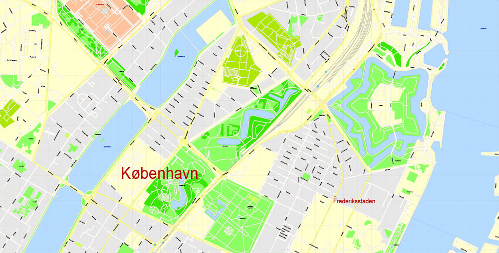
Originally a Viking fishing village established in the 10th century in the vicinity of what is now Gammel Strand, Copenhagen became the capital of Denmark in the early 15th century. Beginning in the 17th century it consolidated its position as a regional centre of power with its institutions, defences and armed forces. After suffering from the effects of plague and fire in the 18th century, the city underwent a period of redevelopment. This included construction of the prestigious district of Frederiksstaden and founding of such cultural institutions as the Royal Theatre and the Royal Academy of Fine Arts. After further disasters in the early 19th century when Horatio Nelson attacked the Dano-Norwegian fleet and bombarded the city, rebuilding during the Danish Golden Age brought a Neoclassical look to Copenhagen’s architecture. Later, following the Second World War, the Finger Plan fostered the development of housing and businesses along the five urban railway routes stretching out from the city centre.
«Assign»
The «Assign» tab is used to view and control on how the original colors are replaced with colors from the color group like your corporate colors in the Vector Map of Copenhagen city.
The assign color ability is provided only if the entire map, layer or fragment is selected in the document. You can specify which of new colors replace the current colors, whether the spot colors should be preserved and how colors are replaced (for example, you can replace colors completely or changing the color tone while maintaining the brightness). The «Assign» tab allows you to redefine colors in the Vector Map of Copenhagen city, or in separate layers and fragments using the current color group or reducing the number of colors in the current Vector Map.
Color groups
Is a list of all saved color groups for current document (the same groups appear in the «Samples» palette). You can edit and delete the existing color groups, as well as creating a new ones using the list of “Color Groups” in the dialog box. All changes appear in the «Samples» palette.
The highlighted color group shows, which color group is currently edited.
Any color group can be selected and edited, or used to redefine the colors in the selected vector map of Copenhagen city, its fragments or elements.
Saving a color group adds this group to the specified list.
Opening the «Edit Colors»/«Repaint Graphic Object» dialog box.
Open the «Edit Colors»/«Repaint Graphic Object» dialog box using one of the following methods:
«Edit»> «Edit Colors»> «Repaint Graphic object» or «Repaint With Style».
Guides are not limited to vertical and horizontal in Adobe Illustrator. You can also create a diagonal guide for example. Moreover, you can turn any contours into guides. Select the outline and go to View > Guides > Make Guides (Create Guides), or simply press Cmd/Ctrl + 5. You can also turn the guides back into an editable object. Go to menu, View > Guides > Unlock Guides (Release Guides), select the guide you want to edit and select View > Guides > Release Guides (Reset Guides), or just press Cmd/Ctrl + Option / Alt + 5).
You will probably want to change the color scheme used on our Copenhagen vector city map.
To quickly and effectively play with colors.
Of course, you can do it manually, all objects in our Copenhagen city vector map are divided according to types and layers, and you can easily change the color gamma of vector objects in groups and layers.
But there is more effective way of working with the whole VECTOR MAP of Copenhagen city and all layers:
The overview dialog «Edit colors»/«Repaint Graphic Object» (this dialog box name can change depending on the context):
If you have selected a part or a layer of Copenhagen city vector map and open the dialog box by clicking the icon in the Control panel, on the Samples palette or the Color Catalog, or if you choose Edit > Edit Colors> Repaint Graphic Object, then the «Repaint Graphic Object» dialog box appears, and you get access to «Assign» and «Edit» tabs.
If a picture or a map fragment is not selected, and you open the dialog box by clicking the icon in the Control panel, on the Samples palette or in the Color Catalog, the «Edit Colors» dialog box appears and you can only access the «Edit» tab.
Regardless of the name at the top of the dialog box, the right-hand side always displays the color group of the current document, as well as two default color groups: Print Color and Grayscale. These color groups can be selected and used any time.
Create and edit color groups of Copenhagen city vector map, and also assign colors using the «Edit Colors»/ а «Repaint Graphic Object» dialog box.
A. Creating and editing of a color group on the «Edit» tab
B. Assigning colors on the «Assign» tab
C. Select a group of colors from the «Color groups» list
The option «Repaint a graphic object» in the lower part of the dialog box allows you to preview the colors on a selected layer of Vector map, or a group of elements, and specify whether its colors will be redefined when the dialog box is closed.
The main areas of the dialog box are:
«Edit»
The «Edit» tab is designed to create a new or edit the existing color groups.
The harmony rules Menu and the Color Wheel are used to conduct experiments with color harmonies. The color wheel shows how colors are related in color harmony, and the color bars allow you to view and manipulate an individual color values. In addition, you can adjust the brightness, add and remove colors, save color groups and view colors on the selected Vector Map of Copenhagen city or a separated layers.
Use these commands if you need to edit the colors in the selected vector map of Copenhagen city.
«Repaint Graphic object» button on the «Control» panel.
Use this button if you need to adjust colors of Copenhagen city vector map using the а «Repaint graphic object» dialog box.
The specified button is available if the selected vector map or its fragment contains two or more colors.
Note. This color editing method is convenient for global color adjustment in a vector map, if global colors were not used when creating a City Map of Copenhagen.
The «Edit colors» button or «Edit or apply colors» on the «Color Catalog» palette
Click this button if you need to edit colors on the «Color Catalog» palette or edit and then apply them to the selected Vector Map of Copenhagen city or its fragment.
The «Edit color group» button or «Edit or apply color group» on the «Samples» palette.
Click this button if you need to edit the colors in the specific color group or edit and apply them to the selected Vector Map of Copenhagen city or a group of its elements, for example, the whole layer “Streets and lines”. You can also double-click the color group in the Samples panel to open the dialog box.
If the map file is too large and your computer freezes or even can’t open it quickly:
1. Try to reduce the color resolution of the video card (display) to 256 colors while working with a large map.
2. Using Windows Task Manager, select all the application you don’t need, while working with map, just turn them off.
3. Launch Adobe Illustrator. (DO NOT OPEN the vector map file)
4. Start the Windows Task Manager using administrator rights > Find the “Illustrator” process > set the «real time» priority,
5. Open the file. When you see the LEGACY FONT popup window – click “OK” (do not update). You can restore the TEXT later.
6. Can also be useful: When file is opened – Edit > Settings > Basic Settings > disable smoothing. /// It looks scary, but works quickly)))
We recommend saving the file in Adobe Illustrator 10 version. It’s much more stable when working with VERY BIG size files.
Since the turn of the 21st century, Copenhagen has seen strong urban and cultural development, facilitated by investment in its institutions and infrastructure. The city is the cultural, economic and governmental centre of Denmark; it is one of the major financial centres of Northern Europe with the Copenhagen Stock Exchange. Copenhagen’s economy has seen rapid developments in the service sector, especially through initiatives in information technology, pharmaceuticals and clean technology. Since the completion of the Øresund Bridge, Copenhagen has become increasingly integrated with the Swedish province of Scania and its largest city, Malmö, forming the Øresund Region. With a number of bridges connecting the various districts, the cityscape is characterised by parks, promenades and waterfronts. Copenhagen’s landmarks such as Tivoli Gardens, The Little Mermaid statue, the Amalienborg and Christiansborg palaces, Rosenborg Castle Gardens, Frederik’s Church, and many museums, restaurants and nightclubs are significant tourist attractions. The largest lake of Denmark, Arresø, lies around 27 miles (43 kilometers) northwest of the City Hall Square.
Copenhagen is home to the University of Copenhagen, the Technical University of Denmark, Copenhagen Business School and the IT University of Copenhagen. The University of Copenhagen, founded in 1479, is the oldest university in Denmark. Copenhagen is home to the FC København and Brøndby football clubs. The annual Copenhagen Marathon was established in 1980. Copenhagen is one of the most bicycle-friendly cities in the world.
The Copenhagen Metro launched in 2002 serves central Copenhagen while the Copenhagen S-train and Lokaltog (private railway) and the Coast Line network serves and connects central Copenhagen to outlying boroughs. To relieve traffic congestion, which is partly the result of increased traffic because of the Fehmarn Belt Fixed Link road and rail construction is planned because the narrow 9-9.5 mile isthmus between Roskilde Fjord and Køge Bugt (Køge Bay) forms a traffic bottleneck. The Copenhagen-Ringsted Line will relieve traffic congestion in the corridor between Roskilde and Copenhagen.
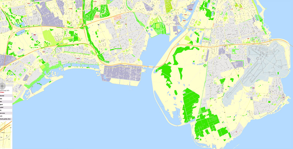
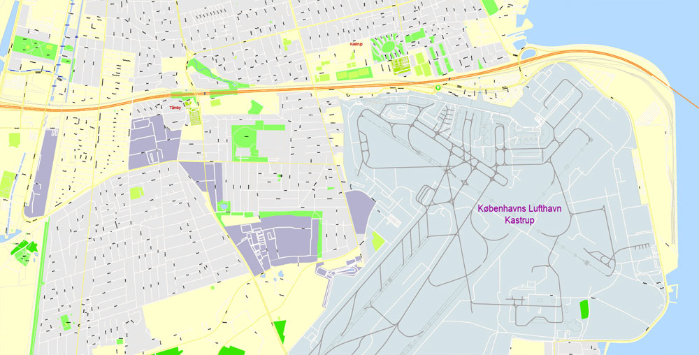
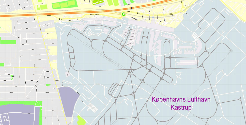
Serving roughly two million passengers a month, Copenhagen Airport, Kastrup, is the busiest airport in the Nordic countries.
Geography
Copenhagen is part of the Øresund Region, which consists of Zealand, Lolland-Falster and Bornholm in Denmark and Scania in Sweden. It is located on the eastern shore of the island of Zealand, partly on the island of Amager and on a number of natural and artificial islets between the two. Copenhagen faces the Øresund to the east, the strait of water that separates Denmark from Sweden, and which connects the North Sea with the Baltic Sea. The Swedish towns of Malmö and Landskrona lie on the Swedish side of the sound directly across from Copenhagen. By road, Copenhagen is 42 kilometres (26 mi) northwest of Malmö, Sweden, 85 kilometres (53 mi) northeast of Næstved, 164 kilometres (102 mi) northeast of Odense, 295 kilometres (183 mi) east of Esbjerg and 188 kilometres (117 mi) southeast of Aarhus by sea and road via Sjællands Odde.
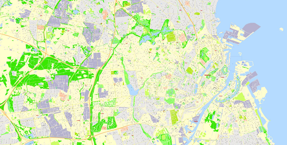
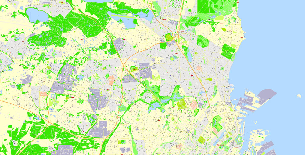
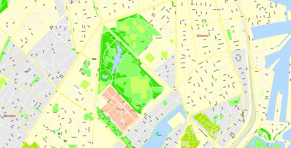
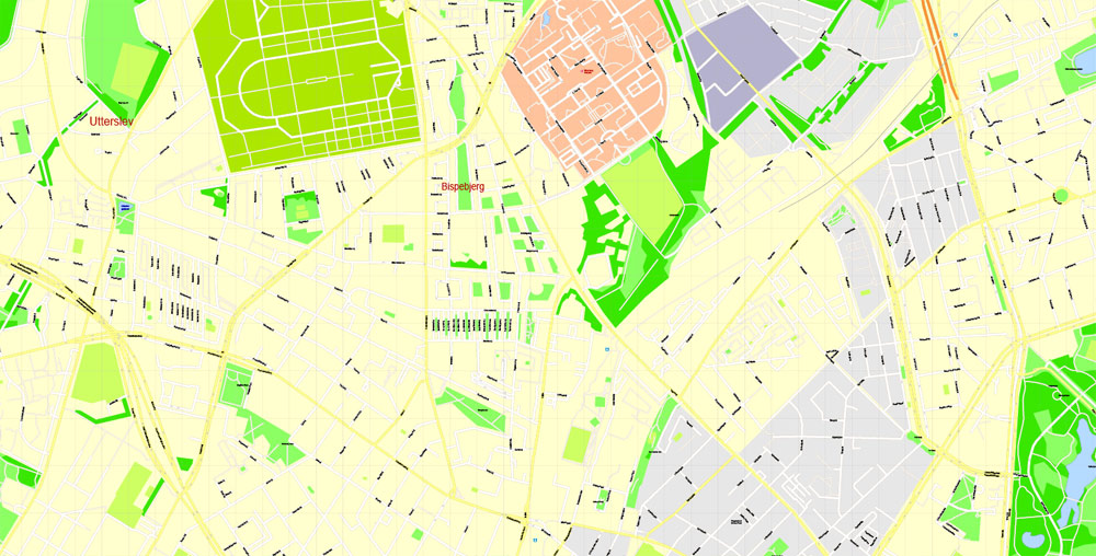
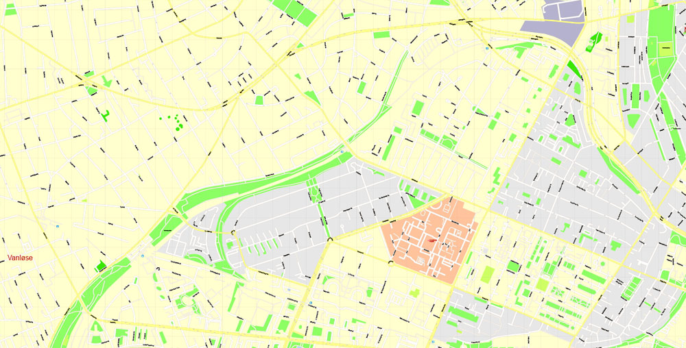
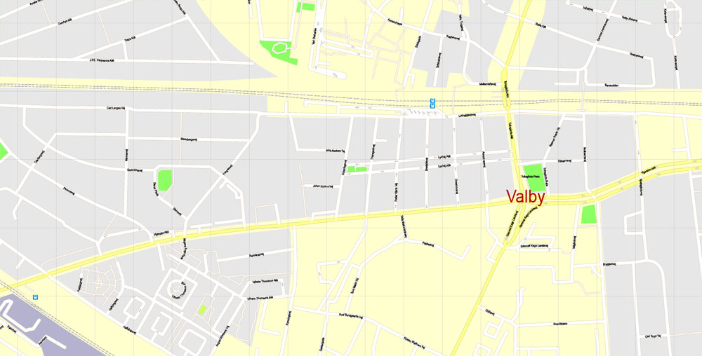
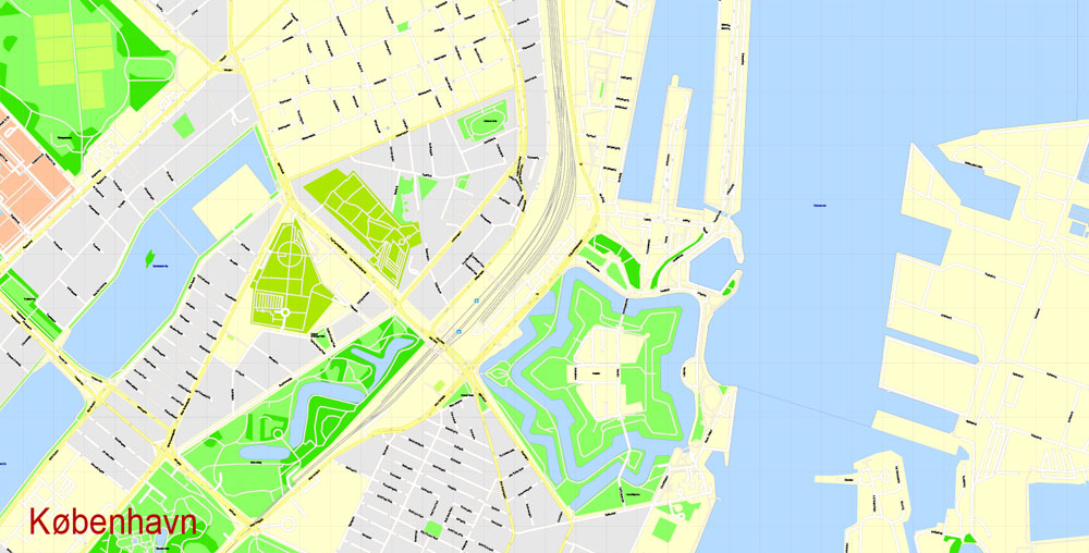
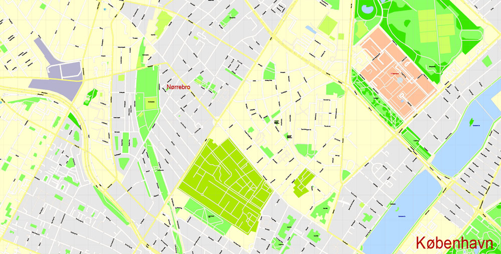
The city centre lies in the area originally defined by the old ramparts, which are still referred to as the Fortification Ring (Fæstningsringen) and kept as a partial green band around it. Then come the late-19th- and early-20th-century residential neighbourhoods of Østerbro, Nørrebro, Vesterbro and Amagerbro. The outlying areas of Kongens Enghave, Valby, Vigerslev, Vanløse, Brønshøj, Utterslev and Sundby followed from 1920 to 1960. They consist mainly of residential housing and apartments often enhanced with parks and greenery.
Topography
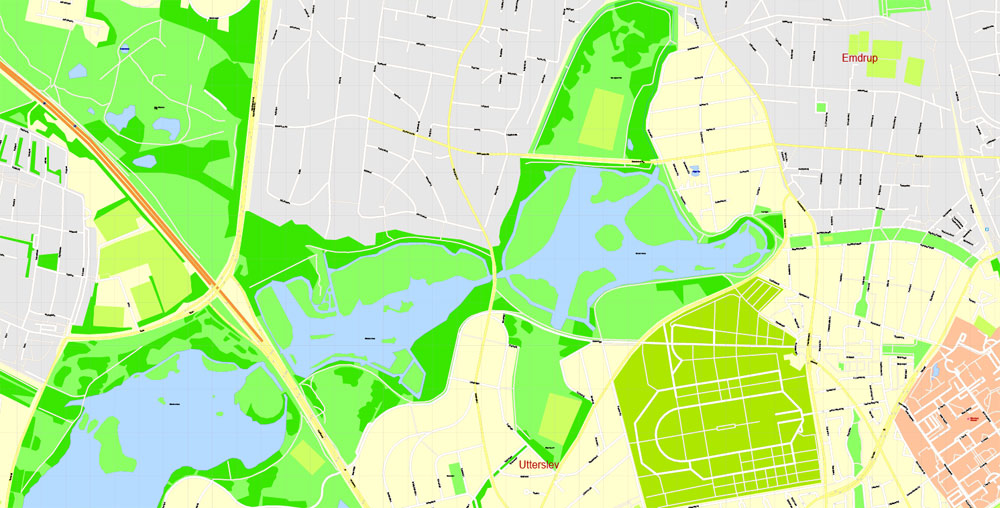
The central area of the city consists of relatively low-lying flat ground formed by moraines from the last ice age while the hilly areas to the north and west frequently rise to 50 m (160 ft) above sea level. The slopes of Valby and Brønshøj reach heights of over 30 m (98 ft), divided by valleys running from the northeast to the southwest. Close to the centre are the Copenhagen lakes of Sortedams Sø, Peblinge Sø and Sankt Jørgens Sø.
Copenhagen rests on a subsoil of flint-layered limestone deposited in the Danian period some 60 to 66 million years ago. Some greensand from the Selandian is also present. There are a few faults in the area, the most important of which is the Carlsberg fault which runs northwest to southeast through the centre of the city. During the last ice age, glaciers eroded the surface leaving a layer of moraines up to 15 m (49 ft) thick.
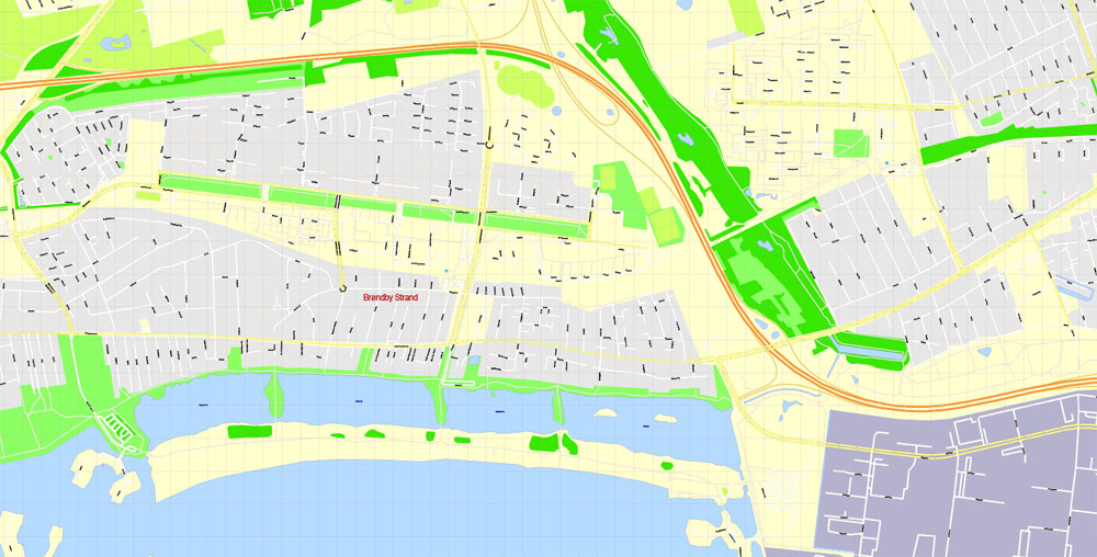
Amager Strandpark, which opened in 2005, is a 2 km (1 mi) long artificial island, with a total of 4.6 km (2.9 mi) of beaches. It is located just 15 minutes by bicycle or a few minutes by metro from the city centre. In Klampenborg, about 10 kilometers from downtown Copenhagen, is Bellevue Beach. It is 700 metres (2,300 ft) long and has both lifeguards and freshwater showers on the beach.
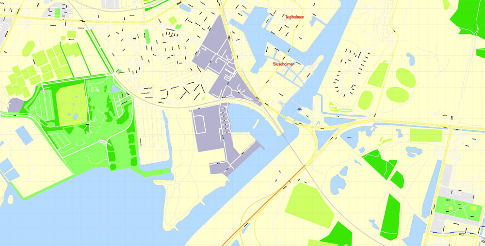
The beaches are supplemented by a system of Harbour Baths along the Copenhagen waterfront. The first and most popular of these is located at Islands Brygge and has won international acclaim for its design.
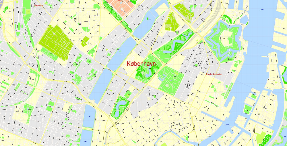
Copenhagen
Capital of Denmark
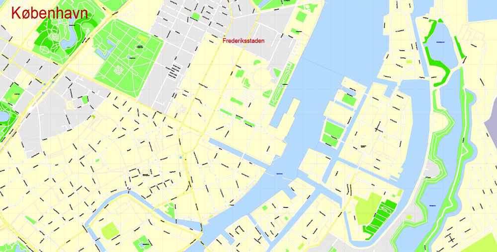
Copenhagen, Denmark’s capital, sits on the coastal islands of Zealand and Amager, linked to Malmo in southern Sweden by the Öresund Bridge. Indre By, the central district, contains 18th-century, rococo Frederiksstaden, home to the royal family’s Amalienborg Palace. The city’s center also has the Christiansborg parliament building and the Renaissance Rosenborg Castle, which has a museum of royal artifacts and a popular garden.
Copenhagen is the capital and most populated city of Denmark. It has a municipal population of 591,481 and a larger urban population of 1,280,371 (as of 1 January 2016). The Copenhagen metropolitan area has just over 2 million inhabitants. The city is situated on the eastern coast of the island of Zealand; another small portion of the city is located on Amager, and is separated from Malmö, Sweden, by the strait of Øresund.
Originally a Viking fishing village founded in the 10th century, Copenhagen became the capital of Denmark in the early 15th century. Beginning in the 17th century, under the reign of Christian IV, it developed into an important regional centre, consolidating its position as capital of Denmark–Norway with its institutions, defences and armed forces. Magnificent architectural expressions of prestige from this time include some of Copenhagen’s most important tourist attractions, such as Børsen (Stock Exchange), the Rundetårn (Round Tower) and Rosenborg Castle. After suffering from the effects of plague and fire in the 18th century, the city underwent a period of redevelopment. This included construction of the prestigious district of Frederiksstaden and founding of such cultural institutions as the Royal Theatre and the Royal Academy of Fine Arts. After further disasters in the early 19th century when Nelson attacked the Dano-Norwegian fleet and bombarded the city, rebuilding during the Danish Golden Age brought a Neoclassical look to Copenhagen’s architecture. Later, following the Second World War, the Finger Plan fostered the development of housing and businesses along the five urban railway routes stretching out from the city centre.
Since the turn of the 21st century, Copenhagen has seen strong urban and cultural development, facilitated by investment in its institutions and infrastructure. The city is the cultural, economic and governmental centre of Denmark; it is one of the major financial centres of Northern Europe with the Copenhagen Stock Exchange.
Copenhagen’s economy has seen rapid developments in the service sector, especially through initiatives in information technology, pharmaceuticals and clean technology. Since the completion of the Øresund Bridge, a road, railway and tunnel project, the Copenhagen metropolitan area has become increasingly integrated with the Swedish province of Scania and its largest city, Malmö, known as the Øresund Region. With a number of bridges connecting the various districts, the cityscape is characterized by parks, promenades and waterfronts. Copenhagen’s landmarks such as Tivoli Gardens, the Little Mermaid Statue, the Amalienborg and Christiansborg palaces, Rosenborg Castle Gardens, Frederik’s Church, and many museums, restaurants and nightclubs are significant tourist attractions.
Copenhagen is home to the University of Copenhagen, the Technical University of Denmark and Copenhagen Business School. The University of Copenhagen, founded in 1479, is the oldest university in Denmark. Copenhagen is home to the FC København and Brøndby football clubs. The annual Copenhagen Marathon was established in 1980. Copenhagen is one of the most bicycle-friendly cities in the world. The Copenhagen Metro serves central Copenhagen together with the S-train network connecting the outlying boroughs. Serving roughly 2 million passengers a month, Copenhagen Airport, Kastrup, is the largest airport in the Nordic countries.
Free vector maps:

Free download printable map Europe vector Adobe Illustrator >>>
Free download printable PDF map Europe vector Adobe PDF >>>
Small guide: How to work with the vector map?
You can: Mass select objects by type and color – for example, the objects type “building” (they are usually dark gray) – and remove them from the map, if you do not need them in your print or design project. You can also easily change the thickness of lines (streets), just bulk selection the road by the line color.
The streets are separated by type, for example, type “residential road” are usually white with a gray stroke. Highway usually orange with a brown or dark gray stroke.
It is easy to change the font of inscriptions, all or each individually. Also, just can be make and any other manipulation of objects on the vector map in Adobe illustrator format.
Important: All the proportions on the map are true, that is, the relative sizes of the objects are true, because Map is based on an accurate GPS projection, and It transated into the (usual for all) the Mercator projection.
You can easily change the color, stroke and fill of any object on the map, zoom without loss of quality Image Verification.
Select object

Bulk selection the same objects on the vector map

See the bulk selected objects on the vector map

Bulk delete buildungs from the vector map

Select residencial road (small street) on the vector map

Bulk selection the same lines (streets, roads) on the full map

Create fat lines of the streets on the vector maps (bulk action) 1

Create fat lines of the streets on the vector maps (bulk action) 2

Create fat lines of the streets on the vector maps (bulk action) 3

You can easily change the color, stroke and fill of any object on the map, zoom without loss of quality Image Verification.

 Author: Kirill Shrayber, Ph.D. FRGS

 street City Plan map, full editable, Adobe Illustrator")
 street City Plan map, full editable, Adobe Illustrator")