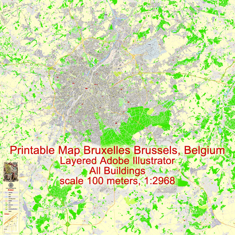
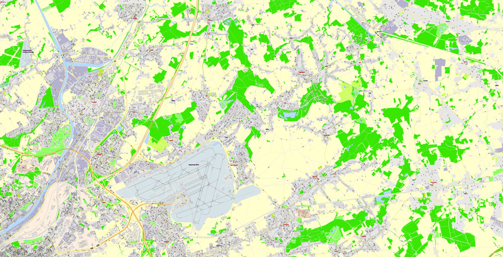
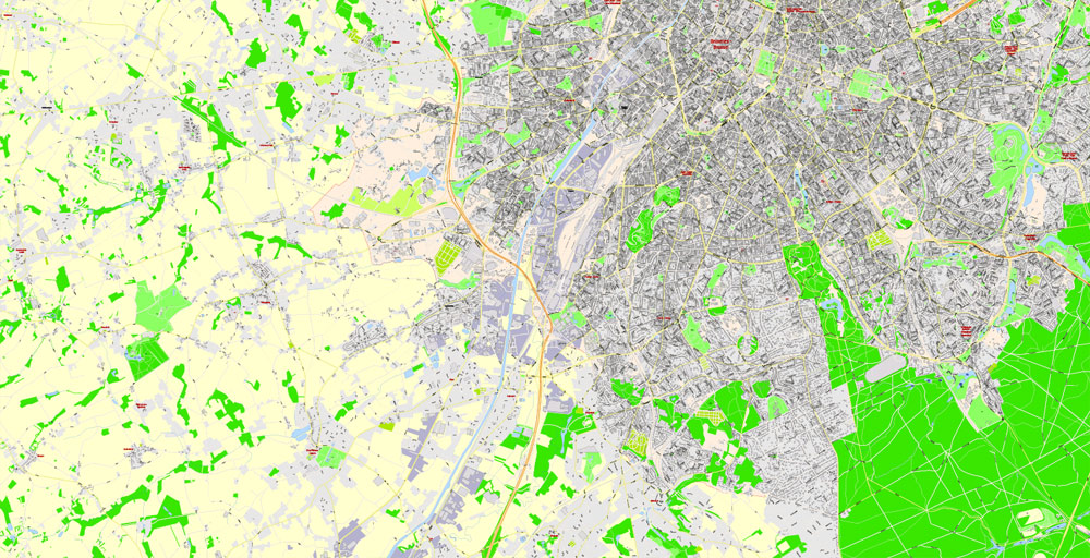
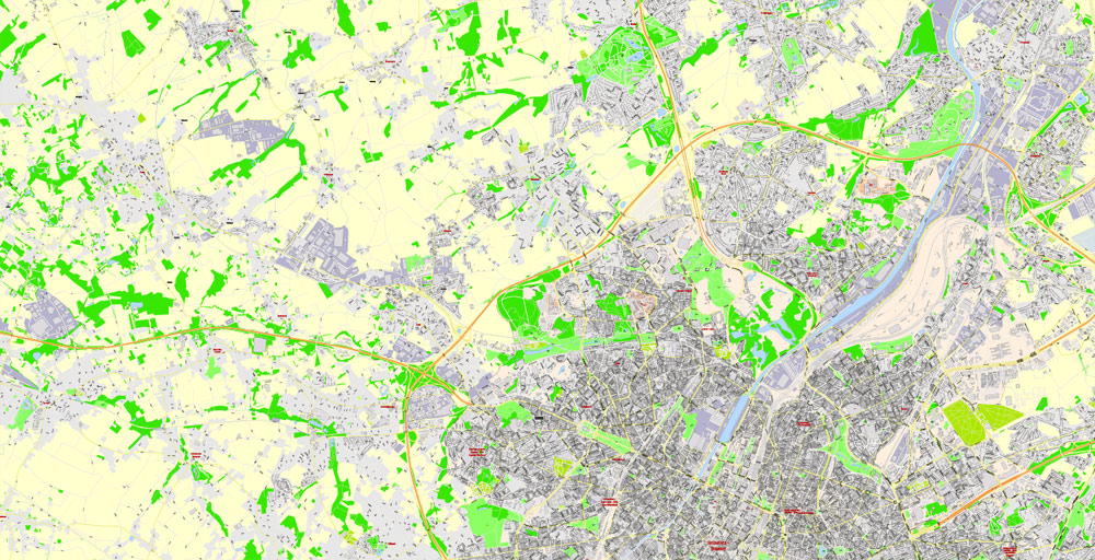
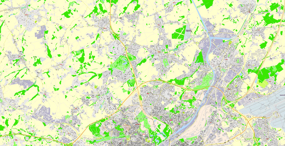
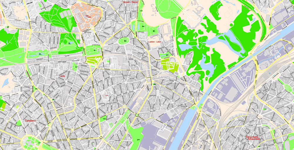
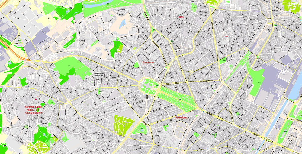
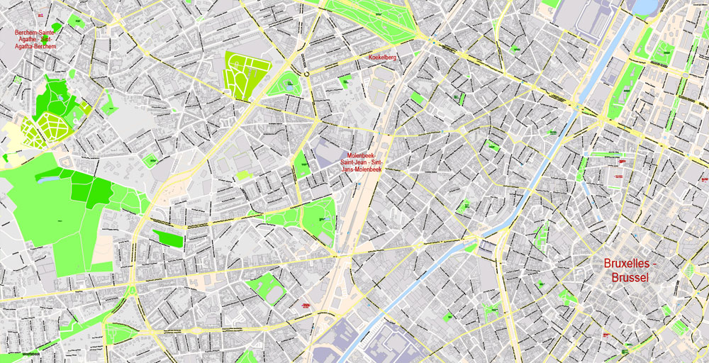
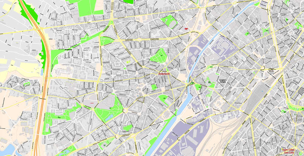
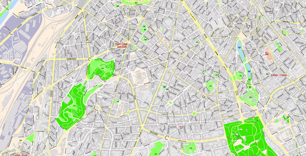
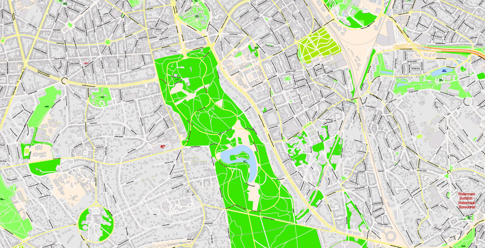
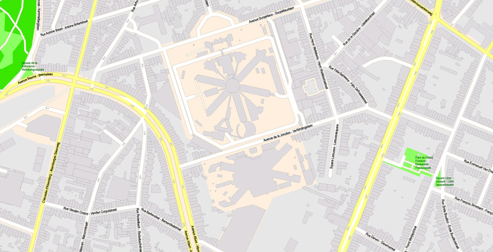
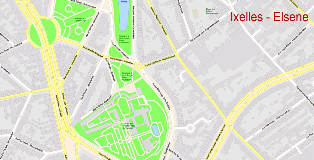
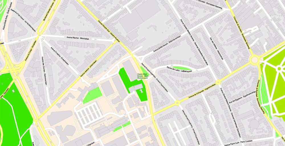
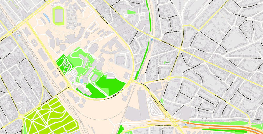
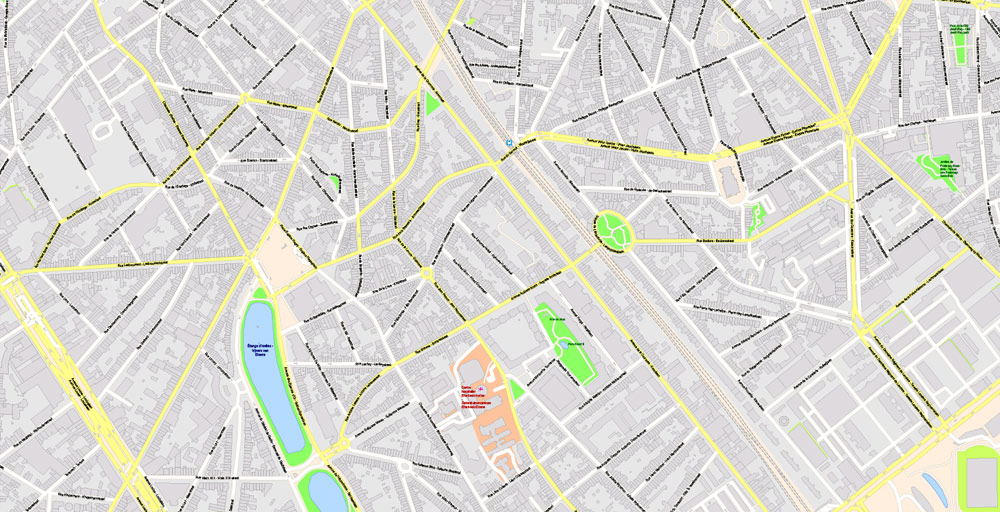
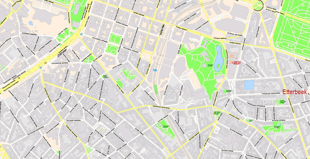
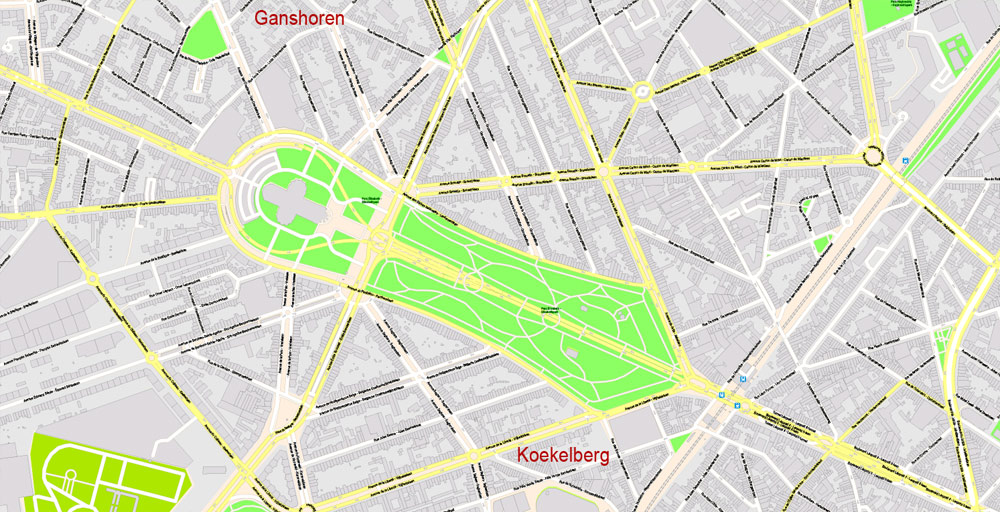
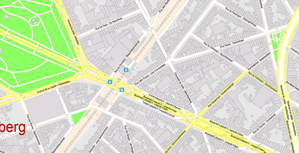
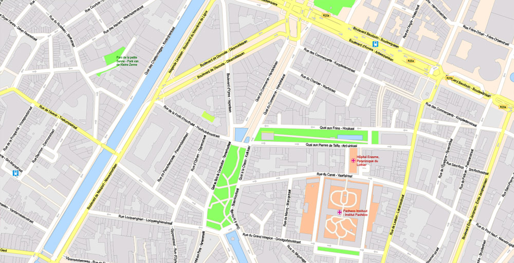
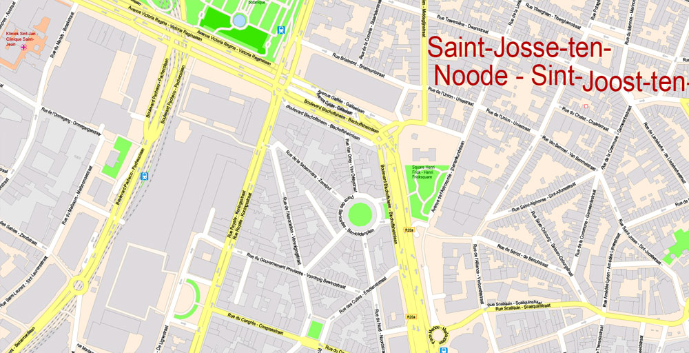
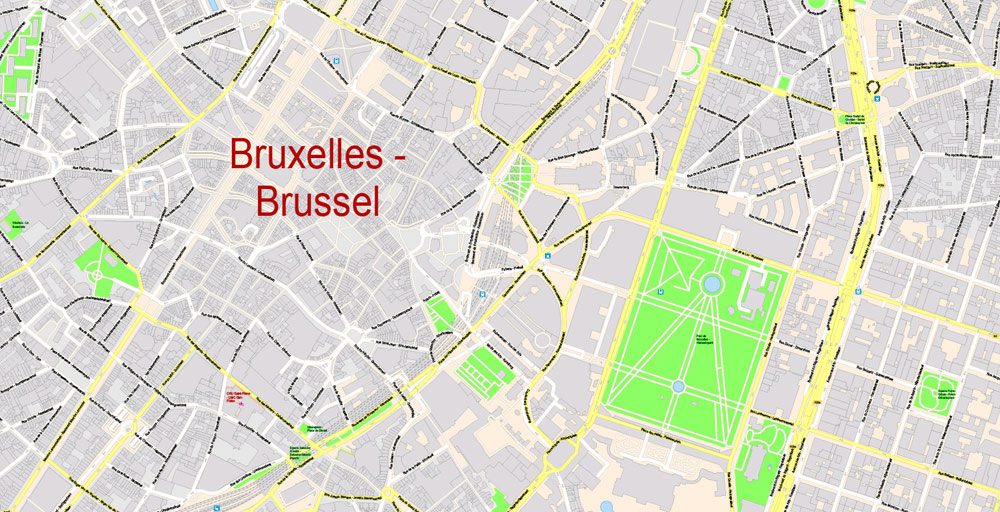
PDF Vector Map Bruxelles Brussels, Belgium, exact City Plan ALL Buildings, street G-View Level 17 (100 meters scale) map, fully editable, Adobe PDF, full vector, scalable, 176 Mb ZIP.
All streets named, main objects, ALL buildings. Map for publishing, design, printing, publications, arts, projects, presentations, for architects, designers and builders, business, logistics. The most exact and detailed map of the city.
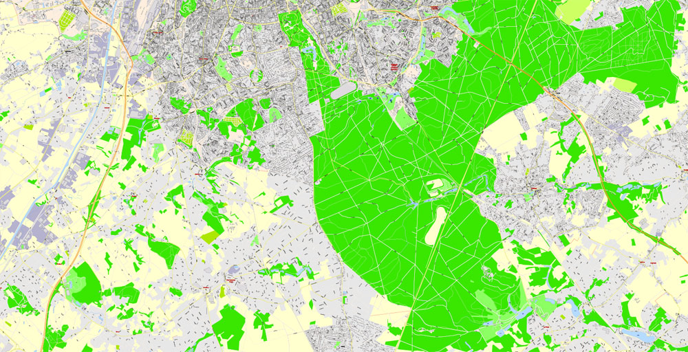
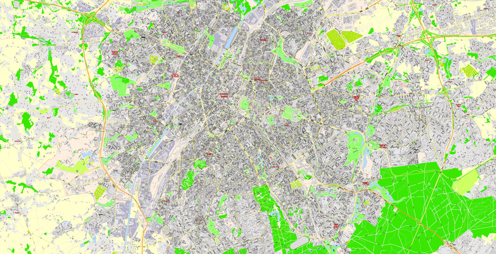
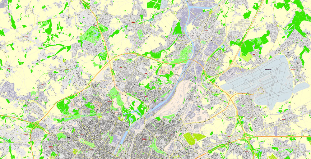
For printing LARGE (WALL) format
You can edit this file by Adobe Illustrator, Adobe Acrobat, Corel Draw.
DWG, DXF, CDR, ESRI Shapes, and other formats – by request, same price, please contact.
Brussels, Belgium.
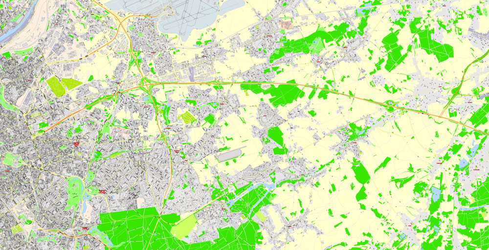
This vector map of Brussels city is used as a basis for design, editing, and further printing.
This is the most detailed, exact map of Brussels city for high-quality printing and polygraphy. You can always clarify the map development date by contacting us.
For your convenience, all objects on Brussels vector city map are divided into layers. And the editing is very easy – colors, lines, etc.
You can easily add any objects needed (e.g. shops, salons, sale points, gas station or attraction) on any layer of Brussels vector map.
Brussels is a region of Belgium comprising 19 municipalities, including the City of Brussels, which is the capital of Belgium. The Brussels-Capital Region is located in the central portion of the country and is a part of both the French Community of Belgium and the Flemish Community, but is separate from the Flemish Region (in which it forms an enclave) and the Walloon Region.
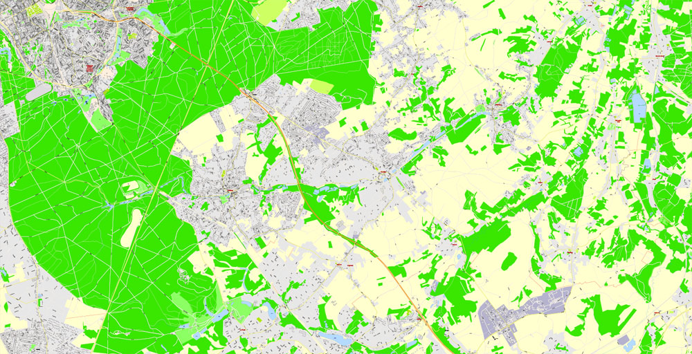
One of the advantages of Brussels city vector maps of our production is the relevance of cartographic data, we constantly update all our products.
This vector map of Brussels city is used by:
designers, layout designers, printers, advertisers and architects. Our product – vector maps – is designed for further editing and printing in large formats – from @Wall format (a few meters) to A-0 and A-1, A-2, A-3.
The Brussels city map in vector format is used for design, urban planning, presentations and media visualizations.
The advertising and presentation map of Brussels city (usually the final designer marks the routes, and puts the client’s objects (shops, saloons, gas stations etc.)
The undoubted advantage is that people will NEVER throw out this advertising product – the map. In fact, as an advertising medium, a city map is the most “long-playing” of the well-known polygraphic advertising media, with the longest lifespan, and the maximum number of interactions with the customer.
Brussels is the most densely populated and the richest region in Belgium in terms of GDP per capita. It covers 161 km2 (62 sq mi), a relatively small area compared to the two other regions, and has a population of 1.2 million. The metropolitan area of Brussels counts over 2.1 million people, which makes it the largest in Belgium. It is also part of a large conurbation extending towards Ghent, Antwerp, Leuven and Walloon Brabant, home to over 5 million people.
For travelers, maps are sold at the airports and gas stations around the world. Often the source is our vector maps.
Take a look, who purchases our vector maps of Brussels city in “Our Clients and Friends” page – these are large and small companies, from super-brands like Volvo and Starbucks, to small design studios and printing houses.
It’s very easy to work with vector maps of Brussels city, even for a not very experienced designer who can turn on and off the map layers, add new objects, change the colors of fill and lines according to customer requirements.
The undoubted advantage of Brussels city vector maps in printing is an excellent and detailed visualization, when customer can expand a large paper map and instantly define his location, find a landmark, an object or address on map, unlike using the popular electronic formats of Google and Yandex maps for example.
Printable vector maps of Brussels city are much more convenient and efficient than any electronic maps on your smartphone, because ALL DETAILS are displayed in the entire space of Brussels city map.
Useful tips on working with vector maps of cities and countries in Adobe Illustrator.
«V» – launches the Selection tool (cursor, black arrow), which makes active any vector line.
«А» – launches the Direct Selection tool (white cursor), allows you to select curve elements and drag them to the desired place.
«R» – activates the Rotate tool, which helps you rotating selected objects around the center point by 360 degrees.
«E» – gives you the opportunity to use the Eraser tool and erase unnecessary parts.
«X» – switches between Fill and Stroke in the Tools section. Try to get used to this hot key and
you will quickly understand that you can’t live and work without it.
Guides are not limited to vertical and horizontal in Adobe Illustrator. You can also create a diagonal guide for example. Moreover, you can turn any contours into guides. Select the outline and go to View > Guides > Make Guides (Create Guides), or simply press Cmd/Ctrl + 5. You can also turn the guides back into an editable object. Go to menu, View > Guides > Unlock Guides (Release Guides), select the guide you want to edit and select View > Guides > Release Guides (Reset Guides), or just press Cmd/Ctrl + Option / Alt + 5).
Brussels grew from a small rural settlement on the river Senne to become an important city-region in Europe. Since the end of the Second World War, it has been a major centre for international politics and the home of numerous international organisations, politicians, diplomats and civil servants. Brussels is the de facto capital of the European Union, as it hosts a number of principal EU institutions (the two other capitals are Luxembourg and Strasbourg) and its name is sometimes used metonymically to describe the EU and its institutions. The secretariat of the Benelux and headquarters of NATO are also located in Brussels.
You will probably want to change the color scheme used on our Brussels vector city map.
To quickly and effectively play with colors.
Of course, you can do it manually, all objects in our Brussels city vector map are divided according to types and layers, and you can easily change the color gamma of vector objects in groups and layers.
But there is more effective way of working with the whole VECTOR MAP of Brussels city and all layers:
The overview dialog «Edit colors»/«Repaint Graphic Object» (this dialog box name can change depending on the context):
If you have selected a part or a layer of Brussels city vector map and open the dialog box by clicking the icon in the Control panel, on the Samples palette or the Color Catalog, or if you choose Edit > Edit Colors> Repaint Graphic Object, then the «Repaint Graphic Object» dialog box appears, and you get access to «Assign» and «Edit» tabs.
As the economic capital of Belgium and one of the top financial centres of Western Europe with Euronext Brussels, it is classified as an Alpha global city. Brussels is a hub for rail, road and air traffic, sometimes earning the moniker “Crossroads of Europe”. The Brussels Metro is the only rapid transit system in Belgium. In addition, both its airport and railway stations are the largest and busiest in the country.
If a picture or a map fragment is not selected, and you open the dialog box by clicking the icon in the Control panel, on the Samples palette or in the Color Catalog, the «Edit Colors» dialog box appears and you can only access the «Edit» tab.
Regardless of the name at the top of the dialog box, the right-hand side always displays the color group of the current document, as well as two default color groups: Print Color and Grayscale. These color groups can be selected and used any time.
Create and edit color groups of Brussels city vector map, and also assign colors using the «Edit Colors»/ а «Repaint Graphic Object» dialog box.
A. Creating and editing of a color group on the «Edit» tab
B. Assigning colors on the «Assign» tab
C. Select a group of colors from the «Color groups» list
The option «Repaint a graphic object» in the lower part of the dialog box allows you to preview the colors on a selected layer of Vector map, or a group of elements, and specify whether its colors will be redefined when the dialog box is closed.
Historically Dutch-speaking, Brussels saw a language shift to French from the late 19th century. The Brussels-Capital Region is officially bilingual in Dutch and French, even though French is now the de facto main language with over 90% of the population speaking it. Brussels is also increasingly becoming multilingual. English is spoken as a second language by nearly a third of the population and a large number of migrants and expatriates speak other languages.
The main areas of the dialog box are:
«Edit»
The «Edit» tab is designed to create a new or edit the existing color groups.
The harmony rules Menu and the Color Wheel are used to conduct experiments with color harmonies. The color wheel shows how colors are related in color harmony, and the color bars allow you to view and manipulate an individual color values. In addition, you can adjust the brightness, add and remove colors, save color groups and view colors on the selected Vector Map of Brussels city or a separated layers.
«Assign»
The «Assign» tab is used to view and control on how the original colors are replaced with colors from the color group like your corporate colors in the Vector Map of Brussels city.
The assign color ability is provided only if the entire map, layer or fragment is selected in the document. You can specify which of new colors replace the current colors, whether the spot colors should be preserved and how colors are replaced (for example, you can replace colors completely or changing the color tone while maintaining the brightness). The «Assign» tab allows you to redefine colors in the Vector Map of Brussels city, or in separate layers and fragments using the current color group or reducing the number of colors in the current Vector Map.
Brussels is known for its cuisine and gastronomy, as well as its historical and architectural landmarks; some of them are registered as UNESCO World Heritage sites. Main attractions include its historic Grand Place, Manneken Pis, Atomium, and cultural institutions such as La Monnaie and the Museums of Art and History. It is also a capital of the comic strip.
Color groups
Is a list of all saved color groups for current document (the same groups appear in the «Samples» palette). You can edit and delete the existing color groups, as well as creating a new ones using the list of “Color Groups” in the dialog box. All changes appear in the «Samples» palette.
The highlighted color group shows, which color group is currently edited.
Any color group can be selected and edited, or used to redefine the colors in the selected vector map of Brussels city, its fragments or elements.
Saving a color group adds this group to the specified list.
Opening the «Edit Colors»/«Repaint Graphic Object» dialog box.
Open the «Edit Colors»/«Repaint Graphic Object» dialog box using one of the following methods:
«Edit»> «Edit Colors»> «Repaint Graphic object» or «Repaint With Style».
Use these commands if you need to edit the colors in the selected vector map of Brussels city.
«Repaint Graphic object» button on the «Control» panel.
Use this button if you need to adjust colors of Brussels city vector map using the а «Repaint graphic object» dialog box.
The specified button is available if the selected vector map or its fragment contains two or more colors.
Note. This color editing method is convenient for global color adjustment in a vector map, if global colors were not used when creating a City Map of Brussels.
The «Edit colors» button or «Edit or apply colors» on the «Color Catalog» palette
Click this button if you need to edit colors on the «Color Catalog» palette or edit and then apply them to the selected Vector Map of Brussels city or its fragment.
The «Edit color group» button or «Edit or apply color group» on the «Samples» palette.
Click this button if you need to edit the colors in the specific color group or edit and apply them to the selected Vector Map of Brussels city or a group of its elements, for example, the whole layer “Streets and lines”. You can also double-click the color group in the Samples panel to open the dialog box.
If the map file is too large and your computer freezes or even can’t open it quickly:
1. Try to reduce the color resolution of the video card (display) to 256 colors while working with a large map.
2. Using Windows Task Manager, select all the application you don’t need, while working with map, just turn them off.
3. Launch Adobe Illustrator. (DO NOT OPEN the vector map file)
4. Start the Windows Task Manager using administrator rights > Find the “Illustrator” process > set the «real time» priority,
5. Open the file. When you see the LEGACY FONT popup window – click “OK” (do not update). You can restore the TEXT later.
6. Can also be useful: When file is opened – Edit > Settings > Basic Settings > disable smoothing. /// It looks scary, but works quickly)))
We recommend saving the file in Adobe Illustrator 10 version. It’s much more stable when working with VERY BIG size files.
Geography
Brussels lies in the north-central part of Belgium, about 110 kilometres (68 miles) from the Belgian coast and about 180 km (110 mi) from the southern tip of Belgium. It is located in the heartland of the Brabantian Plateau, about 45 km (28 mi) south of Antwerp (Flanders), and 50 km (31 mi) north of Charleroi (Wallonia). Its average elevation is 57 metres (187 feet) above sea level, varying from a low point in the valley of the almost completely covered Senne, which cuts the region from east to west, up to high points in the Sonian Forest, at the southeastern side. In addition to the Senne, tributary streams such as the Maalbeek and the Woluwe, to the east of the region, account for significant elevation differences. Brussels’ central boulevards are 15 metres (49 feet) above sea level. The highest point lies at a height of about 108 metres (354 feet), near Place de l’Altitude Cent/Hoogte Honderdplein, in Forest.
Bruxelles Brussels
Capital of Belgium
The City of Brussels is the largest municipality of the Brussels-Capital Region, and the de jure capital of Belgium. The City of Brussels covers most of the Region’s centre, as well as northern outskirts where it borders municipalities in Flanders.
Area
• Region/City 161.38 km2 (62.2 sq mi)
Elevation 13 m (43 ft)
Population
• Region/City 1,175,173
• Density 7,025/km2 (16,857/sq mi)
• Metro 1,830,000
Free vector maps:

Free download printable map Europe vector Adobe Illustrator >>>
Free download printable PDF map Europe vector Adobe PDF >>>
Small guide: How to work with the vector map?
You can: Mass select objects by type and color – for example, the objects type “building” (they are usually dark gray) – and remove them from the map, if you do not need them in your print or design project. You can also easily change the thickness of lines (streets), just bulk selection the road by the line color.
The streets are separated by type, for example, type “residential road” are usually white with a gray stroke. Highway usually orange with a brown or dark gray stroke.
It is easy to change the font of inscriptions, all or each individually. Also, just can be make and any other manipulation of objects on the vector map in Adobe illustrator format.
Important: All the proportions on the map are true, that is, the relative sizes of the objects are true, because Map is based on an accurate GPS projection, and It transated into the (usual for all) the Mercator projection.
You can easily change the color, stroke and fill of any object on the map, zoom without loss of quality Image Verification.
Select object

Bulk selection the same objects on the vector map

See the bulk selected objects on the vector map

Bulk delete buildungs from the vector map

Select residencial road (small street) on the vector map

Bulk selection the same lines (streets, roads) on the full map

Create fat lines of the streets on the vector maps (bulk action) 1

Create fat lines of the streets on the vector maps (bulk action) 2

Create fat lines of the streets on the vector maps (bulk action) 3

You can easily change the color, stroke and fill of any object on the map, zoom without loss of quality Image Verification.

 Author: Kirill Shrayber, Ph.D. FRGS

 map, fully editable, Adobe Illustrator")
 map, fully editable, Adobe Illustrator")