Extended Description of the Vector Map
PDF Printable Map Vancouver Metro Area, Canada, exact vector Map street G-View City Plan Level 17 (100 meters scale) full editable, Adobe PDF, full vector, scalable, editable text format street names, 43 mb ZIP
All streets named, Main Objects, No buildings. Map for design, printing, arts, projects, presentations, for architects, designers and builders, business, logistics.
Layers: color fills, streets_roads, arrows_streets, labels_roads, objects, names objects, names_streets, names_places, grids, legend.
The most exact and detailed map of the city.
For print LARGE (WALL) format.
You can edit this file by Adobe Illustrator, Adobe Acrobat, Corel Draw.
DWG, DXF, CDR and other formats – on request, same price, please, contact
Vancouver
City in British Columbia, Canada
Vancouver, a bustling west coast seaport in British Columbia, is among Canada’s densest, most ethnically diverse cities. A popular filming location, it’s surrounded by mountains, and also has thriving art, theatre and music scenes. Vancouver Art Gallery is known for its works by regional artists, while the Museum of Anthropology houses preeminent First Nations collections.
Area
• City 114.97 km2 (44.39 sq mi)
• Metro 2,878.52 km2 (1,111.40 sq mi)
Elevation 0–152 m (0–501 ft)
Population
• City 631,486 (8th)
• Density 5,492.6/km2 (14,226/sq mi)
• Urban 2,135,201
• Metro 2,463,431 (3rd)
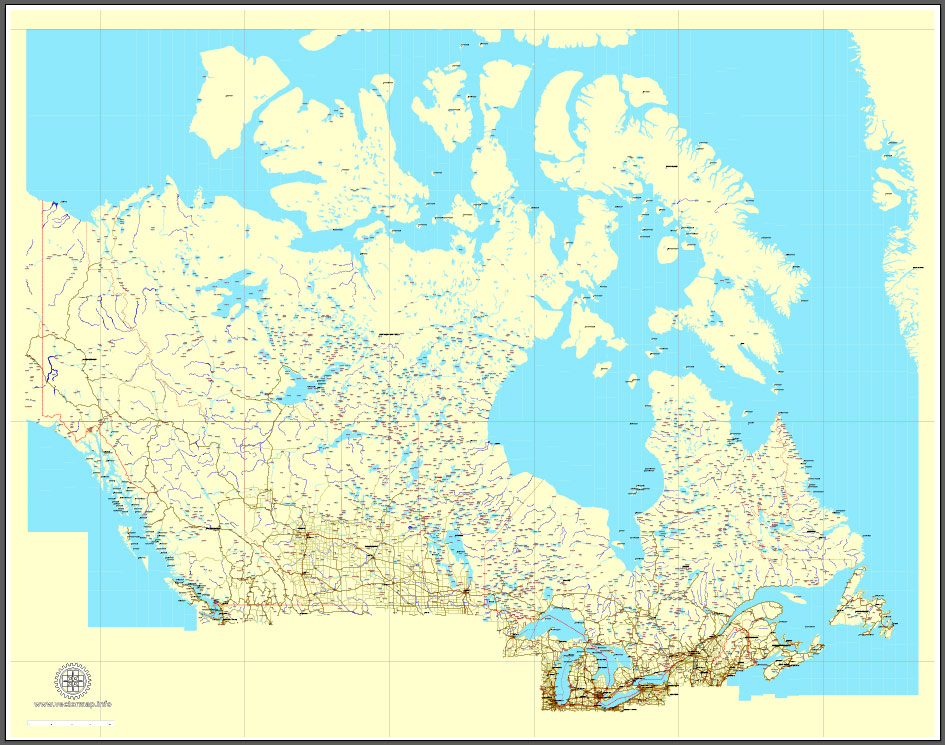
Download Free vector Map Canada, mainroads, cities, borders, province borders, Adobe Illustrator Text format street names, full editable, Layers: grownd, nombres, borders, symbols, halo
vector_map_canada_mainroads_mercator_projection_ai-ai
Download Free PDF Map Canada, mainroads, cities, borders, province borders, Adobe PDF Text format street names, full editable, Layers: grownd, nombres, borders, symbols, halo
vector_map_canada_mainroads_mercator_projection_pdf-pdf
Small guide: How to work with the vector map?
You can: Mass select objects by type and color – for example, the objects type “building” (they are usually dark gray) – and remove them from the map, if you do not need them in your print or design project. You can also easily change the thickness of lines (streets), just bulk selection the road by the line color.
The streets are separated by type, for example, type “residential road” are usually white with a gray stroke. Highway usually orange with a brown or dark gray stroke.
It is easy to change the font of inscriptions, all or each individually. Also, just can be make and any other manipulation of objects on the vector map in Adobe illustrator format.
Important: All the proportions on the map are true, that is, the relative sizes of the objects are true, because Map is based on an accurate GPS projection, and It transated into the (usual for all) the Mercator projection.
You can easily change the color, stroke and fill of any object on the map, zoom without loss of quality Image Verification.
Select object

Bulk selection the same objects on the vector map

See the bulk selected objects on the vector map

Bulk delete buildungs from the vector map

Select residencial road (small street) on the vector map

Bulk selection the same lines (streets, roads) on the full map

Create fat lines of the streets on the vector maps (bulk action) 1

Create fat lines of the streets on the vector maps (bulk action) 2

Create fat lines of the streets on the vector maps (bulk action) 3

You can easily change the color, stroke and fill of any object on the map, zoom without loss of quality Image Verification.
Free vector map World, Adobe Illustrator, download now maps vector clipart
Map for design, projects, presentation free to use as you like.
See also: TERMS & CONDITIONS: SOFTWARE LICENSE AGREEMENT FOR DIGITAL CARTOGRAPHIC DATA.
Need more USA Vector Maps, printable and editable?
 full editable, Adobe Illustrator")
 full editable, Adobe Illustrator")
 full editable, Adobe Illustrator")
 full editable, Adobe Illustrator")
 full editable, Adobe Illustrator")
 full editable, Adobe Illustrator")
 full editable, Adobe Illustrator")
 full editable, Adobe Illustrator")
 full editable, Adobe Illustrator")
 full editable, Adobe Illustrator")
 full editable, Adobe Illustrator")
 full editable, Adobe Illustrator")
 full editable, Adobe Illustrator")
 full editable, Adobe Illustrator")
 full editable, Adobe Illustrator")
 full editable, Adobe Illustrator")
 full editable, Adobe Illustrator")
 full editable, Adobe Illustrator")
 full editable, Adobe Illustrator")
 full editable, Adobe Illustrator")
 full editable, Adobe Illustrator")
 full editable, Adobe Illustrator")
 full editable, Adobe Illustrator")
 full editable, Adobe Illustrator")

 Author: Kirill Shrayber, Ph.D. FRGS
 Street Map editable Adobe Illustrator in layers")
 Street Map editable Adobe Illustrator in layers")
 Street Map editable Adobe Illustrator in layers")