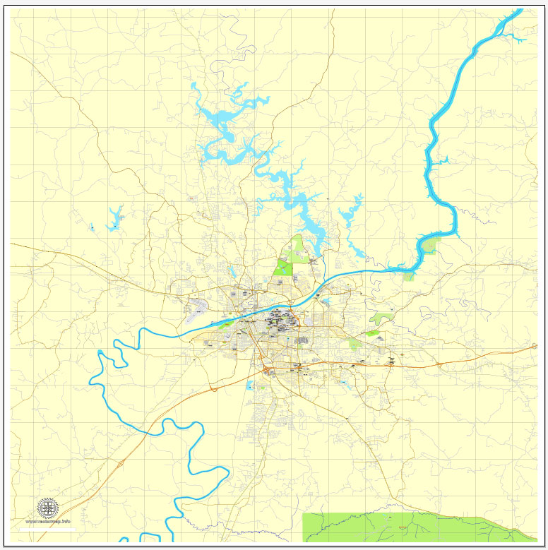
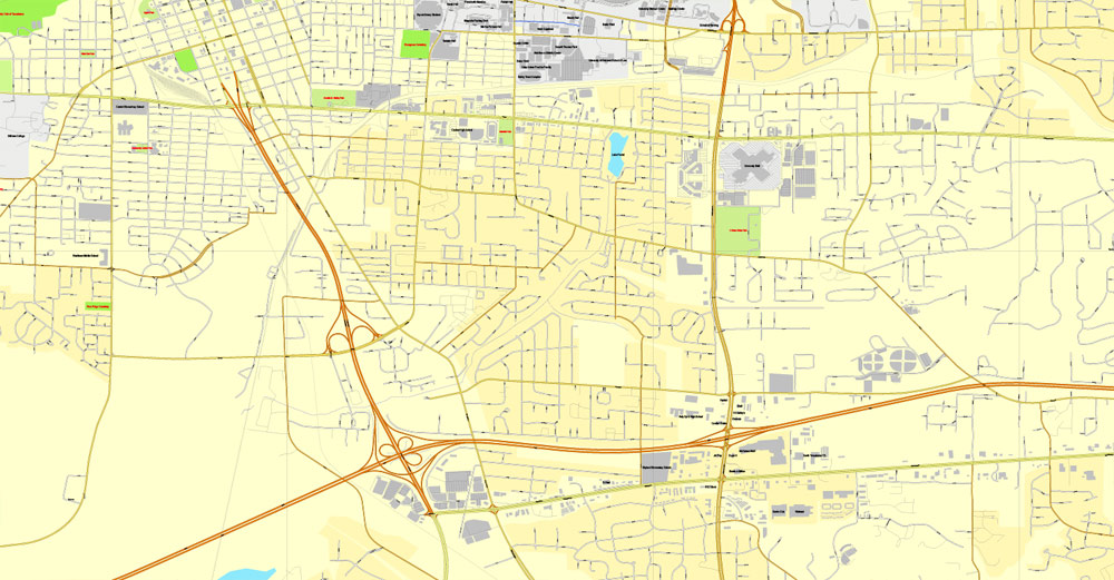
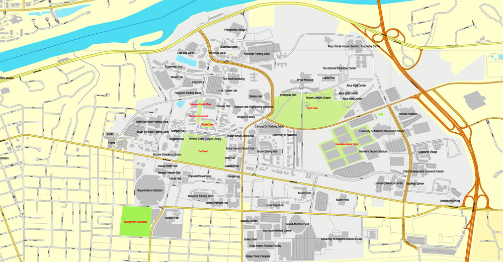
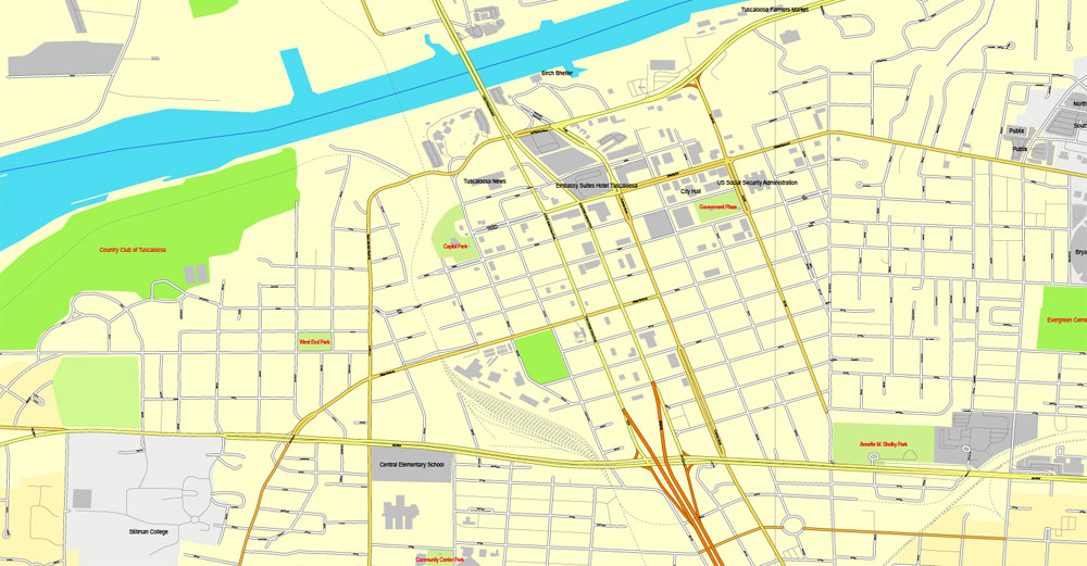
Tuscaloosa, Alabama, US, exact vector street City Plan map V3.09, full editable, Adobe PDF, full vector, scalable, editable text format street names, 12 mb ZIP
All streets, Some More buildings. Map for publishing, design, printing, publications, arts, projects, presentations, for architects, designers and builders, business, logistics. The most exact and detailed map of the city.
You can edit this file by Adobe Illustrator, Adobe Acrobat, Corel Draw.
DWG, DXF, CDR and other formats – on demand, same price, please, contact
Tuscaloosa, Alabama, USA.
This vector map of Tuscaloosa is used as a basis for design, editing, and further printing.
This is the most detailed, exact map of Tuscaloosa for high-quality printing and polygraphy. You can always clarify the map development date by contacting us.
For your convenience, all objects on Tuscaloosa vector map are divided into layers. And the editing is very easy – colors, lines, etc.
You can easily add any objects needed (e.g. shops, salons, sale points, gas station or attraction) on any layer of Tuscaloosa vector map.
Tuscaloosa is a city in and the seat of Tuscaloosa County in west central Alabama (in the southeastern United States). Located on the Black Warrior River at the Atlantic Seaboard fall line of the Piedmont, it is the fifth-largest city in Alabama, with an estimated population of 100,287 in 2017.
One of the advantages of Tuscaloosa vector maps of our production is the relevance of cartographic data, we constantly update all our products.
This vector map of Tuscaloosa is used by:
designers, layout designers, printers, advertisers and architects. Our product – vector maps – is designed for further editing and printing in large formats – from @Wall format (a few meters) to A-0 and A-1, A-2, A-3.
Tuscaloosa map in vector format is used for design, urban planning, presentations and media visualizations.
Advertising and presentation map of Tuscaloosa (usually the final designer marks the routes, and puts the client’s objects (shops, saloons, gas stations etc.)
The undoubted advantage is that people will NEVER throw out this advertising product – the map. In fact, as an advertising medium, a map is the most “long-playing” of the well-known polygraphic advertising media, with the longest lifespan, and the maximum number of interactions with the customer.
For travelers, maps are sold at the airports and gas stations around the world. Often the source is our vector maps.
Take a look, who purchases our vector maps of Tuscaloosa in “Our Clients and Friends” page – these are large and small companies, from super-brands like Volvo and Starbucks, to small design studios and printing houses.
It’s very easy to work with vector maps of Tuscaloosa, even for a not very experienced designer who can turn on and off the map layers, add new objects, change the colors of fill and lines according to customer requirements.
The undoubted advantage of Tuscaloosa vector maps in printing is an excellent and detailed visualization, when customer can expand a large paper map and instantly define his location, find a landmark, an object or address on map, unlike using the popular electronic formats of Google and Yandex maps for example.
Printable vector maps of Tuscaloosa are much more convenient and efficient than any electronic maps on your smartphone, because ALL DETAILS are displayed in the entire space of Tuscaloosa map.
Useful tips on working with vector maps of cities and countries in Adobe Illustrator.
«V» – launches the Selection tool (cursor, black arrow), which makes active any vector line.
«А» – launches the Direct Selection tool (white cursor), allows you to select curve elements and drag them to the desired place.
«R» – activates the Rotate tool, which helps you rotating selected objects around the center point by 360 degrees.
«E» – gives you the opportunity to use the Eraser tool and erase unnecessary parts.
«X» – switches between Fill and Stroke in the Tools section. Try to get used to this hot key and
you will quickly understand that you can’t live and work without it.
Guides are not limited to vertical and horizontal in Adobe Illustrator. You can also create a diagonal guide for example. Moreover, you can turn any contours into guides. Select the outline and go to View > Guides > Make Guides (Create Guides), or simply press Cmd/Ctrl + 5. You can also turn the guides back into an editable object. Go to menu, View > Guides > Unlock Guides (Release Guides), select the guide you want to edit and select View > Guides > Release Guides (Reset Guides), or just press Cmd/Ctrl + Option / Alt + 5).
You will probably want to change the color scheme used on our Tuscaloosa vector map.
To quickly and effectively play with colors.
Of course, you can do it manually, all objects in our Tuscaloosa vector map are divided according to types and layers, and you can easily change the color gamma of vector objects in groups and layers.
But there is more effective way of working with the whole VECTOR MAP of Tuscaloosa and all layers:
The overview dialog «Edit colors»/«Repaint Graphic Object» (this dialog box name can change depending on the context):
If you have selected a part or a layer of Tuscaloosa vector map and open the dialog box by clicking the icon in the Control panel, on the Samples palette or the Color Catalog, or if you choose Edit > Edit Colors> Repaint Graphic Object, then the «Repaint Graphic Object» dialog box appears, and you get access to «Assign» and «Edit» tabs.
If a picture or a map fragment is not selected, and you open the dialog box by clicking the icon in the Control panel, on the Samples palette or in the Color Catalog, the «Edit Colors» dialog box appears and you can only access the «Edit» tab.
Regardless of the name at the top of the dialog box, the right-hand side always displays the color group of the current document, as well as two default color groups: Print Color and Grayscale. These color groups can be selected and used any time.
Create and edit color groups of Tuscaloosa vector map, and also assign colors using the «Edit Colors»/ а «Repaint Graphic Object» dialog box.
A. Creating and editing of a color group on the «Edit» tab
B. Assigning colors on the «Assign» tab
C. Select a group of colors from the «Color groups» list
The option «Repaint a graphic object» in the lower part of the dialog box allows you to preview the colors on a selected layer of Vector map, or a group of elements, and specify whether its colors will be redefined when the dialog box is closed.
The main areas of the dialog box are:
«Edit»
The «Edit» tab is designed to create a new or edit the existing color groups.
The harmony rules Menu and the Color Wheel are used to conduct experiments with color harmonies. The color wheel shows how colors are related in color harmony, and the color bars allow you to view and manipulate an individual color values. In addition, you can adjust the brightness, add and remove colors, save color groups and view colors on the selected Vector Map of Tuscaloosa or a separated layers.
«Assign»
The «Assign» tab is used to view and control on how the original colors are replaced with colors from the color group like your corporate colors in the Vector Map of Tuscaloosa.
The assign color ability is provided only if the entire map, layer or fragment is selected in the document. You can specify which of new colors replace the current colors, whether the spot colors should be preserved and how colors are replaced (for example, you can replace colors completely or changing the color tone while maintaining the brightness). The «Assign» tab allows you to redefine colors in the Vector Map of Tuscaloosa, or in separate layers and fragments using the current color group or reducing the number of colors in the current Vector Map.
Color groups
Is a list of all saved color groups for current document (the same groups appear in the «Samples» palette). You can edit and delete the existing color groups, as well as creating a new ones using the list of “Color Groups” in the dialog box. All changes appear in the «Samples» palette.
The highlighted color group shows, which color group is currently edited.
Incorporated as a town on December 13, 1819, it was named after Tuskaloosa, the chief of a band of Muskogean-speaking people. They battled and were defeated by forces of Spanish explorer Hernando de Soto in 1540 in the Battle of Mabila, thought to have been located in what is now central Alabama. Tuscaloosa served as Alabama’s capital city from 1826 to 1846.
Any color group can be selected and edited, or used to redefine the colors in the selected vector map of Tuscaloosa , its fragments or elements.
Saving a color group adds this group to the specified list.
Opening the «Edit Colors»/«Repaint Graphic Object» dialog box.
Open the «Edit Colors»/«Repaint Graphic Object» dialog box using one of the following methods:
«Edit»> «Edit Colors»> «Repaint Graphic object» or «Repaint With Style».
Use these commands if you need to edit the colors in the selected vector map of Tuscaloosa.
«Repaint Graphic object» button on the «Control» panel.
Use this button if you need to adjust colors of Tuscaloosa vector map using the а «Repaint graphic object» dialog box.
The specified button is available if the selected vector map or its fragment contains two or more colors.
Note. This color editing method is convenient for global color adjustment in a vector map, if global colors were not used when creating a Map of Tuscaloosa.
The «Edit colors» button or «Edit or apply colors» on the «Color Catalog» palette
Click this button if you need to edit colors on the «Color Catalog» palette or edit and then apply them to the selected Vector Map of Tuscaloosa or its fragment.
The «Edit color group» button or «Edit or apply color group» on the «Samples» palette.
Click this button if you need to edit the colors in the specific color group or edit and apply them to the selected Vector Map of Tuscaloosa or a group of its elements, for example, the whole layer “Streets and lines”. You can also double-click the color group in the Samples panel to open the dialog box.
If the map file is too large and your computer freezes or even can’t open it quickly:
1. Try to reduce the color resolution of the video card (display) to 256 colors while working with a large map.
2. Using Windows Task Manager, select all the application you don’t need, while working with map, just turn them off.
3. Launch Adobe Illustrator. (DO NOT OPEN the vector map file)
4. Start the Windows Task Manager using administrator rights > Find the “Illustrator” process > set the «real time» priority,
5. Open the file. When you see the LEGACY FONT popup window – click “OK” (do not update). You can restore the TEXT later.
6. Can also be useful: When file is opened – Edit > Settings > Basic Settings > disable smoothing. /// It looks scary, but works quickly)))
We recommend saving the file in Adobe Illustrator 10 version. It’s much more stable when working with VERY BIG size files.
Tuscaloosa is the regional center of industry, commerce, healthcare, and education for the area of west-central Alabama known as West Alabama. It is the principal city of the Tuscaloosa Metropolitan Statistical Area, which includes Tuscaloosa, Hale and Pickens counties. In 2013 its estimated metro population was 235,628. Tuscaloosa is also the home of The University of Alabama, Stillman College and Shelton State Community College. While the city attracted international attention when Mercedes-Benz announced it would build its first automotive assembly plant in North America in Tuscaloosa County, the University of Alabama remains the dominant economic and cultural engine in the city.
Tuscaloosa has been traditionally known as the “Druid City” because of the numerous water oaks planted in its downtown streets since the 1840s. The city has become known nationally for the sports successes of the University of Alabama, particularly in football. City leaders adopted the moniker “The City of Champions” after the Alabama Crimson Tide football team won the BCS National Championship in their 2009, 2011, and again in their 2012 seasons. The Tide won the College Football Playoff in the 2015 season and 2017 season.
In 2008, the City of Tuscaloosa hosted the USA Olympic Triathlon trials for the Beijing Games.
In recent years, Tuscaloosa has been named the “Most Livable City in America,” one of America’s “100 Best Communities for Young People,” one of the “50 Best College Towns,” and one of the “Best Places to Launch a Small Business.”
Geography and climate
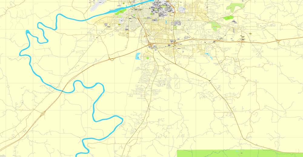
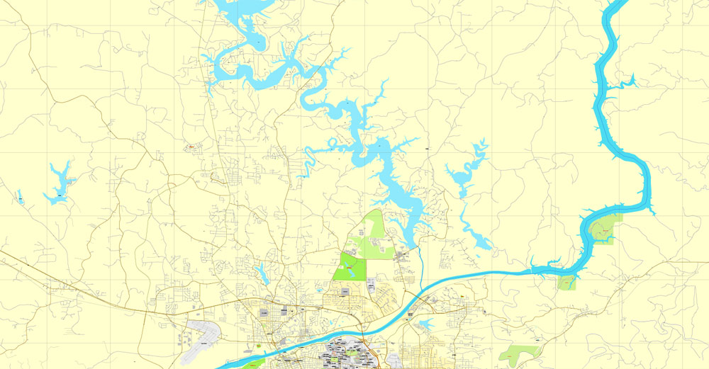
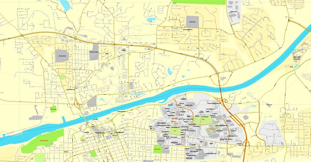
According to the U.S. Census Bureau, Tuscaloosa has a total area of 70.3 square miles (182 km2), of which 60.2 square miles (156 km2) is land and 10.1 square miles (26 km2) is water. Most water within the city limits is in Lake Tuscaloosa, which is entirely in the city limits, and the Black Warrior River.
Tuscaloosa is located at 33°12′24″N 87°32′5″W (33.206540, −87.534607), approximately 60 miles (97 km) southwest of Birmingham. It lies on the fall line of the Black Warrior River, approximately 193 miles (311 km) upriver from the river’s confluence with the Tombigbee River at Demopolis. Because of its location on the boundary between the Appalachian Highland and the Gulf Coastal Plain, the geography of the area around Tuscaloosa is diverse, varying from heavily forested hills to the northeast to a low-lying, marshy plain to the southwest.
Free vector maps:

Free download Vector Map US Interstate roads, Adobe PDF, V.2 Free_Map_US_Interstates_Roads_2.pdf
Free download Vector Map US Interstate roads, Adobe Illustrator, V.2 Free_Map_US_Interstates_Roads_2.ai

Free Download Vector Map US County and State Adobe Illustrator
Free_Vector_Map_US_States_County_Map.ai
Free Download Vector Map US County and State Adobe PDF
Free_Vector_Map_US_States_County_Map.pdf

Free Vector Map US Census Data Top US Ancestries by County Adobe Illustrator
Free_Vector_Map_US_Census-Data-Top-US-Ancestries-by-County.ai
Free Vector Map US Census Data Top US Ancestries by County Adobe PDF
Free_Vector_Map_US_Census-Data-Top-US-Ancestries-by-County.pdf

 Author: Kirill Shrayber, Ph.D. FRGS


