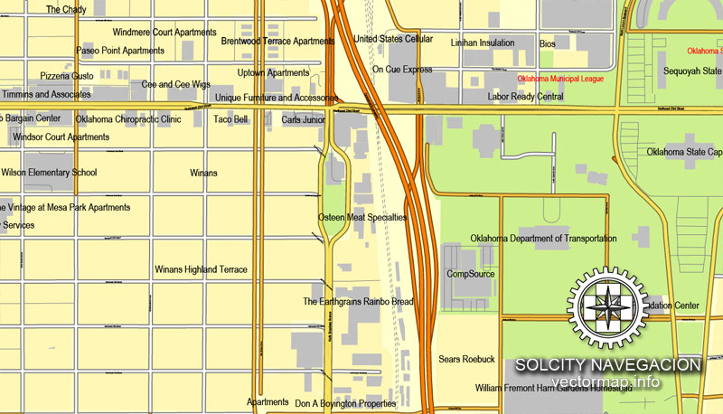
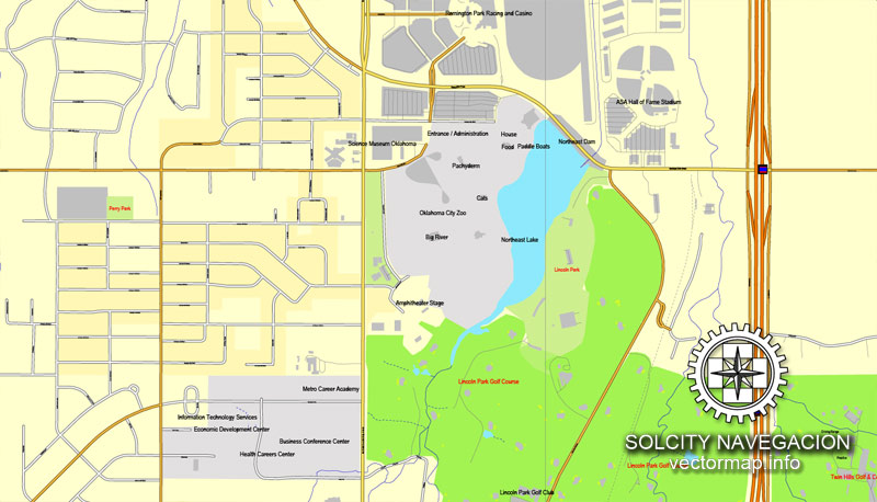
Oklahoma City, Oklahoma, US printable vector street City Plan map, full editable, Adobe PDF, full vector, scalable, editable, text format street names, 31 mb ZIP
All streets, some buildings. Map for design, print, arts, projects, presentations.
You can edit this file by Adobe Illustrator, Adobe Acrobat, Corel Draw.
DWG, DXF, CDR and other formats – on request, same price, please, contact
Oklahoma, USA.
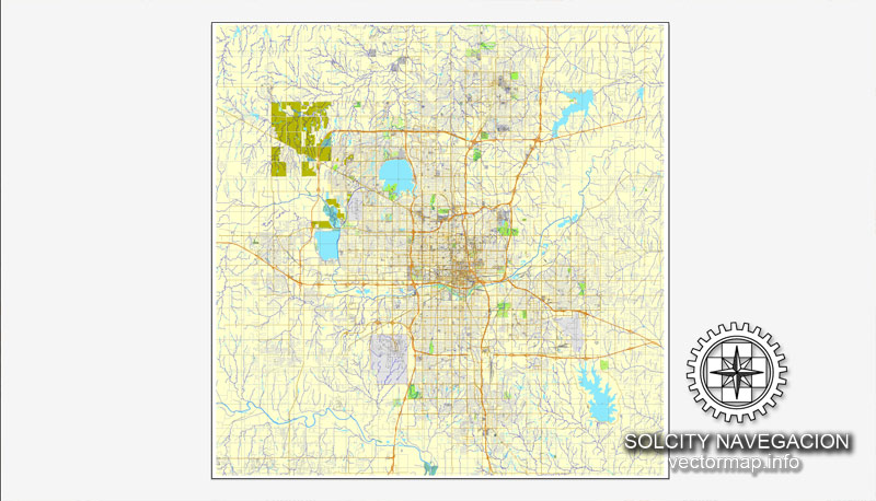
This vector map of Oklahoma city is used as a basis for design, editing, and further printing.
This is the most detailed, exact map of Oklahoma city for high-quality printing and polygraphy. You can always clarify the map development date by contacting us.
You can easily add any objects needed (e.g. shops, salons, sale points, gas station or attraction) on any layer of Oklahoma vector map.
Oklahoma City often shortened to OKC, is the capital and largest city of the U.S. state of Oklahoma. The county seat of Oklahoma County, the city ranks 27th among United States cities in population. The population grew following the 2010 Census, with the population estimated to have increased to 643,648 as of July 2017. As of 2015, the Oklahoma City metropolitan area had a population of 1,358,452, and the Oklahoma City-Shawnee Combined Statistical Area had a population of 1,459,758 residents, making it Oklahoma’s largest metropolitan area.
This vector map of Oklahoma city is used by:
designers, layout designers, printers, advertisers and architects. Our product – vector maps – is designed for further editing and printing in large formats – from @Wall format (a few meters) to A-0 and A-1, A-2, A-3.
The Oklahoma city map in vector format is used for design, urban planning, presentations and media visualizations.
The advertising and presentation map of Oklahoma city (usually the final designer marks the routes, and puts the client’s objects (shops, saloons, gas stations etc.)
The undoubted advantage is that people will NEVER throw out this advertising product – the map. In fact, as an advertising medium, a city map is the most “long-playing” of the well-known polygraphic advertising media, with the longest lifespan, and the maximum number of interactions with the customer.
For travelers, maps are sold at the airports and gas stations around the world. Often the source is our vector maps.
Take a look, who purchases our vector maps of Oklahoma city in “Our Clients and Friends” page – these are large and small companies, from super-brands like Volvo and Starbucks, to small design studios and printing houses.
It’s very easy to work with vector maps of Oklahoma city, even for a not very experienced designer who can turn on and off the map layers, add new objects, change the colors of fill and lines according to customer requirements.
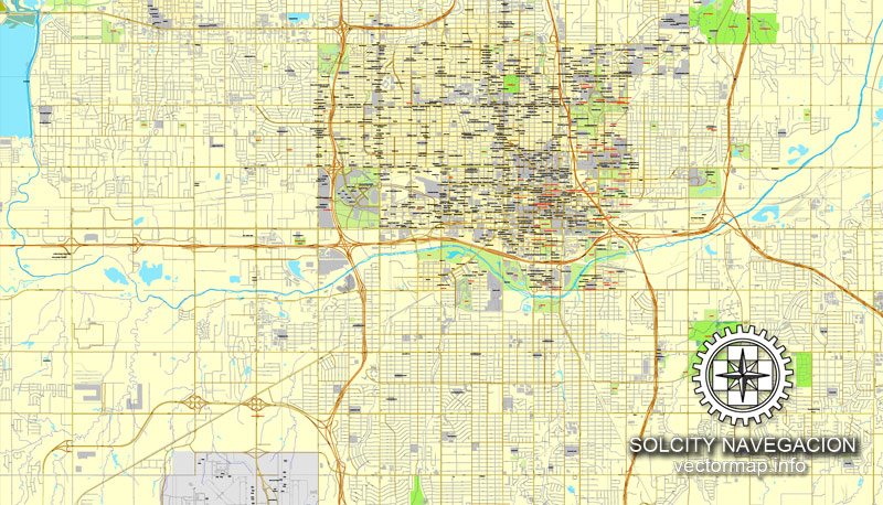
The undoubted advantage of Oklahoma city vector maps in printing is an excellent and detailed visualization, when customer can expand a large paper map and instantly define his location, find a landmark, an object or address on map, unlike using the popular electronic formats of Google and Yandex maps for example.
Printable vector maps of Oklahoma city are much more convenient and efficient than any electronic maps on your smartphone, because ALL DETAILS are displayed in the entire space of Oklahoma city map.
Useful tips on working with vector maps of cities and countries in Adobe Illustrator.
«V» – launches the Selection tool (cursor, black arrow), which makes active any vector line.
«А» – launches the Direct Selection tool (white cursor), allows you to select curve elements and drag them to the desired place.
«R» – activates the Rotate tool, which helps you rotating selected objects around the center point by 360 degrees.
«E» – gives you the opportunity to use the Eraser tool and erase unnecessary parts.
«X» – switches between Fill and Stroke in the Tools section. Try to get used to this hot key and
you will quickly understand that you can’t live and work without it.
Guides are not limited to vertical and horizontal in Adobe Illustrator. You can also create a diagonal guide for example. Moreover, you can turn any contours into guides. Select the outline and go to View > Guides > Make Guides (Create Guides), or simply press Cmd/Ctrl + 5. You can also turn the guides back into an editable object. Go to menu, View > Guides > Unlock Guides (Release Guides), select the guide you want to edit and select View > Guides > Release Guides (Reset Guides), or just press Cmd/Ctrl + Option / Alt + 5).
The «Edit colors» button or «Edit or apply colors» on the «Color Catalog» palette
Click this button if you need to edit colors on the «Color Catalog» palette or edit and then apply them to the selected Vector Map of Oklahoma city or its fragment.
The «Edit color group» button or «Edit or apply color group» on the «Samples» palette.
Click this button if you need to edit the colors in the specific color group or edit and apply them to the selected Vector Map of Oklahoma city or a group of its elements, for example, the whole layer “Streets and lines”. You can also double-click the color group in the Samples panel to open the dialog box.
If the map file is too large and your computer freezes or even can’t open it quickly:
1. Try to reduce the color resolution of the video card (display) to 256 colors while working with a large map.
2. Using Windows Task Manager, select all the application you don’t need, while working with map, just turn them off.
3. Launch Adobe Illustrator. (DO NOT OPEN the vector map file)
4. Start the Windows Task Manager using administrator rights > Find the “Illustrator” process > set the «real time» priority,
5. Open the file. When you see the LEGACY FONT popup window – click “OK” (do not update). You can restore the TEXT later.
6. Can also be useful: When file is opened – Edit > Settings > Basic Settings > disable smoothing. /// It looks scary, but works quickly)))
We recommend saving the file in Adobe Illustrator 10 version. It’s much more stable when working with VERY BIG size files.
You will probably want to change the color scheme used on our Oklahoma vector city map.
To quickly and effectively play with colors.
Of course, you can do it manually, all objects in our Oklahoma city vector map are divided according to types and layers, and you can easily change the color gamma of vector objects in groups and layers.
But there is more effective way of working with the whole VECTOR MAP of Oklahoma city and all layers:
The overview dialog «Edit colors»/«Repaint Graphic Object» (this dialog box name can change depending on the context):
If you have selected a part or a layer of Oklahoma city vector map and open the dialog box by clicking the icon in the Control panel, on the Samples palette or the Color Catalog, or if you choose Edit > Edit Colors> Repaint Graphic Object, then the «Repaint Graphic Object» dialog box appears, and you get access to «Assign» and «Edit» tabs.
If a picture or a map fragment is not selected, and you open the dialog box by clicking the icon in the Control panel, on the Samples palette or in the Color Catalog, the «Edit Colors» dialog box appears and you can only access the «Edit» tab.
Oklahoma City’s city limits extend into Canadian, Cleveland, and Pottawatomie counties, though much of those areas outside the core Oklahoma County area are suburban or rural (watershed). The city ranks as the ninth-largest city in the United States by total area (including consolidated city-counties; it is the second largest city in the United States by total area, after Houston, whose government is similarly not consolidated with that of a county or borough).
Regardless of the name at the top of the dialog box, the right-hand side always displays the color group of the current document, as well as two default color groups: Print Color and Grayscale. These color groups can be selected and used any time.
Create and edit color groups of Oklahoma city vector map, and also assign colors using the «Edit Colors»/ а «Repaint Graphic Object» dialog box.
A. Creating and editing of a color group on the «Edit» tab
B. Assigning colors on the «Assign» tab
C. Select a group of colors from the «Color groups» list
The option «Repaint a graphic object» in the lower part of the dialog box allows you to preview the colors on a selected layer of Vector map, or a group of elements, and specify whether its colors will be redefined when the dialog box is closed.
The main areas of the dialog box are:
«Edit»
The «Edit» tab is designed to create a new or edit the existing color groups.
The harmony rules Menu and the Color Wheel are used to conduct experiments with color harmonies. The color wheel shows how colors are related in color harmony, and the color bars allow you to view and manipulate an individual color values. In addition, you can adjust the brightness, add and remove colors, save color groups and view colors on the selected Vector Map of Oklahoma city or a separated layers.
«Assign»
The «Assign» tab is used to view and control on how the original colors are replaced with colors from the color group like your corporate colors in the Vector Map of Oklahoma city.
Lying in the Great Plains region, Oklahoma City has one of the world’s largest livestock markets. Oil, natural gas, petroleum products and related industries are the largest sector of the local economy. The city is in the middle of an active oil field and oil derricks dot the capitol grounds. The federal government employs large numbers of workers at Tinker Air Force Base and the United States Department of Transportation’s Mike Monroney Aeronautical Center (these two sites house several offices of the Federal Aviation Administration and the Transportation Department’s Enterprise Service Center, respectively).
The assign color ability is provided only if the entire map, layer or fragment is selected in the document. You can specify which of new colors replace the current colors, whether the spot colors should be preserved and how colors are replaced (for example, you can replace colors completely or changing the color tone while maintaining the brightness). The «Assign» tab allows you to redefine colors in the Vector Map of Oklahoma city, or in separate layers and fragments using the current color group or reducing the number of colors in the current Vector Map.
Color groups
Is a list of all saved color groups for current document (the same groups appear in the «Samples» palette). You can edit and delete the existing color groups, as well as creating a new ones using the list of “Color Groups” in the dialog box. All changes appear in the «Samples» palette.
The highlighted color group shows, which color group is currently edited.
Oklahoma City is on the I-35 Corridor, which is one of the primary travel corridors south into neighboring Texas and Mexico and north towards Wichita and Kansas City. Located in the state’s Frontier Country region, the city’s northeast section lies in an ecological region known as the Cross Timbers. The city was founded during the Land Run of 1889, and grew to a population of over 10,000 within hours of its founding. The city was the scene of the April 19, 1995 bombing of the Alfred P. Murrah Federal Building, in which 168 people died. It was the deadliest terror attack in the history of the United States until the attacks of September 11, 2001, and remains the deadliest act of domestic terrorism in U.S. history.
Any color group can be selected and edited, or used to redefine the colors in the selected vector map of Oklahoma city, its fragments or elements.
Saving a color group adds this group to the specified list.
Opening the «Edit Colors»/«Repaint Graphic Object» dialog box.
Open the «Edit Colors»/«Repaint Graphic Object» dialog box using one of the following methods:
«Edit»> «Edit Colors»> «Repaint Graphic object» or «Repaint With Style».
Use these commands if you need to edit the colors in the selected vector map of Oklahoma city.
«Repaint Graphic object» button on the «Control» panel.
Use this button if you need to adjust colors of Oklahoma city vector map using the а «Repaint graphic object» dialog box.
The specified button is available if the selected vector map or its fragment contains two or more colors.
Note. This color editing method is convenient for global color adjustment in a vector map, if global colors were not used when creating a City Map of Oklahoma.
Since the time weather records have been kept, Oklahoma City has been struck by thirteen strong tornadoes; eleven of these tornadoes were rated F4 or EF4 on the Fujita and Enhanced Fujita scales, and two were rated F5 or EF5. Since 2008, Oklahoma City has been home to the National Basketball Association (NBA)’s Oklahoma City Thunder, who play their home basketball games at the Chesapeake Energy Arena.
Geography
Oklahoma City lies along one of the primary corridors into Texas and Mexico, and is a three-hour drive from the Dallas-Fort Worth metroplex. The city is in the Frontier Country region in the center of the state, making it an ideal location for state government.
According to the United States Census Bureau, the city has a total area of 620.34 square miles (1,606.7 km2), of which 601.11 square miles (1,556.9 km2) is land and 19.23 square miles (49.8 km2) is water.
Oklahoma City lies in the Sandstone Hills region of Oklahoma, known for hills of 250 to 400 feet (120 m) and two species of oak: blackjack oak (Quercus marilandica) and post oak (Q. stellata). The northeastern part of the city and its eastern suburbs fall into an ecological region known as the Cross Timbers.
The city is roughly bisected by the North Canadian River (recently renamed the Oklahoma River inside city limits). The North Canadian once had sufficient flow to flood every year, wreaking destruction on surrounding areas, including the central business district and the original Oklahoma City Zoo. In the 1940s, a dam was built on the river to manage the flood control and reduced its level. In the 1990s, as part of the citywide revitalization project known as MAPS, the city built a series of low-water dams, returning water to the portion of the river flowing near downtown. The city has three large lakes: Lake Hefner and Lake Overholser, in the northwestern quarter of the city; and the largest, Lake Stanley Draper, in the city’s sparsely populated far southeast portion.
The population density normally reported for Oklahoma City using the area of its city limits can be misleading. Its urbanized zone covers roughly 244 sq mi (630 km2) resulting in a density of 2,500 per square mile (2013 est), compared with larger rural watershed areas incorporated by the city, which cover the remaining 377 sq mi (980 km2) of the city limits.
Oklahoma City is one of the largest cities in the nation in compliance with the Clean Air Act.
Downtown Oklahoma City.
Downtown Oklahoma City itself is currently undergoing a renaissance. Between the mid-1980s and 1990s, downtown was unchanged and largely vacant. It was the scene of the bombing of the Alfred P. Murrah Federal Building on 5th Street between Robinson and Harvey Avenues, caused by convicted domestic terrorist Timothy McVeigh; most buildings within a 1-mile (1.6 km) radius were structurally damaged by the explosion, including the old Journal Record Building (now home to the National Memorial museum). Many other buildings, such as the unique international style YMCA building, supposedly one of few remaining in the United States were damaged or destroyed.
White flight during the 1950s and 1960s left much of the inner city abandoned. During the Urban Renewal days of the early 1980s, controversial urban planning allowed for the destruction of almost 50 historic buildings and skyscrapers. Examples include the Biltmore Hotel, which was imploded to make way for the I. M. Pei-designed Myriad Botanical Gardens, the only major Urban Renewal project completed as planned. Many of the buildings which were not destroyed in the Central Business District were covered by new façades or left to Class-C office space. The removal of historic structures left downtown without much retail presence.
The Myriad Gardens.
In stark contrast to the promise of Urban Renewal, Downtown had not seen a new skyscraper or any sort of major construction project for many years. The last major skyscraper built downtown was the First Oklahoma Tower in 1982 and the Leadership Square complex built in 1984. Leadership Square was originally intended to be a single 60+ floor skyscraper but was later scaled down to two connected towers due to economic downturn.
Downtown and surrounding areas such as Bricktown and Midtown have seen a significant revival in the wake of the MAPS program, which created new venues and attractions in the downtown area. Today, as Downtown and the Central Business District continue in their economic revival, there are numerous condo and apartment developments being built around downtown, along with older buildings that are being converted into apartments and hotels. Leading this charge is the renovation of the historic Skirvin Hotel, where numerous presidents and dignitaries have stayed. The historic Colcord Building, Oklahoma City’s first skyscraper, was also converted from office space to a boutique hotel in 2006.
Devon Energy, which had previously been occupying space in five separate downtown buildings, revealed plans in August 2008 for a new 1,900,000-square-foot (180,000 m2), 925-foot (282 m)-tall skyscraper at the corner of Sheridan and Hudson, a space originally planned for a “Galleria” mall under the Pei urban renewal plan. The building is expected to bring new life to the west side of downtown, which has seen less growth compared to Bricktown on the eastern edge and Midtown to the north. The Devon Tower, which became the tallest building in the state of Oklahoma at 844 feet (257 m), was completed in 2012.
Other development projects, which are either in planning or have since been completed, include:
$100 million in proposed improvements to the Ford Center were approved by voters in March 2008. The improvements allowed for offices and new locker rooms for the Oklahoma City Thunder NBA team, new restaurants and bars, rooftop terraces, a new grand entrance, and a family fun center.
Block 42 is a high-end condominium project offering luxury condos with a modern, urban aesthetic. The project was completed in the summer of 2008.
The Hill is a project with almost 200 town homes being built on a hill overlooking the Deep Deuce district and Bricktown. The project is currently under construction.
The Triangle (encompassing the Flatiron District and some of Deep Deuce) is a project by TAP Architecture that will include 700 loft units, office and retail space.
The Central Avenue Villas which has 30 loft units.
A new Hampton Inn and Suites in Bricktown.
The area due south of the Chesapeake Energy Arena is anticipated to become OKC’s latest downtown district following the long overdue move of the I-40 Crosstown bridge that is in the process of being completed as of 2013. The master plan for the “Core to Shore” area shows a boulevard running through downtown – where the original alignment of the Crosstown bridge was located, as well as a large new city park stretching from the Myriad Botanical Gardens down to the Oklahoma River. It is also assumed that the Central Business District would be extended south, and new highrise construction will take place there.
Bricktown is an entertainment district located on the east side of Downtown Oklahoma City. Before a recent renaissance, the area was a warehouse district that had begun to get run down. Today, it is bustling with restaurants, dance clubs, live music venues, upscale retail shops, and offices. Top attractions include the Chickasaw Bricktown Ballpark and a navigable Bricktown Canal, both the result of the city’s MAPS projects. The Bricktown Canal stretches one mile (1.6 km) through the district toward to a new park past the Oklahoma Land Run Monument. When completed, the Land Run Monument will be a series of 77 giant statues stretching over an area the size of two football fields on the south canal, and will be one of the largest sculptural monuments in the world.
Lower Bricktown (a newly constructed area south of existing warehouses) boasts a brand-new 16-screen movie complex run by Harkins Theatres, a Bass Pro Shops Outdoor World, a Toby Keith’s I Love This Bar & Grill theme restaurant, a Red Pin Bowling Lounge, and several upscale retail establishments and restaurants. The Centennial on the Canal is Bricktown’s first new residential construction, and contains three levels of high-end condos with retail on the canal and street levels. The area also includes the corporate headquarters of Sonic Drive-In and a six-story Residence Inn.
The brick buildings of the district were created between 1898 and 1930 to aid in the freight operations by the four major railroad companies that used the area. Oklahoma City’s first black newspaper, the Black Dispatch was officed in Bricktown at 228 E. First, along with the first local branch of the National
Association for the Advancement of Colored People.
Deep Deuce, located directly north of Bricktown, ignited the downtown urban housing boom in the late 1990s with the Deep Deuce Apartments. The area consists mostly of low-rise apartment buildings and various formerly vacant mixed use buildings. Deep Deuce was once the largest African American neighborhood downtown in the 1940s and 1950s and was the regional center of culture and jazz music. Bands such as the Count Basie Orchestra, the Blue Devils, the Charlie Christian Band, and others resided in this downtown neighborhood. It is also noteworthy that Reverend Martin Luther King, Jr. was rejected for an executive position at the Calvary Baptist Church in Deep Deuce for being “too young.”
Small guide: How to work with the vector map?
You can: Mass select objects by type and color – for example, the objects type “building” (they are usually dark gray) – and remove them from the map, if you do not need them in your print or design project. You can also easily change the thickness of lines (streets), just bulk selection the road by the line color.
The streets are separated by type, for example, type “residential road” are usually white with a gray stroke. Highway usually orange with a brown or dark gray stroke.
It is easy to change the font of inscriptions, all or each individually. Also, just can be make and any other manipulation of objects on the vector map in Adobe illustrator format.
Important: All the proportions on the map are true, that is, the relative sizes of the objects are true, because Map is based on an accurate GPS projection, and It transated into the (usual for all) the Mercator projection.
You can easily change the color, stroke and fill of any object on the map, zoom without loss of quality Image Verification.
Select object

Bulk selection the same objects on the vector map

See the bulk selected objects on the vector map

Bulk delete buildungs from the vector map

Select residencial road (small street) on the vector map

Bulk selection the same lines (streets, roads) on the full map

Create fat lines of the streets on the vector maps (bulk action) 1

Create fat lines of the streets on the vector maps (bulk action) 2

Create fat lines of the streets on the vector maps (bulk action) 3

You can easily change the color, stroke and fill of any object on the map, zoom without loss of quality Image Verification.

 Author: Kirill Shrayber, Ph.D. FRGS

