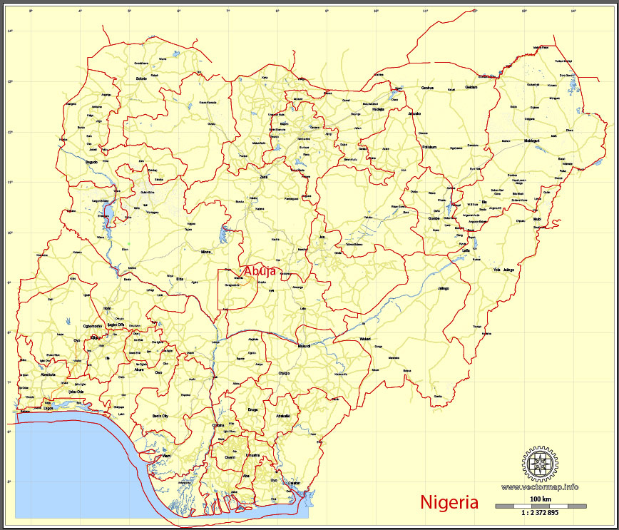
Nigeria, full, printable exact vector map G-View level 8 (100 kilometers) Main Roads and borders, full editable, Adobe PDF, full vector, scalable, editable text format street names, 8 mb ZIP
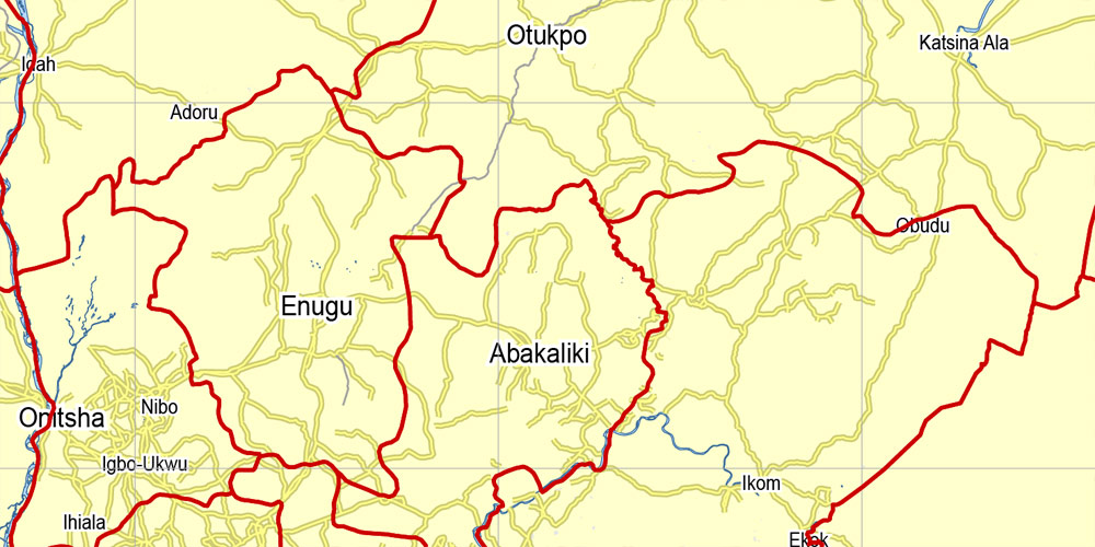
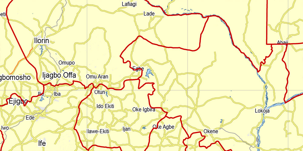
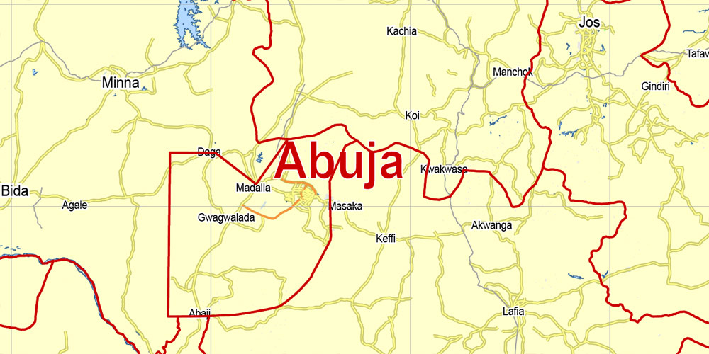
Main Roads map.
Map for publishing, design, printing, arts, projects, presentations, for architects, designers and builders, business, logistics. The most accurate and detailed map.
You can edit this file by Adobe Illustrator, Adobe Acrobat, Corel Draw.
DWG, DXF, CDR and other formats – on request, same price, please, contact
Nigeria.
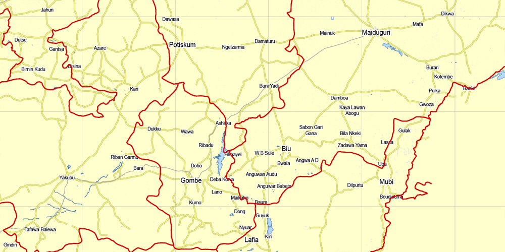
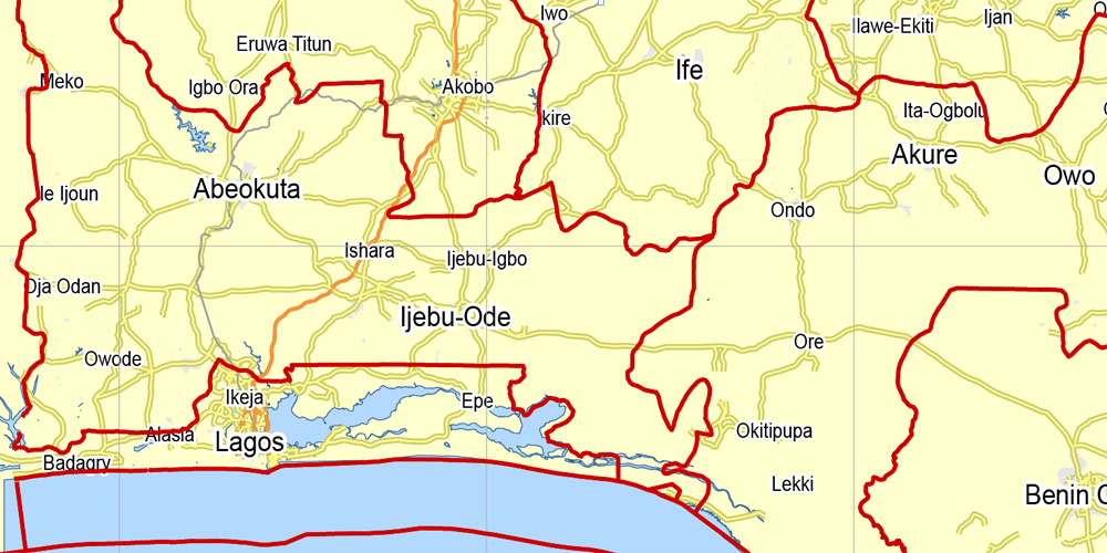
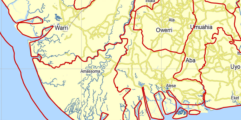
This vector map of Nigeria is used as a basis for design, editing, and further printing.
This is the most detailed, exact map of Nigeria for high-quality printing and polygraphy. You can always clarify the map development date by contacting us.
For your convenience, all objects on Nigeria vector map are divided into layers. And the editing is very easy – colors, lines, etc.
You can easily add any objects needed (e.g. shops, salons, sale points, gas station or attraction) on any layer of Nigeria vector map.
The Federal Republic of Nigeria, commonly referred to as Nigeria is a federal republic in West Africa, bordering Niger in the north, Chad in the northeast, Cameroon in the southeast, and Benin in the west. Its coast in the south is located on the Gulf of Guinea in the Atlantic Ocean. The federation comprises 36 states and 1 Federal Capital Territory, where the capital, Abuja is located. Nigeria is officially a democratic secular country.
One of the advantages of Nigeria vector maps of our production is the relevance of cartographic data, we constantly update all our products.
This vector map of Nigeria is used by:
designers, layout designers, printers, advertisers and architects. Our product – vector maps – is designed for further editing and printing in large formats – from @Wall format (a few meters) to A-0 and A-1, A-2, A-3.
Nigeria map in vector format is used for design, urban planning, presentations and media visualizations.
Advertising and presentation map of Nigeria (usually the final designer marks the routes, and puts the client’s objects (shops, saloons, gas stations etc.)
The undoubted advantage is that people will NEVER throw out this advertising product – the map. In fact, as an advertising medium, a map is the most “long-playing” of the well-known polygraphic advertising media, with the longest lifespan, and the maximum number of interactions with the customer.
For travelers, maps are sold at the airports and gas stations around the world. Often the source is our vector maps.
Take a look, who purchases our vector maps of Nigeria in “Our Clients and Friends” page – these are large and small companies, from super-brands like Volvo and Starbucks, to small design studios and printing houses.
It’s very easy to work with vector maps of Nigeria, even for a not very experienced designer who can turn on and off the map layers, add new objects, change the colors of fill and lines according to customer requirements.
The undoubted advantage of Nigeria vector maps in printing is an excellent and detailed visualization, when customer can expand a large paper map and instantly define his location, find a landmark, an object or address on map, unlike using the popular electronic formats of Google and Yandex maps for example.
Printable vector maps of Nigeria are much more convenient and efficient than any electronic maps on your smartphone, because ALL DETAILS are displayed in the entire space of Nigeria map.
Useful tips on working with vector maps of cities and countries in Adobe Illustrator.
«V» – launches the Selection tool (cursor, black arrow), which makes active any vector line.
«А» – launches the Direct Selection tool (white cursor), allows you to select curve elements and drag them to the desired place.
«R» – activates the Rotate tool, which helps you rotating selected objects around the center point by 360 degrees.
«E» – gives you the opportunity to use the Eraser tool and erase unnecessary parts.
«X» – switches between Fill and Stroke in the Tools section. Try to get used to this hot key and
you will quickly understand that you can’t live and work without it.
Guides are not limited to vertical and horizontal in Adobe Illustrator. You can also create a diagonal guide for example. Moreover, you can turn any contours into guides. Select the outline and go to View > Guides > Make Guides (Create Guides), or simply press Cmd/Ctrl + 5. You can also turn the guides back into an editable object. Go to menu, View > Guides > Unlock Guides (Release Guides), select the guide you want to edit and select View > Guides > Release Guides (Reset Guides), or just press Cmd/Ctrl + Option / Alt + 5).
You will probably want to change the color scheme used on our Nigeria vector map.
To quickly and effectively play with colors.
Of course, you can do it manually, all objects in our Nigeria vector map are divided according to types and layers, and you can easily change the color gamma of vector objects in groups and layers.
But there is more effective way of working with the whole VECTOR MAP of Nigeria and all layers:
The overview dialog «Edit colors»/«Repaint Graphic Object» (this dialog box name can change depending on the context):
If you have selected a part or a layer of Nigeria vector map and open the dialog box by clicking the icon in the Control panel, on the Samples palette or the Color Catalog, or if you choose Edit > Edit Colors> Repaint Graphic Object, then the «Repaint Graphic Object» dialog box appears, and you get access to «Assign» and «Edit» tabs.
If a picture or a map fragment is not selected, and you open the dialog box by clicking the icon in the Control panel, on the Samples palette or in the Color Catalog, the «Edit Colors» dialog box appears and you can only access the «Edit» tab.
Regardless of the name at the top of the dialog box, the right-hand side always displays the color group of the current document, as well as two default color groups: Print Color and Grayscale. These color groups can be selected and used any time.
Create and edit color groups of Nigeria vector map, and also assign colors using the «Edit Colors»/ а «Repaint Graphic Object» dialog box.
A. Creating and editing of a color group on the «Edit» tab
B. Assigning colors on the «Assign» tab
C. Select a group of colors from the «Color groups» list
The option «Repaint a graphic object» in the lower part of the dialog box allows you to preview the colors on a selected layer of Vector map, or a group of elements, and specify whether its colors will be redefined when the dialog box is closed.
The main areas of the dialog box are:
«Edit»
The «Edit» tab is designed to create a new or edit the existing color groups.
The harmony rules Menu and the Color Wheel are used to conduct experiments with color harmonies. The color wheel shows how colors are related in color harmony, and the color bars allow you to view and manipulate an individual color values. In addition, you can adjust the brightness, add and remove colors, save color groups and view colors on the selected Vector Map of Nigeria or a separated layers.
«Assign»
The «Assign» tab is used to view and control on how the original colors are replaced with colors from the color group like your corporate colors in the Vector Map of Nigeria.
The assign color ability is provided only if the entire map, layer or fragment is selected in the document. You can specify which of new colors replace the current colors, whether the spot colors should be preserved and how colors are replaced (for example, you can replace colors completely or changing the color tone while maintaining the brightness). The «Assign» tab allows you to redefine colors in the Vector Map of Nigeria, or in separate layers and fragments using the current color group or reducing the number of colors in the current Vector Map.
Color groups
Is a list of all saved color groups for current document (the same groups appear in the «Samples» palette). You can edit and delete the existing color groups, as well as creating a new ones using the list of “Color Groups” in the dialog box. All changes appear in the «Samples» palette.
The highlighted color group shows, which color group is currently edited.
Nigeria has been home to a number of ancient and indigenous kingdoms and states over the millennia. The modern state originated from British colonial rule beginning in the 19th century, and took its present territorial shape with the merging of the Southern Nigeria Protectorate and Northern Nigeria Protectorate in 1914. The British set up administrative and legal structures whilst practicing indirect rule through traditional chiefdoms. Nigeria became a formally independent federation in 1960. It experienced a civil war from 1967 to 1970. It thereafter alternated between democratically elected civilian governments and military dictatorships until it achieved a stable democracy in 1999, with the 2011 presidential election considered the first to be reasonably free and fair.
Any color group can be selected and edited, or used to redefine the colors in the selected vector map of Nigeria , its fragments or elements.
Saving a color group adds this group to the specified list.
Opening the «Edit Colors»/«Repaint Graphic Object» dialog box.
Open the «Edit Colors»/«Repaint Graphic Object» dialog box using one of the following methods:
«Edit»> «Edit Colors»> «Repaint Graphic object» or «Repaint With Style».
Use these commands if you need to edit the colors in the selected vector map of Nigeria.
«Repaint Graphic object» button on the «Control» panel.
Use this button if you need to adjust colors of Nigeria vector map using the а «Repaint graphic object» dialog box.
The specified button is available if the selected vector map or its fragment contains two or more colors.
Note. This color editing method is convenient for global color adjustment in a vector map, if global colors were not used when creating a Map of Nigeria.
The «Edit colors» button or «Edit or apply colors» on the «Color Catalog» palette
Click this button if you need to edit colors on the «Color Catalog» palette or edit and then apply them to the selected Vector Map of Nigeria or its fragment.
The «Edit color group» button or «Edit or apply color group» on the «Samples» palette.
Click this button if you need to edit the colors in the specific color group or edit and apply them to the selected Vector Map of Nigeria or a group of its elements, for example, the whole layer “Streets and lines”. You can also double-click the color group in the Samples panel to open the dialog box.
If the map file is too large and your computer freezes or even can’t open it quickly:
1. Try to reduce the color resolution of the video card (display) to 256 colors while working with a large map.
2. Using Windows Task Manager, select all the application you don’t need, while working with map, just turn them off.
3. Launch Adobe Illustrator. (DO NOT OPEN the vector map file)
4. Start the Windows Task Manager using administrator rights > Find the “Illustrator” process > set the «real time» priority,
5. Open the file. When you see the LEGACY FONT popup window – click “OK” (do not update). You can restore the TEXT later.
6. Can also be useful: When file is opened – Edit > Settings > Basic Settings > disable smoothing. /// It looks scary, but works quickly)))
We recommend saving the file in Adobe Illustrator 10 version. It’s much more stable when working with VERY BIG size files.
Nigeria is often referred to as the “Giant of Africa”, owing to its large population and economy. With 186 million inhabitants, Nigeria is the most populous country in Africa and the seventh most populous country in the world. Nigeria has the third-largest youth population in the world, after India and China, with more than 90 million of its population under age 18. The country is viewed as a multinational state as it is inhabited by 250 ethnic groups, of which the three largest are the Hausa, Igbo and Yoruba; these ethnic groups speak over 250 different languages and are identified with a wide variety of cultures. The official language is English. Nigeria is divided roughly in half between Christians, who live mostly in the southern part of the country, and Muslims, who live mostly in the north. A minority of the population practice religions indigenous to Nigeria, such as those native to the Igbo and Yoruba ethnicities.
As of 2015, Nigeria is the world’s 20th largest economy, worth more than $500 billion and $1 trillion in terms of nominal GDP and purchasing power parity respectively. It overtook South Africa to become Africa’s largest economy in 2014. The 2013 debt-to-GDP ratio was 11 percent. Nigeria is considered to be an emerging market by the World Bank; it has been identified as a regional power on the African continent, a middle power in international affairs, and has also been identified as an emerging global power. However, it currently has a “low” Human Development Index, ranking 152nd in the world. Nigeria is a member of the MINT group of countries, which are widely seen as the globe’s next “BRIC-like” economies. It is also listed among the “Next Eleven” economies set to become among the biggest in the world. Nigeria is a founding member of the African Union and a member of many other international organizations, including the United Nations, the Commonwealth of Nations and OPEC.
Geography
Nigeria is located in western Africa on the Gulf of Guinea and has a total area of 923,768 km2 (356,669 sq mi), making it the world’s 32nd-largest country (after Tanzania). It is comparable in size to Venezuela, and is about twice the size of the US state of California. Its borders span for 4,047-kilometre (2,515 mi)s, and it shares borders with Benin (773 km or 480 mi), Niger (1,497 km or 930 mi), Chad (87 km or 54 mi), Cameroon (1,690 km or 1,050 mi), and has a coastline of at least 853 kilometres (530 miles)s. Nigeria lies between latitudes 4° and 14°N, and longitudes 2° and 15°E.
The highest point in Nigeria is Chappal Waddi at 2,419 m (7,936 ft). The main rivers are the Niger and the Benue, which converge and empty into the Niger Delta. This is one of the world’s largest river deltas, and the location of a large area of Central African mangroves.

Nigeria has a varied landscape. The far south is defined by its tropical rainforest climate, where annual rainfall is 60 to 80 inches (1,500 to 2,000 mm) a year. In the southeast stands the Obudu Plateau. Coastal plains are found in both the southwest and the southeast. This forest zone’s most southerly portion is defined as “salt water swamp”, also known as a mangrove swamp because of the large amount of mangroves in the area. North of this is fresh water swamp, containing different vegetation from the salt water swamp, and north of that is rainforest.
Nigeria’s most expansive topographical region is that of the valleys of the Niger and Benue river valleys (which merge into each other and form a “y” shape). To the southwest of the Niger is “rugged” highland. To the southeast of the Benue are hills and mountains, which form the Mambilla Plateau, the highest plateau in Nigeria. This plateau extends through the border with Cameroon, where the montane land is part of the Bamenda Highlands of Cameroon.
The area near the border with Cameroon close to the coast is rich rainforest and part of the Cross-Sanaga-Bioko coastal forests ecoregion, an important centre for biodiversity. It is habitat for the drill monkey, which is found in the wild only in this area and across the border in Cameroon. The areas surrounding Calabar, Cross River State, also in this forest, are believed to contain the world’s largest diversity of butterflies. The area of southern Nigeria between the Niger and the Cross Rivers has lost most of its forest because of development and harvesting by increased population, with it being replaced by grassland (see Cross-Niger transition forests).
Everything in between the far south and the far north is savannah (insignificant tree cover, with grasses and flowers located between trees). Rainfall is more limited, to between 500 and 1,500 millimetres (20 and 60 in) per year. The savannah zone’s three categories are Guinean forest-savanna mosaic, Sudan savannah, and Sahel savannah. Guinean forest-savanna mosaic is plains of tall grass interrupted by trees. Sudan savannah is similar but with shorter grasses and shorter trees. Sahel savannah consists of patches of grass and sand, found in the northeast. In the Sahel region, rain is less than 500 millimetres (20 in) per year and the Sahara Desert is encroaching. In the dry northeast corner of the country lies Lake Chad, which Nigeria shares with Niger, Chad and Cameroon.

 Author: Kirill Shrayber, Ph.D. FRGS
