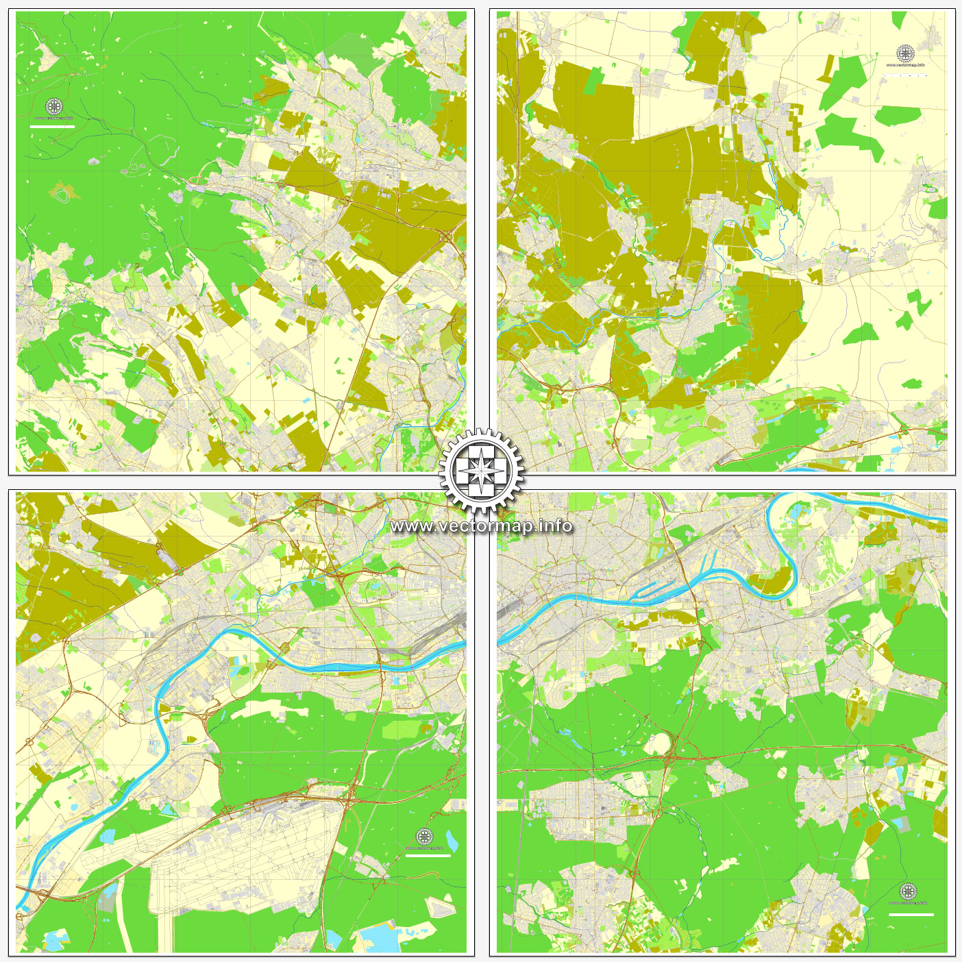
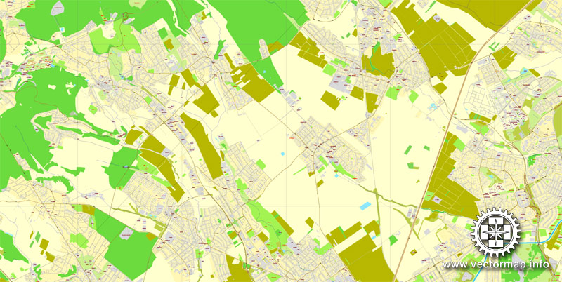
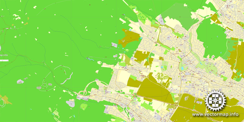
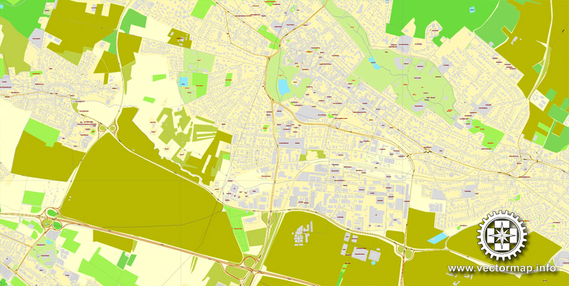
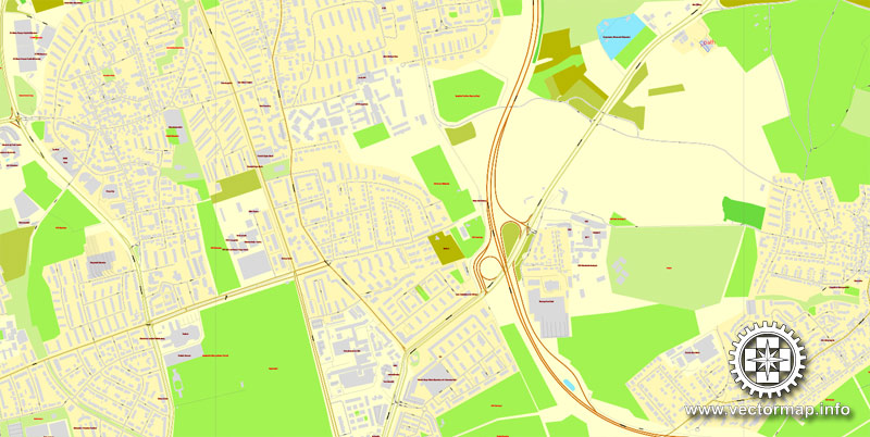
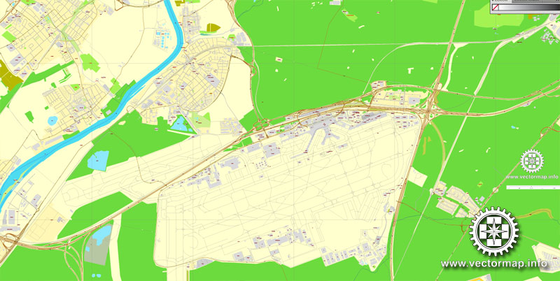
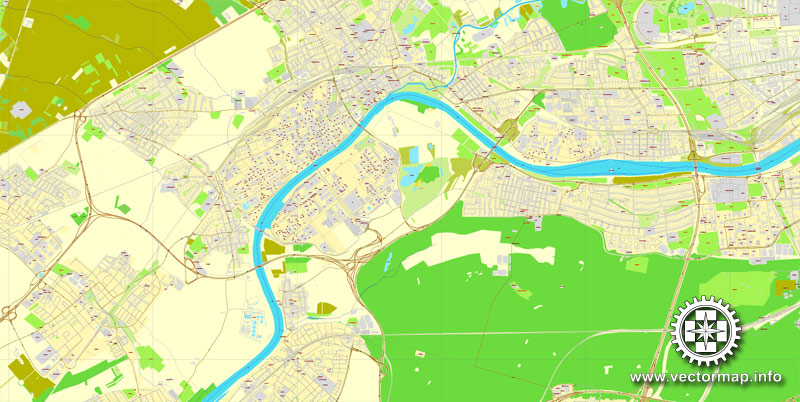
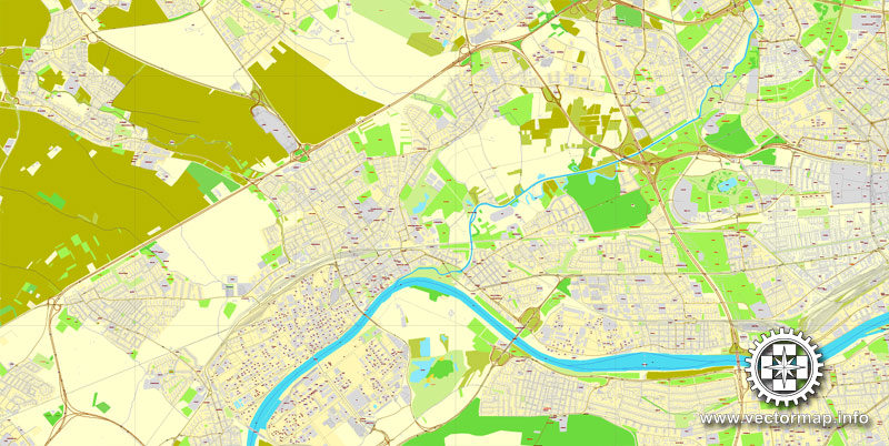
Frankfurt am Main, Germany, printable vector street City Plan map in 4 parts, full editable, Adobe PDF, full vector, scalable, editable, text format street names, 56 mb ZIP
All streets, All buildings. Map for design, print, arts, projects, presentations.
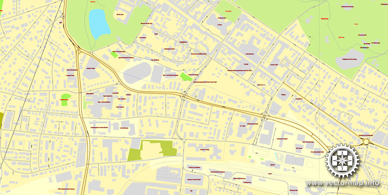
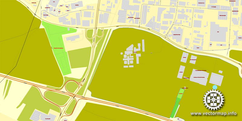
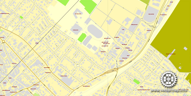
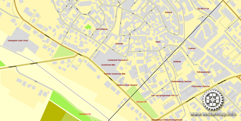
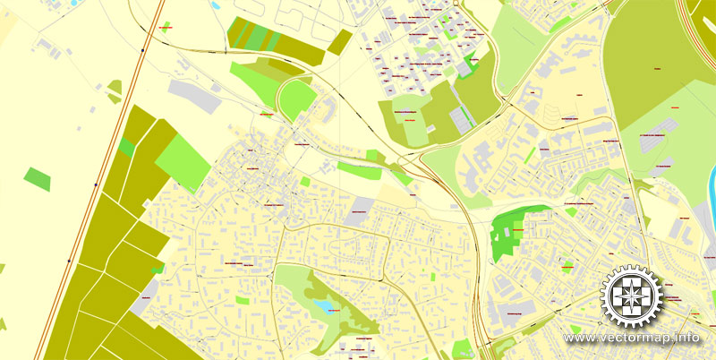
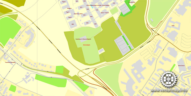
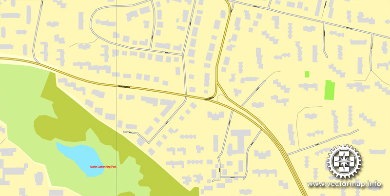
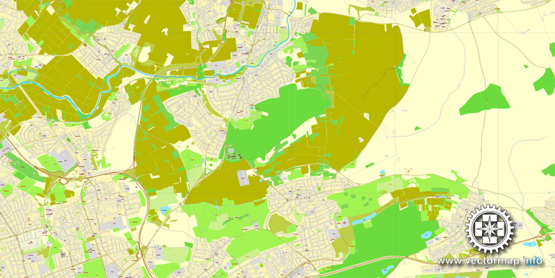
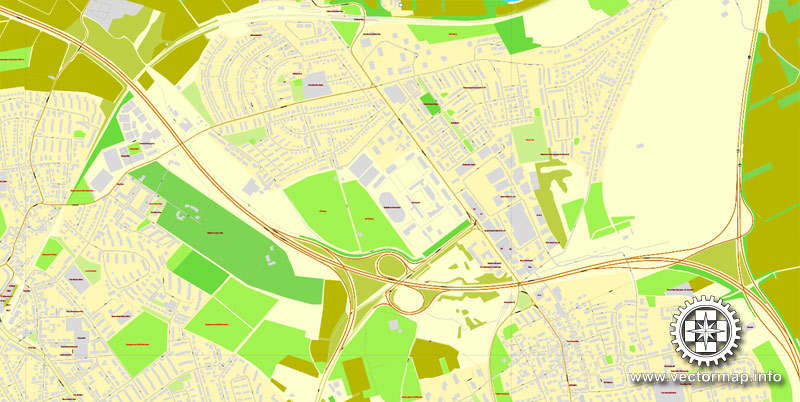
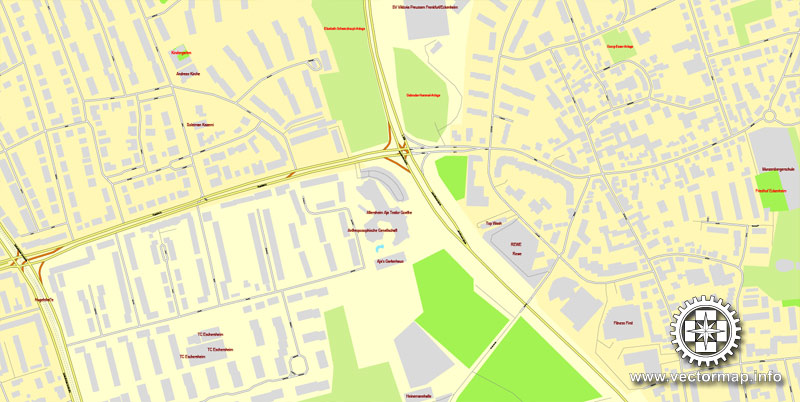
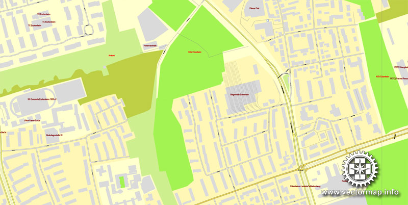
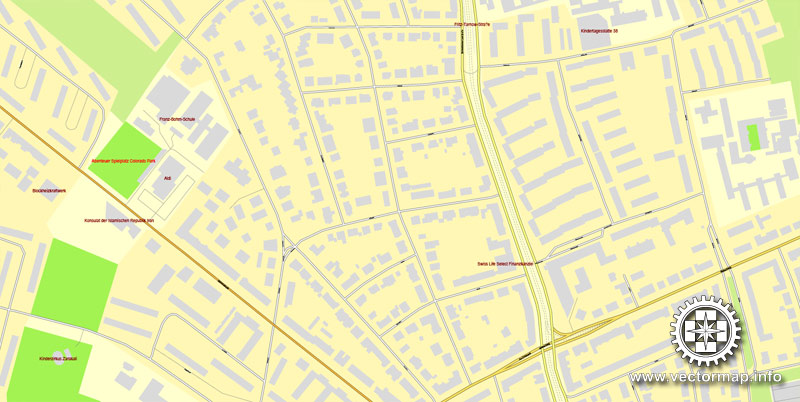
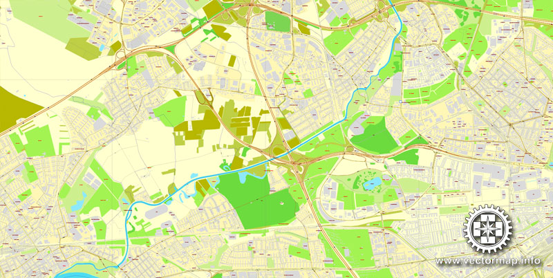
The most accurate and detailed map of the city.
Different font colors of the street names (black); object names by type (brown,red).
You can edit this file by Adobe Illustrator, Adobe Acrobat, Corel Draw.
DXF, DWG, CDR and other formats – on request, same price, please, contact
Frankfurt, Germany.
This vector map of Frankfurt city is used as a basis for design, editing, and further printing.
This is the most detailed, exact map of Frankfurt city for high-quality printing and polygraphy. You can always clarify the map development date by contacting us.
For your convenience, all objects on Frankfurt vector city map are divided into layers. And the editing is very easy – colors, lines, etc.
You can easily add any objects needed (e.g. shops, salons, sale points, gas station or attraction) on any layer of Frankfurt vector map.
Frankfurt, officially Frankfurt am Main is a metropolis and the largest city of the German federal state of Hesse, and its 746,878 (2017) inhabitants make it the fifth-largest city of Germany after Berlin, Hamburg, Munich, and Cologne.
One of the advantages of Frankfurt city vector maps of our production is the relevance of cartographic data, we constantly update all our products.
This vector map of Frankfurt city is used by:
designers, layout designers, printers, advertisers and architects. Our product – vector maps – is designed for further editing and printing in large formats – from @Wall format (a few meters) to A-0 and A-1, A-2, A-3.
The Frankfurt city map in vector format is used for design, urban planning, presentations and media visualizations.
The advertising and presentation map of Frankfurt city (usually the final designer marks the routes, and puts the client’s objects (shops, saloons, gas stations etc.)
The undoubted advantage is that people will NEVER throw out this advertising product – the map. In fact, as an advertising medium, a city map is the most “long-playing” of the well-known polygraphic advertising media, with the longest lifespan, and the maximum number of interactions with the customer.
For travelers, maps are sold at the airports and gas stations around the world. Often the source is our vector maps.
Take a look, who purchases our vector maps of Frankfurt city in “Our Clients and Friends” page – these are large and small companies, from super-brands like Volvo and Starbucks, to small design studios and printing houses.
On the River Main (a tributary of the Rhine), it forms a continuous conurbation with the neighbouring city of Offenbach am Main, and its urban area has a population of 2.3 million. The city is at the centre of the larger Rhine-Main Metropolitan Region, which has a population of 5.8 million and is Germany’s second-largest metropolitan region after Rhine-Ruhr and behind Berlin-Brandenburg Metropolitan region. Since the enlargement of the European Union in 2013, the geographic centre of the EU is about 40 km (25 mi) to the east of Frankfurt’s central business district.
It’s very easy to work with vector maps of Frankfurt city, even for a not very experienced designer who can turn on and off the map layers, add new objects, change the colors of fill and lines according to customer requirements.
The undoubted advantage of Frankfurt city vector maps in printing is an excellent and detailed visualization, when customer can expand a large paper map and instantly define his location, find a landmark, an object or address on map, unlike using the popular electronic formats of Google and Yandex maps for example.
Printable vector maps of Frankfurt city are much more convenient and efficient than any electronic maps on your smartphone, because ALL DETAILS are displayed in the entire space of Frankfurt city map.
Useful tips on working with vector maps of cities and countries in Adobe Illustrator.
«V» – launches the Selection tool (cursor, black arrow), which makes active any vector line.
«А» – launches the Direct Selection tool (white cursor), allows you to select curve elements and drag them to the desired place.
«R» – activates the Rotate tool, which helps you rotating selected objects around the center point by 360 degrees.
«E» – gives you the opportunity to use the Eraser tool and erase unnecessary parts.
«X» – switches between Fill and Stroke in the Tools section. Try to get used to this hot key and
you will quickly understand that you can’t live and work without it.
Guides are not limited to vertical and horizontal in Adobe Illustrator. You can also create a diagonal guide for example. Moreover, you can turn any contours into guides. Select the outline and go to View > Guides > Make Guides (Create Guides), or simply press Cmd/Ctrl + 5. You can also turn the guides back into an editable object. Go to menu, View > Guides > Unlock Guides (Release Guides), select the guide you want to edit and select View > Guides > Release Guides (Reset Guides), or just press Cmd/Ctrl + Option / Alt + 5).
You will probably want to change the color scheme used on our Frankfurt vector city map.
To quickly and effectively play with colors.
Of course, you can do it manually, all objects in our Frankfurt city vector map are divided according to types and layers, and you can easily change the color gamma of vector objects in groups and layers.
But there is more effective way of working with the whole VECTOR MAP of Frankfurt city and all layers:
The overview dialog «Edit colors»/«Repaint Graphic Object» (this dialog box name can change depending on the context):
If you have selected a part or a layer of Frankfurt city vector map and open the dialog box by clicking the icon in the Control panel, on the Samples palette or the Color Catalog, or if you choose Edit > Edit Colors> Repaint Graphic Object, then the «Repaint Graphic Object» dialog box appears, and you get access to «Assign» and «Edit» tabs.
If a picture or a map fragment is not selected, and you open the dialog box by clicking the icon in the Control panel, on the Samples palette or in the Color Catalog, the «Edit Colors» dialog box appears and you can only access the «Edit» tab.
Regardless of the name at the top of the dialog box, the right-hand side always displays the color group of the current document, as well as two default color groups: Print Color and Grayscale. These color groups can be selected and used any time.
Create and edit color groups of Frankfurt city vector map, and also assign colors using the «Edit Colors»/ а «Repaint Graphic Object» dialog box.
A. Creating and editing of a color group on the «Edit» tab
B. Assigning colors on the «Assign» tab
C. Select a group of colors from the «Color groups» list
The option «Repaint a graphic object» in the lower part of the dialog box allows you to preview the colors on a selected layer of Vector map, or a group of elements, and specify whether its colors will be redefined when the dialog box is closed.
The main areas of the dialog box are:
«Edit»
The «Edit» tab is designed to create a new or edit the existing color groups.
The harmony rules Menu and the Color Wheel are used to conduct experiments with color harmonies. The color wheel shows how colors are related in color harmony, and the color bars allow you to view and manipulate an individual color values. In addition, you can adjust the brightness, add and remove colors, save color groups and view colors on the selected Vector Map of Frankfurt city or a separated layers.
«Assign»
The «Assign» tab is used to view and control on how the original colors are replaced with colors from the color group like your corporate colors in the Vector Map of Frankfurt city.
The assign color ability is provided only if the entire map, layer or fragment is selected in the document. You can specify which of new colors replace the current colors, whether the spot colors should be preserved and how colors are replaced (for example, you can replace colors completely or changing the color tone while maintaining the brightness). The «Assign» tab allows you to redefine colors in the Vector Map of Frankfurt city, or in separate layers and fragments using the current color group or reducing the number of colors in the current Vector Map.
Frankfurt is the largest city in the Rhine Franconian dialect area (Franconian, Central German dialects). Like France and the region of Franconia, the city is named after the Franks. Frankfurt was a city state, the Free City of Frankfurt, for nearly five centuries, and was one of the most important cities of the Holy Roman Empire, as a site of imperial coronations; it lost its sovereignty upon the collapse of the empire in 1806 and then permanently in 1866, when it was annexed by the Kingdom of Prussia. It has been part of the federal state of Hesse since 1945. The city is culturally and ethnically diverse, with around half of the population, and a majority of young people, having a migration background. A quarter of the population are foreign nationals, including many expatriates.
Color groups
Is a list of all saved color groups for current document (the same groups appear in the «Samples» palette). You can edit and delete the existing color groups, as well as creating a new ones using the list of “Color Groups” in the dialog box. All changes appear in the «Samples» palette.
The highlighted color group shows, which color group is currently edited.
Any color group can be selected and edited, or used to redefine the colors in the selected vector map of Frankfurt city, its fragments or elements.
Saving a color group adds this group to the specified list.
Opening the «Edit Colors»/«Repaint Graphic Object» dialog box.
Open the «Edit Colors»/«Repaint Graphic Object» dialog box using one of the following methods:
«Edit»> «Edit Colors»> «Repaint Graphic object» or «Repaint With Style».
Use these commands if you need to edit the colors in the selected vector map of Frankfurt city.
«Repaint Graphic object» button on the «Control» panel.
Use this button if you need to adjust colors of Frankfurt city vector map using the а «Repaint graphic object» dialog box.
The specified button is available if the selected vector map or its fragment contains two or more colors.
Note. This color editing method is convenient for global color adjustment in a vector map, if global colors were not used when creating a City Map of Frankfurt.
The «Edit colors» button or «Edit or apply colors» on the «Color Catalog» palette
Click this button if you need to edit colors on the «Color Catalog» palette or edit and then apply them to the selected Vector Map of Frankfurt city or its fragment.
The «Edit color group» button or «Edit or apply color group» on the «Samples» palette.
Click this button if you need to edit the colors in the specific color group or edit and apply them to the selected Vector Map of Frankfurt city or a group of its elements, for example, the whole layer “Streets and lines”. You can also double-click the color group in the Samples panel to open the dialog box.
If the map file is too large and your computer freezes or even can’t open it quickly:
1. Try to reduce the color resolution of the video card (display) to 256 colors while working with a large map.
2. Using Windows Task Manager, select all the application you don’t need, while working with map, just turn them off.
3. Launch Adobe Illustrator. (DO NOT OPEN the vector map file)
4. Start the Windows Task Manager using administrator rights > Find the “Illustrator” process > set the «real time» priority,
5. Open the file. When you see the LEGACY FONT popup window – click “OK” (do not update). You can restore the TEXT later.
6. Can also be useful: When file is opened – Edit > Settings > Basic Settings > disable smoothing. /// It looks scary, but works quickly)))
We recommend saving the file in Adobe Illustrator 10 version. It’s much more stable when working with VERY BIG size files.
Frankfurt is an alpha world city and a global hub for commerce, culture, education, tourism and transportation. It is the site of many global and European corporate headquarters. Frankfurt Airport is among the world’s busiest. Frankfurt is the major financial centre of the European continent, with the headquarters of the European Central Bank, German Federal Bank, Frankfurt Stock Exchange, Deutsche Bank, DZ Bank, KfW, Commerzbank, several cloud and fintech startups and other institutes. Automotive, technology and research, services, consulting, media and creative industries complement the economic base. Frankfurt’s DE-CIX is the world’s largest internet exchange point. Messe Frankfurt is one of the world’s largest trade fairs. Major fairs include the Frankfurt Motor Show, the world’s largest motor show, the Music Fair, and the Frankfurt Book Fair, the world’s largest book fair.
Frankfurt is home to influential educational institutions, including the Goethe University, the UAS, the FUMPA, and graduate schools like the Frankfurt School of Finance & Management. Its renowned cultural venues include the concert hall Alte Oper, Europe’s largest English theatre and many museums (e.g. the Museumsufer ensemble with Städel and Liebieghaus, Senckenberg Natural Museum, Goethe House, and the Schirn art venue at the old town). Frankfurt’s skyline is shaped by some of Europe’s tallest skyscrapers. The city is also characterised by various green areas and parks, including the central Wallanlagen, the City Forest and two major botanical gardens, the Palmengarten and the University’s Botanical Garden. In electronic music, Frankfurt has been a pioneering city since the 1980s, with renowned DJs including Sven Väth, Marc Trauner, Scot Project, Kai Tracid, and the clubs Dorian Gray, U60311, Omen and Cocoon. In sports, the city is known as the home of the top tier football club Eintracht Frankfurt, the basketball club Frankfurt Skyliners, the Frankfurt Marathon and the venue of Ironman Germany.
Geography
It is the largest city in the federated state of Hesse in the south-western part of Germany.
Frankfurt is located on both sides of the Main River, south-east of the Taunus mountain range. The southern part of the city contains the Frankfurt City Forest, Germany’s largest city forest. The city area is 248.31 km2 (95.87 sq mi) and extends over 23.4 km (14.54 mi) east to west and 23.3 km (14.48 mi) north to south. The city centre is north of the River Main in Altstadt district (the historical centre) and the surrounding Innenstadt district. The geographical centre is in Bockenheim district near Frankfurt West station.
Frankfurt is the centre of the densely populated Frankfurt Rhine-Main Metropolitan Region with a population of 5.5 million. Other important cities in the region are Wiesbaden (capital of Hessen), Mainz (capital of Rhineland-Palatinate), Darmstadt, Offenbach am Main, Hanau, Aschaffenburg, Bad Homburg vor der Höhe, Rüsselsheim, Wetzlar and Marburg.
Districts
The city is divided into 46 city districts (Stadtteile), which are in turn divided into 121 city boroughs (Stadtbezirke) and 448 electoral districts (Wahlbezirke). The 46 city districts combine into 16 area districts (Ortsbezirke), which each have a district committee and chairperson.
The largest city district by population and area is Sachsenhausen, while the smallest is Altstadt, Frankfurt’s historical center. Three larger city districts (Sachsenhausen, Westend and Nordend) are divided for administrative purposes into a northern (-Nord) and a southern (-Süd) part, respectively a western (-West) and an eastern (-Ost) part, but are generally considered as one city district (which is why often only 43 city districts are mentioned, even on the City’s official website).
Some larger housing areas are often falsely called city districts, even by locals, like Nordweststadt (part of Niederursel, Heddernheim and Praunheim), Goldstein (part of Schwanheim), Riedberg (part of Kalbach-Riedberg) and Europaviertel (part of Gallus). The Bankenviertel (banking district), Frankfurt’s financial district, is also not an administrative city district (it covers parts of the western Innenstadt district, the southern Westend district and the eastern Bahnhofsviertel district).
Many city districts are incorporated suburbs (Vororte), or were previously independent cities, such as Höchst. Some like Nordend and Westend arose during the rapid growth of the city in the Gründerzeit following the Unification of Germany, while others were formed from territory which previously belonged to other city district(s), such as Dornbusch and Riederwald.
Frankfurt am Main is the largest city in the German state of Hesse (Hessia) and the fifth-largest city in Germany, with a 2015 population of 731,095 within its administrative boundaries. The urban area called Frankfurt Rhein-Main has a population of 2,221,910. The city is at the centre of the larger Frankfurt Rhine-Main Metropolitan Region which has a population of 5,500,000 and is Germany’s second-largest metropolitan region. Since the enlargement of the European Union in 2013, the geographic centre of the EU is about 40 km (25 mi) to the east.
Frankfurt is a global hub for commerce, culture, education, tourism and traffic. It is the most important financial centre of the European continent, with the HQs of the European Central Bank, German Federal Bank, Frankfurt Stock Exchange, Deutsche Bank, Commerzbank, DZ Bank, KfW, several fintech startups and other institutes. Messe Frankfurt is one of the world’s largest trade fairs. Major fairs include the Frankfurt Motor Show, the world’s largest motor show, and the Frankfurt Book Fair, the world’s largest book fair.
Frankfurt is home to many cultural and educational institutions, including the Goethe University and Frankfurt University of Applied Sciences, many museums (e.g. Städel, Senckenberg Natural Museum, Schirn, Goethe House) and two major botanical gardens: the Palmengarten, which is Germany’s largest, and the Botanical Garden of Goethe University.
Frankfurt is the largest financial centre in continental Europe. It is home to the European Central Bank, Deutsche Bundesbank, Frankfurt Stock Exchange and several large commercial banks.
The Frankfurt Stock Exchange is one of the world’s largest stock exchanges by market capitalization and accounts for more than 90 percent of the turnover in the German market.
In 2010 63 national and 152 international banks had their registered offices in Frankfurt, including Germany’s major banks, notably Deutsche Bank, Commerzbank, DZ Bank and KfW, as well as 41 representative offices of international banks.
Frankfurt is considered a global city (alpha world city) as listed by the GaWC group’s 2012 inventory. Among global cities it was ranked 10th by the Global Power City Index 2011 and 11th by the Global City Competitiveness Index 2012. Among financial centres it was ranked 8th by the International Financial Centers Development Index 2013 and 9th by the Global Financial Centres Index 2013.
Its central location within Germany and Europe makes Frankfurt a major air, rail and road transport hub. Frankfurt Airport is one of the world’s busiest international airports by passenger traffic and the main hub for Germany’s flag carrier Lufthansa. Frankfurt Central Station is one of the largest rail stations in Europe and the busiest junction operated by Deutsche Bahn, the German national railway company, with 342 trains a day to domestic and European destinations. Frankfurter Kreuz, the Autobahn interchange close to the airport, is the most heavily used interchange in the EU, used by 320,000 cars daily.
In 2011 human-resource-consulting firm Mercer ranked Frankfurt as seventh in its annual ‘Quality of Living’ survey of cities around the world. According to The Economist cost-of-living survey, Frankfurt is Germany’s most expensive city and the world’s 10th most expensive.
Frankfurt has many high-rise buildings in the city centre, forming the Frankfurt skyline. It is one of the few cities in the European Union to have such a skyline and because of it Germans sometimes refer to Frankfurt as “Mainhattan”, a portmanteau of the local Main River and Manhattan. Before World War II the city was globally noted for its unique old town with timber-framed buildings, the largest timber-framed old town in Europe. The Römer area was later rebuilt and is popular with visitors and for events such as Christmas markets. Other parts of the old town are to be reconstructed as part of the Dom-Römer Project by 2016.
Small guide: How to work with the vector map?
You can: Mass select objects by type and color – for example, the objects type “building” (they are usually dark gray) – and remove them from the map, if you do not need them in your print or design project. You can also easily change the thickness of lines (streets), just bulk selection the road by the line color.
The streets are separated by type, for example, type “residential road” are usually white with a gray stroke. Highway usually orange with a brown or dark gray stroke.
It is easy to change the font of inscriptions, all or each individually. Also, just can be make and any other manipulation of objects on the vector map in Adobe illustrator format.
Important: All the proportions on the map are true, that is, the relative sizes of the objects are true, because Map is based on an accurate GPS projection, and It transated into the (usual for all) the Mercator projection.
You can easily change the color, stroke and fill of any object on the map, zoom without loss of quality Image Verification.
Select object

Bulk selection the same objects on the vector map

See the bulk selected objects on the vector map

Bulk delete buildungs from the vector map

Select residencial road (small street) on the vector map

Bulk selection the same lines (streets, roads) on the full map

Create fat lines of the streets on the vector maps (bulk action) 1

Create fat lines of the streets on the vector maps (bulk action) 2

Create fat lines of the streets on the vector maps (bulk action) 3

You can easily change the color, stroke and fill of any object on the map, zoom without loss of quality Image Verification.
Please also check this map catalog: Europe countires and cities vector maps.


 Author: Kirill Shrayber, Ph.D. FRGS


 street City Plan map, full editable, Adobe Illustrator")